Missouri holds secrets most travelers never discover, and some of the best ones flow quietly through forests, valleys, and rocky bluffs far from busy highways.
These waterways carry stories of Native American tribes, early settlers, and wildlife that still thrives along their banks today.
While the Mississippi and Missouri Rivers grab all the attention, smaller streams wind through hidden corners where adventure waits for those willing to explore.
Pack your canoe, lace up your hiking boots, and get ready to meet seven rivers that whisper tales only the curious will hear.
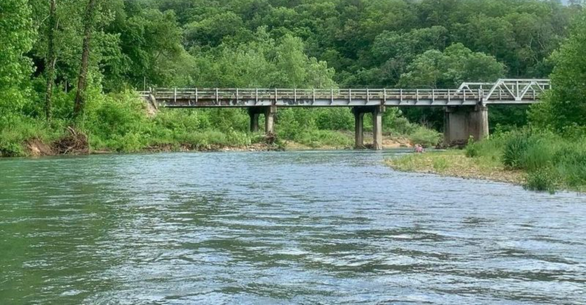
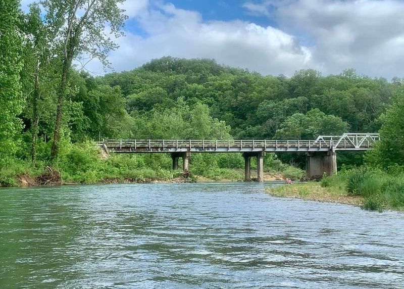
1. Current River
Clear water the color of emeralds flows over smooth stones, creating a soundtrack that echoes off towering bluffs carved by thousands of years of patient erosion.
Current River earned its spot as one of the first National Scenic Riverways back in 1964, protecting 134 miles of pristine waterway that still looks much like it did centuries ago.
Spring-fed and cold even during Missouri’s hottest summers, this river maintains a steady temperature that makes it perfect for float trips from April through October.
Akers Ferry, Round Spring, and Big Spring feed millions of gallons of crystal-clear water into the Current every single day, keeping it flowing strong even when rainfall runs scarce.
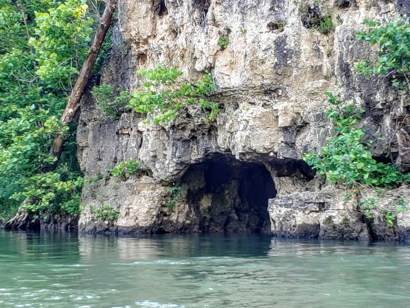
You can launch a canoe at Cedargrove Access near Van Buren and paddle past caves where bats hibernate and springs bubble up from underground chambers.
The river corridor shelters over 900 plant species and provides habitat for river otters, bald eagles, and the elusive hellbender salamander that needs clean, oxygen-rich water to survive.
Alley Spring, located at 4896 Highway 106 in Eminence, features a historic red mill beside a spring that pumps out 81 million gallons daily into a tributary feeding the Current.
Families camp at Pulltite Campground or Two Rivers Campground, waking to mist rising off the water and songbirds announcing dawn.
Fishing enthusiasts cast lines for smallmouth bass, goggle-eye, and channel catfish in pools where the current slows around bends.
Floating the Current means leaving cell service behind and entering a world where time moves at the pace of water over stone.
Gravel bars offer perfect lunch spots, and on summer weekends, you might share the river with other paddlers, but midweek trips often feel like private adventures through Missouri’s wildest terrain.
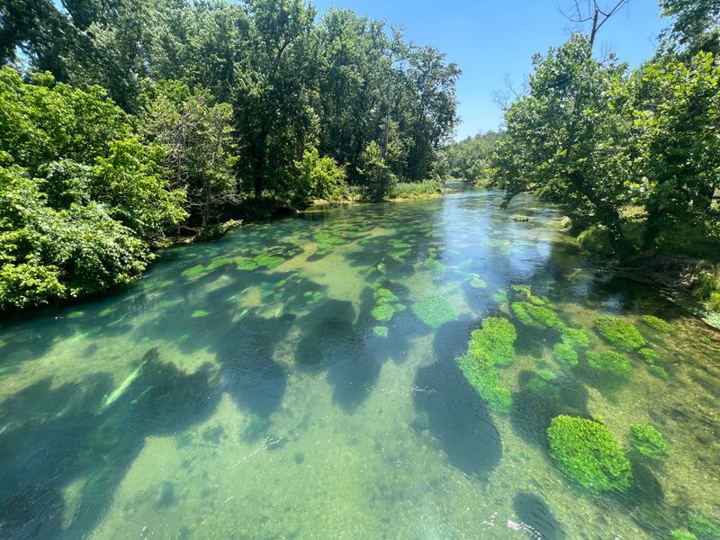
2. Jacks Fork
Twisting through some of the most rugged terrain in the Missouri Ozarks, Jacks Fork carves a path so remote that stretches of its banks remain untouched by development.
This tributary joins the Current River after running 42 miles of tight bends, shallow riffles, and occasional deep pools where sunlight barely penetrates the forest canopy overhead.
Named after a long-ago settler whose identity has faded into history, the river now belongs to paddlers seeking solitude and challenges that test their navigation skills.
Gravel bars appear around every third bend, providing natural rest stops where you can stretch your legs and skip stones across glassy pools.
The river drops an average of seven feet per mile, creating Class I rapids that add just enough excitement without requiring expert whitewater skills.
Spring-fed tributaries keep Jacks Fork running clear and cold, with visibility often reaching several feet down to the rocky bottom where crayfish scuttle between stones.
Jam Up Cave sits along the riverbank, accessible only by water, offering explorers a chance to peek into Missouri’s underground world without specialized caving equipment.
Alley Spring Mill, though technically on Alley Spring Creek before it joins Jacks Fork, serves as a popular starting point for multi-day float trips.
Paddlers often camp on gravel bars under permits from the National Park Service, falling asleep to the sound of water rushing over shallow riffles nearby.
Wildlife sightings happen frequently along this corridor, from deer drinking at dawn to great blue herons stalking fish in the shallows.
The river demands attention because submerged logs and tight channels punish daydreamers with unexpected swims.
Yet that wild character keeps Jacks Fork feeling authentic, a waterway that refuses to be tamed or made easy for casual visitors looking for lazy float experiences.
3. Eleven Point River
Designated as a National Wild and Scenic River in 1968, Eleven Point flows through southern Missouri carrying a reputation for solitude that even other Ozark streams cannot match.
The name supposedly comes from an early survey marker placed eleven points from some forgotten reference, though locals have debated the true origin for generations without reaching consensus.
What nobody disputes is the river’s ability to make you feel like the first person to ever paddle its 44-mile Missouri stretch, despite centuries of human history along its banks.
Greer Spring, the second-largest spring in Missouri, pumps an astounding 214 million gallons of water daily into the Eleven Point near the town of Greer.
A short hiking trail from the parking area at Greer Crossing leads to the spring’s boil, where water surges up from deep underground with such force that it creates standing waves.
This massive influx keeps the river running strong and clear even during summer droughts that turn other streams into muddy trickles.
Float trips typically launch at Riverton Access or Greer Crossing, both offering parking and basic facilities for paddlers preparing for single-day or overnight adventures.
The river corridor supports healthy populations of smallmouth bass, making it popular with fly fishermen who wade the riffles casting poppers and streamers.
Turner Mill North Campground and McCormack Lake Recreation Area provide developed camping for families who prefer amenities over primitive gravel bar camping.
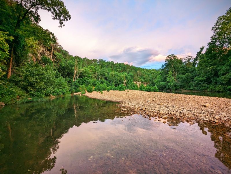
Bluffs rise 200 feet above the water in some sections, their faces decorated with ferns and mosses that thrive in the constant moisture from river spray.
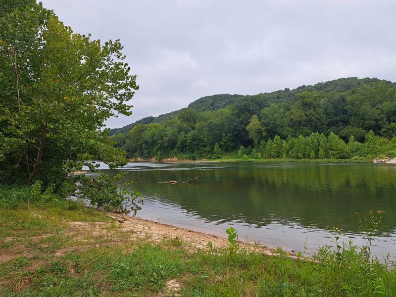
Because the Eleven Point remains less crowded than Current River, you can float entire weekday stretches without seeing another human soul, just endless forest and water flowing toward Arkansas.
4. Meramec River
Starting near Salem and flowing 218 miles before joining the Mississippi River south of St. Louis, the Meramec cuts through the heart of Missouri’s cave country with more personality than any single river should possess.
One moment you are paddling past peaceful farmland, the next you are navigating rapids formed by ledges of ancient limestone that jut across the channel.
The Meramec drains more than 4,000 square miles, making it one of the longest free-flowing rivers in Missouri without a single major dam interrupting its journey.
Meramec Caverns, located at 1135 Highway W in Sullivan, has drawn tourists since the 1930s with its massive underground chambers and colorful formation displays.
Legend claims outlaw Jesse James used these caves as a hideout, though historians debate whether those stories hold water or just boost ticket sales.
Above ground, the river flows past the cavern entrance, offering paddlers a chance to combine underground exploration with surface adventures on the same trip.
Meramec State Park near Sullivan provides camping, hiking trails, and canoe rentals for families wanting easy access to the river without hauling their own boats.
The park’s location puts you within paddling distance of Fisher Cave, another spectacular underground formation accessible through ranger-led tours.
Downstream sections near Eureka and Fenton run through increasingly suburban landscapes, yet the river corridor maintains surprising wildness with wooded banks and wildlife sightings remaining common.
Spring flooding can turn the Meramec dangerous, with water levels rising rapidly after heavy rains upstream send walls of muddy water churning toward the Mississippi.
Summer and fall offer the best floating conditions, when water levels drop to reveal gravel bars perfect for picnicking.
Local outfitters dot the river corridor, offering shuttle services and equipment rentals that make day trips accessible even for visitors without their own gear.
5. Big Piney River
Tucked away in the Mark Twain National Forest, Big Piney winds through some of the most remote public land in Missouri, where cell phone signals disappear and the only sounds come from water, wind, and wildlife.
The river earned its name from the towering pine trees that once dominated its watershed, though hardwoods now outnumber pines along most stretches.
Floating Big Piney requires more planning than other Missouri rivers because access points sit far apart and services remain scarce in the surrounding countryside.
Paddy Creek Wilderness borders sections of the river, protecting 6,888 acres of roadless forest where hiking trails lead to vistas overlooking the river valley far below.
The river itself drops steadily through its course, creating continuous riffles and occasional Class I rapids that keep paddlers engaged without overwhelming beginners.
Water levels fluctuate dramatically based on recent rainfall, and the Big Piney can drop too low for comfortable floating during dry summers when rocks scrape boat bottoms every few yards.
Ross Access and Boiling Spring Access serve as primary put-in points, though both require driving several miles on gravel roads that turn muddy after storms.
Camping happens primarily on gravel bars since developed campgrounds do not line the river corridor like they do on more popular streams.
Fishing pressure remains light, giving anglers willing to work for their catch excellent opportunities for smallmouth bass and rock bass in pools beneath undercut banks.
The remoteness that makes Big Piney special also demands respect and preparation from visitors.
Carry everything you need because no convenience stores or outfitters operate along the river to bail out unprepared paddlers.
That isolation filters out casual floaters, leaving Big Piney to those who appreciate wild rivers that have not been sanitized or made safe for mass tourism.
6. Bourbeuse River
French explorers named this river after the muddy, turbid quality of its water during spring floods, with “bourbeuse” roughly translating to muddy or murky in their language.
Flowing 153 miles from its headwaters near Rolla to its junction with the Meramec River, the Bourbeuse passes through a landscape of rolling hills, farmland, and scattered woodlots that represent Missouri’s transition zone between prairie and forest.
Unlike the spring-fed clarity of Ozark streams to the south, the Bourbeuse carries sediment that gives it a milky appearance after any significant rainfall upstream.
The town of Union serves as a hub for river access, with several parks and boat ramps maintained by the city for public use.
Bourbeuse River Access at Highway 47 Bridge provides parking and a concrete ramp suitable for launching larger boats, not just canoes and kayaks.
Fishing enthusiasts target channel catfish, which thrive in the river’s warmer, murkier water that would not suit trout or other species demanding pristine conditions.
Historic Union Covered Bridge, though no longer spanning the Bourbeuse after being relocated to a city park, reminds visitors of the river’s importance to early settlement and commerce in Franklin County.
Float trips on the Bourbeuse tend to be longer and slower than Ozark river adventures because the gradient remains gentle and current moves lazily through most sections.
Local outfitters offer fewer services here compared to tourist-heavy rivers like the Current, meaning paddlers often need to arrange their own shuttles or leave vehicles at takeout points.
Summer water levels can drop significantly, exposing mudflats and making navigation tricky in shallow sections where sandbars shift with each flood.
Yet the Bourbeuse offers something other Missouri rivers cannot: a peaceful float through working landscapes where farms meet forests and the pace of life still follows agricultural rhythms.
Birdwatchers appreciate the river corridor for migrating waterfowl and wading birds that use its wetlands as stopover habitat during spring and fall journeys.
7. Castor River
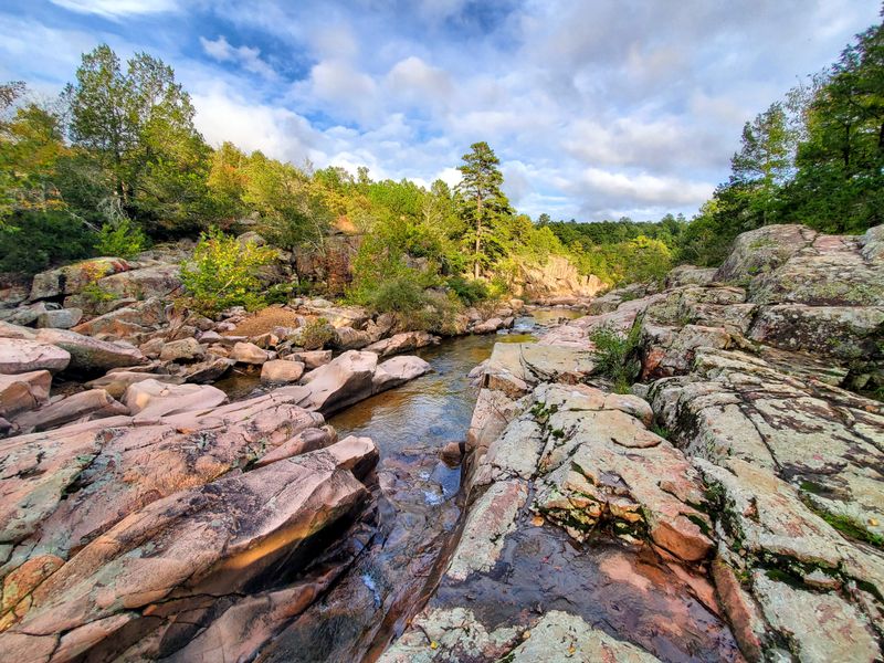
Most Missouri rivers flow over limestone and dolomite, but Castor River carved its channel through billion-year-old Precambrian granite and rhyolite that create a landscape unlike anywhere else in the state.
The river’s most spectacular section runs through Amidon Memorial Conservation Area near Fredericktown, where ancient volcanic rock forces the water through narrow channels called shut-ins.
These geological formations create natural water parks where smooth pink and gray boulders form pools, chutes, and miniature waterfalls that look more like Colorado than Missouri.
Amidon Memorial Conservation Area, located at 1513 County Road 253 in Marquand, protects 1,375 acres surrounding the shut-ins and offers hiking trails, picnic areas, and swimming holes that draw families throughout summer.
The shut-ins section runs too shallow and rocky for boat traffic, making this a wading and swimming destination rather than a paddling river.
Wildflowers bloom spectacularly in spring when bloodroot, hepatica, and trout lily carpet the forest floor beneath oak and hickory trees that survived the 2009 ice storm that devastated much of southeast Missouri.
Downstream from the shut-ins, Castor River becomes floatable during periods of adequate water flow, though paddlers must watch for ledges and rocky shoals that can damage boats.
The Missouri Department of Conservation maintains the area primarily for day use, with no camping allowed within the conservation area boundaries.
Birders visit the shut-ins hoping to spot Louisiana waterthrush, a warbler species that nests along rocky streams and announces its presence with loud, ringing songs echoing off stone walls.
Visiting Castor River shut-ins feels like discovering a secret that somehow escaped Missouri’s tourism marketing machine.
Crowds remain manageable even on summer weekends, and weekday visits often mean having entire sections of river to yourself.
The billion-year-old rocks beneath your feet tell stories that dwarf human history, making this one of Missouri’s most humbling and beautiful natural areas.
Dear Reader: This page may contain affiliate links which may earn a commission if you click through and make a purchase. Our independent journalism is not influenced by any advertiser or commercial initiative unless it is clearly marked as sponsored content. As travel products change, please be sure to reconfirm all details and stay up to date with current events to ensure a safe and successful trip.