Utah stands as one of the most spectacular destinations for road trippers seeking adventure and natural beauty.
From towering red rock formations to alpine meadows and ancient geological wonders, the state offers driving experiences unlike anywhere else in the country.
Whether you’re planning a week-long journey through national parks or a weekend escape into the mountains, these routes showcase the incredible diversity of Utah’s landscapes.
Each drive tells its own story through dramatic canyons, sweeping vistas, and hidden treasures waiting around every curve.
Pack your camera, fill up your tank, and get ready to discover why Utah continues to captivate travelers from around the world.
These ten road trips will transform the way you see the American West and create memories that last a lifetime.
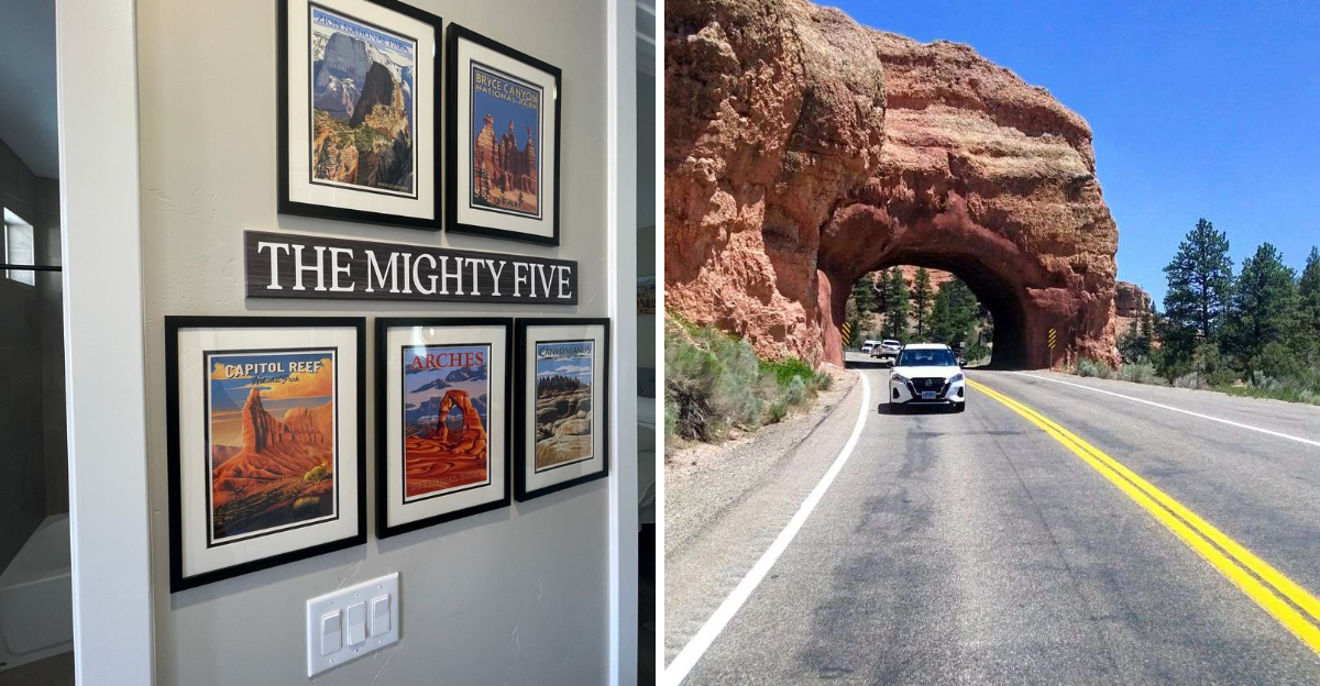
1. The Mighty Five Route
Connecting all five of Utah’s celebrated national parks creates an unforgettable loop through some of America’s most stunning terrain.
Zion National Park kicks off this adventure with its towering sandstone cliffs and narrow slot canyons that seem to touch the sky.
Moving northeast, Bryce Canyon welcomes you with its otherworldly hoodoos standing like ancient sentinels across the amphitheater.
Capitol Reef offers a quieter experience with its colorful rock layers and historic orchards tucked into the Waterpocket Fold.
Canyonlands stretches endlessly before you, carved by the Colorado and Green Rivers into distinct districts of mesas and buttes.
Arches National Park completes the circuit near Moab, home to over two thousand natural stone arches including the famous Delicate Arch.
This comprehensive journey requires a week to ten days for proper exploration, allowing time to hike, photograph, and absorb each park’s unique character.
The route covers roughly 800 miles of Southern Utah, passing through small towns where you can refuel and rest between parks.
Spring and fall provide the most comfortable temperatures for this extended adventure.
Advanced reservations for campgrounds and lodging are essential during peak travel seasons.
Each park charges an entrance fee, though an America the Beautiful pass covers all five.
The diversity of landscapes along this route demonstrates why Utah has become synonymous with natural wonder and geological splendor.
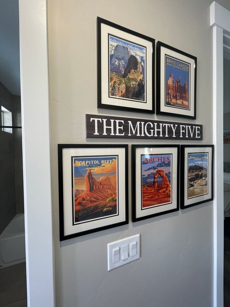
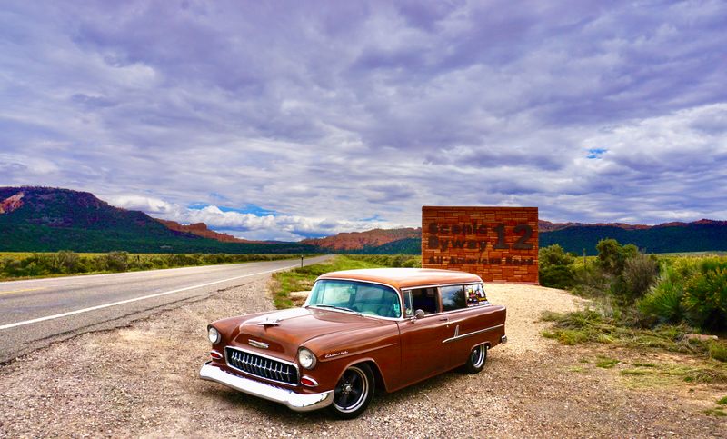
2. Zion to Bryce Canyon via Scenic Byway 12

Starting from the massive walls of Zion, this route carries you through some of the most photogenic terrain in the American West.
Scenic Byway 12 has earned its designation as an All-American Road, a recognition given to fewer than three dozen routes nationwide.
The highway climbs out of the desert floor and into the cool forests of Dixie National Forest, where ponderosa pines provide welcome shade.
Red Canyon greets you with its brilliant crimson hoodoos and natural tunnel carved through solid rock.
Continuing east, the road passes through the charming town of Escalante before entering Grand Staircase-Escalante National Monument.
Here the landscape opens into vast plateaus and hidden slot canyons accessible only by foot.
Boulder serves as a welcome stop with local eateries and art galleries showcasing regional crafts.
The famous Hogback section narrows to a knife-edge ridge with heart-stopping views plunging hundreds of feet on both sides.
Photographers find endless opportunities at every pullout and vista point along this stretch.
Bryce Canyon appears almost suddenly as you approach from the west, its pink and orange spires rising from the plateau edge.
Plan for at least half a day to fully appreciate this drive, though many travelers extend it to two or three days to explore side roads and hiking trails.
The route covers approximately 120 miles of pure visual feast.
3. Scenic Byway 12: An All-American Road
Few highways in North America can match the sustained beauty of State Route 12 as it winds 122 miles from Panguitch to Torrey.
This ribbon of asphalt threads through landscapes so diverse they seem pulled from different planets.
Beginning near Bryce Canyon, the road descends through twisted canyons where every turn reveals another geological masterpiece.
Grand Staircase-Escalante National Monument dominates the middle section, protecting nearly two million acres of rugged wilderness.
The Hogback stands as the route’s most dramatic feature, where the roadway balances on a narrow ridge barely wider than two lanes.
Looking down from this section feels like flying, with steep slopes dropping away into painted badlands below.
Calf Creek Recreation Area offers a midpoint break with a waterfall hike that rewards your effort with a 126-foot cascade.
Boulder Mountain rises ahead as you continue east, its summit reaching over 11,000 feet elevation.
Aspen groves line the upper elevations, turning brilliant gold in autumn and creating tunnels of shimmering leaves.
The descent into Capitol Reef country brings you back to red rock desert, completing the transition through multiple life zones.
Wildlife sightings include mule deer, golden eagles, and occasionally pronghorn antelope in the open valleys.
Every season transforms this drive into something new, from spring wildflowers to winter’s snow-dusted rocks.
4. US Route 163 Monument Valley Scenic Drive

Rolling south from Mexican Hat, this 64-mile stretch delivers the quintessential American Southwest experience.
Monument Valley’s towering buttes rise from the desert floor like ancient skyscrapers, their red sandstone faces glowing at sunrise and sunset.
The Navajo Nation administers this sacred landscape, maintaining its cultural significance while welcoming respectful visitors.
Forrest Gump made one section of this highway famous when the title character ended his cross-country run at mile marker 13.
Travelers from around the world now stop at this exact spot to recreate the iconic movie scene with the monuments behind them.
The road runs arrow-straight for miles, creating that classic vanishing-point perspective photographers crave.
West Mitten Butte, East Mitten Butte, and Merrick Butte form the signature trio visible from the main viewpoint.
Inside the valley itself, unpaved roads lead deeper into the landscape where additional formations bear names like Totem Pole and Three Sisters.
Guided tours led by Navajo guides provide cultural context and access to areas closed to independent travelers.
The visitor center sits just off the highway, offering exhibits about Navajo history and the valley’s geological formation.
Sunrise brings the best light for photography, painting the monuments in shades of crimson and gold.
This drive connects to other regional attractions including Four Corners Monument and Natural Bridges National Monument.
5. Potash-Lower Colorado River Scenic Byway
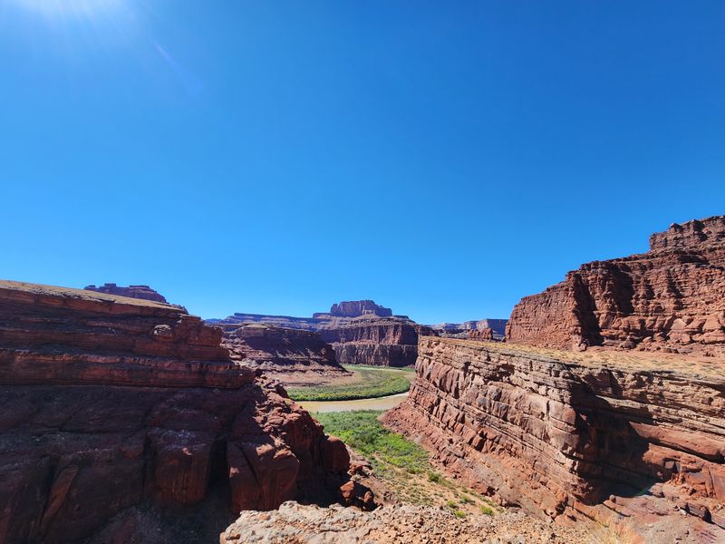
Highway 279 departs from Moab and immediately plunges into a world of vertical sandstone walls and ancient rock art.
The Colorado River flows beside the road for most of this 17-mile journey, its green water contrasting sharply with red cliffs.
Rock climbers flock to the Wall Street section, where smooth Wingate Sandstone faces rise hundreds of feet straight up.
Watching climbers scale these imposing walls adds human perspective to the massive geological features.
Petroglyphs appear along the cliff bases, carved by ancestral Puebloan peoples centuries before European contact.
Interpretive signs help visitors locate and understand these precious cultural resources without disturbing them.
Dinosaur tracks preserved in stone reveal where ancient creatures walked across mudflats during the Jurassic period.
The tracks appear as three-toed impressions, remarkably clear despite their age of roughly 150 million years.
Potash evaporation ponds mark the road’s end, their brilliant blue color visible from overlooks high above.
Mining operations have worked this area for decades, extracting potassium salts from underground deposits.
Mountain bikers often tackle the Shafer Trail, a steep dirt road connecting this byway to Canyonlands National Park.
The entire drive takes less than an hour without stops, but plan several hours to explore pullouts and short trails properly.
6. Mirror Lake Scenic Byway
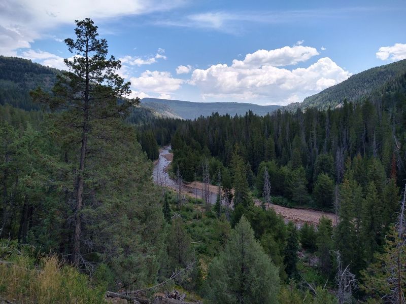
Climbing into the Uinta Mountains from Kamas, Highway 150 transports you from sagebrush valleys to alpine tundra in just 56 miles.
The Uintas stand unique among American mountain ranges, running east to west rather than north to south.
Dense forests of lodgepole pine, spruce, and fir blanket the lower slopes, giving way to open meadows higher up.
The Upper Provo River parallels much of the route, its clear waters attracting fly fishers casting for native cutthroat trout.
Dozens of lakes dot the high country, many accessible by short hikes from trailheads along the highway.
Mirror Lake itself sits just off the road, its still surface reflecting the surrounding peaks on calm mornings.
Campgrounds appear frequently, ranging from developed sites with amenities to primitive spots for those seeking solitude.
Wildflowers carpet the meadows in July and August, painting the landscape in purples, yellows, and reds.
Moose browse in willow thickets near streams and lakes, often visible during early morning or evening hours.
The byway tops out near Bald Mountain Pass before descending toward the Wyoming border.
Winter closes this route, typically from late October through late May, when deep snow makes passage impossible.
Summer weekends draw crowds from the Salt Lake City area seeking cooler temperatures and mountain recreation.
7. Nebo Loop National Scenic Byway

This 38-mile loop between Payson and Nephi climbs the flanks of Mount Nebo, the tallest peak in the Wasatch Range.
Central Utah’s mountainous spine rises dramatically from the valley floor, creating a natural barrier between communities.
Nebo Loop Road, also known as Forest Road 015, winds through this terrain with numerous switchbacks and overlooks.
Utah Valley spreads below like a patchwork quilt, with farms, towns, and Utah Lake visible from upper viewpoints.
Devil’s Kitchen stands as a geological highlight, featuring red rock hoodoos that resemble miniature versions of Bryce Canyon formations.
The resemblance is striking, with the same pink and orange limestone creating similar spires and fins.
Aspen groves dominate the mountainsides, particularly spectacular during September and October when leaves turn golden.
Photographers time their visits to coincide with peak color, which typically occurs in late September.
Several campgrounds along the route provide base camps for exploring side trails and fishing spots.
The Payson Lakes area offers family-friendly recreation with easy trails and picnic areas near the water.
Winter snow closes portions of this byway, making it a seasonal drive typically open from late May through October.
The entire loop can be driven in two hours, though most visitors spend half a day or more exploring.
8. Flaming Gorge-Uintas National Scenic Byway
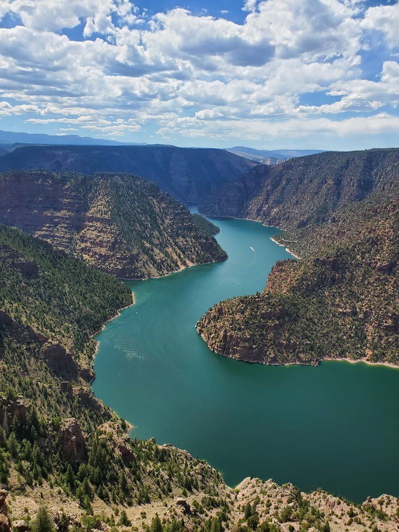
Stretching between Vernal and Manila, this byway earns its nickname as the drive through the ages.
Geological layers spanning over a billion years lie exposed along this route, telling Earth’s story in stone.
The road begins in the high desert near Vernal, where dinosaur fossils have made the region famous among paleontologists.
Climbing north, the landscape transitions into juniper-covered hills before entering the montane forests of the Uinta Mountains.
Red Canyon Overlook provides the first breathtaking view of Flaming Gorge Reservoir, its blue waters cutting through crimson cliffs.
The reservoir stretches for 91 miles behind Flaming Gorge Dam, creating a recreational paradise for boaters and anglers.
Wildlife viewing opportunities abound, with elk, mule deer, bighorn sheep, and pronghorn antelope all inhabiting different elevations along the route.
Birdwatchers spot everything from golden eagles soaring overhead to ospreys diving for fish in the reservoir.
The Ashley National Forest encompasses much of this area, offering countless trails and backcountry camping opportunities.
Manila sits at the northern end of the drive, a small community serving as a gateway to Wyoming’s high plains.
Summer brings comfortable temperatures at the higher elevations, while the reservoir area can be hot.
This scenic byway combines geological wonder, outdoor recreation, and abundant wildlife into one spectacular drive.
9. Cathedral Valley Loop
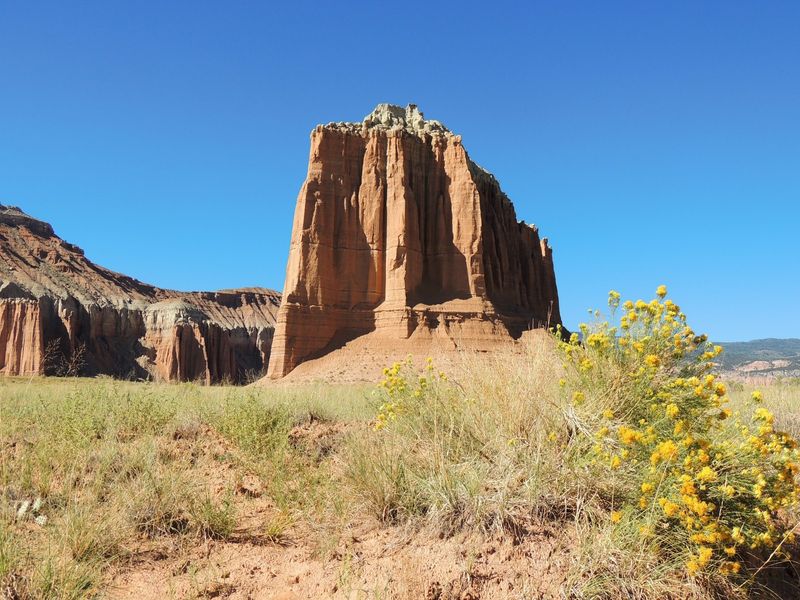
Adventure seekers willing to tackle 58 miles of unpaved roads discover one of Utah’s most remote and rewarding drives.
Cathedral Valley occupies the northern district of Capitol Reef National Park, far from the crowds that gather along Highway 24.
High-clearance vehicles are mandatory here, with four-wheel drive recommended after any precipitation.
The Temple of the Sun rises 400 feet from the valley floor, a massive monolith of Entrada Sandstone standing in solitary splendor.
Nearby, the Temple of the Moon creates a companion formation, equally impressive in its isolation.
These geological cathedrals formed through millions of years of erosion, leaving behind the hardest rock layers as towers.
The loop typically takes four to six hours to complete, depending on road conditions and how many stops you make.
River crossings add to the adventure, with the Fremont River and Hartnet Creek requiring careful navigation.
Check current conditions at the Capitol Reef Visitor Center before attempting this route, as flash floods can make crossings dangerous.
Primitive camping is permitted in designated areas, allowing overnight visitors to experience the valley’s incredible night skies.
With virtually no light pollution, stars fill the sky from horizon to horizon after sunset.
This drive rewards those seeking solitude and raw natural beauty away from developed tourist areas.
10. Dinosaur Diamond Highway
Paleontology enthusiasts find their paradise along this 512-mile loop connecting Utah and Colorado’s richest fossil sites.
The route follows US 191, US 6, and State Route 24 through terrain that was once home to some of Earth’s largest creatures.
Dinosaur National Monument anchors the northern section, where a quarry wall displays over 1,500 dinosaur bones still embedded in rock.
The Quarry Exhibit Hall protects these fossils while allowing visitors to see them exactly where paleontologists found them.
Vernal hosts the Utah Field House of Natural History State Park Museum, featuring life-size dinosaur models and fossil displays.
Moving south, the route passes through Price, where the Prehistoric Museum showcases specimens found throughout central Utah.
Cleveland-Lloyd Dinosaur Quarry lies off the main route but rewards the detour with one of the world’s densest concentrations of Jurassic bones.
Scientists have removed over 12,000 individual bones from this single location, representing at least 70 different animals.
The landscape itself tells stories of ancient environments, with colorful badlands revealing layers deposited during the age of dinosaurs.
Small towns along the route offer local museums and fossil shops, some allowing visitors to participate in actual digs.
This journey combines natural beauty with scientific wonder, making complex geological history accessible and exciting.
Plan several days to properly explore the museums, monuments, and fossil sites scattered along this educational adventure.
Dear Reader: This page may contain affiliate links which may earn a commission if you click through and make a purchase. Our independent journalism is not influenced by any advertiser or commercial initiative unless it is clearly marked as sponsored content. As travel products change, please be sure to reconfirm all details and stay up to date with current events to ensure a safe and successful trip.