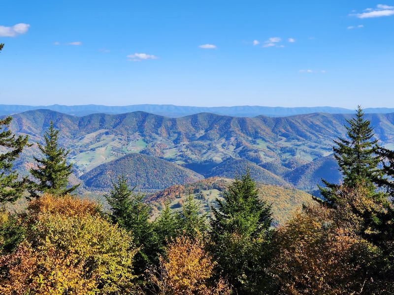
The highest spot in West Virginia sits at 4,863 feet, and you can park just a short stroll from the top. No ropes, no multi-day trek, no blistered heels required.
Up there, wind-battered red spruce trees grow their branches mostly on one side. The whole summit feels more like Canada than the Mountain State.
I love that a place this wild sits at the end of a paved road.
A gentle gravel loop circles the crown of the mountain. Benches wait along the way, and a stone and steel tower stands in the middle.
I can’t imagine a lazier way to stand on top of an entire state.
So what does the world look like from the very roof of West Virginia? And why does the drive up matter almost as much as the view?
The Roof Of The Mountain State Is Closer Than You Think
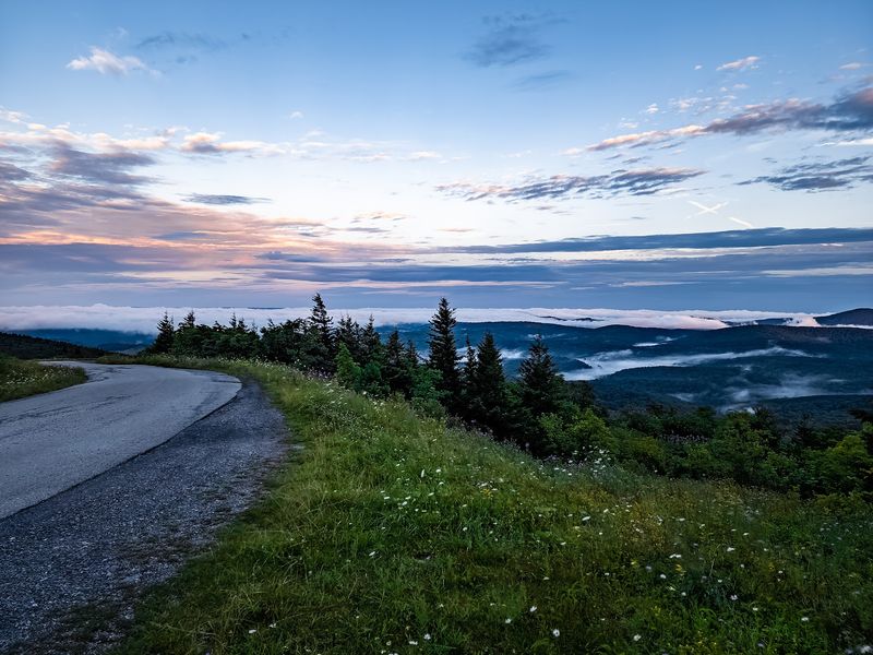
Spruce Mountain is the long ridge that holds West Virginia’s highest point. Its summit, called Spruce Knob, rises to 4,863 feet above sea level.
The peak sits in Pendleton County, near the small community of Riverton. It lies inside the Monongahela National Forest, so the whole mountaintop is public land.
Most high points make you earn them the hard way. Here, a winding forest road carries you nearly to the top, and a short path finishes the job.
That accessibility changes everything for families and older travelers. Someone who could never tackle a rugged backcountry climb can still say they stood on top of West Virginia.
The summit area is often called Spruce Knob, while the larger mountain carries the Spruce Mountain name. Both point to the same prize, so don’t let the double naming confuse your map app.
Free parking waits near the top, and the views reportedly start before you even leave the lot. You could stay in the car and still feel pretty proud of yourself.
Of course, a little walking pays off in a big way. The best scenery hides just beyond the pavement, along a trail that loops around the very crown of the mountain.
A Winding Forest Road Does Most Of The Climbing

Your car does the heavy lifting on this mountain. The usual route follows Briery Gap Run Road and then Forest Road 104 toward the summit.
Expect plenty of curves and a slow, steady climb. Some stretches feel narrow, and a few drivers describe the road as nerve-wracking on the way up.
Take your time and enjoy the changing forest. Several pull-offs along the route let you stop for photos without blocking traffic.
Some approaches include gravel sections that can feel bumpy. Watch for potholes, and leave plenty of space between you and the car ahead.
Larger vehicles may struggle on the tighter turns. The roads are reportedly not well suited for medium or large RVs, so plan accordingly if you’re towing your home behind you.
Driving after dark or in bad weather is a poor idea here. The curves, the drop-offs, and the remote setting all reward a daylight trip.
Patience is the best travel companion on this drive. Go slow, crack a window, and let the cooler mountain air tell you you’re getting close.
By the time you reach the top, the climb itself already feels like part of the adventure.
Plan Around Snow, Ice, And Zero Cell Bars
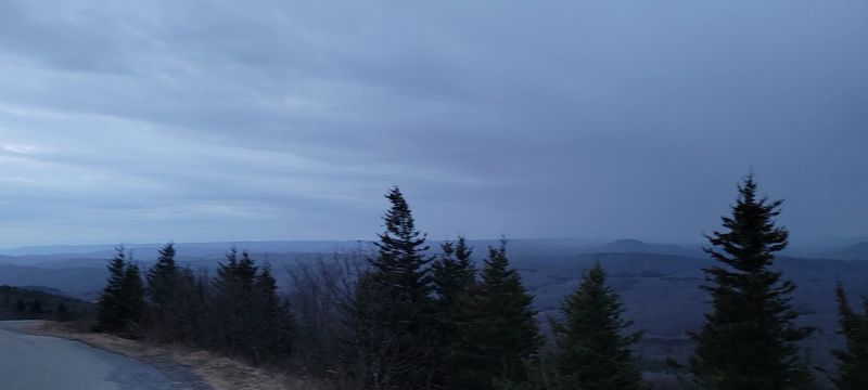
Winter plays by its own rules up here. The summit area reportedly averages around 180 inches of snow a year, which is a lot of shoveling nobody signed up for.
The roads to the top are not plowed in winter. That makes warmer months the easy choice for most visitors.
Some determined folks still try the trip in colder weather. Bringing tire chains is a smart move if you try your luck after the snow arrives.
Icy roads can turn a scenic drive into a white-knuckle ride. If the forecast looks dicey, save the mountain for a better day.
Don’t count on your phone either. Cell service is spotty to nonexistent at the summit, so download maps before leaving town.
Tell someone your plans and pack a few basics. Water, snacks, layers, and a full gas tank go a long way in a remote corner of West Virginia.
Weather can shift fast at this elevation, even in summer. A sunny morning down in the valley might bring wind and cool temperatures on top.
A light jacket in July feels silly until you need it. Then it feels like genius.
Half A Mile Of Gravel Circles The Very Top
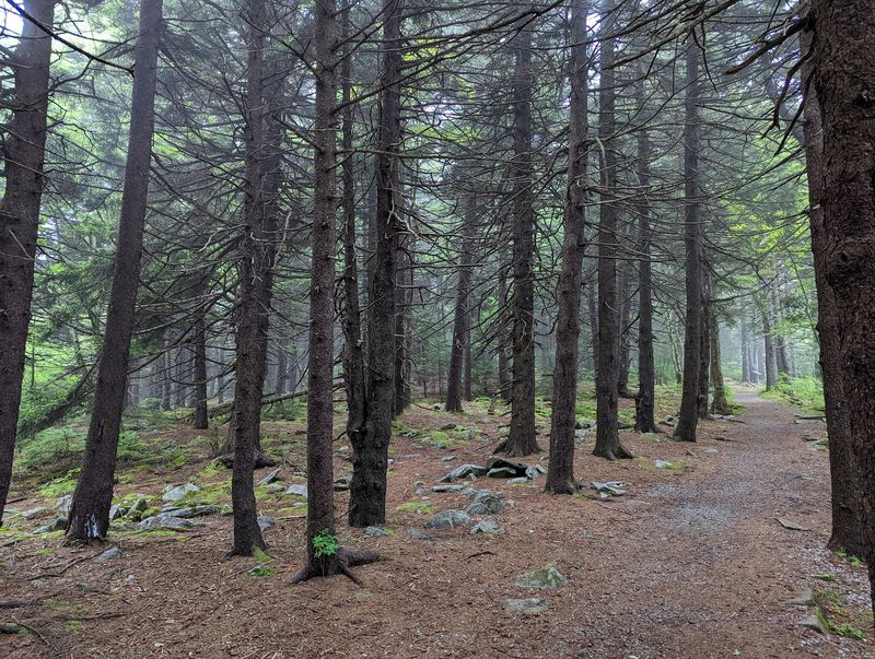
Half a mile. That’s all it takes to loop the summit on the Whispering Spruce Trail.
The path is smooth, graveled, and gentle. It circles the crown of Spruce Knob, making it one of the easiest high-point walks you’ll find anywhere.
Many people consider the trail wheelchair friendly. The surface stays even, though the observation tower itself requires climbing steps.
Benches dot the loop, so nobody needs to rush. You can sit, catch your breath, and soak up the ridges whenever the mood strikes.
Interpretive signs along the way explain the plants, rocks, and wildlife of this high-elevation world. Kids may learn something, and so might the grownups pretending they already knew.
Some of the most rewarding views come from openings along the trail. These spots often beat the tower, especially when summer leaves fill in the scene.
The west-facing side of the loop is a favorite for sunsets. Time your visit right, and the hills turn gold, pink, and purple before your eyes.
Easy hike, big payoff. Few trails offer a better ratio of effort to wow.
A Stone Tower Built For 360-Degree Bragging Rights
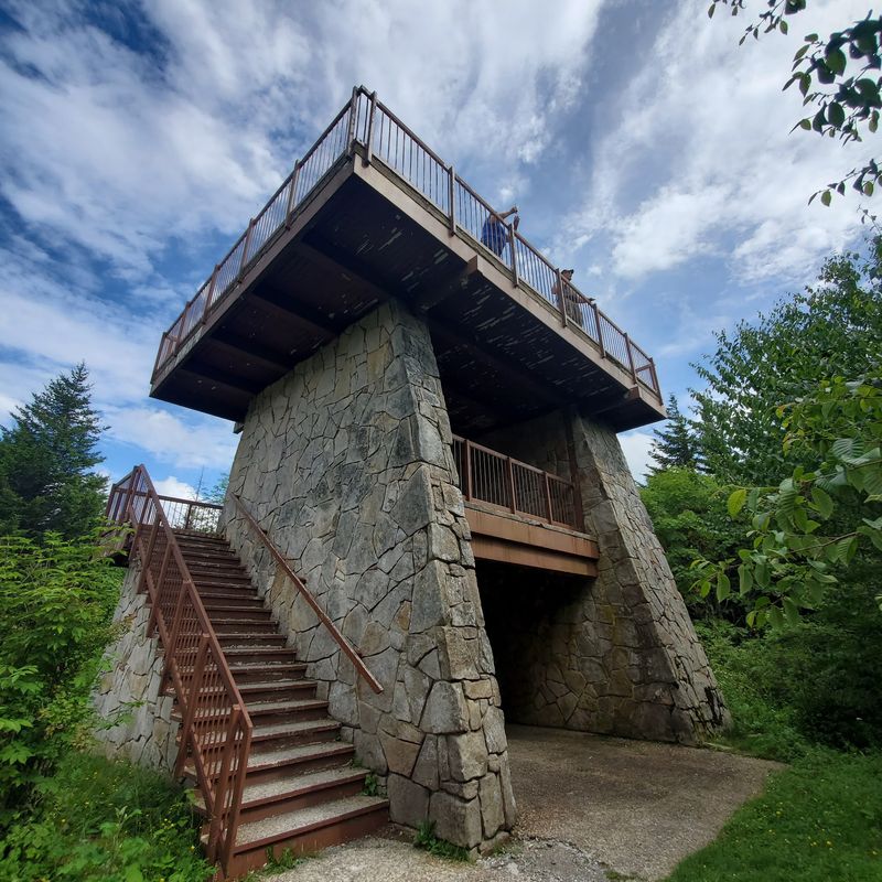
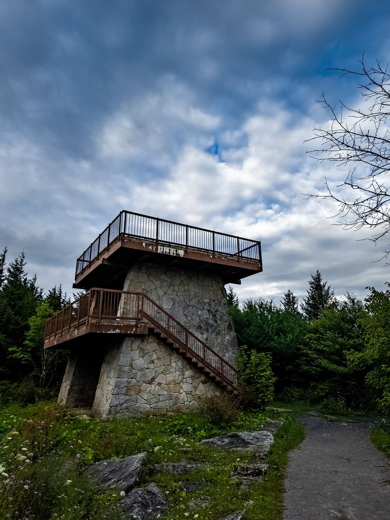
Stone below, steel above. The Spruce Knob Observation Tower was completed in 1969 and stands near the summit parking area.
A short, accessible path leads from your car to the tower. Climb up, and you’re standing a bit higher than West Virginia’s highest ground.
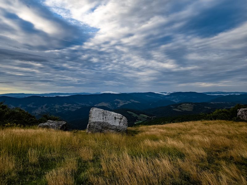
From the platform, the Allegheny Mountains roll away in every direction. On a clear day, the 360-degree view feels endless.
Now for the honest part. The surrounding spruce trees have grown, and in summer they can block parts of the view from the tower.
That doesn’t make the climb pointless. It just means the tower works best as one stop, not the whole show.
Fall and early spring may offer clearer sightlines through the trees. Either way, the tower makes a great photo spot and a fun landmark for kids to race toward.
Pair the tower with a walk along the trail. The openings on the loop deliver wide, unobstructed views that fill in what the trees hide.
Think of it as dessert after the main course. The real feast lies just down the path.
Lopsided Trees Tell The Story Of The Wind
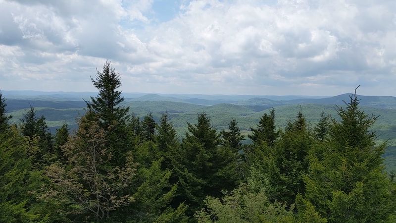
Look closely at the red spruce trees near the summit. Many have branches growing mostly on their eastern side, like they’re all pointing the same direction.
Strong westerly winds shaped them that way. Over years, the harsh weather stripped branches from the windward side and left the leeward side standing.
These twisted, stunted forms are often called krummholz. It’s a fancy word for trees that lost a long argument with the wind.
The summit environment feels more like northern New England or Canada. Spruce forests, open meadows, and old boulder fields create a landscape unlike most of West Virginia.
Beneath your feet lies Pottsville sandstone, which reportedly dates back more than 300 million years. That’s some seriously old ground for a casual afternoon walk.
The mix of rock, wind, and cold makes life tough up here. Plants and animals that thrive at this elevation have adapted in clever ways.
Spend a minute just studying one tree. Its shape tells you more about mountaintop weather than any forecast could.
Nature put on a whole science lesson. You just have to notice the lopsided branches.
Old Rocks, Old Trails, And A National First
Long before parking lots, Indigenous peoples knew these mountains well. Tribes including the Shawnee, Cherokee, and Mingo reportedly valued the region for its resources.
In 1921, Spruce Knob became part of the U.S. Forest Service holdings within the Monongahela National Forest.
That move helped protect the summit for future visitors.
Then came a bigger milestone. In 1965, President Lyndon Johnson signed the act creating the Spruce Knob-Seneca Rocks National Recreation Area.
According to the Forest Service, it was the first National Recreation Area established within a U.S. National Forest.
Not a bad title for a mountain in Pendleton County.
The observation tower followed a few years later, finishing in 1969. Since then, generations of families have made the drive to stand on top of the state.
That history makes the trip feel personal for many West Virginians. Some natives wait years before finally seeing their state’s highest point.
Maybe your grandparents made the climb decades ago. Maybe this is your first time.
Either way, you’re joining a long line of people drawn to the same windy summit.
Pack A Lunch For The Highest Picnic In The State
Sandwiches taste better at 4,863 feet. That’s not science, but it feels true.
Picnic tables and grills sit near the summit area. They give you a great excuse to linger after your walk instead of rushing back down the mountain.
Vault toilets are also on site, though they close during winter months. Plan ahead if you’re visiting in the colder season.
The parking area is free and roomy. You’ll find space to unload a cooler, stretch your legs, and gather the family before hitting the trail.
No restaurants or snack stands wait at the top. Bring everything you need, including plenty of water and a bag for trash.
Leave the picnic spot as clean as you found it. The summit feels special partly because it stays wild and uncluttered.
A simple spread works best up here. Think pepperoni rolls, fruit, cookies, and a thermos of something warm on a breezy day.
Find a table with a view, and the mountain does the rest. Few dining rooms in West Virginia can match that backdrop.
Bears, Hawks, And A Squirrel That Glides
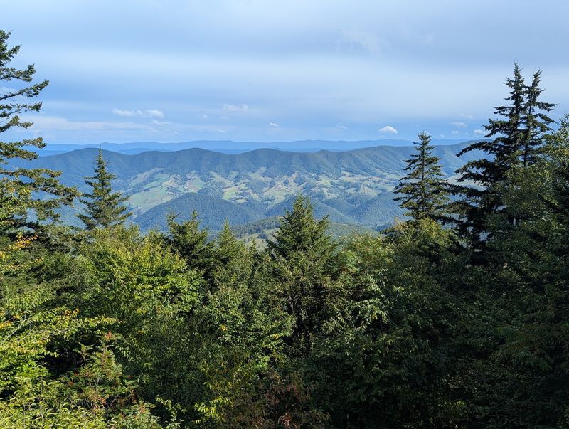
Keep your eyes moving as you walk. The summit area supports black bears, rabbits, porcupines, hawks, and even eagles.
Bear sightings are never guaranteed. Still, it’s wise to keep food packed away and give any wildlife plenty of room.
The high-elevation habitat also shelters some rare residents. The Atlantis fritillary and green comma butterflies reportedly flutter through these mountain meadows.
Then there’s the Spruce Knob threetooth, a tiny land snail. It’s not exactly a crowd-pleaser, but it shows how unusual this place really is.
The star of the show might be the West Virginia northern flying squirrel. This small glider depends on the red spruce forests that crown the region.
Spotting one takes luck, since they’re mostly active at night. Knowing they’re out there adds a little magic to every evening visit.
Birders may want binoculars on the trail. Hawks riding the ridge winds make for a fine show against the open sky.
Stay quiet, move slowly, and let the mountain reveal its neighbors. The patient visitor usually sees the most.
Some Of The Darkest Skies In The East
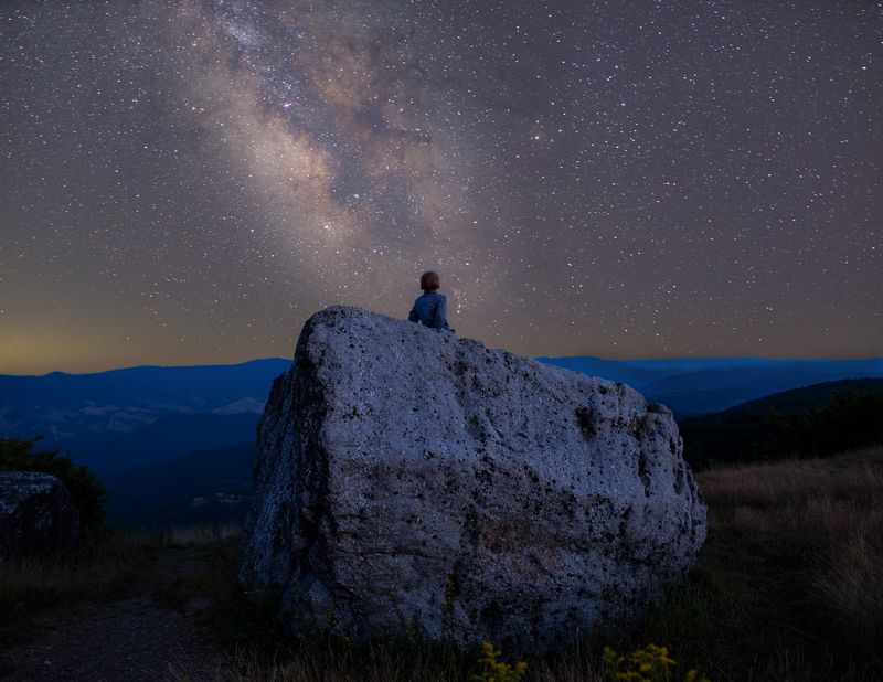
When the sun drops, the show isn’t over. Spruce Knob is known for some of the darkest skies in the eastern United States.
Remote location and little light pollution make the difference. On a clear night, the Milky Way can stretch across the sky above the ridges.
Some stargazers even spot satellites drifting overhead. It’s a humbling reminder of how many lights we miss back home.
Before you plan a night trip, remember the drive. The winding road feels much harder after dark, so arriving before sunset makes sense.
Bring warm layers, even in summer. Mountaintop nights can turn chilly quickly, and wind adds an extra bite.
A red flashlight helps protect your night vision. Folding chairs or a blanket make the wait for full darkness more comfortable.
Check the moon phase before you go. A new moon gives you the darkest sky and the most stars.
Watching the sunset from the west side of the trail, then staying for the stars, makes a perfect evening. It’s a double feature with no ticket required.
A Lake, Campgrounds, And Seneca Rocks Nearby
One summit rarely satisfies a curious traveler. Thankfully, the Spruce Knob-Seneca Rocks National Recreation Area covers about 100,000 acres of extra adventure.
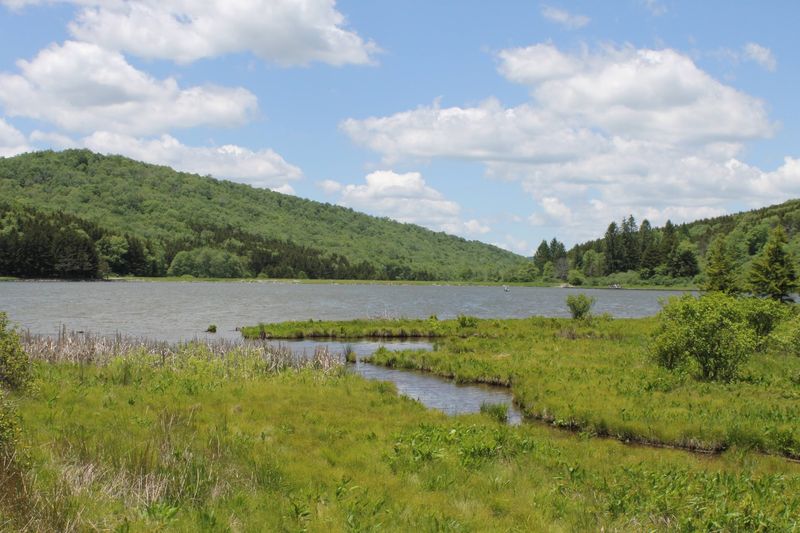
Spruce Knob Lake sits a short drive away and is the highest-elevation lake in West Virginia. The 25-acre lake was built in 1952 for fishing and boating.
Trout anglers can try their luck there. Swimming isn’t allowed, so leave the cannonballs for another trip.
Camping options include Spruce Knob Lake Campground and Gatewood Campground. A few primitive spots with fire pits also exist around the area.
The recreation area offers more than 75 miles of trails for hiking and mountain biking. Seneca Creek is a popular next stop for walkers wanting more miles.
Then there’s Seneca Rocks, a dramatic 900-foot quartzite crag famous for rock climbing. The Seneca Rocks Discovery Center helps explain the region’s natural and human story.
Linking the summit, the lake, and the rocks makes a full weekend. You’ll head home with tired legs and a camera roll full of mountains.
Not bad for one corner of Pendleton County.
Getting There And When To Go
Ready to map it out? The main access for Spruce Knob is listed as Forest Rd 274, Riverton, WV 26814.
Riverton sits in Pendleton County, in the eastern highlands of West Virginia. From there, forest roads lead up toward the summit area.
Download directions before leaving reliable cell coverage. Once you start climbing, your phone may become a very expensive paperweight.
Late spring through fall offers the easiest access. Roads aren’t plowed in winter, and the vault toilets close for the season.
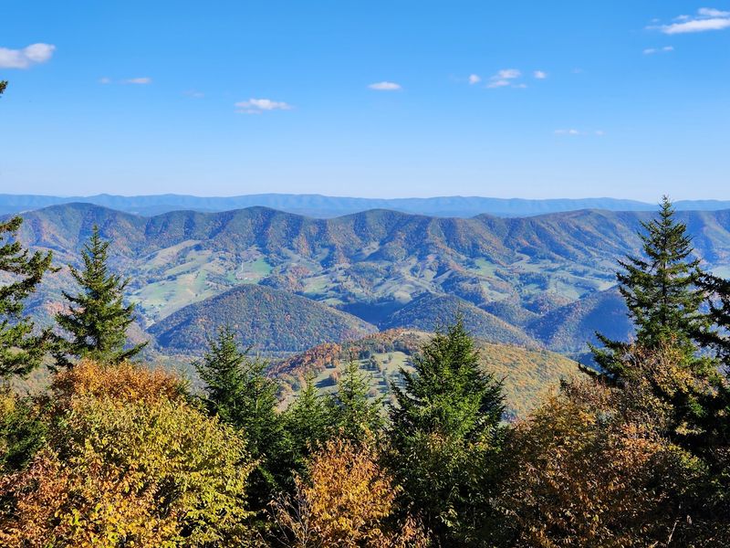
Fall deserves special mention. The changing leaves across the Allegheny ridges make autumn a favorite time to visit.
Summer brings green forests and cooler temperatures than the valleys below. It’s a natural escape when the lowlands turn sticky.
Parking at the summit is free. Arrive earlier on busy weekends, since the mountain can draw steady traffic in peak seasons.
Give yourself a relaxed half day at minimum. The drive, the trail, the tower, and a picnic deserve unhurried time.
Fill your gas tank in town first. Stations are scarce once you leave the main roads.
Why The Top Of West Virginia Belongs On Your List
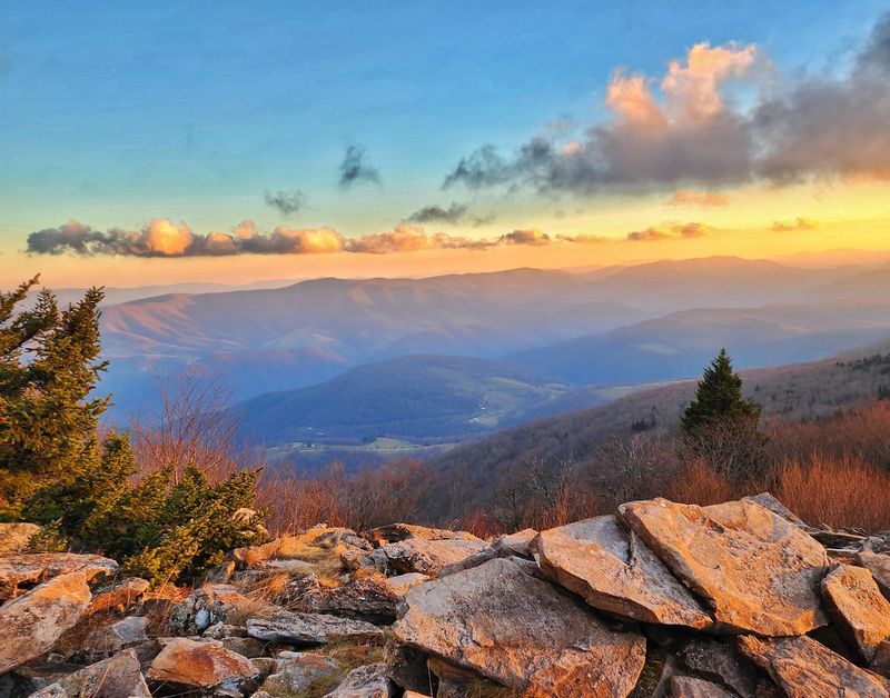
Few places let you stand on top of a whole state this easily. Spruce Mountain hands you that moment at the end of a scenic drive and a short gravel walk.
The appeal goes beyond bragging rights. Wind-shaped spruce, ancient rock, wide views, and big quiet skies make the summit feel like another world.
Families will love the easy trail and picnic tables. Retirees can enjoy the views without punishing their knees.
Photographers get sunsets on the west side of the loop. Night owls get some of the darkest skies in the East.
It’s also a place full of pride for West Virginia. Folks who grew up in these hills often call it one of the most beautiful spots the Mountain State offers.
Plan around the weather, respect the curvy roads, and pack your own supplies. A little preparation keeps the trip smooth.
Then let the mountain work on you. Sit on a bench, watch the hawks, and feel the breeze bending those lopsided trees.
Have you ever stood at the top of West Virginia? If not, the road is waiting.
