New York roads can be beautiful, but some are downright dangerous.
Whether you are a local driver or a visitor exploring the state, certain routes should make you think twice before hitting the gas.
These roads are known for sharp turns, unpredictable weather, and accidents that happen far too often.
Buckle up as we explore seven of the most terrifying roads in New York that might make you regret your travel plans this season.
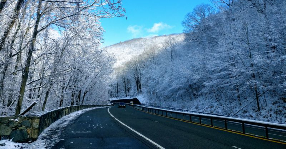
1. Route 97: The Hawk’s Nest
Carved into the cliffs above the Delaware River, this stretch of highway has earned a reputation that makes even experienced drivers nervous.
Route 97 winds through the Upper Delaware Scenic Byway with hairpin turns that seem to appear out of nowhere.
The road drops steeply on one side, offering breathtaking views that can also distract you at the worst possible moment.
Motorcyclists flock here for the thrill, but that same excitement has led to numerous accidents over the years.
The pavement can be slick after rain, and fallen leaves in autumn make the surface even more treacherous.
Guardrails are present in some sections, but they feel inadequate when you peer over the edge into the rocky gorge below.
Wildlife crossings add another layer of danger, as deer often dart across the road without warning.
Local residents know to slow down well before each curve, but tourists unfamiliar with the terrain often misjudge their speed.
Winter ice transforms this route into a nightmare, with black ice forming in shaded areas that remain frozen long after sunrise.
Emergency services have a hard time reaching accident sites quickly due to the remote location and narrow roadway.
If you must travel this route, go during daylight hours and keep your speed well below the posted limit.
Check weather conditions before you leave, and consider taking an alternate route if rain or snow is in the forecast.
Many drivers who have conquered Route 97 say the views are worth it, but they also admit they would not want to do it again.
This road demands your full attention and respect, or it will remind you why it has such a fearsome reputation.
2. Palisades Interstate Parkway

Running along the Hudson River, this parkway might seem like a peaceful drive through nature, but appearances can be deceiving.
The road was built decades ago when cars were smaller and slower, which means the lanes feel cramped by modern standards.
Sharp curves come one after another, and the lack of shoulders leaves no room for error if you need to pull over.
Thick tree cover blocks sunlight, creating pockets of darkness even on bright days, and fog rolls in without warning near the river.
Speed limits are strictly enforced, but some drivers still try to race through, leading to dangerous tailgating and sudden braking.
The parkway prohibits commercial vehicles, which helps reduce traffic, but it also means fewer witnesses if something goes wrong.
Stone walls and steep embankments line both sides of the road, turning any loss of control into a potentially serious crash.
During fall, wet leaves blanket the pavement, reducing traction and causing vehicles to slide unexpectedly.
Winter brings another set of challenges, as snow removal can be slow and ice forms quickly on bridges and overpasses.
Deer are a constant threat, especially at dawn and dusk when visibility is already poor.
Cell phone reception is spotty in many areas, making it difficult to call for help if you break down or witness an accident.
Local drivers know the quirks of this road and navigate it with caution, but visitors often underestimate how demanding it can be.
If you plan to use the Palisades Interstate Parkway, allow extra travel time and avoid driving after dark if possible.
Stay alert, keep both hands on the wheel, and remember that this scenic route requires constant vigilance to navigate safely.
3. Whiteface Mountain Veterans Memorial Highway
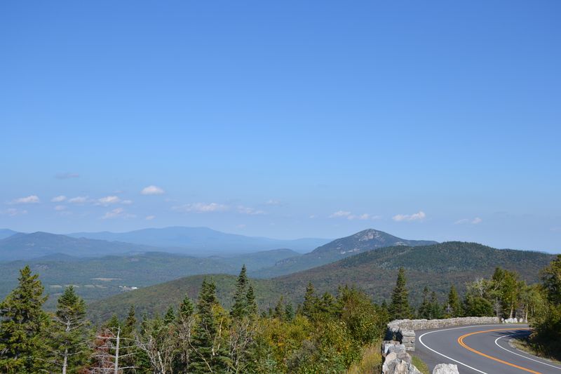
Climbing nearly 3,000 feet in just over eight miles, this highway takes you to one of the highest points accessible by car in New York.
The road was built as a memorial to veterans, but its steep grades and relentless switchbacks make it a white knuckle experience for many drivers.
Each hairpin turn feels tighter than the last, and the lack of guardrails in some sections means nothing stands between you and a long drop.
The pavement is narrow, and when vehicles approach from opposite directions, it can feel like a game of chicken to see who will yield first.
Weather conditions change rapidly at higher elevations, with clear skies at the base giving way to dense fog or sudden rain near the summit.
Brakes overheat on the descent, and the smell of burning brake pads is common as drivers struggle to control their speed.
Inexperienced drivers often panic halfway up and either freeze in the middle of the road or attempt reckless maneuvers to turn around.
The road is only open seasonally, typically from late May through October, but even during those months, conditions can be harsh.
Rockslides occasionally block sections of the highway, and maintenance crews work constantly to keep the route passable.
Motorcyclists love the challenge, but the combination of steep inclines and unpredictable weather has led to several tragic accidents.
Visitors who reach the top are rewarded with stunning views of the Adirondacks, but the journey tests nerves and driving skills alike.
If you decide to tackle Whiteface Mountain Veterans Memorial Highway, make sure your vehicle is in good condition and your brakes are recently serviced.
Drive slowly, use lower gears to control your speed, and pull over at designated lookout points if you need a break.
This road is not for the faint of heart, and many who complete the drive admit they felt relief once they were back on level ground.
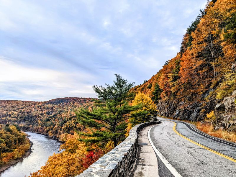
4. Route 9W Along the Hudson
Stretching along the western shore of the Hudson River, Route 9W offers scenic views but also presents serious hazards for drivers.
The road alternates between residential areas, commercial zones, and isolated stretches where help can be miles away.
Traffic moves fast, and aggressive drivers frequently weave between lanes, creating a chaotic environment during rush hours.
Many sections lack adequate lighting, turning nighttime driving into a guessing game where pedestrians and cyclists can appear suddenly.
The road surface is uneven in places, with potholes and cracks that can damage tires or throw a vehicle off course.
Steep hills challenge underpowered vehicles, and trucks often slow to a crawl on inclines, backing up traffic and increasing frustration.
Intersections are poorly marked in some areas, and drivers unfamiliar with the route often make last minute turns or stops.
Deer crossings are frequent, particularly in areas where woods meet the roadway, and collisions with wildlife are common.
During winter, snow and ice accumulate quickly on shaded sections, and plows sometimes miss isolated spots until after accidents occur.
Flooding can also be an issue during heavy rain, as water runs off the cliffs and onto the pavement, creating hazardous conditions.
Emergency shoulders are narrow or nonexistent in many places, leaving disabled vehicles stranded in active traffic lanes.
The mix of local traffic, tourists, and commercial vehicles creates unpredictable driving patterns that require constant attention.
If you need to use Route 9W, plan your trip during off peak hours and stay in the right lane unless you need to pass.
Keep your headlights on even during the day to increase visibility, and watch for sudden stops or lane changes by other drivers.
This road may not look intimidating at first glance, but its combination of hazards makes it one of the more stressful drives in New York.
5. Route 23A Through Kaaterskill Clove

Cutting through the heart of the Catskill Mountains, Route 23A follows a narrow gorge that challenges even the most confident drivers.
The road climbs steeply through Kaaterskill Clove, with sharp curves that hug the mountainside and offer little margin for error.
Rock faces loom on one side while the other side drops away into the valley below, creating a sense of exposure that can be unsettling.
The pavement is often damp from waterfalls and streams that cross the road, making the surface slippery year round.
Guardrails provide some protection, but they look flimsy compared to the steep drops they are meant to prevent.
Tourists stop frequently to take photos, sometimes parking in unsafe locations or walking along the roadway, adding to the danger.
The road is popular with motorcyclists who enjoy the twists and turns, but the same features that attract them also lead to accidents.
During autumn, leaf peepers flock to the area, increasing traffic and slowing travel to a crawl on weekends.
Winter conditions make Route 23A nearly impassable at times, with ice forming in shaded areas and snow drifting across the pavement.
Spring thaw brings the risk of rockslides and falling debris, as freeze thaw cycles loosen stones from the cliffs above.
Visibility is limited on many curves, and oncoming traffic can appear suddenly, forcing quick reactions to avoid a head on collision.
The road is too narrow for large vehicles to pass comfortably, yet trucks and RVs still attempt the route, causing bottlenecks and delays.
If you must drive Route 23A, go during the middle of the week when traffic is lighter, and avoid the route entirely during bad weather.
Keep your speed low, use your horn before blind curves, and be prepared to stop suddenly if another vehicle crosses the center line.
This road offers stunning natural beauty, but it demands respect and caution from everyone who travels through Kaaterskill Clove.
6. Route 28 in the Adirondacks
Winding through some of the most remote wilderness in New York, Route 28 offers solitude but also presents unique dangers.
The road stretches for miles without services, meaning a breakdown or accident can leave you stranded far from help.
Cell phone coverage is unreliable at best, and in many areas, you will have no signal at all to call for assistance.
Wildlife is abundant, and moose crossings are particularly dangerous because these massive animals can total a vehicle and cause serious injuries.
The road surface is rough in places, with frost heaves and potholes that can appear without warning and damage your suspension.
During winter, Route 28 becomes a snow covered track that requires four wheel drive and winter tires to navigate safely.
Whiteout conditions are common during storms, and the lack of landmarks makes it easy to become disoriented.
Summer brings its own challenges, as logging trucks use the route heavily, kicking up dust and gravel that can crack windshields.
The trucks travel fast and take up most of the road, forcing smaller vehicles to pull over or risk a dangerous encounter.
Gas stations and rest stops are few and far between, so running low on fuel can become a serious problem.
The isolation also means that if you have a medical emergency, it could take an hour or more for an ambulance to reach you.
Black bears and other wildlife are active along the road, and hitting an animal at highway speed can be catastrophic.
If you plan to travel Route 28, make sure your vehicle is reliable and carry emergency supplies including food, water, and blankets.
Let someone know your route and expected arrival time, and check road conditions before you leave.
This road rewards adventurous spirits with incredible scenery, but it also punishes those who are unprepared or careless.
7. Taconic State Parkway
Built in the 1920s and 1930s, the Taconic State Parkway has a deadly history that continues to this day.
The road was designed for leisurely Sunday drives in vehicles that rarely exceeded 40 miles per hour, but modern traffic moves much faster.
Lanes are narrow, shoulders are almost nonexistent, and the curves are sharper than what current highway standards would allow.
Head on collisions are alarmingly common because the parkway has no median barrier in many sections, just a painted line separating opposing traffic.
Drivers often drift across the center line, either from distraction or fatigue, leading to devastating crashes.
The road surface is poorly maintained in places, with cracks and uneven pavement that can cause vehicles to lose control.
Visibility is limited on many curves, and the rolling hills create blind spots where you cannot see oncoming traffic until it is too late.
Trees line both sides of the parkway, and hitting one at high speed almost always results in serious injury or death.
Exit ramps are short and poorly marked, causing drivers to brake suddenly or miss their turn and attempt dangerous maneuvers.
The parkway is especially hazardous at night, when poor lighting and reduced visibility make it difficult to judge distances and speeds.
Drunk driving incidents are frequent on weekends, adding another unpredictable element to an already dangerous road.
Despite numerous calls for upgrades, the historic designation of the parkway has limited what improvements can be made.
If you must use the Taconic State Parkway, stay alert and avoid distractions like cell phones or eating while driving.
Keep your speed reasonable, even if other drivers are going faster, and increase your following distance to allow more reaction time.
This road has claimed too many lives over the years, and respecting its dangers is the best way to ensure you do not become another statistic.
Dear Reader: This page may contain affiliate links which may earn a commission if you click through and make a purchase. Our independent journalism is not influenced by any advertiser or commercial initiative unless it is clearly marked as sponsored content. As travel products change, please be sure to reconfirm all details and stay up to date with current events to ensure a safe and successful trip.