Water levels dropping across the state are starting to get people’s attention. More lakes across Texas are showing signs of change, and it is becoming harder to ignore.
Texas communities are beginning to feel the impact in ways that go beyond the shoreline.
Boat ramps sit higher above the water, shorelines stretch farther out, and familiar views no longer look the same. What used to be full, active lakes are shifting into something quieter and more exposed.
The changes happen gradually, but they are noticeable to anyone who has spent time around these areas.
The concern is not just about how things look. It ties into water supply, recreation, and the long-term future of these spaces that so many people rely on and enjoy.
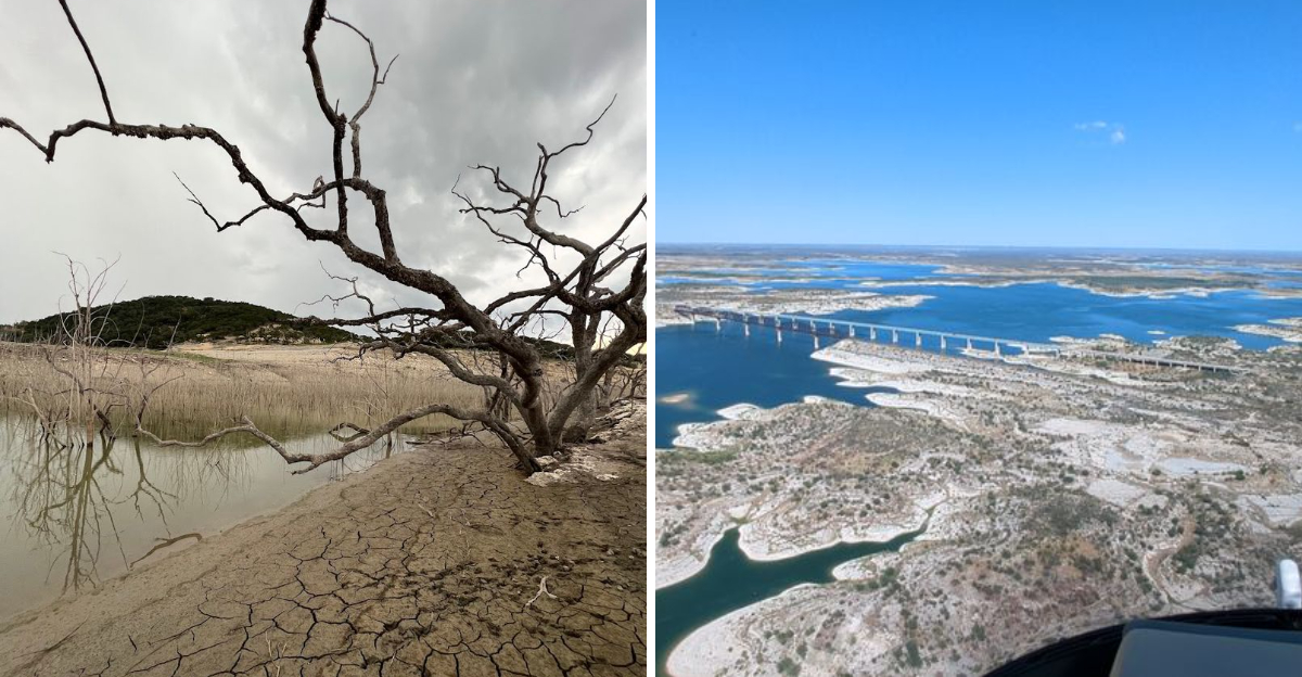
1. Lake Corpus Christi
The first time you see Lake Corpus Christi at dramatically low levels, it feels less like a lake and more like a memory of one. Pale rings of exposed earth trace where the waterline used to be, telling the story of years of drought and heavy demand without saying a single word.
Lake Corpus Christi serves as a primary water source for the city of Corpus Christi and several surrounding communities, which makes its declining levels far more than just a scenic concern.
The reservoir has struggled through repeated drought cycles, and recovery has been painfully slow each time conditions improve even slightly.
Fishing piers that once extended over open water now reach over cracked mud flats. Local anglers who have fished here for decades describe the change as surreal and deeply unsettling.
The lake still draws visitors, but the mood is different now, more reflective than celebratory.
Conservation efforts and water use restrictions have been put in place, but the challenge remains enormous. The lake sits in a region that receives limited annual rainfall, making it especially vulnerable during extended dry spells.
Watching the water recede here is a reminder of just how fragile the balance between supply and demand really is.
2. Choke Canyon Reservoir
Choke Canyon Reservoir has a name that sounds almost prophetic now, because for years, drought has had this lake in a firm grip.
Located in South Texas near Three Rivers, the reservoir was built to help supply water to Corpus Christi alongside Lake Corpus Christi, and together they form a critical two-lake system that has been under serious stress.
At its lowest points, Choke Canyon has dropped to single-digit percentages of capacity, which sends alarm bells ringing across water management offices throughout the region.
The lake covers a large surface area when full, but the exposed banks during drought years reveal a landscape that looks almost lunar in its emptiness.
Wildlife that depends on the reservoir, including migratory birds and native fish species, faces real habitat disruption when levels fall this low. The Choke Canyon State Park still attracts nature lovers, but the experience shifts considerably when the water retreats far from the usual shoreline.
Ranchers and small towns nearby rely on this water supply for daily life, which gives every inch of water level a weight far beyond recreation. Recovery here requires sustained rainfall over long periods, and in South Texas, that kind of patience is always being tested.
3. Falcon Lake
Falcon Lake sits right on the Texas-Mexico border, split between two countries and shared by two sets of communities who both depend on it deeply.
The lake is fed by the Rio Grande, and that dependence on a river that itself has faced severe flow reductions makes Falcon Lake particularly vulnerable to the compounding pressures of drought and upstream water use.
I have seen photos of Falcon Lake from different decades, and the contrast is striking. What was once a broad, shimmering body of water has in certain years been reduced to a shallow, murky shadow of itself.
Old structures from submerged towns have re-emerged from the waterline during the worst droughts, which is both fascinating and eerie.
The lake has long been celebrated for its bass fishing, drawing anglers from across the Southwest who chase trophy catches in its warm waters. But low water concentrates fish into smaller areas, stresses aquatic ecosystems, and can lead to fish kills that take years to recover from fully.
International water treaties complicate management decisions here, adding layers of diplomacy to what is already a difficult environmental situation. Falcon Lake is a place where geography, politics, and climate change all meet at the waterline.
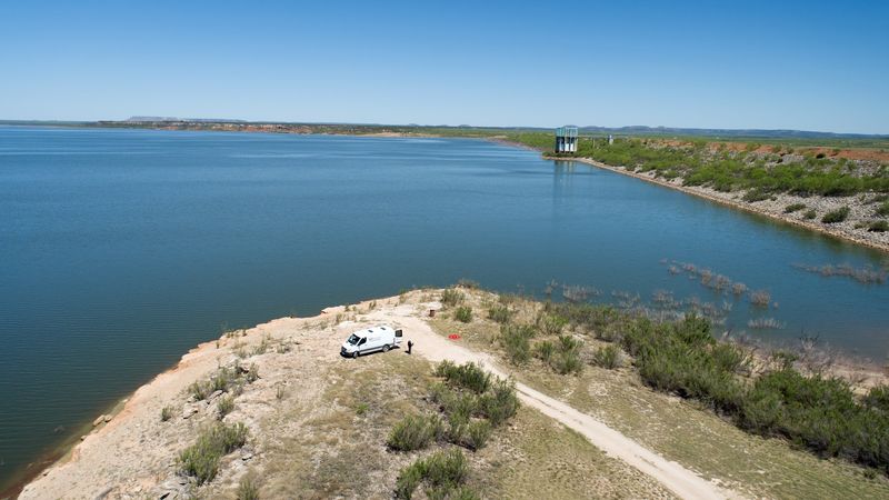
4. Lake Amistad
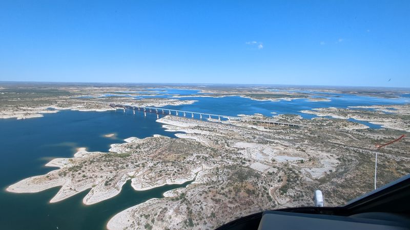
Lake Amistad is one of those places that commands respect the moment you see it, even when the water is low. Carved into the rugged limestone country near Del Rio, the reservoir straddles the US-Mexico border and is jointly managed by both countries through an international commission.
That cooperative arrangement is impressive, but it has not shielded the lake from the relentless pressure of drought.
Amistad means friendship in Spanish, and the lake was meant to symbolize exactly that between neighboring nations. In recent years, however, water levels have fallen enough to expose ancient rock art sites along the canyon walls, which archaeologists find both alarming and revealing.
These petroglyphs were not meant to be above the waterline, and their reappearance signals just how far the water has dropped.
Boaters, kayakers, and scuba divers have long loved Amistad for its clear water and dramatic scenery. The lake sits within a national recreation area managed by the National Park Service, bringing in visitors from across the country who come for fishing, camping, and the sheer beauty of the landscape.
When the water retreats, the canyon walls loom even larger and more dramatic, which is beautiful in a sobering sort of way. The lake is resilient, but it needs rain, and lots of it.
5. Medina Lake
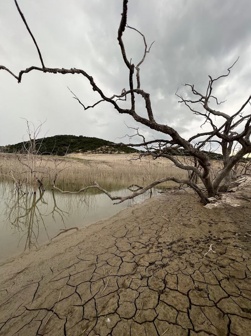
Medina Lake has spent most of recent years in a state that longtime residents describe as heartbreaking. As of early 2026, the lake sat at just 4.2% capacity, a figure so low it is almost hard to process.
The lake has been below 10% capacity since August 2022, which means recovery has not just stalled, it has barely begun.
Built in 1913, Medina Lake is one of the oldest reservoirs in Texas and has a deep history woven into the fabric of the Hill Country communities around it.
Old cabins, roads, and even foundations from long-submerged neighborhoods have emerged from the receding water, turning the dry lakebed into something that feels like an open-air museum of a lost world.
The lake once supported a thriving recreational scene, with boating, swimming, and waterfront cabins drawing San Antonio families for summer getaways. That world feels distant now.
Property owners along the shoreline have watched their docks sit on cracked earth for years, unsure when or whether the water will return in any meaningful way.
Local water districts are working on alternative supply strategies, but the scale of the deficit is enormous. Medina Lake is a clear and urgent example of what prolonged drought does to a community that built its identity around water.
6. E.V. Spence Reservoir
Out in the rolling plains of West Texas, E.V. Spence Reservoir tells one of the most dramatic water stories in the entire state.
The reservoir near Robert Lee has at various points in recent years been functionally empty, reduced to a small puddle surrounded by miles of cracked, sandy lakebed that stretches to the horizon like a desert mirage.
Spence was built to serve as a water supply for the Colorado River Municipal Water District, which means its decline has real consequences for communities in the region.
When a reservoir designed to hold over 1.4 million acre-feet of water drops to near zero, the people who depend on it have to scramble for alternatives fast.
The lake was once a popular spot for fishing and water sports, but those days feel like a different era entirely. Local fishermen remember tournament-level bass fishing on Spence, and the contrast between those memories and the current reality is stark.
Grass and shrubs have taken root across sections of the old lakebed, which gives the place an almost post-apocalyptic quality.
Recovery depends entirely on rainfall in the upper Colorado River basin, and West Texas does not hand out rain generously. Spence is a sobering lesson in just how quickly a large reservoir can vanish under the right conditions.
7. Champion Creek Reservoir
Champion Creek Reservoir near Colorado City is not one of Texas’s most famous lakes, but the people who live around it know exactly how important it is and exactly how much trouble it has been in.
The reservoir serves as a cooling water source for a nearby power plant and also provides municipal water supply for the area, which means its health is tied directly to everyday life in ways most visitors would never guess.
Low water levels here carry a kind of double weight. When the lake drops, it does not just affect recreation, it affects industrial operations and the reliability of basic utilities for the surrounding community.
That combination makes Champion Creek a uniquely pressured reservoir among the many struggling lakes in West Texas.
The landscape around the reservoir is classic West Texas scrubland, wide and flat with big skies that make the shrinking waterline look even more exposed than it already is. Watching the red clay banks rise higher above the waterline with each passing dry season is not something you forget easily.
Efforts to manage water use carefully have helped somewhat, but the root issue is the same one facing lakes across the state. Champion Creek is a quiet crisis that deserves far more attention than it typically receives from people outside the immediate region.
8. Lake Meredith
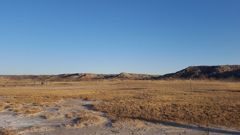
Lake Meredith sits in the Texas Panhandle near Amarillo, carved into rugged Canadian River canyon country that looks unlike anywhere else in the state.
The lake has had a turbulent history with water levels, dropping so severely in the early 2000s that boat ramps sat stranded hundreds of feet from the actual waterline.
It felt less like a lake visit and more like exploring an ancient riverbed.
The reservoir serves as a drinking water source for several Panhandle communities and has also been a recreational destination for generations of families in a part of Texas that does not have many alternatives. When Meredith struggles, the communities around it feel it immediately and personally.
There is no easy backup option out here.
Managed by the National Park Service as part of the Lake Meredith National Recreation Area, the lake draws visitors for boating, hiking, and wildlife watching even during low-water periods.
The canyon scenery is genuinely spectacular, with towering red and ochre walls that frame the water beautifully no matter the level.
In recent years, water levels have improved somewhat compared to the historic lows of the early 2000s, but the lake remains vulnerable to the dry cycles that sweep across the Panhandle with regularity. The story of Lake Meredith is still being written, and the next chapter depends entirely on the sky.
Dear Reader: This page may contain affiliate links which may earn a commission if you click through and make a purchase. Our independent journalism is not influenced by any advertiser or commercial initiative unless it is clearly marked as sponsored content. As travel products change, please be sure to reconfirm all details and stay up to date with current events to ensure a safe and successful trip.