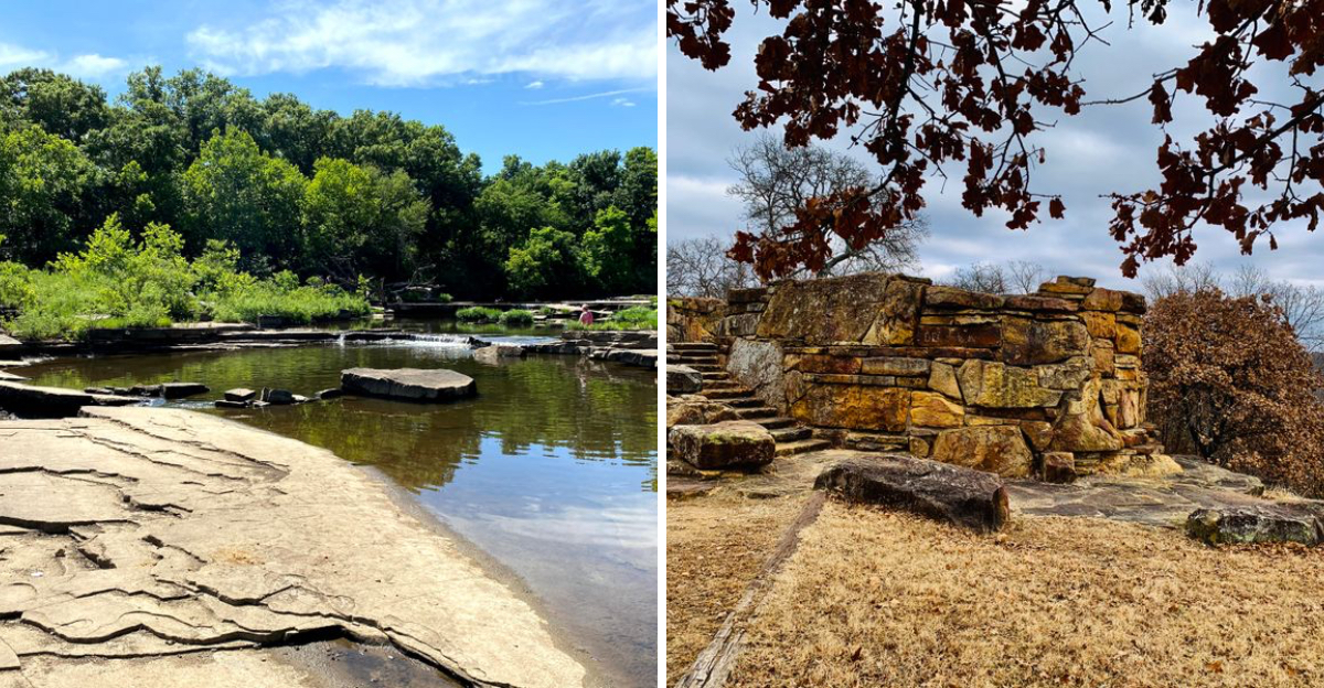
Most people picture Oklahoma as flat prairie under endless sky. That image falls apart within minutes of stepping onto the Coon Creek Loop Trail in Osage Hills State Park.
This four-mile path winds through narrow limestone corridors, passes shallow caves carved by centuries of erosion, and even hides a natural sinkhole that most hikers walk right past without noticing.
The landscape here feels borrowed from the Ozarks or Appalachia rather than the southern plains. Water has quietly shaped this corner of the state into something unexpected, creating rock-walled passages and shaded creek crossings that feel worlds away from the open terrain just minutes down the road.
If someone blindfolded you and dropped you here, Oklahoma wouldn’t be your first guess.
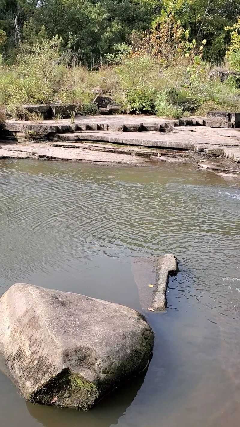
The Rock-Walled Creek Corridor
Early in the loop, the trail drops into a narrow stretch where Coon Creek cuts between limestone walls. The rock rises close on both sides, creating a shaded passage that feels more canyon than prairie.
Sound dampens here, and even busy days feel quiet once you step into this section. The corridor runs for several hundred yards, with the creek sometimes brushing right against the stone on one side.
Moss clings to the north-facing surfaces where sunlight barely reaches. You can see layers in the rock that tell a story of sediment deposited millions of years ago when this area sat under an ancient sea.
During spring runoff, the creek runs faster and louder, filling the corridor with white noise. In late summer, it slows to a trickle, exposing smooth stones worn down by constant flow.
This section makes you forget you are in Oklahoma. The walls block the horizon and replace open sky with a narrow strip of green canopy overhead.
Photographers love this spot in early morning when low light filters through the trees and reflects off wet rock. The contrast between shadow and filtered sun creates dramatic compositions.
Most people pause here instinctively, drawn to the cool air and the way the space feels protected. It is one of those places where you naturally lower your voice without thinking about it.
The Shallow Limestone Caves
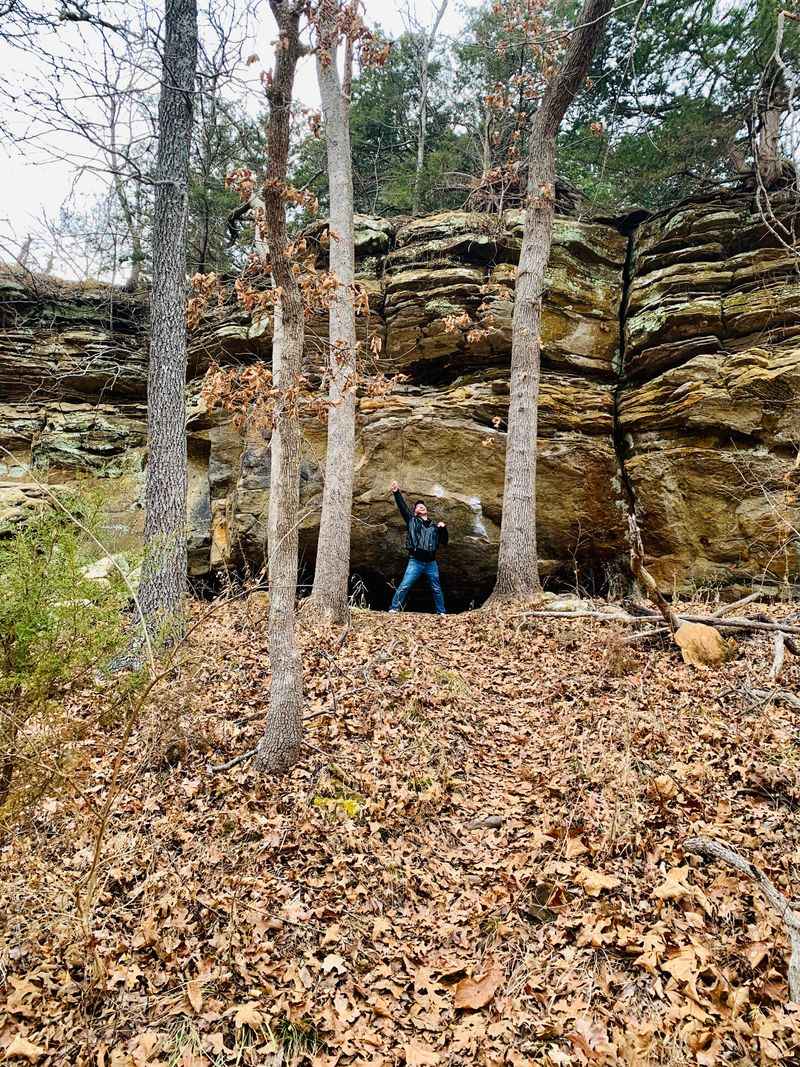
Scattered along the rock faces are small caves and overhangs formed by erosion. Most are shallow, but deep enough to step into and cool off during warmer months.
They are unmarked and easy to miss if you are not watching the walls instead of the trail. Some are barely recesses, while others extend back six or eight feet into the hillside.
The ceilings show patterns where softer layers of limestone dissolved faster than harder bands. Water still seeps through cracks during wet seasons, leaving mineral stains in rust and gray tones.
These caves never housed ancient peoples or wildlife dens, at least not that archaeologists have documented. They are simply the result of patient water working on soluble rock over thousands of years.
On hot days, the temperature inside drops noticeably compared to the trail outside. The stone holds coolness the way it holds moisture, creating natural air conditioning.
Ferns and small plants grow near the entrances where indirect light reaches. The humidity stays higher here, supporting species that struggle in the drier prairie sections nearby.
Kids find these alcoves irresistible, ducking inside to test echoes or imagine hideouts. Adults appreciate them as brief shelters during sudden rain or intense sun.
The caves remind you that landscapes are never static. What looks solid is actually being reshaped constantly, just too slowly for us to notice in a single lifetime.
The Hidden Sinkhole Depression
One of the most surprising features is a natural sinkhole just off the main path. It appears as a sudden dip in the terrain rather than a dramatic drop, which is why many hikers walk past without noticing.
Looking down into it reveals how much unseen water movement has shaped the area. The depression measures roughly thirty feet across and drops about fifteen feet at its deepest point.
Trees grow at odd angles along the rim, their roots exposed where soil has gradually slumped inward. The bottom stays damp even during dry spells, suggesting underground water still flows beneath the surface.
Sinkholes form when acidic groundwater dissolves limestone bedrock, creating underground voids that eventually collapse. This one likely formed over centuries as the ceiling of a small cave gave way.
The feature is not fenced or signed, which adds to its hidden quality. You need to veer slightly off the main trail to get a clear view down into the depression.
Leaves collect in the bottom during fall, creating a thick mat that decomposes slowly in the shaded, moist environment. Small wildlife use it as a travel corridor, leaving tracks in the soft earth.
Standing at the edge, you get a visceral sense of how fragile solid ground can be. The landscape here is hollow in places, with empty spaces just beneath your feet.
It serves as a quiet reminder that geology is an ongoing process, not a finished product.
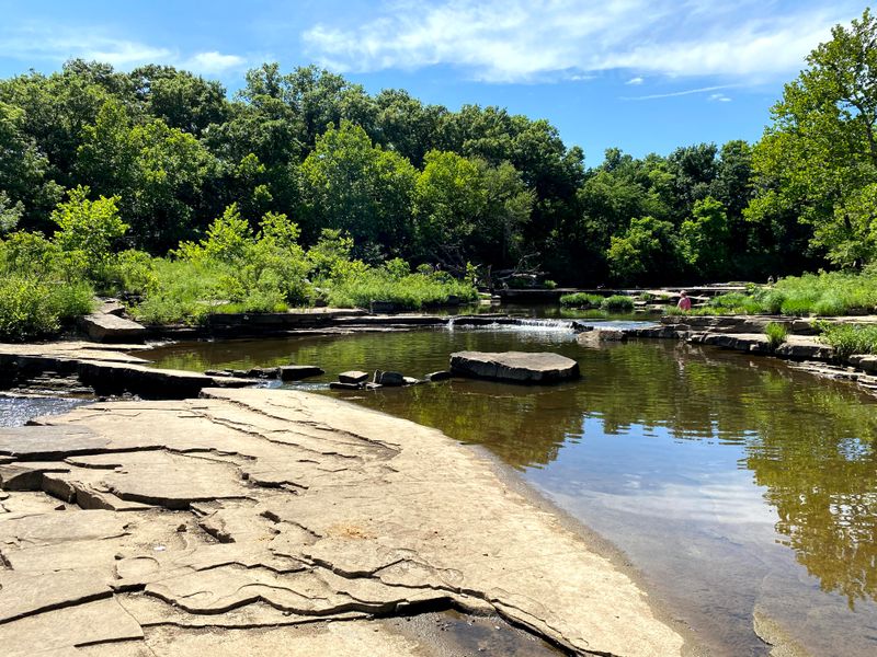
Coon Creek Crossings
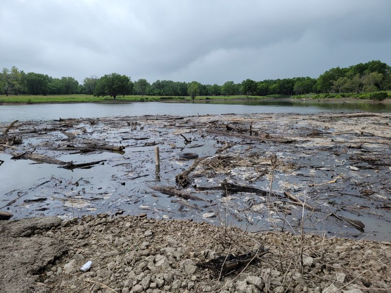
Several low-water crossings bring you directly into contact with the creek. During dry periods, the water runs clear and shallow.
After rain, these crossings become slick and reinforce the feeling that this trail belongs to the creek, not the other way around. You can usually hop across on exposed rocks without getting your boots wet.
The creek bed is mostly limestone slabs worn smooth by constant flow. In some spots, you can see fossil imprints in the rock, remnants of ancient sea life preserved in what is now a freshwater stream.
The crossings force you to slow down and pay attention to foot placement. That pause often turns into a longer stop as people notice minnows darting in the shallows or water striders skating across the surface.
Spring brings higher water levels that sometimes cover the crossing stones entirely. During those times, you are wading through ankle-deep current, which feels refreshing on warm days.
The sound of moving water is constant along this section, creating a soundtrack that blocks out distant road noise. It is one of the most peaceful stretches of the entire loop.
Sycamore and cottonwood trees lean over the creek, their roots exposed along the banks where erosion has undercut the soil. These trees depend on the water and help stabilize the banks in return.
Each crossing feels slightly different depending on the season and recent weather, making the trail experience variable rather than predictable.
The Enclosed Woodland Stretch
Midway through the loop, the landscape closes in under dense tree cover. The canopy blocks wide views and replaces them with filtered light and earthy smells.
It feels more like eastern woodland than western Oklahoma. Oak, hickory, and maple dominate here, species more common in Missouri or Arkansas than on the plains.
The trail narrows to a single track with vegetation pressing close on both sides. In late spring, wildflowers bloom in patches where enough light reaches the forest floor.
Bird activity increases noticeably in this section. Warblers, woodpeckers, and thrushes prefer the layered habitat that mature forest provides, and their calls echo through the trees.
The temperature drops several degrees under the canopy, especially on hot summer days. The shade and transpiration from all those leaves create a microclimate distinctly cooler than the open sections.
Fallen logs decompose slowly along the trail edges, hosting fungi, insects, and salamanders. This decay process recycles nutrients back into the soil, feeding the next generation of trees.
The enclosed feeling can be disorienting if you are used to seeing landmarks in the distance. Navigation depends on following the trail rather than spotting distant features.
This stretch highlights how varied Oklahoma ecosystems can be within a small area. The transition from open terrain to closed woodland happens over just a few hundred yards, driven by topography and moisture availability.
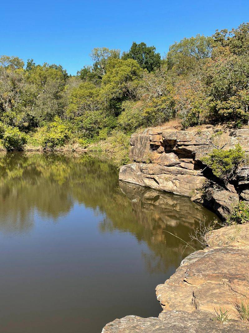
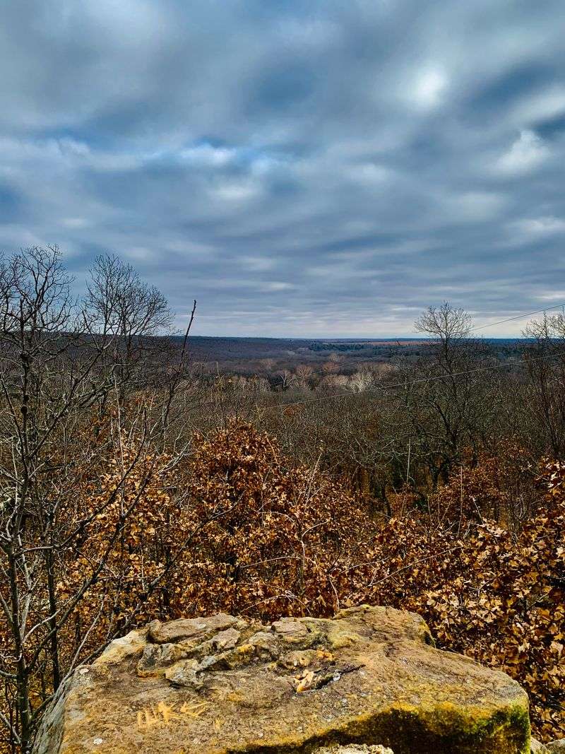
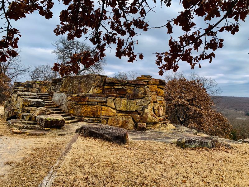
The Rock Ledge Overlooks
Short spur-like openings along the trail reveal elevated rock ledges above the creek. These natural overlooks are not formal viewpoints, but they offer quiet places to stop and take in the layered rock and flowing water below.
The ledges jut out from the hillside where harder layers of limestone resisted erosion better than the softer rock beneath. This differential weathering created flat platforms ten to twenty feet above the creek.
Standing on one of these ledges, you can see how the creek has carved its channel over time. The water follows the path of least resistance, working around harder rock and exploiting weaknesses in softer layers.
The view includes both upstream and downstream perspectives, showing how the landscape folds and bends. You notice patterns in the vegetation, with moisture-loving species clustering near the water and drought-tolerant plants dominating higher slopes.
These spots are perfect for a rest break or a snack. The elevation provides a slight breeze that is absent down in the creek corridor.
Lichens coat the exposed rock surfaces in patches of gray, green, and orange. These slow-growing organisms indicate relatively clean air, as they are sensitive to pollution.
The ledges also offer good sunrise and sunset views when the timing works out. The low angle light catches the rock faces and creates long shadows that emphasize the terrain’s relief.
Most hikers discover these overlooks by accident rather than seeking them out, which makes each find feel like a personal discovery.
The Transition Back to Open Terrain
Near the end of the loop, the trail gradually opens back up. The rock walls recede, the creek widens, and the landscape begins to resemble the Oklahoma most people expect.
That contrast makes the enclosed sections feel even more surprising in hindsight. The transition is not abrupt but happens over a quarter mile as trees thin out and prairie grasses start appearing between the woodland patches.
The sky becomes visible again in wider angles, and you can see farther in all directions. The horizon returns, along with the sense of space that defines much of the state.
Wildflowers bloom here in different species than those in the shaded woodland. Coneflowers, black-eyed Susans, and prairie clovers thrive in the full sun that would stress the forest floor plants.
The temperature rises noticeably without the tree canopy to filter sunlight. On summer days, this section reminds you why the shaded portions felt so refreshing.
The trail surface changes from leaf litter to exposed dirt and rock, sometimes becoming dusty during dry spells. The footing is easier here, with fewer roots and obstacles to navigate around.
This final stretch lets you reflect on the variety packed into just four miles. The trail delivered caves, rock walls, a sinkhole, creek crossings, and dense forest before returning you to familiar Oklahoma landscape.
The loop design works perfectly, saving the transition for the end so the unique features stay fresh in your memory as you finish.
Dear Reader: This page may contain affiliate links which may earn a commission if you click through and make a purchase. Our independent journalism is not influenced by any advertiser or commercial initiative unless it is clearly marked as sponsored content. As travel products change, please be sure to reconfirm all details and stay up to date with current events to ensure a safe and successful trip.