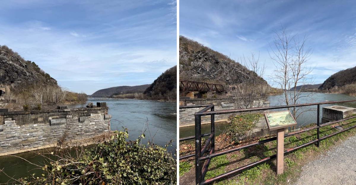
The first thing that catches your eye here is a line of stone blocks rising out of the water, spaced apart like footprints left by something enormous.
I remember squinting at them and trying to picture the wooden bridge that once rested on top, carrying wagons across to the Virginia side.
Locals will tell you the story goes back further than the Civil War, all the way to the days when factories hummed on the islands just upstream.
The short answer to the question in the title is yes, these piers really are tied to a run of destruction, rebuilding, and flooding that shaped this little town.
What surprised me most is that war was only half the story, because the river itself finished the job more than once.
Give this West Virginia spot ten quiet minutes and it starts talking.
Stone Piers Rising Straight Out Of The Shenandoah
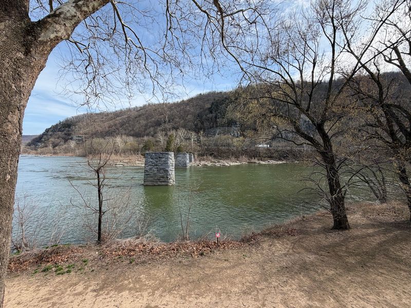
Four squat stone piers sit in the current, worn smooth on the upstream edges and streaked dark where the water rises after heavy rain. They look ancient, though the ones you see today held up a bridge built in 1882.
What gets people is the craftsmanship. One visitor to the site put it well when wondering how crews managed to divert a moving river long enough to set foundations that deep, with no cranes and no hydraulic anything.
Stone was cut, floated, stacked, and locked into place by hand and animal power. The river has been pushing against that work for well over a century and the blocks have barely shifted.
Morning is the nicest time to look at them, when mist hangs low and the tops catch early sun. Bring binoculars if you have a pair, since the tool marks on the stone show up beautifully from the bank.
No fences, no ticket booth, just rock and water doing their long slow argument.
June 1861 And The Night Confederate Raiders Struck
On June 28, 1861, Confederate raiders destroyed the Shenandoah bridge, and that single date sits at the heart of the whole story here. Harpers Ferry had become a place where crossings were worth more than buildings.
Control the bridges and you controlled who moved through the gap between the mountains. Both armies understood that math perfectly.
The town changed hands again and again during the war, and each shift brought new orders to burn, blow, or rebuild whatever spanned the water. Engineers got very good at throwing up temporary pontoon crossings, floating platforms of boats and planks that could be assembled fast and cut loose faster.
Reading the dates on interpretive material nearby, the pattern becomes almost comic in its stubbornness. Build, destroy, build again.
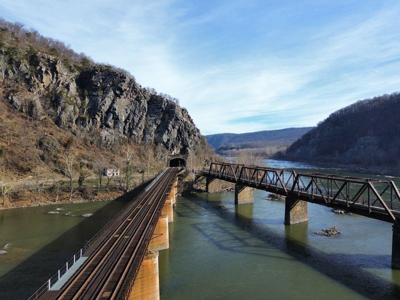
Standing on the bank now, with kayakers drifting past, that chaos feels impossibly far away. Then a train rumbles across the Potomac bridge behind you and the whole idea of this place as a transportation choke point snaps right back into focus.
Sorting Out Which Bridge You Are Actually Looking At
Here is where a lot of visitors get tangled up, and honestly it took me two passes to get it straight. The piers visible in the river belong to an 1882 structure, not the bridge that stood during John Brown’s raid in 1859.
Those older foundations sit roughly 300 yards downstream from where the 1882 crossing went up. Same river, same town, different footprint.
The 1859 bridge connected wagon traffic to Bridge Street, which then fed into Hamilton and Shenandoah Streets, with a toll house waiting on the Virginia side. Traffic rolled toward Virginius and Hall Islands, both packed with water powered mills and factories at the time.
Knowing that difference changes how you read the shoreline. You stop looking for one ruin and start noticing that several eras overlap in the same stretch of water.
An 1859 town map is worth pulling up on your phone before you visit. Suddenly the empty banks fill in with canals, workshops, and roads that vanished long ago.
Floods Did What Cannons Could Not
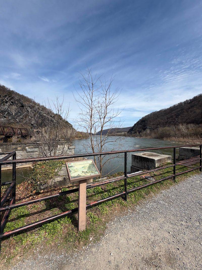
War gets the headlines, but water wrote the final chapter. The 1882 bridge lasted only seven years before an enormous flood in 1889 swept it away.
Crews rebuilt. Then came 1936, and the historic flood that tore through the Potomac and Shenandoah valleys finished the crossing for good.
Nobody replaced it after that. The piers were simply left standing, stripped of their deck, and they have been sitting there ever since like posts with nothing to hold.
Harpers Ferry sits exactly where two rivers slam together, which is spectacular for scenery and brutal for infrastructure. High water marks painted on buildings in the lower town show levels that seem impossible until you see the photographs.
Walking the bank on a calm day, the Shenandoah looks lazy and harmless, all shallow riffles and sunbathing rocks.
That is the trick of it. Come back after a spring storm and the same river turns the color of coffee and moves fast enough to make you step back from the edge.
A Wagon Road, Not A Railroad
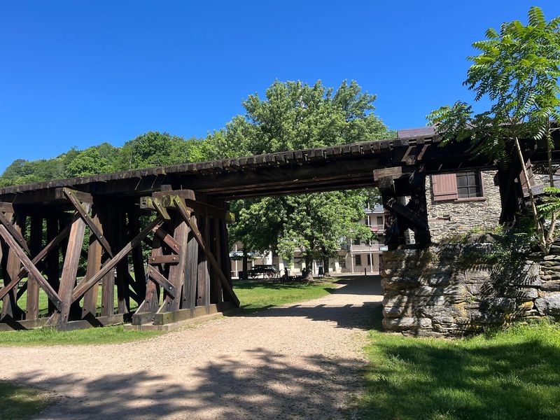
People often assume every old bridge in Harpers Ferry carried trains, since the Baltimore and Ohio line dominates the skyline over the Potomac. The Shenandoah crossing was a different animal.
It served wagons first, hauling goods, produce, and mill supplies between the town and the countryside to the south. Later versions handled early automobiles.
That distinction matters because it explains the scale. Railroad bridges were built for tremendous weight and long spans, while a road bridge needed to be sturdy but not monstrous.
The piers reflect that, spaced in a way that suited timber trusses rather than heavy iron. Picture farm carts creaking across, drivers paying at the toll house, hooves knocking on planks.
Less dramatic than a locomotive, sure, but this was the everyday artery of the town.
I like that ordinary quality. The grand engineering nearby tends to steal attention, yet these stones held up the route regular people used to get home, sell goods, and visit family across the water.
Finding The Spot Without Any Signage
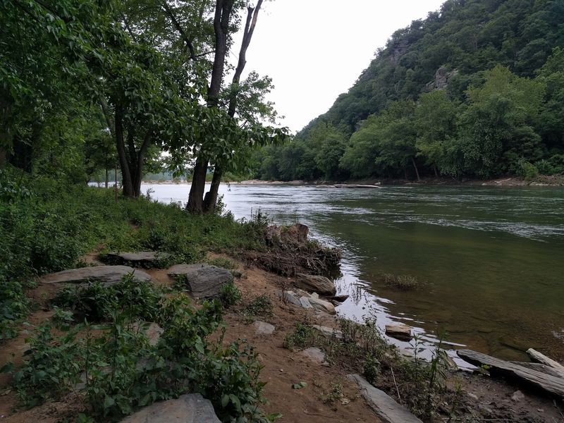
Do not expect a big interpretive board planted at the water’s edge, because there really is not one marking the original site. Several visitors have noted the same thing, and it can leave you wondering whether you found the right stretch of bank.
Look for the piers themselves. They are unmistakable once spotted.
There is a sign further up near the pavilion where the visitor center shuttle drops passengers off, and that gives useful context before you wander down. Both riverside trails offer clear views, so you can approach from more than one direction.
The lack of fanfare turns out to be part of the appeal. Instead of a crowd bunched around a plaque, you get a quiet bank, water sounds, and time to look properly.
Pack a phone with the National Park Service page loaded, since cell service can be patchy in the gap.
Sturdy shoes help too. The path down to the shoreline is uneven in places and slick after rain.
John Brown’s Raid And The Spark That Lit Everything
October 1859 changed this town forever. John Brown and his small band seized the federal armory here, hoping to spark an uprising against slavery, and the raid ended within days in bloodshed and capture.
The bridges played a direct role, since raiders used them to enter and control access. Word spread by telegraph and the whole country reacted.
Less than two years later, the nation was at war and Harpers Ferry sat right in the middle of it. Standing near the river, that chain of cause and effect feels unusually short.
John Brown’s Fort, the small engine house where the raiders made their last stand, still exists in town and has been moved several times over the decades.
Pairing a visit to the bridge site with a walk through the lower town makes the timeline click. One place shows the spark, the other shows what burned.
Give yourself half a day at minimum. Rushing this town is a genuine waste.
Where Two Rivers Collide And The Views Take Over
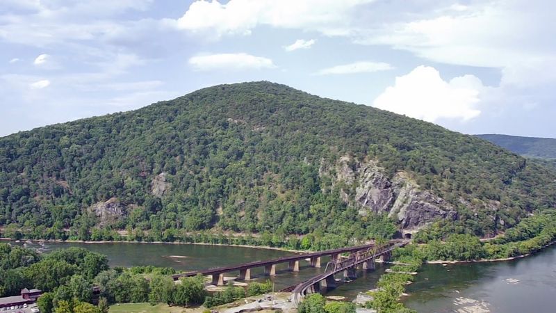
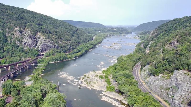
Geography explains almost everything about Harpers Ferry, and the confluence makes that obvious in about three seconds. The Potomac and Shenandoah meet head on, carving a notch through the Blue Ridge that armies, railroads, and canal builders all wanted.
Three states are visible from the point. Maryland, Virginia, and West Virginia all crowd in around the water.
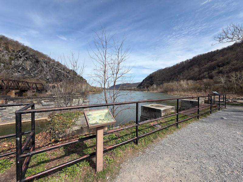
From the bridge ruins you look across at wooded slopes and rocky shelves where herons stand very still, waiting. Kayaks and tubes drift past in warmer months, and the whitewater downstream draws paddlers who know the runs well.
Maryland Heights and Loudoun Heights loom above, both crowned with Civil War era fortifications that once made this valley a shooting gallery.
Sunset here does something lovely to the stone, warming it to honey before the shadows swallow the gorge.
Bring water and a snack. Benches are scarce along the bank, but flat rocks work fine and cost nothing.
Open Around The Clock And Free To Wander
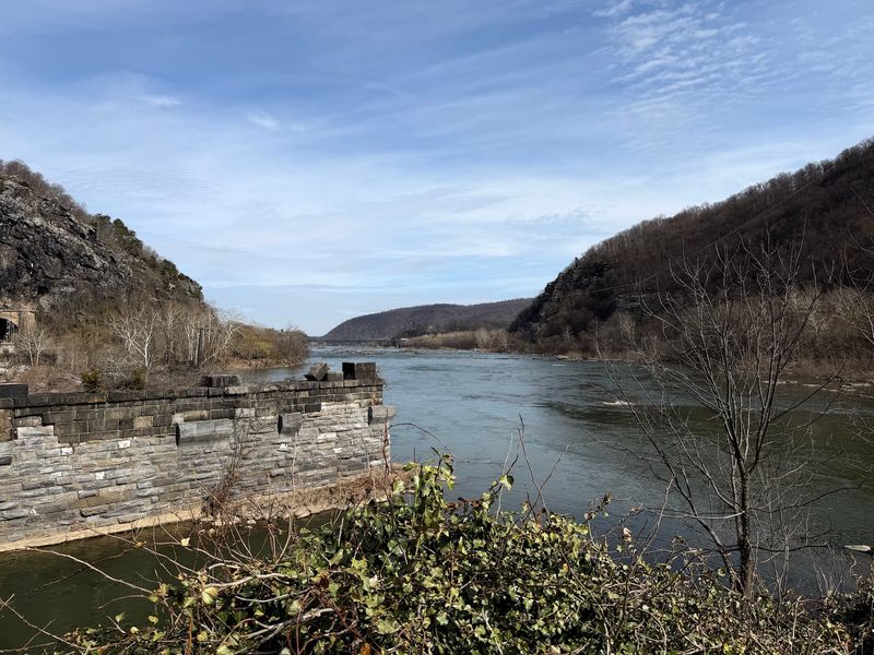
One practical perk of a ruin with no gate is that the site stays accessible any hour of the day, every day of the week. Sunrise photographers take full advantage of that.
Parking is the real planning issue. The main visitor center lot sits up the hill and a shuttle runs down into the historic town.
Getting there early beats the midday rush, particularly on autumn weekends when the foliage pulls big numbers into the valley. Weekday mornings in spring feel almost private.
Since the site falls within Harpers Ferry National Historical Park, standard park rules apply, so leave the stones and artifacts exactly where they are.
Weather changes the whole experience. Fog makes the piers look like something from a dream, while bright afternoon sun shows every chisel mark and mortar line.
Restrooms and water are available in town, a short walk away.
Comfortable footwear beats fashion here, since cobblestones and gravel dominate the lower streets.
Why These Silent Stones Still Matter
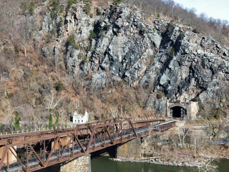
Ruins have a way of being more honest than restored buildings. Nothing here has been polished up for visitors, and that raw quality is exactly why the site lands so hard.
Each pier represents somebody’s labor, then somebody else’s decision to destroy it. Then labor again.
Between war and flood, this crossing was wiped out repeatedly across roughly eighty years, and people kept rebuilding because the town needed the link. Eventually the river won the argument for good.
What remains is a plain, unglamorous set of stone blocks that outlasted every deck ever laid on top of them. There is a stubborn kind of dignity in that.
Answering the question posed at the start, yes, the ruins are genuine and yes, they are wrapped up in Civil War chaos, though nature deserves equal billing in the tale.
Come look, stay quiet a while, and let the current fill in the rest.
Address: Original Site, Shenandoah River Bridge, Harpers Ferry, WV 25425, United States
