If you are going to drive the California coast, I should tell you about how the ocean and the crowds are reshaping the places you want to see.
The views are still wild and ridiculous, but some stretches are literally slipping while everyone scrambles for the same parking pullout.
Erosion, closures, and overflow have turned a few once-easy stops into places that need more patience and awareness.
You can still have a great day at the beach, you just need to know what you are stepping into and where the ground is getting soft.
That means reading signs, respecting barriers, and sometimes skipping a stop that looks better in photos than in person.
Big Sur
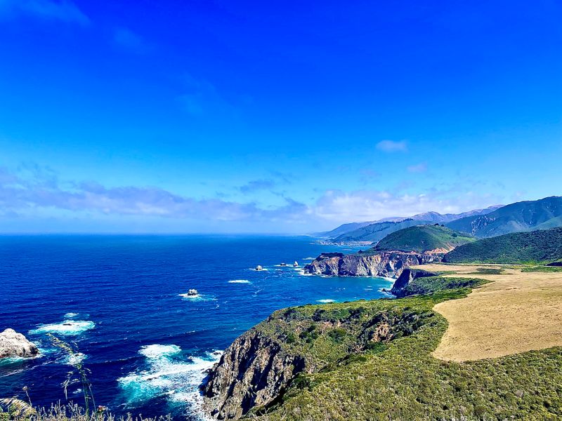
You know how Big Sur makes you pull over every five minutes because the cliffs look unreal? That habit adds up along Highway 1, especially around the Garrapata area, where informal trails braid through scrub and chew at the bluff edges.
Those narrow paths seem harmless, but they focus runoff and make the topsoil crumble faster.
Rangers and signs try to steer everyone, and still people step past the ropes to get a cleaner photo.
Past Bixby Bridge, the viewpoints perch on fragile shelves that feel steady until a winter storm reworks the edge.
The road closures that follow are not just traffic drama, they are geology doing what it wants.
Want a safer pause without trampling the lip? Use the pullouts with railings and stay on the gravel, then breathe it in without inching closer for one more angle.
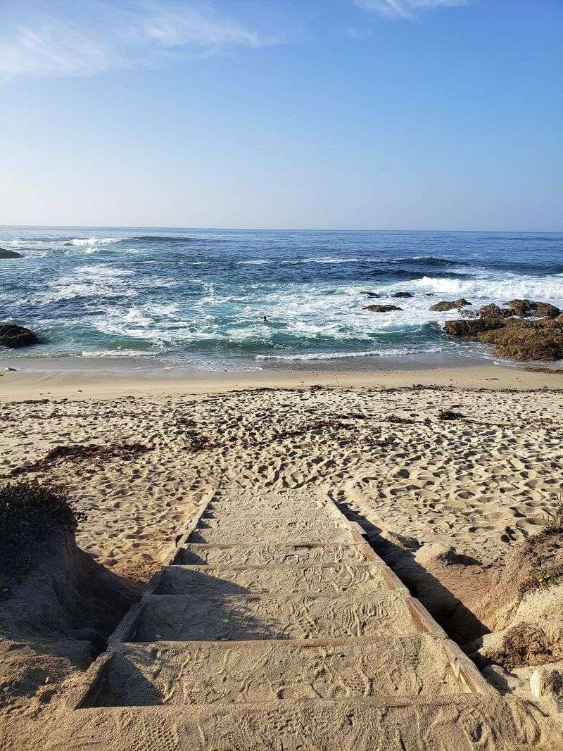
Down near Pfeiffer Beach at Sycamore Canyon Rd, the sand funnels wind that scours the base of the bluffs. Walk near the waterline when the tide is low, and skip climbing the purple sand banks.
If the fog rolls in and you cannot see the drop, call it and move on to Julia Pfeiffer Burns State Park. The McWay Falls overlook is fenced, the ground is firmer, and the view still knocks you back.
Capitola
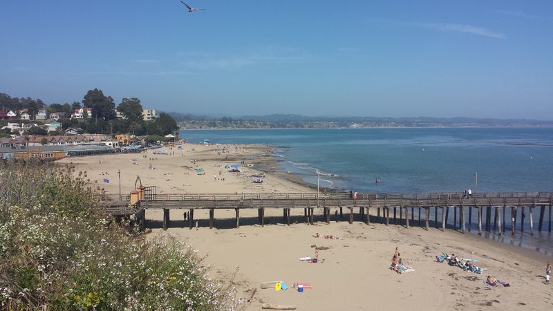
Capitola looks sweet and pastel until a big swell pins the tide against the seawall.
When the crowd squeezes onto the narrow sand, feet churn the slope and the waves take the loosened grains back out.
Walk the village first, then step onto the beach at the main access, and you will see how the seawall holds the line. It helps during storms, but it also bounces energy, which gnaws away at the lower beach.
Those bright balconies and the pier pull a lot of eyes, so patience helps here.
Stake a spot away from the seawall base and watch for sets if the tide is rising.
For a breather, slide over to New Brighton State Beach.
The bluff path sits farther back, and you can watch the shorebreak without toeing a crumbling edge.
Capitola Village merchants are used to heavy weekends, so aim for early morning. The light is softer, the sand is steadier, and you will actually hear the water.
If you catch a king tide, keep to the promenade and the upper benches near the bandstand at Esplanade Park. You still get the scene, minus the scramble and the slosh.
Pacifica
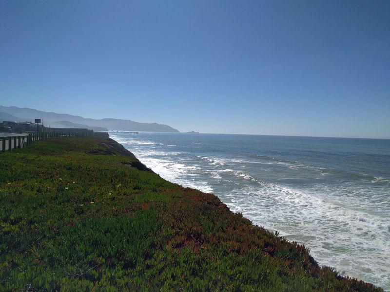
Pacifica wears its cliff stories on the sleeve, especially along Esplanade Ave. You can see fencing pulled back from fresh scarps where winter storms and heavy surf undercut the base.
If you swing by Rockaway Beach, the path feels solid until you notice the hairline cracks near the edge.
That is the hint to step back and take the longer, safer loop toward the parking lot.
Sharp Park Beach brings crowds to the pier and the seawall. Great for a walk, but the sandy berm shifts around after big swells, and people climbing dunes speed up the shuffle.
Pacific Coast Highway slices the view into quick stop after quick stop.
Be choosy and pull into signed lots rather than shoulder nooks that crumble under tires.
If the fog drops, the drop-off feels closer than it looks, so handrails are your friend. There is no shame in taking the pier vantage for the drama.
When you are ready to roll, Linda Mar Beach, gives a roomy arc and gentler walking. It is still California, still busy, but the sand takes traffic better than the fragile cliff tops.
Stinson Beach
Stinson looks easygoing from the lot, but the dunes behind the sand are doing quiet work. That rope fencing is not decoration, it keeps feet off the plants that hold the ridge.
The main beach spreads people out, yet on warm weekends everyone beelines to the same spots near the lifeguard area.
That concentrated traffic wears paths through the dune grass that are hard to heal.
Walk north toward the Bolinas Lagoon side and you will feel the wind pick up. It reshapes the sand fast, which is beautiful and also rough on the fragile edge.
If you want a calmer entry, drop into the south end where the Shoreline Highway curves near 3468 Shoreline Hwy. The dune fencing guides you, and the access is less steep.
Storm days are when you really see the tug-of-war.
Water rushes high, people cluster on the dry shoulder, and the slope scuffs down.
Pack out everything and dodge the dune shortcuts. The view is better from the firm sand anyway, and the ridge will thank you.
Half Moon Bay
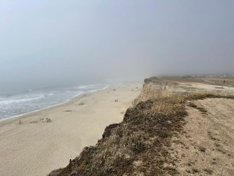
The Coastal Trail in Half Moon Bay runs so close to the edge you can hear the bluff talk, especially near Francis Beach. After storms, the path jogs inland around fresh cuts that look like someone took a bite out of the coast.
Pop into Poplar Beach, and you will see stairs patched and re-patched.
It is a busy access point, and all those steps compress the bluff face.
On weekends the parking spills into side streets, and folks poke new side trails through ice plant. That plant slides when it is wet, which drags sand with it and opens new gullies.
If you want a mellow look, the Miramar stretch has railings and a wider shoulder.
You still get that long horizon without flirting with the break.
Harbor views at Johnson Pier, give a different angle on sediment moving in and out. Boats stay safe, but the longshore drift keeps shifting the nearby beaches.
Walk the official path and give the cliff a buffer. The photos turn out the same, and you leave the edge alone for the next storm cycle.
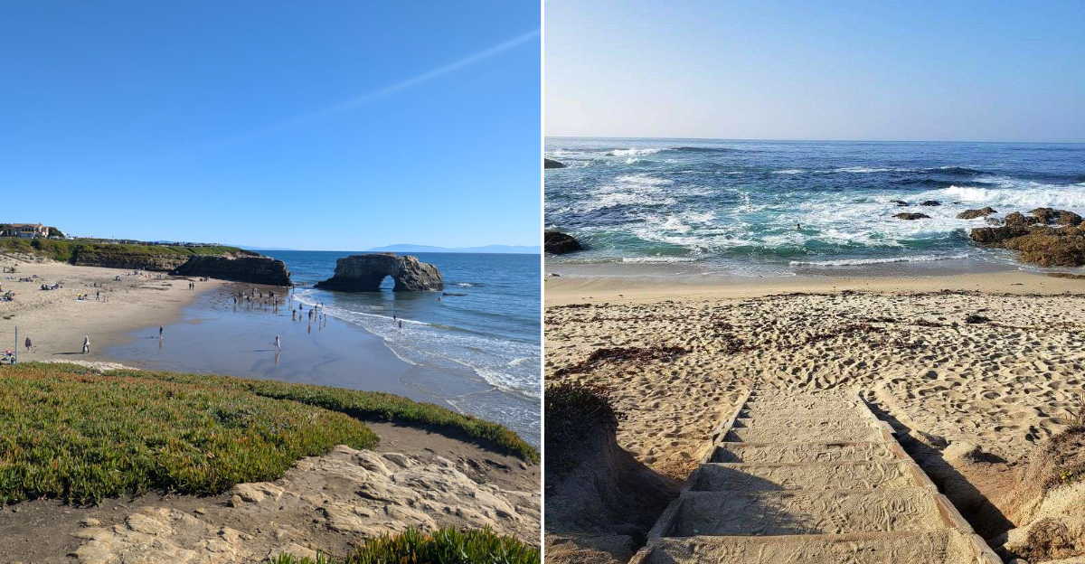
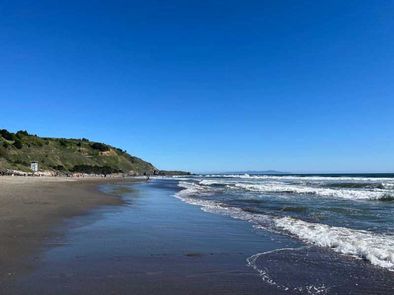
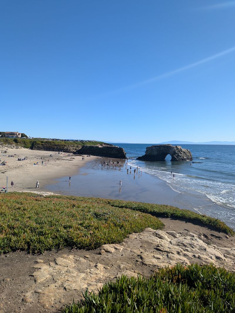
Santa Cruz
West Cliff Drive in Santa Cruz is the classic stroll where you get surfers below and bluffs right at your elbow.
Starting near Lighthouse Point, you will spot fresh cracks in the sandstone where winter waves reached high.
Natural Bridges State Beach, corrals people onto the main path, but side tracks still spider toward the edge. Those little lines funnel rain and speed up the peel.
By the giant staircase, the railing tells you all you need to know. The ocean eats the base, and the top gets nervous when crowds dodge past each other.
Downtown is close, which keeps foot traffic steady all day.
That rhythm is great for energy and rough on the grass buffers that keep the edge planted.
If you want a breather, Seabright State Beach spreads out and feels kinder to the shore. Walk the firm sand and steer clear of any dune cuts.
You can still catch the sunset, just from one step back. The waves look bigger from a safe spot anyway, and the bluff gets to exhale.
Pismo Beach
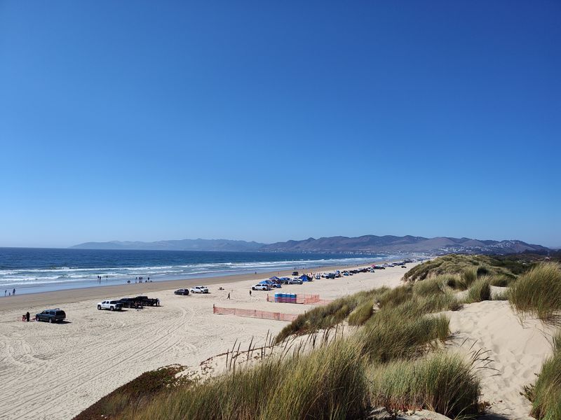
Pismo Beach is all about that big sandy sweep, and the dunes behind it are the quiet workhorses. Near the pier you can see fencing that tries to keep drifting sand in place.
Oceano Dunes access is where heavy use shows up as rutted lines and broken crust.
When the crust breaks, the wind lifts sand more easily and the dune slides.
On busy days people carve new footpaths over the foredune to shortcut bathrooms and the lot. That is how a small nick becomes a moving gap.
If you want calmer sand, Monarch Grove area is a softer stroll.
Stay on the signed trail and the plants keep doing their job.
Storm tides push up to the dry sand and erase footprints. That looks like a reset, but it also strips the slope that took months to build.
Find a spot close to the waterline and keep the back dunes out of play. The horizon is the same, and the wind stings less down low.
Carmel-By-The-Sea
Carmel-by-the-Sea looks tidy, but the bluff path above Carmel Beach keeps shifting under those wind-shaped cypress trees.
From the main access at Scenic Rd and Ocean Ave, the stairs show fresh timber where crews reinforce weak spots.
Scenic Road runs right along the edge, and people love leaning on the rail with a coffee and a camera. That means constant foot pressure on the narrow shoulder.
If you drop down near 13th Ave and Scenic Rd, the stair flights feel steeper. That is because the sand moves and the lower landings need constant reset.
The beach looks wide and friendly, then a set rolls in and chews at the base.
It is subtle until you watch the foam line creep up the bluff toe.
For a quieter angle, walk toward the Pebble Beach side. Stay on the pavement and you get cliff views without pressing the lip.
Keep your prints on the stairs and the packed sand. The cypress can keep sculpting the wind without us tugging at their roots.
Mendocino
Mendocino Headlands State Park wraps the village with cliff meadows that look sturdy and are absolutely not. Start at the Ford House Visitor Center, and you will see braided paths where people cut corners toward the blowholes.
The edge feels wild and unplanned, which is the charm. It also means a misstep off the main path can loosen a whole slice of turf.
Walk west from Main Street toward the bluffs and you will hear the caves knocking.
The roof lines change over time, and the safe line changes too.
For a steady loop, hug the signed trail near Heeser Dr and Little Lake Rd.
The fencing is light, but it marks the real ground, not the wishful ground.
Head north toward the Point Cabrillo Light Station, for a calmer shoulder. The trail is set back, and the views still open wide.
Step wide around muddy spots instead of carving detours. The meadow can handle rain, just not a thousand shortcuts.
Avila Beach
Avila Beach has that neat little curve with a polished promenade, and the shoreline tells a longer story. At Avila Beach Park, you can spot rockwork and retaining features that keep the edge in place.
The redevelopment tightened things up, which means sediment moves differently along the cove.
It feels stable, but you see how the sand bar shifts from one side to the other after storms.
The end of Front Street, funnels people straight to the shore. That focus wears the upper beach, so walking a few minutes down the strand spreads the load.
For a quieter walkway, hit the Bob Jones Trail trailhead. It pulls you inland a bit and gives the beach some breathing room.
Port San Luis shows the working side.
Breakwaters calm the water and change how sand circulates along the arc.
You can still park the towels and watch the boats turn. Keep off the soft dune patches and let the engineered bits do their job without extra help from our feet.
Montecito
Montecito’s shoreline feels calm until a big storm pins the tide against the beach and shows where the weak links are. Butterfly Beach draws a steady crowd to a narrow strip that shifts with each season.
Access points tuck between homes, and that funnels foot traffic into tight corridors.
When people cut around the steps, those little side tracks slice the bluff face.
Near Miramar Beach, the sand looks wide at low tide and vanishes fast at high. You can see fresh wrack lines sketching how far the water reached.
The coastal trail segments feel stitched together, not one long ribbon. That patchwork pushes walkers onto the beach where the slope is soft.
If you want a steadier stroll, Andree Clark Bird Refuge is just next door and set back from the surf. It is not the same view, but it gives the beach a break on stormy days.
When the swells line up, let’s admire from the seawall or the road shoulder where it is posted legal.
The sand will come back in time, and you will still be here for the next calm spell.
Dear Reader: This page may contain affiliate links which may earn a commission if you click through and make a purchase. Our independent journalism is not influenced by any advertiser or commercial initiative unless it is clearly marked as sponsored content. As travel products change, please be sure to reconfirm all details and stay up to date with current events to ensure a safe and successful trip.