Oregon holds more stories than its rivers can carry, and many of those stories whisper from empty streets and boarded doorways.
You can feel time slow in these places, where rail lines shifted, forests thinned, and fortunes blew away like dust across the High Desert.
Every ghost town here faded for reasons that were practical, not mythical, and that truth makes their silence even more compelling.
Follow along as we trace the broken rails, burned timbers, and drowned foundations that changed the map of the Pacific Northwest.
Each stop offers a real cause, a clear lesson, and a vivid glimpse of what remains.
As you explore, you will meet the Oregon that boomed, faltered, and adapted, town by town.
Let these ruins guide you toward the bigger story of movement, resource, and resilience across this state.
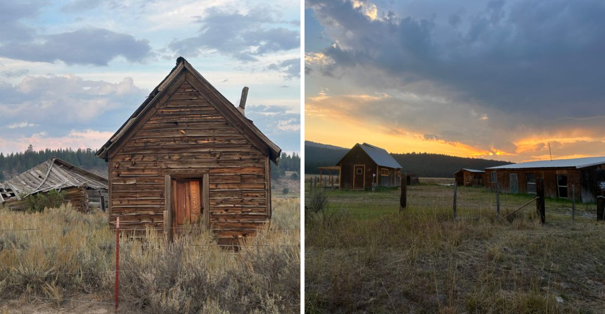
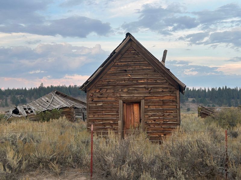
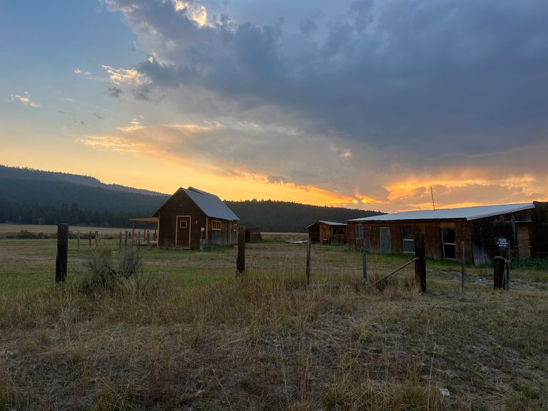
1. Shaniko
Shaniko rises from sagebrush like a stage set, its wooden facades facing a wind that never stopped moving freight across Oregon.
Once known as the Wool Capital of the World, the town flourished when sheep and railcars set the pace of commerce across arid plateaus.
Then a rival rail connection redirected the flow, and Shaniko became a quiet junction without a reason to gather or ship.
You walk the boardwalk and picture loaded wagons creaking toward the depot, now an echo chamber for dust and sparrows.
The hotel stands with confidence, its windows catching sun, its rooms watching a road that rarely pauses.
Storefronts lean with dignity, names faint on painted trim, a ledger of trades long settled and forgotten.
In the distance, basalt and cheatgrass underline how infrastructure picks winners and leaves others behind.
That bypassed rail line turned prosperity into a memory, proving geography can change without a single hill moving.
Today, interpretive signs and preserved buildings sketch the story clearly, inviting you to read economic history in cedar and nails.
You can reach Shaniko at 300 Main Street, Shaniko, OR 97057, a waypoint on a landscape that still rewards patient eyes.
Even a short stroll along the boardwalk reveals textures of weathered wood, faded paint, and wind-shaped corners.
Birdsong, wind, and distant traffic become a quiet soundtrack for imagining daily life at the town’s peak.
Photography captures the interplay of light on façades, cast shadows, and the open plateau beyond.
Walking slowly encourages reflection on how infrastructure, nature, and commerce shape communities over time.
By the end, Shaniko leaves a sense of history and resilience, where absence and preservation tell equally compelling stories.
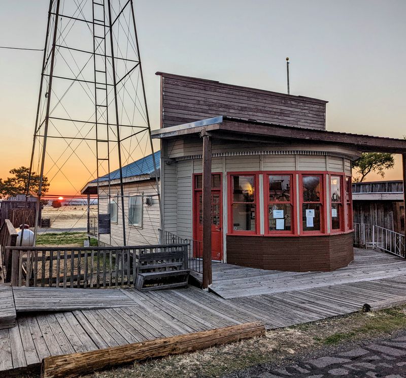
2. Sumpter
Sumpter sits in a pine bowl where gold fever once rang louder than the wind through lodgepole needles.
The boom faded after a catastrophic fire tore down blocks of the business district and left char behind brick.
Mining dwindled later, equipment stilled, and workers drifted toward surer paychecks in larger Oregon hubs.
You can still see the outsized machinery that reshaped creek beds, a hulking reminder of how extraction redraws valleys.
The Sumpter Valley Dredge stands like a floating factory, all corrugated muscle and rusted memory.
Wooden storefronts line a street that watches seasons roll in, each one softening scars with needles and snow.
Here the lessons are practical, that fire changes plans, and resource cycles eventually crest and fall.
Interpretive trails trace tailings, while depots and cabooses recall the short line that kept supplies and letters coming.
You arrive and feel how quiet can hold a whole era, packed tight between timber and rail.
Find it at 461 S Mill Street, Sumpter, OR 97877, a place where Oregon’s mining chapter remains readable in timber and steel.
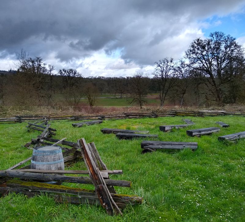
3. Golden
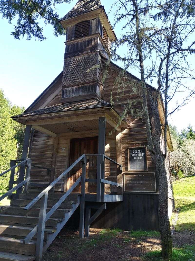
Golden nestles in a forested hollow where a small congregation once shaped daily life around prayer and mining shifts.
As nearby placers ran thin, hope lightened, then letters stopped when the post office shuttered for good.
Families packed tools, then benches, and the chapel stood as the last heartbeat in a slowing town.
You walk past split rail fences and read silence as if it were a ledger of dwindling yields.
The church, modest and bright, reflects careful restoration that respects wood grain and history equally.
Cabins hold their corners square, yet doorways open to nothing but understory and birdsong.
Golden tells a simple truth, that once the mines give less, people move toward steadier ground.
Trails link the structures with interpretive signs that favor facts over folklore, keeping the narrative clean.
It is an easy place to imagine candlelight and creek water carrying plans downstream.
Visit Golden at 13090 Coyote Creek Road, Wolf Creek, OR 97497, a preserved Oregon settlement where absence speaks clearly.
Even brief exploration rewards attention to textures of wood, stone, and forest floor.
Birdsong and running water provide a gentle soundtrack that frames the empty cabins and chapel.
Photography captures light filtering through trees, highlighting both decay and careful preservation.
Walking slowly along trails encourages reflection on the cycles of settlement, work, and departure.
By the end, Golden leaves a quiet impression: absence carries memory as vividly as presence once did.
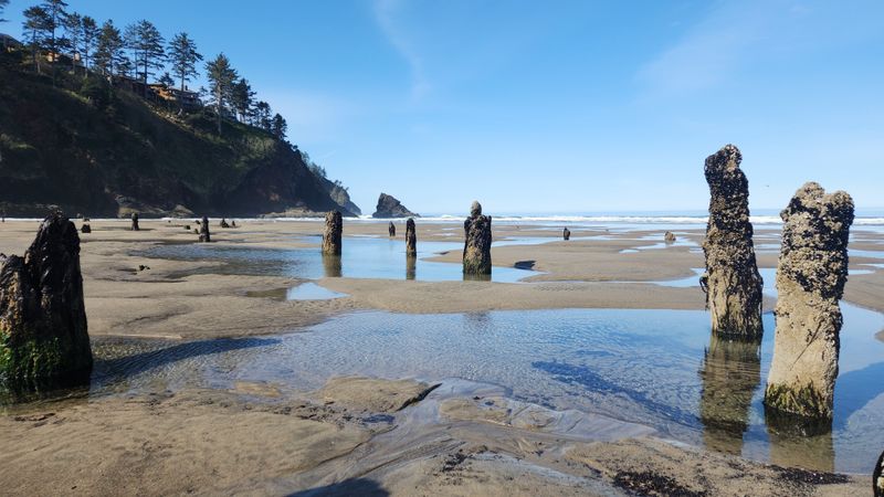
4. Bayocean
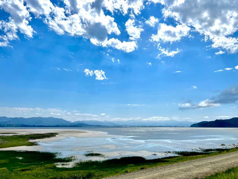
Bayocean once promised a perfect seaside escape, with promenades and vistas rolling out along a slim sand spit.
Nature had other plans, and waves unstitched the shoreline until buildings faltered and foundations slid away.
Storms reclaimed streets, and by the end, the town’s last pieces met the surf and vanished.
You walk now on wind combed dunes where porches once framed sunsets and lanterns cut the fog.
Fragments linger, low concrete and scattered pilings, the punctuation marks of a vanished paragraph.
Interpretive panels keep the through line straight, explaining jetties, erosion, and the long arc of coastal change in Oregon.
Every step balances between ocean breath and bay stillness, a corridor that always needed careful stewardship.
This ghost town proves that even festive maps must fold when shorelines shift grain by grain.
The hike carries a quiet, a reminder to read the land before drawing plans upon it.
Access the former site near Bayocean Peninsula Park, 9000 Bayocean Road NW, Tillamook, OR 97141, where absence overlooks water.
5. Blalock
Blalock lived along the Columbia before progress lifted the river and drew a clean line across its map.
Construction upstream filled a reservoir that drowned streets, chimneys, and routines beneath steady, engineered water.
Families moved, buildings went down, and the current settled into a new, wide corridor.
You stand by the shoreline and imagine porches facing train whistles that no longer echo here.
The river looks calm, but it holds foundations and storylines below its reflective skin.
Markers along the highway tie dates and place names to a landscape reshaped by power and navigation choices.
Blalock’s lesson is stark, that large projects can trade one community for a broader regional plan.
The view stretches long, with basalt benches and a sky that keeps traveling with the barges.
It is quiet, dignified, and laced with memory that rises when wind riffles the surface.
Find the submerged site near 62080 Hwy 84, Arlington, OR 97812, a waypoint where Oregon’s river history runs deep.
Even a short stop invites reflection on the communities once rooted here and the choices that reshaped the land.
Ripples and reflections hint at hidden structures, turning the river into a living archive.
Photography captures the contrast between engineered calm and the memory of past activity.
Birds, barges, and wind provide a quiet soundtrack, connecting past and present through observation.
Walking away, you carry both the scale of the Columbia and the weight of human stories submerged beneath its surface.
6. Boyd
Boyd grew around grain, a mill, and a rail spur that connected fields to distant buyers.
When the highway alignment skipped past town, traffic and trade thinned like chaff on the wind.
The mill hushed, the depot quieted, and farmland absorbed parcels where storefronts once counted customers.
You can still see sturdy remnants, including an elevator that guards the horizon with practical grace.
Wooden structures stand near wheat and pasture, proving that rural economies pivot with routes and seasons.
It feels open here, every direction mapped by fences and sky, each mile shaped by harvest.
Boyd’s decline tracks a simple fact, that even small changes in roads can reroute livelihoods.
The scene carries calm persistence, a reminder that ground keeps producing while towns come and go.
Walk lightly and you will hear field birds sorting the afternoon into neat measures.
Set your pin near 67145 Boyd Market Road, The Dalles, OR 97058, where Oregon history rests between rails and rows.
Even a brief pause lets you notice patterns in fences, tracks, and cultivated land.
The silence emphasizes how quickly infrastructure shapes community life, and how slowly nature reclaims it.
Birdsong and wind across wheat create a steady, meditative rhythm that contrasts with the absent bustle.
Photography captures the textures of weathered wood, golden fields, and open skies that define the area.
Walking away, you carry a sense of Oregon’s rural resilience, where landscapes endure even as towns fade.
7. Champoeg
Champoeg once stood along the Willamette with tidy streets and a civic spirit anchored to fertile floodplain.
The river rose in a historic surge, tore through gardens and homes, and left little worth rebuilding.
Residents shifted uphill and organized elsewhere, carrying forward community without the original footprint.
Today the heritage area interprets both the early settlement and the forces that erased it overnight.
Grassy fields, riverside paths, and markers create a calm classroom where water and memory share the lesson.
Foundations sit low in the earth, offering coordinates for imaginations that prefer facts to myth.
This is Oregon civic history laid out carefully, with the river always speaking in the background.
Seasonal blooms line the trails, yet the narrative stays pointed, clear, and grounded in place.
You leave with a sense that towns survive in people even after boards and bricks go.
Visit at 8239 Champoeg Road NE, St Paul, OR 97137, where the state’s story flows beside the path.
Even brief stops reward careful observation of markers, landscapes, and subtle traces of foundations.
The river’s presence teaches patience, showing how water shapes both settlement and memory.
Walking the trails, you sense the rhythm of daily life long past, imagined through careful interpretation.
Photography captures seasonal blooms, flowing water, and the quiet geometry of former streets.
By the end, Champoeg leaves a reflective impression: communities endure in stories, even when buildings do not.
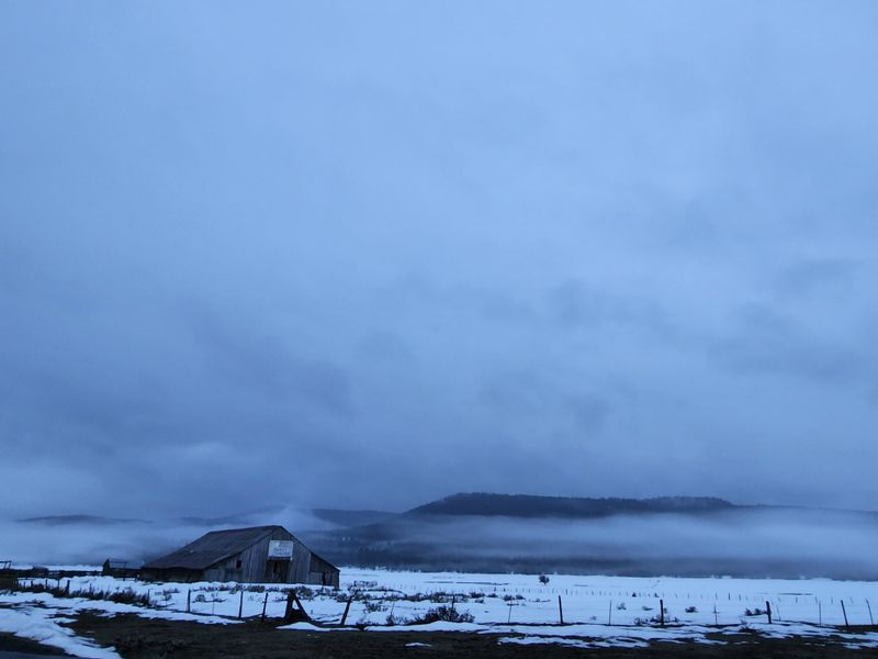
8. Whitney
Whitney lived for timber and ore, a supply point where a sawmill squared logs for nearby camps.
The mill burned and the heartbeat faltered, leaving rail grades and foundations to mark the grid.
Without the mill’s rhythm, freight slowed, and the settlement eased into long pauses between winters.
Buildings stand with spare elegance, rooflines holding snow and sun with equal patience.
Old equipment rusts into the grass, an outdoor archive that needs little captioning to speak clearly.
Pines frame every view, and the air carries that sweet dry scent of aged wood and dust.
Whitney shows how one industry can carry a town until the engine goes quiet.
Roadside pullouts give safe vantage, and the silence has a respectful, museum like quality.
You read the landscape by tie piles, skid roads, and square nails in weathered boards.
Find Whitney near 24498 Sumpter Stage Highway, Baker City, OR 97814, a still point in Oregon’s timber past.
Even a short walk across the site reveals layers of labor, from rail ties to foundation outlines.
The contrast between rusted equipment and living pines emphasizes the passage of time and resilience of nature.
Quiet moments let you imagine the rhythm of the mill and the people who relied on it.
Photography captures the textures of weathered wood, metal, and sunlit grass, each telling part of the story.
Leaving Whitney, you carry a sense of Oregon’s industrial past and the subtle dialogue between work and wilderness.
9. Waldport West
Waldport West sat close to coastal timber, a company townlet sized to the cut list and crew roster.
When nearby stands thinned, the sawmill closed and paychecks evaporated with the last good logs.
Residents dispersed to larger communities, leaving behind a few structures that still square up to the wind.
Today the site reads as a quiet margin between forest and town where work once set the tempo.
You notice footings, sheds, and graded pads that reveal how efficiently space was organized for production.
Coastal mist softens edges and makes the forest look both close and uncommitted.
The story is plain, that accessible resources shrink, and settlements adjust in the only direction available.
Walk slowly and you will hear water moving under the fern floor, a metronome for patience.
This corner of Oregon shows the overlap of industry and ecology without sentimentality or blame.
Start near 170 NW Hemlock Street, Waldport, OR 97394, then explore westward to trace the lumber footprint in the trees.
Even brief observation reveals patterns of human labor etched into the landscape.
The contrast between cleared lots and dense timber highlights how quickly nature reclaims space.
Birdsong and running water provide a soft counterpoint to the remnants of industry.
Photography captures textures of weathered wood, moss, and fog that tell both past and present.
Walking slowly encourages reflection on impermanence and adaptation in coastal Oregon.
By the end, the site leaves a quiet impression, a reminder of work, change, and resilience intertwined.
Dear Reader: This page may contain affiliate links which may earn a commission if you click through and make a purchase. Our independent journalism is not influenced by any advertiser or commercial initiative unless it is clearly marked as sponsored content. As travel products change, please be sure to reconfirm all details and stay up to date with current events to ensure a safe and successful trip.