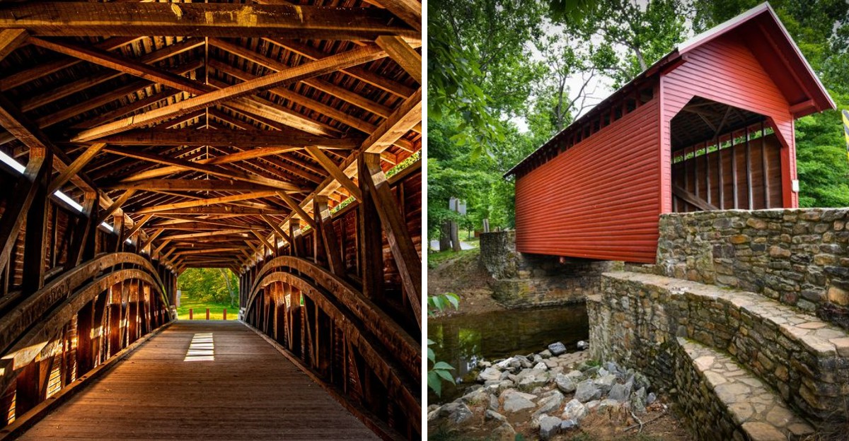
Covered bridges are relics of a slower time. They are not built for speed, they are built for appreciation.
This list highlights eight Maryland covered bridges worth a slow drive across scenic back roads. Each one has its own character and history, spanning quiet streams and winding through rural landscapes.
You can take your time, stop to snap a photo, and imagine the travelers who passed through before you. The routes themselves are part of the charm, with farmland, small towns, and open skies stretching out around you.
A reminder that the journey is just as important as the destination. The kind of drive that makes you appreciate the simple beauty of Maryland’s countryside.
Historic Foxcatcher Farms Covered Bridge, Strahorn’s Mill
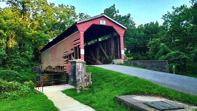
Big Elk Creek slides quietly beneath a bridge that no longer carries cars, and that fact alone changes the whole visit. Hikers, cyclists, and riders on horseback get the crossing to themselves.
Ferdinand Wood framed the 65 foot span back in 1860, using the old Burr plan that pairs a long timber arch with a sturdy truss.
The unusual name comes from later years. William duPont, Jr. bought the surrounding land in 1927 and raised cattle, raced horses, and hunted fox on it, and the whole property picked up the Foxcatcher Farms label.
Before that, the crossing was known as Strahorn’s Mill Bridge, tied to a mill that took turns as a nail factory, grist mill, turning mill, and tan bark yard.
Sitting on private land for decades probably saved it. While iron bridges up and down the county washed out in the floods of 1884, 1887, and 1898, this one simply held on.
Trucks did more harm than water ever managed. Two of them punched through the deck, once in 1938 and again in 1950.
Maryland purchased the duPont estate lands in 1975, and the bridge now sits inside the Fair Hill Natural Resources Management Area. A reconstruction in 1992 brought new trusses and deck supports under the old roof, with some original timbers reused inside so the interior still looks its age.
Engineers recognized that careful work in 1994 with the state’s Historic Civil Engineering Landmark Award. Hurricane Floyd chewed at the lower sideboards in 1999, though repairs followed quickly.
What lingers most out here is the quiet. Sunlight slips through the sideboards in thin stripes, the creek chatters below, and anglers often work the stocked trout water within earshot.
Sturdy shoes help, since the approach is gravel and grass rather than smooth pavement. Give the stop a full hour and the slow pace of the place takes over completely.
Address: Foxcatcher Farms Covered Bridge, Tawes Dr, Elkton, MD 21921, United States
Gilpin’s Falls Covered Bridge Beside The Old Highway
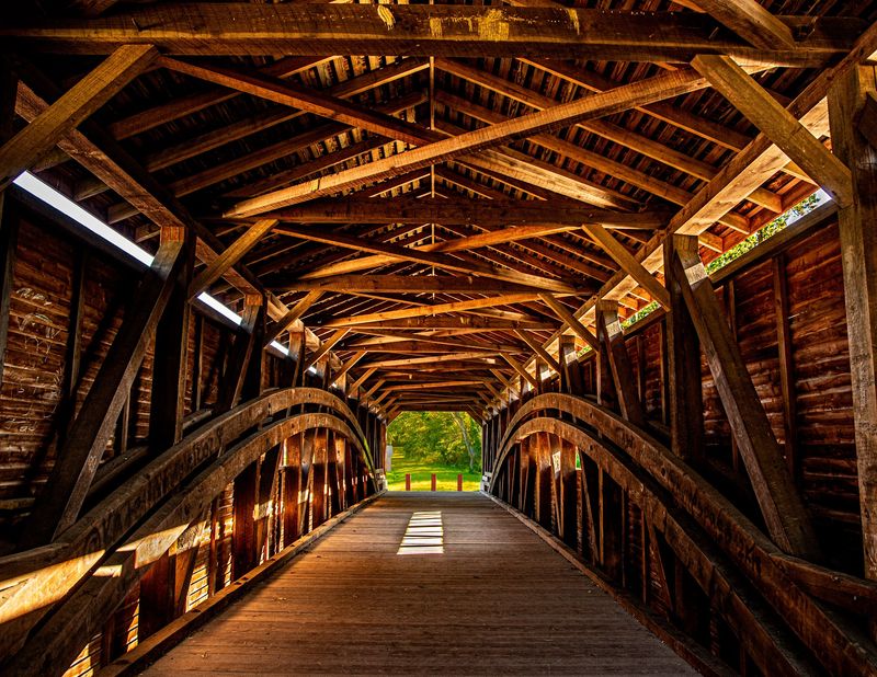
A covered bridge parked beside a modern road sounds like an odd fate, yet that arrangement is likely the reason it still stands. Route 272 was pushed past it in 1936, and the old crossing was left to rest.
Joseph G. Johnson raised this Burr arch through truss in 1860, and at 119 feet overall it holds the title of longest covered bridge remaining in Maryland, with a clear span of 100 feet between abutments.
North East Creek runs below. Samuel Gilpin claimed land in this valley during the early 1730s, using the power of the falls for his grist and saw mills.
The bridge went up right beside those mills and their dam, crossing the millpond they created.
Peer down from the banks and traces of that industry are still visible, along with remnants of a hydroelectric plant that once tapped the same water.
Floods never managed to take it out, even through the mid and late 1800s when high water flattened covered and iron bridges all over northeast Maryland. Snow proved the real enemy.
A heavy load collapsed the roof in 1958, and a major rehabilitation followed the next year.
Vandals kicked out several boards in 1971, and by 1997 an engineering study found so much sway and deterioration that even foot traffic was stopped.
A thorough restoration across 2009 and 2010 brought in bridge-wrights who specialize in this sort of timber joinery, and a repainting in 2015 tidied things up again. The National Register added the span in 2008.
Pull off carefully, because traffic moves briskly on the road alongside. Once parked, the engine noise fades faster than expected.
Spring pushes green right up to the abutments, while October frames the whole scene in gold.
The pale siding photographs beautifully in the last hour of light, and the creek keeps up a steady rush that drowns out most passing cars. Twenty minutes is enough, though the sheer scale of that inner arch tends to stretch the visit.
Address: North East Rd, North East, MD 21901, United States
Jericho Covered Bridge Over Little Gunpowder Falls
The sound is what sticks with visitors. Tires rumble over historic planks in a low, hollow drum that no concrete overpass will ever imitate.
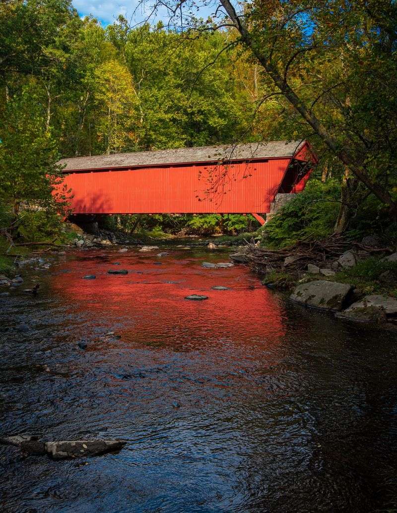
Jericho Covered Bridge still carries traffic across the Little Gunpowder Falls, stitching Harford and Baltimore counties together the way it has since 1865.
Thomas F. Forsyth designed it as a Burr arch through truss, combining king post framing with a long wooden arch to create a stronger crossing than either could manage on its own.
At 88 feet long and roughly 15 feet wide, it fits exactly one vehicle at a time. Drivers take turns, wave, and nobody seems to mind.
Clearance sits at 12 feet 4 inches, and dangling warning cans rattle against anything too tall before real damage happens.
Working traffic came first. The span was built to link the cotton mills of Jericho and a spade factory and wrought iron works in Franklinville with the flour mills and blacksmith shops over in Jerusalem.
Horse-drawn carriages were the intended load, which makes its long service record all the more impressive.
Rehabilitations arrived in 1937, then the early 1980s, then again in 2015. The 1983 project slipped five hidden steel girders beneath the deck, laid new flooring set on edge, replaced the roof, and repaired the stone abutments.
Later grant work rebuilt the portals and wingwalls and added cedar shingles, fresh siding, fire retardant, and a surveillance system.
Deep red boards and the wooded ravine around them make this the most photographed of the group, and also the most storied. Ghost tales cling to it locally, with claims of stalled engines and shapes glimpsed near the portals.
Take those stories lightly and enjoy the setting instead.
Parking is scarce, so use a legal spot and walk back rather than lingering on the roadway. Early mornings are calmest, with mist drifting over the water and barely a car around.
Listed on the National Register in 1978 and on the Baltimore County Landmarks List, it remains the last covered span in either county. That single detail turns a short stop into something rarer.
Address: 12228 Jericho Rd, Kingsville, MD 21087, United States
Historic Utica Covered Bridge On Fishing Creek
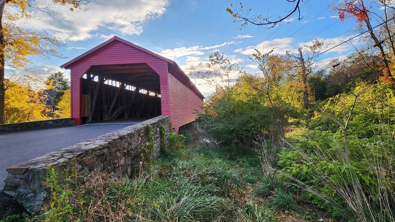
Few bridges have travelled anywhere. This one did, arriving at its current home in pieces loaded onto wagons.
Built in 1834, the original structure spanned the Monocacy River, where it was sometimes called the Devilbiss Road bridge, though sources argue over whether the true date was 1843 or nearer 1850.
A brutal flood wrecked it in 1889, and instead of writing off the wreckage, crews dismantled the surviving half, hauled it overland, and rebuilt it above Fishing Creek in 1891.
Much of the original timber came along for the ride. Step inside and the proof is right overhead.
Hand-hewn beams show old axe marks, and faded painted advertisements still cling to the interior rafters, a reminder that covered bridges once doubled as billboards for anyone passing through.
The Burr truss design marries an arch to a truss, spreading weight in a way that let 19th century builders cover longer distances using timber alone.
At roughly 101 feet, it is both the oldest and the longest of Frederick County’s three surviving covered bridges, and it joined the National Register in 1978.
Reinforcement arrived in 1934 with steel beams and a center pier, though corrosion eventually cut the load capacity. A rehabilitation across 1996 and 1997 replaced that steel, much of the labor done with hand tools, and lifted the limit back to fifteen tons.
Clapboarding and decking here closely match two nearby cousins, which turns comparing the three into a fun little game on a loop drive.
Parking sits close, the approach is level enough for wheelchairs, and a recreation park next door adds picnic tables, short trails, and fishing access.
Photographers turn up in spring for fresh green and again in October when the creek banks go gold and rust.
Traffic still crosses, so keep an ear open and step off the deck when a car rolls up. Locals are used to visitors and generally slow down.
Bring a snack and stay a while. The water runs shallow, clear, and endlessly distracting.
Address: 7720 Utica Rd, Thurmont, MD 21788, United States
Historic Loys Station Covered Bridge Near Rocky Ridge
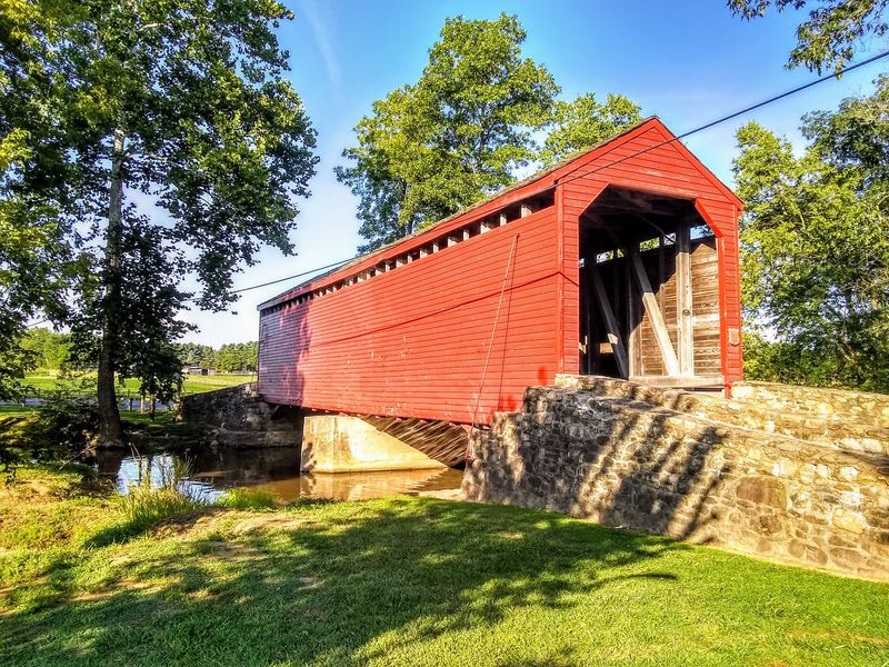
History leaned hard on this crossing. On July 7, 1863, only days after Gettysburg, General George Meade and the Union Army are believed to have marched over it while pursuing the retreating Confederate columns.
The multiple king post span crosses Owen’s Creek near Rocky Ridge, and its name traces back to a Western Maryland Railroad stop that once stood close by.
An unknown builder raised the original in 1848, stretching roughly 90 feet across the water.
Between 1929 and 1930 a concrete pier and steel beams went in underneath, splitting the crossing into two 45 foot spans and toughening it for heavier loads.
National Register listing followed in 1978. Then came the worst night in its long history.
Arsonists burned the bridge down on June 27, 1991 as part of an insurance fraud scheme, and for three years the creek ran under nothing but open air.
What happened next says plenty about the neighborhood. Fundraising took the shape of T-shirt sales, record hop dances, and limited edition prints of the bridge made by a local artist.
Surviving framing timbers were worked back into the new structure, and the rebuild deliberately copied the 1930s appearance, reinforcements included.
Reopening day landed on July 4, 1994, which is about as fitting a date as anyone could have chosen.
Repairs have continued since, including a preservation grant in 2011 shared with two nearby bridges, plus quick fixes after vehicles clipped the portals twice in October 2013.
The setting today is genuinely restful, with a small park, a playground, and a hiking trail tracing the water.
Families tend to stay longest here. Kids wade, dogs splash, and the bridge frames the creek like a painting.
The nearby hamlets of Loys, Graceham, and Rocky Ridge keep the surrounding drive pleasantly unhurried, and road shoulders are narrow, so use the park lot rather than stopping on the pavement.
Visit on a weekday morning for near total silence, and take a minute inside to study the joinery. Old work, honest work, still doing its job.
Address: 13506 Old Frederick Rd, Rocky Ridge, MD 21778, United States
Historic Roddy Road Covered Bridge And Its Little Park
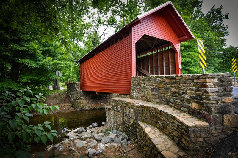
Small can be charming. At roughly 40 feet, Roddy Road is the shortest of Maryland’s survivors, and it wears that modesty well.
Owen’s Creek slips beneath a single span king post truss, thought to be the only bridge of its exact type left in the state.
Builders raised the original somewhere between 1850 and 1860, with 1856 a favorite guess among historians, and the National Register added it in 1978.
Width measures near 16 feet, clearance 12 feet 8 inches, and those tight numbers have caused trouble more than once.
Local tradition holds that Confederate General J.E.B. Stuart and his cavalry crossed here on July 5, 1863 during the Gettysburg campaign, though no records confirm any fighting nearby.
Steel beams went under the floor in the early 1930s and were swapped out twice as rust took hold.
Oversized trucks became the real nemesis. One tore into the structure in March 1992, forcing a closure, and volunteers working with donated materials had it open again by that October.
Repainting to historic standards followed in 1993, and heavier repairs across 1994 and 1995 replaced rotted material, cut back the wingwalls for air circulation, and added nine new steel I-beams before the July 1995 reopening.
Another truck struck in 2016, and the damage ran deep enough that a faithful replica took its place in 2017.
The new build added headache bars at both ends, which now stop tall vehicles before they reach any timbers. Roddy Creek Road was rerouted as well, making the northern approach far less nerve-racking.
A small park sits alongside with swings, picnic space, restrooms, and a short walking path.
Among the three Frederick County bridges, this is the easiest to enjoy on foot, partly because the creek is so reachable and partly because shade falls in every direction.
Red siding against green woods hands photographers an easy win, especially in the hour before sunset.
Save it for last on a loop. It makes a fine place to sit before the drive home.
Address: 14760 Roddy Rd, Thurmont, MD 21788, United States
