You think you know Oregon, but the locals keep a quiet list of places that feel almost too special to share.
These corners of the state trade crowds for calm, letting rugged coastlines, fossil-colored hills, and volcanic ridges whisper their stories in peace.
Follow along and you will find gentle trails behind waterfalls, wind-carved canyons, and lakes that mirror Mount Hood like glass.
Each stop has a distinct mood, a rhythm that sets your shoulders down and widens your breath.
Come ready to wander slowly, notice details, and leave no trace, because these favorites stay magical when they remain cared for.
Cape Meares and the Three Capes Loop
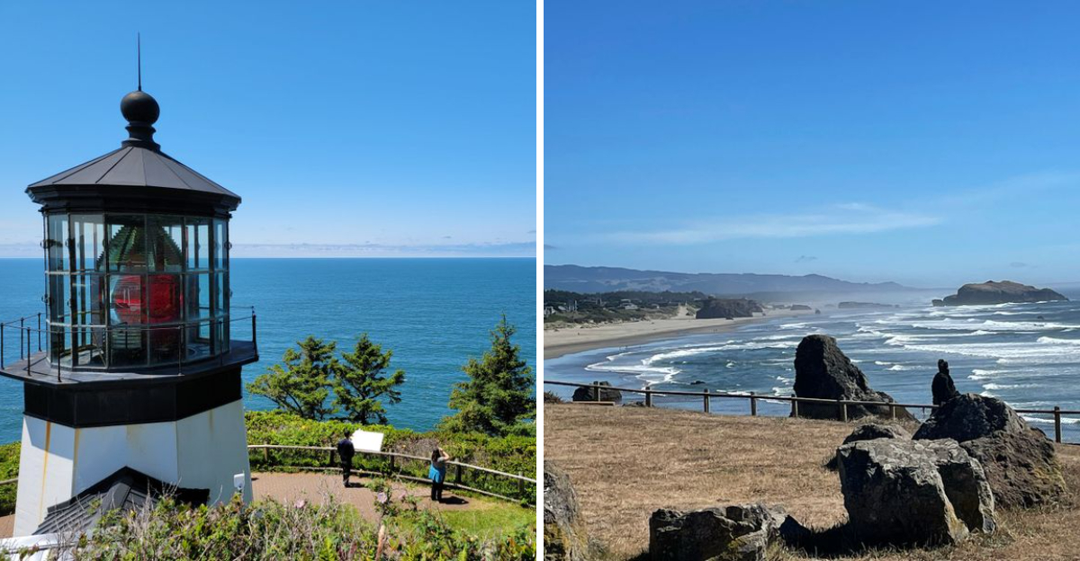
Cape Meares sits at the quiet end of the Three Capes Loop, where cliffs drop into a restless blue and spruce trees lean into the wind.
Park near Cape Meares Lighthouse, 3500 Cape Meares Loop, Tillamook, OR 97141, and walk the short path to a lantern room that glows even on gray days.
The Octopus Tree spreads like a living sculpture nearby, its limbs twisting above Netarts Bay and the soft hum of waves below.
Drive the loop to find peaceful pullouts, each view changing with tide and fog, and hear gulls trace the air along the headlands.
On calm mornings the ocean turns metallic, and the lighthouse stands steady as a small beacon over layered rock and foamy seams.
Netarts, Oceanside, and Cape Lookout create a trio of moods, from sheltered coves to wide beaches where sand squeaks under steady steps.
Skip big name viewpoints and linger at the smaller turnouts that locals favor, where windbreaks of salal and shore pine screen the road.
The coastal forest feels fragrant after rain, and the boardwalks frame the bluffs without crowding the experience.
You can watch shifting light trace the horizon for an hour, then circle back to the lighthouse and listen to its quiet hardware click.
This is Oregon at an easy pace, patient and generous, a coastline that rewards anyone who slows down and looks closely.
Painted Hills, John Day Fossil Beds
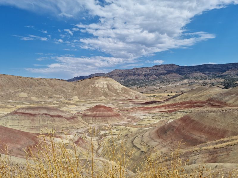
The Painted Hills rise in bands of ochre, rust, and gold, their colors shifting with each cloud that passes over the ridges.
Set your map to Painted Hills Overlook, 45500 Bear Creek Rd, Mitchell, OR 97750, and follow the boardwalks that protect the fragile clay.
The air feels still here, and every footstep echoes against quiet hills shaped by ancient ash and long seasons of sun.
Walk the Carroll Rim Trail for a gentle climb above the basin, where patterns ripple outward like brushstrokes on a wide canvas.
Mornings tend to soften the palette, while late light turns the mounds luminous and the shadows silky and long.
Interpretive signs explain the geology without crowding the viewpoint, leaving space to take in the sweep of Eastern Oregon.
Bring patience for the textures, because the details appear slowly, and the scene deepens the more you stand still.
Stay on marked paths so the soil crust remains intact, and let the silence carry the story of time layered underfoot.
Nearby pullouts reveal new angles, each one quieter than the last, where wind sketches faint lines across the surface.
When you leave, the colors linger behind your eyes, and the road back feels like a gentle return from another world.
Silver Falls State Park, Trail of Ten Falls
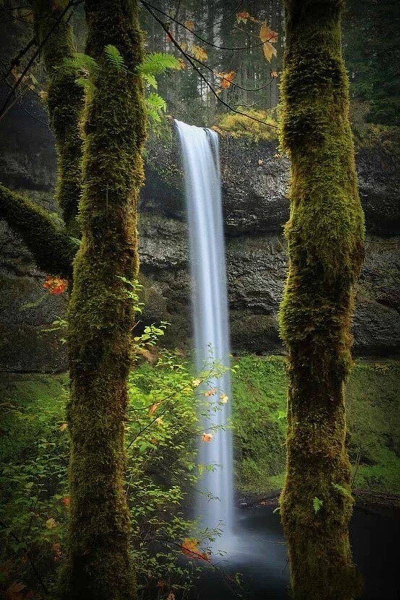
Silver Falls State Park rewards unhurried walkers with a corridor of water, moss, and basalt that feels both grand and intimate.
Begin at South Falls Day Use Area, 20024 Silver Falls Hwy SE, Sublimity, OR 97385, and step onto the Trail of Ten Falls loop.
Here the path curves behind curtains of water, and the roar turns to a steady hush as you enter the cool alcoves.
Basalt ledges create safe passage behind several falls, where mist beads on ferns and the canyon breathes damp and green.
Look up to see rim forests framing the drop, then look down for polished stones and the shine of cedar rails.
Photo overlooks sit just off the main route, though the best moments happen in the quiet between posted viewpoints.
Every season brings a new cadence, with spring vigor, summer shade, autumn color, and winter drama along the creek.
The loop can be shortened with connecting trails, allowing gentle strolls or longer circuits through the park.
Facilities near the day use area keep things simple, while trail signs make navigation easy without breaking the spell.
This is Oregon distilled into water and rock, a place that invites slow steps and leaves you lighter at the end.
Newberry National Volcanic Monument
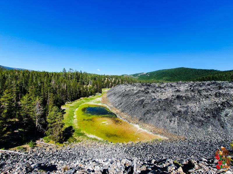
Volcanic history sits close to the surface at Newberry, where obsidian glints and broad lava fields hold heat like a memory.
Start at Lava Lands Visitor Center, 58201 US-97, Bend, OR 97702, then branch out to Paulina Lake, East Lake, and the Big Obsidian Flow.
The strolls here reveal textures, from cinders underfoot to glassy shards that sparkle beside sturdy boardwalks.
Paulina Peak Road leads to sweeping views when open, and interpretive panels outline eruptions that shaped Central Oregon.
At the Big Obsidian Flow Day Use Area, 19025 Paulina Lake Rd, La Pine, OR 97739, the wooden steps wind carefully through black glass.
Nearby lava tubes and cinder cones add contrast, each one telling a chapter in the monument’s layered timeline.
Water meets fire at the lakes, where shoreline trails feel calm and the air smells like pine and stone.
Respect closures that protect sensitive ground, and keep to pathways that skirt the sharp, delicate surfaces.
Views stretch out to the Cascades, with ridgelines stacking in pale blues and the forest holding a steady hush.
You leave with pockets of quiet and a clearer sense of how Oregon rose and cooled, one flow at a time.
Owyhee Canyonlands
The Owyhee feels like a quiet continent, a mosaic of canyons, buttes, and sage where solitude sets the day’s tempo.
Use the Owyhee River put-in as a landmark, 20409 Owyhee Ave, Rome, OR 97910, to orient yourself along the remote corridor.
Clifftop overlooks open to serpentine water below, and the wind carries the soft rasp of grasses across rimrock.
Dirt roads lead to trailheads and viewpoints, each one inviting a careful approach and a long pause.
Volcanic tuff and basalt stack in pastel layers that glow at low sun, while swallows stitch the air along the walls.
The scale can surprise you, with amphitheaters of stone that feel both fragile and enduring in the same breath.
Plan with intention, bring maps, and keep an eye on road conditions that shift with weather and season.
Riverside benches and high mesas share the same wide hush, a signature of Eastern Oregon’s open spaces.
When clouds move in, the palette turns moody and the canyon deepens, offering new textures from every bend.
Leave the place as you found it, and the Owyhee will give back silence, light, and a lasting sense of space.
Shaniko Ghost Town

Shaniko rests on a high desert plateau, its wooden fronts and boardwalks holding the echo of wagons and wool markets.
Point your drive to Shaniko Hotel and town center, 209 Main St, Shaniko, OR 97057, where storefronts frame a wide, quiet street.
Preserved buildings show weathered grain and trim, and their windows mirror a sky that runs clear to the horizons.
Interpretive plaques sketch the arc of the town, letting you trace how commerce rose, shifted, and settled into memory.
The old schoolhouse and city hall sit within easy steps, and the grid makes wandering simple and satisfying.
Light changes everything here, warming the facades in morning and turning them amber as afternoon leans west.
Photographers love the symmetry of porches and stairways, while history fans read the small details on doors and beams.
The stillness feels protective, and the town’s caretakers keep a gentle hand on restoration and access.
This is a place to slow your pace, listen for creaks in the boards, and consider how communities adapt over time.
Eastern Oregon stretches out beyond the last building, and the road north rolls you back into open country.
Vista House at Crown Point
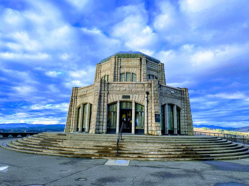
Vista House crowns Crown Point with a rotunda of stone and glass that looks over the Columbia River like a sentinel.
Set navigation to 40700 Historic Columbia River Hwy, Corbett, OR 97019, and climb the old highway’s graceful curves.
From the terrace the river stretches in braided blues, and cliffs stack upriver in a procession of ridgelines.
Inside, marble and warm light create a calm hall that honors travel and the landscape that made the road possible.
Wind can be brisk, so step carefully and pause by the railings where the view opens in every direction.
Interpretive displays illuminate the highway’s design, guiding your attention to tunnels, viaducts, and scenic pullouts nearby.
Morning brings clear edges, while late day softens the river into silver ribbons that catch the last light.
Nearby trailheads offer short walks to quiet overlooks that many drivers miss as they pass through.
The building’s curves photograph beautifully from the lower lot, with basalt walls framing the structure against sky.
This classic Oregon stop endures because it turns a view into a room, and a road into a story you can stand inside.
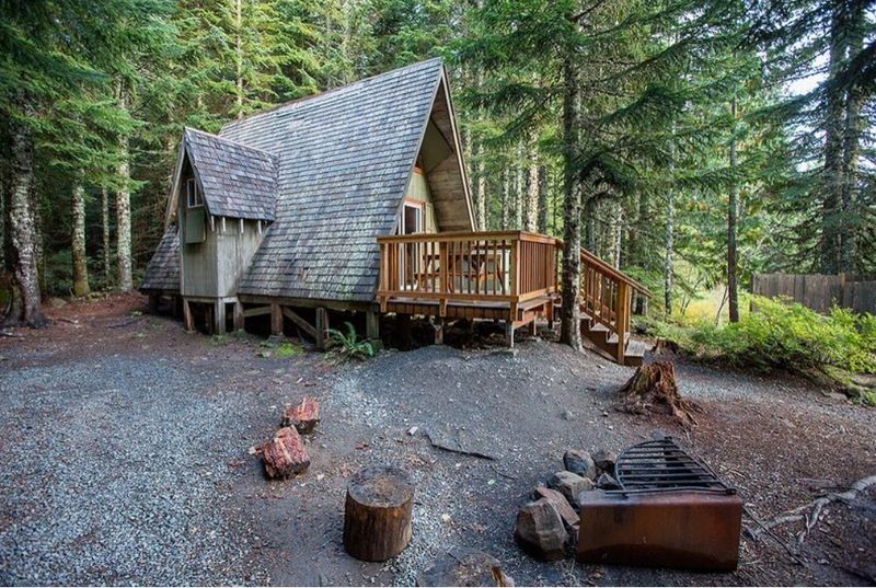
Lost Lake, Mount Hood Region
Lost Lake rests like a mirror beneath Mount Hood, a basin where trees, sky, and peak line up in perfect calm.
Head for Lost Lake Resort and Campground, 9000 Lost Lake Rd, Hood River, OR 97031, and follow signs to day use parking.
A lakeside path slips through cedar and hemlock, giving frequent glances at the mountain’s clear reflection.
Docks and quiet nooks offer places to sit, listen to birds along the shoreline, and watch light move across the water.
The forest keeps temperatures pleasant, and the scent of needles and damp wood lingers along the trail.
Cabins and simple facilities sit back from the shore, leaving room for wide views and soft edges.
Morning often brings a hush that smooths the surface into polished glass, and the peak looks close enough to touch.
Evenings carry a gentle breeze that sketches ripples, turning the reflection into brushed silver.
The experience is unhurried, the kind that invites a picnic blanket, a notebook, and a long breath.
This is Oregon at its quietest, a lakeside sanctuary that nourishes without asking for more than attention.
Cascade Lakes Scenic Byway
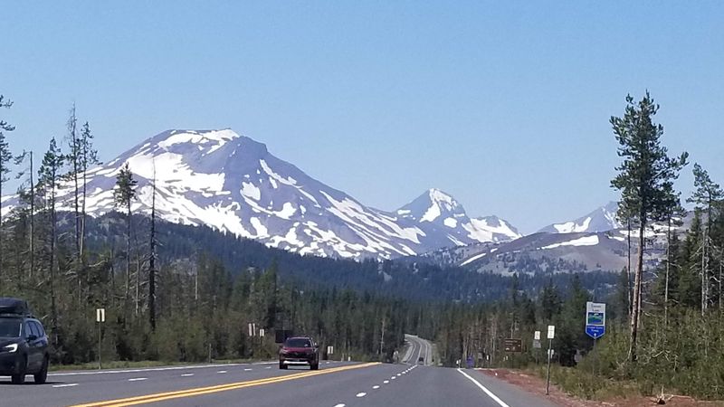
The Cascade Lakes Scenic Byway threads a necklace of clear lakes under broad Cascade summits and quiet lodgepole forests.
Start near Bend Visitor Center, 750 NW Lava Rd, Bend, OR 97703, and head toward Mt Bachelor before looping past alpine water.
Sparks Lake, Devil’s Lake, and Elk Lake each carry a distinct mood, with mirrorlike mornings and lively breezes by afternoon.
Pullouts reveal reflections of South Sister and Broken Top, while trailheads invite short strolls to peaceful shorelines.
Pumice soils and open meadows create bright edges, and the road flows gently between stands of pine.
Interpretive signs at viewpoints give context about glaciation, fire, and the volcanic roots of Central Oregon.
Plan simple stops, move slowly, and choose a few lakes to savor rather than racing the whole loop.
Even roadside benches feel special here, framed by water that shifts tone with every angle of light.
Late light can turn peaks rosy, and the forest breathes out the day as shadows lengthen.
The byway delivers variety without hurry, a string of scenes that makes you fall for Oregon one turn at a time.
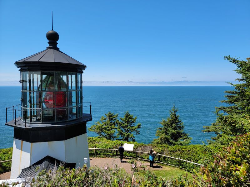
Bandon’s Secluded Beaches
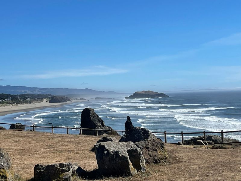
The beaches around Bandon stretch wide and quiet, a sculpture garden of sea stacks that shift with tide and light.
Navigate to Face Rock State Scenic Viewpoint, 79889 US-101, Bandon, OR 97411, and take the stairs to the sand below.
Walk south toward Cathedral Rock and north toward Elephant Rock, letting the soundtrack be wind and surf alone.
Pools form around the bases at low tide, mirroring arches and the steep silhouettes of weathered stone.
Several access points along Beach Loop Drive offer new angles, with small parking areas tucked behind the dunes.
Even on busy days you can find space, because the shore absorbs footsteps and spreads people thin.
Morning fog often drifts like gauze, then lifts to reveal crisp edges and slate blue water.
Evening softens everything, and the stacks turn copper as the horizon eases into gray and rose.
Look back from the waterline to frame the bluffs, cottages, and pathways that rise gently from the coast.
These south coast stretches feel like Oregon distilled, serene and spacious, and they linger long after you head home.
Seabirds wheel overhead, their calls echoing off the cliffs and adding life to the stillness.
Driftwood gathers along the high tide line, each piece telling a story of storms and distant shores.
At sunset, the light catches the wet sand, turning it into a mirror for the fiery sky above.
The gentle roar of the ocean seems to slow time, inviting quiet reflection with every step along the shore.
Dear Reader: This page may contain affiliate links which may earn a commission if you click through and make a purchase. Our independent journalism is not influenced by any advertiser or commercial initiative unless it is clearly marked as sponsored content. As travel products change, please be sure to reconfirm all details and stay up to date with current events to ensure a safe and successful trip.