
Oregon sweeps you from wave-lashed headlands to quiet deserts in a single day, and that range is exactly what makes a trip here unforgettable.
You get easy access to parks, green cities, and small towns, yet the same popularity can slow you down without smart planning.
This guide shares what travelers love and what might complicate your route, based on up to date details and on the ground experience.
Read on to set good expectations, save time, and enjoy more of what the state does best.
1. Crater Lake National Park’s Unmatched Clarity

Oregon rewards curious travelers with coastline drama, mossy forests, high desert skies, and lively small towns.
Yet the same geography and popularity that make it special can also complicate plans if you are unprepared.
This guide highlights what shines and what might slow you down, using recent facts and traveler tested insights.
Read on to make smarter choices, stretch your time, and enjoy more of what the state does best.
Crater Lake National Park stands apart for its stunning simplicity, a deep blue lake cradled within the remnants of an ancient volcano.
Fed entirely by snow and rain, the water remains remarkably pure and still, mirroring the surrounding cliffs and sky with striking clarity.
The park’s high elevation brings crisp air, fast shifting weather, and dramatic color changes as light moves across the caldera.
Visitors often note the broad silence, interrupted only by wind or birds circling above the rim.
Snow lingers for long stretches, then yields to wildflowers and vivid summer skies before autumn settles in with steady calm.
Every season reframes the view, from stark winter reflections to saturated blues on extended summer afternoons.
Scientists continue to measure the lake’s rare transparency, which ranks among the clearest recorded in natural waters.
Standing at the rim feels like stepping into a living lesson on time, pressure, and patience.
Rim Village, 565 Rim Dr, Crater Lake, OR 97604 anchors services with viewpoints, historic stonework, and essential facilities.
Road openings vary by snowfall, so current conditions pages help you choose the best loop or shuttle plan.
Good traction shoes, layers, and sun protection turn short walks into unhurried hours along the rim.
Come early, watch shadows shift, and let Oregon’s most famous circle of blue set the pace for the day.
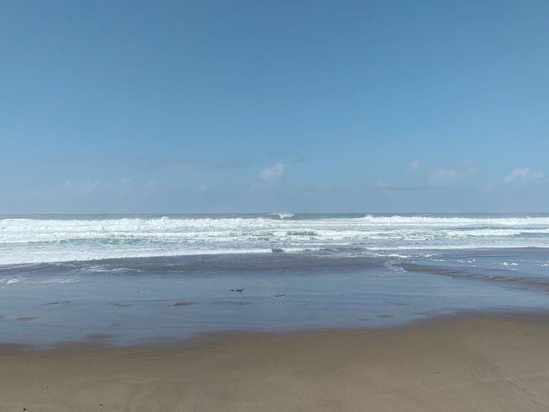
2. The Oregon Coast’s Public Access Tradition
Oregon rewards curious travelers with coastline drama, mossy forests, high desert skies, and lively small towns.
Yet the same geography and popularity that make it special can also complicate plans if you are unprepared.
This guide highlights what shines and what might slow you down, using recent facts and traveler tested insights.
Read on to make smarter choices, stretch your time, and enjoy more of what the state does best.
Oregon protects public access to its entire ocean shoreline, so beaches from Astoria to Brookings stay open to everyone.
State parks and signed waysides sit along U.S. 101, connecting headlands, lighthouses, and towns with steady services.
Low tides expose tide pools near Haystack Rock, where volunteers share guidelines that safeguard marine life.
Coastal weather flips fast, so a waterproof layer keeps walks comfortable during gusts and mist.
Winter storms draw photographers for dramatic surf, while spring and fall often soften crowds.
Parking fills early at Ecola State Park and Cape Kiwanda, and some sites use timed or paid systems.
Check park pages for closures tied to bluff erosion or trail work that can shift access points.
These policies shape how people experience Oregon, reinforcing a culture of open beaches and shared stewardship.
Haystack Rock, 1400 S Hemlock St, Cannon Beach, OR 97110 anchors a classic walk with nearby parking areas and paths.
Ecola State Park, 84318 Ecola Park Rd, Cannon Beach, OR 97110 offers headland vistas and forested trails above the surf.
Bring sturdy shoes for wet sand and rocky tide zones, plus a bag to pack out trash.
Stay mindful of tides, give wildlife space, and enjoy a coast built for unhurried public wandering.
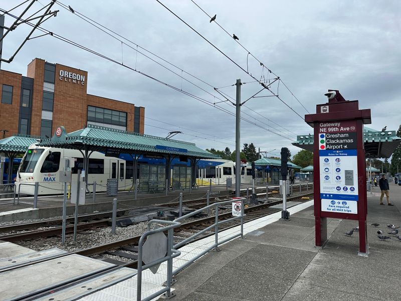
3. Portland’s Green Spaces and Transit
Oregon rewards curious travelers with coastline drama, mossy forests, high desert skies, and lively small towns.
Yet the same geography and popularity that make it special can also complicate plans if you are unprepared.
This guide highlights what shines and what might slow you down, using recent facts and traveler tested insights.
Read on to make smarter choices, stretch your time, and enjoy more of what the state does best.
Portland is straightforward to navigate thanks to MAX light rail, frequent buses, bikeways, and pedestrian bridges.
Washington Park concentrates gardens and museums on one hillside reachable by shuttle and transit connections.
The International Rose Test Garden and Portland Japanese Garden sit nearby, making a compact afternoon without a car.
Food carts cluster along transit lines, so you can plan short hops with relaxed breaks.
TriMet rider alerts flag service changes that can affect transfers during events or construction.
Cathedral Park under the St. Johns Bridge and Mt. Tabor’s cinder cone add breezy green escapes.
Trails can turn muddy, and some Forest Park paths close after storms for maintenance.
City parks post updates that help reroute walks and avoid resource damage.
Washington Park, 4033 SW Canyon Rd, Portland, OR 97221 provides signs, maps, and shuttles for hilltop sights.
Portland Visitor Center, 1132 SW Harvey Milk St, Portland, OR 97205 can help build a car free plan.
Tap a day pass, keep an eye on departures, and let the network carry you between neighborhoods.
Oregon’s biggest city proves that green space and transit can pair elegantly with easygoing urban days.
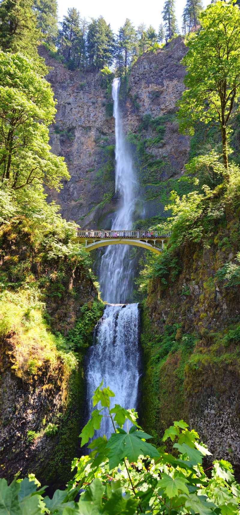
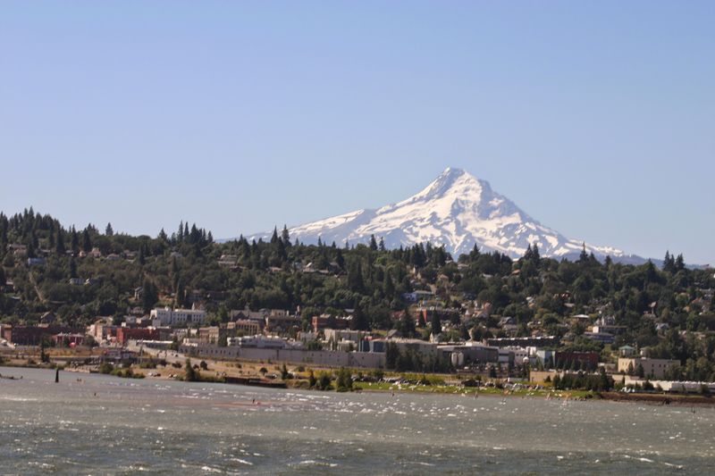
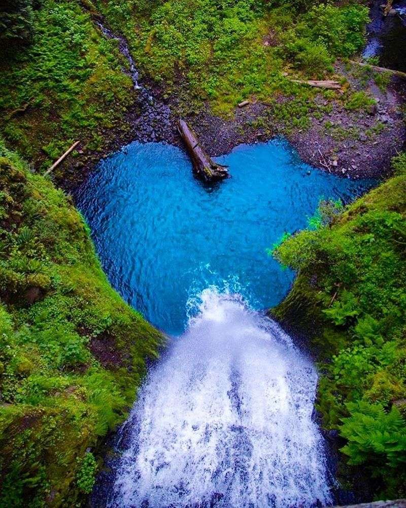
4. Columbia River Gorge Waterfalls and Historic Highway
Oregon rewards curious travelers with coastline drama, mossy forests, high desert skies, and lively small towns.
Yet the same geography and popularity that make it special can also complicate plans if you are unprepared.
This guide highlights what shines and what might slow you down, using recent facts and traveler tested insights.
Read on to make smarter choices, stretch your time, and enjoy more of what the state does best.
The Gorge places basalt cliffs and waterfall strolls within easy reach of Portland for quick day trips.
For peak times in summer 2025, timed use permits apply only to parking at the I 84 Exit 31 lot at Multnomah Falls.
No permit is needed if you arrive by shuttle, bike, tour, or access trailheads along the Historic Highway.
Sections of the scenic byway open and close for repairs or landslide work, so check conditions before you go.
Trails span paved overlooks to forest climbs with exposure, so footwear with grip matters in all seasons.
Spring winds can howl at Vista House, making layers crucial for comfort on exposed points.
Troutdale and Hood River provide bases with visitor centers and updated maps for quick planning.
Summer heat dries brush fast, which can trigger restrictions on open flames and certain routes.
Vista House, 40700 Historic Columbia River Hwy, Corbett, OR 97019 stands above sweeping river bends.
Multnomah Falls, 53000 E Historic Columbia River Hwy, Bridal Veil, OR 97010 posts live parking guidance.
Arrive early, favor shuttles, and build buffer time to avoid tight windows and packed lots.
Patience pays with spray cooled overlooks, canyon views, and a classic road that rewards careful timing.
5. Willamette Valley Trails, Farms, and Small Towns
Oregon rewards curious travelers with coastline drama, mossy forests, high desert skies, and lively small towns.
Yet the same geography and popularity that make it special can also complicate plans if you are unprepared.
This guide highlights what shines and what might slow you down, using recent facts and traveler tested insights.
Read on to make smarter choices, stretch your time, and enjoy more of what the state does best.
The Willamette Valley spreads between forested hills with bike paths, farm stands, and refuges for relaxed days.
William L. Finley National Wildlife Refuge posts seasonal closures to protect habitats with clear on site signage.
Towns like Corvallis and Albany offer walkable districts, riverfront paths, and easy navigation without a car.
Spring and early summer bring blooms and u pick windows, while fall color warms country drives.
Public markets highlight produce and crafts, and farms list hours online to help time stops.
Moderate weather makes shoulder seasons attractive when summer traffic fades to a gentler pace.
Refuge notices help you avoid sensitive areas and reroute around nesting zones.
Map your loops to mix town browsing with short country detours on the same day.
William L. Finley NWR, 26208 Finley Refuge Rd, Corvallis, OR 97333 anchors wildlife viewing and flat trails.
Corvallis Riverfront, 100 SW 1st St, Corvallis, OR 97333 frames benches, paths, and open green views.
Pack layers, bring binoculars, and keep drives short to maximize time on foot.
Oregon’s fertile core supports slow mornings, local foods, and nature first itineraries that never feel rushed.
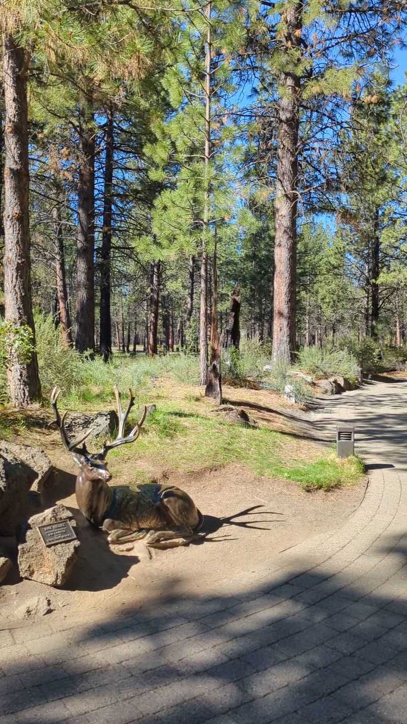
6. Bend’s High Desert and Cascade Access
Oregon rewards curious travelers with coastline drama, mossy forests, high desert skies, and lively small towns.
Yet the same geography and popularity that make it special can also complicate plans if you are unprepared.
This guide highlights what shines and what might slow you down, using recent facts and traveler tested insights.
Read on to make smarter choices, stretch your time, and enjoy more of what the state does best.
Bend sits where high desert meets the Cascades, shifting quickly from sage flats to alpine lakes and peaks.
Clear skies and dry air sharpen horizons while the Deschutes River threads paths and parks through town.
Nearby geology tells stories of eruptions, lava tubes, and glaciers that shaped canyons and plateaus.
Many visitors base here to sample diverse terrain with short drives and simple logistics.
Days can start cool and end warm, so flexible layers reward early mornings and late light.
Open landscapes suit spotting hawks, deer, and occasional coyotes across rimrock and meadow.
Downtown services make stocking up easy before heading for trailheads or lakes.
Local shops and outfitters post current conditions that refine daily plans.
Bend Visitor Center, 750 NW Lava Rd, Bend, OR 97703 helps with maps and transit links.
Drake Park, 777 NW Riverside Blvd, Bend, OR 97703 offers shady paths and river views near cafes.
Pick a loop that mixes river time with a quick run to the mountains for sunsets.
Oregon’s interior blends stark beauty, active geology, and inviting towns into one compact playground.
7. Southern Oregon Shakespeare and Outdoor Blend

Oregon rewards curious travelers with coastline drama, mossy forests, high desert skies, and lively small towns.
Yet the same geography and popularity that make it special can also complicate plans if you are unprepared.
This guide highlights what shines and what might slow you down, using recent facts and traveler tested insights.
Read on to make smarter choices, stretch your time, and enjoy more of what the state does best.
Ashland’s Oregon Shakespeare Festival adjusts schedules and venues, so check the active calendar before you go.
Downtown theaters sit a short walk from Lithia Park, where shade, ponds, and paths cool performance days.
The Rogue Valley adds rafting access, cycling routes, and seasonal wildflowers on Table Rocks with broad views.
Jacksonville’s historic core pairs with a hillside venue that hosts outdoor events in warm months.
Smoke can affect plans, and venues now share air quality guidance with flexible policies.
Public transit links Ashland and Medford for simple transfers without lengthy parking hunts.
Regional flights into MFR reduce drive time and smooth out tight itineraries.
Visitor centers post show updates and park notices that help pivot plans quickly.
Oregon Shakespeare Festival, 15 S Pioneer St, Ashland, OR 97520 anchors the cultural hub downtown.
Lithia Park, 59 Winburn Way, Ashland, OR 97520 winds through creekside lawns and wooded slopes.
Keep evenings open for curtain times and leave mornings free for trails or galleries.
Southern Oregon invites a balanced rhythm, where stages and shaded paths share the same easy pace.
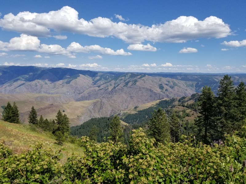
8. Wallowa Mountains and Hells Canyon Vistas
Oregon rewards curious travelers with coastline drama, mossy forests, high desert skies, and lively small towns.
Yet the same geography and popularity that make it special can also complicate plans if you are unprepared.
This guide highlights what shines and what might slow you down, using recent facts and traveler tested insights.
Read on to make smarter choices, stretch your time, and enjoy more of what the state does best.
Far in the northeast, the Wallowas mix alpine scenery with the easygoing pace of lakeside Joseph.
The Wallowa Lake Tramway runs seasonally, delivering views from Mt. Howard and fast access to ridge paths.
Hells Canyon viewpoints reveal the depth of the Snake River’s cut and demand careful gravel driving.
Wildlife sightings are common, and guides share current trail and road conditions at outfitters.
Eastern Oregon has long distances between services, so fuel and water planning matters.
Campgrounds and trailheads can fill on peak weekends, with thunderstorms building quickly in heat.
Leave room in your schedule for scenic pauses that steal extra minutes with no regret.
Stargazing rewards late nights with quiet that differs from the coast and valley.
Wallowa Lake Tramway, 59919 Wallowa Lake Hwy, Joseph, OR 97846 marks the lift base near the shore.
Hat Point Overlook, NF 4240, Imnaha, OR 97842 offers a lofty perch when seasonal roads are open.
Carry layers, check conditions, and let viewpoints shape the day instead of the clock.
Oregon’s far corner trades crowds for space, turning patience into wide open satisfaction.
9. Seasonal Wildfire Smoke and Closures
Oregon rewards curious travelers with coastline drama, mossy forests, high desert skies, and lively small towns.
Yet the same geography and popularity that make it special can also complicate plans if you are unprepared.
This guide highlights what shines and what might slow you down, using recent facts and traveler tested insights.
Read on to make smarter choices, stretch your time, and enjoy more of what the state does best.
Late summer and early fall can bring wildfire smoke that lowers visibility and reshapes outdoor plans.
Agencies publish real time air quality maps, and land managers close trails or roads when needed.
Trip flexibility helps with backup indoor options or upwind regions that sit outside smoke plumes.
Park websites maintain alert banners that outline closures and reopening estimates you can review daily.
Local news and incident dashboards provide briefings worth scanning every morning on the go.
Masks, eye protection for ash, and extra fluids make smoky days more manageable when travel must continue.
Refundable stays add a safety valve during peak fire windows, easing last minute pivots.
Most trips still proceed, but planning for smoke is now part of summer travel in this state.
Oregon State Parks Headquarters, 725 Summer St NE, Suite C, Salem, OR 97301 publishes statewide updates.
U.S. Forest Service offices post local notices with maps and phone contacts near affected districts.
Keep expectations flexible and choose clear air zones to salvage hiking time.
Preparation reduces stress and keeps your Oregon itinerary on track when skies turn hazy.
10. Crowds and Timed Entry at Icons
Oregon rewards curious travelers with coastline drama, mossy forests, high desert skies, and lively small towns.
Yet the same geography and popularity that make it special can also complicate plans if you are unprepared.
This guide highlights what shines and what might slow you down, using recent facts and traveler tested insights.
Read on to make smarter choices, stretch your time, and enjoy more of what the state does best.
The state’s most famous viewpoints and waterfall corridors can test patience on sunny weekends.
Crowds swell at parking areas, and timed entry systems push planning earlier than many expect.
These permits protect fragile places while steering flow, but spontaneity takes a back seat.
Miss a window or arrive late, and tight schedules can unravel before the hike begins.
Remote spots popular online now draw steady traffic that strains narrow roads and small towns.
Arriving early or choosing midweek helps, though lots can still reach capacity quickly.
Shuttles often bypass permit needs and turn stacked lots into simpler board and go moments.
Visitor centers share maps that help stitch together second choice viewpoints without losing the day.
Multnomah Falls Lodge, 53000 E Historic Columbia River Hwy, Bridal Veil, OR 97010 posts real time notices.
Silver Falls State Park, 20024 Silver Falls Hwy SE, Sublimity, OR 97385 manages heavy use on loop trails.
Build backup options and watch alerts to keep momentum steady.
Oregon stays beautiful, and patience plus preparation unlocks its icons without unnecessary stress.
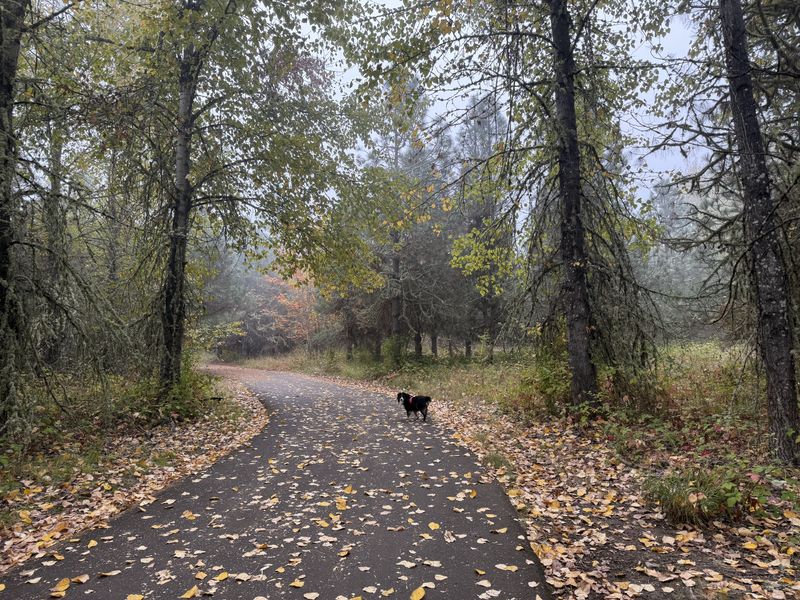
11. Changeable Weather and Mountain Roads
Oregon rewards curious travelers with coastline drama, mossy forests, high desert skies, and lively small towns.
Yet the same geography and popularity that make it special can also complicate plans if you are unprepared.
This guide highlights what shines and what might slow you down, using recent facts and traveler tested insights.
Read on to make smarter choices, stretch your time, and enjoy more of what the state does best.
Rapid weather shifts stack up near the Cascades and along the coast within short driving spans.
A sunny morning can turn to slick passes or cold wind on exposed viewpoints by afternoon.
ODOT maintains pass cameras and chain updates that help drivers choose safer routes.
Shoulder seasons bring rain that muddies trails and slows progress on steep climbs.
Coastal fog can erase headland vistas for hours, rewarding those who wait for breaks.
Layers, waterproof footwear, and backup plans keep the day productive and comfortable.
Local ranger stations post avalanche advisories and notices after heavy precipitation events.
Building buffer time into schedules prevents rushed decisions when conditions turn.
ODOT Region 1 HQ, 123 NW Flanders St, Portland, OR 97209 lists contacts and traveler info.
Mt. Hood Information Center, 65000 E Hwy 26, Welches, OR 97067 shares road and trail updates.
Check cams, time your crossings, and favor daylight for complex routes.
Oregon’s variability becomes part of the adventure when you plan with weather in mind.
Dear Reader: This page may contain affiliate links which may earn a commission if you click through and make a purchase. Our independent journalism is not influenced by any advertiser or commercial initiative unless it is clearly marked as sponsored content. As travel products change, please be sure to reconfirm all details and stay up to date with current events to ensure a safe and successful trip.