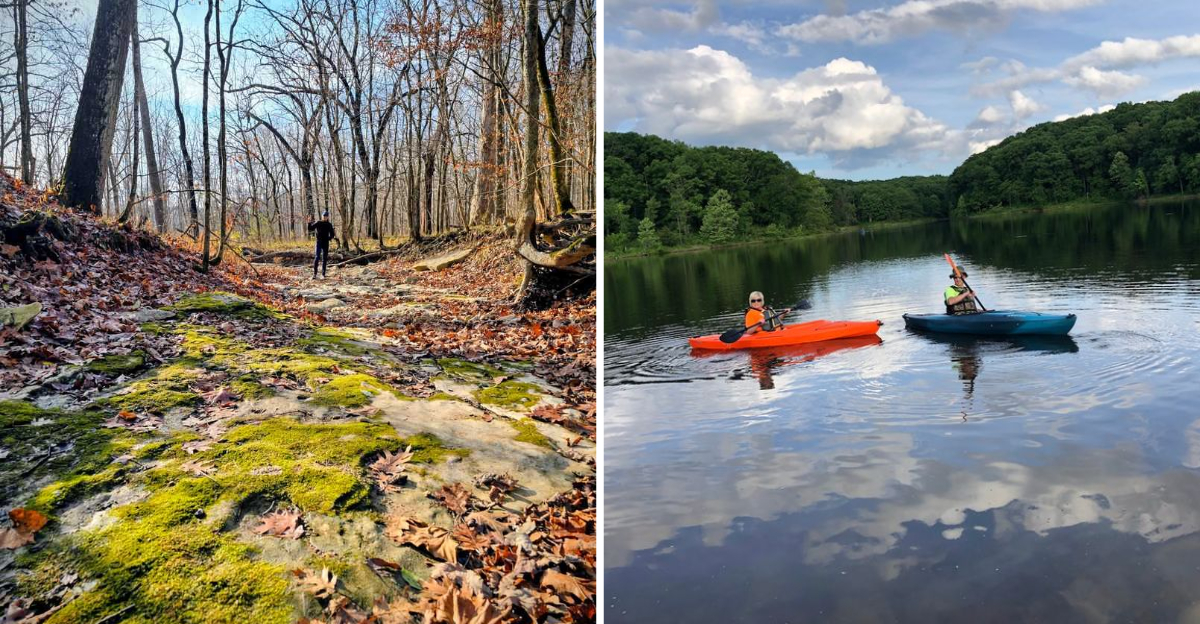
That view from the top of a Missouri bluff caught me completely off guard. The drive out runs past farm fields and quiet county roads, so the moment the land starts folding into steep, rocky hills, it hits you without warning.
About twenty minutes into the hike, the trail tips upward and the trees begin to thin, and then suddenly there is nothing in front of you but open air above the river valley below. I stood there longer than I planned, listening to the wind push through the oaks beneath me, watching the light shift across the treetops.
What surprised me most is how short the whole loop is, just over a mile and a half, yet it feels like a real accomplishment. The terrain changes quickly, from flat woodland to rocky incline, and each step rewards you with a slightly wider view.
A state park has become one of those places I keep circling back to, and this trail is the reason why. The climb is short, the payoff is huge, and the quiet at the top is the kind you do not find often enough.
Frenchman’s Bluff Trail And That 120-Foot Payoff
The first stretch of Frenchman’s Bluff Trail hugs Geode Creek, and it fooled me into thinking this would be a flat stroll. Water trickles over gravel, birds move through the branches, and the forest closes in gently around the path.
Then the climbing starts. The trail bends uphill and asks for real effort, though never enough to leave you gasping.
My legs noticed it, my lungs less so.
Blue blazes mark the route, guiding hikers counterclockwise through the loop, which matters because sections overlap with the Cuivre River Trail and the Blackhawk Point Mountain Bike Trail. Keeping an eye on those blazes saves you from accidental detours.
At the top, the reward arrives all at once. The bluff drops 120 feet into the Cuivre River valley, and the view spreads wide across rolling wooded ridges that look nothing like the flat farmland you passed on the way in.
The rock underfoot is Burlington limestone, ancient stuff, shaped long before anyone thought to build a trail across it. I ran my hand along the exposed edge and felt how rough and layered it was.
Loose gravel along the bluff top demands attention. I slowed my pace considerably and stayed back from the drop, which honestly made the whole experience better because I looked around more.
Total time for the loop landed near an hour and ten minutes for me. That is short enough to squeeze into a morning, long enough to feel like a genuine hike rather than a walk.
Ozark-Border Hills Hiding In Lincoln County
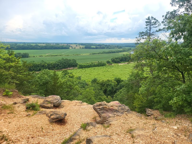
Something feels geographically out of place here, and I mean that as a compliment. Northern Missouri is supposed to be plains and cropland, yet Cuivre River State Park protects rugged Ozark-border hills that carry a wilder, more Ozarkian character.
Oaks and hickories dominate the open woodlands. Between them, sunlit glades and savannas break the canopy and let light pour straight to the ground.
The park sits inside the Lincoln Hills region, an area shaped by glaciers that once pushed across this land and left scattered boulders behind. Those glacial erratics show up in odd spots, big stones sitting where no stone logically belongs, and spotting one always makes me pause.
Biodiversity here runs deeper than most visitors realize. Thousands of species live within park boundaries, and a number of them are considered species of conservation concern.
False yellow mallow and eastern blazing star grow in the right pockets of habitat. Cerulean warblers and ringed salamanders depend on these specific woodlands, glades, and wet spots to survive.
Park staff use prescribed burns to keep prairie, savanna, and limestone glade communities healthy, which is why the open areas stay open instead of filling in with brush. I noticed blackened bark on some trunks and understood immediately what I was seeing.
Walking between dense shade and bright glade in the space of a few minutes never gets old. The landscape keeps changing character, and that variety is what pulled me back a second time.
Big Sugar Creek Winding Through The Valley
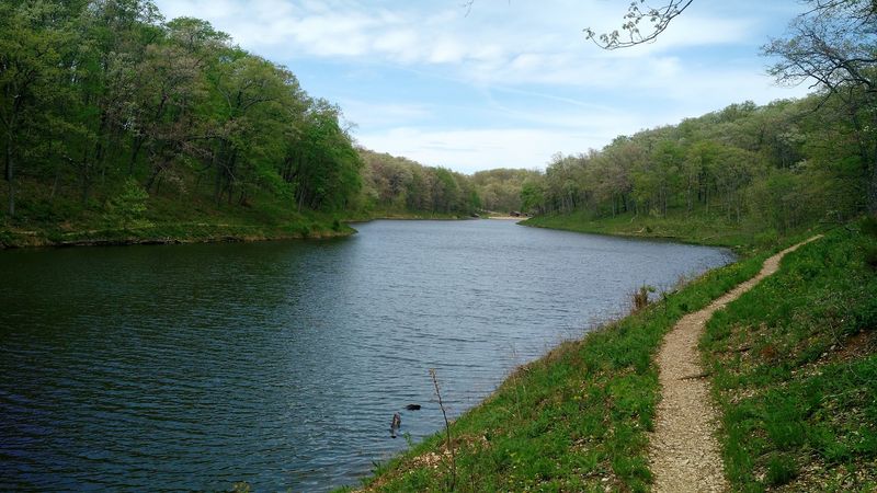
My favorite sound in this park is not the wind on the bluff. It is Big Sugar Creek moving over gravel somewhere below the trail, close enough to hear but not always close enough to see.
The Cuivre River itself borders the park along the southwest boundary. Big Sugar Creek, though, cuts right through the interior, and it does most of the work shaping these valleys.
On clear days the water sparkles in a way that reminds me of streams much deeper into the Ozarks. Parts of the creek run intermittently, though sizable springs keep water flowing through it during the year.
Bluffs rise along its banks, echoing the bigger formations found up at Frenchman’s Bluff. Some of them lean over the water at angles that look almost deliberate.
The creek valley holds extensive woodlands, scattered glades, and even sinkhole ponds tucked into low spots. That mix of habitats supports a genuinely wide range of plants and animals, so wildlife watching along here rewards patience.
I like stopping where the trees open onto sunny creek banks. The temperature shift between deep shade and open sun is immediate, and so is the change in what you hear and see.
Nothing about walking beside this creek feels rushed. I have sat on a gravel bar for twenty minutes doing absolutely nothing productive, and it counted as one of the better parts of the day.
Wildflowers, Fall Color, And Summer Water
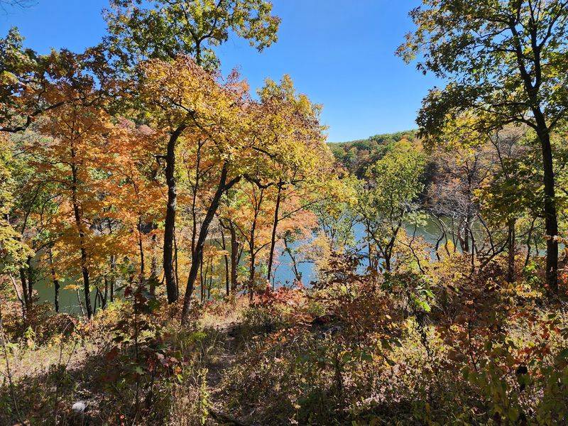
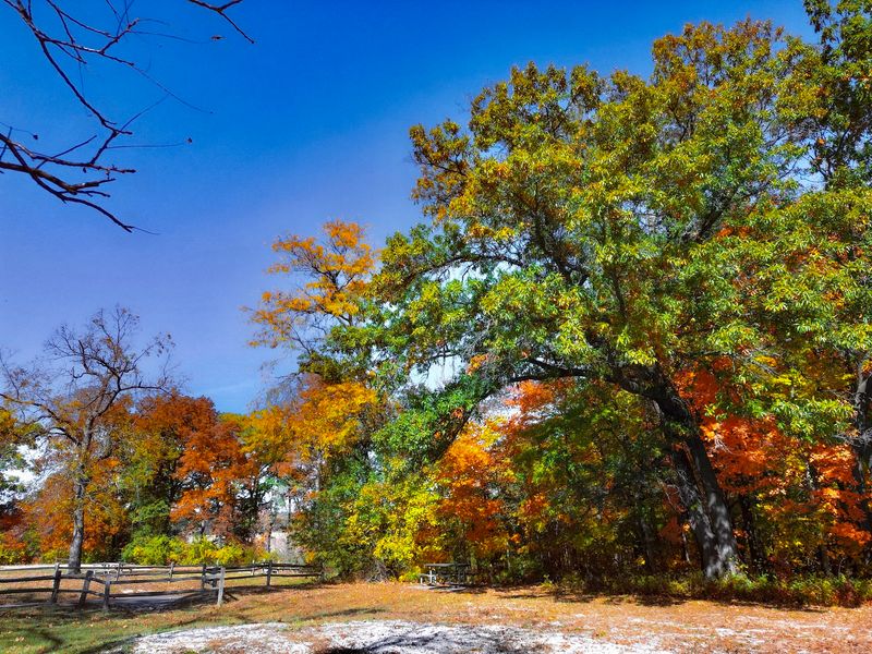
Fall is when this park shows off, and I will happily admit it won me over completely. Oaks and hickories turn red, orange, and gold, and the views from the bluff open up as leaves thin out.
Crisp air helps too. Hiking uphill in mild temperatures beats doing it in July heat by a wide margin.
Spring brings a different kind of show. Wildflowers spread across the forest floor, flowering dogwoods scatter white through the greening canopy, and migrating birds fill the woods with sound.
I found the spring trails muddier in low spots near the creek. Worth knowing before you pick footwear.
Summer shifts the focus toward water. Lake Lincoln has a sandy public beach for swimming, plus fishing and non-motorized boating, which makes hot afternoons far more bearable.
Winter has its own quiet appeal for anyone who does not mind bundling up. Bare branches mean the limestone bluffs and rock formations stand out clearly, and the trails stay peaceful.
Weekends draw more people, so arriving early pays off twice over. You get easier parking and cooler air on the climb.
Whatever month you pick, checking the forecast first saves frustration since trail conditions change quickly after rain. Wet limestone and loose gravel near the bluff edge are not a combination worth testing.
Every season here gives you a reason to come back, which is exactly the problem with this park. One visit is never enough.
Beyond The Bluff: Lake Lincoln, Camping, And 45 Miles Of Trails
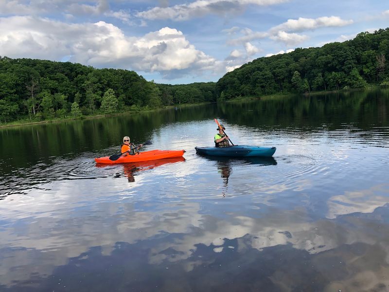
After hauling myself up to Frenchman’s Bluff, Lake Lincoln looked awfully good. The park lake sits within easy reach and offers swimming, fishing, and non-motorized boating, plus a sandy public beach where sitting still feels earned.
Going from shaded forest trail to wide open water in one afternoon changes the whole mood of a visit. Two very different experiences, same park.
Campers get options here. Both primitive and modern campsites are available, so you can rough it or keep a few comforts, depending on your tolerance for waking up cold.
Falling asleep to nocturnal forest sounds is genuinely part of the appeal. Owls, insects, the occasional unidentifiable rustle.
Horse riders have dedicated trails and their own campground for overnight stays with animals, which is not something every state park manages to provide. The trail network across the park stretches past 45 miles total.
That range covers easy walks, moderate loops like Frenchman’s Bluff, and longer backpacking routes for anyone wanting multiple days out. Picking a trail becomes a real decision rather than a default.
Photographers and wildlife watchers do well in the wild and natural areas, especially early morning. I keep a mental list of birds spotted, and it grows every trip.
Picnic areas, restrooms, and a visitor center handle the practical side. Having those basics available makes bringing family along much simpler than it would otherwise be.
Practical Tips Before You Lace Up
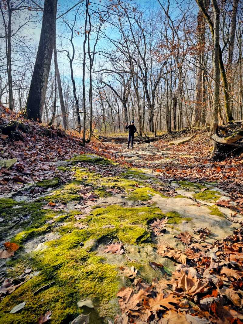
A few small preparations make this hike much better, and I learned some of them the hard way. Sturdy shoes come first because the terrain includes rocky stretches, exposed roots, and uneven footing along the bluff.
Sneakers with worn tread are a bad idea up there. The loose gravel does not forgive much.
Water matters more than people expect on a 1.6-mile trail, especially once the climb starts. I carry more than I think I need, along with a snack for the top.
Bug spray belongs in the pack from late spring through summer. Wooded sections get buggy, and swatting ruins a good view.
Admission to the park is free, which makes a spontaneous trip easy to justify. Arriving early on weekends helps with parking and gives you cooler temperatures for the uphill section.
Dogs are welcome in most outdoor areas as long as they stay on a leash no longer than ten feet. Mine would love the creek crossings.
Stopping at the visitor center first is worth ten minutes of your time. Maps help, and the displays on the park’s natural and cultural history give context to what you see on the trail.
Rain changes everything, so check conditions before driving out. Muddy trails near Geode Creek slow the pace considerably.
This park balances genuine wilderness with enough amenities to keep things comfortable, and that combination keeps drawing me back north from St. Louis.
Address: 678 State Route 147, Troy, Missouri
