Buckle up, because this 110-mile Oregon rail trail is basically an adventure buffet on wheels – or sneakers. I hopped on my bike (and sometimes ran) and discovered charming forgotten towns I never knew existed.
Every stretch offers surprises: rolling hills, scenic rivers, and trails so smooth it almost feels unfair. Locals glide past like it’s their daily commute, while I’m busy stopping every few minutes for photos, snacks, or just to admire the view.
Historic buildings, quirky roadside attractions, and peaceful forests make it feel like a treasure hunt with wheels. Even short segments pack more charm than a whole weekend elsewhere.
After a day on this trail, I was hooked, already plotting my next run, ride, or casual wander down its endless, scenic path.
The History Behind The Rail Line
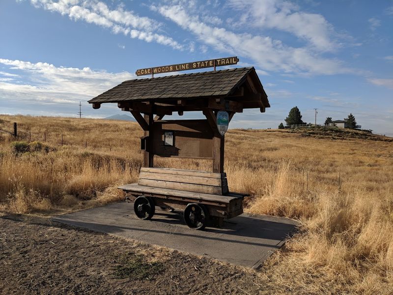
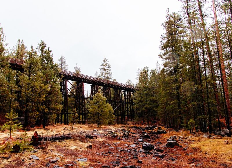
Not every trail comes with a backstory this good. The OC&E Woods Line was originally built in 1917 by the Oregon, California and Eastern Railway.
It was designed to haul timber and freight through the rugged Klamath Basin and into the Fremont forest.
The line eventually shut down, and Oregon converted it into a state trail in 1992. That transformation gave the route a second life that feels just as purposeful as the first.
Old railroad markers still stand along the path. You can spot weathered mile posts and remnants of loading platforms if you keep your eyes open.
The trail runs through land that shaped southern Oregon’s economy for decades.
Knowing that history makes every mile feel heavier in the best way. You are not just crossing terrain.
You are walking the same ground that workers, trains, and entire communities depended on. That connection to the past adds a layer of meaning that most trails simply cannot offer.
Starting Point In Klamath Falls
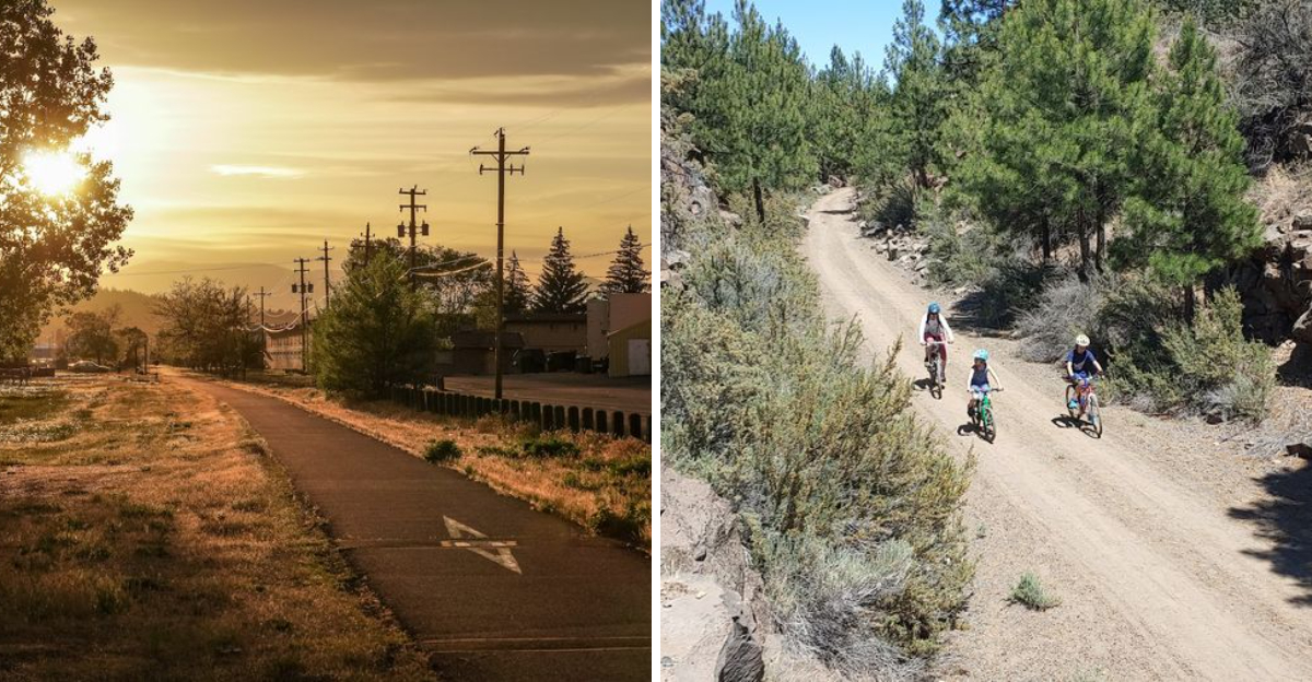
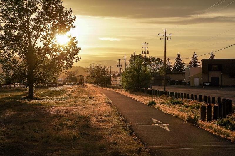
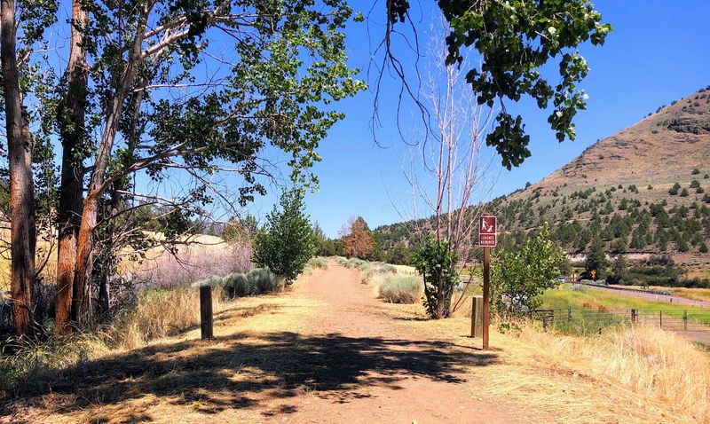
Klamath Falls is where the whole adventure begins. The trailhead sits at the edge of town and gives you an immediate sense of what the next 110 miles could look like.
The transition from city streets to open trail happens fast, and it feels good.
The first few miles are paved, which makes them friendly for casual riders and families with younger kids. There are restrooms and parking near the start, so getting organized before heading out is easy.
I liked how the town itself has a relaxed, no-fuss energy. There are coffee shops and gear-friendly spots nearby if you need to stock up before hitting the trail.
The surrounding landscape opens up quickly once you leave the trailhead behind.
Starting in Klamath Falls also means you have services close by if anything goes wrong early in your trip. For longer expeditions, having that safety net nearby is genuinely reassuring.
It is a solid, practical starting point with real character.
Running The Flat Rail Grade
Rail trails have a gift that mountain trails do not always offer: consistent, forgiving terrain. The OC&E follows a converted rail grade, which means the elevation changes are gradual and manageable.
For runners, that is a serious advantage.
Long stretches of flat, packed gravel make for smooth footing. You can settle into a rhythm and just go.
The wide trail surface also means you rarely feel boxed in, even when other users are nearby.
I found the section between Beatty and Sprague River particularly satisfying to run. The air is dry and clean, and the surrounding high desert stretches out in every direction.
There is a meditative quality to running through that kind of open space.
Trail runners training for longer events will appreciate the consistent mileage opportunities. You can plan out-and-back routes or point-to-point runs depending on your goals.
The flatness is deceptive in the best way. It lets you go farther than you expect without wrecking your legs.
Biking Through The Klamath Basin
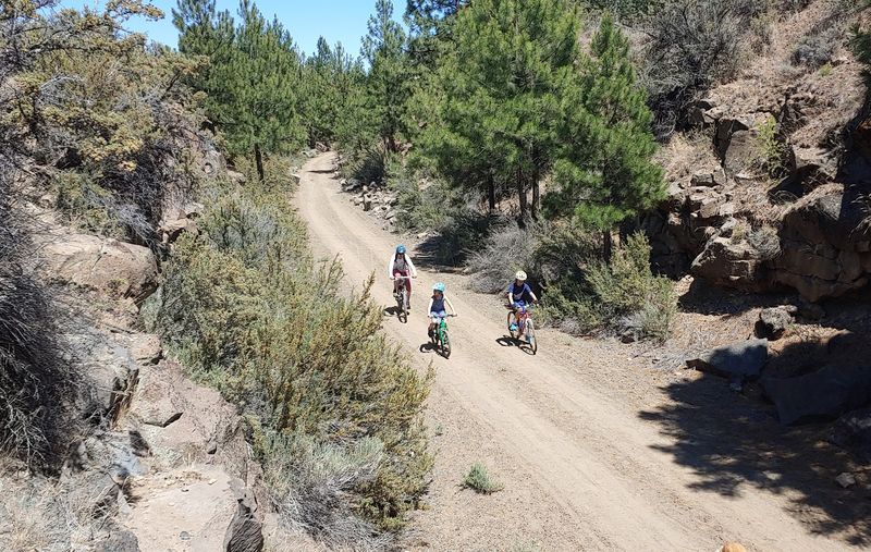
Cyclists absolutely love this trail. The gentle grade and wide path make it ideal for everything from casual cruisers to loaded touring setups.
You cover ground quickly, and the scenery keeps shifting in ways that hold your attention.
The Klamath Basin section feels almost cinematic on a bike. Wide skies, distant rimrock, and the occasional hawk circling overhead create a backdrop that is hard to beat.
There is very little vehicle traffic to worry about on most of the route.
Gravel bikes and hybrid bikes handle the surface well. Mountain bikes work fine too, though you will not need fat tires for most of the trail.
Bring enough water because services are sparse between towns.
Multi-day bike touring is genuinely popular here. Riders camp along the route and cover the full distance over several days.
Packing light and planning your resupply stops carefully makes the whole experience smoother. The trail rewards those who take their time and soak in the landscape rather than rushing through it.
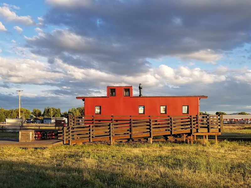
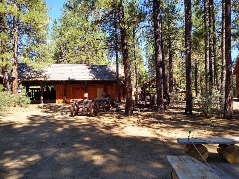
The Ghost Towns Along The Route
Some of the most memorable moments on this trail have nothing to do with physical effort. They come from stumbling onto the remnants of communities that once buzzed with logging activity and rail commerce.
Towns like Bly and Dairy still exist in some form.
Others are little more than a few foundations and a faded sign. Sprague River has a quiet, lived-in quality that feels frozen in time.
You can sense the history without anyone needing to explain it to you.
Walking or riding through these places invites real curiosity. Who lived here?
What did this town look like at its peak? The trail does not answer every question, but it puts you in the right mood to ask them.
Stopping to explore adds time to any trip, but it is absolutely worth it. Old structures, weathered fences, and rusted equipment are scattered along the route.
None of it feels staged or curated. It is just what is left, and somehow that honesty makes it more interesting than any museum exhibit could.
Wildlife And Nature Along The Trail
The wildlife situation on this trail is genuinely impressive. Southern Oregon’s high desert and forest edges create a mix of habitats that support a wide variety of animals.
You do not have to look hard to find something worth watching.
Sandhill cranes pass through the Klamath Basin during migration. Deer are common near the wooded sections.
Hawks and eagles patrol the open stretches, and the occasional coyote trots across the trail without much concern for whoever is watching.
Bring binoculars if you have them. The open terrain means you can spot animals from a distance before they disappear.
Early mornings are especially good for wildlife sightings when the trail is quiet and animals are most active.
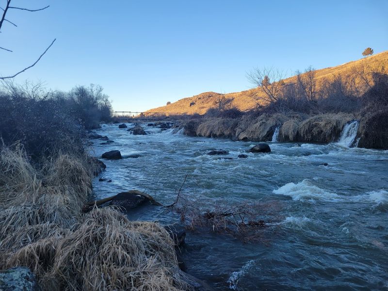
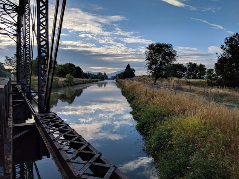
The Sprague River runs alongside parts of the trail, adding a riparian layer to the ecosystem. Waterfowl gather near the water, and the vegetation shifts noticeably as you move between dry uplands and the river corridor.
That ecological variety keeps the trail feeling fresh even on longer trips.
The Fremont National Forest Extension
The trail does not stay in the basin forever. It climbs into the Fremont National Forest, and the shift in landscape is dramatic.
Ponderosa pines replace sagebrush, and the air takes on that clean, resinous forest smell that feels like a reward for the miles behind you.
The forest section adds real variety to an already diverse trail. Shade is a welcome change after the exposed basin stretches.
The terrain gets a bit more rolling, which gives your legs something different to work with.
Old-growth pines tower over the path in places. The forest floor is carpeted with dry needles and occasional wildflowers depending on the season.
It is quieter in there, in a way that feels different from the open desert quiet.
The extension into the national forest adds roughly 40 miles to the full trail experience. Most casual visitors do not make it this far, which means the forest section tends to be less crowded.
That solitude is a real draw for those who seek it out deliberately.
Best Seasons To Visit The Trail
Timing your visit to this trail makes a real difference. Spring brings wildflowers and mild temperatures that are ideal for both running and biking.
The basin turns green briefly, and the whole corridor feels alive in a way that summer heat can flatten.
Summer is popular but warm. The high desert sun is intense, so early morning starts are smart.
Carrying more water than you think you need is not optional in July and August. Heat exhaustion is a real risk on exposed sections.
Fall is arguably the best time to visit. Temperatures drop to comfortable levels.
The light turns golden in the afternoons. Crowds thin out considerably after Labor Day, and the trail feels more personal in that quieter season.
Winter access depends on snowfall and can be limited in the forest sections. The lower basin portions near Klamath Falls are often accessible year-round.
Checking current trail conditions with Oregon State Parks before heading out in winter is always a good idea. Conditions can shift quickly in this region.
Camping And Overnight Options
Multi-day adventures on this trail are very doable with a bit of planning. Several primitive camping areas exist along the route, particularly in the national forest section.
They are basic but functional, with enough space to pitch a tent and rest properly.
The town of Bly has limited services but sits at a useful point along the trail. Sprague River offers a few more options for resupply and basic overnight needs.
Neither place is a resort, but that is part of the appeal.
Backpacker-style camping suits this trail well. Traveling light and carrying your own food and water between supply points is the standard approach for through-hikers and cyclists.
Planning your water sources in advance is critical, especially in summer.
There is something genuinely satisfying about waking up on the trail after a full day of covering miles. The stars in this part of Oregon are extraordinary.
Light pollution is minimal, and on a clear night, the sky puts on a show that no campsite with hookups can replicate. That alone is worth the effort of planning an overnight trip.
Tips For Planning Your OC&E Adventure
A little preparation goes a long way on a trail this long. The full 110-mile distance is not something most people tackle in one shot.
Breaking it into sections and picking the stretch that matches your fitness level is the smarter approach for most visitors.
Water is the number one concern. Carry more than you expect to need.
Refill opportunities are limited between towns, and the high desert climate will drain you faster than you anticipate. A reliable filter is useful in the forest section near streams.
Oregon State Parks manages the trail and maintains a useful website with current conditions and maps. Downloading an offline map before heading out is a solid backup plan.
Cell service is unreliable along much of the route.
Letting someone know your itinerary before you leave is basic but important. The trail is remote in places.
Wearing sun protection and bringing layers for cooler mornings rounds out the essentials. The OC&E rewards those who respect the terrain and come prepared.
It is a trail that gives back exactly what you put into it.
Dear Reader: This page may contain affiliate links which may earn a commission if you click through and make a purchase. Our independent journalism is not influenced by any advertiser or commercial initiative unless it is clearly marked as sponsored content. As travel products change, please be sure to reconfirm all details and stay up to date with current events to ensure a safe and successful trip.