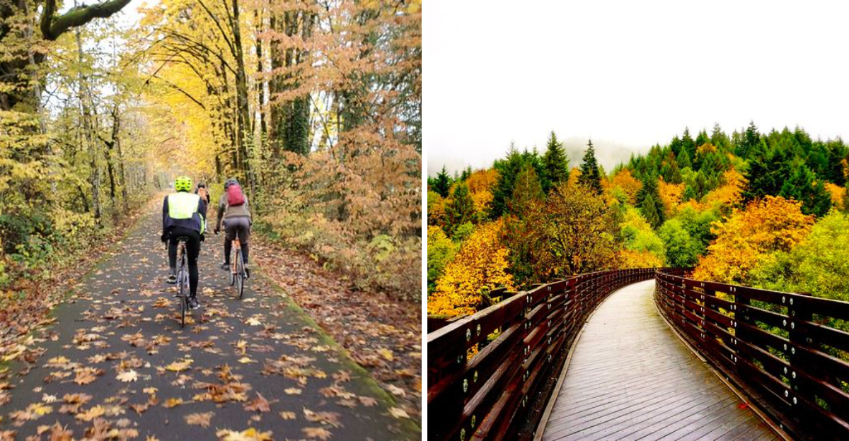
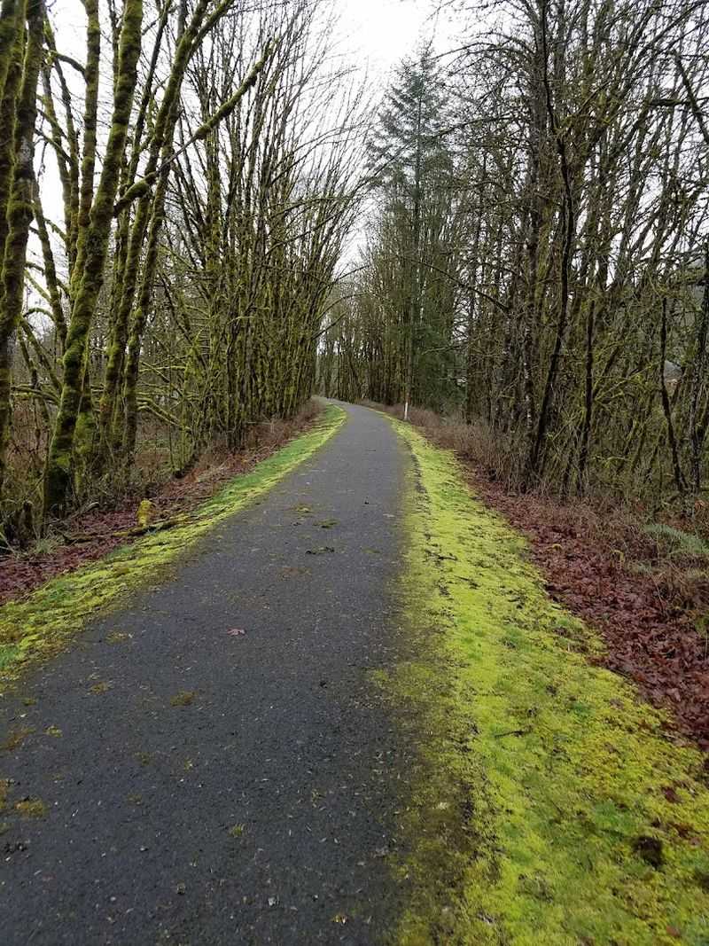
A 21-mile Oregon trail built on an old railroad instantly feels different from the moment I start moving. The path is long, steady, and surprisingly smooth, like it was designed for wandering without hurry.
I bike a stretch, then switch to walking just to take in more of the scenery. Old railroad roots still shape the route, giving it a quiet sense of history under every mile.
Locals treat it like an everyday escape, while I keep discovering small details that make the journey feel layered and alive.
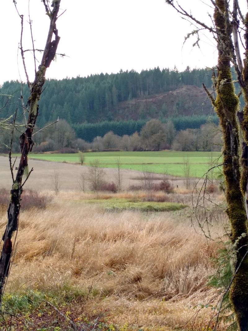
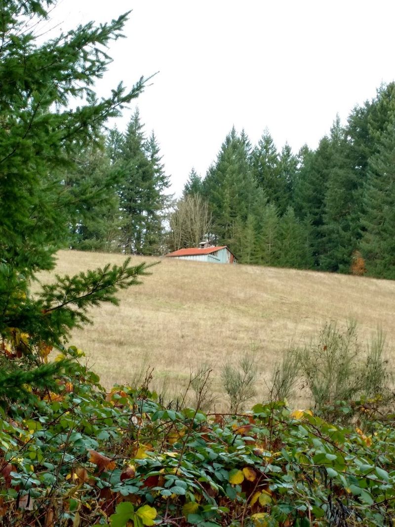
Forests open up, fields stretch wide, and every section brings a new pace. Some parts feel energetic, others almost meditative, like the trail is changing moods with you.
And somewhere along the way, it stops feeling like a route you’re completing. It starts feeling like a place you’re spending time inside.
The History Behind the Old Railroad Corridor
Long before hikers and cyclists claimed this route, trains rumbled through here. The corridor was originally built for the Spokane, Portland and Seattle Railway, hauling timber and goods through the Coast Range.
Operations on this line ran from the early 1920s until the railroad was eventually abandoned. Oregon Parks and Recreation Department then transformed it into a recreational trail, preserving much of the original infrastructure.
Old rail ties still peek through in some sections. The trestles, some towering over 80 feet high, are original structures that have been reinforced for public use.
Walking across one feels like stepping into a living history lesson.
The trail officially opened in 1990 and has grown steadily in popularity ever since. Knowing the story behind the path adds a layer of meaning to every step.
You are not just moving through nature. You are moving through time.
Starting Point at the Banks Trailhead
Most people begin their journey at the Banks Trailhead, located near the town of Banks in Washington County. It is easy to find, has a decent parking area, and offers restroom facilities.
I started here on a crisp Saturday morning. The energy at the trailhead is relaxed but excited.
Families unload bikes. Solo hikers lace up boots.
A few trail runners stretch near the signboard.
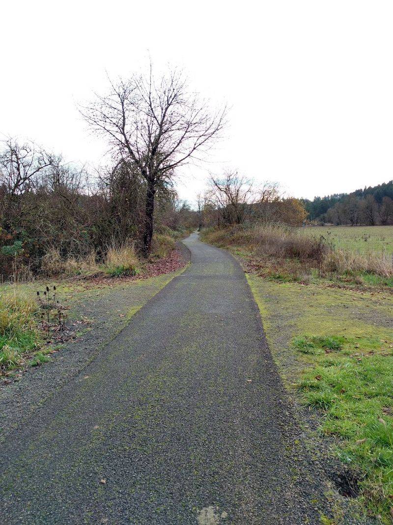
The elevation at this end is lower, which means the first few miles heading north feel manageable. The trail gradually climbs as you move toward Vernonia, gaining about 700 feet in elevation overall.
It is worth spending a moment at the trailhead map before heading out. The signage is clear and helpful.
You can plan your turnaround point, check distances to key features like trestles, and get a feel for the terrain ahead. Starting prepared makes the whole experience smoother and more enjoyable from the first pedal stroke.
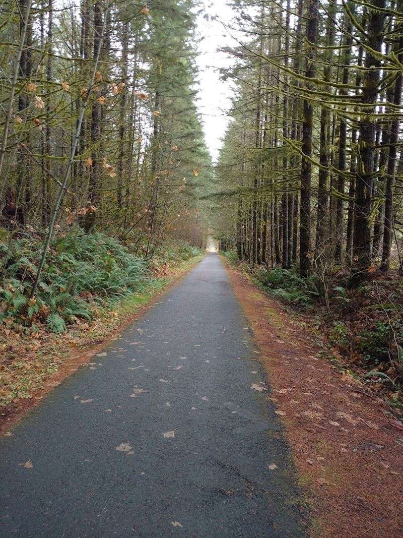
Biking the Full 21-Mile Stretch
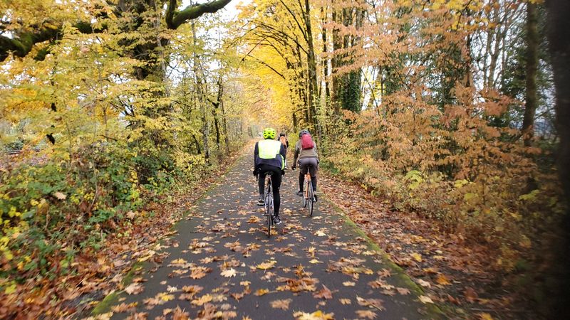
Biking the full trail is the most popular way to experience it. The paved surface runs most of the length, making it accessible for road bikes, hybrids, and casual riders alike.
I completed the full out-and-back ride one summer afternoon. My legs felt it by mile 30, but the scenery kept me going.
The forest stretches are genuinely beautiful, and the open farmland sections offer a welcome change of pace.
The trail has a gentle but consistent grade in places, so expect some real effort on the climb toward Vernonia. Coming back downhill, though, is a reward worth earning.
Speed picks up, the wind rushes past, and the trees blur into green streaks.
Beginners can ride shorter sections between access points. The trail is well-maintained and free of technical obstacles.
Bring water, snacks, and a basic repair kit. Cell service can be spotty in the forested sections, so plan ahead.
The ride is long but deeply satisfying.
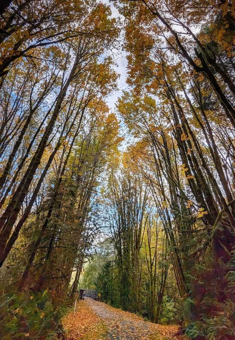
Hiking Through Dense Oregon Forest
Not everyone comes here on wheels. Hikers love this trail for its peaceful forest corridors and steady rhythm.
The sound of your footsteps on packed gravel, birdsong overhead, and the occasional creek rushing nearby creates a genuinely calming atmosphere.
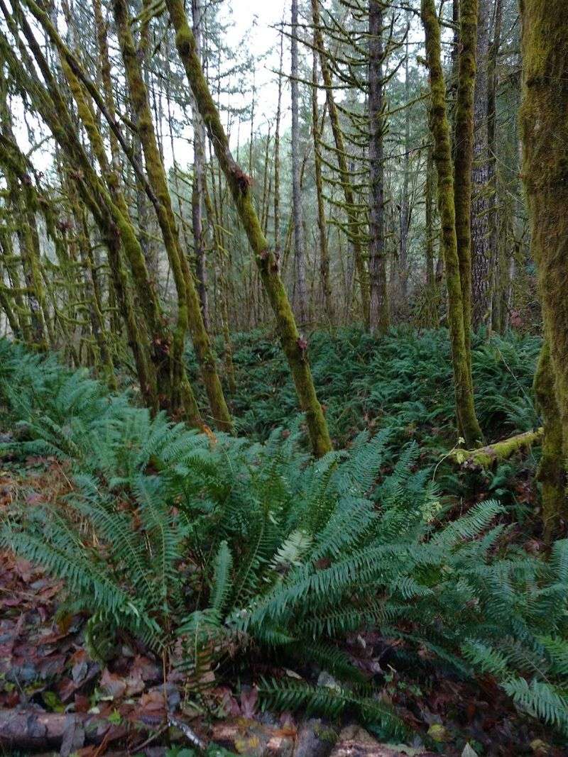
The forested sections between Banks and the Buxton Trestle are especially rich. Ferns carpet the ground beneath towering Douglas firs and western red cedars.
The canopy is thick enough to keep you shaded even on warm days.
Shorter hikes are easy to plan using the multiple trailheads along the route. The Buxton Trailhead, for example, puts you right in the heart of the most scenic forest stretch.
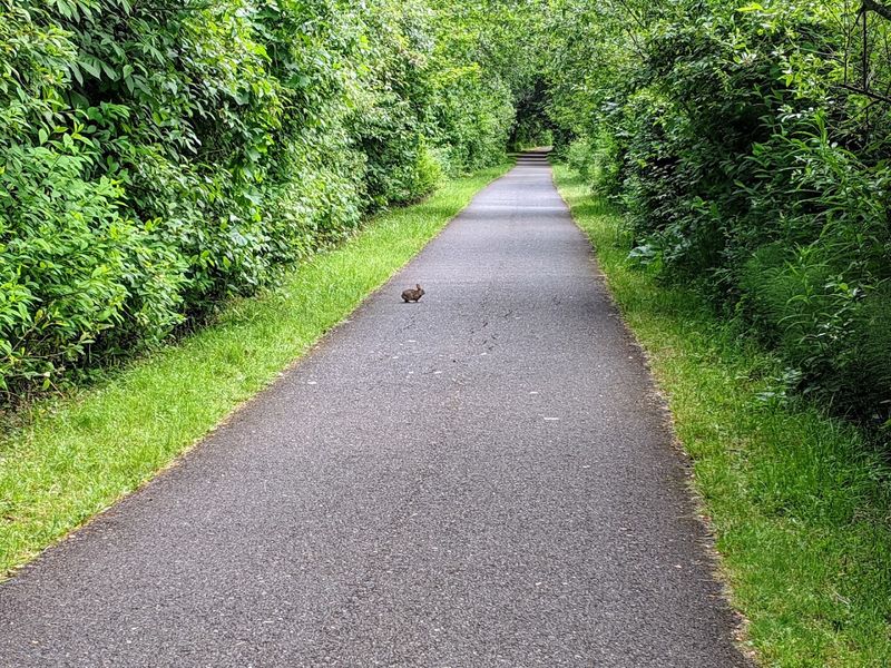
Wildlife sightings are common. Deer, elk, and various bird species have all been spotted along the trail.
Bring binoculars if you are into birdwatching. The trail is wide enough that hikers and cyclists share it comfortably, though staying aware of your surroundings keeps things smooth for everyone on the path.
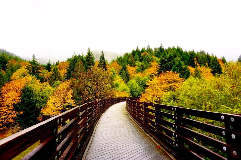
The Impressive Trestles Along the Route
The trestles on this trail are genuinely jaw-dropping. There are several along the route, but the Buxton Trestle near the Buxton Trailhead is the one that stops most people in their tracks.
Standing on it and looking down into the forested ravine below gives you a real sense of scale. The original railroad engineers built these structures to carry heavy freight.
Now they carry curious visitors, and the views from the top are hard to beat.
Crossing a trestle on a bike feels a little thrilling the first time. The railings are solid, the surface is safe, and the experience is unlike anything on a typical trail.
I stopped mid-crossing just to take it all in.
Each trestle has its own character and height. Some are shorter and tucked into hillsides.
Others span wide, open valleys with sweeping views of the surrounding landscape. They are a big reason why this trail has earned such a strong reputation among Oregon outdoor enthusiasts and visitors from across the Pacific Northwest.
Arriving at the Vernonia End of the Trail
Reaching Vernonia after a full trail journey feels like a genuine accomplishment. The town sits in a wide valley surrounded by forested hills, and the trailhead here connects directly to the town center.
Vernonia is small and unhurried. It has a relaxed, welcoming energy that pairs well with the tired, satisfied feeling of finishing a long trail.
Local shops, a park, and a small lake are all within easy reach of the trailhead.
Anderson Park sits right at the Vernonia end of the trail. It has picnic tables, restrooms, and open grass where you can stretch out and recover before heading back or loading up for the drive home.
The town has a proud connection to its logging and railroad heritage. You can see nods to that history in local murals and signage.
Spending even a short time here adds context to the journey. The trail does not just take you through Oregon scenery.
It carries you into a community with real roots and a genuine story worth knowing.
Wildlife and Nature Along the Way
Nature on this trail is not a backdrop. It is the main event.
The corridor passes through habitat that supports a wide variety of Pacific Northwest wildlife, and patient observers are regularly rewarded.
Elk are spotted frequently in the open meadow sections, especially during early morning hours. Deer are almost a given.
I once rounded a bend and came face to face with a doe standing completely still in the middle of the trail. We both froze for a moment before she stepped quietly into the ferns.
Birdlife is abundant throughout the seasons. Pileated woodpeckers drum loudly in the older growth sections.
Raptors circle above the open farmland stretches. The variety is impressive even for casual observers.
Wildflowers bloom along the trail edges in spring and early summer. Trilliums, bleeding hearts, and native ferns add color to the forest floor.
Bringing a small field guide makes the experience richer. The natural diversity here is one of the trail’s most underrated qualities, easy to overlook but impossible to forget once you slow down and notice.
Best Seasons to Visit the Trail
Every season brings something different to this trail, and honestly, each one has a strong case for being the best. Spring brings wildflowers, rushing creeks, and that electric green that only happens in the Pacific Northwest after winter rains.
Summer is peak season. Long days mean more time on the trail, and the forest canopy keeps temperatures manageable even when the sun is strong.
It gets busy on weekends, so early starts are a smart move.
Fall might be the most visually rewarding time to visit. The deciduous trees along the corridor turn gold and amber.
The air is crisp and the crowds thin out. Riding or hiking through autumn color here is genuinely memorable.
Winter visits are quieter and moodier. Rain is likely, and some sections can get muddy near the edges.
However, the forest looks dramatic in low light, and the solitude is real. Dressing in layers and bringing waterproof gear makes a winter visit surprisingly enjoyable.
The trail rarely closes, so it is accessible year-round for those willing to embrace the weather.
Horseback Riding and Other Trail Uses
Biking and hiking get most of the attention, but the Banks-Vernonia Trail is also open to horseback riders. A parallel gravel path runs alongside the paved surface in several sections, specifically designed for equestrian use.
This is a thoughtful feature. Horses and cyclists sharing a single narrow path can be stressful for animals and riders alike.
The separate equestrian lane keeps everyone comfortable and the experience pleasant for all trail users.
Riding a horse through the forested sections of this trail must be something special. The quiet, the shade, and the soft sound of hooves on gravel create a completely different experience than biking or hiking the same ground.
Trail runners also use the route regularly, especially on weekday mornings when traffic is lighter. The wide, consistent surface is ideal for long training runs.
No matter how you choose to move through this landscape, the trail accommodates you with a respect for different paces and purposes. That flexibility is part of what makes it such a well-loved community and recreational resource in northwest Oregon.
Tips for Planning Your Visit
A little planning goes a long way on a 21-mile trail. The most important thing is knowing where you want to start and how far you realistically want to go.
Multiple access points make it easy to customize your experience.
Parking is available at several trailheads including Banks, Buxton, Beaver Creek, and Vernonia. A Oregon State Parks parking permit is required at designated lots.
Day passes are available at the trailheads themselves, so there is no need to purchase one in advance.
Carry more water than you think you need. The forested sections can feel deceptively cool even when your body is working hard.
Snacks and a basic first aid kit round out a smart day pack.
Cell service is unreliable through much of the forested corridor. Downloading an offline map before you leave is a practical step.
Let someone know your plan if you are going solo. The trail is safe and well-marked, but being prepared keeps the experience stress-free.
Dear Reader: This page may contain affiliate links which may earn a commission if you click through and make a purchase. Our independent journalism is not influenced by any advertiser or commercial initiative unless it is clearly marked as sponsored content. As travel products change, please be sure to reconfirm all details and stay up to date with current events to ensure a safe and successful trip.