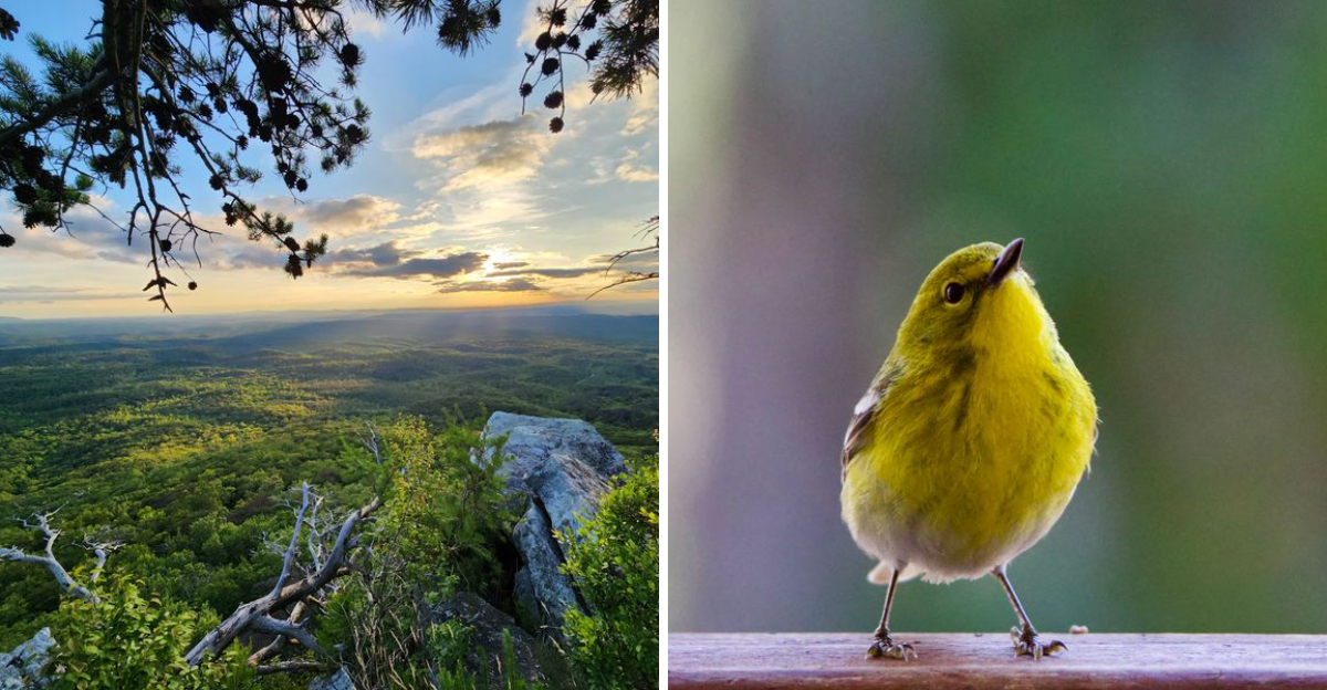
I knew Alabama had mountains, but I did not expect to be standing above the treetops with the forest stretched out in every direction. The funniest part is how easy the walk is.
There is no brutal climb, no scrambling over rocks, and no moment where tired legs start questioning the entire plan. Instead, a smooth wooden boardwalk carries you through the trees until the forest suddenly opens onto a huge granite overlook.
The air feels noticeably cooler up there too, which is especially welcome when the summer heat is doing its worst. Along the way, signs explain the geology, wildlife, and history of the mountain, so there is plenty to notice before the view steals the show.
Then the trees disappear, the horizon opens wide, and the whole place starts to feel less like a mountain and more like an island floating above the forest.
The Boardwalk That Welcomes Absolutely Everyone
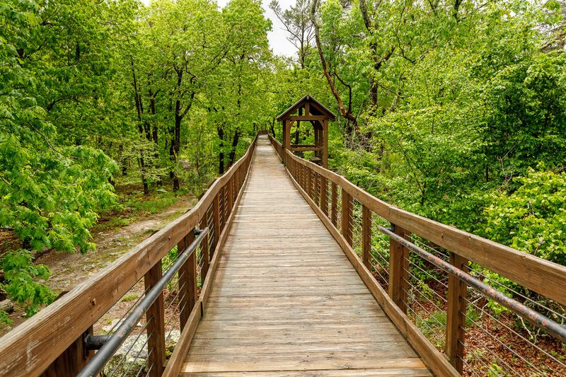
Few trails in Alabama manage to be both dramatic and easy, yet the Doug Ghee Accessible Trail pulls it off. Smooth planks run roughly 0.3 miles from the parking area to the Bald Rock Overlook, with wooden railings on both sides and no stairs anywhere along the route.
Wheels roll along without a fight. Strollers, wheelchairs, and walkers all handle the surface comfortably, which explains why so many multi-generational groups pick this path over the steeper options nearby.
Benches appear at intervals, tucked into little alcoves where the forest presses close. Sitting for a moment tends to be worth it, since the sounds change depending on where visitors stop, from wind in the pine needles to the tapping of a woodpecker somewhere overhead.
The elevated design also protects the fragile ground below, keeping roots and mountain soil undisturbed while foot traffic passes above. That thoughtful touch is easy to miss until the boardwalk lifts noticeably higher over a dip in the terrain.
Practical tip: sturdy shoes are not strictly required here, though comfortable ones help. Restrooms sit near the trailhead, and the walk out and back rarely takes more than half an hour at an unhurried pace.
Cell service on the mountain can be spotty, so downloading a park map before arriving saves guesswork later.
Where the Trees Part and Alabama Stretches Out Forever
The payoff arrives suddenly. One moment the boardwalk is threaded through close-growing trees, and the next the canopy drops away to reveal ridge after ridge of the Talladega National Forest rolling toward the horizon.
Bald Rock itself is a broad shelf of quartzite, an extremely hard metamorphic rock that resisted erosion while softer stone around it wore down. That stubborn geology is the reason Cheaha Mountain stands as the highest natural point in the state, at roughly 2,407 feet.
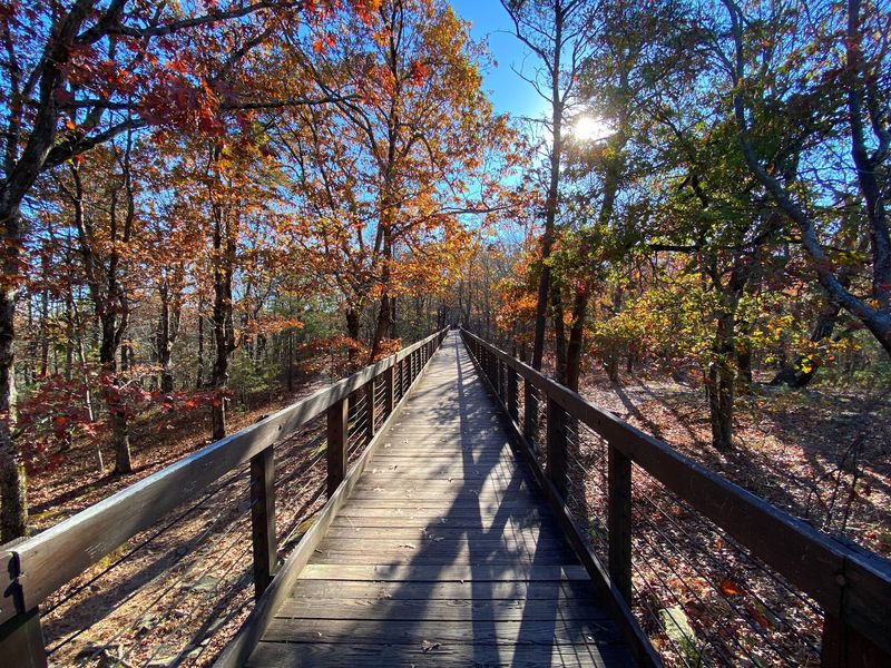
Views shift with the season. Spring brings a thousand shades of new green, autumn turns the slopes into patchwork orange and rust, and winter strips the trees back so the shape of the land shows plainly.
Late afternoon light is especially kind here. Sunset from the overlook spreads gold and purple across the treetops, and the temperature drop that follows is noticeable enough that a light jacket earns its place in the bag.
Photographers should know the railing offers a steady spot to brace a camera. Wide-angle shots capture the sweep, though a zoom picks out details like distant fire towers and the darker bands of longleaf pine among the hardwoods.
Standing room at the platform is generous, so nobody has to jostle for a look.
A Mountain Named High Place, and It Earns the Title
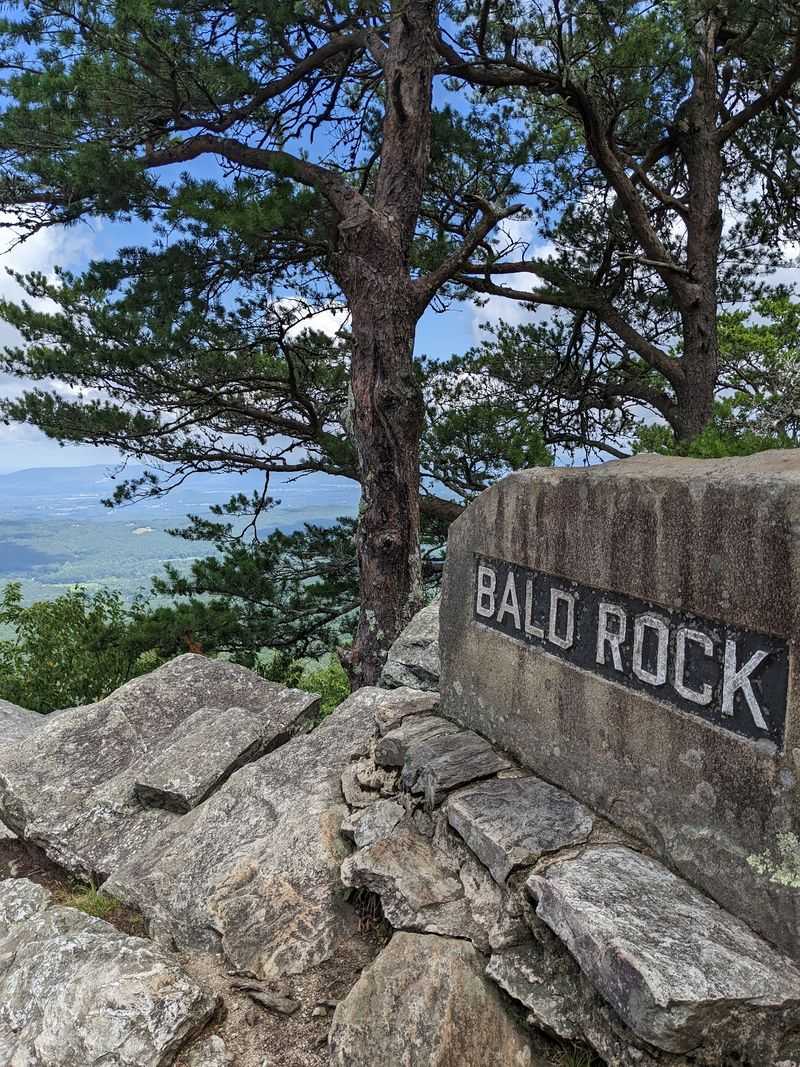
Long before boardwalks and parking lots, the Muscogee people of the Creek nation had a word for this ridge. Cheaha comes from their language and translates to high place, which is about as accurate a name as any mountain has ever received.
Interpretive signs along the boardwalk unpack that story piece by piece. Panels cover the mountain’s formation, the plants that thrive at this elevation, and the human history layered across the ridge over centuries.
Cheaha State Park opened in 1933 and holds the title of Alabama’s oldest continuously operating state park. Much of what visitors touch and walk on traces back to the Civilian Conservation Corps, the Depression-era program that built roads, cabins, pavilions, and trails across the mountain.
Those CCC crews worked with local stone, and the results have weathered nearly a century without losing their character. Rustic stonework shows up in unexpected places, blending into the landscape rather than competing with it.
Reading the signs slows the walk down in the best way. Families with curious kids often find the markers turn a short stroll into a scavenger hunt of facts about quartzite, longleaf pines, and mountain weather.
History buffs should budget extra time. There is more here than the view suggests.
Birdsong, Wildflowers, and Other Small Discoveries
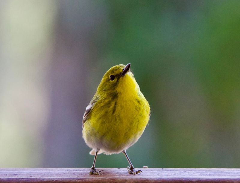
Binoculars come in handy on this boardwalk. Birders treat the elevated path as a front-row seat to the forest canopy, since the walkway puts eyes closer to branches where songbirds actually spend their time.
Warmer months bring flashes of red from Scarlet and Summer Tanagers, plus the steady drumming of Pileated and Hairy Woodpeckers. Pine Warblers and Brown-headed Nuthatches move through the pines in quick, busy bursts.
Cold weather changes the cast entirely. Winter feeding flocks can include Purple Finches, Pine Siskins, Golden-crowned and Ruby-crowned Kinglets, Brown Creepers, and Red-breasted Nuthatches, while Winter Wrens tend to hunt low around fallen logs and root tangles.
Plants deserve attention too. Native azaleas and hydrangeas add seasonal color along the edges, and mountain laurel thickets grow dense in nearby areas, blooming with clusters of pale pink and white.
The mix of longleaf pine and hardwood creates a patchy, layered forest that supports species not commonly found in lower parts of the state. Protected land in the surrounding national forest extends that habitat for hundreds of thousands of acres.
Quiet pays off here. Standing still for two minutes near a bench usually reveals more movement than ten minutes of walking.
Trails Beyond the Planks for Anyone Craving a Challenge
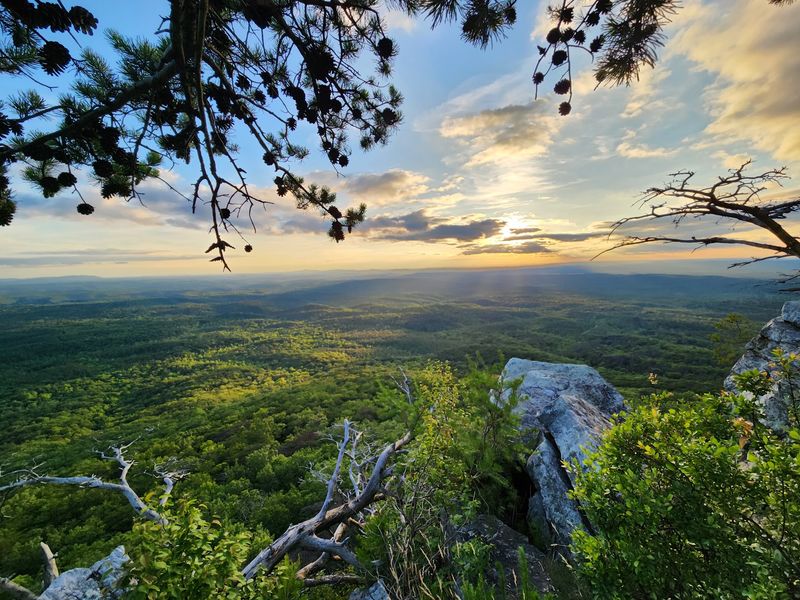
Once the boardwalk is finished, the mountain offers plenty more. Pulpit Rock sits a short drive away and rewards a rocky walk with a jutting stone perch that looks out over the valley, a favorite among photographers and climbers.
The Rock Garden Trail drops downhill through scattered boulders toward Cheaha Lake, while the Mountain Laurel Trail follows a streambank through laurel thickets to another overlook. Both feel worlds apart from the smooth planks up top.
Serious hikers find something bigger here. Cheaha connects to the Pinhoti Trail system, a long-distance route running through the Talladega National Forest that eventually links up with the Appalachian Trail network.
Distances vary widely, so checking a park map before setting out matters. Terrain gets rocky fast, and loose stone on descents catches people wearing casual sneakers off guard.
Water is essential, even on short routes. Elevation and open rock faces make hikes feel warmer than the temperature suggests, and refill spots are limited once away from the main developed areas.
Mountain bikes are welcome on designated trails, and motorized vehicles are not, which keeps the paths peaceful.
Mixing one easy boardwalk with one rugged trail makes for a nicely balanced day.
Bunker Tower and Its Sixty-One Stone Steps
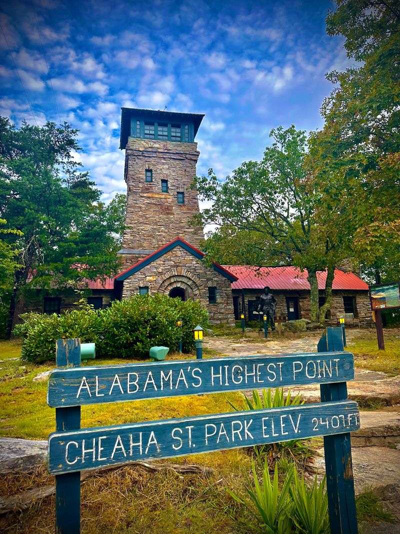
Castle or lighthouse? Bunker Tower sparks that debate constantly, with thick stone walls, narrow openings, and a squat, fortress-like shape that looks transplanted from somewhere far older than 1934.
Civilian Conservation Corps workers built it from local stone at the very summit of Cheaha Mountain, and it has stood there ever since. A winding interior staircase of roughly sixty-one steps leads to an observation room at the top.
Views from up there run a full 360 degrees. Ridges of the Ridge and Valley Appalachians fold away in long parallel lines, and on clear days the layers seem to keep going well past the state line.
Trees have grown tall around the base over the decades, so the outlook differs from the wide-open drama of Bald Rock. Some visitors find that surprising, though standing at the state’s highest point still carries its own satisfaction.
A small museum near the tower covers CCC history and mountain life, which pairs nicely with the climb. Kids tend to love the stairwell more than the exhibits.
Pairing the tower with the boardwalk gives two very different perspectives on the same peak, one built of stone and one built of wood.
Both are worth the time.
Make a Full Day of Your Mountain Adventure
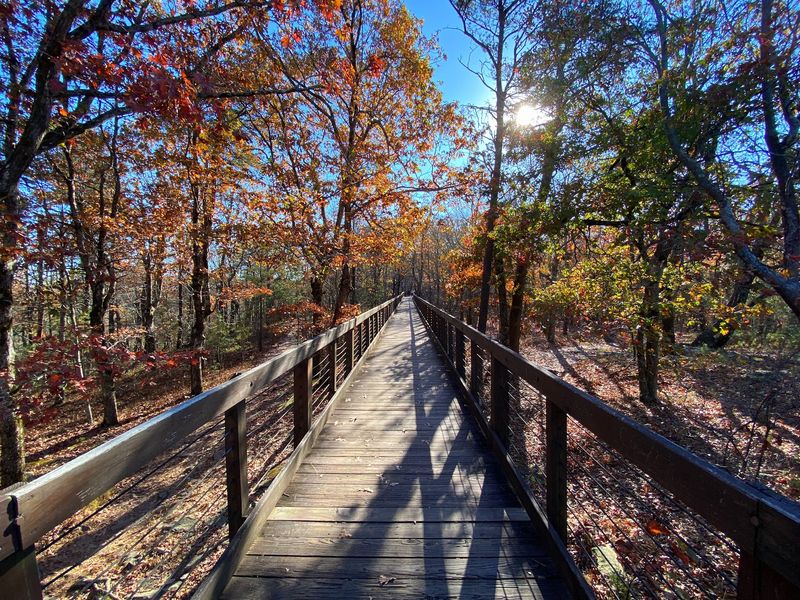
Plenty of visitors arrive planning a quick look and end up staying until closing. The Mountain Store near the park entrance handles reservations and stocks snacks, souvenirs, and camping basics, making it a smart first stop before heading uphill.
Two picnic areas, Cheaha Imagination Tree and Cheaha Lake, come with tables, grills, and playground equipment. Kids burn off energy while everyone else enjoys the mountain air.
Down at Cheaha Lake, swimming, paddling, and fishing fill an afternoon easily. The water sits lower on the mountain, so the drive down offers its own set of views through the trees.
The Interpretive Center occupies a repurposed CCC lake house and includes a nature center, an environmental literacy corner, and rotating exhibits on local geology, plants, and animals. Programs there suit curious kids and adults alike.
Lodging ranges from campgrounds with hookups to rustic cabins and chalets, and booking well ahead is wise, especially during race weekends at the nearby speedway. Dogs are welcome in many areas, including a dedicated dog park.
Bring water, snacks, and a paper map, since phone signal fades in spots. Park hours shift slightly by day, closing at 7 PM most evenings and 9 PM on Fridays and Saturdays.
Address: 19644 AL-281, Delta, Alabama
