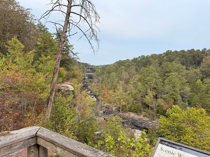
I thought I had missed the sign entirely, until I stepped onto a small wooden platform and looked straight across a canyon. There it was, a thin silver ribbon dropping 133 feet down a crack in sandstone.
This waterfall stands as the tallest above-ground drop in Alabama, and it only appears when rain has been generous enough to feed it. That rarity somehow makes it feel earned rather than guaranteed.
What caught me off guard was the silence along the rim, just wind moving through pines and a hawk gliding past somewhere below eye level. I stayed far longer than planned, mostly because the canyon kept shifting color as clouds drifted overhead.
This stretch of the state rewards patience in a way few overlooks manage. If scenic drives with unexpected payoffs are your thing, this one belongs on the list.
The Tallest Waterfall In Alabama Sits Right Across The Gorge
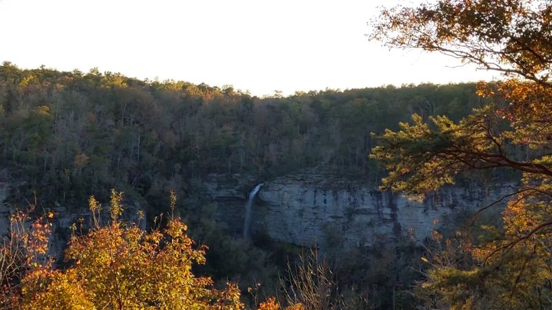
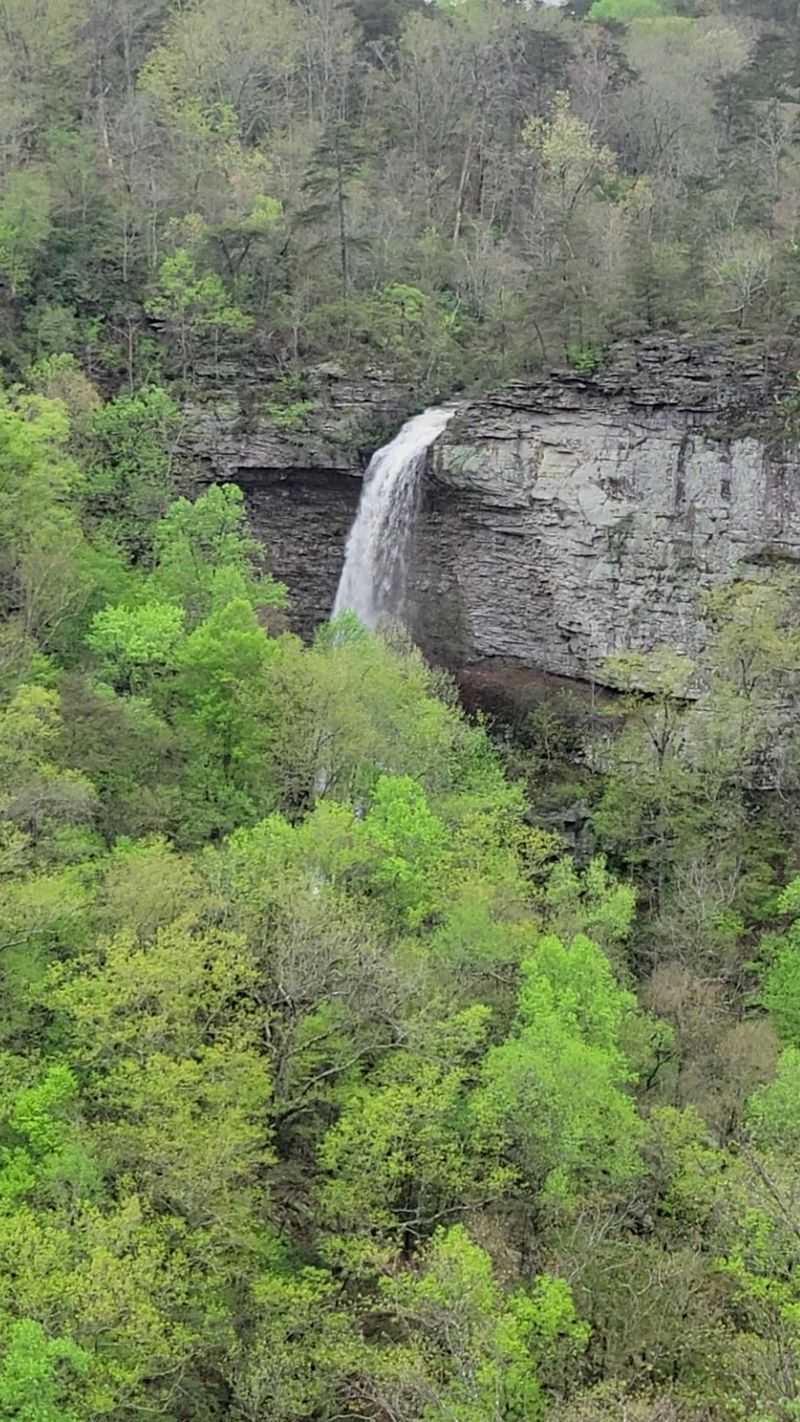
Grace’s High Falls drops 133 feet, which makes it the tallest above-ground waterfall in the entire state of Alabama. That is a fun fact to hold in your head while you look at it.
Here is the twist nobody warns you about. The falls sit across the canyon from the overlook, tucked into a side gorge, so the scale sneaks up on you slowly instead of hitting you all at once.
I found myself squinting at first, then zooming in with my phone, and suddenly the height made sense. The water threads down a narrow cut in the sandstone where centuries of runoff have carved a groove into the cliff face.
Even when the falls are dry, that groove stays visible, a pale scar in the rock that tells you exactly where the water belongs. Some visitors find that oddly satisfying.
Worth knowing before you go, the falls are not fed by the Little River itself. A smaller creek supplies them, which is why rainfall matters so much for the flow.
Bring binoculars if you have a pair, or a camera with real zoom. Both turn a distant white line into something far more dramatic.
And take your time. The longer you look, the more you notice the mist drifting, the ledges catching water, and the way the sound carries faintly across open air.
A Rim Drive That Hands You One View After Another
Driving the Little River Canyon Rim Parkway feels less like getting somewhere and more like collecting moments. Also known as Canyon Rim Drive or Alabama Highway 176, it runs along the western edge of the canyon with pull-offs spaced generously along the way.
You get roughly eleven miles of paved rim road, and a longer twenty-three mile loop if you continue on the connecting county routes. Eight or nine named overlooks sit along the route.
Little River Falls Overlook, Lynn Overlook, Mushroom Rock, Hawks Glide, Canyon View, Wolf Creek, Crow Point, Grace’s High Falls, and Eberhart Point each frame the gorge from a slightly different angle. No two look the same.
My advice, do not rush it. I made the mistake of trying to hit everything in under an hour and ended up backtracking twice because the light had shifted.
Grace’s High Falls Overlook sits near the far end of the drive, so it works nicely as a finale. Some travelers drive it in reverse and start there instead.
One practical note. If you are towing a trailer or driving a large RV, the county road sections have sharp turns, blind hills, and almost no shoulder, so the shorter paved stretch is the safer choice.
Slow speeds, windows down, that is the way to do it.
Alabama’s Grand Canyon Is Deeper Than You Expect
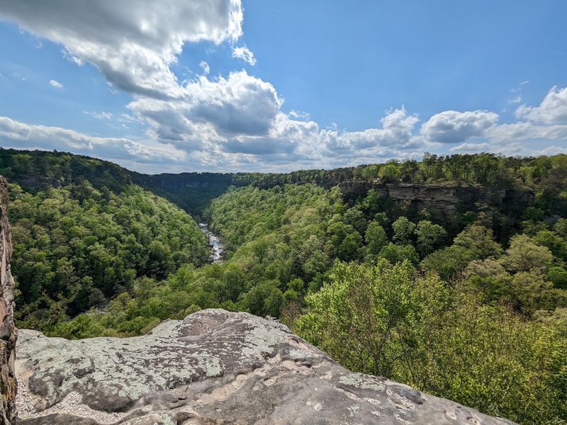
People call Little River Canyon Alabama’s Grand Canyon, and while the comparison is a stretch in scale, the drama holds up. Sandstone walls rise as high as 600 feet in places.
Looking down from the rim, the river below looks almost toy-sized. That distance does something strange to your sense of proportion, and it took me a minute to adjust.
What makes the geology genuinely unusual is the river itself. The Little River flows almost entirely along the top of a mountain, which is rare, and over time it carved one of the deepest and longest canyon systems in the southeastern United States.
It is also considered one of the cleanest and wildest waterways in the South. Clear water, exposed bedrock, very little development anywhere in sight.
The preserve covers 15,288 acres on Lookout Mountain and became a National Preserve in 1992, set aside to protect its natural, scenic, recreational, and cultural resources. That protection is why the views still feel untouched.
From the Grace’s High Falls platform you get both stories at once, the waterfall in the distance and the enormous canyon it spills into.
Stand there long enough and you start picking out layers in the rock. Different colors, different eras, all stacked up like pages.
It is a humbling little pause on an otherwise easy drive.
Timing Your Trip For Water, Color, Or Quiet
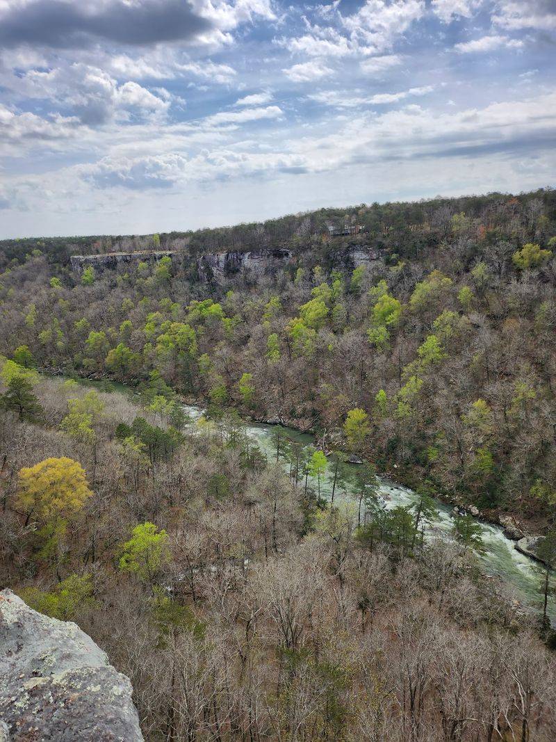
Rain is the whole story with Grace’s High Falls. The flow depends entirely on rainfall, so a dry summer week can leave you staring at bare rock instead of falling water.
Winter and early spring are your best bets for real volume. Higher river levels and heavy rains turn the thin ribbon into something with actual force behind it.
There is a bonus to visiting in the colder months too. With the leaves down, sightlines across the canyon open up and the falls become much easier to spot from the overlook.
Spring brings wildflowers scattered along the rim, while fall delivers the color show, usually peaking in late October and early November. Cooler air makes the hiking far more pleasant then.
If crowds bother you, November tends to be the quietest month for tourism in the preserve. I have also had good luck arriving early in the morning, when mist still hangs in the gorge and the parking areas sit empty.
A practical habit I picked up, check recent rainfall before committing to the drive. A couple of good storms in the days beforehand change everything.
And if the falls are dry when you arrive, the rest of the rim still delivers. The canyon does not take days off.
An Overlook That Asks Almost Nothing Of You
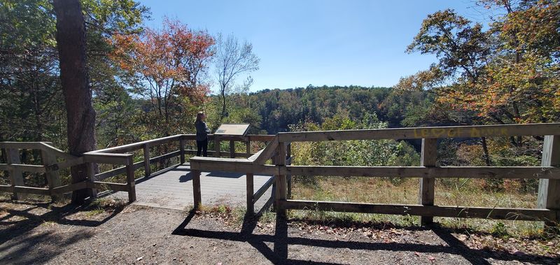
Not every great view requires sweat, and Grace’s High Falls Overlook proves it. There is a wooden platform right beside the road, and reaching it takes about as long as buckling a seatbelt.
No hiking, no elevation gain, no trail markers to follow. Just park, step over, and look.
That said, the pull-off is modest. Parking is essentially a widened shoulder, and it is genuinely easy to drive past if you are not watching for the sign, which I did on my first attempt.
Go slow through that stretch. The road curves plenty, so give yourself room to spot the platform and pull over safely without surprising anyone behind you.
Because the stop is quick, it pairs beautifully with the longer overlooks nearby. You can linger at Wolf Creek or Canyon View, then swing by here for the tallest waterfall in the state.
One important caution. There are steep, slippery routes down from this area that some people attempt, and they are not maintained or marked for casual visitors.
Stay on the platform. The view is the point, and the drop-offs beyond the railing deserve real respect.
The whole thing is free to visit, open around the clock, which makes it an easy add-on no matter how your day is running.
Trails, Paddling, And Swimming Holes Within Easy Reach
Once you have had your fill of the overlook, the preserve opens up in every direction. Little River Falls drops 45 feet and sits near the northern end of the park, reachable by an accessible boardwalk that leads to close-up views.
In summer and fall, when the water runs lower, people wade in the pools above the falls or swim in the hole below. It is a lively, splashy kind of spot.
Little Falls, once called Martha’s Falls, is the quieter favorite. Getting there means a three-quarter-mile walk and 137 stone steps, which sounds worse than it is.
For hikers wanting more, Bridge Trail and Beaver Pond Trail stay easy and family-friendly, while Eberhart, Powell, and the rocky Canyon Mouth Trail push deeper and harder into the gorge.
Paddlers take the river seriously here. Rapids range from Class III up to Class VI depending on the section and the season, so this is expert territory when the water rises.
Fishing, rock climbing, and rappelling are all permitted too. Canyon Mouth Park has picnic tables and swimming, and most overlooks along the rim include tables as well.
I packed lunch and ate it at an overlook table. Honestly one of the better meals I have had outdoors.
Wildlife, Rare Plants, And Centuries Of History Along The Rim

Birds were the surprise highlight of my visit. Vultures and hawks glide below rim level here, which means you sometimes watch them from above rather than craning your neck upward.
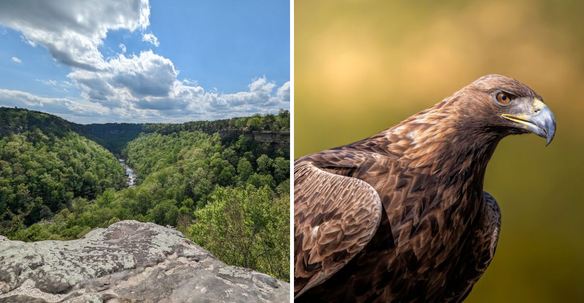
The preserve records 147 bird species, including Yellow-breasted Chats and Prairie Warblers, plus occasional Peregrine Falcons and Golden Eagles. Raptor sightings are common along the cliffs.
Beyond birds, the numbers stack up quickly. Forty fish species, thirty-five mammal species, and twenty-eight species each of reptiles and amphibians share these 15,288 acres.
Plant life gets just as interesting. Thick hardwood and pine forest covers the slopes, with ferns, mosses, grasses, and wildflowers filling in the gaps between rock outcrops.
The preserve also shelters rare and endangered plants like the green pitcher plant, Harperella, and Kral’s water-plantain. Knowing they grow nearby changed how carefully I stepped near the edges.
Human history runs deep too. Cherokee people lived across this landscape for centuries, and the area later saw Civil War activity along with construction of the Tennessee, Alabama, and Georgia Rail Line.
Start at the Little River Canyon Center for maps and current conditions, then work your way along the rim. Ask about recent rainfall while you are there.
Address: 12035 AL-176, Fort Payne, Alabama
