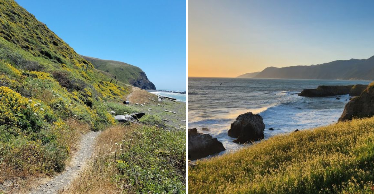
California still holds stretches of coastline that refuse to be shaped by convenience or speed, where mountains drop straight into the ocean and roads simply stop making sense.
Along a remote northern edge, black sand beaches run beneath steep ridgelines, and waves hit the shore with uninterrupted force. No signs of modern life interrupt the silence, no services, no crowds, no signal, only wind, water, and raw terrain in constant motion.
Scale becomes the defining feature here, where distance feels heavier and the land feels uncompromising. It is a setting where a wild stretch of California coastline remains one of the last unbroken edges of the Pacific.
Why No Highway Was Ever Built Here
Most people assume California’s coastline is one long scenic highway, and for most of it, that is true. The Lost Coast is the exception that breaks that assumption completely.
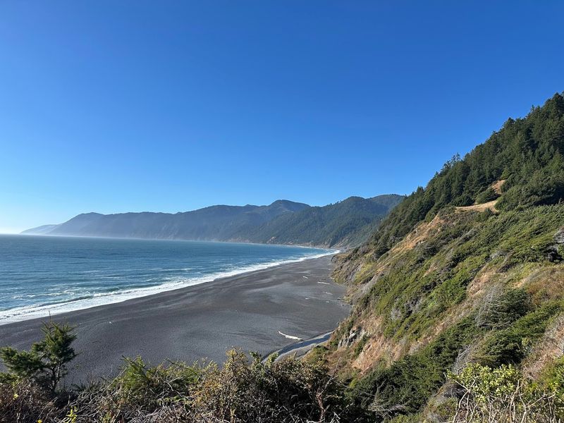
The King Range mountains rise so sharply from the ocean that engineers planning California’s State Route 1, the famous Pacific Coast Highway, eventually rerouted the road inland. By 1984, the project was officially declared unfeasible.
The terrain was simply too steep, too unstable, and too expensive to work with.
King Peak, the highest point in the range, sits at 4,088 feet above sea level. It is only three miles from the shoreline.
That kind of elevation gain in such a short horizontal distance creates geotechnical nightmares for road builders.
The result is a coastline that has remained largely untouched for generations. No highway means no easy access, no roadside turnouts, and no casual drive-through tourists.
You have to want to be here, and you have to work for it. That sense of earned arrival is part of what makes the Lost Coast feel so different from anywhere else in California.
Getting There Is Half the Adventure
Reaching the Lost Coast requires patience, a reliable vehicle, and a healthy respect for small mountain roads. The two main access routes are Mattole Road, which winds down from Ferndale, and Shelter Cove Road, which drops steeply from Redway toward the coast.
Neither road is for the faint of heart. Mattole Road twists through fog-heavy hills and cattle ranches before eventually reaching the hamlet of Petrolia, one of the tiny isolated communities in the region.
Shelter Cove Road is paved but steep enough to make your ears pop on the descent.
During heavy winter rains, sections of these roads can become impassable. A four-wheel drive vehicle is strongly recommended, especially if you plan to venture onto unpaved sections inside the conservation area.
The nearest larger towns are Garberville and Eureka, each roughly one to two hours away depending on your starting point. Cell service disappears well before you arrive.
Download your maps offline, charge your devices, and let someone know your itinerary. The remoteness is genuine, not decorative.
That said, the drive itself is gorgeous, and the views before you even reach the coast are already worth the effort.
The Lost Coast Trail, A Hike Unlike Any Other
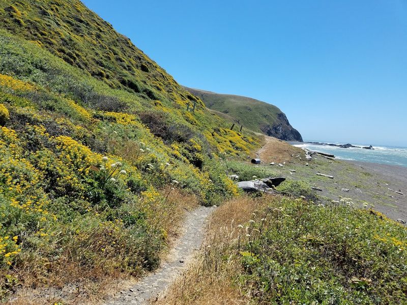
The Lost Coast Trail is the main reason most people make the journey here. Running roughly 25 to 28 miles from the Mattole River trailhead in the north to Black Sands Beach near Shelter Cove in the south, it is a backpacking route that demands real preparation.
The terrain is relentless. Much of the trail runs directly along the beach, through coarse black sand, wet pebbles, and wave-smoothed stones that shift under every step.
Your ankles will feel it. Your calves will definitely feel it.
Certain sections of the trail are only passable at low tide. Timing your hike around the tide chart is not optional; it is a safety requirement.
Hikers have been caught in surges along rocky headland passages, and the currents here are genuinely dangerous. Rip currents and undertows are serious hazards, and swimming is strongly discouraged.
Bear canisters are mandatory for overnight trips. Rattlesnakes are present, particularly in drier months, so watch where you step.
Permits are required for overnight stays. Despite all of that, or maybe because of it, the trail offers something rare: miles of coastline where the only sounds are wind, waves, and your own breathing.
Black Sand Beaches and Tide Pools Worth Exploring
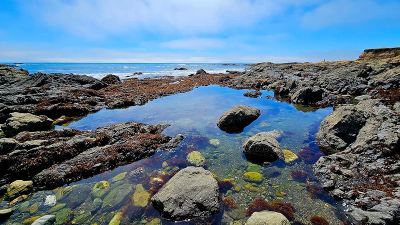
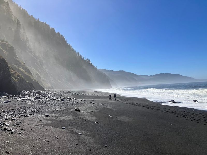
The beaches along the Lost Coast are not your typical soft-sand, warm-water California experience. The sand here is dark, almost charcoal-colored, made up of eroded black shale and other dark minerals washed down from the King Range.
It is coarser and heavier than typical beach sand, and it crunches differently underfoot. First-time visitors often stop and stare, genuinely surprised by how dramatic the contrast looks between the dark shore and the grey-green Pacific.
Beyond the visual drama, the tide pools here are exceptional. Sea anemones, hermit crabs, sea stars, and small fish pack into rocky pools exposed at low tide.
Seals and sea lions are commonly spotted hauled out on rocks or bobbing just offshore.
The surf is powerful and unpredictable. Even wading is risky along many sections of beach due to the force of the waves and the uneven underwater terrain.
This is a place to watch the ocean, not fight it. Bring a good pair of waterproof boots for tide pool exploration, and always keep an eye on the incoming tide.
The reward is a coastline that feels genuinely prehistoric, untouched in a way that most California beaches simply are not anymore.
Wildlife That Calls This Wild Place Home
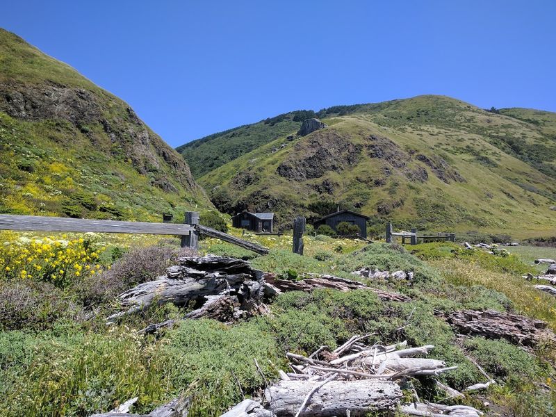
The King Range National Conservation Area supports a remarkable range of wildlife, and spending time here makes that very clear. Roosevelt Elk are one of the most striking residents, and spotting a herd grazing in the coastal grasslands near the Mattole River estuary is the kind of moment that stops you mid-step.
The area is home to nearly 300 species of native and migratory birds. Bald eagles soar over the ridgelines, and northern spotted owls nest in the old-growth Douglas-fir forests higher up on the slopes.
Black-tailed deer move through the chaparral with quiet ease.
Black bears are present throughout the conservation area, which is exactly why bear canisters are required for overnight camping. Keeping a clean camp is not just good practice here; it is essential for both your safety and the health of the bear population.
Offshore, California grey whales pass through during their annual migration, and harbor seals are regulars along the rocky shoreline. The diversity of ecosystems packed into this one area, from ocean surf to Douglas-fir peaks, creates habitat for an extraordinary variety of species.
Coming here without paying attention to the wildlife around you would honestly be a missed opportunity.
The History Behind America’s First National Conservation Area
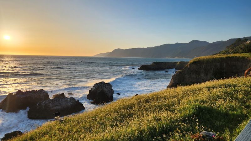
The King Range National Conservation Area was established in 1970, making it the very first National Conservation Area in the United States. That is a title worth pausing on.
Before there was a national model for this kind of land designation, this stretch of California coastline was already being recognized as something worth protecting differently.
Managed by the Bureau of Land Management, the conservation area covers 68,000 acres and spans 35 miles of coastline. The designation helped preserve a landscape that development had already passed over, not by choice, but by geography.
The small communities scattered through the region, Petrolia, Shelter Cove, and Whitethorn, each have their own quiet character shaped by decades of isolation. Petrolia, notably, was the site of California’s first commercial oil well, drilled in 1865.
That history sits quietly beneath the pastoral surface of the town today.
The King Range NCA visitor contact station is located at 768 Shelter Cove Rd in Whitethorn, and the office is open on weekdays. Stopping in before your hike is genuinely useful.
Staff can provide current trail conditions, tide charts, and permit information, all of which can make a real difference in how your trip goes.
Tips for Planning Your Visit to the Lost Coast
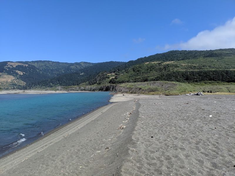
Planning a trip to the Lost Coast takes more thought than most California destinations, and that extra effort pays off in a big way. The best time to visit is from late spring through early fall, when the weather is most stable and the mountain roads are reliably passable.
Summer brings dry, windy conditions that keep the fog thinner than you might expect. Winters are wet and wild, with heavy rainfall that can close roads and flood creek crossings along the trail.
Spring offers wildflowers on the hillsides and fewer hikers on the beach.
Pack layers no matter what season you visit. Coastal temperatures swing dramatically between midday and evening, and the wind off the Pacific cuts through even in July.
Sun protection is still necessary on clear days, especially on the exposed beach sections.
Overnight hikers must carry bear canisters, and permits are required for backcountry camping. Day visitors do not need permits but should still check current conditions with the BLM office before heading out.
Leave no trace principles are taken seriously here, and the landscape genuinely depends on visitors following them. The Lost Coast rewards people who come prepared and leave it exactly as they found it.
Address: 768 Shelter Cove Rd, Whitethorn, CA 95589
