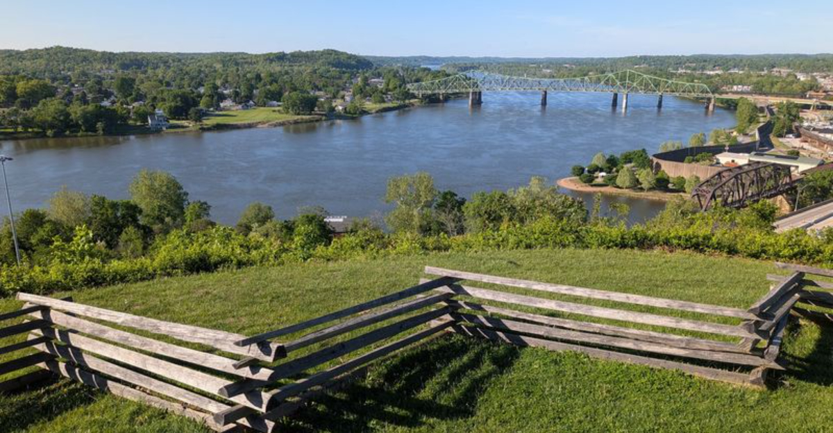
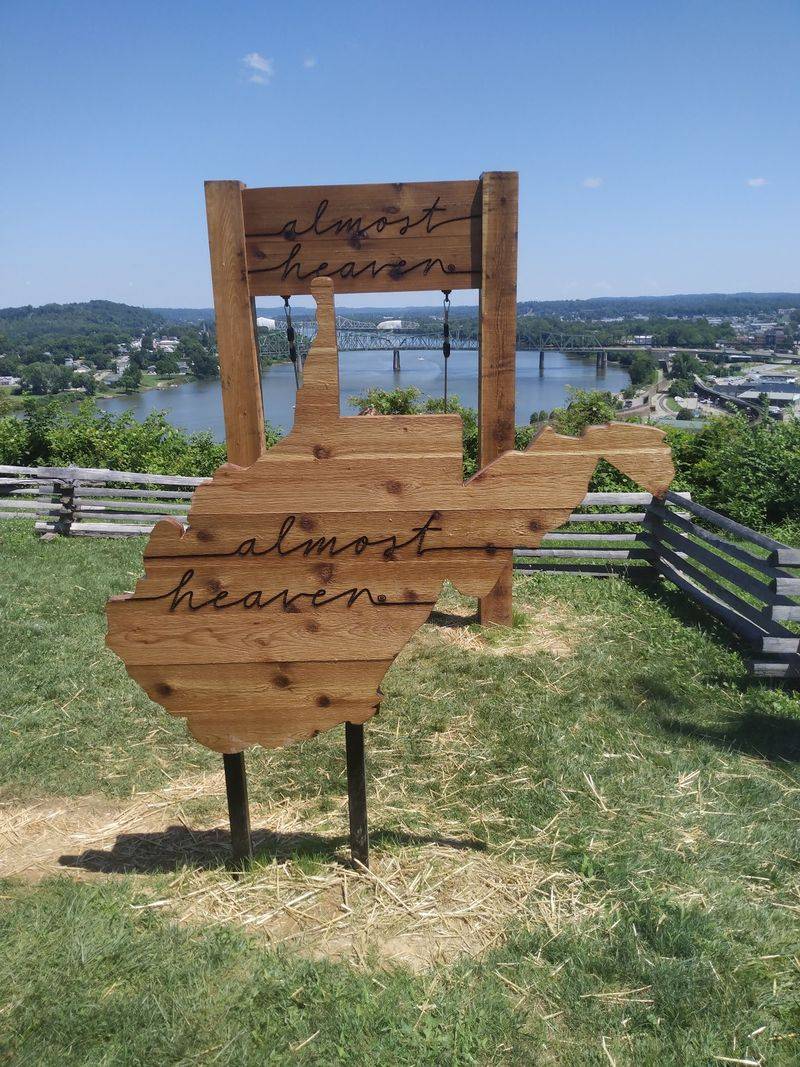
You do not come here for the fort. You come here for what the fort was built to protect: the view of two rivers merging below and two states unfolding beyond them.
A hilltop in West Virginia where soldiers once stood guard, and now you can stand in their exact spot with a picnic blanket and a camera.
No shots were ever fired in battle here, but the payoff is better than any war story.
The high point catches your eye from downtown, and the wooden boardwalk takes you to an overlook that makes you forget your phone exists.
Built long ago, forgotten for decades, resurrected as a park in recent years.
It turns a history lesson into a front row seat for some of the most gorgeous views in the state.
The Drive Up That Builds Anticipation
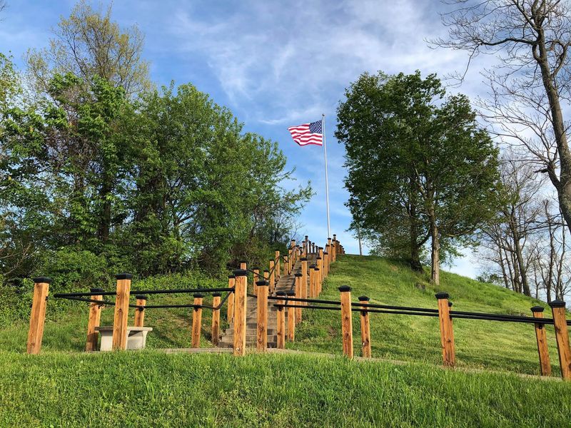
Roads that climb slowly are underrated. The route up to this hilltop bends through leafy hillside, and each turn peels back a little more of the valley below, so the view arrives in pieces instead of all at once.
Parking sits at both the base and the summit, which is genuinely handy. Visitors who want a longer walk can leave the car lower down and follow the path up, while anyone short on time or energy can drive straight to the top and step out almost directly into the panorama.
The lot at the summit is roomy, and the flagpoles are visible from below, acting like a marker for the highest point.
My advice is simple. Roll the windows down on the way up, because the air shifts as you gain elevation and carries that green, damp-earth smell you only get near rivers.
The park keeps generous hours, so early risers and late-afternoon wanderers both get their turn. Sunrise regulars swear by it.
Where The Ohio And Little Kanawha Meet
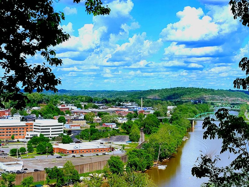
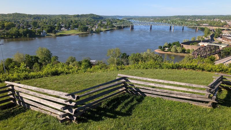
Two rivers joining is a quiet kind of drama. From the overlook, the broad Ohio River rolls past with steady power, while the Little Kanawha slides in from the side like a narrower silver thread finding its way home.
Watching the water merge is oddly hypnotic, and it explains in about three seconds why anyone would build a fort here.
Downtown Parkersburg spreads out below, close enough that you can pick out streets and rooftops without squinting. Farther downstream, Blennerhassett Island sits green in the middle of the channel, and upstream the outlines of Vienna appear on clear days.
Boat traffic adds movement to the scene, and sternwheelers occasionally pass through the frame, which feels almost theatrical.
Bring a camera with a bit of zoom if you have one, since the details reward a closer look.
Light matters here more than season. Late afternoon warms the water, while morning haze softens the far hills into layers.
A Lookout That Reaches Into Ohio
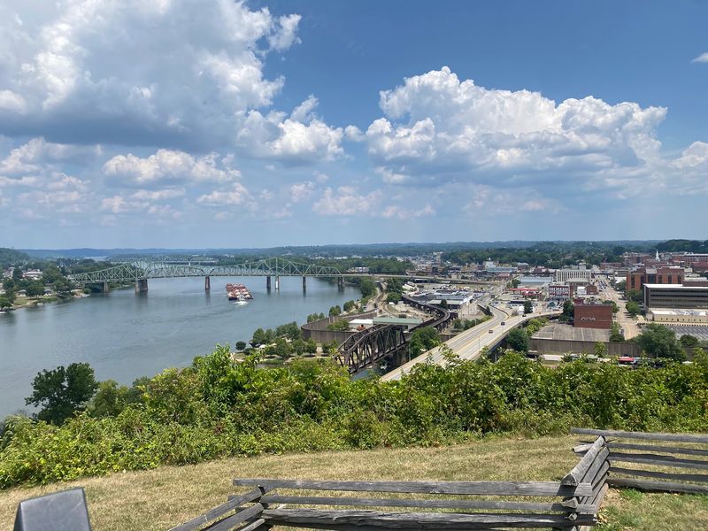
Seeing two states in one glance never gets old. The Ohio River forms the border here, so from the hilltop the far bank belongs to a different state entirely, with Belpre, Ohio, sitting right across the water.
It gives the view a strange sense of scale, like standing on the edge of a map.
The Belpre curve of the river is easy to trace from the overlook, and the whole bend feels laid out on purpose for anyone standing at the top. Bridges connect the two shores, tiny from this height, with cars crossing back and forth all day.
Golden hour is when the two banks glow differently, one lit and one shaded.
Sunset watchers show up for exactly this reason, and the summit has enough open space that nobody has to jostle for position.
Interstate traffic hums faintly in the background, a small reminder that this quiet perch sits close to a working city.
Trenches Still Zigzagging Across The Summit
Earthworks tell stories without saying a word. Union soldiers of Company A, 11th West Virginia Volunteer Infantry Regiment built a fort on this hill in 1863, and the reconstructed trenches still trace their zigzag pattern around the crest.
Roughly four feet deep, the paired trenches were laid out to hold up to one hundred men.
Walking beside them, it becomes clear how much thought went into the design. Every angle gave defenders a sightline, and the shape hugged the natural contour of the hilltop rather than fighting it.
The hill was originally called Mount Logan before the fort took the name of Arthur I. Boreman, the first governor of the state and a Parkersburg resident.
Take your time along this stretch, because the ground itself is the exhibit.
Footing can be uneven in spots, so shoes with grip beat sandals here. Kids tend to love the trenches, since they look like the world’s oldest hide-and-seek course.
Cannons That Guarded A Vital Supply Line
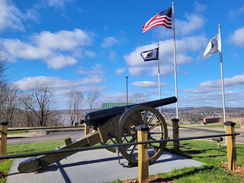
An artillery piece sits near the summit, pointed out over the valley, and it changes how you read the whole landscape. Suddenly the rivers below look less like scenery and more like something worth defending.
The fort’s job was protection. Guns here covered the Baltimore and Ohio Railroad terminal, important turnpikes, and the commercial river facilities that made Parkersburg a key Union supply point.
Records describe a serious lineup of firepower for the site, including two twelve-pound siege guns, a six-pound field gun, and two three-inch guns spread across five gun positions.
Here is the part that surprises most visitors. The cannons were never fired in battle, only for celebrations, and the fort’s real value came from simply existing in such a commanding spot.
Deterrence, it turns out, can be its own kind of victory.
Stand behind the barrel and follow its line down to the water. That single sightline explains more than any paragraph could.
Interpretive Signs Worth Slowing Down For
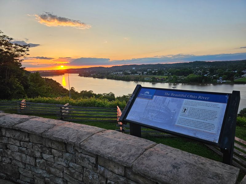
Signs get skipped at a lot of historic sites, but these are actually good. Placed along the paths and walkways, they cover the fort’s strategic role, daily life for the soldiers stationed here, and how Parkersburg fit into the wider war effort.
Reading two or three in a row turns a pretty overlook into a place with weight.
The panels are spaced so you naturally pause, look up, then look out at whatever the text just described. That back-and-forth between words and landscape is the whole trick.
Paved walkways connect several of the historical areas, which makes the interpretive route manageable for most visitors.
Set aside a little extra time if history is your thing, because rushing past defeats the purpose.
Families with curious kids often find the signs spark good questions. Bring water and let the reading happen at whatever pace feels right, since there is no rush at the top of a hill.
Shady Walking Trails Around The Hillside
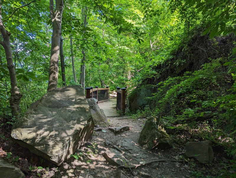
Gravel crunching underfoot is a good sound. The trail system here loops around the hillside, dipping into woods where the temperature drops a few degrees and the town noise fades behind the trees.
Nothing is punishing. The routes are short and beginner-friendly, though a few sections get rocky and mildly steep.
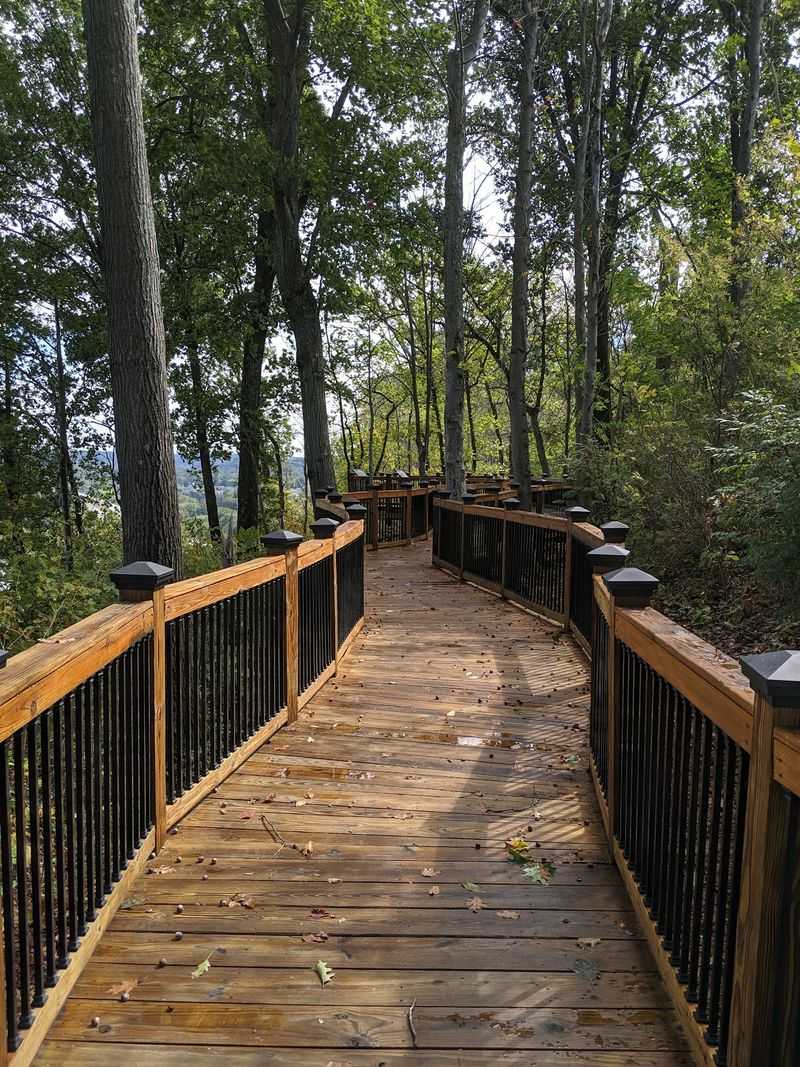
One wooden boardwalk stretches out toward a view several miles up the Little Kanawha River, and another spot lines up perfectly with Market Street far below. Different paths reveal different slices of the valley, so the same hill keeps offering new angles.
A popular short loop runs from the parking area, around the hillside, and back up to the flagpoles.
Sneakers are plenty, but skip the smooth-soled shoes after rain.
Wildlife shows up if you are patient, and eagles have been spotted riding the air currents above the point. Keep your eyes up once in a while, not just on the trail.
Picnic Shelters With A Front-Row View
Lunch tastes better a few hundred feet up. Picnic shelters sit near the summit with tables and grills, and they are shaded, which matters on a bright summer afternoon.
Families spread out here regularly, and the mood is relaxed rather than crowded.
Restrooms on site make longer visits comfortable, and the ample parking means you are not hauling a cooler half a mile. Small gatherings and birthday celebrations work well in this setting, since there is room to move without wandering far from the tables.
A small play area gives younger visitors somewhere to burn off energy between snacks.
Pack simple food and something cold to drink, then claim a table facing the water.
Weekend hours run from early morning until evening on Saturday and Sunday, so plan accordingly if you want a late picnic. Weekday access stretches longer, which suits anyone chasing a quiet breakfast with a view.
Bring a trash bag and leave the spot spotless.
How A Forgotten Hill Became A Park Again
Nature reclaims things quickly. After the Civil War the fort site slid back into brush and trees, and by the mid-1900s much of it had been largely forgotten by everyone except local history buffs.
Then a plan took shape. Efforts to turn the hilltop into a public park began in 1997, driven by community members who understood what the site represented.
Recognition followed when Fort Boreman was added to the National Register of Historic Places in 2003, confirming its national importance.
Clearing thick undergrowth and building trails, shelters, and parking took years of work, and the historical park opened to the public in 2007. The site also stands as a lasting memorial connected to the Wood County Bicentennial Celebration of 1999.
Knowing that backstory makes the mowed grass and tidy walkways feel earned rather than automatic.
Preservation like this depends on people showing up and caring. Visiting is the easiest way to say thank you.
Quiet Moments At The Flagpoles
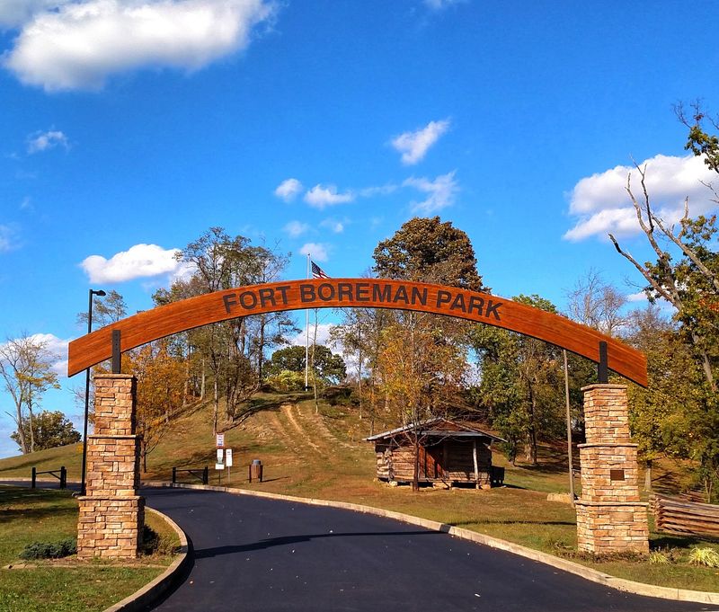
The flagpoles mark the apex, and that is where most people end up lingering. Wind moves steadily across the open grass, and the whole valley sits below like something you were handed rather than found.
Sunrise and sunset both work beautifully here, which is why locals treat the spot as a reliable escape.
Photographers have long used this hilltop for portraits and seasonal landscape shots, and it is easy to see why once the light turns golden.
Sit for a while and let the layers sink in. Trenches behind you, two rivers in front, and a neighboring state just across the water.
History and scenery rarely share a stage this comfortably, and the combination is what makes the visit stick in memory long after the drive home through West Virginia.
Fort Boreman Park is located at Fort Boreman Dr, Parkersburg, WV 26101, and it is an easy, worthwhile stop for anyone passing through the region.
