A shaded Oregon forest hike like this feels like stepping into a cooler, quieter world. I follow the 3.5-mile trail and instantly trade noise for the steady sound of a flowing creek beside me.
Sunlight filters through the trees in soft patches, never quite fully reaching the ground.
Locals treat it like a peaceful reset loop, while I keep slowing down just to stay in the moment a little longer.
Every bend reveals another calm stretch of water or moss-covered log that looks untouched for years. And somehow, the deeper I go, the lighter everything outside the trail feels.
The creek never rushes, and before long, neither do I. It’s the kind of hike that quietly resets your whole mood without even trying.
The Trail Overview: A 3.5-Mile Forest Walk Worth Every Step
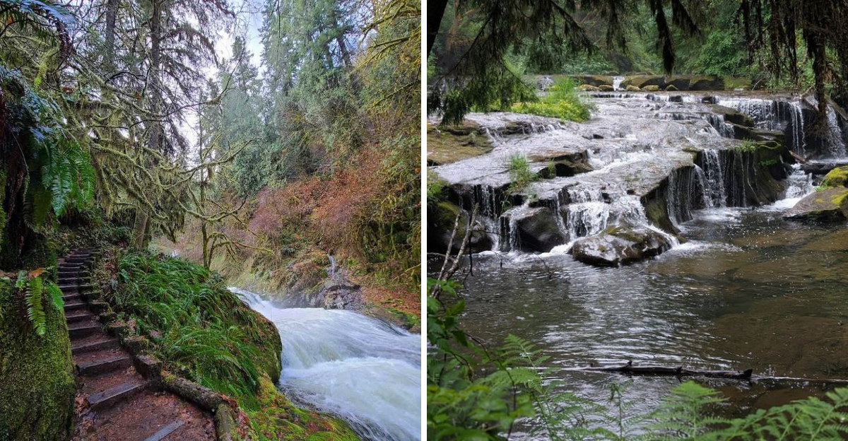
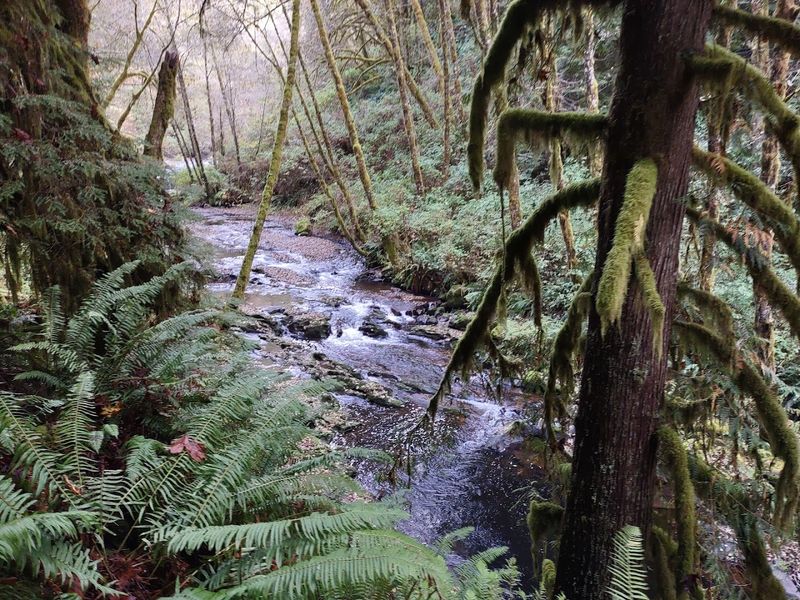
Sweet Creek Falls Trail sits inside the Siuslaw National Forest, about eleven miles from Mapleton, Oregon. The trail follows Sweet Creek through a dense, shaded canyon.
Multiple waterfalls appear along the route, each one different from the last.
The full experience covers roughly 3.5 miles depending on which trailheads you use. Two main trailheads serve the area.
The lower Homestead Trailhead starts the journey, while the upper trailhead sits about a quarter mile up the road.
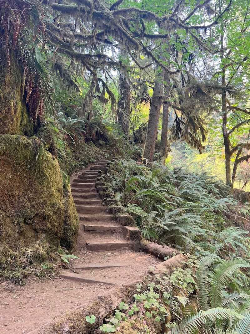
The path is rated easy to moderate. Some sections have exposed roots and slippery rocks, so solid footwear matters.
There are no guardrails along most of the trail, so staying alert keeps things safe.
Hikers typically finish in one to two hours, though many stay longer to enjoy the swimming holes. The trail is open 24 hours every day of the week.
Parking is free at both lots, though spaces fill up fast on weekends, especially after 11am.
Getting There: The Drive Along Sweet Creek Road
The drive to Sweet Creek Falls is part of the experience. Highway 126 between Florence and Mapleton offers some genuinely beautiful scenery.
Rolling hills, tall trees, and the occasional river view make the 15-mile stretch from Florence feel short.
Once you turn onto Sweet Creek Road, the road narrows. It stays paved but winds tightly through the forest.
Morning frost and ice can coat the road in winter, so early arrivals should drive carefully.
The road eventually becomes one lane past the first trailhead entrance. It is manageable but requires patience, especially when other cars are coming from the opposite direction.
Pulling over at wide spots is just part of the routine.
The GPS coordinates for the trailhead are 43.9574899, -123.9029367. Plugging those in before you leave avoids confusion on the road.
The drive itself sets the mood perfectly for the hike ahead, quiet, green, and unhurried from start to finish.
The Lower Trailhead: Starting Point and First Impressions
Pulling into the Homestead Trailhead parking lot, the first thing you notice is how small it is. About ten cars fit comfortably.
A vault toilet sits near the entrance, which is useful before a hike but not exactly fresh-smelling.
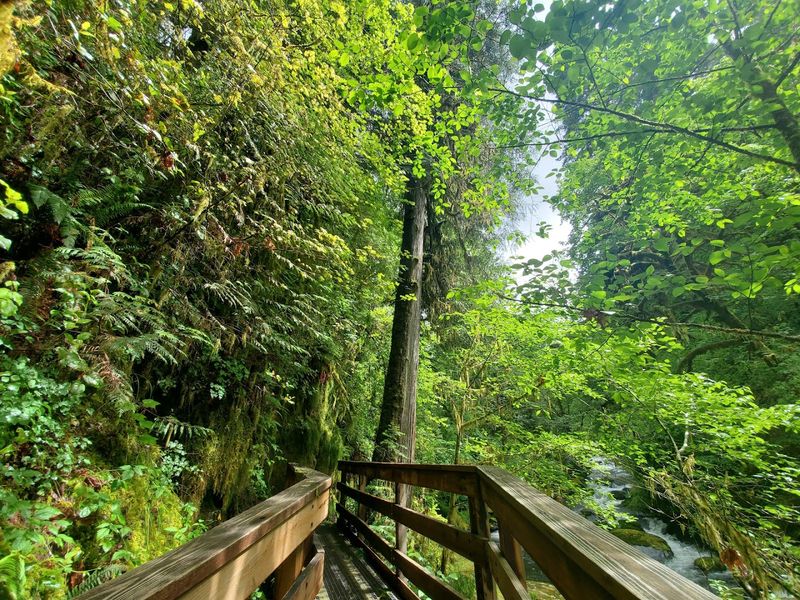
Trail signs at the lower lot direct hikers upstream along Sweet Creek. The first stretch of path is relatively flat and easy.
Tall alder and big-leaf maple trees arch overhead, and the creek stays close the entire time.
After about three-quarters of a mile, hikers reach a bridge that has been out of service due to storm damage. At certain times, this section is impassable.
Signage at the trailhead directs visitors to drive up the road to the second lot instead.
Even with the bridge situation, the lower trail still offers beautiful creek views and a peaceful walk. The forest here feels especially quiet in the morning.
Birds call from somewhere deep in the canopy, and the air smells like wet moss and cedar.
The Upper Trailhead: Where the Falls Get Serious
The upper trailhead sits just a quarter mile up the road from the lower lot. It is easy to miss if you are not watching for it.
Parking here is slightly larger, fitting around 15 to 20 vehicles, though there is no bathroom at this location.
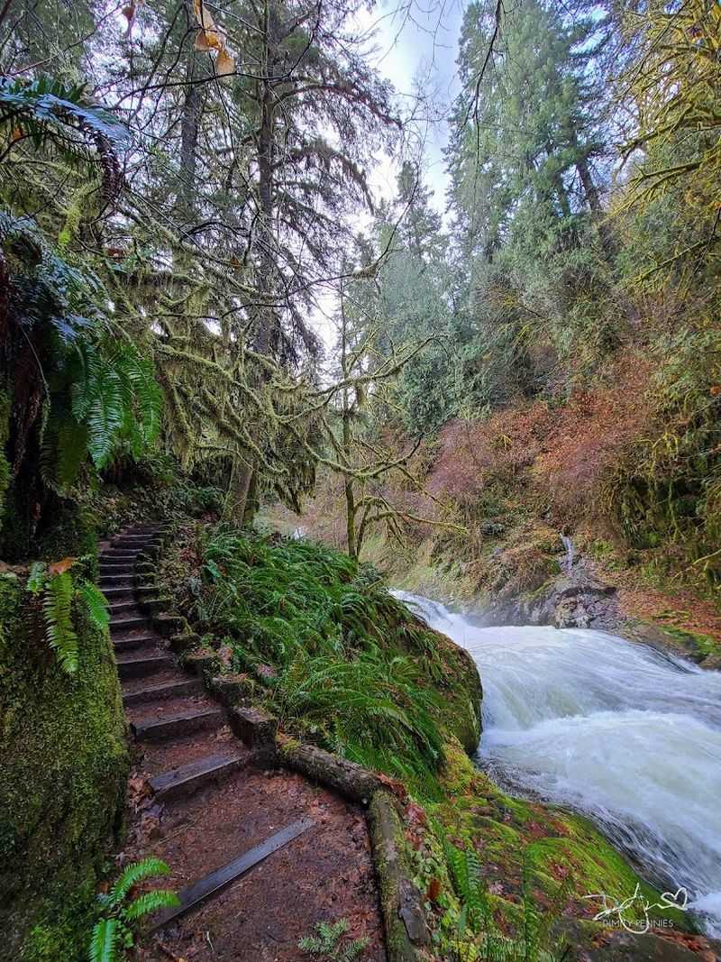
From the upper lot, the trail leads almost immediately to the big falls. Some hikers reach the main waterfall in under half a mile from this starting point.
That makes it a solid option for families with younger children or anyone short on time.
The path from the upper trailhead has more incline than the lower section. It is still considered easy overall, but the terrain gets rockier and the trail narrows in spots.
Exposed roots and muddy patches show up regularly, especially after rain.
Arriving here early on a weekend morning gives you the best shot at a quiet experience. By midday, the lot fills quickly.
The payoff for arriving early is worth it, because the falls look stunning in soft morning light.
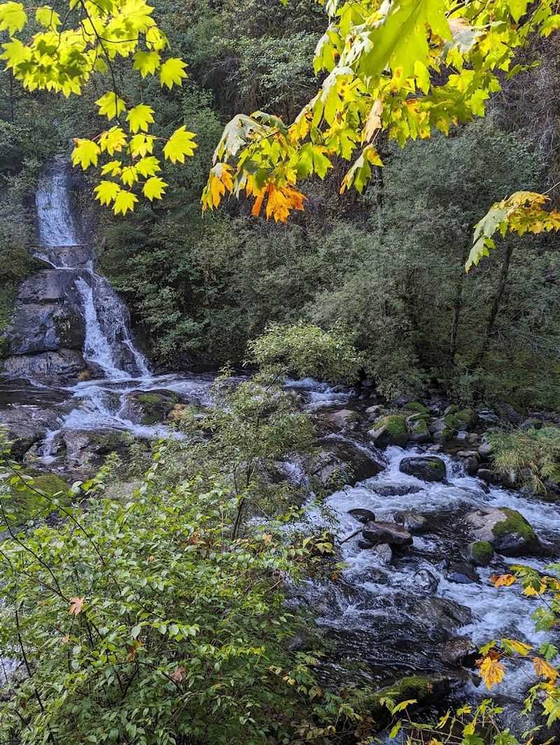
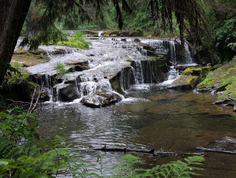
The Waterfalls: Eleven Falls and Counting
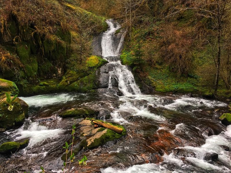
Sweet Creek delivers something rare: not just one waterfall, but a whole series of them. Reports from hikers mention up to eleven falls along the creek corridor.
Each one has its own personality, some wide and rushing, others narrow and delicate.
Water weeps from moss-covered rock walls in certain spots. Natural rock pools collect below several of the falls, creating calm, clear swimming holes that look almost too perfect to be real.
The water runs cold even in late summer.
Spring brings the most dramatic displays. Snowmelt and heavy rain push Sweet Creek to full volume, and the sound becomes almost overwhelming in the best possible way.
Late August visits still impress, though the flow is calmer and more accessible.
Anise Falls is one of the named highlights along the route. Some falls are only visible from specific sections of trail.
Visiting both trailheads gives you the most complete picture of what Sweet Creek has to offer across its full length.
Swimming Holes and Creek Access: The Real Secret
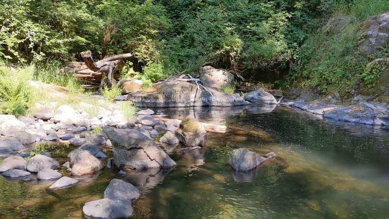
Honestly, the swimming holes along Sweet Creek might be the best-kept secret on the whole trail. Clear, deep pools form naturally between rock formations.
The water is cold at first, but hikers who jump in say they quickly stop noticing.
Goggles are worth packing if you plan to swim. The water clarity underwater is remarkable.
Some pools are deep enough for small jumps off nearby rocks, though care is always needed around natural water features.
Families bring water shoes, towels, and packed lunches to spend full afternoons by the creek. Some visitors spend more time in the water than on the trail itself.
That is not a bad approach at all.
Access points to the creek appear frequently along the path. You do not have to go far off-trail to reach the water.
Bringing a bathing suit is strongly recommended, even if swimming is not the original plan, because the pools are genuinely hard to resist once you see them up close.
Trail Conditions and What to Watch For
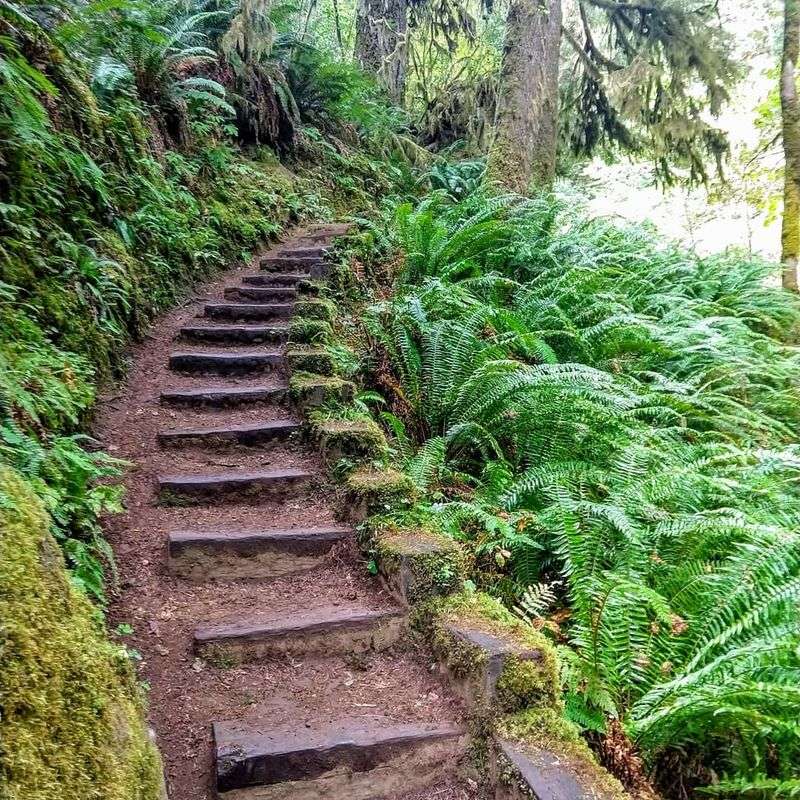
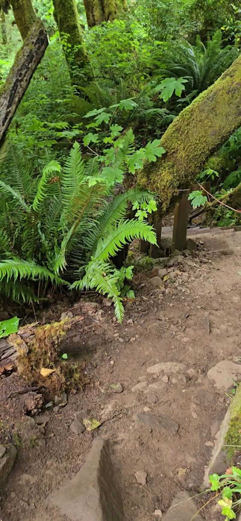
Sweet Creek Trail is not a manicured path. Exposed roots cross the trail constantly, and rocks of all sizes show up underfoot.
Wet conditions make both of these hazards more serious, so waterproof hiking shoes with good grip are a smart choice.
Poison oak grows along sections of the trail. Knowing what it looks like before you go prevents a miserable few days afterward.
Staying on the marked path reduces contact significantly.
Narrow sections of the trail require hikers to pass single-file. If dogs or children are with you, keeping them close and controlled is important.
Other hikers need space to pass safely, especially on the steeper upper sections.
Trail conditions change with the seasons. Winter brings mud, ice on the road, and high creek levels.
Summer dries things out but can still leave muddy patches in shaded areas. Checking the Siuslaw National Forest website before your visit gives you the most current trail status and any closure updates worth knowing about.
Wildlife and Forest Life Along the Creek
The forest along Sweet Creek is alive in ways that sneak up on you. Park rangers have been spotted along the trail at busy times, setting up informal stations with information about local flora and fauna.
Beaver prints in the mud near the creek are a surprisingly common find.
Douglas-fir, alder, and big-leaf maple dominate the canopy. Their combined shade keeps the trail noticeably cooler than the surrounding landscape.
On an 80-degree day, the temperature under those trees drops dramatically.
Birds are active throughout the hike. You hear them more than you see them, calling from deep in the branches above.
The creek itself supports a healthy ecosystem, and water quality in Sweet Creek has been a subject of local conservation attention.
Dogs are welcome on the trail but must stay on leash. The wildlife and other hikers both benefit from that rule.
Seeing a family of ducks drifting along a calm section of the creek is the kind of small moment that makes a hike feel genuinely memorable.
Best Times to Visit and Practical Tips
Spring is the most dramatic time to visit Sweet Creek. The creek runs full and fast, and every waterfall operates at peak volume.
The green of the moss and ferns is almost electric after months of rain. Crowds are manageable in early spring on weekdays.
Summer brings families, swimmers, and longer daylight hours. Arriving before 11am on weekends is the most common advice from regular visitors.
The parking lots fill fast, and latecomers end up parking along the narrow road.
Winter visits are possible and genuinely beautiful. The creek swells with rainwater, and the forest feels wild and untouched.
Road conditions require extra caution though. Ice and frost on Sweet Creek Road in the early morning can make the drive tense.
A few practical notes worth keeping in mind: leave no valuables in your car, as the area has a known history of vehicle break-ins. Bring water, snacks, and layers regardless of the season.
The trail is open 24 hours and admission is free at all trailheads.
Why Sweet Creek Falls Trail Stays With You Long After You Leave
Some trails leave a mark that is hard to explain. Sweet Creek Falls Trail is one of those places.
It is not the tallest waterfall in Oregon, and it is not the longest hike. But the way the creek follows you the whole way, and the way the forest closes in just enough to feel intimate, makes it feel personal.
The combination of easy access, multiple waterfalls, and swimming holes creates something for nearly every kind of visitor. Families with older kids, solo hikers, photographers, and casual walkers all find something worth stopping for.
Coming back feels natural here. Many hikers mention returning in different seasons just to see how the creek changes.
That kind of pull is not something every trail earns.
Sweet Creek Falls Trailhead is located at Sweet Creek Road, Mapleton, Oregon 97453. More details are available at the official USDA Forest Service recreation page for the area.
Dear Reader: This page may contain affiliate links which may earn a commission if you click through and make a purchase. Our independent journalism is not influenced by any advertiser or commercial initiative unless it is clearly marked as sponsored content. As travel products change, please be sure to reconfirm all details and stay up to date with current events to ensure a safe and successful trip.