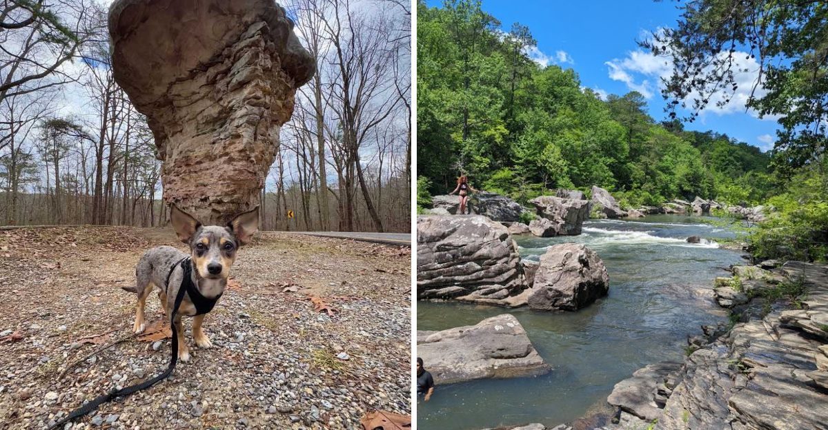
The passenger seat went quiet. That usually means something is worth looking at.
The road had just rounded another curve when the trees opened and the canyon appeared below, stretching far enough to make the car feel very small. From there, the drive became a series of interruptions: another overlook, another waterfall, another reason to pull over.
The Alabama route follows the canyon rim for about 23 miles, with sandstone cliffs and the Little River far below. There are swimming holes for summer, rushing falls after spring rains, and brilliant color along the rim in autumn.
The scenery keeps changing just enough to make the next curve impossible to ignore.
A Rim Road Built Around Overlooks
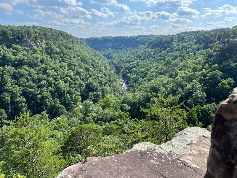
Few roads reward slow driving like this one. Alabama Highway 176 traces the western rim of Little River Canyon before continuing onto County Roads 148 and 275, stretching roughly 23 miles across Lookout Mountain.
The gorge below ranks among the deepest and widest canyon systems east of the Mississippi River. Eight or nine marked overlooks line the route, and skipping them defeats the whole point.
Lynn Overlook looks straight down toward the whitewater rapids that paddlers call the Suicide section, a stretch of river that churns white even from hundreds of feet above. Canyon View and Wolf Creek Overlooks sit close together, split by a narrow ravine where Wolf Creek drops toward the river.
Each pull-off has its own personality. Some open into wide panoramas, while others tuck behind trees until the last few steps.
Practical tip for first-timers: budget far more time than the mileage suggests. Twenty-three miles sounds like a half-hour drive, but with stops, photos, and the occasional urge to just sit on a rock and stare, the parkway easily fills an afternoon.
Guardrails and low stone walls mark most viewpoints, though the sandstone ledges beyond them stay slick after rain. Sturdy shoes matter more than expected.
Morning light favors the eastern walls, late light warms the western cliffs, and either hour beats midday for photographs.
Waterfalls That Change With the Rain
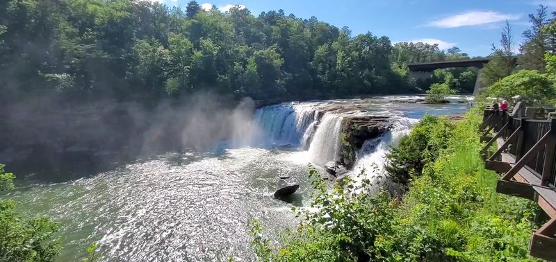
Water does the heavy lifting here, and it shows off in several places along the preserve. Little River Falls marks the northern gateway to the canyon, just off Highway 35, and it is the first big stop most visitors make.
The river drops about 45 feet over a broad rocky ledge, and that plunge essentially starts the canyon. A boardwalk leads to accessible viewing platforms close enough to feel the mist drifting up.
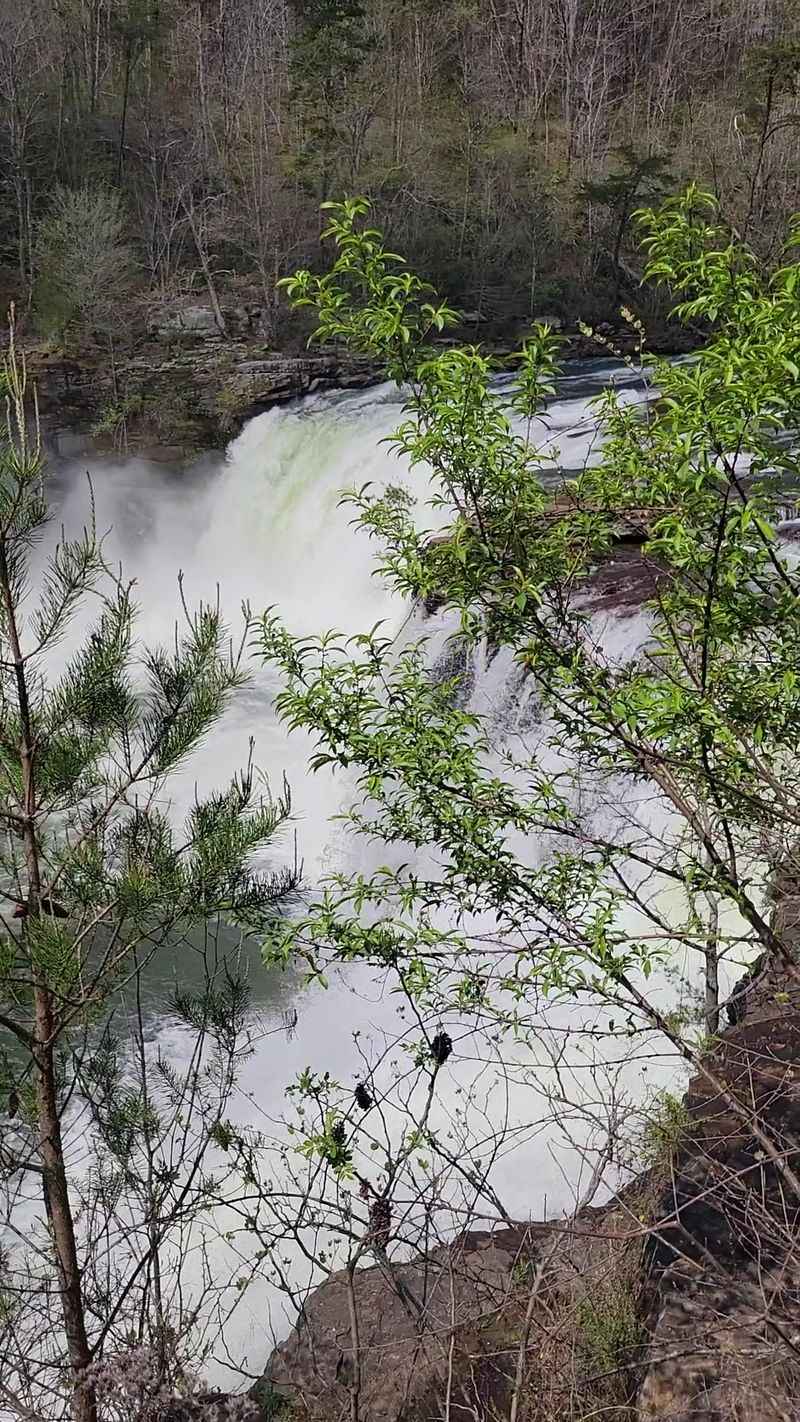
Flow changes dramatically with rainfall. Winter and early spring bring the loudest, widest curtains of water, while late summer can reduce the falls to slender ribbons over bare stone.
Farther down the parkway, Grace’s High Falls claims the title of Alabama’s tallest above-ground waterfall at roughly 133 feet. It spills into a side canyon carved by Bear Creek, and it only performs after significant rain.
Catching it full is a bit of luck. Visit a day or two after a good storm and the odds improve considerably.
Little Falls, also known as Martha’s Falls, sits deeper in the canyon and requires a hike to reach. The reward is a closer, more personal encounter with the river’s ledges and pools.
Three waterfalls, three moods, one road connecting them all.
Mushroom Rock and Other Stone Oddities
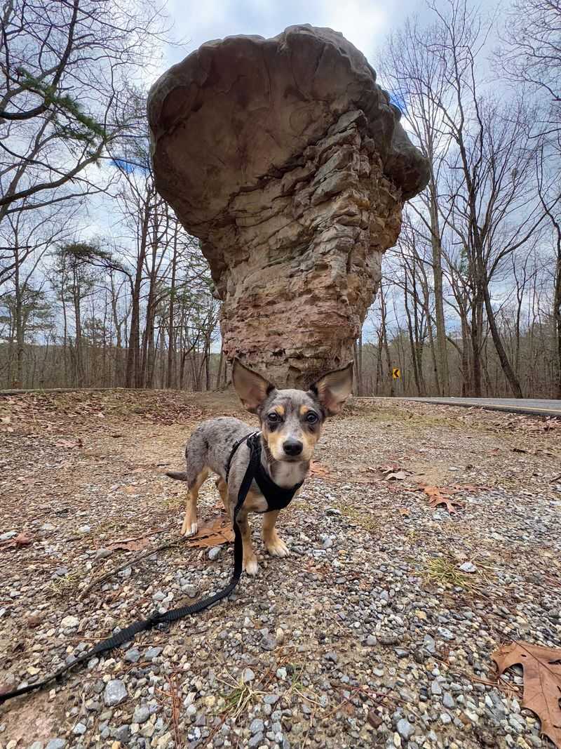
Roadside attractions rarely come shaped by erosion, but Mushroom Rock is exactly that. Perched along Highway 176, the sandstone formation balances a wide cap on a narrower stem, earning it nicknames like Umbrella Rock and Needle Rock.
Softer layers wore away faster than the tough ones above, and millions of years later the leftover shape looks almost engineered. Small parking space, big photo payoff.
The canyon itself is the larger geology lesson. The gorge cuts through the Lookout Mountain syncline into the Pottsville Formation, a thick stack of sandstone and conglomerate laid down during the Pennsylvanian period.
Some of that stone once formed the floor of a shallow sea in the Paleozoic Era. Now it stands as vertical cliff walls hundreds of feet tall.
Look closely at the bluffs from any overlook and the horizontal banding becomes obvious, layer stacked on layer like pages in a very old book. Rock climbers know these walls well, and the same cliffs that draw them make the views so sharp-edged.
Anyone traveling with curious kids will find plenty to point at, from honeycomb weathering on boulders to potholes worn into the riverbed.
Bring a pair of binoculars. Details on the far canyon wall come alive with a little magnification.
Trails for Every Kind of Walker
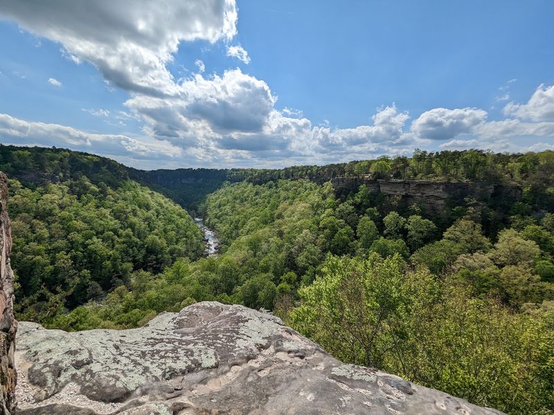
Boots optional on some trails, absolutely essential on others. Little River Canyon National Preserve holds more than 26 miles of hiking trails plus over 20 miles of backcountry roads, which covers an enormous range of effort levels.
Easy strolls stay up on the wooded rim. Steep, rugged descents drop all the way to the riverbed.
The Path to Learning Trail near the Jacksonville State University Little River Canyon Center makes a gentle half-mile loop, with interpretive exhibits explaining local plants, animals, geology, and human history. Families with small children usually start there.
The Bridge Trail offers another short, easy walk from the Canyon Center toward Little River Falls.
For a serious workout, the Eberhart Trail plunges into the canyon and delivers river-level views that overlooks simply cannot match. Lower Two-Mile Trail and Powell Trail are similarly demanding, and kayakers use them to haul boats down during cooler months.
The DeSoto Scout Trail runs longest of all, linking the canyon with nearby DeSoto State Park and crossing the Wildlife Management Area with multiple exit points.
Spring and early summer turn the slopes into a rhododendron and mountain laurel show. Water and a paper map are smart companions, since cell service gets patchy once the canyon walls rise overhead.
Cooling Off in the Little River
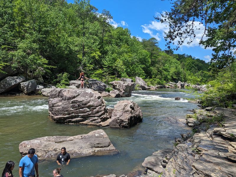
Summer heat on Lookout Mountain has an obvious solution, and it runs right through the canyon. Because the Little River flows mostly along the top of a mountain, its water stays notably clear.
Blue Hole sits a short distance from Little River Falls off Highway 35, and calm, easy-flowing water makes it a favorite for families with young kids. Picnic benches and grills sit nearby, which turns a quick swim into a whole afternoon.
Weekend arrivals should come early, since the small lot fills fast once temperatures climb.
Downstream, Martha’s Falls, widely called Hippie Hole, attracts a slightly more adventurous crowd. Curved rock shelves, sandstone bluffs, and thick greenery frame the pool, and flat boulders serve as natural sunning spots.
No lifeguards patrol any of these swimming areas. Water levels shift with rainfall, submerged rocks hide in the shallows, and wet sandstone gets genuinely slippery, so caution belongs in the packing list.
Anglers cast for redeye bass, though water this transparent makes fish harder to fool. Canoes and kayaks appear mostly in winter and spring when flows rise, and portions of the river reach expert-level rapids that beginners should skip.
Water shoes solve most complaints. Rocky entries are the rule, not the exception.
Fall Color, Spring Blooms, and Quiet Winters
Repeat visitors swear the canyon feels like four different places across the year. Autumn draws the biggest crowds, and for good reason.
Woolly sumac flames red first, then sassafras, dogwood, hickory, oak, and maple join in, usually peaking in late October and early November. Driving the rim during those weeks means looking out over waves of red, orange, gold, and rust stacked against gray cliffs.
Spring works differently, softer and greener. Fresh leaves unfurl, redbud and dogwood blossoms brighten the understory, and wildflowers scatter across the canyon floor.
Heavier spring rainfall also means the waterfalls, Grace’s High Falls included, run at their strongest. Photographers chasing full cascades tend to plan around March and April.
Summer belongs to the swimming holes and long, warm evenings on the rim. Shade along the trails helps, though midday heat on exposed overlooks can be intense.
Winter surprises people. Bare branches expose rock layers and side ravines that leaves normally hide, trails stay quiet, and overlooks often sit completely empty.
Ice sometimes decorates seep walls after a cold snap, and the canyon takes on a hushed, stripped-down beauty.
No single season wins outright. That is precisely why one visit rarely feels like enough.
Canyon Mouth Park at the Southern End
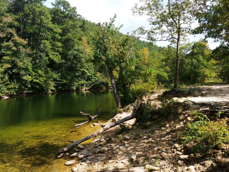
The parkway saves something relaxed for its finish. Canyon Mouth Park sits at the southern end of the drive and offers one of the few places where a vehicle can reach the banks of the Little River directly.
Paved parking, maintained restrooms, and a reservable pavilion make it practical for groups. Picnic tables and grills sit scattered through shady spots along the water.
River access here is gentle compared with the rapids upstream, which suits wading, splashing, and general lazing about. A one-mile trail runs parallel to the river, easy enough for grandparents and toddlers alike.
Songbirds work the dense understory along that path, and hawks and vultures ride thermals above the canyon walls. Birders often linger longer than planned.
Kids gravitate straight to the playground, which buys parents a few minutes with their feet in the water.
Canyon Mouth Park is the one spot inside the preserve that charges a day-use fee, and the amenities plus riverfront access explain why it stays busy on warm weekends. Arriving before late morning helps.
Treated as the closing chapter of the drive, it balances all those high overlooks with something ground level and easy. Cliffs above, cool water below, and no reason to rush.
Address: 4322 Little River Trail NE, Suite 100, Fort Payne, AL 35967
