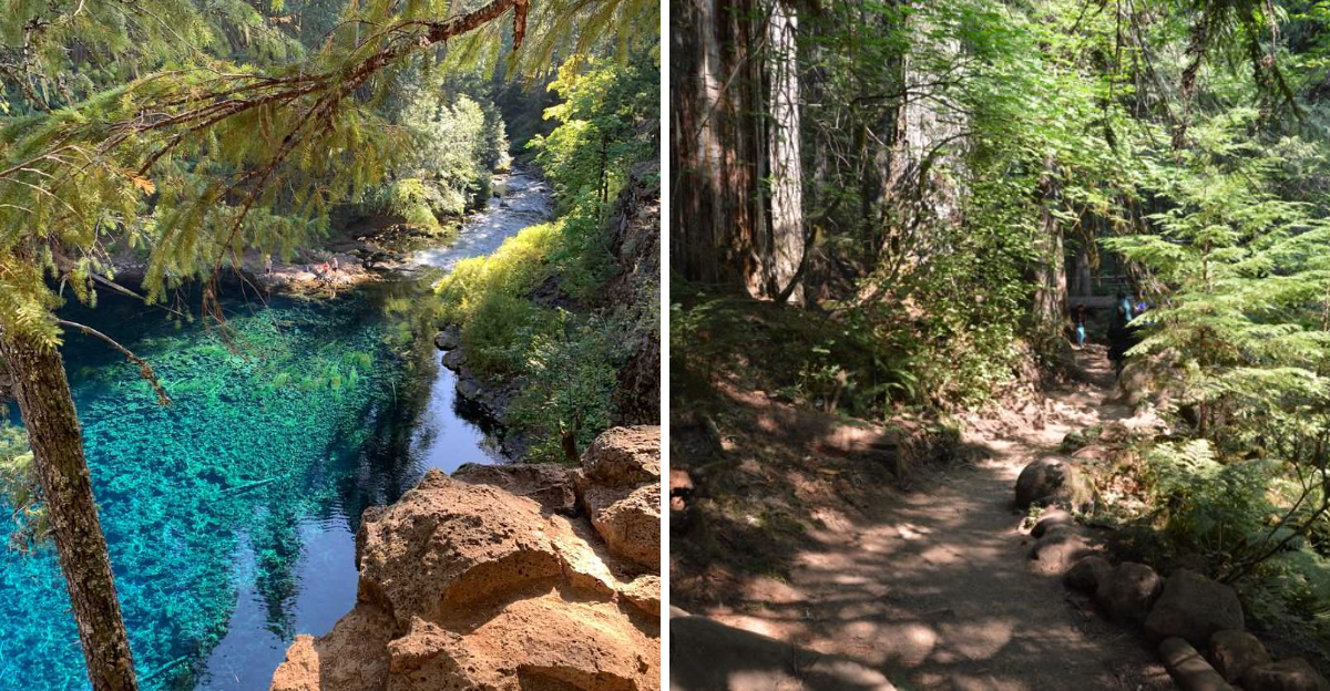
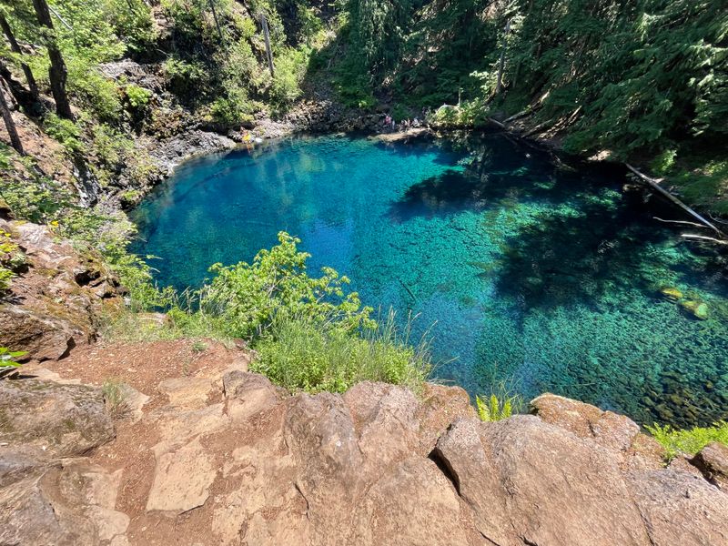
Stumbling upon Tamolitch Falls in Oregon’s Willamette National Forest felt like finding a hidden portal. This isn’t just another waterfall – it’s a mesmerizing blue pool where the McKenzie River magically reemerges after disappearing underground through ancient lava tubes.
The water is so clear and electric turquoise that it looks like someone dropped food coloring into a crystal bowl. Standing there, it’s impossible not to feel like you’ve stepped into another dimension.
The dilemma for anyone who visits? Keep it secret or share the magic.
I shared, and now my peaceful escape is busier every season. The water is shockingly cold – jump-in-and-immediately-regret-it cold – but no one can resist.
I’ve seen grown adults squeal like kids at that first glimpse of color. Pack your hiking boots and get ready for a jaw-dropping experience that will haunt your Instagram feed in the best way possible.
The Mesmerizing Blue Pool Itself

Standing at the edge of this pool for the first time literally made me gasp out loud. The water is such an intense shade of electric blue that my brain couldn’t quite process it as real.
I’ve traveled to tropical beaches and fancy resort pools, but nothing compares to the surreal color of Tamolitch’s naturally fed waters.
The McKenzie River vanishes upstream into underground lava tubes, then dramatically resurfaces here in this bowl-shaped depression. The result is water so pure and cold that it maintains this otherworldly clarity year-round.
Sunlight filters through the surface and illuminates every pebble on the bottom, creating an almost magical glow.
I watched several brave souls test the water temperature, and their reactions were priceless. One guy dipped his toe in and immediately yanked it back like he’d touched a hot stove, except the opposite.
The pool stays around 37 degrees Fahrenheit regardless of the season, cold enough to cause serious shock if you’re not prepared.
Local legend says the pool has no actual bottom, though that’s just fun storytelling. Still, peering into those depths, I could almost believe it.
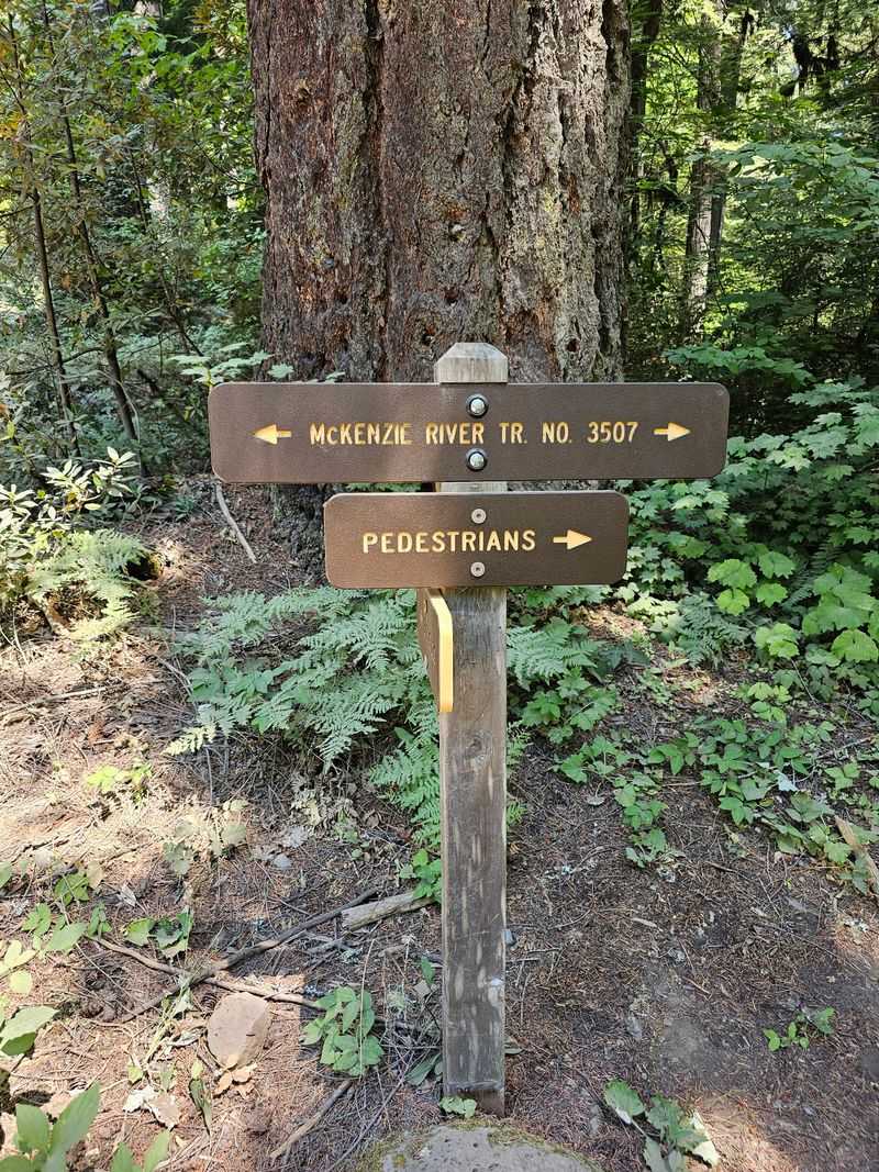
The Scenic McKenzie River Trail Hike
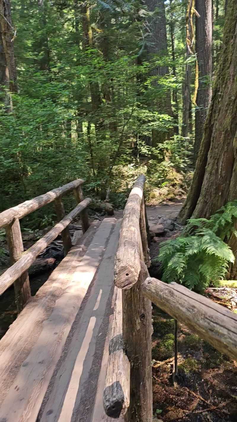
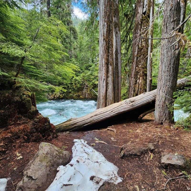
Getting to the Blue Pool means tackling a 4.4-mile round trip hike that honestly became one of my favorite Oregon trails. The path follows the McKenzie River for most of the journey, offering constant water views and the soothing soundtrack of rushing rapids.
I started at the Trail Bridge Reservoir trailhead and immediately felt transported into a Pacific Northwest fairy tale.
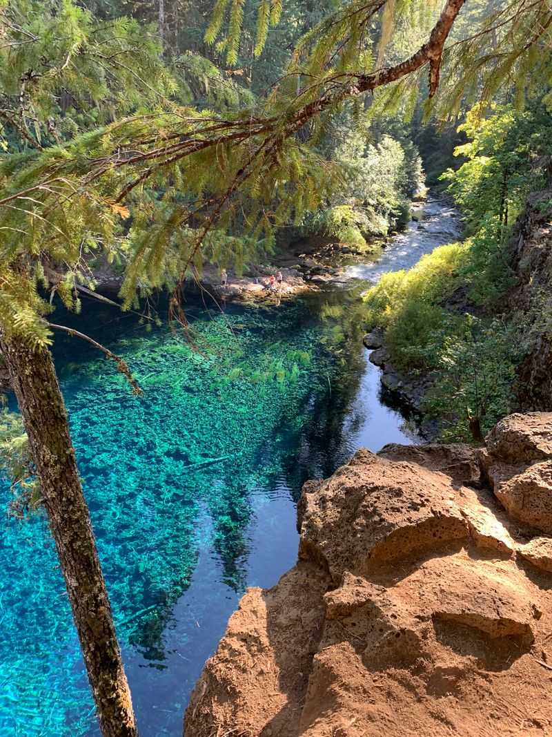
The trail itself rates as easy to moderate, which means most people with basic fitness can handle it comfortably. I passed families with young kids, older couples taking their time, and even someone’s adventure cat in a backpack.
The elevation changes are gentle enough that you barely notice you’re climbing.
About halfway through, the terrain shifts dramatically. Suddenly you’re navigating sections of chunky black lava rock that require more careful footing.
I recommend actual hiking boots here, not just sneakers, because those volcanic chunks can be ankle-twisters if you’re not paying attention.
The forest canopy provides excellent shade during summer months, keeping temperatures surprisingly comfortable even on hot days. I visited in July and never felt overheated despite the exertion.
The Vanishing River Phenomenon
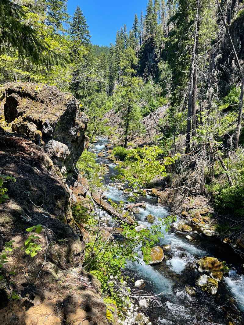
About three miles upstream from the Blue Pool, I witnessed something that still blows my mind. The McKenzie River literally vanishes into the ground, swallowed completely by ancient lava tubes formed thousands of years ago.
Walking along the dry riverbed felt like discovering a magic trick in progress.
Geologists explain that volcanic eruptions created these underground channels when molten lava drained away, leaving hollow tubes behind. The river found these natural pipes and decided they made a perfect shortcut.
The water travels roughly three miles underground before dramatically resurfacing at Tamolitch.
I stood at the spot where the river disappears and tried to imagine the journey happening beneath my feet. The water maintains its temperature and purity during this subterranean adventure, emerging just as cold and clear as it entered.
Scientists estimate the underground journey takes several days to complete.
You can actually hike to both the disappearance point and the reappearance point in one trip if you’re feeling ambitious. I did exactly that, and seeing both ends of this natural phenomenon made the experience even more incredible.
It’s like watching nature perform its own spectacular vanishing act.
The Challenging Lava Rock Scramble

Reaching the actual pool requires descending a steep, rocky scramble that separates casual hikers from determined adventurers. I paused at the top of this section and watched several people debate whether to attempt it.
The main trail stays up high with a safe viewing area, but getting down to the water’s edge is a whole different challenge.
The descent involves carefully picking your way down jagged lava rocks that offer no clear path. I used my hands as much as my feet, essentially rock-scrambling rather than hiking.
The volcanic rock is sharp and unforgiving, so I was grateful for my sturdy gloves and long pants.
Several reviewers I’d read beforehand mentioned this section transforms an easy hike into a moderate one, and they weren’t exaggerating. Going down felt manageable but slightly nerve-wracking.
Coming back up had me breathing hard and using muscles I’d forgotten I had.
I noticed families with small children wisely chose to admire the pool from the upper viewpoint instead. Smart move, honestly.
The scramble isn’t dangerous if you’re careful, but it’s definitely not suitable for everyone. My advice is to assess your comfort level with uneven terrain before committing to the descent.
The Wildflower-Lined Trail Sections
Spring and early summer transform the trail into an absolute wildflower wonderland that made me stop every few feet to take photos. I’m not usually the type to get excited about flowers, but the variety and colors along this path were genuinely stunning.
Bright purple lupines mixed with yellow Oregon sunshine and delicate white trilliums created natural bouquets everywhere I looked.
The combination of volcanic soil, river moisture, and forest shade creates perfect growing conditions for dozens of native species. I downloaded a plant identification app before my trip and had a blast naming everything I encountered.
My favorite discovery was the vibrant pink bleeding hearts tucked under fern canopies.
Local botanists say the lava rock areas support unique plant communities that have adapted to the harsh, nutrient-poor conditions. Watching tiny flowers push through cracks in solid volcanic rock reminded me how determined nature can be.
These tough little plants thrive where you’d think nothing could survive.
Timing matters if you want the full floral show. I visited in late May and caught peak bloom season.
By mid-July, many flowers had already faded, replaced by lush green growth instead.
The Ancient Lava Flow Landscape

Walking through this area feels like exploring a frozen moment from Earth’s violent past. The entire landscape is shaped by lava flows that erupted from nearby volcanic vents roughly 3,000 years ago.
I kept running my hands over the twisted, rope-like patterns in the rock, imagining this stone as molten liquid flowing downhill.
The lava created the tubes that now carry the McKenzie River underground, but it also shaped the surface terrain in fascinating ways. Massive boulders sit scattered randomly, deposited by ancient flows and never moved since.
Some chunks are bigger than my car, just casually resting in the middle of the forest.
I noticed how the forest has slowly reclaimed this volcanic destruction. Douglas firs and western hemlocks grow directly from cracks in the lava, their roots somehow finding enough soil and moisture to thrive.
Moss blankets many rock surfaces, adding splashes of brilliant green to the black stone.
Geologists love this area because the lava flows are relatively young and well-preserved. You can clearly see different flow patterns and volcanic features without needing an advanced degree to interpret them.
I felt like I was getting a free geology lesson just by paying attention.
The Peaceful Forest Canopy
One of my favorite aspects of this hike was the cathedral-like feeling created by massive old-growth trees towering overhead. Douglas firs reaching 200 feet tall create a natural ceiling that filters sunlight into soft, dappled patterns.
Walking beneath these giants made me feel wonderfully small and connected to something much older than myself.
The forest composition changes subtly as you hike, transitioning from mixed conifer stands to areas dominated by western hemlocks and western red cedars. I’m no tree expert, but even I could appreciate the diversity and age of these woods.
Some trees are easily 400 years old, quietly witnessing centuries of river flow and seasonal changes.
The canopy provides excellent temperature regulation, keeping the trail comfortable even during Oregon’s warmest months. I hiked in July when temperatures in nearby towns hit the high 80s, but under the trees, it felt at least 15 degrees cooler.
The shade is genuinely a gift on sunny days.
Bird songs echoed through the canopy constantly during my hike. I’m not skilled at bird identification, but I definitely heard several woodpecker species hammering away at dead snags.
The forest felt alive and vibrant, not silent or spooky.
The Instagram-Famous Photo Spots
I’ll admit it, I absolutely wanted those perfect Instagram shots of the impossibly blue water. Several spots along the trail and around the pool have become famous for offering the best angles.
The upper viewpoint provides a sweeping overview that captures the entire pool and surrounding lava formations in one frame.
Getting down to water level opens up completely different photographic opportunities. I spent probably 30 minutes just experimenting with angles, trying to capture how the sunlight illuminated the pool from different directions.
The clarity of the water creates amazing reflection opportunities if you time it right.
Midday light works surprisingly well here, contrary to typical photography advice. The sun directly overhead penetrates the water and makes that blue color absolutely pop.
I’ve seen sunset shots that are gorgeous too, with golden light filtering through the trees and creating warm contrast against the cool blue water.
Fair warning though, the popularity of this spot means you’ll likely have other people in your shots unless you visit during off-peak times. I went on a Sunday morning and still had to wait for clear frames.
Weekday visits or early morning arrivals give you better chances of solitude.
The Parking and Trailhead Situation
Here’s something I wish someone had warned me about: parking at the trailhead is absolutely chaotic during peak season. I arrived at 9 AM on a Sunday thinking I’d beaten the crowds, but the small parking area was already completely full.
Cars lined both sides of Forest Road 730 for probably a quarter mile in each direction.
The official parking area holds maybe 15 vehicles maximum, which is laughably inadequate for this trail’s current popularity. I ended up parking on the shoulder about a third of a mile from the actual trailhead, adding extra distance to my hike.
Make sure you pull completely off the road because forest service vehicles need to pass.
Weekday visits offer much better parking prospects, based on what other hikers told me. Several people I met on the trail specifically chose Tuesday or Wednesday to avoid the weekend madness.
Early morning starts help too, with the best availability before 8 AM.
A Northwest Forest Pass is required for parking in this area, costing about $5 for a day pass or $30 annually. Rangers do check and issue tickets, so don’t skip this step.
You can purchase passes at ranger stations or online before your trip.
Dear Reader: This page may contain affiliate links which may earn a commission if you click through and make a purchase. Our independent journalism is not influenced by any advertiser or commercial initiative unless it is clearly marked as sponsored content. As travel products change, please be sure to reconfirm all details and stay up to date with current events to ensure a safe and successful trip.