I first stumbled onto the Delaware & Raritan Canal State Park Trail on a crisp autumn morning, and I haven’t stopped exploring its winding pathways since.
Stretching across 70 glorious miles through the heart of New Jersey, this historic towpath transforms from a working canal route into an outdoor playground where runners, cyclists, and history buffs find their perfect escape.
The trail follows the old Delaware and Raritan Canal, weaving through charming towns, dense woodlands, and past crumbling stone structures that whisper stories from the 1800s.
I’ve discovered hidden lock tenders’ houses, moss-covered bridges, and forgotten industrial ruins that make every mile feel like a treasure hunt.
Whether you’re lacing up your running shoes at sunrise or packing a picnic for a leisurely bike ride, this path delivers scenery that changes with every season.
Want to know the wildest part? You can literally run from the Delaware River to the Raritan River without dodging a single car.
Honestly, where else can you get your cardio fix while playing amateur archaeologist among 19th-century ruins?
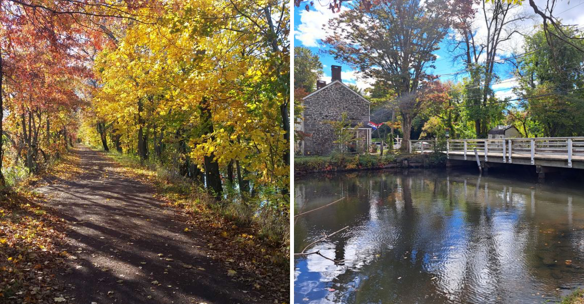
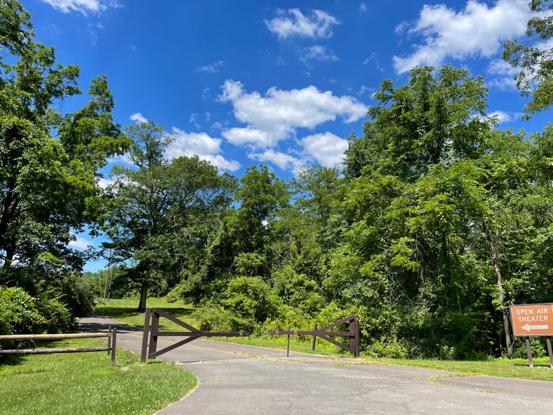
Starting Point at Bull’s Island Recreation Area
Bull’s Island Recreation Area marks the northern gateway to this incredible trail system, and I always recommend starting your adventure here if you want the full experience. Located along Route 29 near Stockton, this access point offers ample parking, clean restrooms, and immediate immersion into the canal’s natural beauty.
The moment you step onto the crushed stone path, you’re transported back to an era when mule-drawn barges navigated these waters carrying coal and cargo between Philadelphia and New York.
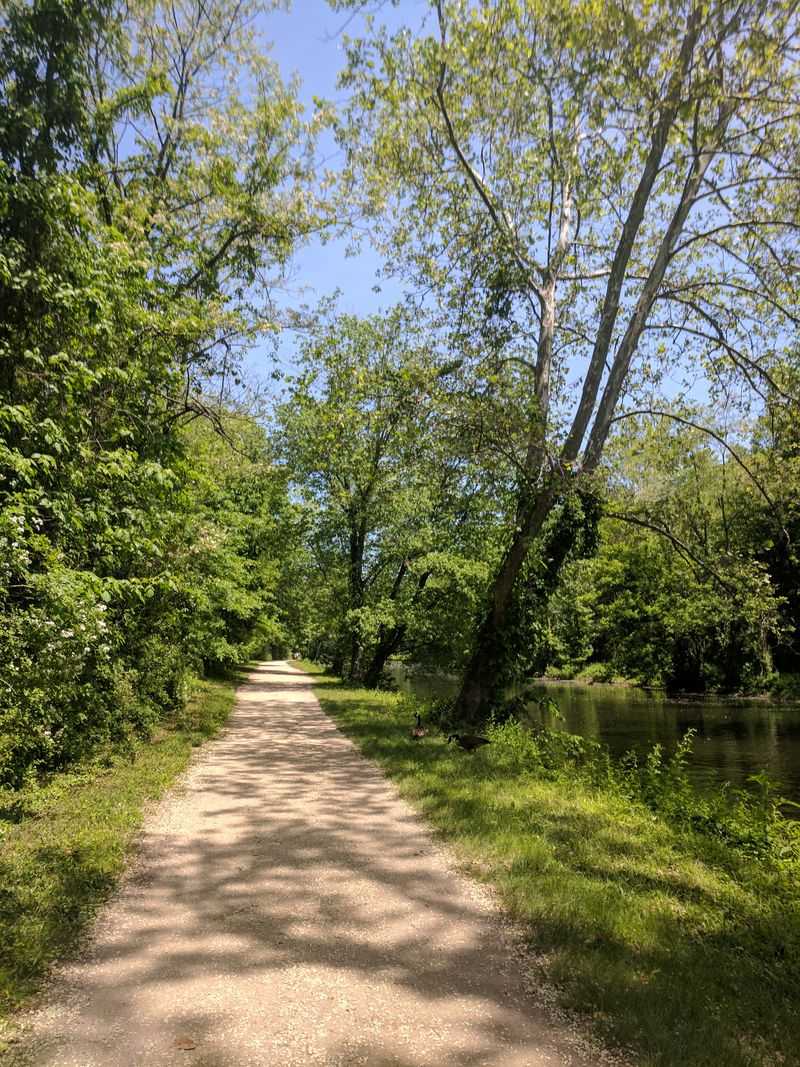
I love how the trail here runs parallel to the Delaware River, creating this peaceful corridor between flowing water on both sides. The towpath surface is incredibly well-maintained, making it perfect for road bikes, though I’ve seen plenty of runners and walkers enjoying the flat, forgiving terrain.
During spring, wildflowers explode along the banks, and by summer, the tree canopy provides blessed shade during those humid New Jersey afternoons.
What really captures my attention at Bull’s Island is the immediate sense of history. You can still spot original stone mile markers embedded along the route, counting down the distance to New Brunswick.
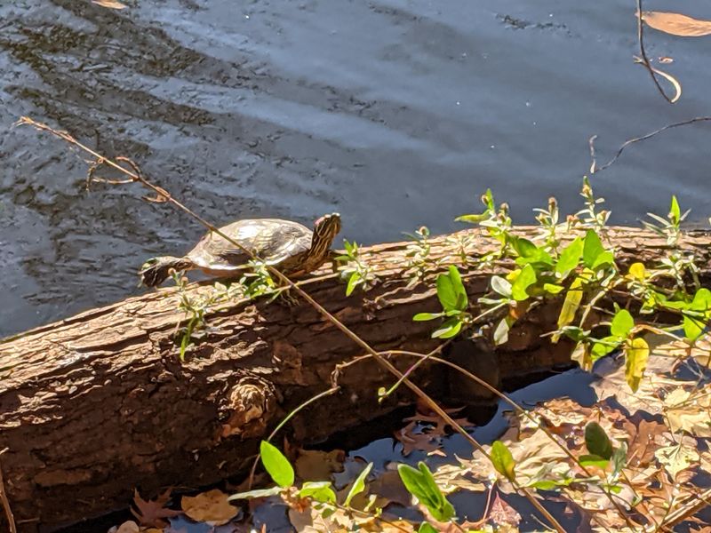
The old wooden footbridges crossing the canal retain their rustic charm, creaking slightly under your weight as you pause to photograph turtles sunbathing on fallen logs.
If you’re planning a long ride or run, Bull’s Island serves as an excellent base camp. I’ve watched sunrise here more times than I can count, and there’s something magical about being the first person on the trail when morning mist still hovers over the canal.
Prallsville Mills Historic District
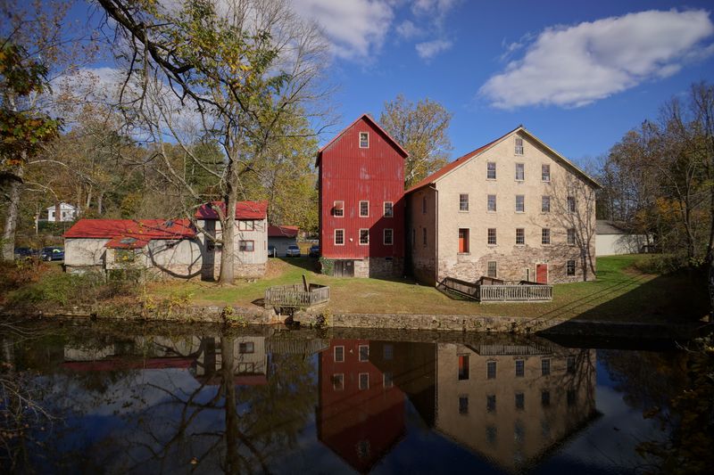
Roughly four miles south from Bull’s Island, Prallsville Mills emerges like a perfectly preserved time capsule from New Jersey’s industrial past. This cluster of historic buildings once formed a thriving milling operation in the 1800s, and today they stand as some of the most photogenic ruins along the entire trail.
I always slow down here, whether I’m running or biking, because the atmosphere practically demands your attention and respect.
The complex includes several structures in varying states of preservation, from the impressive stone grist mill to smaller outbuildings that once housed workers and equipment. What fascinates me most is how nature has begun reclaiming these spaces without completely overtaking them.
Ivy creeps up weathered red siding, wildflowers push through cracks in stone foundations, and swallows nest in the exposed rafters of the old linseed oil mill.
During my visits, I’ve noticed how the light changes throughout the day, casting dramatic shadows across the mill’s facade. Early morning offers golden hour perfection for photography, while late afternoon creates moody silhouettes against the canal.
The Delaware and Raritan Canal State Park has placed informative plaques around the site, explaining how these mills processed grain, flax, and wool for regional markets.
The trail passes directly through the complex, so you don’t need to detour to explore. I recommend budgeting extra time here because once you start examining the architectural details, the hand-hewn beams and original millstones, you’ll lose track of time completely.
Griggstown Lock Tender’s House
Around mile marker 28, Griggstown presents one of my favorite historical stops along the entire Delaware & Raritan Canal Trail. The lock tender’s house here stands as a testament to the daily lives of workers who kept this transportation artery flowing during the 19th century.
Unlike some ruins that require imagination to visualize their original purpose, this sturdy stone structure clearly shows how lock tenders lived right beside their workplace, ready to operate the massive wooden gates at any hour.
I find myself drawn to the architectural details that have survived decades of weather and neglect. The thick stone walls, built to last generations, still display the craftsmanship of stonemasons who understood their trade.
Small windows punctuate the facade, positioned to give workers clear views of approaching canal boats. The adjacent lock mechanism, though no longer operational, remains largely intact with its wooden beams and iron hardware slowly rusting into sculptural forms.
What makes Griggstown particularly special is the interpretive signage installed by New Jersey State Parks. These panels explain the lock system’s engineering, complete with diagrams showing how boats were raised and lowered to navigate elevation changes.
Standing beside the empty lock chamber, I can almost hear the rush of water and the creaking of gates opening.
The surrounding area has been cleared enough for safe exploration, but wild grasses and native plants have reclaimed much of the landscape, creating this beautiful blend of human history and natural regeneration. Cyclists often stop here for water breaks, and I’ve seen families using the spot for impromptu history lessons.
Blackwells Mills Canal House
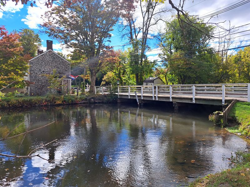
Blackwells Mills represents the crown jewel of preserved canal architecture along this trail, and every time I pass through, I’m grateful that preservation efforts saved this remarkable structure. Located near East Millstone, this beautifully restored canal house now serves as a visitor center and museum, offering restrooms, water fountains, and fascinating exhibits about canal life.
The building’s sunny yellow exterior practically glows against the green corridor of trees lining the towpath.
Unlike many ruins along the trail, Blackwells Mills has been lovingly maintained and restored to its 19th-century appearance. Walking through its rooms feels like stepping into a time machine, with period furnishings, tools, and photographs documenting the canal’s heyday.
Volunteer docents often staff the building on weekends, sharing stories about the families who lived here and the constant parade of canal boats that once passed their windows.
The grounds surrounding the canal house make for perfect picnic spots. I’ve stopped here countless times to refuel during long rides, sitting on benches overlooking the calm canal waters while ducks paddle past.
The wooden footbridge connecting both sides of the canal offers excellent photo opportunities, especially when reflections mirror perfectly in the still water.
What I appreciate most about Blackwells Mills is how it serves as an educational anchor for the entire trail system. First-time visitors can stop here to understand the canal’s history before experiencing the ruins further along the route.
The contrast between this pristine restoration and the crumbling structures elsewhere really highlights how time and preservation efforts shape our relationship with history.
Six Mile Run Reservoir Area Ruins
Between Franklin Township and East Brunswick, the trail passes through the Six Mile Run Reservoir area where several mysterious ruins hide just off the main path. I’ve explored this section dozens of times, and I still discover new stone foundations and forgotten structures tucked into the woods.
These aren’t grand architectural statements like the mills or canal houses, but rather the humble remnants of workers’ cottages, small warehouses, and support buildings that kept the canal system functioning.
Most trail users zip past without noticing these ruins because they require a bit of detective work to find. Look for faint side paths leading into the tree line, or watch for unusual piles of cut stone that don’t occur naturally.
I’ve found collapsed root cellars, the remains of what might have been a small blacksmith shop, and several foundation walls that could have supported any number of canal-related structures.
The Six Mile Run area itself adds another layer of natural beauty to your journey. The reservoir creates wetland habitats that attract incredible bird populations, and I’ve spotted great blue herons, kingfishers, and even bald eagles during different seasons.
The combination of water, woods, and ruins creates an almost enchanted atmosphere, especially during early morning or late evening when wildlife is most active.
Safety note: if you venture off the main trail to explore these ruins, watch your footing carefully. Decades of leaf litter can hide uneven ground, old wells, or unstable stonework.
I always stay on visible paths and never climb on deteriorating structures, no matter how tempting the photo opportunity might seem.
Colonial Park Section Through Somerset County
As the trail winds through Somerset County, it passes through and alongside Colonial Park, creating one of the most accessible and family-friendly sections of the entire 70-mile route. This stretch offers a different vibe from the more remote northern sections, with manicured parkland blending seamlessly with the historic canal corridor.
I often bring friends here when they’re new to the trail because the amenities and scenery make for an easy introduction.
Colonial Park itself sprawls across hundreds of acres, featuring gardens, sports fields, and picnic areas that complement the canal trail perfectly. You can start your ride or run from the park’s main parking areas, which offer clean facilities and plenty of space even on busy weekends.
The trail surface here is exceptionally smooth, maintained by both state and county resources, making it ideal for road bikes, inline skates, or jogging strollers.
What I love about this section is how it demonstrates the trail’s versatility. Within minutes, you transition from formal gardens and groomed lawns into wild canal-side habitat where herons stalk fish and turtles sun themselves on logs.
The juxtaposition reminds me that New Jersey manages to preserve natural corridors even in heavily developed areas.
During spring, the famous rose garden in Colonial Park explodes with color and fragrance, creating a sensory experience that enhances any trail visit. I’ve timed training runs to coincide with peak bloom, rewarding myself with a post-workout stroll through thousands of flowering bushes.
The park also hosts seasonal events, so you might encounter everything from cross-country meets to outdoor concerts depending on when you visit.
Landing Lane Bridge Ruins Near New Brunswick
Approaching New Brunswick from the north, the trail passes under and around Landing Lane where remnants of older bridge structures create an unexpected urban archaeology site. These ruins feel different from the rural mill buildings and lock houses further north, they’re grittier, more industrial, marked by layers of graffiti that actually add to their visual appeal.
I’ve photographed these stone abutments in every season, and they never fail to provide dramatic compositions.
The original bridge structures here served multiple transportation eras, first supporting canal-related traffic, then adapting to automobile use as New Jersey modernized. What remains today are the massive stone supports, built with the same confident craftsmanship visible throughout the canal system.
Weathering has softened the cut stone edges, and vegetation sprouts from every crack, creating this beautiful tension between human engineering and nature’s reclamation.
New Brunswick represents the southern terminus of the main canal trail, and these ruins serve as a fitting endpoint for northbound travelers or starting point for those heading toward Bull’s Island. The urban setting means more trail traffic here, with local residents using this section for daily exercise and commuting.
I’ve encountered everyone from serious cyclists logging training miles to students from Rutgers University squeezing in quick runs between classes.
The proximity to downtown New Brunswick adds practical advantages like nearby restaurants, coffee shops, and bike stores. After completing a long trail ride, I’ve celebrated with meals at local establishments, still wearing my cycling kit and swapping stories with other trail users about favorite sections and hidden discoveries.
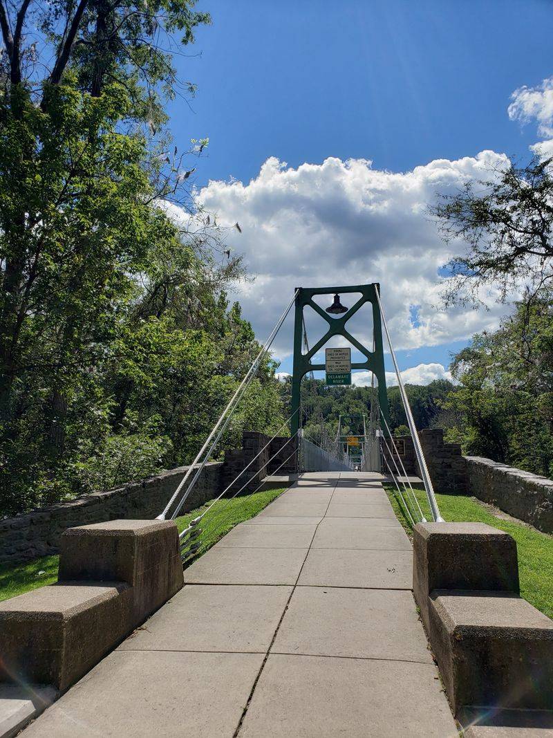
Weston Causeway and Feeder Canal Junction
Near Washington Crossing State Park, the Weston Causeway marks a significant engineering feature where the feeder canal from the Delaware River meets the main canal route. I consider this junction one of the most interesting spots along the entire trail system because it reveals the infrastructure genius behind the canal’s design.
Standing at this intersection, you can literally see how 19th-century engineers managed water flow from two different sources.
The causeway itself consists of stone and earthwork construction that has held up remarkably well considering it’s been channeling water for nearly two centuries. Original stonework remains visible in the bridge abutments and retaining walls, showing the same quality craftsmanship found at locks and other structures throughout the system.
During high water periods, the rush of current through the junction creates mesmerizing patterns and sounds that add another sensory dimension to the experience.
Trail users face a decision point here: continue along the main canal toward New Brunswick, or follow the feeder canal northwest toward Bull’s Island and the Delaware River. I’ve done both routes multiple times, and each offers distinct scenery and historical features.
The feeder canal tends to be quieter and more remote, while the main canal passes through more developed areas with easier access to services.
Interpretive signs at Weston explain the hydraulic engineering that made the entire canal system possible. Without the feeder canal providing constant water supply from the Delaware River, the main canal couldn’t have maintained sufficient depth for boat traffic.
Understanding this relationship transforms how you see the entire trail, revealing it as one integrated system rather than just a recreational path.
Wildlife Viewing Along the Canal Corridor
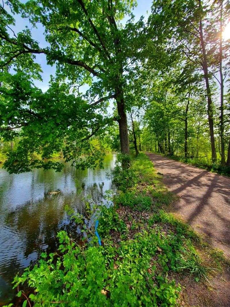
One of my greatest pleasures while running or biking the Delaware & Raritan Canal Trail is the incredible wildlife viewing opportunities that present themselves around every bend. The canal corridor functions as a protected habitat ribbon cutting through New Jersey, providing food, water, and shelter for species that have vanished from more developed areas.
I’ve logged hundreds of miles here, and I still get excited when spotting great blue herons stalking fish or beavers swimming at dusk.
The still waters of the canal itself support healthy fish populations that attract predatory birds. I’ve watched ospreys dive for catches, kingfishers perched on overhanging branches, and even bald eagles soaring overhead during winter months.
The surrounding wetlands and forests host white-tailed deer, red foxes, and countless smaller mammals that occasionally cross the trail during quieter hours.
Spring and fall migrations transform the canal into a birding hotspot. Warblers, thrushes, and other songbirds use the corridor as a rest stop during their journeys, creating spectacular viewing opportunities for anyone carrying binoculars.
I’ve started timing some of my trail visits specifically to coincide with peak migration periods, and the variety of species you can spot in a single morning is truly remarkable.
Reptiles and amphibians thrive in the canal’s aquatic environment. Painted turtles are everywhere, often stacked three or four deep on favorite sunbathing logs.
I’ve spotted snapping turtles, various snake species, and chorus frogs whose evening songs create a natural soundtrack. The ecological health of this corridor demonstrates how historic infrastructure can serve double duty as both recreational resource and wildlife habitat.
Seasonal Beauty and Year-Round Trail Access
I’ve experienced the Delaware & Raritan Canal Trail in every season imaginable, and each brings its own magic to these 70 miles of pathway. Spring explodes with wildflowers carpeting the banks in purple, yellow, and white blooms while trees leaf out in that brilliant fresh green that only lasts a few weeks.
Summer transforms the trail into a shaded tunnel where the tree canopy provides blessed relief from New Jersey’s heat and humidity, though I recommend early morning or evening rides when temperatures moderate.
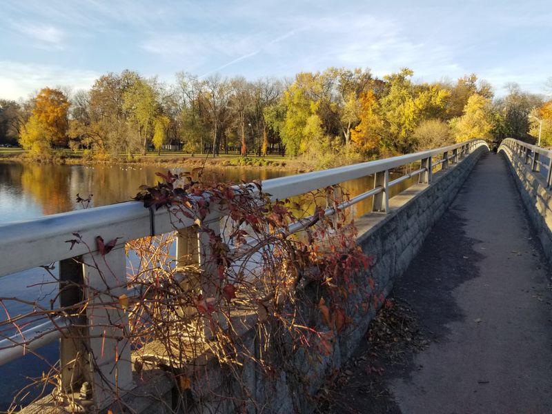
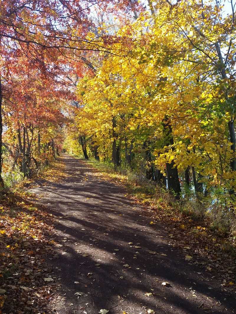
Autumn might be my favorite season here, when the corridor becomes a kaleidoscope of red, orange, and gold foliage. The still canal waters reflect the colors like a mirror, doubling the visual impact and creating photography opportunities that rival anywhere in the state.
Cooler temperatures make this prime time for longer rides or runs, and the trail sees heavy use from cyclists squeezing in final outdoor adventures before winter arrives.
Winter brings a completely different atmosphere to the canal. Snow transforms the towpath into a quiet wonderland where your footprints or tire tracks might be the only marks for miles.
I’ve cross-country skied sections after significant snowfalls, and the experience feels almost meditative in its peacefulness. Ice formations along the canal edges create natural sculptures, and winter birds like cardinals pop brilliantly against the white backdrop.
The trail remains open year-round, maintained by New Jersey State Parks regardless of season. This accessibility means you can build the Delaware & Raritan Canal into your regular fitness routine without worrying about seasonal closures.
Whether you’re training for events or simply seeking outdoor exercise, this path delivers consistent, reliable access to nature and history throughout the entire year.
Dear Reader: This page may contain affiliate links which may earn a commission if you click through and make a purchase. Our independent journalism is not influenced by any advertiser or commercial initiative unless it is clearly marked as sponsored content. As travel products change, please be sure to reconfirm all details and stay up to date with current events to ensure a safe and successful trip.