Twisty roads leading out to a Missouri spot nearly made me turn back. My phone insisted I was going the right way, but the trees kept closing in and the pavement kept narrowing.
Then the trees opened up, a small parking lot appeared, and thirty minutes later I was standing at the bottom of a sandstone canyon with damp walls rising over my head. This Missouri state park is barely an hour from the nearest major city, yet it feels like someone quietly hid a chunk of the Ozarks in the middle of the state.
Box canyons, shelter caves tucked under bluffs, a creek that gurgles along beside the trail, and enough switchbacks to make your legs remember the day. What surprised me most was how quiet it stayed, even on a Saturday with a full parking lot.
The canyon walls hold moisture long after rain, and the sandstone glows warm in the late afternoon light. I have gone back in three different seasons now, and each visit shows me something I somehow missed the time before.
Some places reward you once. This one keeps giving.
Sandstone Canyon Trail And Its Hidden Rock Rooms
My legs were already warm from the first descent when the trail dropped into a corridor of sandstone, and suddenly the air felt about ten degrees cooler. That temperature change is the giveaway.
You are entering the box canyons that give this park its reputation.
The Sandstone Canyon Trail runs roughly four miles as a full loop, and the first 0.6 miles is paved, which makes the opening stretch friendly for strollers, wheelchairs, and anyone easing into the day. After that, the surface turns to dirt, gravel, and plenty of exposed rock.
A connector trail sits about halfway around, letting you cut the hike down to somewhere near 2.5 miles if you want a shorter outing. I have used it once and regretted it, mostly because the second half holds some of the best rock shelters.
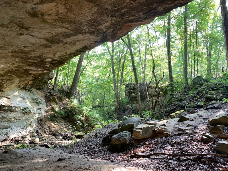
Those shelters look like shallow caves scooped out of the bluff face, with overhangs wide enough to duck under during a passing shower. Sandstone weathers unevenly, so you get honeycombed walls, small natural bridges, and ledges that catch the light in odd ways.
Trail markers are red blazes, and paying attention matters here. Countless unofficial side paths branch off toward the creek, and it is genuinely easy to wander onto one without noticing.
Hiking poles helped me on the steeper switchbacks, especially where wet leaves hid loose stone. Give yourself two hours minimum, longer if you plan to stop and stare, which you will.
LaBarque Hills Trail, The Quieter Half Of The Park
Most people turn one direction at the trailhead area and never see the other loop, which honestly works in your favor. LaBarque Hills Trail covers about 2.4 to 2.6 miles and carries a fraction of the foot traffic.
On my last visit I passed exactly two other hikers.
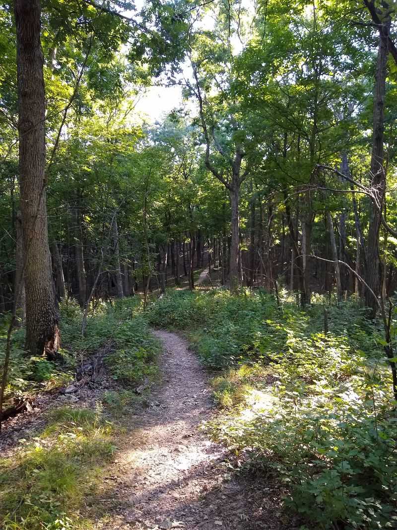
The route threads through bottomland forest first, where the ground stays soft and the tree trunks grow tall and straight. Then it climbs into upland woods with drier soil, more stone underfoot, and pockets of native shortleaf pine.
Elevation changes come in short bursts rather than long grinds, so it feels more like rolling terrain than a serious climb. Still, you will notice your breathing on a couple of pitches.
Rock formations show up here too, and one section includes a cave opening that always makes hikers pause for photos. The scale is smaller than the canyon loop, but the sense of discovery is arguably stronger because there is nobody around narrating it for you.
Birdsong carries better on this side. Spring mornings bring wood thrush, summer tanagers, and blue-gray gnatcatchers moving through the canopy, and the park counts over 650 plant species across its acreage.
Pairing both trails in one day adds up to roughly six and a half miles, which makes for a satisfying but full outing. If you only have ninety minutes, this is the loop I would choose for solitude.
How An Inventor’s Dream Became 800 Acres Of Public Land
Here is the part of the story I did not expect. This park exists because a St. Louis businessman named Don Robinson made his money selling a cleaning product called Off, then spent decades buying up rugged ground in Jefferson County.
Starting in the 1960s, he kept adding parcels with a specific goal in mind. He wanted a property that would rival the size of Central Park in New York City.
When Robinson died in 2012, he left the land to the State of Missouri instead of selling it off for development. The park opened to the public in 2017, which makes it one of the newest additions to the state park system.
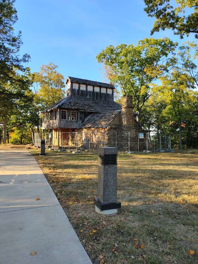
His rustic home, built back in 1928, still stands within the park boundaries. Restoration work has been ongoing, and walking past it feels like stumbling onto a piece of someone’s private world that was quietly handed to the rest of us.
Knowing that backstory changed how I looked at the ridgelines. Those bluffs and canyons were not saved by accident or by a government survey deciding they had scenic value.
One person looked at steep, hard-to-farm land full of rock and decided it was worth protecting. Roughly 800 acres now sit inside the upper watershed of LaBarque Creek because of that decision.
I find myself mentioning it to friends before I mention the trails, and they are always surprised.
LaBarque Creek, Small Waterfalls, And The Best Time To Catch Them
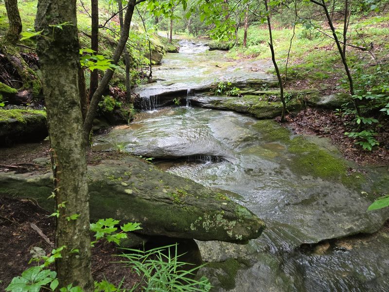
Water is the reason this landscape looks the way it does, and LaBarque Creek is the artist. It has been slicing through soft sandstone for a very long time, carving the ravines and canyons that hikers now scramble around.
The creek ranks as a high-quality stream and supports 42 species of fish, which is impressive for a waterway this close to a major metro area. Crouching down to watch minnows dart between shaded pools became one of my favorite pauses on the loop.
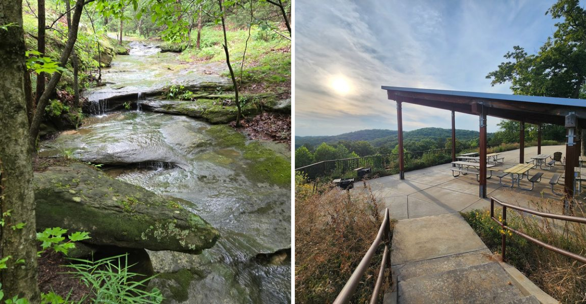
Timing makes an enormous difference. Show up a day or two after a good rain and you will find small waterfalls spilling over ledges, wet rock glistening, and the sound of moving water following you along the trail.
Come during a dry stretch in August and those same spots sit silent and dusty. I learned that the hard way one late summer afternoon.
Winter has its own reward. Freezing temperatures turn the seeps and drips into columns of ice, and hikers regularly report seeing dozens of frozen falls along the canyon route.
Spring brings wildflowers and the strongest flow, which is why March through May is my top recommendation. Waterproof shoes help, since you will cross the creek in places.
Take a moment to look for four-toed salamanders near the wet mossy edges, though they are shy. Partridge berry grows here too, another state-listed species quietly holding on.
Parking, Restrooms, And The Practical Stuff Nobody Warns You About
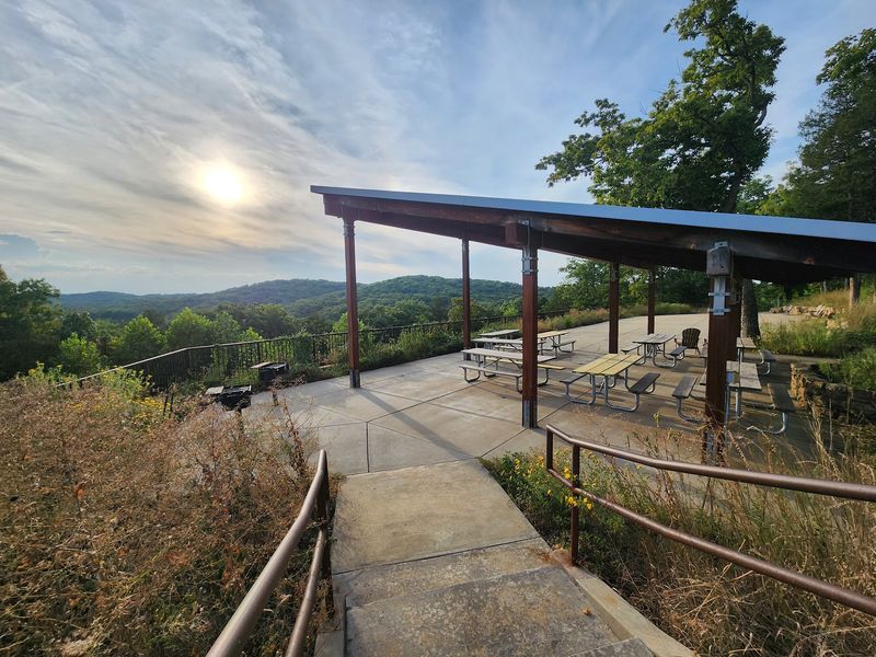
Let me save you some frustration. Parking is limited, with roughly 72 spots spread across the paved lot and an additional gravel lot near the exit, and weekend mornings fill up fast.
Arriving before nine or after three worked best for me. On a bright fall Saturday I circled twice before someone pulled out.
The windy approach roads deserve a mention too. Depending on where you start in the St. Louis area, the drive can be under forty minutes, but the last stretch involves plenty of curves, so factor that in if anyone in your car gets queasy.
Near the main lot you will find restrooms, a picnic shelter with tables, and a large patio with chairs that looks out over the valley. Benches along the overlook area make an excellent spot to cool down after the loop.
Trash cans are not provided, so plan on carrying out everything you bring in. I keep a spare bag in my daypack for exactly this reason.
Water availability can be inconsistent, with a spigot behind the restrooms but drinking fountains sometimes shut off. Bringing your own supply is the safer move.
RV camping is not offered, though a special-use group campground exists for organized groups. Dogs are welcome on leash, and I have seen plenty of happy trail dogs here.
Packing a picnic to enjoy afterward turns a two-hour hike into a genuinely relaxing half day.
Choosing Your Season For The Most Rewarding Visit
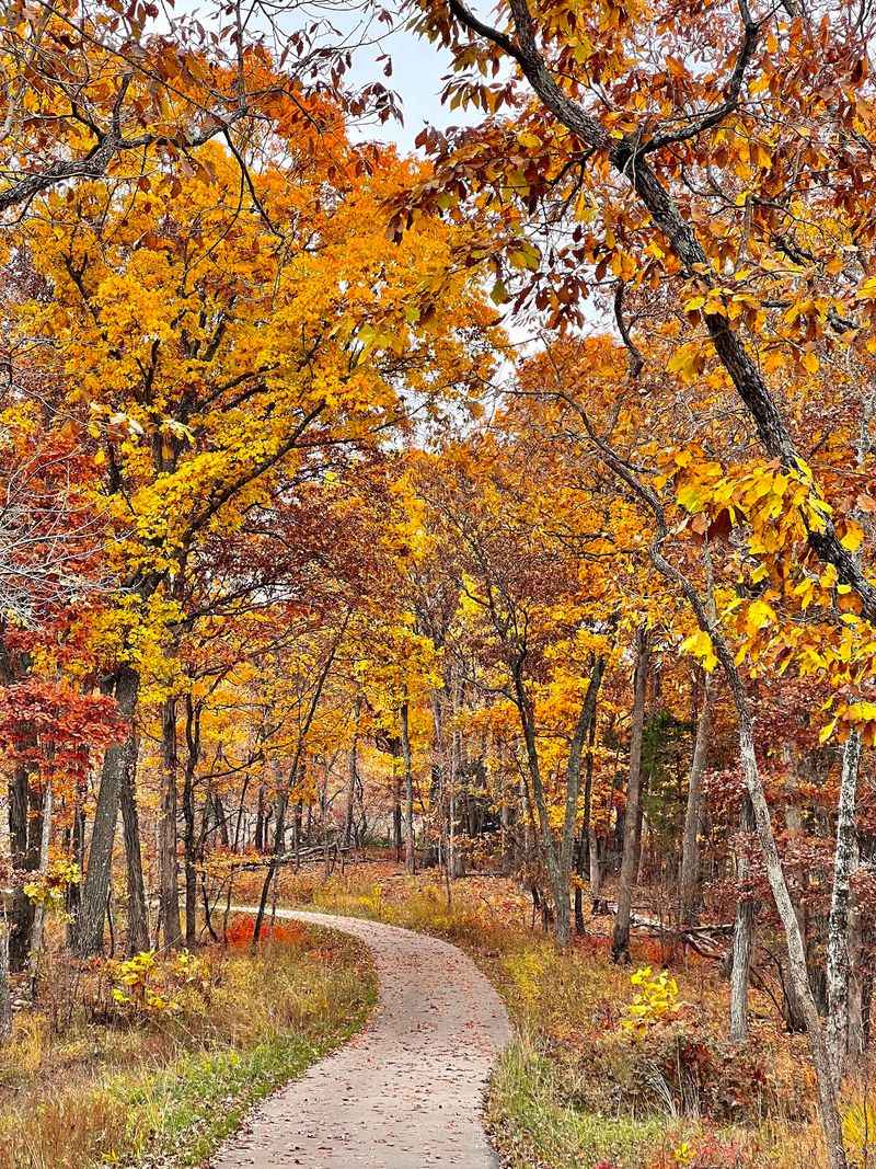
Four visits across different months taught me that this park practically reinvents itself with the calendar. Each season hands you a completely different version of the same trails.
Spring is the showstopper. Wildflowers bloom along the open paved section, migratory songbirds arrive, the creek runs full, and the canyon walls turn deep green with moss and fern growth.
Summer brings dense shade in the bottomlands, which helps, but the canyons can feel humid and the water features often shrink to trickles. Early morning starts make a real difference in July and August.
Autumn might be my personal favorite for the overlook alone. When the hardwoods turn, the view across the valley from the benches near the trailhead is worth the drive by itself, and cooler air makes the switchbacks far more pleasant.
Winter strips the leaves away and reveals the rock in a way no other season does. You can see the bluff lines clearly, spot frozen seeps, and hike without another soul in sight, though mud and lingering snow patches call for careful footing.
Whatever month you pick, sturdy shoes matter more than anything else in your pack. The mix of loose rock, roots, and creek crossings punishes flimsy sneakers.
Turn your phone off for a stretch and just listen. Woodpeckers, wind through the pines, and running water make a better soundtrack than anything on your playlist.
Address: 9275 Byrnesville Road, Cedar Hill, Missouri
