Some Oklahoma swimming holes have more beneath the surface than you’d expect. Lake Eufaula, the state’s largest reservoir, hides more than just fish and old boat anchors under its shimmering waves.
Before this massive body of water existed, entire communities, roads, and pieces of history thrived where boaters now cruise and swimmers splash.
Most visitors have no clue they’re floating above forgotten towns, submerged bridges, and remnants of a world that disappeared when the dam gates closed in the 1960s.
What stories could these underwater ruins tell if they could speak? Let’s explore the fascinating sunken secrets that make this Oklahoma gem far more intriguing than your average lake day.
The Towns That Vanished Beneath the Waves
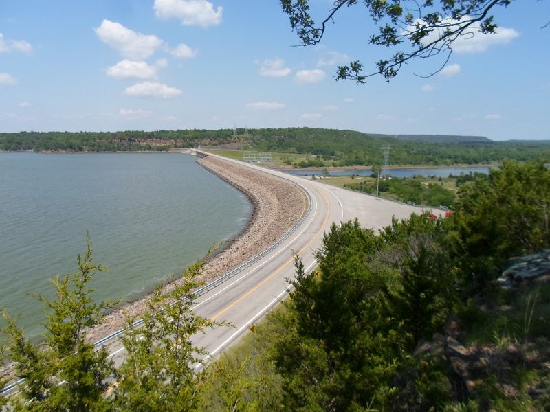
When the U.S. Army Corps of Engineers decided to dam the Canadian River in the early 1960s, entire communities faced an impossible choice.
Families packed up generations of memories, loaded belongings onto trucks, and watched as bulldozers razed the only homes they’d ever known. Small settlements like Onapa and parts of other rural communities simply ceased to exist above water.
Residents relocated to higher ground, but the foundations of their former lives remained below. Old home sites, barn foundations, and even parts of cemeteries that couldn’t be moved in time now rest quietly on the lake floor.
During severe droughts when water levels drop dramatically, eerie remnants sometimes peek through the surface like ghosts from another era.
Divers occasionally explore these submerged ruins, discovering bricks, old farming equipment, and traces of roads that once connected neighbors. Fishermen report snagging lines on unexpected structures far from any visible shore.
These underwater neighborhoods serve as haunting reminders that Lake Eufaula’s recreational paradise came at a significant cost to the people who called this valley home.
Local historians work to preserve stories from displaced families, ensuring their heritage isn’t completely forgotten beneath the waves. Oral histories reveal heartbreaking tales of leaving beloved family farms and the tight-knit communities that supported each other through Oklahoma’s toughest times.
Bridges to Nowhere Under the Surface
Scattered across Lake Eufaula’s floor lie the skeletons of old bridges that once connected rural Oklahoma communities. These structures carried farmers to market, children to school, and families to church every Sunday.
When the reservoir filled, engineers removed some bridge decking for safety, but many support structures and approach roads were simply left to sink.
Modern boaters navigating by GPS have no idea they’re passing directly over these engineering relics. Some bridges date back to the early 1900s, built with craftsmanship that’s rarely seen today.
Their concrete pillars and steel supports create artificial reefs now, attracting schools of crappie, bass, and catfish that shelter in the shadowy structures.
Smart anglers study old county maps to locate these sunken bridges, knowing they’re prime fishing spots. The underwater architecture disrupts current flow and creates perfect ambush points for predatory fish.
During low water years, portions of bridge railings and approach ramps occasionally break the surface, startling unsuspecting kayakers.
One particularly famous submerged bridge near the dam area was once part of a main thoroughfare connecting several towns.
Locals who remember crossing it decades ago sometimes point out its location to younger generations, sharing memories of a landscape that exists only in photographs and recollections now.
The Flooded Cemetery Controversy
Perhaps no aspect of Lake Eufaula’s creation stirred more emotion than the cemeteries that fell within the flood zone. Families faced the agonizing decision of whether to relocate their ancestors’ graves or allow them to rest beneath the coming waters.
Most chose relocation, but not every grave could be found or moved in time.
Unmarked burial sites, forgotten pioneer graves, and sections of old family plots likely remain submerged today. This reality troubles some local residents who view the lake with mixed feelings, appreciating its recreational value while mourning the disruption of sacred ground.
Older generations still speak quietly about relatives whose final resting places now lie underwater.
The Corps of Engineers made extensive efforts to identify and relocate graves before flooding began, but rural Oklahoma cemeteries weren’t always well documented. Some burial grounds had served small communities for generations without formal records or maintained markers.
Vegetation and time had obscured many sites by the 1960s.
Today, respectful divers occasionally encounter stone markers or cemetery features during low visibility dives in certain areas. These discoveries serve as sobering reminders of the human cost behind Oklahoma’s largest lake.
Local historical societies maintain records of relocated cemeteries and work to honor the memory of those whose graves were disturbed by progress.
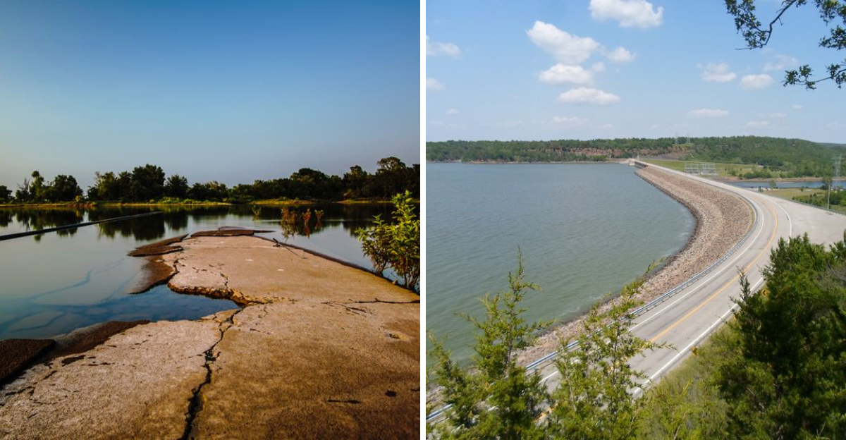
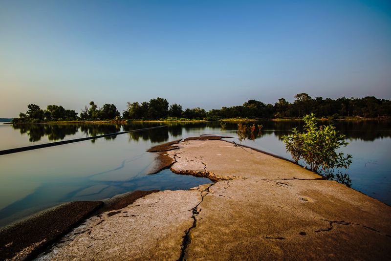
Submerged Roads That Once Connected Communities
Beneath Lake Eufaula’s surface lies an entire network of country roads that once crisscrossed the Canadian River valley. These weren’t major highways but the humble dirt and gravel routes that connected farmhouses, general stores, and small-town squares.
Families traveled these roads for decades, creating memories with every mile.
When lake levels drop significantly during drought conditions, portions of these old roadbeds sometimes emerge from the water like time travelers from the past. Tire ruts worn deep by decades of Model Ts and farm trucks become briefly visible again before the next rain cycle covers them once more.
It’s a strange and moving sight for anyone who remembers when these routes bustled with activity.
Some roads led to one-room schoolhouses, others to fishing holes along the original Canadian River, and still others to churches that served as community anchors.
GPS mapping technology has allowed historians to overlay old county road maps onto modern Lake Eufaula charts, revealing just how extensively the valley was settled before the dam project began.
Scuba enthusiasts with an interest in history sometimes follow these underwater roads, discovering where they lead and imagining the lives of people who traveled them daily.
The experience offers a unique perspective on how dramatically Oklahoma’s landscape transformed in just a few short years during the 1960s.
The Original Canadian River Channel
Before Lake Eufaula existed, the Canadian River flowed freely through eastern Oklahoma, carving a natural channel that had existed for thousands of years. This river sustained Native American communities, early settlers, and countless generations of wildlife.
Its banks witnessed Oklahoma history from territorial days through statehood and beyond.
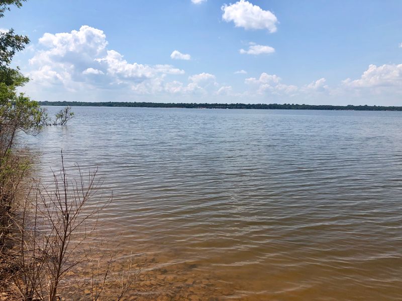
That original river channel still exists beneath the reservoir, now serving as the deepest part of the lake. Boaters cruising across seemingly uniform water have no idea they’re directly above what was once a flowing river with its own personality, seasonal floods, and ecological rhythms.
The channel’s depth makes it a favored route for large catfish and other bottom-dwelling species.
Old-timers who fished the Canadian River before the dam remember its sandbars, swimming holes, and the particular way it smelled after summer rains. They describe a very different landscape than today’s expansive lake, one that felt wild and unpredictable.
The river could rage during spring floods or dwindle to isolated pools during August heat.
Topographical maps of the lake floor reveal the snaking path of the original river, complete with oxbows and tributary junctions. Understanding this hidden geography helps anglers predict fish behavior and locate productive spots.
The submerged channel represents the lake’s foundation, the ancient river that made everything else possible.
Lost Farmland and Agricultural Heritage
Thousands of acres of productive farmland disappeared beneath Lake Eufaula when the reservoir filled. These weren’t just empty fields but working farms that had sustained families through the Great Depression, Dust Bowl, and World War II.
Generations had planted cotton, corn, and wheat in soil their grandparents had first plowed.
Farmers knew every inch of their land, from which sections held moisture longest to where the best fishing worms could be dug. They understood the land’s moods and seasons in ways that can’t be replicated elsewhere.
Relocating meant starting over, often on less familiar or less productive ground.
Submerged fence lines still exist on the lake bottom, marking property boundaries that once sparked neighborly debates and handshake agreements. Old barbed wire, wooden posts, and stone markers rest where they were placed decades or even a century ago.
These humble artifacts tell stories of hard work, hope, and the agricultural heritage that built rural Oklahoma.
Some displaced farming families received compensation for their land, but money couldn’t replace the emotional connection to places where children had been raised and where ancestors were buried.
Today’s lake visitors enjoying water sports rarely consider that they’re playing above what were once carefully tended fields and pastures.
Historical photographs preserved in local museums show these farms in their prime, offering glimpses of the productive landscape that preceded Oklahoma’s largest reservoir.
Archaeological Sites Now Underwater
Long before European settlers arrived, Native American communities thrived along the Canadian River valley. Archaeological evidence suggests human habitation stretching back thousands of years.
These ancient peoples left behind artifacts, campsites, and traces of their daily lives, many of which now rest beneath Lake Eufaula’s waters.
Before the dam project proceeded, archaeologists conducted surveys to document and recover significant artifacts. They found projectile points, pottery fragments, and evidence of seasonal camps where indigenous peoples had gathered for centuries.
However, time and budget constraints meant not every site received thorough investigation before flooding began.
Underwater archaeology in reservoirs is challenging and expensive, so many sites remain unexplored on the lake bottom. Occasionally, drought conditions expose previously submerged areas where sharp-eyed visitors discover arrowheads and stone tools eroding from ancient soil layers.
These finds offer tantalizing hints about the rich cultural heritage hidden beneath recreational waters.
The flooding of these archaeological sites represents an irreplaceable loss to understanding Oklahoma’s deep history. While modern technology like side-scan sonar could potentially map underwater sites, few resources exist for such projects.
Native American descendants sometimes express sadness that ancestral lands and culturally significant locations now lie inaccessible beneath the reservoir.
Preserving knowledge about these submerged sites remains important for honoring the complete history of the Lake Eufaula region, from its earliest inhabitants through today’s visitors seeking weekend recreation.
Dear Reader: This page may contain affiliate links which may earn a commission if you click through and make a purchase. Our independent journalism is not influenced by any advertiser or commercial initiative unless it is clearly marked as sponsored content. As travel products change, please be sure to reconfirm all details and stay up to date with current events to ensure a safe and successful trip.