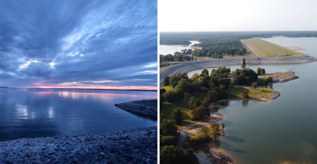
This lake in Oklahoma sits among rugged mountain scenery, and if you’ve ever stood along its shoreline, you already know how striking it can be. But lately, it’s been telling a different story, one marked by pale, exposed rock and wide stretches of mud where water once shimmered.
The receding water has left visible rings along the banks, like a bathtub that’s been slowly draining over time. Activities like fishing, camping, stargazing, and hiking have long made this a favorite escape, which is why the changing water levels feel impossible to ignore.
There’s more going on here than meets the eye, and once you start looking closer, the story becomes hard to overlook.
The Origins of Sardis Lake and Why It Was Built
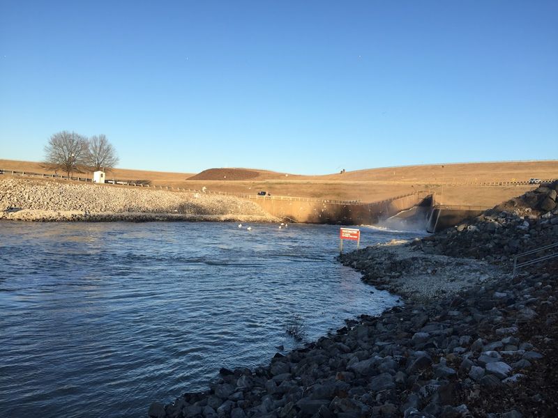
Long before the waterlines began their slow retreat, Sardis Lake was a deliberate creation with a clear purpose. The U.S.
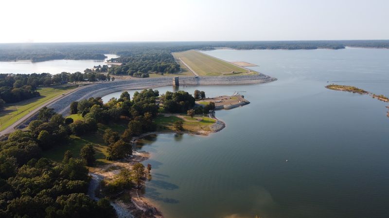
Army Corps of Engineers constructed Sardis Dam on Jackfork Creek in Pushmataha County, Oklahoma, completing the project in 1977. The reservoir was designed primarily for water supply, flood control, and recreation, making it one of the more versatile lakes in the region.
The lake covers approximately 14,360 surface acres at full pool, which gives you a sense of just how massive this body of water really is. It stretches across terrain shaped by the ancient Ouachita Mountains, where rolling hills and dense forests frame the shoreline on nearly every side.
What makes Sardis unique among Oklahoma reservoirs is its designation as a future water supply source for the Oklahoma City metropolitan area. That agreement, negotiated over decades, gave the lake a special protected status that influenced how it has been managed ever since.
Understanding this backstory helps explain why water levels here are watched so closely by both state officials and everyday visitors who simply love spending time on the water.
What the Waterlines Actually Reveal
Stand at almost any point along the Sardis Lake shoreline today, and the story is right there in plain sight. Bands of pale, mineral-stained rock trace the old waterline like rings on a tree stump, each one marking a different chapter in the lake’s recent decline.
Some of these marks sit several feet above the current surface, which is a sobering thing to see up close.
During periods of prolonged drought, which Oklahoma has experienced with increasing frequency, the lake drops well below its conservation pool elevation of 599 feet above sea level.
When that happens, boat ramps that once sat at the water’s edge end up stranded on dry land, and formerly submerged stumps and creek channels reappear like relics from the past.
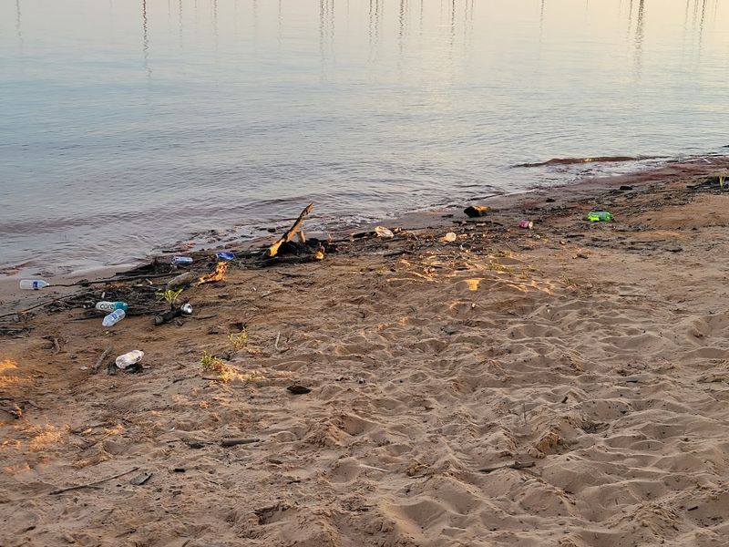
The exposed mudflats along the upper lake arms are particularly striking. Cracked earth, dried vegetation, and the occasional forgotten anchor mark the spots where houseboats and ski boats once floated freely.
Drought and climate variability have been the primary drivers of this decline, and the waterlines serve as a quiet but powerful record of every dry season the lake has endured.
The Ouachita Mountain Setting That Still Takes Your Breath Away
Even with reduced water levels, the landscape around Sardis Lake remains genuinely spectacular. The Ouachita Mountains provide a backdrop that feels almost cinematic, with forested ridgelines rising above the water and dense stands of pine and hardwood covering nearly every hillside in view.
Southeastern Oklahoma does not always get the credit it deserves as a scenic destination, but this corner of the state has a raw, unhurried beauty that surprises first-time visitors.
The Potato Hills area, which sits near the Potato Hills Central campground, is especially striking, with rugged terrain and long views that stretch across the reservoir toward distant ridges.
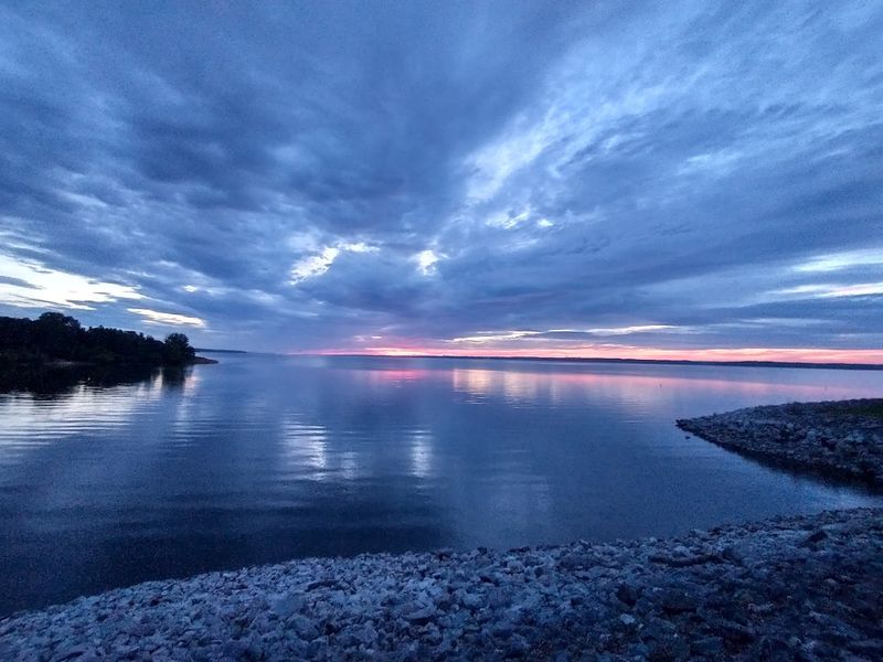
Sunrise and sunset over Sardis Lake are the kinds of moments that make you reach for your camera before your brain even registers what you are seeing. The water picks up color fast, turning from silver to gold to deep orange as the light shifts.
On calm mornings, the reflection of the tree-lined banks creates a mirror effect that makes the whole scene feel doubled in beauty. Whatever the water level may be, the setting itself has not lost a single inch of its appeal.
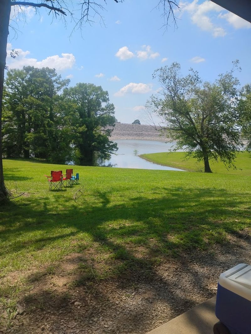
Camping at Sardis Lake and Why It Draws Repeat Visitors
Camping at Sardis Lake has a reputation that spreads mostly by word of mouth, and once you spend a night here, it is easy to understand why people keep coming back. The Potato Hills Central campground, managed by the U.S.
Army Corps of Engineers, consistently earns praise for its cleanliness, spacious sites, and remarkably peaceful atmosphere.
Each campsite comes equipped with electric hookups and its own water connection, which is a level of convenience that not every Corps of Engineers campground offers. Many sites also have a covered picnic table, which makes a huge difference during the blazing Oklahoma summer afternoons.
The shade trees throughout the campground are mature and generous, keeping temperatures noticeably cooler than the open fields nearby.
What sets Sardis apart from busier Oklahoma lakes is the quiet. There are no generators roaring through the night, no chaotic crowds spilling between sites, and no sense that the place has been loved past its limits.
Walk-in tent sites near the top of the dam offer bathroom facilities, a boat ramp, and stunning lake views with minimal foot traffic. For anyone who values a calm, well-managed camping experience in a genuinely beautiful natural setting, Sardis Lake delivers consistently.
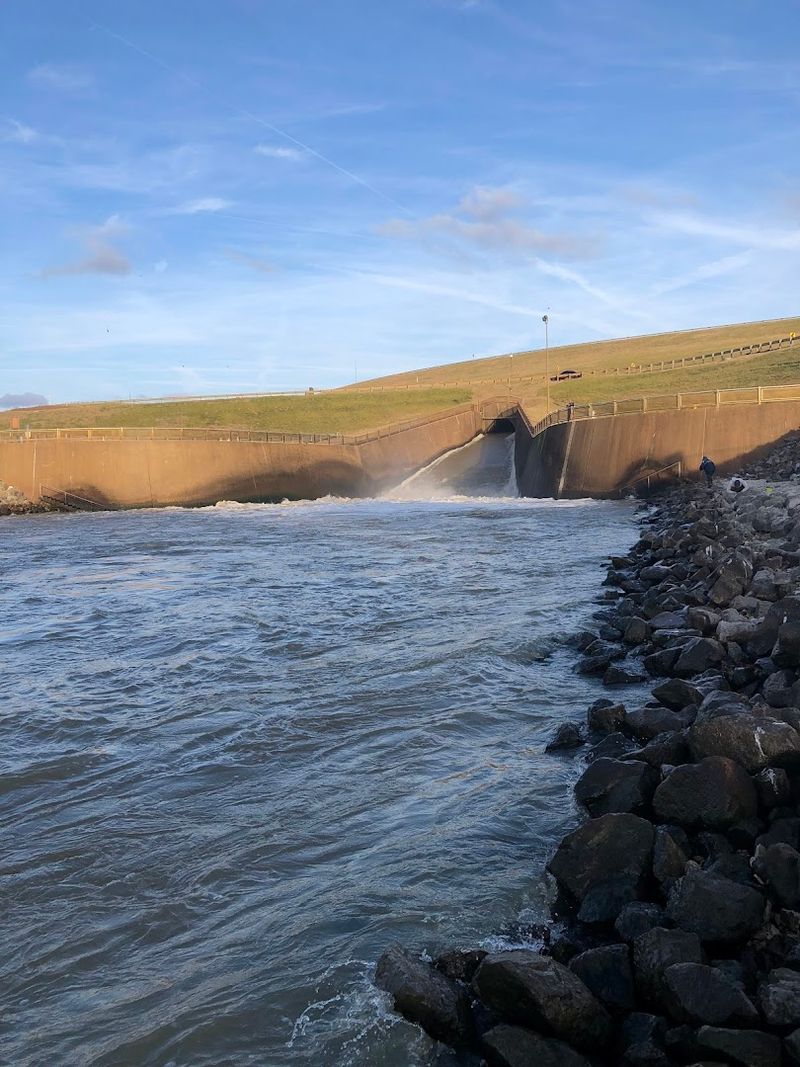
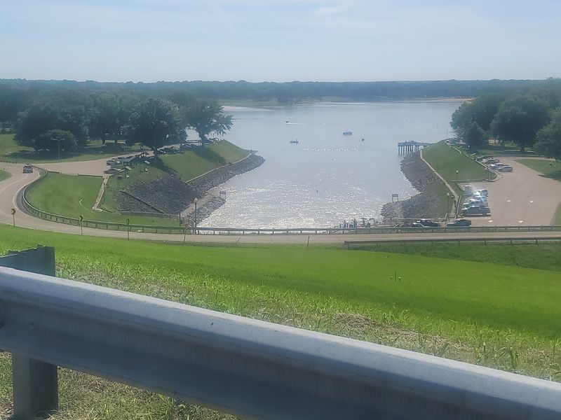
Fishing the Lake and the Spillway Below the Dam
Fishing at Sardis Lake covers two very different experiences depending on where you drop your line. Up on the main lake, largemouth bass, crappie, catfish, and white bass are the primary targets, and the lake’s coves and submerged structure give fish plenty of places to set up.
The upper lake arms, even when water levels are lower than normal, still hold productive habitat.
Below the dam, the spillway area offers a completely different kind of fishing. The water here tends to run cooler and clearer, and the rocky banks provide solid footing for bank anglers who prefer to stay out of a boat.
Game wardens in the area are known for being approachable and helpful, which makes the experience feel more welcoming for anglers who are new to the lake.
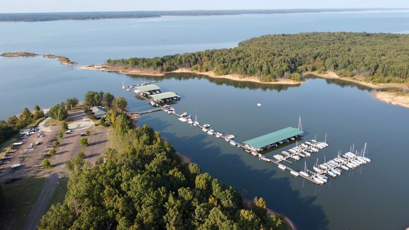
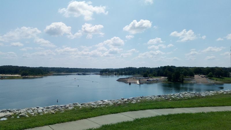
Boat ramps at Beach Landing and Engineers Point are well-designed Corps of Engineers facilities that make launching straightforward, even for larger vessels.
The main challenge during low-water periods is finding ramps that still reach the waterline, so checking current lake levels before a trip is always worth the extra few minutes.
When conditions cooperate, Sardis Lake rewards patient anglers with a peaceful, uncrowded fishing experience that is hard to replicate at more popular Oklahoma reservoirs.
Boating, Skiing, and Water Sports on a Big Oklahoma Reservoir
Sardis Lake is genuinely big. I spent hours on a pontoon boat and still did not cover the entire lake, which tells you something about the scale of this reservoir.
At full pool, the open water stretches far enough to give boaters real room to move, making it a favorite for water skiing, wakeboarding, and casual cruising.
The upper lake tends to attract more ski boats and recreational watercraft, while the lower lake near the dam draws anglers and those looking for a quieter paddle.
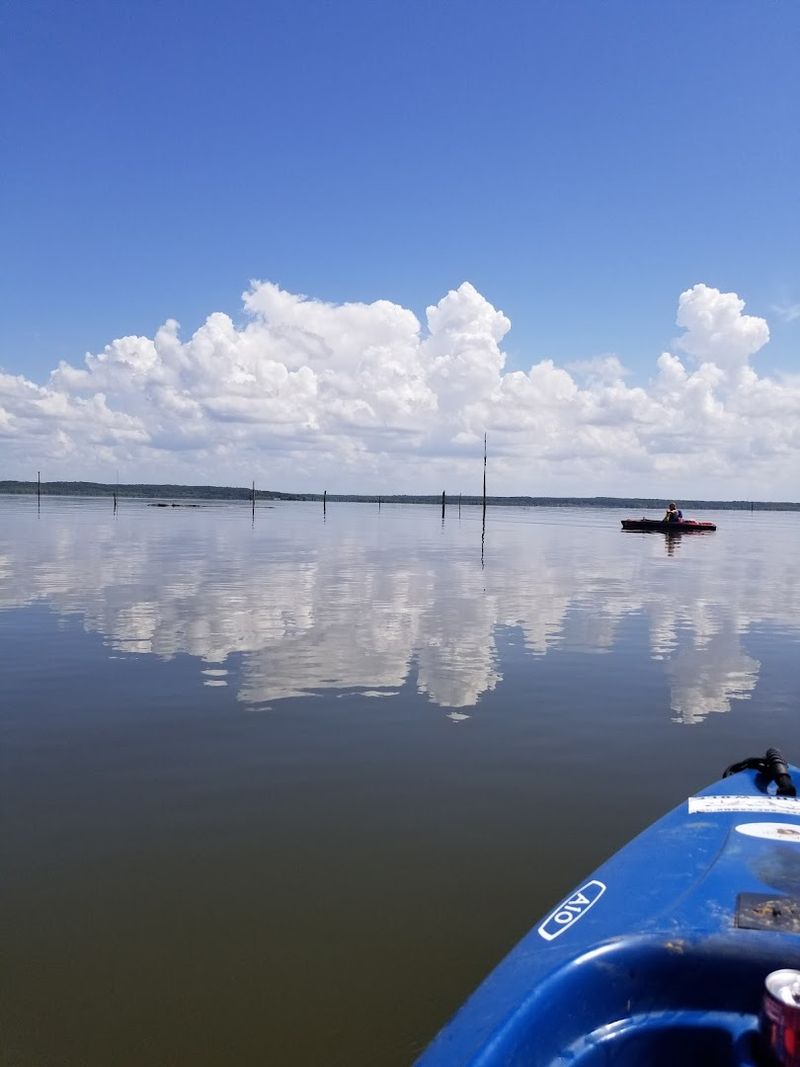
Kayaking and canoeing are popular options for people who want to explore the coves and inlets at a slower pace, and the calm morning hours before the ski boats arrive make for ideal paddling conditions.
Water sports activity does slow down when lake levels drop significantly, since shallow areas expand and some familiar channels become unreliable for deeper-draft boats. Still, the lake maintains enough depth in its central basin to support most recreational boating even during moderate drought conditions.
Checking the current pool elevation before trailering your boat out is a smart habit that saves frustration and protects both your equipment and the lake’s sensitive shoreline areas from unnecessary impact.
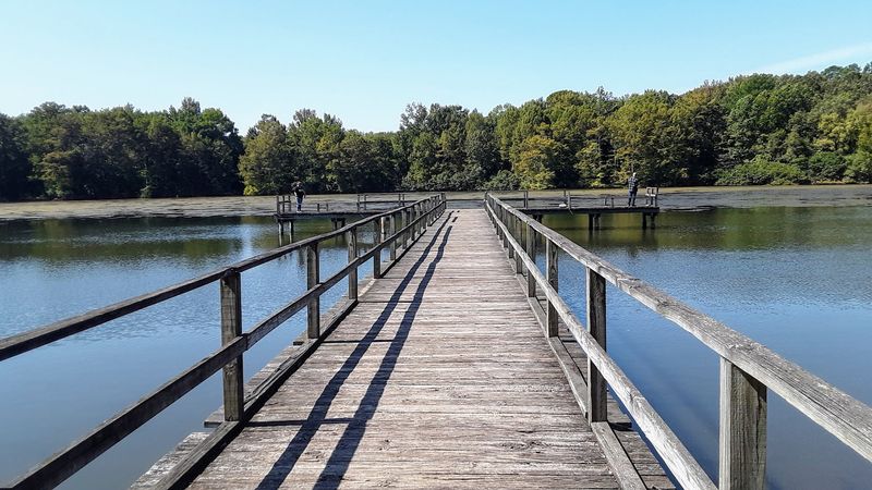
The Nature Trail Over the Swamp That Surprises Everyone
Most people come to Sardis Lake expecting water, boats, and campfire smoke, and they get all of that. What catches them off guard is the nature trail that winds through the back of the park and takes you directly over a swamp on an elevated boardwalk.
It is one of those features that sounds ordinary until you are actually standing on it.
The trail passes through a wetland ecosystem that feels completely separate from the open lake just a short walk away. Cypress-like trees, dense undergrowth, and the sounds of frogs and birds create an atmosphere that leans more toward Louisiana bayou than central Oklahoma.
The boardwalk keeps your feet dry while giving you an eye-level view of the swamp that you simply cannot get from the bank.
At night, the trail transforms into something almost otherworldly. When I walked it after dark, I looked up and saw a sky packed with stars, the branches overhead framing the Milky Way like a natural skylight.
The lake’s remote location away from major urban centers means light pollution is minimal, and the dark sky above Sardis Lake is one of its most underrated and genuinely memorable features for anyone willing to stay past sunset.
Stargazing Above Sardis Lake Is Genuinely Spectacular
One of the most unexpected pleasures of a visit to Sardis Lake is what happens after the sun goes down.
The lake sits far enough from major Oklahoma cities that the night sky above it remains genuinely dark, and on clear nights, the Milky Way stretches from horizon to horizon in a way that feels almost surreal if you are accustomed to city skies.
Campers at the Potato Hills Central campground have spotted satellite clusters crossing the sky, watched meteor showers without any light interference, and seen the kind of star density that most people only encounter in photographs.
The absence of generator noise and artificial lighting throughout the campground makes the experience feel even more immersive.
Stargazing at Sardis does not require any special equipment, though a simple pair of binoculars opens up a remarkable amount of detail in the night sky. The best viewing tends to happen on moonless nights between late spring and early fall, when the air is clear and the humidity has settled.
Bringing a reclining chair or a sleeping pad to lie on while looking straight up is the kind of low-effort, high-reward move that turns a good camping trip into one you talk about for years afterward.
Picnicking, Playgrounds, and Family-Friendly Spaces Around the Lake
Sardis Lake has always been a family destination, and the infrastructure around the lake reflects that clearly. Picnic areas with shaded pavilions are scattered throughout the park, giving families a comfortable place to spread out without fighting the Oklahoma heat.
The pavilions are sturdy, well-maintained, and positioned close enough to the water to catch a breeze on warm afternoons.
Playground equipment is available near several of the main day-use areas, which keeps younger visitors occupied while adults handle the grill or set up fishing gear.
The combination of open grassy areas, shade trees, and easy water access makes Sardis a natural choice for birthday gatherings, family reunions, and casual weekend outings that need a little more space than a city park can offer.
Swimming areas provide a safe place for kids to splash around, and the lake’s calm coves are far enough from the main boating channels to feel relaxed and manageable. Families who pack a full day’s worth of food and activities rarely run out of things to do before the sun starts to set.
The sheer variety of options, from hiking to fishing to simply sitting under a tree and watching the water, makes Sardis Lake one of southeastern Oklahoma’s most reliably enjoyable day-trip destinations.
The Water Supply Agreement That Shapes the Lake’s Future
Few visitors standing at the Sardis Lake shoreline realize that the water beneath their feet is at the center of one of Oklahoma’s most significant water rights disputes.
Decades ago, the state negotiated an agreement that designated Sardis Lake as a future water supply source for the Oklahoma City metropolitan area, located roughly 150 miles to the northwest.
That agreement has been contested, renegotiated, and scrutinized repeatedly over the years, particularly by communities in southeastern Oklahoma who argue that exporting water from their region would cause long-term harm to local ecosystems, economies, and quality of life.
The Choctaw Nation of Oklahoma has also been an active voice in these discussions, asserting tribal water rights that add another layer of legal and cultural complexity to the debate.
The declining waterlines at Sardis Lake have made these conversations more urgent. When visible evidence of water loss is etched into the limestone banks for every visitor to see, abstract policy debates start to feel very concrete.
Whether water from the lake could eventually be used by Oklahoma City or remains in Pushmataha County, the outcome of this dispute will shape Sardis Lake’s future in ways that go far beyond recreation or scenery. It is a story about resources, rights, and what Oklahoma values most.
Drought’s Impact on the Lake and What It Means Going Forward
Oklahoma has always known drought. The state sits in a climatic zone where wet years and dry years trade places with little warning, and Sardis Lake has absorbed the full weight of that variability.
During extended dry periods, the lake can drop several feet below its conservation pool, shrinking visibly and leaving behind the pale waterline stains that now mark its banks like a timeline.
The practical effects of low water are significant. Boat ramps become unusable, fishing habitat shifts as shallow areas dry out, and campground access near the water’s edge becomes limited.
Businesses and visitors who depend on a full lake for their plans face real disruptions that no amount of optimism can fully offset.
Climate projections for the southern Great Plains suggest that drought conditions may become more frequent and more intense over the coming decades, which places reservoirs like Sardis Lake in an increasingly difficult position.
Managing a lake that serves both recreational and water supply purposes during periods of chronic low rainfall requires careful planning and honest public conversation.
The waterlines at Sardis are not just a scenic curiosity; they are a measurement of a challenge that Oklahoma, and many other states, will need to address seriously and soon.
Planning Your Visit to Sardis Lake Today
Sardis Lake is located in Pushmataha County in southeastern Oklahoma, accessible via Highway 2 south of the town of Clayton. The Potato Hills Central campground is one of the primary managed areas, run by the U.S.
Army Corps of Engineers, and reservations can be made through the Recreation.gov platform ahead of busy holiday weekends.
Spring and fall are the most comfortable seasons to visit, with mild temperatures and lower humidity making outdoor activities far more enjoyable than the peak summer heat.
Summer remains popular for boating and water sports, but arriving early in the morning helps you beat both the heat and the boat traffic on the main lake.
Before heading out, checking the current lake elevation on the U.S. Army Corps of Engineers Tulsa District website is a practical step that saves surprises at the boat ramp.
Nearby attractions worth combining with a Sardis visit include the Ouachita National Forest and the small town of Talihina, which sits about an hour’s drive east and offers its own scenic appeal.
For anyone who has not yet made the trip to this corner of Oklahoma, Sardis Lake remains a destination that earns its reputation every single time the conditions align.
Dear Reader: This page may contain affiliate links which may earn a commission if you click through and make a purchase. Our independent journalism is not influenced by any advertiser or commercial initiative unless it is clearly marked as sponsored content. As travel products change, please be sure to reconfirm all details and stay up to date with current events to ensure a safe and successful trip.