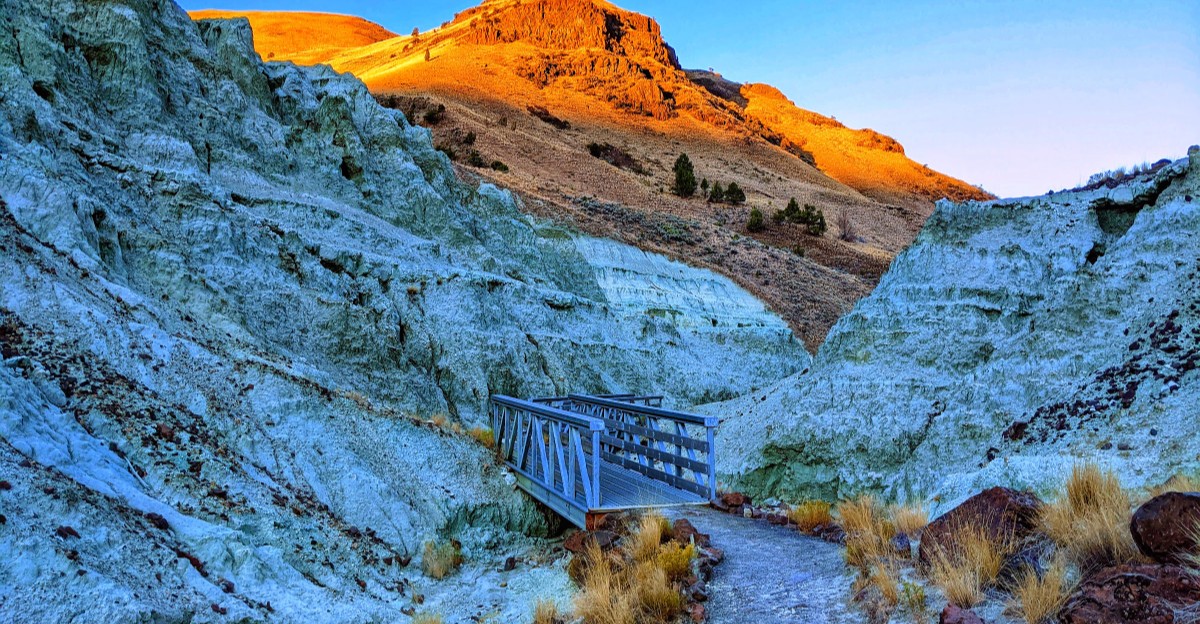
The hills here are green. Not grass green, but a minty, seafoam shade that looks like someone tinted the whole canyon with a highlighter.
That color comes from volcanic ash that fell roughly 28 to 30 million years ago. Over time, the ash hardened into soft rock, and minerals like celadonite gave it that strange blue-green glow.
I like how this place in eastern Oregon feels both ancient and a little sci-fi. A short gravel path leads you straight into the colorful walls, with metal bridges and fossil replicas along the way.
The best part? You don’t have to be a serious hiker to see it up close.
Those Wild Colors Have A Very Real Explanation
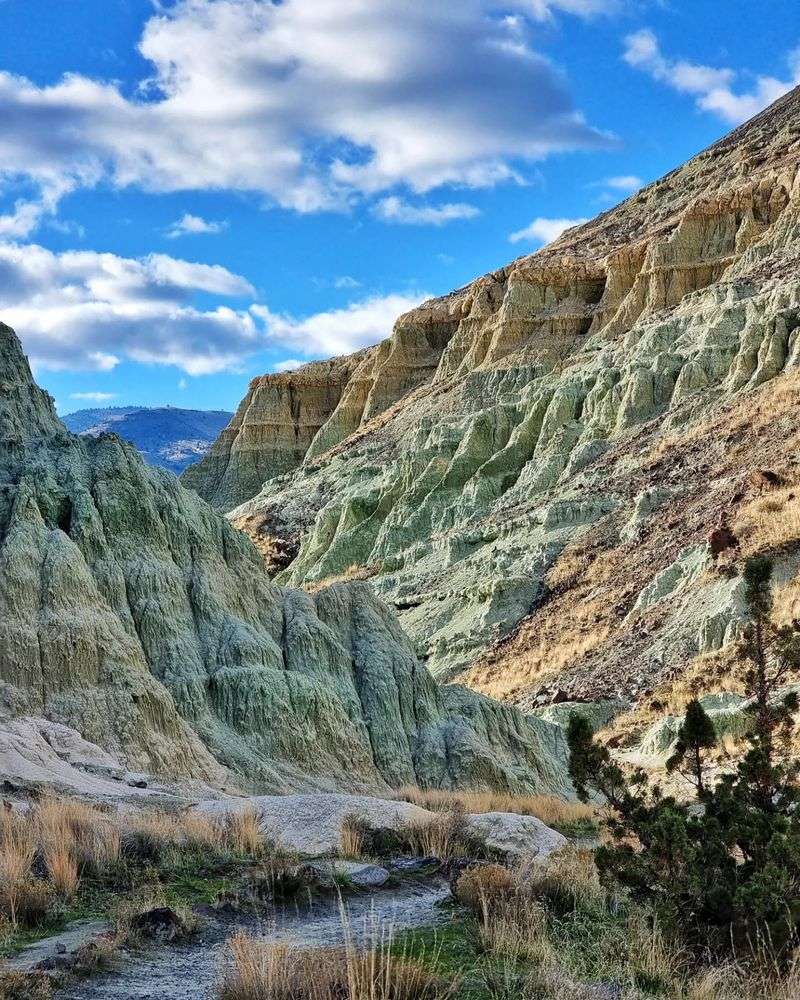
Blue Basin Lower Trail sits inside the Sheep Rock Unit of John Day Fossil Beds National Monument. The colors that make it famous started with a very messy chapter in Earth history.
Around 28 to 30 million years ago, volcanic eruptions blanketed this part of Oregon in ash. That ash slowly hardened into rock now called the Turtle Cove Member of the John Day Formation.
Here’s the fun science bit. Minerals formed inside that rock, mainly celadonite and clinoptilolite, and they created the mint and blue-green shades you see today.
So no, nobody spray-painted the hills overnight. The color is baked right into the stone, layer after layer.
Wind and water keep wearing the soft rock away. That steady erosion carves the basin into raw ridges, gullies, and steep, rippled walls.
It also means the landscape never truly sits still. Fresh surfaces get exposed over time, which keeps the colors looking crisp and the formations looking sharp.
I believe knowing the story makes the view even better. You’re not just staring at pretty hills.
You’re looking at ancient ash clouds that turned into one of the most unusual canyons in the state. That’s a pretty great upgrade for dust.
Fossil Replicas Wait Right Where The Real Ones Were Found
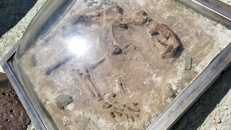
Most trails offer wildflowers or a nice bench. This one offers prehistoric animals, sort of.
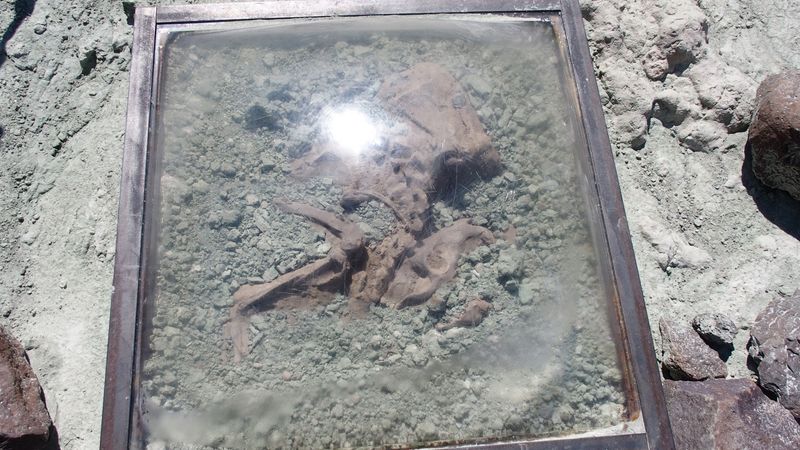
Along the Island in Time Trail, fossil replicas sit under protective covers. They’re placed where real discoveries were made, so you see the find right in its original setting.
Interpretive panels explain what lived here and how scientists figured it out. Kids tend to treat them like clues in a giant outdoor puzzle.
And the cast of characters is impressive. Three-toed horses, rhinos, and small deer-like animals once roamed a warmer, wetter woodland here.
Cat-like predators called nimravids hunted in the same area. Picture a saber-toothed vibe without the modern cat attitude, though honestly, maybe the attitude too.
So many turtle fossils turned up that the area earned the name Turtle Cove. That’s how the rock layer got its formal name.
Scientists have identified more than 2,000 species of ancient plants and animals from the region. New fossils still slowly work their way to the surface as the rock erodes.
One rule matters here. Leave every fossil and rock exactly where it is, since collecting is not allowed in the national monument.
Metal Bridges Make The Walk Feel Like An Expedition
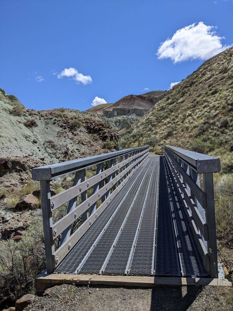
Few things make a short walk feel adventurous like a bridge. Blue Basin has several of them.
Metal footbridges carry the trail over a small creek and narrow ravines. Each crossing pulls you a little deeper into the twisting canyon.
They also protect the fragile ground. The soft clay erodes easily, so staying on bridges and marked paths helps the landscape keep its shape.
Dog owners should take note. Leashed dogs are allowed on the trail, but the bridges have steel grates that some pups find awkward.
Smaller dogs may struggle with the openings. In summer, hot clay and sunbaked metal can also be rough on paws, so rangers advise caution during afternoon heat.
A cooler morning walk solves a lot of those problems. Your dog will appreciate it, and so will your water bottle.
The bridges add a nice rhythm to the hike. Walk a stretch, cross a gap, look up, and notice the walls getting taller and greener.
It’s a simple design choice that makes a big difference. The trail feels less like a sidewalk and more like a path into a lost world.
Golden Hour Turns The Canyon Into A Living Paint Swatch
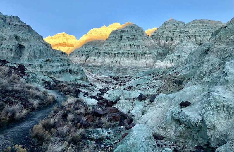
Blue? Green? Teal? Seafoam?
Honestly, the canyon refuses to pick one.
The name says Blue Basin, but the rock often reads as mint or seafoam green. Deeper blue-green tones show up in shadowed folds and steeper walls.
Light changes everything here. The exact shade shifts with the time of day and the angle of the sun.
Midday sun can flatten colors a bit. Early morning and late afternoon soften them and add warm contrast, which makes the hills almost glow.
Photographers love that window for good reason. Long shadows show off every ridge and gully, adding depth that flat light hides.
Bring a wide-angle lens if you have one. The walls wrap around you, and fitting them into one frame takes some creativity.
Even phone photos can look striking here. Still, the colors tend to look stranger and richer in person than any screen can show.
A sunset walk also dodges the worst summer heat. Just plan your timing so you aren’t fumbling back along the gravel in total darkness without a flashlight.
High Desert Heat Deserves Real Respect
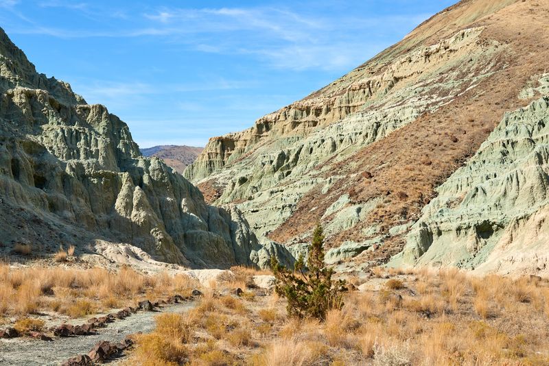
Summer in this canyon doesn’t mess around. Temperatures in the high desert can climb past 100 degrees.
The colorful walls trap and reflect heat, and shade is scarce. That short trail can feel a lot longer under a blazing afternoon sun.
So pack smart. Bring plenty of water, sunscreen, and a hat, even for the easy lower route.
Timing helps most of all. Starting early in the day keeps things far more comfortable and gives you softer light for photos too.
Spring and fall are lovely options as well. Cooler months make the whole walk feel relaxed instead of like a slow bake.
Rain brings its own challenge. The clay gets slick when wet, so firm-soled shoes and a dry day make the smartest combination.
Stay on the marked trail at all times. The badlands look tough, but the surface is fragile and footprints can scar it for years.
None of this should scare you off. A little preparation turns a hot hike into a cool memory, and the canyon really earns the effort.
An Easy Stroll Leads Straight Into The Color
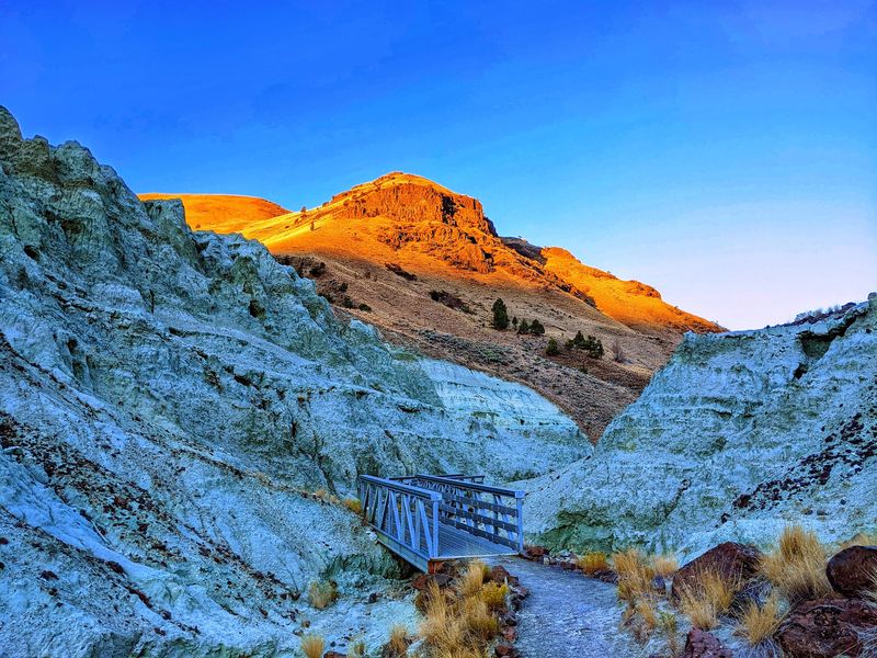
Good news for anyone who prefers views over sweat. The lower route, known as the Island in Time Trail, covers about 1.3 miles round trip.
The elevation gain is roughly 200 feet, spread out as a gradual climb. Most of the work feels more like a steady walk than a real hike.
The path follows a gravel trail up a narrow canyon. As you go, the blue-green walls rise closer and closer around you.
That’s the magic of this route. Instead of viewing the basin from far away, you end up right inside it, almost close enough to count the ripples in the clay.
It’s an out-and-back trail, so you return the same way. That’s actually a bonus, since the scenery looks different heading downhill.
Families, casual walkers, and curious road-trippers can all handle it with some planning. Sturdy shoes still help on the gravel and loose spots.
The trail ends in a natural amphitheater of colorful rock. It feels a bit like reaching the back row of a giant stone stadium.
Take a few minutes there before turning around. Rushing a place this odd and beautiful would be a waste of a good drive.
Free Entry And All-Day Access Make This An Easy Yes
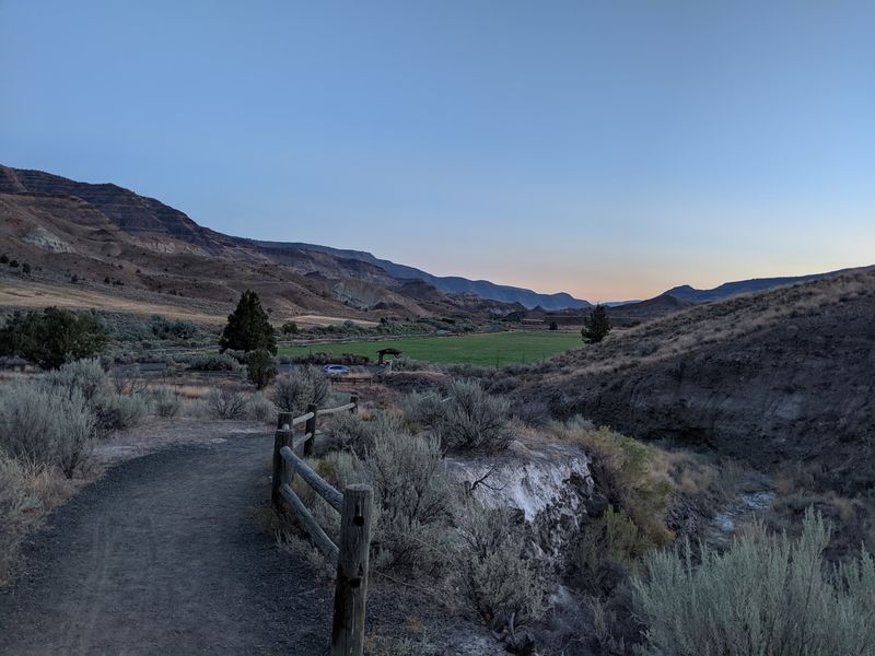
Here’s a rare treat in modern travel. Admission to John Day Fossil Beds National Monument is free.
No entrance fee, no parking permit, and the trail is open around the clock. That makes it easy to fit into a road trip without much planning stress.
The trailhead sits off Highway 19, roughly 14 miles northwest of Dayville. The address is Blue Basin Lower Trail, OR-19, Dayville, OR 97825.
The drive itself is part of the fun. Highway 19 winds through the John Day River valley, with rugged hills and wide-open eastern Oregon scenery.
Cell service can be patchy out here. Download maps ahead of time and fill your gas tank before leaving bigger towns.
Dayville is a small community, so services are limited. Packing snacks and extra water keeps the day running smoothly.
Since the trail never closes, night visits are possible too. The region has very dark skies, which makes stargazing above the basin a memorable bonus.
Just bring a reliable light and watch your footing. Desert nights feel peaceful, but the gravel path still deserves your full attention after sundown.
Trail Conditions Can Change, So Check Before You Go
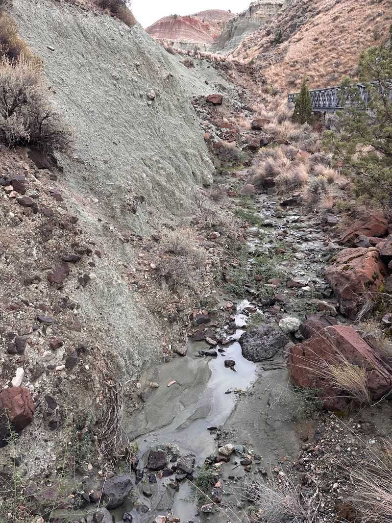
Soft rock makes gorgeous scenery. It also makes trails vulnerable to landslides and washouts.
Blue Basin has two main routes. The lower Island in Time Trail heads into the canyon, while the Blue Basin Overlook Trail climbs around the rim.
The overlook loop runs about 3.25 miles with roughly 760 feet of gain. It’s considered moderate to strenuous, with zigzagging climbs and wide valley views.
The Blue Basin Overlook Trail has been closed since March 2025 because of landslides, washouts, and hazardous conditions. As of October 2026, the National Park Service has not confirmed its reopening, so visitors should use the shorter Island in Time Trail and check for updates before traveling.
Because conditions shift, checking the National Park Service page before your trip is smart. A quick look can save you from a surprise detour.
The lower trail stays the easiest way to experience the basin’s heart. It delivers the up-close color without a tough climb.
Strong hikers who catch the overlook open get a bonus perspective. Looking down into the bowl shows how dramatic the erosion really is.
Either way, the canyon wins. One route puts you inside the color, and the other lets you admire the whole masterpiece from above.
Save Time For The Fossil Center Just Down The Road
A few miles south on Highway 19, the story keeps going. The Thomas Condon Paleontology Center serves as the main visitor center for the Sheep Rock Unit.
Like the trail, it offers free admission. That makes it an easy pairing with your Blue Basin walk.
Exhibits explain the fossils and ancient ecosystems found across the monument. You’ll see how Oregon looked when rhinos and early horses wandered through forests.
The best feature might be the lab windows. Visitors can often watch scientists carefully preparing and studying fossils pulled from the surrounding hills.
Seeing that work changes how the trail feels. Those replicas on the path suddenly connect to real research happening just down the road.
Nearby, the historic James Cant Ranch adds another stop. Sheep Rock itself towers over the valley and makes a great photo pause too.
Visiting the center first gives helpful background. Visiting after lets you match exhibits to the canyon you just explored.
Either order works beautifully. By the end of the day, those blue-green hills will feel less like a mystery and more like an old friend with incredible stories.
