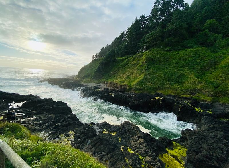
Standing at the edge of the Pacific, where ancient forests meet crashing waves, I discovered a trail system that changed how I think about coastal hiking. Cape Perpetua near Yachats, Oregon, isn’t just another scenic overlook.
It’s a 15-mile network of paths that climb through old-growth rain forests and lead to the highest car-accessible viewpoint on the entire Oregon coast.
Every turn reveals something unexpected: a 500-year-old spruce, a churning water feature carved into volcanic rock, or a panoramic vista that stretches from horizon to horizon.
The trails range from wheelchair-accessible loops to challenging climbs that test your stamina. What makes this place remarkable is how it layers experiences, offering everything from gentle forest strolls to dramatic coastal encounters where the ocean’s raw power is on full display.
Summit Views from the Highest Point

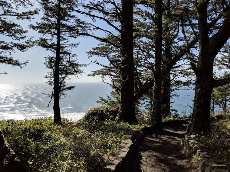
Reaching the Cape Perpetua Overlook feels like standing on top of the world. At 803 feet above sea level, this viewpoint claims the title of the highest spot you can drive to on Oregon’s entire coastline.
The 360-degree views from up here are absolutely breathtaking. On clear days, I could see 37 miles of coastline stretching in both directions, with the Pacific Ocean extending endlessly to the west.
The panorama includes rugged headlands, hidden coves, and the Siuslaw National Forest rolling inland like a green carpet. During my visit, I watched waves crash against rocky outcrops far below while seabirds circled on thermal currents.
What struck me most was how the elevation changes your perspective entirely. The ocean becomes a vast blue canvas, and you can trace the curve of the Earth along the horizon.
Photographers flock here for sunrise and sunset shots, and I completely understand why. The way light plays across the water and illuminates the coastal forests creates scenes that feel almost otherworldly.
Even on foggy days, the experience is magical as clouds roll through the trees below you.
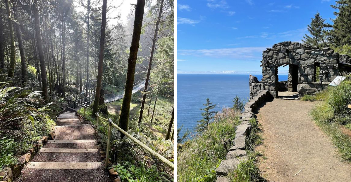
Historic Stone Shelter with a Story
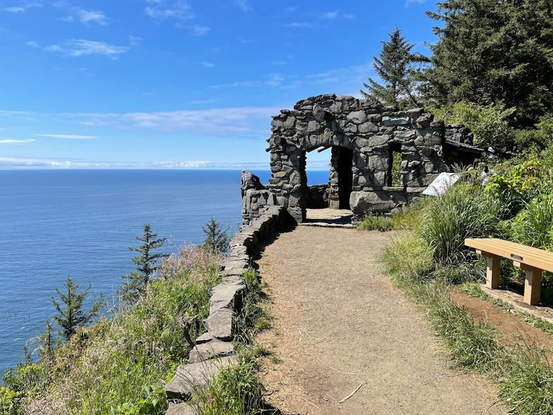
Perched at the summit sits a remarkable piece of Depression-era craftsmanship. The West Shelter, built by the Civilian Conservation Corps in the 1930s, stands as a testament to both human ingenuity and historical preservation.
This stone structure earned its place on the National Register of Historic Places, and walking through its doorway feels like stepping back in time. The CCC workers hauled stones up the mountain and carefully fitted them together to create this windbreak for visitors.
I spent time examining the craftsmanship, noticing how each stone was positioned to withstand decades of coastal weather. The shelter provides welcome protection from wind and rain, which can be fierce at this elevation.
Inside, interpretive displays tell the story of the young men who built trails and structures throughout Oregon during the Great Depression. Their work created recreational opportunities that we still enjoy today.
The shelter’s windows frame the ocean perfectly, turning the Pacific into living artwork. During my visit, I met other hikers who were equally fascinated by the building’s history and its practical design.
It serves as both destination and resting spot for trail hikers.
Thor’s Well and Its Dramatic Display
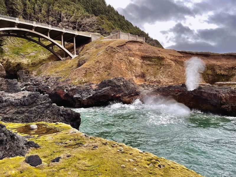
Few natural features capture the ocean’s raw power quite like Thor’s Well. This bowl-shaped opening in the basalt shoreline creates one of the most photographed phenomena along the Oregon coast.
During high tide, especially when waves are strong, water rushes into the well and shoots skyward in spectacular fountains. I timed my visit carefully, arriving about an hour before high tide to watch the show build in intensity.
The well sits in the intertidal zone, carved into dark volcanic rock that contrasts beautifully with the white foam of crashing waves. As each surge arrives, water fills the depression and then explodes upward, sometimes reaching heights of 20 feet or more.
Safety is crucial here because the rocks are slippery and waves unpredictable. I maintained a respectful distance while still getting great views of this natural wonder.
The best viewing times are during winter storms or spring high tides when the Pacific is especially energetic. Photographers often set up tripods at dawn or dusk to capture the well with dramatic lighting.
What appears to be a bottomless pit is actually a collapsed sea cave, though the illusion of water draining into Earth’s core remains captivating.
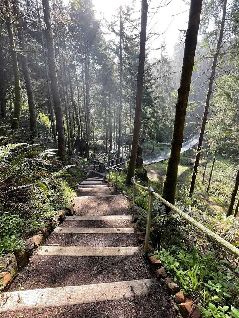
Trail Network for Every Ability
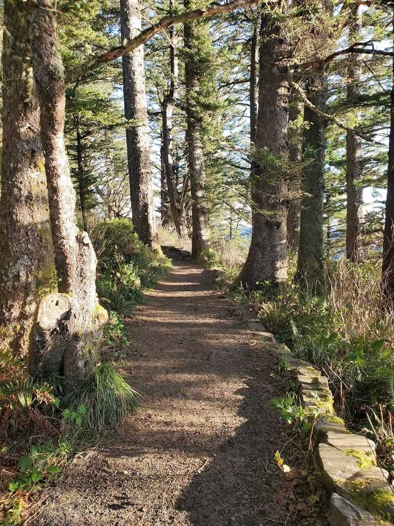
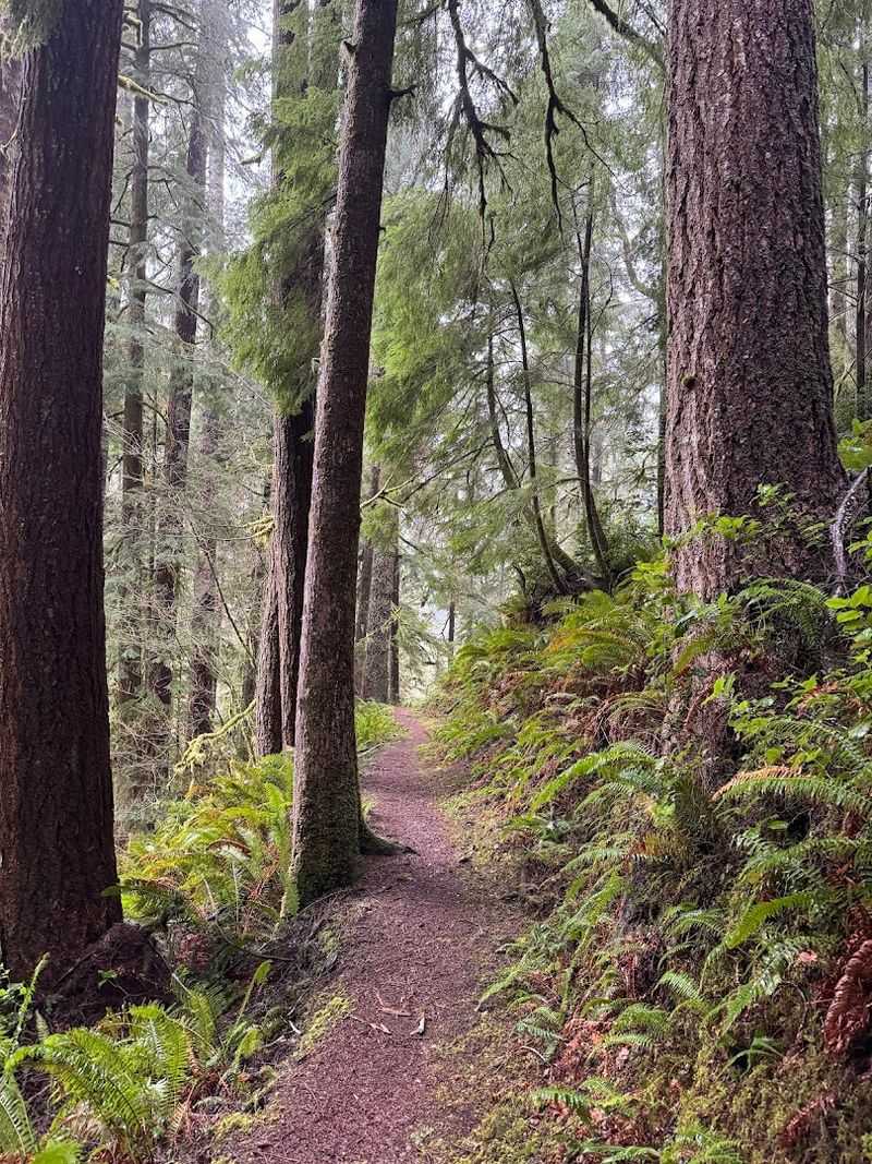
Exploring over 15 miles of interconnected trails felt like unwrapping a gift with multiple surprises inside. The Cape Perpetua trail system accommodates everyone from families with small children to experienced hikers seeking challenges.
Each path offers distinct experiences and varying difficulty levels. Some wind through cathedral-like old-growth forests where Sitka spruce and Douglas fir tower overhead, while others climb steep slopes with ocean vistas as rewards.
I appreciated how well-maintained and clearly marked the trails are. Signage at intersections includes distances and difficulty ratings, making route planning straightforward even for first-time visitors.
The trail surfaces range from paved wheelchair-accessible paths to rugged dirt tracks with roots and rocks. This variety means you can choose your adventure based on fitness level, available time, and weather conditions.
Spring brings wildflowers along many trails, while fall offers mushroom spotting opportunities. Winter hiking requires caution due to mud and potential ice at higher elevations.
St. Perpetua Trail to the Summit
Tackling the St. Perpetua Trail proved to be the most challenging and rewarding hike of my visit. This 2.8-mile route climbs from the visitor center to the summit overlook, gaining significant elevation through switchbacks and steady inclines.
Trail guides often cite this path as offering the best view of the Oregon coast, and after completing it, I can’t argue with that assessment. The journey upward takes you through multiple forest ecosystems as elevation increases.
Lower sections pass through dense undergrowth and fern-covered slopes, while higher portions feature more open canopy with glimpses of the ocean through the trees. Each switchback brings slightly different vegetation and increasingly dramatic preview views.
I needed to pace myself on the steeper sections, taking breaks to catch my breath and appreciate the surroundings.
About halfway up, the forest opens enough to provide motivation in the form of coastal vistas. The final push to the summit feels earned, and arriving at the overlook with the historic shelter in view creates a genuine sense of accomplishment.
Descending takes less time but demands careful footing on the downhill sections.
Giant Spruce Trail Through Ancient Forest
Walking the Giant Spruce Trail transported me into a living cathedral of ancient trees. This 2-mile point-to-point path ranks among the most family-friendly options in the Cape Perpetua system, with gentle grades and fascinating forest ecology.
The destination is a 500-year-old Sitka spruce that simply must be seen to be believed. Its massive trunk requires several people linking hands to encircle, and its canopy disappears into the forest ceiling high above.
The trail follows Cape Creek through a lush rain forest environment where everything is covered in moss and ferns carpet the ground. I heard the creek’s constant music throughout the hike, sometimes seeing it cascade over rocks beside the path.
Interpretive signs along the route explain the forest ecosystem, including how nurse logs provide nutrients for new growth and why certain species thrive in this coastal environment.
The old-growth trees create a microclimate that stays cooler in summer and more protected in winter. Even on rainy days, the dense canopy provides some shelter, though waterproof gear remains advisable.
The trail ends at the giant spruce, where a viewing platform allows proper appreciation of this botanical elder.
Amanda’s Trail Connecting Communities
Learning about Amanda’s Trail added a deeply human dimension to my Cape Perpetua experience. This 3.7-mile path honors Amanda De-Cuys, a blind Coos woman whose story connects indigenous history with modern trail systems.
The trail links the town of Yachats directly to Cape Perpetua’s summit, creating a continuous hiking corridor that serves both practical and memorial purposes. I found the dedication meaningful, recognizing how trails can honor individual lives while serving communities.
Starting from Yachats, the path climbs steadily through coastal forest, offering intermittent ocean views as you gain elevation. The route passes through varied terrain, including second-growth forest recovering from historical logging and pockets of older trees that escaped cutting.
Trail builders designed Amanda’s Trail with sustainable grades that minimize erosion while remaining accessible to a wide range of hikers.
During my hike, I appreciated how the trail’s design considers both ecological preservation and user experience. Benches at strategic viewpoints provide rest spots with rewarding vistas.
The trail’s dedication to Amanda De-Cuys serves as a reminder that Oregon’s landscape holds countless indigenous stories worth remembering and honoring.
Whispering Spruce Accessible Loop
Discovering the Whispering Spruce Trail reminded me that spectacular views should be available to everyone. This 0.2-mile paved loop at the summit provides wheelchair accessibility while delivering the same stunning ocean panoramas that other viewpoints offer.
The trail’s design is thoughtful and inclusive, with gentle grades and smooth surfaces that accommodate wheelchairs, strollers, and visitors with mobility challenges. Railings provide safety and support at viewing areas.
I watched families with young children easily navigate the loop, and older visitors who might struggle with longer or steeper trails were able to enjoy the summit experience fully. The path winds through wind-sculpted trees that give the trail its name.
The accessibility of this trail means that Cape Perpetua’s signature views aren’t limited to those who can hike strenuous routes. During my visit, I saw visitors of all ages and abilities enjoying the overlook together.
This inclusive approach to trail design sets an example for how public lands can serve entire communities rather than just the physically fit.
Devil’s Churn and Coastal Forces
Watching the Pacific Ocean funnel into Devil’s Churn ranks among the most visceral experiences at Cape Perpetua. This narrow basalt inlet concentrates wave energy into a churning, foaming spectacle that demonstrates the ocean’s relentless power.
The churn formed over millennia as waves exploited weaknesses in the volcanic rock, gradually carving a deep channel that now amplifies every surge. I stood on the viewing platform, feeling the vibration of each wave impact through the stone beneath my feet.
During high tide or stormy conditions, water rushes into the churn with tremendous force, creating explosions of spray that can reach the observation areas. The sound alone is impressive, a combination of crashing, hissing, and the deep rumble of moving water.
Safety barriers keep visitors at a respectful distance because rogue waves can appear without warning and conditions change rapidly. I watched the churn for nearly 30 minutes, mesmerized by the constantly changing patterns as different waves arrived.
Interpretive signs explain the geological processes that created this feature and continue to shape Oregon’s rocky coastline.
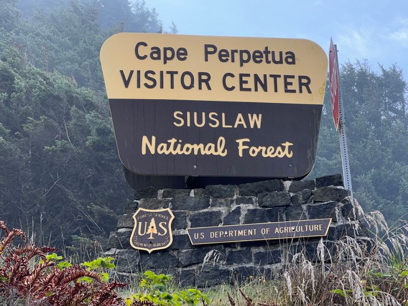
Visitor Center and Practical Information
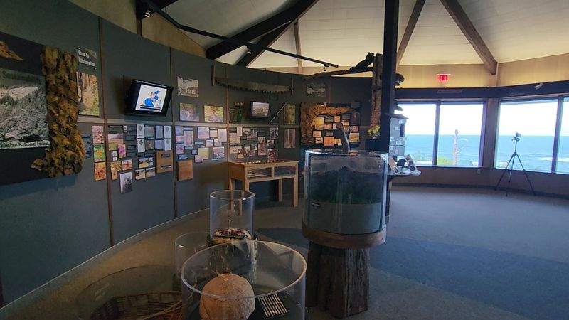
Starting my Cape Perpetua adventure at the visitor center proved invaluable for planning and understanding the area. The facility provides maps, current trail conditions, tide tables, and knowledgeable staff who can answer questions about the best routes for your interests and abilities.
The center features exhibits about the area’s natural and cultural history, including the Civilian Conservation Corps work, indigenous connections to the land, and the coastal ecosystem’s unique characteristics. I spent time reviewing the trail map and discussing options with a ranger before heading out.
Parking throughout Cape Perpetua Scenic Area requires either a $5 day-use fee or a valid Northwest Forest Pass, America the Beautiful pass, or similar recreation pass. Fee stations are clearly marked, and the revenue supports trail maintenance and facility operations.
Restrooms at the visitor center provide the most reliable facilities in the area, though vault toilets exist at some trailheads.
Operating hours vary seasonally, with reduced winter hours, so checking ahead is wise. During peak summer months, parking can fill quickly, especially on weekends, so arriving early is advisable.
The staff’s local knowledge helped me time my visit to Thor’s Well perfectly and avoid crowded trails.
Dear Reader: This page may contain affiliate links which may earn a commission if you click through and make a purchase. Our independent journalism is not influenced by any advertiser or commercial initiative unless it is clearly marked as sponsored content. As travel products change, please be sure to reconfirm all details and stay up to date with current events to ensure a safe and successful trip.