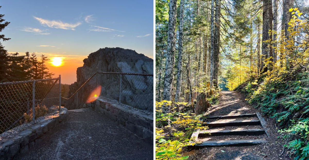
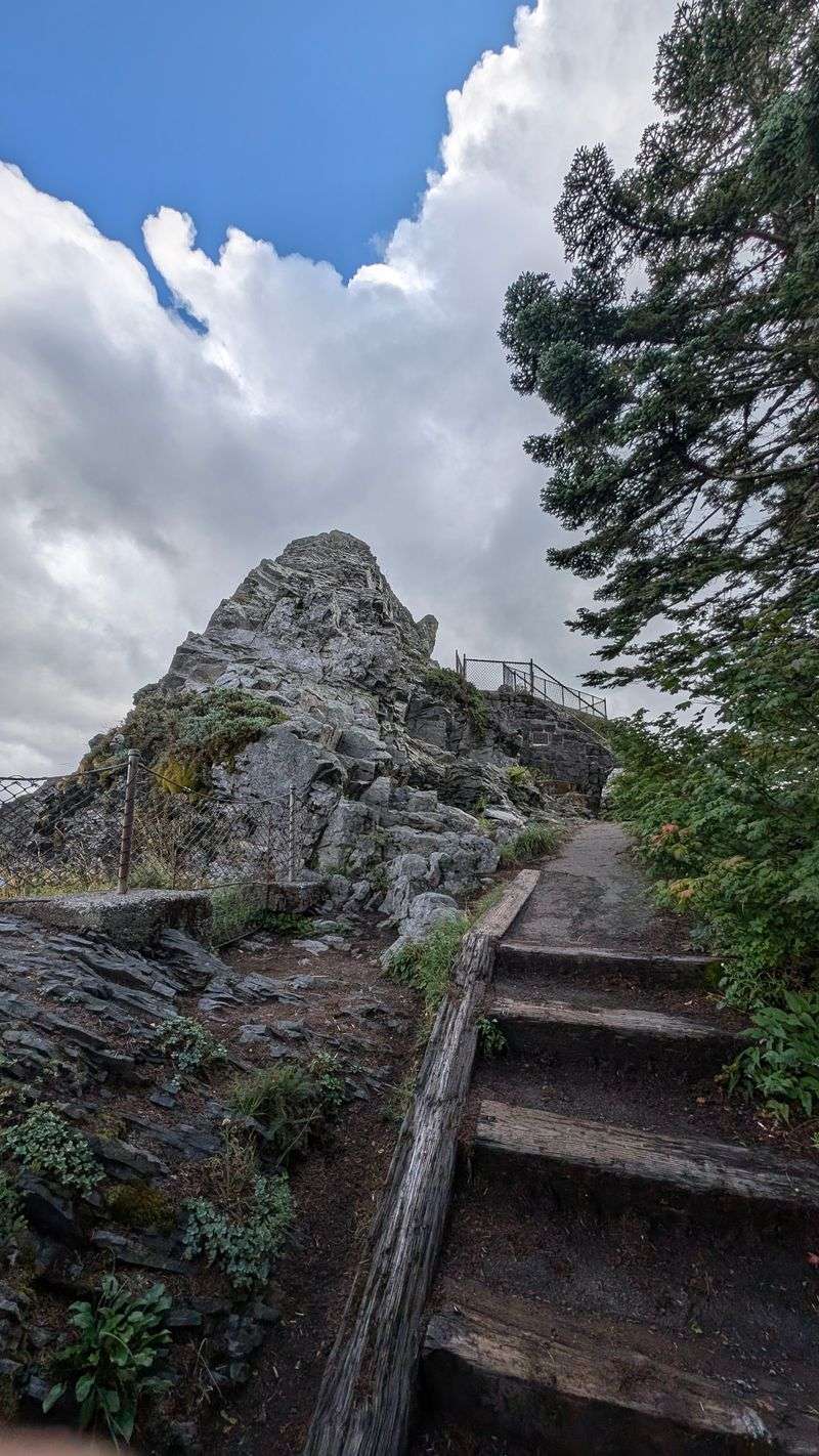
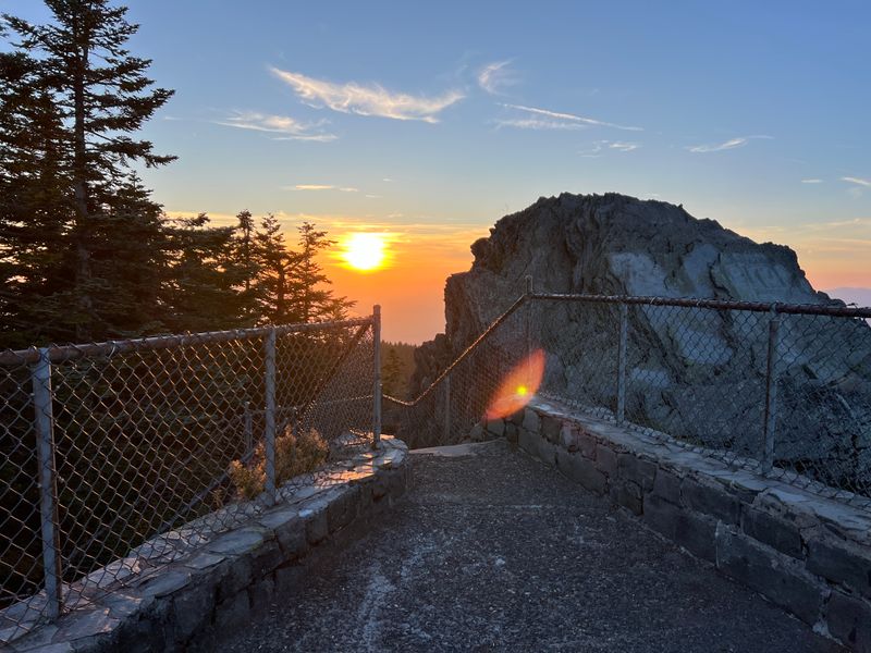
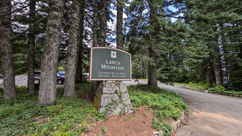
Climbing the 120 stairs to Sherrard Point for the first time felt like stepping onto a postcard. Perched at 4,055 feet in the Columbia River Gorge, Larch Mountain delivers one of Oregon’s most jaw-dropping panoramic views.
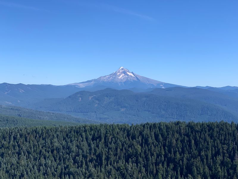
From the stone platform at the trail’s end, five volcanic peaks – Mt. Hood, Mt. St. Helens, Mt. Rainier, Mt. Adams, and Mt. Jefferson – stretch across the horizon like ancient guardians of the Pacific Northwest.
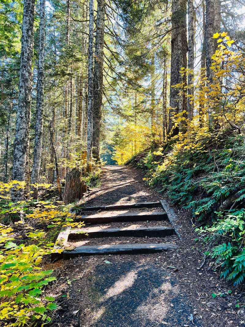
The short but steep 0.3-mile paved trail winds through old-growth forests, past signs of volcanic history, and the air is so crisp it feels like nature’s own energy drink.
Hiking boots and an NW Forest Pass are a must. The road closes in winter, so aim for June through October for guaranteed access.
Families love it, dogs thrive here, and photographers lose their minds at sunrise. Stand at the top of Multnomah County’s highest road, and it’s impossible not to feel on top of the world.
Five Cascade Peaks in One Epic View
Standing on Sherrard Point feels like someone handed you a VIP pass to the best mountain show in the Pacific Northwest. On clear days, you can spot all five major Cascade volcanoes stretching across the horizon in a lineup that rivals any postcard you’ve ever seen.
Mt. Hood dominates the view at 11,240 feet, sitting closest and most dramatic with its snowy crown gleaming in the sunlight.
Mt. St. Helens shows off its blown-out crater to the north, a powerful reminder of its 1980 eruption.
Mt. Rainier towers in the distance at 14,411 feet, often peeking through clouds like a shy giant.
Mt. Adams and Mt.
Jefferson round out the volcanic family reunion, each bringing their own personality to the skyline.
The concrete markers on the viewing platform identify each peak with distances and elevations, turning your visit into an interactive geography lesson. Early morning visits offer the clearest views before afternoon haze rolls in.
I’ve watched photographers camp out at sunrise to capture that golden light hitting all five peaks simultaneously, and honestly, I totally get why. Bring binoculars if you want to study the details of each mountain’s unique features and snow patterns.
The Volcanic Heart of Larch Mountain
Geology nerds, this one’s for you. Sherrard Point isn’t just a pretty viewpoint; it’s actually the exposed volcanic conduit of an ancient shield volcano that’s part of the Boring Lava Field.
You’re literally standing on the hardened throat of a volcano that erupted thousands of years ago, and how cool is that?
The rock beneath your feet represents the final gasp of volcanic activity that shaped this entire region. Unlike the towering stratovolcanoes you can see from the summit, Larch Mountain was a broad, gently sloping shield volcano that oozed lava rather than exploding dramatically.
Erosion over millennia has stripped away the softer outer layers, leaving behind this resistant plug of basalt that now serves as our viewing platform.
The Boring Lava Field extends throughout the Portland area, creating many of the region’s distinctive hills and buttes. Walking around the summit, you can spot the columnar jointing patterns in the rock where lava cooled and contracted into geometric shapes.
It’s like reading the mountain’s autobiography written in stone. The volcanic history adds an extra layer of appreciation when you realize you’re standing on something that once flowed as molten rock deep beneath the earth’s surface.
Multnomah County’s Highest Drive
Larch Mountain Road holds the title as the highest drivable road in Multnomah County, topping out at 4,055 feet elevation. The 14-mile drive from the base twists and climbs through elevation zones that shift from lowland forest to high-altitude wilderness, and the journey itself becomes part of the adventure.
Your ears will pop as you gain altitude, and the temperature drops noticeably as you ascend.
The road passes through a gate around milepost 10 that closes from November through late May or early June depending on snowmelt. During open season, the paved road stays in good condition, though you’ll navigate plenty of curves and switchbacks that demand focused driving.
Cell service disappears pretty quickly once you leave the main highway, so download directions beforehand and let someone know your plans.
Wildlife sightings along the drive include deer, elk, and various bird species that call these elevations home. The forest changes character as you climb, transitioning from mixed deciduous trees to predominantly coniferous old-growth.
I always budget extra time for the drive up because the views through the trees and occasional pullouts are too tempting to ignore. The final stretch opens up to the parking area where your hiking adventure begins.
Short Trail, Big Reward
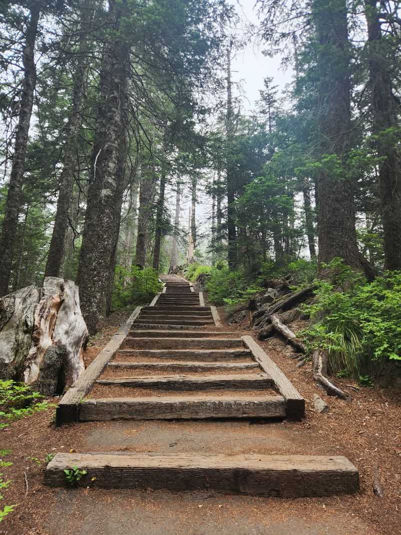
The trail from parking lot to summit covers just 0.6 miles roundtrip, making it one of the most rewarding effort-to-payoff ratios you’ll find in Oregon hiking. Don’t let the short distance fool you though; those 120 to 125 stairs at the end will definitely remind your legs they’re working.
The paved path starts gently before ramping up to a legitimate climb that gets your heart pumping.
Families with kids tackle this trail regularly, and I’ve seen toddlers make it to the top with encouragement and frequent snack breaks. The paved surface means regular sneakers work fine, though hiking shoes provide better grip on the steeper sections.
Handrails line the staircase portion, offering support for those who need it and peace of mind for parents with energetic children.
The trail takes most people 15 to 20 minutes to reach the summit, though you can definitely go slower and enjoy the forest scenery along the way. Ancient hemlocks and Douglas-firs tower overhead, creating a cathedral-like atmosphere even before you reach the panoramic views.
Rest benches appear at strategic intervals if you need to catch your breath. The return trip goes much faster, and your knees will appreciate the gradual descent back to the parking area where picnic tables await.
Ancient Forest Guardians
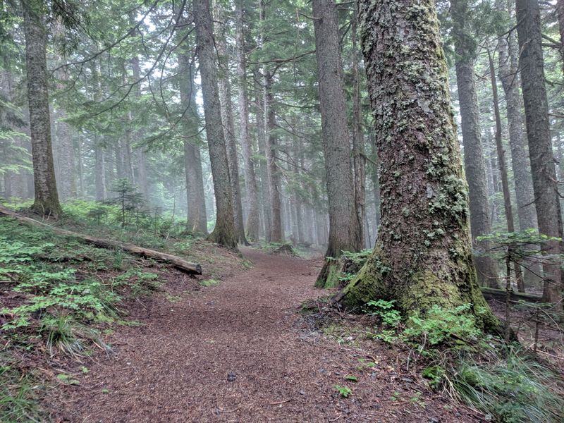
Walking through the forests surrounding Larch Mountain feels like stepping into a time machine set to 400 years ago. These old-growth stands feature hemlock and Douglas-fir trees that were already giants when the first European explorers arrived in Oregon.
Some trunks measure six feet or more in diameter, their bark deeply furrowed and covered with moss that adds vibrant green accents to the brown columns.
The forest canopy creates a microclimate underneath that stays cooler and more humid than the surrounding areas. Sword ferns carpet the forest floor in thick waves, while fallen logs nurse new seedlings in what foresters call nurse logs.
The ecological complexity here supports countless species from tiny soil organisms to Roosevelt elk that browse the understory vegetation.
Light filters through the canopy in shafts that create dramatic photography opportunities, especially in early morning when mist clings to the branches. The quiet in these groves feels profound, broken only by bird calls and the whisper of wind through needles hundreds of feet overhead.
Some trees show fire scars from historical burns that they survived through thick bark and sheer resilience. Taking time to really look at these ancient beings reminds you how temporary our human timescales are compared to the patient growth of these forest elders.
Eagle Creek Fire Recovery Zone
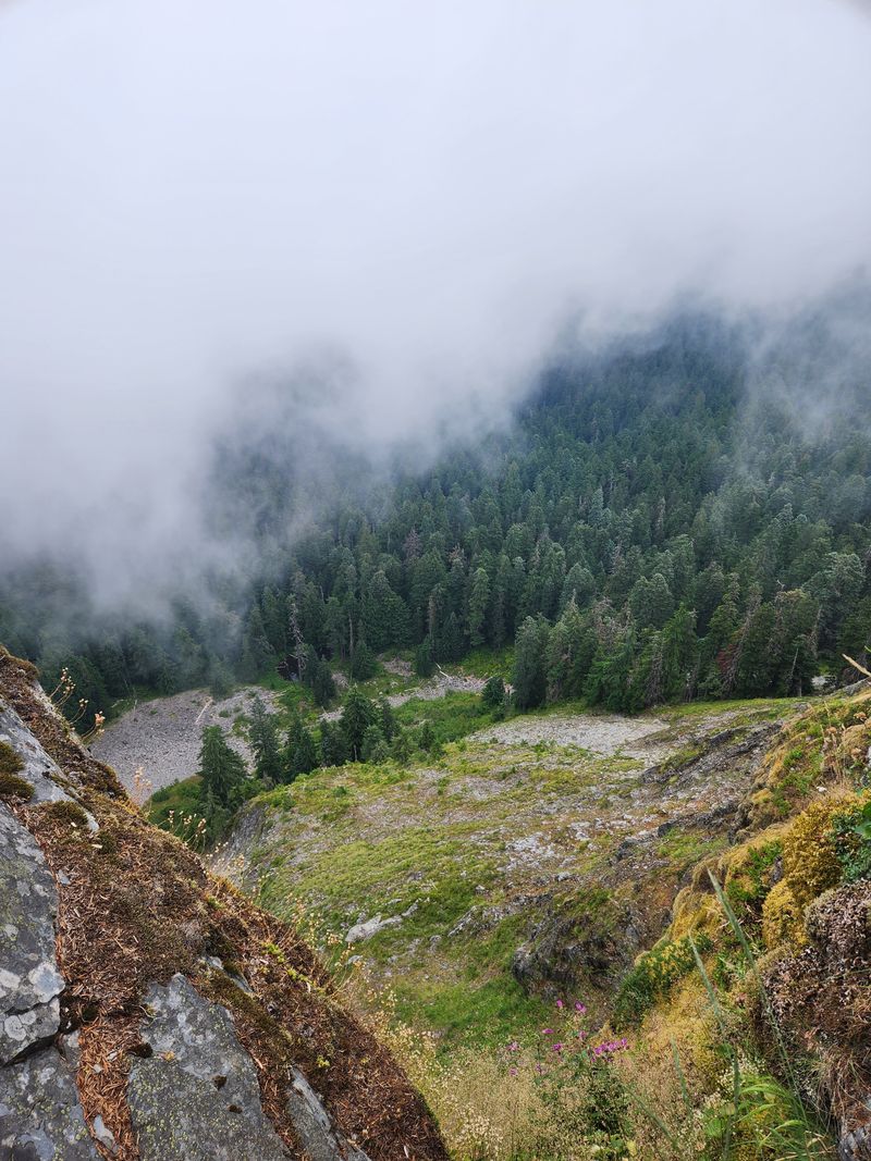
From Sherrard Point, you can look down into the crater area affected by the 2017 Eagle Creek Fire that burned nearly 49,000 acres across the Columbia River Gorge. The view offers a powerful perspective on both destruction and nature’s remarkable ability to bounce back.
Blackened snags still stand in some areas, stark reminders of the fire’s intensity, while vibrant green understory growth paints hope across the hillsides.
The fire started from a teenager’s firework and quickly exploded into a massive wildfire that closed trails and threatened communities for months. Looking at the recovery now, you can see how different plant species respond to fire in different ways.
Some trees died completely, while others sprouted new growth from their bases. Fireweed and other pioneer species colonized the burned areas first, creating purple carpets in summer.
Wildlife has returned to the recovering areas, finding new habitat in the mix of standing dead trees and regenerating vegetation. The ecological succession happening below provides a real-time lesson in forest dynamics that textbooks can’t match.
Photographers document the changing landscape year by year, creating visual records of recovery. It’s sobering and inspiring simultaneously to witness how landscapes heal themselves given time and the right conditions, though full recovery to mature forest will take many human lifetimes.
Peak Identification Made Easy
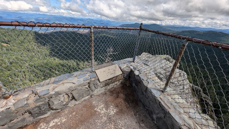
The summit platform at Sherrard Point features concrete markers that take all the guesswork out of peak identification. Each marker points toward a specific mountain and lists its name, distance from where you’re standing, and elevation.
It’s like having a knowledgeable guide built right into the landscape, and it makes the experience accessible for everyone from geology professors to elementary school kids on their first mountain adventure.
Mt. Hood sits closest at about 20 miles away, so prominent that you can spot climbers on its slopes with good binoculars.
Mt. St. Helens lies approximately 35 miles north, its crater clearly visible on clear days.
Mt. Rainier dominates the northern horizon at roughly 100 miles distant, yet still appears massive due to its extreme elevation.
The markers help you understand the immense scale of the Cascade Range and how these volcanic peaks relate to each other geographically. On exceptionally clear days, some visitors report seeing additional peaks beyond the main five, including the Three Sisters far to the south.
I always bring my phone to snap photos of the markers alongside the actual peaks they identify, creating educational souvenirs that help me remember which mountain is which. The setup encourages visitors to spend more time studying the landscape rather than just snapping quick selfies and leaving.
Seasonal Access and Timing
Planning your visit to Larch Mountain requires attention to seasonal access patterns since the upper road closes completely during winter months. The gate at milepost 10 typically closes in November and doesn’t reopen until late May or early June, depending on snowpack and road conditions.
Calling ahead or checking the Forest Service website before making the drive saves disappointment from finding a locked gate miles before the trailhead.
Summer and early fall offer the most reliable access and the clearest weather for mountain viewing. July through September provides the highest probability of clear skies, though morning visits beat afternoon haze regardless of season.
Spring opening can be spectacular with wildflowers blooming and waterfalls running full from snowmelt, but weather remains more unpredictable.
Autumn transforms the surrounding forests with golden larches and colorful understory plants, creating a completely different visual experience than summer’s uniform green. The mountain’s namesake larches are actually relatively scarce on Larch Mountain itself, which confuses some visitors expecting extensive larch groves.
Winter access for the truly adventurous requires snowshoes or cross-country skis and covers about 10 miles from the gate, turning it into a serious backcountry expedition. Whatever season you choose, checking current conditions and bringing layers for temperature changes serves you well at this elevation.
Permits and Practical Information
Before you head up Larch Mountain, make sure you’ve got a valid parking permit because rangers do check and tickets are expensive. A Northwest Forest Pass costs $5 for a day pass or $30 for an annual pass, and it’s valid at dozens of recreation sites across Oregon and Washington.
The America the Beautiful pass also works if you already have one of those from visiting national parks and federal recreation areas.
You can purchase day passes at the trailhead from self-service stations that accept cash or credit cards, though bringing exact change makes the process smoother. The parking lot holds maybe 30 to 40 vehicles, and it does fill up on perfect summer weekends, so arriving before 10 AM gives you better chances of snagging a spot.
Overflow parking along the road is not permitted, and you’ll get ticketed for that too.
The site officially stays open 24 hours, making sunrise and sunset visits possible for photographers and astronomy enthusiasts. Pit toilets near the parking area provide basic facilities, though they’re not always the most pleasant by late afternoon on busy days.
No water is available at the trailhead, so bring everything you need from below. The elevation and exertion mean you’ll drink more than you expect, especially on warm days when the sun feels more intense at 4,000 feet than at lower elevations.
Dear Reader: This page may contain affiliate links which may earn a commission if you click through and make a purchase. Our independent journalism is not influenced by any advertiser or commercial initiative unless it is clearly marked as sponsored content. As travel products change, please be sure to reconfirm all details and stay up to date with current events to ensure a safe and successful trip.