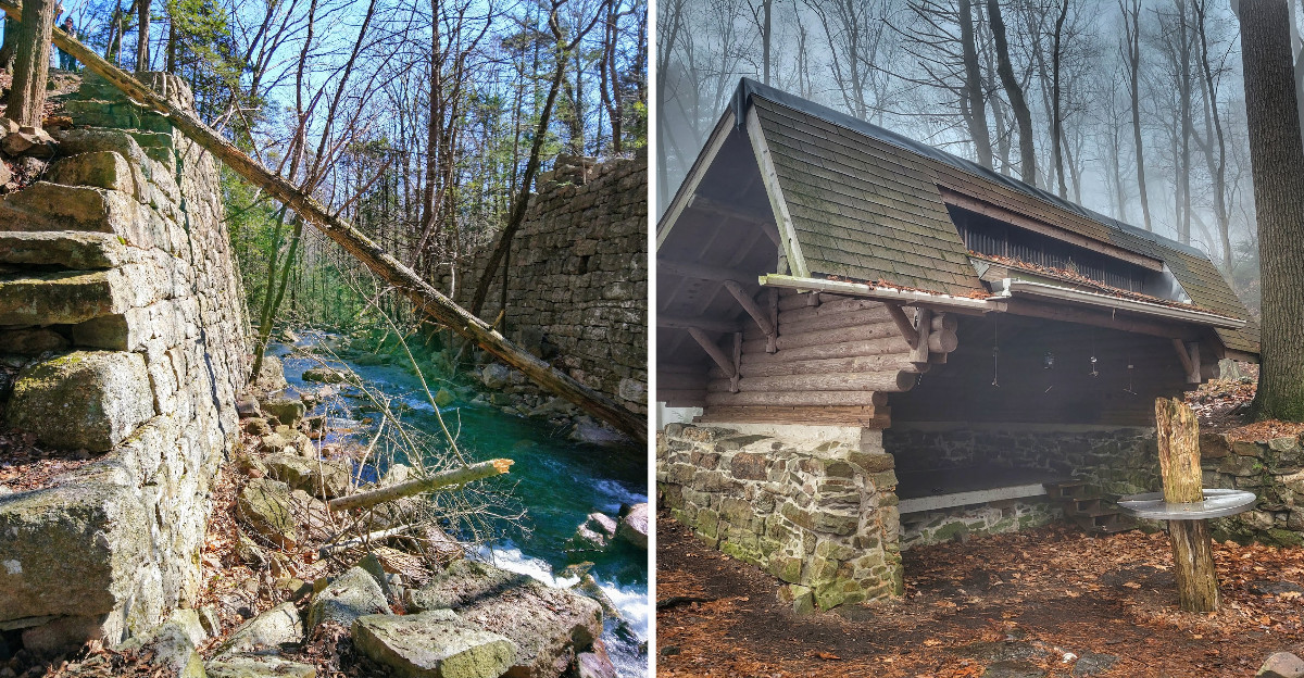
Moss, ferns, and a low rectangle of stacked stone half swallowed by roots are what wait at the end of a trail in Pennsylvania. The forest never opens up into something obvious like a sign or a ruined wall.
Hiking in, the expectation was something grander, but the quiet rectangle was once someone’s home in a town that held about a thousand people and served as a busy railroad center. Sitting on a rock and drinking water, it was hard to picture locomotives where chipmunks now argue over acorns.
History does not shout here. It just sits there and waits.
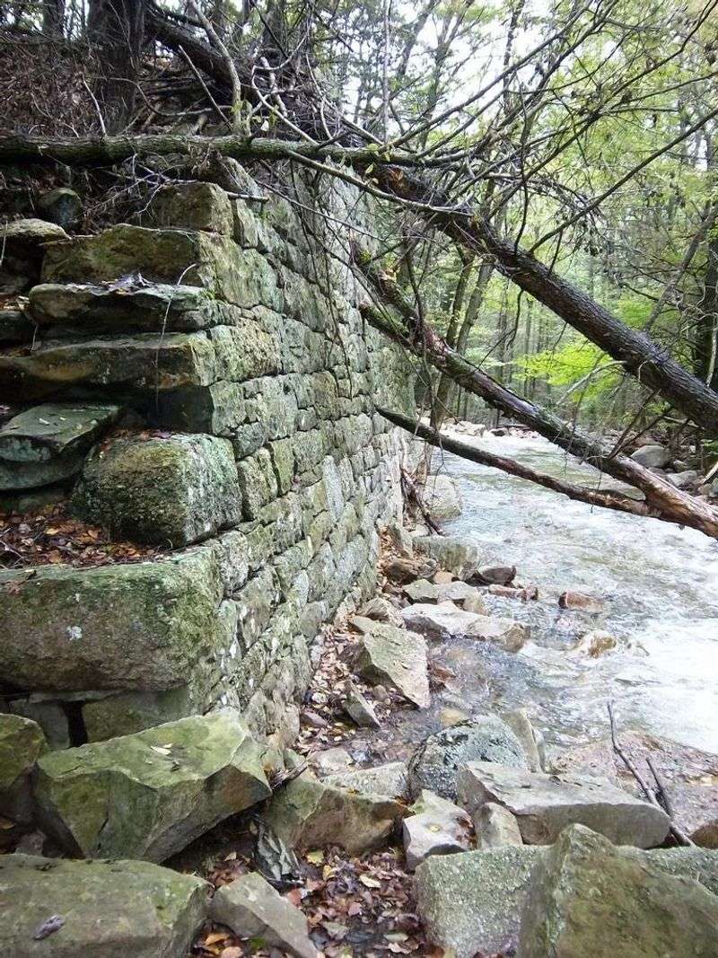
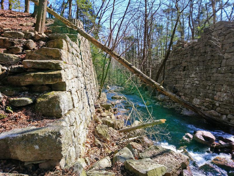
The stone is worn smooth in places, and the foundation lines are still visible under the leaves. Trails like this reward the curious, offering mystery instead of monuments.
Few places in the state deliver that feeling so completely, and this valley does it without a single signboard telling you what to think.
A Coal Vein Started Everything Back in 1823
Long before anyone laid track here, a doctor with an eye for business changed this valley forever. In 1823, Dr. Kugler opened a coal mine on the northern slope of Sharp Mountain, in what is now Cold Spring Township.
Five years later, in 1828, the Dauphin and Susquehanna Coal Company put up a rough shantytown called Rausch Run. It sat in a stony hollow, almost exactly where the rail-trail runs today.
The name shifted to Rausch Gap sometime between 1839 and 1851, which tells you how loosely records were kept out here. Most of the earliest residents were English and Irish immigrant families who arrived for mining work and lived in simple wooden structures.
I think about that when I walk the flat trail bed now, because nothing about this place is easy. The valley was remote, heavily forested, and previously crossed mainly by Native Americans and Moravian missionaries.
Getting supplies in must have been brutal. Building a working community here took real stubbornness, and that stubbornness set the stage for everything that followed, including the railroad that eventually made Rausch Gap a name worth knowing.
When Locomotives Made This Valley the Center of Things
Around 1850, everything sped up. The Dauphin and Susquehanna Coal Company built a rail line straight to Rausch Gap from the Susquehanna River valley, and the town stopped being a mining camp and became a hub.
Company offices moved in. Train repair shops opened.
Crews lived here alongside the miners, which gave the settlement a different rhythm than a typical coal patch town.
By 1854 the line stretched eastward to Pine Grove and Auburn in Schuylkill County, a fifty-one-mile route with Rausch Gap serving as headquarters. Population climbed to roughly 1,000 residents by 1860.
Picture that number against what you see today and it barely computes. There were board houses and stone houses, a cemetery, and the constant noise of an industry that never really slept.
What gets me is the geography. Somebody looked at a narrow gap cut through Sharp Mountain and decided it should be the nerve center of a regional railroad.
For about two decades, that decision worked beautifully, and this hollow hummed with more activity than most towns twice its size ever managed.
How a Single Business Decision Emptied the Town
Rausch Gap didn’t end slowly. It got hollowed out by paperwork, which somehow feels worse than a dramatic collapse.
The local coal turned out to be lower quality than what other regions produced, so mines here struggled to compete, though some activity limped along into the 1930s. A grand plan to extend the rail line all the way to Allentown never happened either, capping the town’s growth.
Then came the real blow. By the 1870s the Philadelphia and Reading Railroad controlled the line, and the Lebanon and Tremont Branch was finished in 1870, pushing operations toward Pine Grove.
In 1872 the machine shops and company offices were relocated to Pine Grove. That was the town’s entire reason for existing, packed up and moved down the line.
Three years later, in 1875, fewer than one hundred people remained out of a thousand. The railroad tore down most buildings around 1883, and by 1910 the final residents had gone.
Standing in the quiet now, I keep thinking about how fast a place can unravel when the jobs leave. Forty years from boomtown to nothing.
Stone Foundations Hiding in Plain Sight
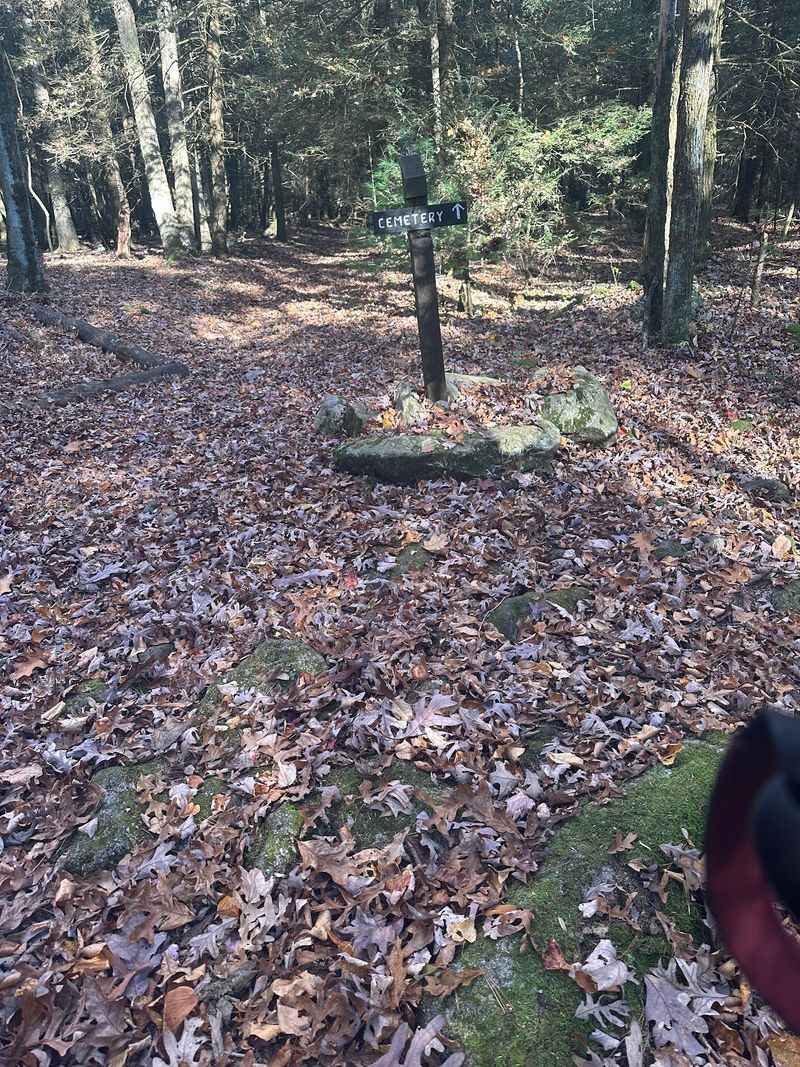
Here’s the thing nobody warns you about: the ruins are easy to walk right past. Vegetation has crept over almost everything, so you have to slow down and actually look.
Once your eyes adjust, the outlines appear everywhere. Low rectangles of stacked stone mark where homes, shops, and probably the company offices once stood.
Some spots drop away into cellar holes, dark little pockets that show the buildings had lower levels. An abandoned well sits nearby, which is the detail that got to me most, since it means somebody hauled water from that exact spot every single day.
Bring a headlamp if you want a better look into the deeper depressions, and watch your footing around the edges.
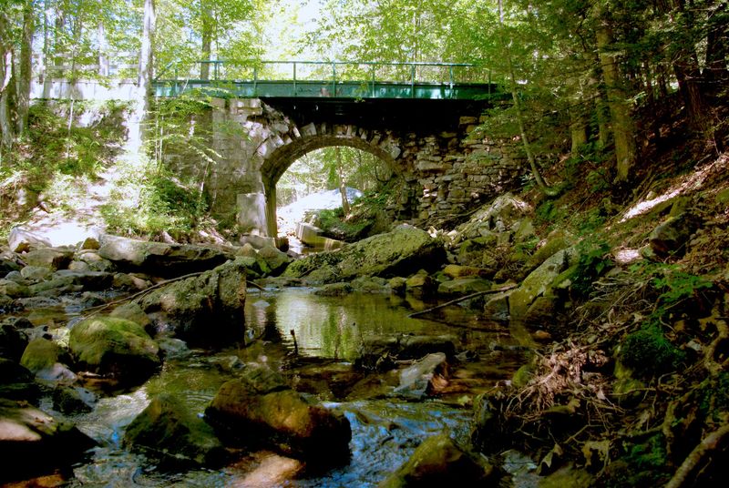
The industrial past shows up too. Remains of an old stone arch railroad bridge still stand, worn down but impressive enough to hint at the engineering that once ran through here.
The whole area now belongs to the Pennsylvania State Game Commission as part of State Game Lands 211, which is why it stays wild instead of turning into a parking lot with a gift shop.
The Small Cemetery That Tells the Real Story
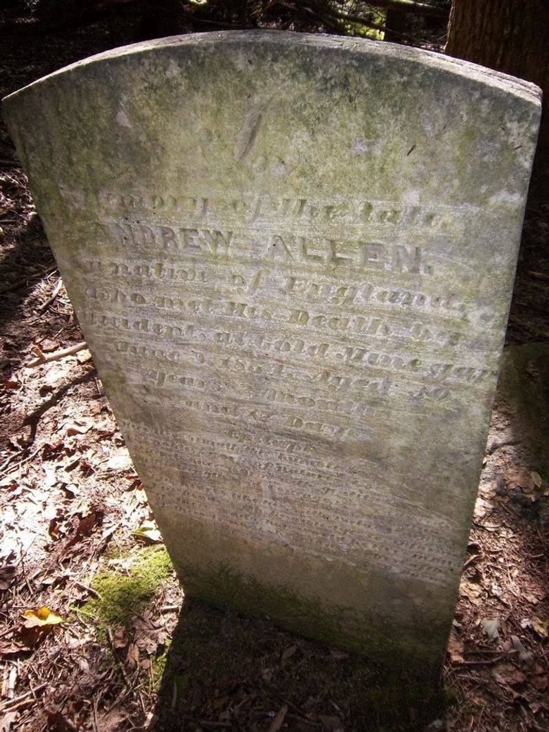
Of everything in Rausch Gap, the cemetery hit hardest. It’s small, overgrown, and tucked off the main path, and it does more to explain this place than any historical marker could.
I counted between three and four legible headstones. Several date from 1854 to 1857, right in the middle of the town’s strongest years.
Those dates matter. A boomtown burying people during its peak says plenty about mining accidents and the illnesses that swept through tight-knit settlements without modern medicine.
Reading a worn name out loud in an empty forest is a strange feeling. It turns the abstract idea of a thousand residents into actual families who lost people.
Treat the spot with respect if you find it. Don’t move stones, don’t lean on them, and leave everything exactly as you found it.
I stayed longer than I planned, mostly because the surrounding woods were so quiet that leaving felt abrupt. The cemetery is the piece of Rausch Gap that sticks with you weeks later, long after the trail dust has been washed out of your socks.
Forest, Creek, and the Slow Work of Nature Taking Over
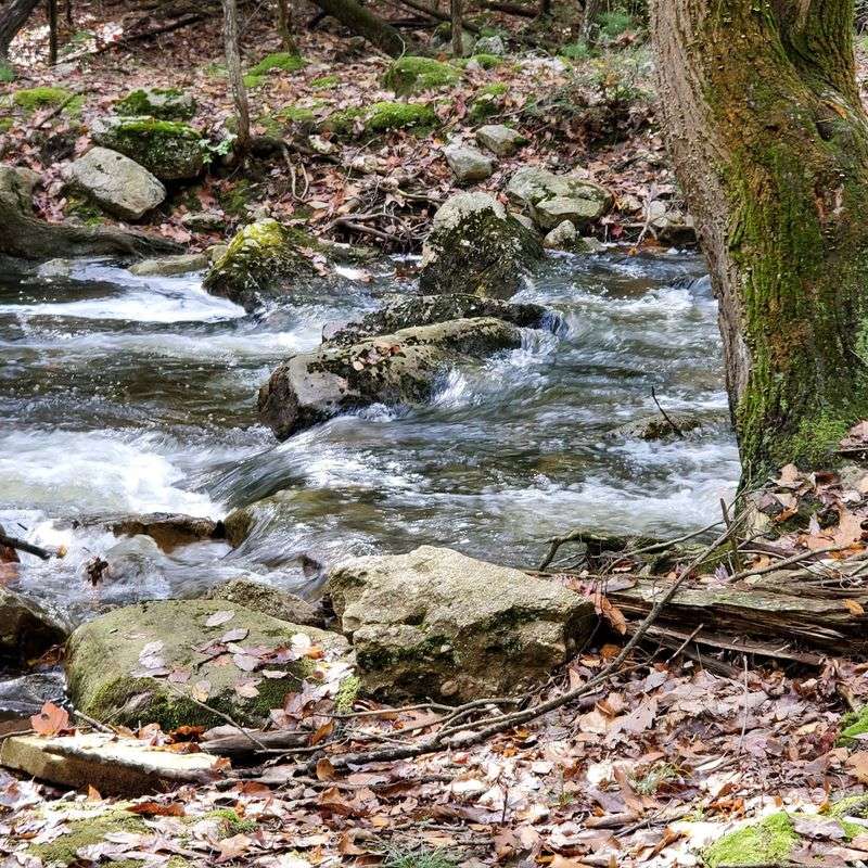
Nature won this one, and honestly it looks great doing it. The hemlocks and hardwoods have closed in so completely that you’d never guess an industrial town stood here.
Rausch Creek still runs through the gap it originally carved through Sharp Mountain, eventually joining Stony Creek. Along the side paths I found small waterfalls, nothing enormous, just steady little drops that keep the soundtrack going.
The air smells like pine and wet earth. It’s the opposite of what this valley must have smelled like in 1860.
All of this sits inside St. Anthony’s Wilderness, a rugged stretch known for thick forest and active wildlife. Birds are constant overhead, and deer wander through without much concern for hikers.
Seasons change the whole mood. Spring and summer go deep green, while autumn turns the slopes into something worth planning a trip around.
There’s one modern touch worth noticing. A limestone neutralization system operates here to treat acid mine drainage, keeping the water healthier for trout, which is a quiet reminder that the old mining left marks you can’t always see.
Hiking the Old Rail Bed Into Town
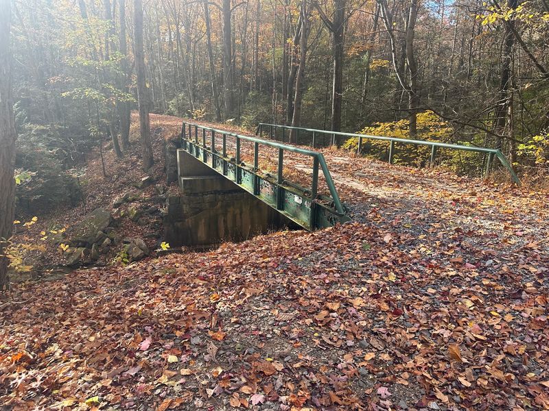
My favorite part of the whole trip was realizing I was hiking on the railroad itself. The old bed became the Stony Valley Rail Trail, and it’s wonderfully flat, which your knees will appreciate.
Expect roughly 3.5 miles from the nearest practical parking areas to reach the heart of the former town. That distance is part of the experience.
You get time to settle in, notice the forest changing, and build a little anticipation before the foundations start appearing.
The route is well maintained and generally moderate, suitable for most hikers with decent stamina. Bikes work here too, and plenty of people ride it.
Keep an eye out for concrete markers along the way. They once held spare track pieces for emergency repairs, and spotting one feels like finding a puzzle piece from the working railroad.
Rausch Gap also sits on the Appalachian Trail, which means thru-hikers pass through constantly. The Rausch Gap Shelter offers a well-configured overnight spot with a reliable cold-water spring and an outhouse, making this ghost town an unexpectedly welcoming rest stop.
Getting There Without Guessing
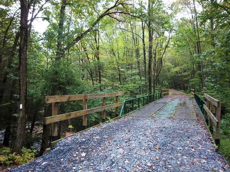
Plug Rausch Gap into a map app and you’ll get a general point, not a driveway. Since the ruins sit inside State Game Lands 211, there’s no street address for the town site itself.
Access happens on foot or by bike along the old railroad bed. You drive to a trailhead, then walk.
Common access points include parking areas off Gold Mine Road, PA Route 325 known as Clark’s Valley Road, and PA Route 443. Each one gives you a different trade-off.
Some approaches are shorter but involve rougher driving conditions on the way in. Others offer easier parking with a longer walk, which I’d honestly recommend if your vehicle sits low.
Download an offline map before you go. Cell service out here is unreliable at best, and the trail junctions aren’t always obvious.
Give yourself more daylight than you think you need, because exploring foundations takes longer than covering trail miles. I budgeted four hours and used closer to six, mostly because I kept stopping to poke around at things half-buried in leaf litter.
Packing Smart for a Day in the Gap
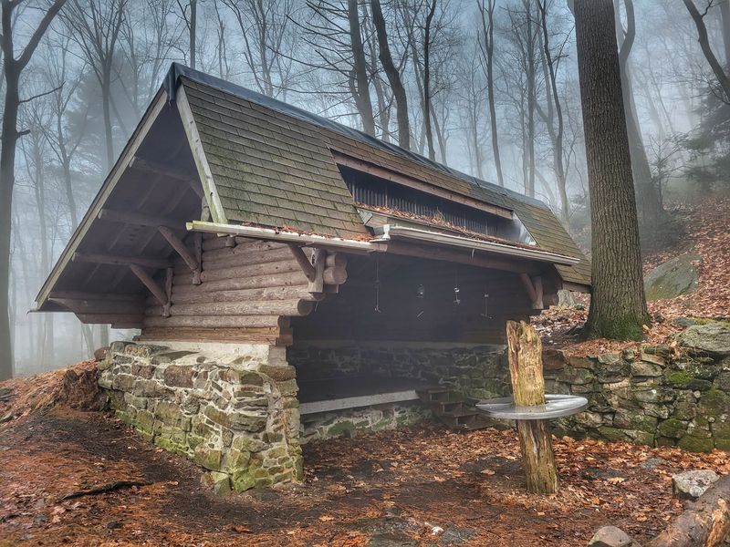
Water deserves your attention here more than at most Pennsylvania trailheads. Some natural sources in this region carry acidic mine runoff, a leftover from the old operations.
Carry plenty from home. The Rausch Gap Shelter does have a reliable cold-water spring if you need to top off along the Appalachian Trail.
Layers make sense too, since mountain weather flips quickly and that flat trail offers little protection when wind funnels through the gap.
Spring through fall is the sweet spot for visiting. Winter brings snow and cold that turn a pleasant outing into a serious undertaking.
Because you’re in state game lands, check hunting seasons before heading out and wear bright colors when appropriate. Wildlife is genuinely active here, which is part of the appeal.
Pack out everything you bring in and stick to Leave No Trace habits, especially near the ruins and cemetery where careless boots do lasting damage. Sturdy shoes help on the uneven ground around foundations.
Do those few things and Rausch Gap rewards you generously, blending real history with real wilderness in a way that’s rare and worth the walk.
Address: Cold Spring Township, PA 17038, USA
