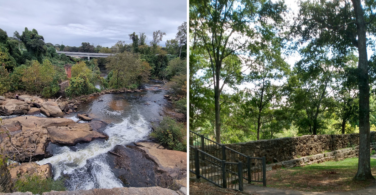
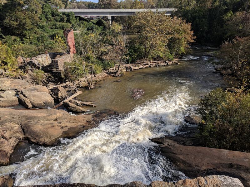
Water folding over a long stone dam, scattering into white shoals, sounds like distant applause from the riverbank above. A plain county park in South Carolina turned out to hold far more than expected.
Below the dam, half buried in ivy and shade, sit the foundations of a cotton mill that first started spinning thread in 1820. Three separate fires eventually took the buildings, the last one in the early 1940s, yet the stone and brick stayed put.
A good hour disappeared while climbing around the rocks, reading a weathered marker, and trying to picture the noise this place once made. The dam stretches bank to bank, and the water has been folding over its lip for nearly two centuries.
Foundations poke through the leaves, and the millrace still cuts a line through the grass. Small, a little rough around the edges, and quietly absorbing, this spot rewards anyone who stops.
The Dam That Refused to Disappear
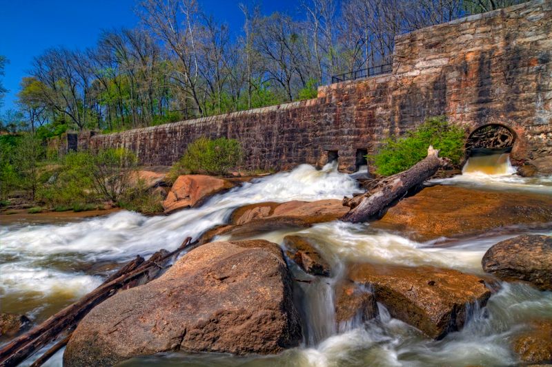
My first look at the dam came from a gap in the trees, and I remember stopping mid-step because the scale caught me off guard. It runs the entire width of the Enoree River, built from mortared stone somewhere between 1880 and 1890.
Six sluice gates are worked into the structure, which were once used to control how much water pushed toward the mill’s machinery. Water now just pours over the whole length of it in a low, steady sheet.
What I liked most was how ordinary it looks at a glance and how impressive it becomes once you understand that men stacked and mortared every one of those stones by hand.
The sound carries farther than you would expect. Even up near the parking area, there is a soft rushing hum underneath the birds and the traffic.
Bring a camera with a decent zoom if you have one, because the best angles are from the rocks downstream rather than directly above.
Morning light hits the face of the dam nicely, and the mist that sometimes gathers over the shoals adds something a photo can barely hold onto.
Stone Foundations Scattered Across the Floodplain
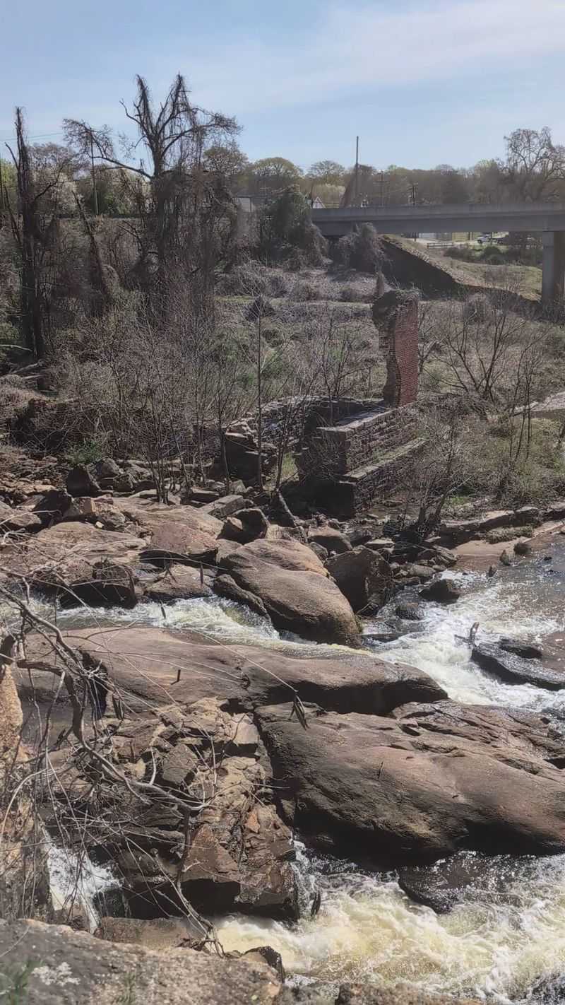
Scrambling around the ruins felt a bit like reading a book with most of the pages torn out. Low stone walls appear, then stop.
Brick corners poke up through leaf litter with no obvious purpose.
The foundations spread across the floodplain, over the rock shoals, and up onto a terrace that overlooks the river. Once your eye adjusts, you start noticing them everywhere.
Two round bases remain from steam smokestacks, along with assorted brick pilings that once held the weight of heavy machinery and long wooden floors.
There is also a channelized stream with stone-reinforced sides, which was clearly engineered rather than natural, and I found that detail oddly satisfying.
Footing gets uneven fast, so I would skip flip flops entirely. Sturdy shoes make the difference between exploring comfortably and turning an ankle on a hidden stone edge.
Poison ivy grows freely here, especially near the benches and along the trail shoulders, so long pants are a smart call in warmer months.
Take your time. The ruins reward slow walking far more than a quick loop.
A Mill That Started Spinning in 1820
Here is the detail that hooked me: this was the first cotton mill in what was then the South Carolina’s Greenville District, started in 1820 by Reverend Thomas Hutchings with just 144 spindles.
One hundred forty four. That is a number you can almost picture in a single room.
The operation changed hands and names repeatedly over the decades, showing up in records as the Hutchings Factory, the Buena Vista Factory, and the Lester Factory before finally becoming Pelham Mill after an 1880 purchase.
By 1907 the site had grown enormously, running well over 10,000 spindles with roughly 300 workers keeping the place going.
Mill life was hard. Workers were billed by the owners for housing and for purchases at the company store, and whatever pay remained often came as tokens redeemable only at that same store.
Children worked the floors too, some younger than twelve, which is a heavy thing to consider while standing on the very ground where it happened.
Interpretive signage around the park explains production methods and daily routines, and I would genuinely read those before wandering off.
Fire, Three Times Over
Bad luck with fire followed this property in a way that almost seems unfair. The very first blaze broke out within months of the original mill starting operations in the 1820s.
Another fire destroyed the Lester Factory in 1853, wiping out yet another version of the operation on the same patch of ground.
The last one was the big one. Accounts place it in the early 1940s, cited variously as 1940, 1941, or 1943, and it took nearly the entire mill complex with it.
By then the mill had already gone quiet. Operations stopped in 1935, and the machinery had been hauled out, so the fire consumed empty buildings rather than a working factory.
Knowing that changes how the ruins feel. These are not the bones of a sudden disaster but the leftovers of a place that had already been abandoned.
Standing among the stone, I kept thinking about how fire took the wood and the roofs and the floors, and how it simply could not touch the masonry.
What survives is the part that was never going to burn.
The Little Post Office With a Long Career
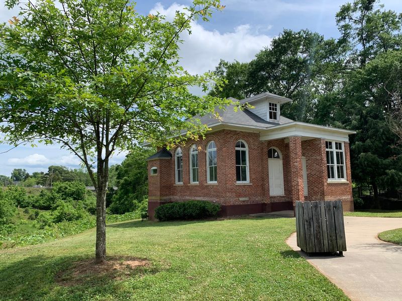
Tucked near the park entrance sits a modest building that I almost walked right past, which would have been a mistake.
Constructed in 1870, it began life as the mill’s office, the place where paperwork, payroll, and company business got handled.
Later it took on a second role entirely and served as a United States Post Office, staying in that job all the way until 1996.
That is an impressively long run for such a small structure. Generations of local families would have collected mail from this exact spot.
In 2002 it was moved and then renovated so visitors could see it preserved rather than crumbling, and the restoration work shows.
I appreciated the contrast between the tidy little building and the wild, half-swallowed ruins down near the water. One got saved and polished.
The others got left to the vines.
Give it a few minutes of attention before you head toward the river. It grounds the whole visit in something human-sized instead of purely industrial.
Small details like the door and window framing are worth a closer look.
Down Among the Rocks on the Enoree
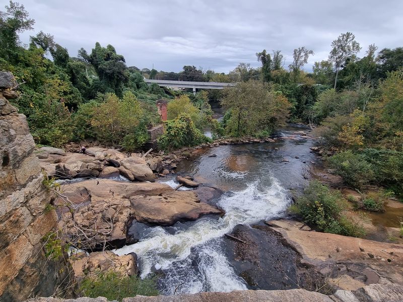
The best part of my visit was not the overlook. It was getting down onto the rock shoals below the dam.
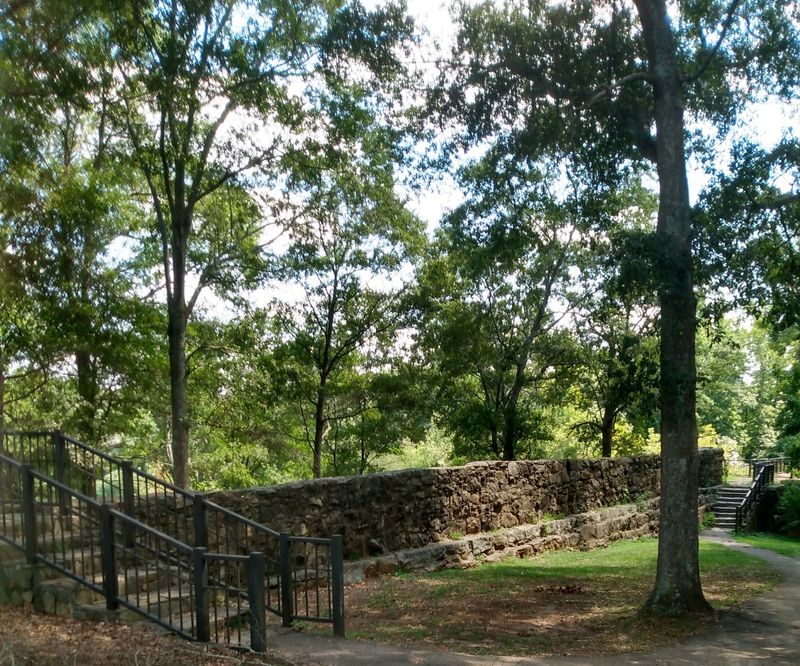
A stone wall entrance with iron railing marks the start of a short path, and that path leads toward the rocks where the Enoree spreads out and tumbles.
Once you are among them, the perspective flips completely. The dam rises on one side, mill ruins sit off to the other, and water rushes between your feet.
People fish, wade, sit, and just listen. I watched one family spend twenty minutes flipping stones looking for crawfish.
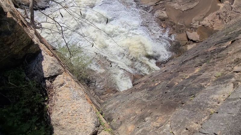
Wet rock is slippery rock, so go slowly and test your footing. After heavy rain the river runs higher and faster, and the shoals become a look-but-do-not-cross situation.
Water shoes are a genuinely good idea in summer if you plan to get in at all.
The stone-walled viewing area up above has two benches and a history marker, though shrubs sometimes block the view of the falls.
Honestly, the rocks give you everything the overlook promises and more.
Short Trails, Deep Shade
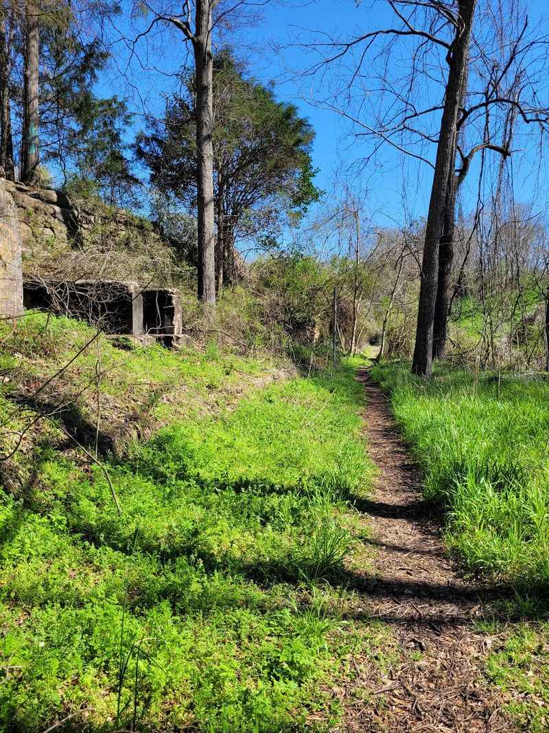
Anyone showing up here for a long run will leave disappointed, and I say that with affection.
The walking trails are short, roughly a quarter mile in places, and they wind through woods that stay pleasantly shaded even on hot afternoons.
Overgrowth is part of the experience. Grass gets tall, paths narrow, and certain stretches feel like you are pushing into somewhere half-forgotten.
Honestly, that scruffiness suits the ruins. A manicured greenway would strip away the atmosphere that makes the place memorable.
One spur leads down to a sandy patch on the riverbank, though access depends on water level and recent trail maintenance.
Bug spray earns its place in your bag between spring and fall, and again, watch for poison ivy along the edges.
Total acreage runs about 24.5, so nothing is far from anything else. You can see the highlights in half an hour, or stretch it into a lazy afternoon.
Mud lingers after rain, especially in the low floodplain sections near the foundations.
I would call it a wander rather than a hike, and that is exactly what I wanted.
Planning a Visit Worth the Detour
A few practical notes I wish I had known before pulling in would have made my first hour smoother.
Gates open at 7 am and close at 7 pm every day of the week, and both admission and parking cost nothing.
Mornings felt calmest to me, with better light on the dam and fewer cars in the small lot. Weekday visits are quieter still.
Wear closed shoes, bring water, and skip the stroller. Uneven stone, tall grass, and muddy patches make wheels more trouble than they are worth.
The Pelham Mills Site carries recognition from the National Register of Historic Places and the Greenville County Historic Preservation Commission, so treat the stonework gently and leave the ruins exactly as you found them.
Graffiti and litter turn up occasionally, which is a shame. Carrying out a little trash on your way back to the car is an easy good deed.
Give yourself an hour minimum, longer if you want to linger on the rocks or picnic.
Address: 2770 E. Phillips Road, Greer, South Carolina 29650
