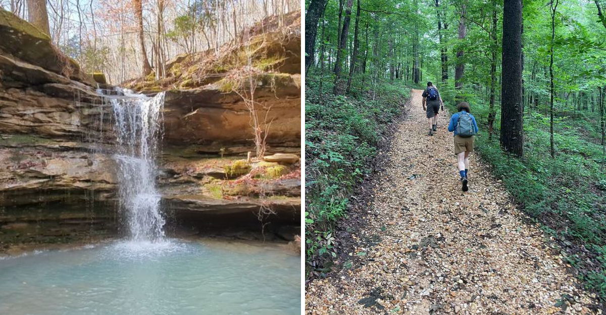
The gravel road looked so unremarkable I checked my map twice before trusting it. Then the trees split open, the ridge dropped away, and a green canyon appeared like it had been hiding there on purpose.
I signed my name at a small station near the trailhead, grabbed a paper map, and lost the next five hours without noticing. Waterfalls tumbled around every other bend.
Rare ferns clung to damp rock shelters that looked untouched by time. Creek water ran so clear I could count pebbles resting on the bottom, and barely another voice broke the quiet the whole way through.
What stuck with me most was the care behind it all, down to water coolers placed thoughtfully along the trail. This pocket of Alabama guards something genuinely rare, and every detail proves it.
I left with muddy shoes and a plan already forming to return before the wildflowers disappear.
A Canyon That Alabama Quietly Kept To Itself
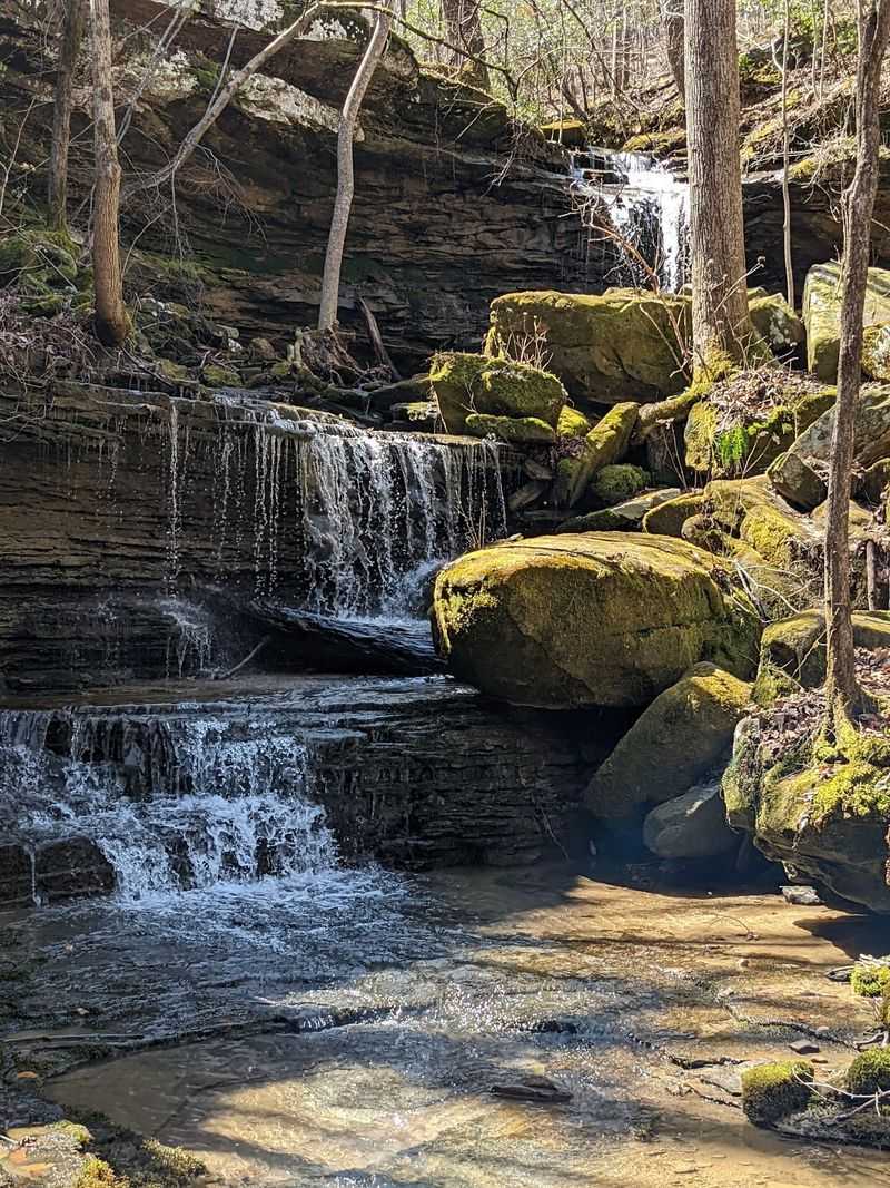
Colbert County does not exactly advertise canyons. Yet here, in the Little Mountains region of southern Colbert County, Cane Creek has been slicing through sandstone and shale for millions of years, leaving cliffs and hollows that feel far bigger than the modest entrance suggests.
The preserve covers roughly 700 acres, and the elevation drop from ridge top to creek level reaches about 350 feet. That number sounds abstract until your knees start reporting back to you.
What makes the landscape so varied is its position where different physiographic regions overlap. Cool, shaded gorges sit near sun-warmed rocky glades, and each pocket grows something a little different.
I remember pausing at an overlook and realizing how quiet it was. No traffic hum, no distant machinery, just wind moving through leaves somewhere below me.
Getting here takes a bit of patience. The approach road feels oddly rural and one reviewer’s advice sums it up well, which is simply to keep going even when you doubt yourself.
Once you arrive, the layout makes sense quickly. Sign in at the visitor support station by the trailhead, grab a map, and pick a direction based on how ambitious you feel.
Plan on more time than you think you need. The canyon has a way of stretching an afternoon into a full day without asking permission.
Fern Caves, Rock Shelters, And Cool Damp Corners
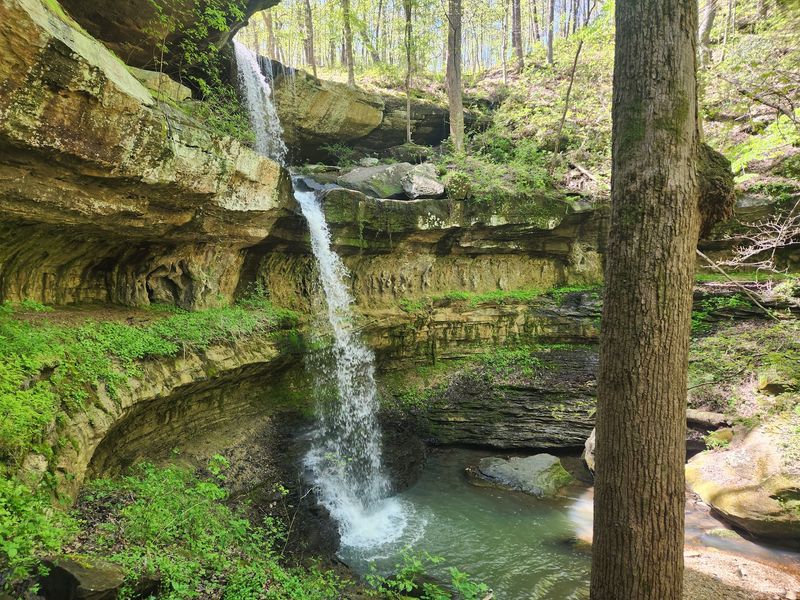
My favorite stop was a fern cave, one of those shadowed overhangs where the temperature drops noticeably the moment you step under the rock lip. Ferns hang from the ceiling and walls in thick green curtains, thriving in the constant moisture that seeps through sandstone.
These damp microclimates are the reason the preserve supports plants you will not find in the drier woods just a mile away. Cool air pools in the gorges, and species that prefer chilly northern conditions hang on here.
Botanists describe the property as unusually diverse, and it is easy to see why. Wetlands, streams, glades, and shaded ravines all sit within walking distance of one another.
Rock shelters add a human layer too. Native peoples of the Mississippian period used some of these overhangs for shelter, and standing beneath one gives the place a weight that photographs never quite capture.
Bring a small flashlight if you want to peer into the darker recesses. Keep your hands off the plants, since the fragile ones are exactly what makes this canyon special.
Rain makes the rock slick, so watch your footing near the drip lines.
I lingered longer than planned in one of these hollows, listening to water tick off the ceiling. It was the coolest spot I found all day, in both senses of the word.
Up To Fifteen Waterfalls When The Rain Cooperates
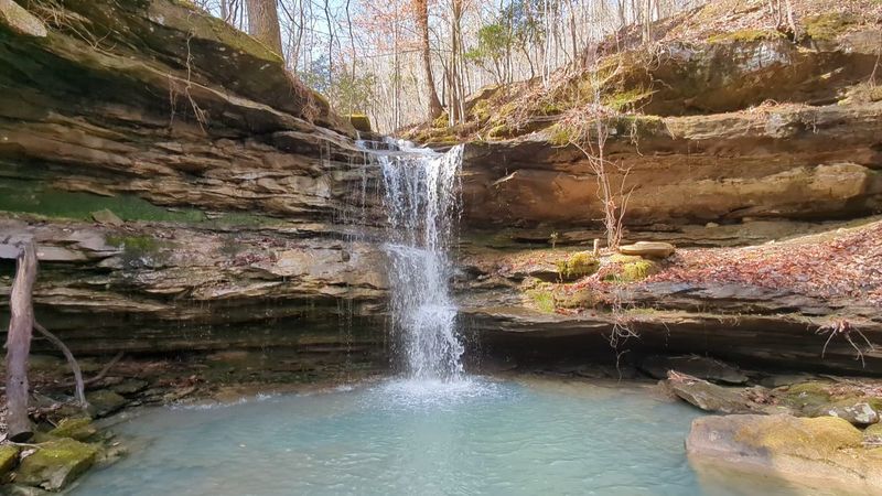
Rain is the whole story with waterfalls here. After a wet stretch, as many as fifteen can be flowing across the preserve, including a drop that falls roughly sixty feet down a sandstone face.
Come during a dry spell and you may find bare rock instead of water. I met that reality once and still enjoyed the hike, though I did make a mental note about timing.
Peak flow generally runs through winter and from late November until early May. That window overlaps beautifully with the cooler hiking weather.
One of the smaller falls lets you walk behind the water, tucked into a cavern-like recess in the cliff. Watching daylight through a moving sheet of water is genuinely strange and wonderful.
The creek pools below are just as photogenic. Locals talk about the blue hole and the boulder pool, both spots where the water sits clear enough to see straight to the bottom.
Wear shoes you do not mind soaking. Several crossings use concrete fords and footbridges, but water still finds a way into socks.
Check recent rainfall before driving out if waterfalls are your main goal.
And if the falls are quiet, redirect toward the overlooks. The canyon rewards flexible plans far more than rigid checklists.
Twenty Five Miles Of Trails, Marked Better Than Most
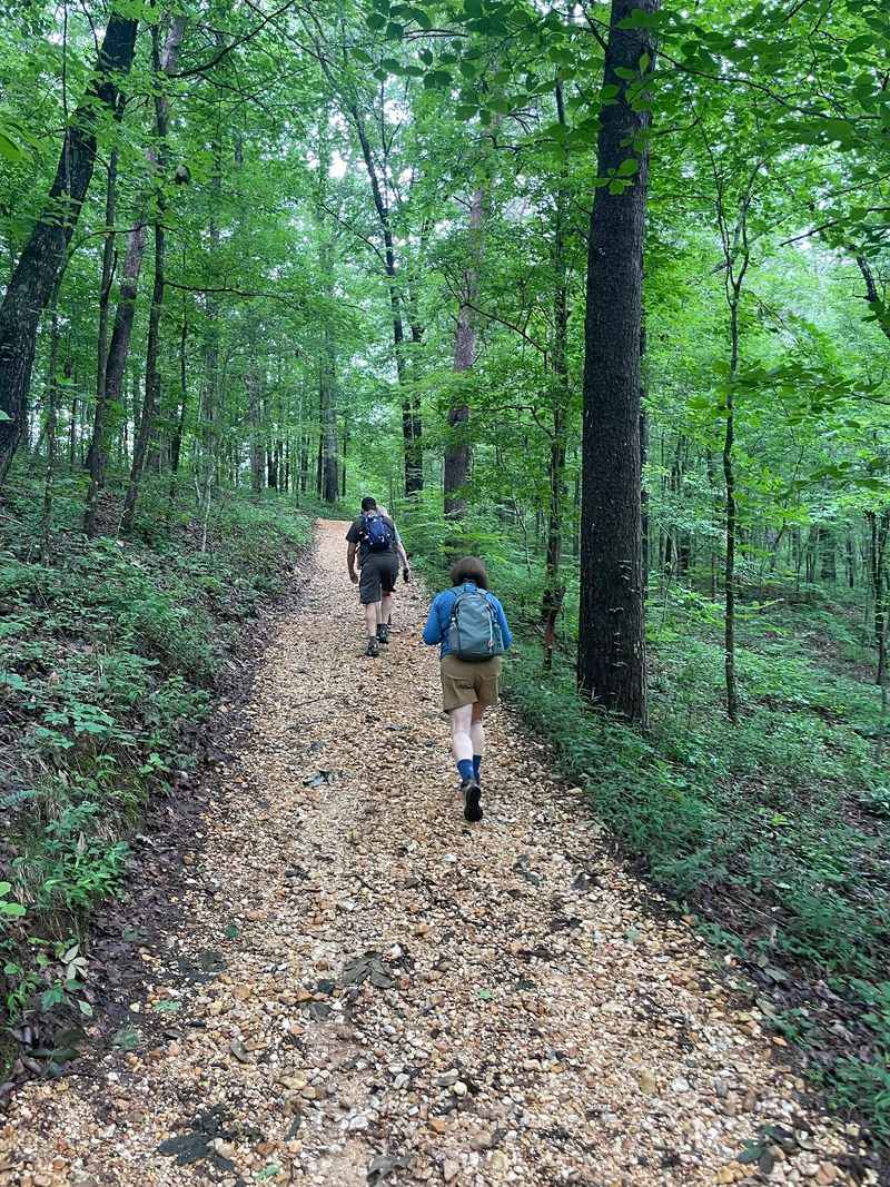
Signage here deserves its own paragraph. Over 25 miles of maintained trails wind through the property, and nearly every junction lists directions to nearby points of interest, which is rarer than it should be.
Difficulty ranges widely. Some paths roll gently along the ridge, while others drop steeply over loose rock toward the creek.
Hiking sticks are often available at the entrance kiosk, and I would take one without hesitation for the steeper descents. Gravity plus damp sandstone is a humbling combination.
A popular option runs around three and a half miles and packs in a waterfall, an overlook, and creek access. That loop suits a half day nicely.
Because there are so many intersecting routes, it is genuinely easy to lose track of which trail you are on. Cell service is unreliable, so an offline GPS app plus the paper map is smart insurance.
Trail access can be limited after 3 PM, which matters if you are planning something long.
Small comforts show up in unexpected places. Restrooms and water coolers appear at points along the trails, along with benches and tables where the views are worth sitting for.
I ate lunch on one of those benches, boots off, watching a hawk work the thermals above the canyon rim. Simple, and hard to beat.
Wildflowers, Including The World’s Largest Shootingstar Colony
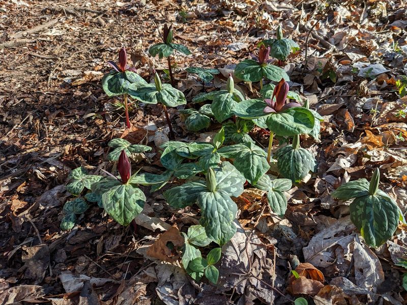
Here is the detail that impressed me most. The preserve holds what is considered the world’s largest colony of French’s shootingstar, a rare wildflower that clings to shaded bluffs and damp rock.
Spring turns the whole canyon into a slow-moving flower show. Alabama azalea and pinxter azalea bloom along the slopes, while Virginia spring beauty and Sweet Betsy trillium crowd the forest floor.
Wood violet and lobed tickseed add color later in the season. If you are the kind of hiker who stops every twenty feet to look at something small, you will be very happy.
Timing matters. Mid spring generally offers the fullest display, and it happens to coincide with strong waterfall flow.
A pocket wildflower guide or a plant identification app makes the walk more rewarding. I found myself naming things out loud like an amateur botanist, which my hiking partner tolerated graciously.
Staying on the trail protects these populations more than anything else you can do. Rare plants do not recover quickly from footprints.
Photographers should bring a lens that focuses close and skip picking anything.
What sticks with me is how ordinary the setting looks at first glance, just Alabama woods. Then you crouch down and realize you are looking at something that grows almost nowhere else on the planet.
Reading Ancient Oceans In The Canyon Walls
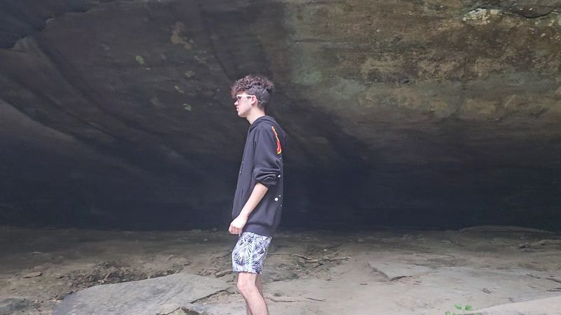
Geology nerds, this one is for you. The cliff faces along Cane Creek preserve the crossbedded patterns of ancient sand dunes, laid down when this part of Alabama sat beneath a shallow sea.
Layer by layer, the creek has cut down through sandstone and shale, exposing a timeline you can walk alongside. It is a rare thing to see so plainly without a museum label attached.
Down in the streambeds, sharp-eyed visitors turn up fossils, agates, jasper, and occasional bits of petrified wood. Kids tend to spot these faster than adults, probably because they are already looking at the ground.
The preserve was developed over decades by Jim and Faye Lacefield, who grew it from 40 acres in 1979 to more than 700, then donated it to The Land Trust of North Alabama in February 2023.
Jim Lacefield’s background in geology shows in how the property is interpreted. Informational handouts have long helped visitors understand what they are seeing.
Pioneer cabin sites add another chapter, quiet reminders of families who once farmed these ridges.
My advice is to slow down at the exposed rock faces instead of hurrying toward the next waterfall. Once you notice the dune patterns, you cannot unsee them, and the whole canyon starts making a different kind of sense.
Weekend Only Access And How To Plan Around It
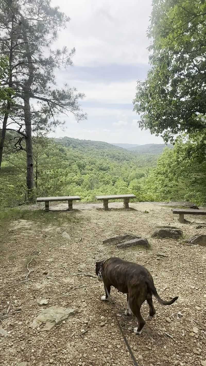
Timing your visit takes a little homework, because the preserve opens Friday through Sunday, roughly 7 AM to 5 PM. It also opens on most major holidays, with Thanksgiving Day and Christmas Day as exceptions.
Arriving early is the move. You get cooler air, better light in the gorges, and enough hours to actually finish a longer route before trail access tightens up in the late afternoon.
Signing in at the trailhead station is required, and signing out when you leave matters just as much for safety.
Spring and fall bring the mildest weather. Summer works if you start early and carry plenty of water, while winter delivers the strongest waterfalls and bare-branch views across the canyon.
A picnic area sits just off the trailhead and is easy to reach, which makes it a solid spot for a family lunch without committing to a hard hike. Primitive camping sites are available as well.
Pack layers, snacks, and a refillable bottle. Leave the fossils and flowers where they are.
Access is free, and donations support the upkeep that makes this place run so smoothly.
Honestly, the weekend-only schedule is part of the charm. It keeps things unhurried, and it gives you a reason to build a proper trip around northwest Alabama.
Address: 251 Loop Rd, Tuscumbia, AL 35674
