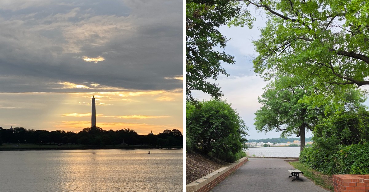
An 18.5-mile paved path just earned a place in the national Rail-Trail Hall of Fame. That’s a major honor for a route where cyclists and walkers can enjoy river views, historic landmarks, and glimpses of the nation’s capital.
The Virginia trail received the 2026 recognition from Rails to Trails Conservancy after winning 58 percent of the public vote. It follows the Potomac River and connects several communities, offering access to parks, memorials, and important historical destinations.
I like how the route combines recreation with sightseeing. You can plan a longer cycling adventure or choose a shorter section for a relaxed walk, depending on your schedule.
With more than a million annual users, the trail clearly plays an important role in local outdoor life. Its latest recognition gives visitors another reason to explore.
The Public Picked a Clear Winner This Year
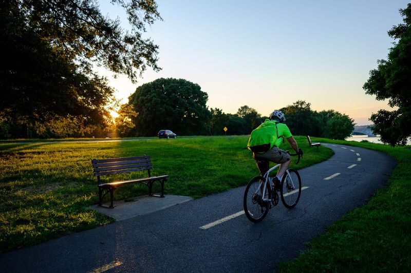
Votes decided this honor, and the Mount Vernon Trail didn’t squeak by. It earned 58 percent of the public vote during the August 2026 voting window.
That result beat two other finalists for a spot in the Rails to Trails Conservancy Hall of Fame. Being chosen by regular trail users feels a little sweeter than a quiet committee decision.
The trail stretches roughly 18 to 18.5 miles through Northern Virginia. It passes through Fairfax County, the City of Alexandria, and Arlington County along the way.
Its southern end sits at George Washington’s Mount Vernon estate. Its northern end reaches Theodore Roosevelt Island, a natural preserve honoring another president.
The Hall of Fame win also puts it in good company. The W&OD Trail, another Virginia favorite, already holds a spot on that same list.
I believe the vote says something simple. People don’t just use this path, they genuinely care about it.
Over one million users travel it each year. Some are commuters heading to work, while others just want fresh river air on a Saturday morning.
Paved asphalt covers most of the route, with wooden boardwalks and concrete bridge sections mixed in. Mostly flat ground makes it friendly for many fitness levels, with only gradual hills to tackle.
Two Determined Neighbors Started the Whole Thing
Long before the trail existed, cyclists had a tricky option. They often rode in one lane of the George Washington Memorial Parkway, sometimes blocked off for them on Sundays.
That setup was hardly ideal. Two Alexandria women, Ellen Pickering and Barbara Lynch, decided people deserved a safe and dedicated path.
Their persistence paid off. The National Park Service built the first segment as a compacted gravel path, and it opened on April 15, 1972.
Volunteers played a huge role in that early work. Over the 1970s and 1980s, the trail grew longer and got paved in sections.
The idea itself is even older. Plans for paths along the Mount Vernon Memorial Highway date back to 1890 and again to 1930.
So the dream took around eighty years to arrive. Talk about patience.
I can’t imagine a better origin story for a community trail. It came from neighbors asking politely, then asking again, and again.
Remember that next time you cruise past a mile marker. Somebody fought for every flat, shaded stretch under your wheels.
That grassroots spirit still shapes the trail today. Volunteer efforts continue to support it, keeping its local roots strong across Virginia.
Your Ride Can End at George Washington’s Front Door
Few bike paths can claim a first president as their neighbor. The southern end of the Mount Vernon Trail delivers you straight to George Washington’s Mount Vernon estate.
The estate sits at 3200 Mount Vernon Memorial Highway, Mount Vernon, VA 22121. That makes it the trail’s most famous anchor point.
Here’s a fun idea for a full day. Ride or walk south, then explore the historic home and grounds once you arrive.
Just plan your energy well. The full trail runs around 18 miles one way, so a round trip adds up quickly.
Bike rentals are available in Alexandria. That gives you a handy midpoint option if you’d rather not start at the far northern end.
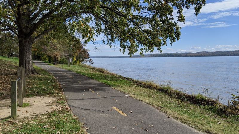
The southern stretch also feels different from the busy northern miles. Woods and open river views take over as city noise fades behind you.
Parking is available at most access points. You can choose a shorter section that ends at the estate instead of tackling everything at once.
History buffs will love finishing a workout at such a landmark. And honestly, earning your sightseeing with your own two legs feels pretty fitting for a place tied to American independence.
Old Town Alexandria Turns Into a Rest Stop
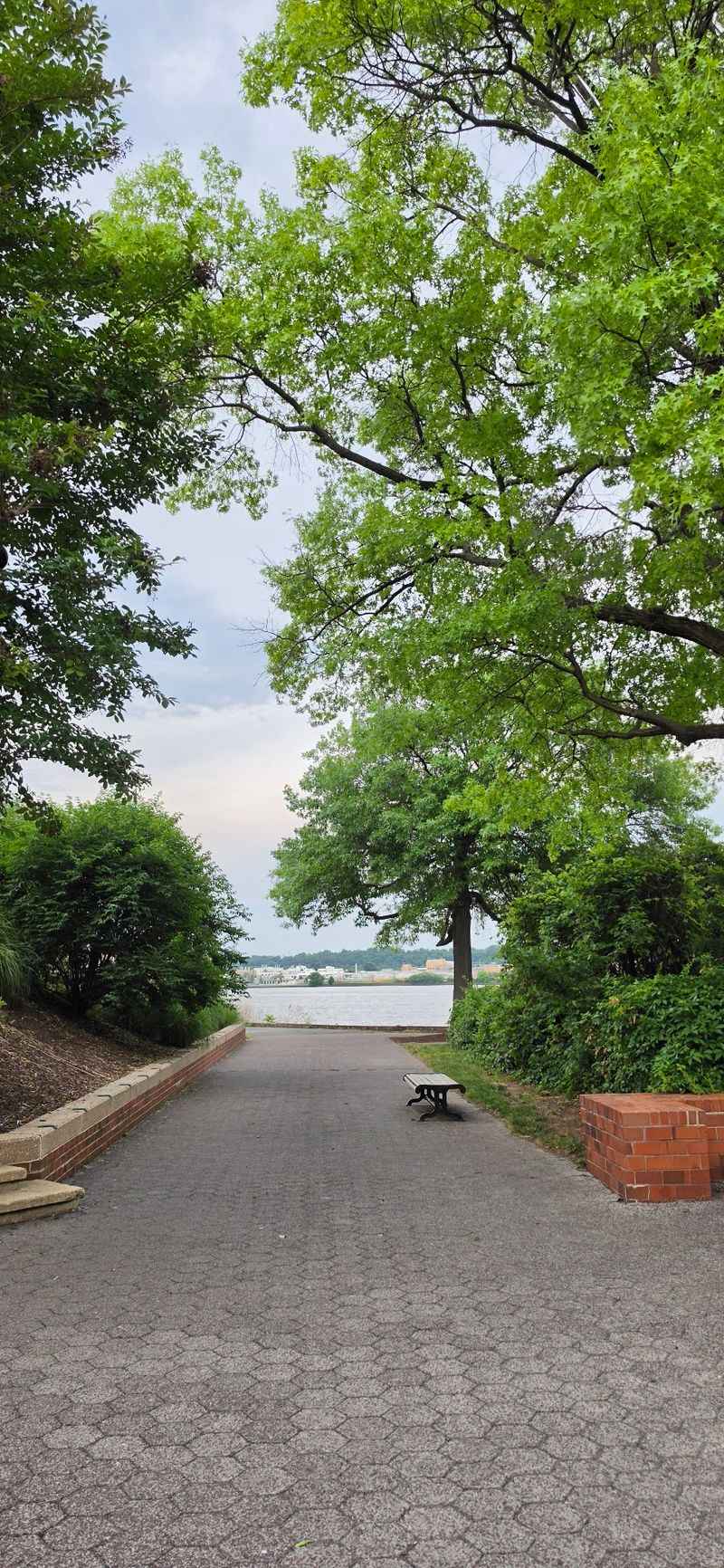
Most trails skirt around towns. This one rolls right through Old Town Alexandria, a beautifully preserved 18th-century waterfront district.
Historic architecture lines the area. Shops and restaurants make it an easy place to stretch your legs and refuel.
I like how the scenery shifts so fast here. One minute it’s trees and water, the next it’s brick buildings full of colonial character.
The district also offers a self-guided Black history tour. That’s a meaningful way to add some learning to your outing.
Bike rentals are available in Alexandria. If you’re visiting without your own wheels, this makes a smart starting point.
Old Town also works as a natural halfway marker. Heading north or south from here gives you two very different adventures.
One small tip helps a lot. Have navigation ready, since the route through town can feel less obvious than the open riverside sections.
Slow down in busier areas too. Sharing space kindly keeps the ride pleasant for everyone.
For a Virginia day trip with a little bit of everything, this stop is hard to beat. History, food options, and river breezes all sit within a short pedal of each other.
Planes Fly Close Enough to Make You Duck
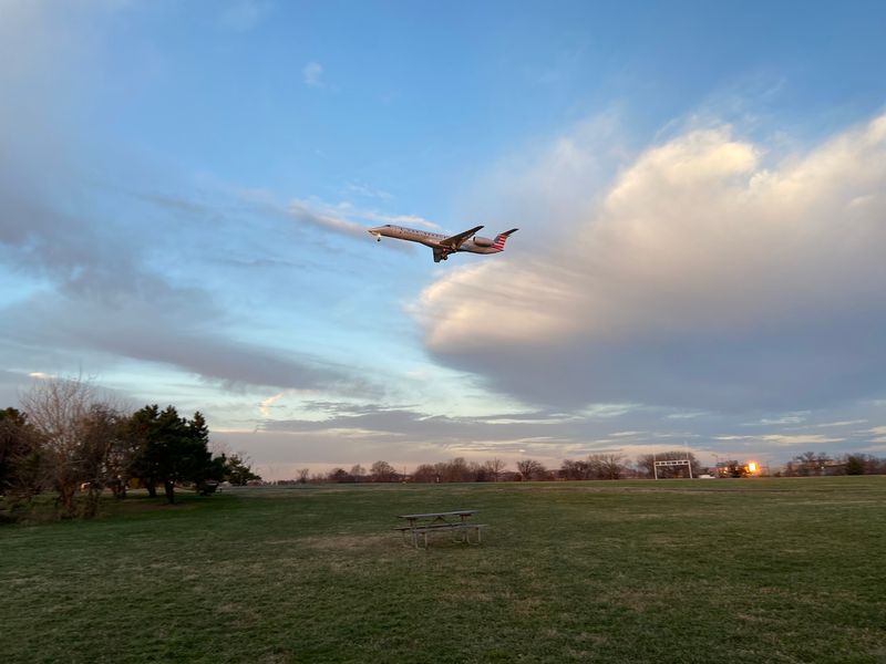
Few parks come with a built-in air show. Gravelly Point, right along the Mount Vernon Trail, offers close-up views of planes taking off and landing at Ronald Reagan Washington National Airport.
The jets pass low overhead. It’s loud, a little wild, and surprisingly fun.
Kids usually go nuts for this stop. Adults do too, if they’re being honest.
It’s a great place to pause after a long ride. Grab a spot, look up, and wait for the next roaring arrival.
One quick heads-up matters. The Long Bridge Project near Gravelly Point may cause temporary detours or bypasses, though the trail stays accessible.
Watch for posted signs as you approach. A small detour beats a surprise dead end.
The area also has a couple of access points near the airport. That makes it easy to hop on for a short loop if you’re nearby.
This is where the trail truly shows its personality. Boats glide on the river, cars hum on the parkway, and airplanes thunder above, all at once.
Bring a camera with a fast shutter. Catching a plane mid-landing makes for a memorable photo.
Washington’s Skyline Steals the Northern Miles
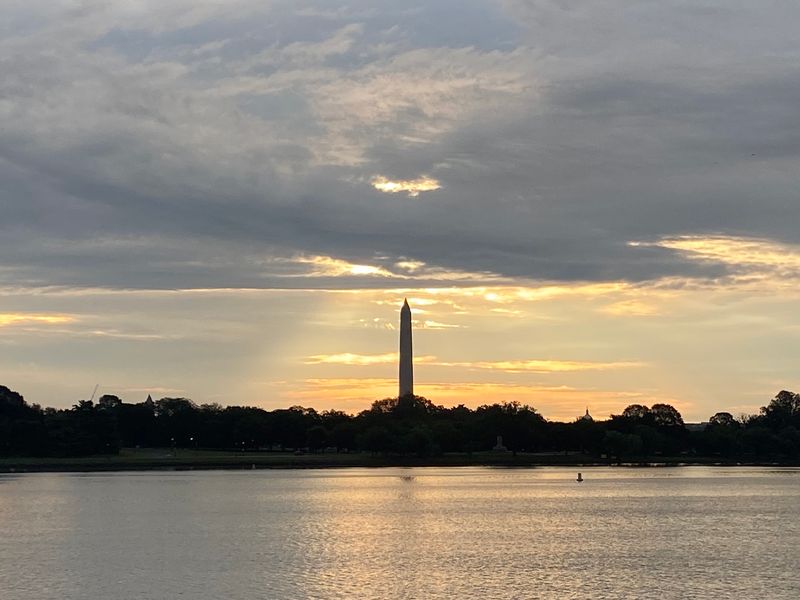
Heading north feels like watching a movie slowly reveal its big stars. The Washington Monument, Lincoln Memorial, Jefferson Memorial, and Kennedy Center all come into view across the Potomac.
These are skyline views many cities would envy. And you get them from a simple paved path in Virginia.
Near the northern end, Lady Bird Johnson Park adds a softer touch. The Lyndon Baines Johnson Memorial Grove offers a peaceful setting with wildflowers.
Close by stands the Navy and Marine Memorial. This striking sculpture honors Americans who served at sea and is almost only reached by the trail.
That makes it a special find. Many people driving through the area never see it up close.
The trail finishes at Theodore Roosevelt Island. This natural preserve gives the route a calm, green bookend.
Golden hour is a smart time to visit. Low sunlight makes the monuments glow over the water.
Commuters enjoy these views daily, which seems almost unfair. Few work routes come with marble memorials and river breezes.
Pack a light jacket on windy days. The open riverfront can feel cooler than you expect.
Bring Binoculars for the Marsh Stretch
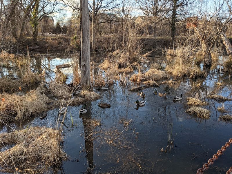
Great blue herons don’t care about your pace. At Dyke Marsh Wildlife Preserve, you’ll want to slow down anyway.
This preserve ranks among the largest remaining freshwater tidal marshes in the National Park System. That’s a big deal for such a busy metro area.
Birdwatchers treasure it. Wildlife spotting here can turn a quick ride into a long, happy pause.
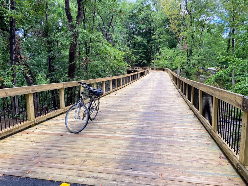
Wooden boardwalks add charm to this part of the route. The bridge at Dyke Marsh was replaced in recent years, giving riders a smoother crossing.
Still, take care on the southern stretch. Tree roots and weather can leave bumps in the asphalt.
A steady speed and alert eyes go a long way. Your tires will thank you.
Binoculars fit easily in a small bag. A field guide or birding app helps you name what you see.
Quiet mornings are a nice choice for nature lovers. The marsh feels calm before the day gets busier.
I believe this section shows the trail’s other side. Beyond monuments and history, it protects a lively natural world right along the Virginia shoreline.
A Lighthouse and Old Batteries Hide Along the Way
A lighthouse on a river might surprise you. Jones Point Park holds Virginia’s only remaining riverine lighthouse.
The same park also protects the oldest surviving original boundary marker of the District of Columbia. History nerds, this one’s for you.
The Woodrow Wilson Bridge rises nearby. It makes a dramatic backdrop for photos along the water.
Farther south, Fort Hunt Park offers wide public green spaces. Old batteries there once defended the Potomac River during the Spanish-American War.
That mix keeps the ride interesting. You can stretch out on grass, then poke around structures with real stories behind them.
Fort Hunt Park also works well as a starting point. Parking there lets you jump onto the trail without driving into busier areas.
Picnic tables and benches appear at spots along the route. Pull-off areas make it easy to take a break by the water.
Kids may enjoy hunting for these historic details. Turning the outing into a scavenger hunt can keep young legs moving.
These stops prove the trail rewards curiosity. Every few miles, something unexpected seems ready to tell its tale.
Smart Tips Before You Clip In
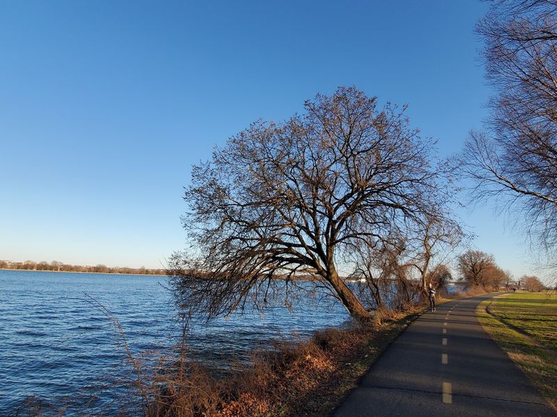
Good planning makes a great trail even better. The Mount Vernon Trail is open year-round, usually from 6 a.m. to 10 p.m., though commuters may use it anytime.
Walking, running, biking, and inline skating are all welcome. Dogs can join too, as long as they stay leashed.
Motorized vehicles are not allowed, except wheelchairs for people with disabilities. That keeps the path friendly for slower travelers.
Amenities include restrooms, water fountains, benches, picnic tables, and trash cans. Some restrooms and fountains may close during colder months, so pack water.
The trail can get crowded on nice days. Keep right, pass carefully, and give a friendly heads-up before going around someone.
It also connects to a huge network. Links include the Custis Trail, Four Mile Run Trail, W&OD Trail, Rock Creek Trail, and Woodrow Wilson Bridge Trail.
The route is part of the East Coast Greenway and the Potomac Heritage National Scenic Trail. It’s also a key piece of the growing Capital Trails Network.
So start small if you’re new. One stretch in Virginia today could turn into a much longer adventure next season.
