I never expected a quiet trail tucked deep in Oregon’s Willamette National Forest to completely knock me off my feet, but Triangulation Peak and Boca Cave did exactly that. Near Detroit Lake, I found myself climbing through wildflower-filled meadows, already stopping every few minutes just to soak it all in.
Oregon has a way of sneaking up on you like that. One moment you’re hiking through the forest, the next you’re staring at huge Cascade peaks rising in every direction.
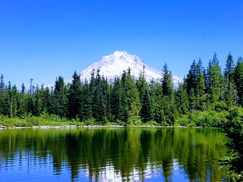
The summit views are unreal. Mount Jefferson, Mount Hood, the Sisters, all laid out like a postcard you can’t stop staring at.
Then there’s the cave. Boca Cave is massive, wide open, and perfectly frames Mount Jefferson like nature planned it that way.
I sat there longer than I meant to, snacks in hand, wondering how more people don’t talk about this place. Early summer turns the whole hike into a explosion of color and quiet.
If you’re craving real Oregon adventure without the crowds, this trail might be the one you didn’t know you were missing.
Finding the Trailhead Through Forest Roads
Getting to this adventure starts with navigating FSR 2233 and FSR 650, which can feel like a treasure hunt through Oregon’s backcountry. I’ve learned that most GPS systems get a little confused once you leave Highway 22 near Detroit, so downloading offline maps beforehand saves a lot of headache.
The forest roads are typically well-maintained and accessible to most vehicles, though I’ve seen some confusion where FSR 650 is sometimes marked as 575 on older maps.
The drive itself offers stunning glimpses of Detroit Lake and surrounding wilderness. Pull over at a few viewpoints if you have time because the scenery rivals the hike itself.
Once you arrive at the trailhead, you’ll find a small parking area that rarely fills up, even on summer weekends.
Don’t forget to grab your free wilderness permit at the trailhead before starting. It’s required for all hikers entering the Mount Jefferson Wilderness, and honestly, filling it out takes less than two minutes.
I always snap a photo of the trailhead sign with my phone just in case I need to find my way back or share directions with friends later.
The Wildflower Explosion in Early July
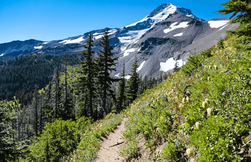
Early July transforms this trail into a botanical wonderland that absolutely took my breath away the first time I saw it. The meadows erupt with bear grass, lupine, paintbrush, and countless other wildflowers that carpet the hillsides in purples, reds, yellows, and whites.
Walking through these fields feels like stepping into a nature documentary, except you’re the star of the show.
The bear grass is particularly spectacular, with its tall white plumes standing like natural candles across the landscape. I’ve hiked this trail in August and September too, and while still beautiful, nothing compares to that peak wildflower window.
The colors are so vivid they almost don’t look real, and every turn reveals another Instagram-worthy scene.
Photographers should plan for golden hour lighting, either early morning or late afternoon. The way sunlight filters through the flowers creates an ethereal glow that makes your photos look professionally shot.
I recommend bringing a macro lens if you have one, because the tiny details on individual blooms are absolutely stunning up close and personal.
The Moderate Climb to Triangulation Peak Summit
The climb covers roughly 1,000 to 1,200 feet of elevation gain over about 2.6 miles, which sits comfortably in the moderate difficulty category. I found the grade steady but never punishing, with plenty of switchbacks that make the ascent manageable even for hikers who aren’t ultra-marathon runners.
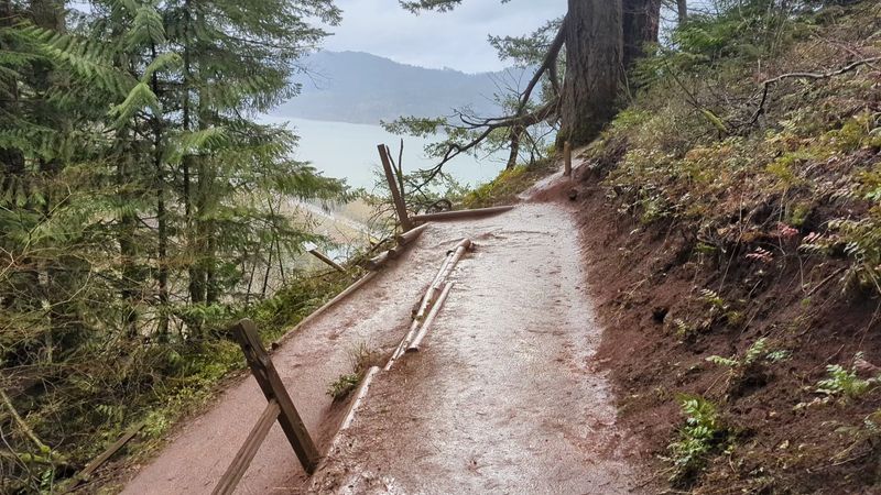
The trail surface alternates between packed dirt and some rocky sections, so decent hiking boots make a real difference.
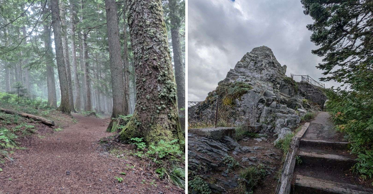
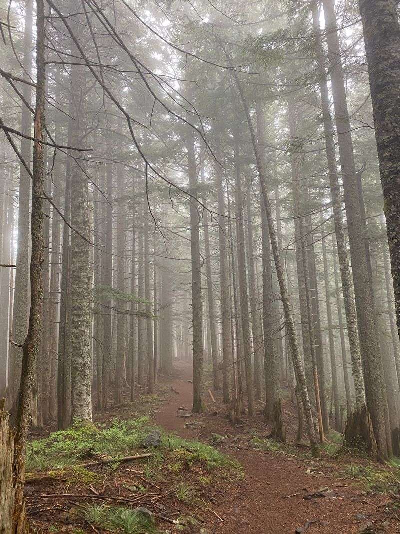
What surprised me most was how quickly the forest transitions from dense evergreens to more open terrain as you gain elevation. The changing ecosystems keep things interesting, and you’ll notice the air getting noticeably cooler and crisper with each hundred feet you climb.
I always pack an extra layer because summit temperatures can be 10 to 15 degrees cooler than the trailhead.
The maintained trail is easy to follow all the way to the peak, with only a few spots where fallen trees might require a quick step-over. Trekking poles helped me maintain rhythm and took pressure off my knees on the descent.
Plan for about 90 minutes to reach the summit at a comfortable pace with photo stops included.
360-Degree Summit Views That Steal the Show
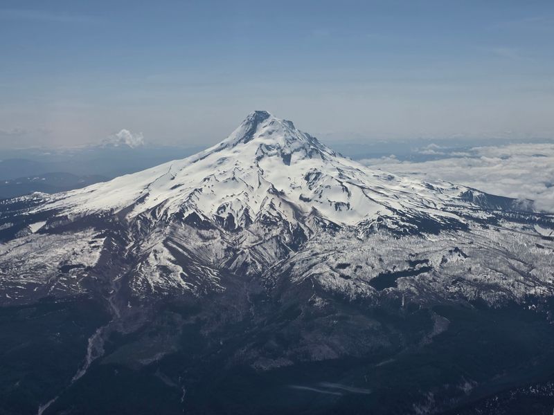
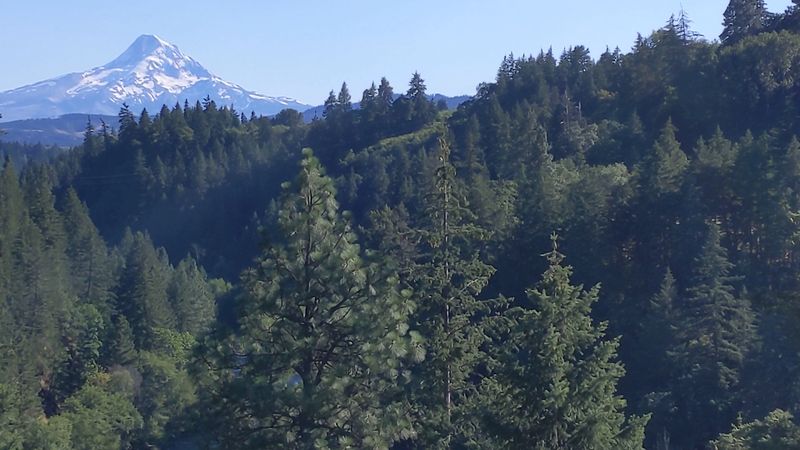
Standing on Triangulation Peak’s summit feels like being on top of the world, with views stretching in literally every direction. Mount Jefferson dominates the southern skyline, so close you feel like you could reach out and touch it.
Mount Hood rises majestically to the north, while Mount St. Helens, Three Fingered Jack, Mount Washington, and the Three Sisters complete this incredible mountain lineup.
I’ve visited this summit four times now, and each visit offers different conditions that change the entire experience. Clear days provide crisp, detailed views of every peak, while partly cloudy conditions create dramatic light and shadow play across the landscape.
Even when clouds partially obscure some mountains, the constantly shifting weather patterns create a dynamic show worth watching.
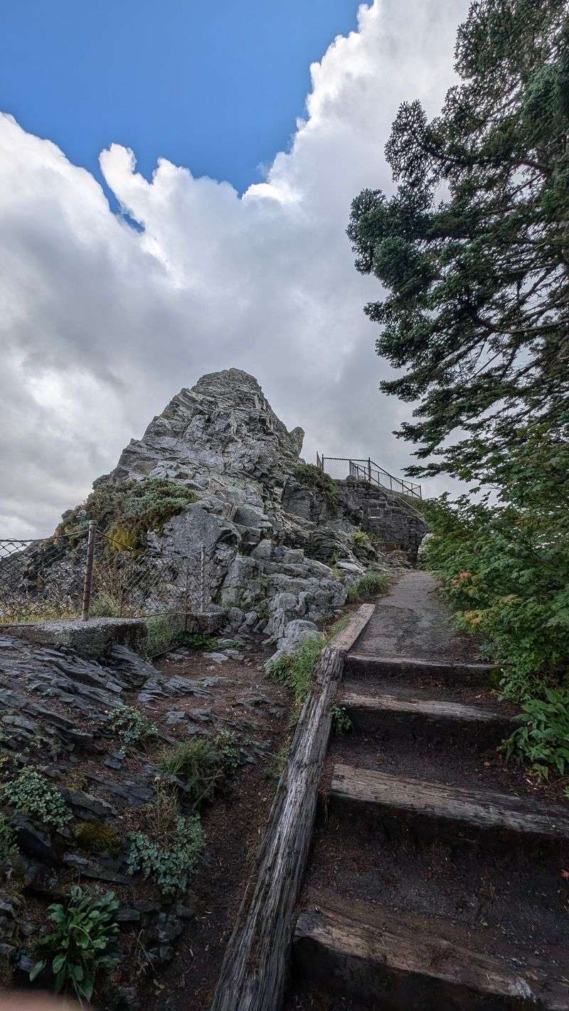
The actual summit area is relatively small but perfectly positioned for 360-degree viewing. I recommend walking the entire perimeter to catch every angle, because each direction offers something unique.
Bring binoculars if you have them, as spotting distant landmarks and geographical features adds another layer of enjoyment to the experience.
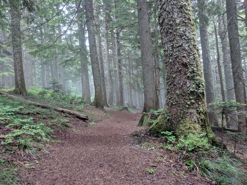
Finding the User Trail Down to Boca Cave
Locating the path down to Boca Cave requires some detective work since it’s not an official, maintained trail. Near the summit area, you’ll spot user-created paths heading downhill toward the east, and I’ve found that following the most worn route usually leads to the cave.
The descent is steep, loose, and definitely the most challenging part of the entire hike.
This scramble drops quickly through an area affected by old forest fires, leaving loose volcanic soil and limited vegetation to grab onto. I take this section slowly, testing each foothold before committing my full weight.
The trail zigzags down about 200 vertical feet over maybe a quarter mile, which sounds short but feels significant given the terrain.
Hiking poles become essential here, providing crucial stability on the descent and even more importantly on the climb back up. I’ve seen hikers attempt this section in running shoes, and I honestly don’t recommend it.
Good traction and ankle support make a massive difference. If you’re uncomfortable with steep, unmaintained terrain, the summit views alone make this hike worthwhile without attempting the cave portion.
Mount Jefferson Perfectly Framed by the Cave
The moment you turn around inside Boca Cave and see Mount Jefferson perfectly centered in the entrance opening, you’ll understand why people call this one of Oregon’s most photogenic spots. The cave naturally frames the mountain like a massive picture window, creating a composition so perfect it almost looks staged.
The contrast between the dark volcanic rock and the bright, snow-capped peak creates stunning visual drama.
I’ve photographed this view in different seasons and times of day, and each offers something unique. Morning light illuminates Jefferson’s eastern face beautifully, while afternoon sun creates more dramatic shadows.
Even on cloudy days when the peak plays hide-and-seek with the clouds, the framed view maintains its magic.
Setting up your camera or phone on a rock inside the cave lets you include the cave’s interior in your foreground, adding depth and context to the shot. I’ve seen photographers spend an hour here experimenting with different angles and exposures.
The view works equally well as a wide-angle landscape or a telephoto shot focusing just on the framed mountain portion.
Why This Trail Stays Relatively Uncrowded
Despite offering world-class views and a unique cave, this trail remains surprisingly quiet compared to more famous Oregon hikes. The somewhat remote location and forest road access keep casual tourists away, while the unmarked nature of the cave path deters less adventurous hikers.
I’ve completed this hike on summer Saturdays and encountered fewer than ten other people on the entire trail.
The trail’s relative obscurity means you can actually enjoy peaceful moments at both the summit and cave without crowds photobombing your pictures. This solitude enhances the wilderness experience, letting you connect with nature without the carnival atmosphere that plagues popular trails like Angel’s Rest or Mirror Lake.
You’ll hear birds singing instead of dozens of conversations echoing through the forest.
Word is slowly spreading about this hidden gem, so I suspect crowds will increase in coming years. Visiting on weekdays or starting early morning maximizes your chances of having the trail nearly to yourself.
The parking area only accommodates about eight to ten vehicles, which naturally limits how many people can access the trail simultaneously, providing a built-in crowd control mechanism.
Important Safety Considerations for Cave Access
The cave portion of this adventure requires honest assessment of your abilities and comfort level with challenging terrain. The steep, loose descent and equally demanding ascent back up aren’t suitable for young children, and I definitely wouldn’t attempt bringing pets down this section.
The unmarked nature means you’re responsible for your own navigation and safety without trail markers or maintained tread.
I always tell friends to turn back if weather conditions deteriorate, especially if rain makes the already loose soil even more treacherous. The volcanic cinder becomes incredibly slippery when wet, transforming a moderate challenge into a genuinely dangerous situation.
Check weather forecasts before starting and be prepared to skip the cave if conditions aren’t ideal.
Cell phone service is spotty to nonexistent in this area, so don’t count on calling for help if something goes wrong. Hiking with a partner provides crucial backup if someone twists an ankle or encounters difficulties.
I pack a basic first aid kit, extra water, and emergency supplies even on this relatively short hike. The wilderness permit you fill out at the trailhead serves as your only notification of where you’re hiking that day.
Planning Your Visit for the Best Experience
Timing your visit makes all the difference between a good hike and an absolutely spectacular one. Early July hits the sweet spot for wildflowers while typically offering stable weather patterns with warm days and cool nights.
I aim to start hiking by 7 or 8 AM, which puts me at the summit during perfect morning light and helps me avoid afternoon thunderstorms that occasionally roll through Oregon’s high country during summer.
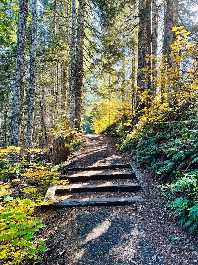
The trail typically becomes accessible in late June once snowmelt clears the higher elevations, remaining hikeable through October before winter snows close forest roads. September offers gorgeous fall colors and fewer bugs, though you’ll miss the wildflower displays.
I’ve hiked this trail in early October and enjoyed crisp autumn air with stunning golden larches mixed among the evergreens.
Pack plenty of water since no reliable sources exist along the trail, and bring layers for changing temperatures between trailhead and summit. Sunscreen and a hat protect against intense high-elevation sun exposure.
I always throw in extra snacks because something about mountain air makes me ravenously hungry, and nothing beats enjoying lunch inside that magnificent cave while gazing at Mount Jefferson through nature’s perfect frame.
Dear Reader: This page may contain affiliate links which may earn a commission if you click through and make a purchase. Our independent journalism is not influenced by any advertiser or commercial initiative unless it is clearly marked as sponsored content. As travel products change, please be sure to reconfirm all details and stay up to date with current events to ensure a safe and successful trip.