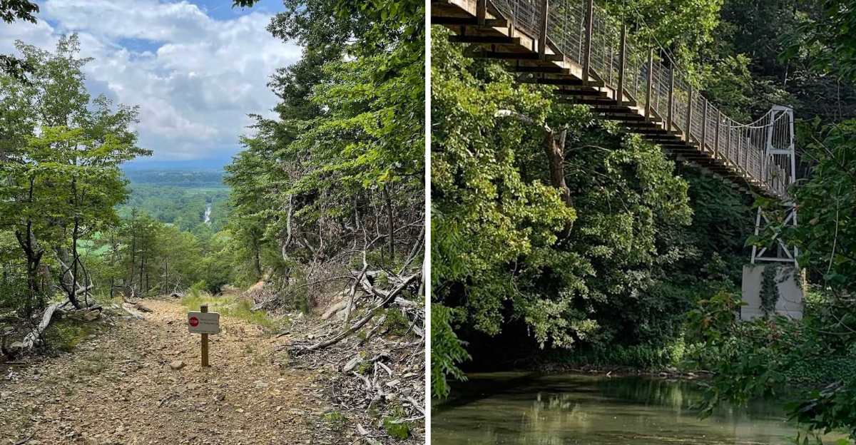
Swinging suspension bridges and peaceful river bends do not usually go together in my mind, but Virginia proved me wrong.
I stepped onto that bridge and felt it sway beneath my feet, my heart jumping a little with every step.
The river curved through the landscape in wide, lazy bends, and the air smelled like cool water and pine.
That park sits on over a thousand acres and opened just a few years ago, so it still feels fresh and uncrowded compared to older parks in the region.
I spent an afternoon crossing that bridge, feeling it sway beneath me, and realized I had found something special.
If you are planning a full day of hiking or just need a few hours outside, that park delivers something genuinely worth the drive.
The Suspension Bridge on Eagles Edge Trail
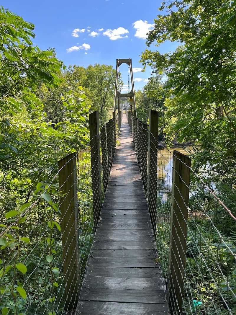
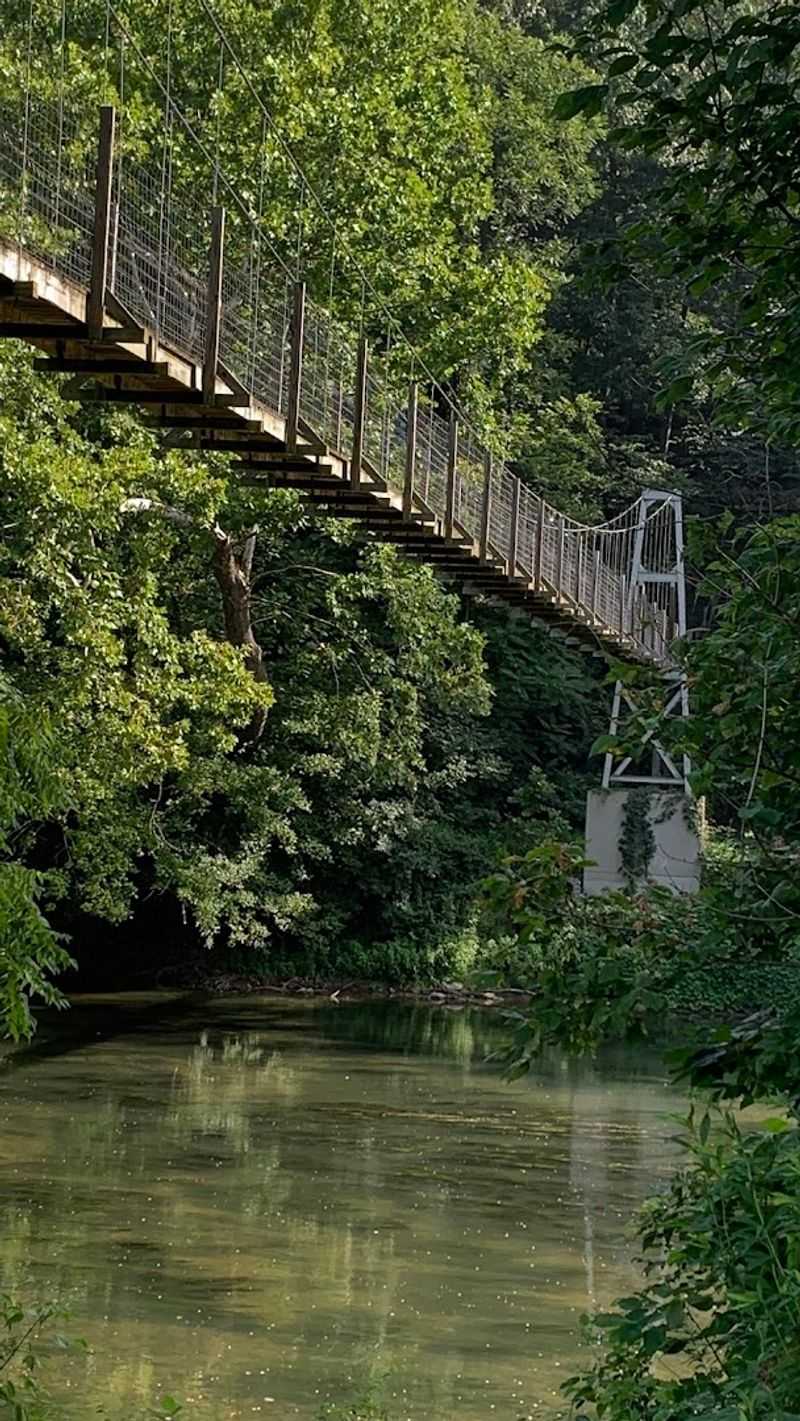
There is a moment on the Eagles Edge Trail when the trees thin out and you catch your first glimpse of the old suspension bridge stretching across the North Fork of the Shenandoah River. It stops you mid-step.
The bridge was originally built in the 1930s to give locals a crossing when the main road flooded, and that history alone makes it feel like something out of a different era.
Because it has no central supports, the whole structure moves as you walk across it.
That gentle sway underfoot turns what would be a simple river crossing into something that feels genuinely thrilling, even for adults who thought they were just out for a casual stroll.
I watched a couple of kids ahead of me go completely silent the second they stepped onto the planks, which says a lot.
It is worth knowing that the bridge is not officially park property. The far end leads to private land, so full crossing is restricted, but you can still walk out onto it and feel the movement.
That swaying sensation, combined with the river rushing below and the mountains framing the view, makes for one of the most memorable moments in the entire park.
The Eagles Edge Trail itself is accessible from the Lupton Road entrance at 1191 Lupton Road. The trail is well-marked and manageable for most fitness levels.
Bring a camera because the bridge photographs beautifully, especially in the morning light when mist still sits on the water.
The North Fork of the Shenandoah River Access
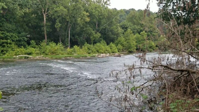
The river is the heartbeat of this park. From the moment you pull into either entrance, you can feel the pull of the water, that low, steady sound of a river moving at its own pace, unhurried and cool.
The North Fork of the Shenandoah runs right through the property, and the park has made it genuinely easy to get down to the bank and actually touch it.
Both the Hollingsworth and Lupton entrances offer river access points. On the Bass Bight Trail, there is a spot roughly a quarter mile in where the bank opens up and the water is shallow enough to wade in comfortably.
On warmer days, families spread out along the rocks, kids splash around, and the whole scene feels relaxed and real, not curated or crowded.
The park also has two hand-carry boat launches for kayaks and canoes.
Self-service kayak rentals are available near the Lupton entrance, and payment is handled through a QR code at the ramp, which makes the whole process surprisingly smooth.
One ranger tip worth following: drop your boat at one entrance, hike through the mountain trails, and reconnect with the river at the other side for a full loop-style adventure.
The water itself is refreshing in a way that genuinely revives you after a warm hike. Even just sitting on a flat rock with your feet in the current feels restorative.
The river views from the trails above are equally stunning, especially where the bends curve through open meadows.
The Trail System and What to Expect on the Paths
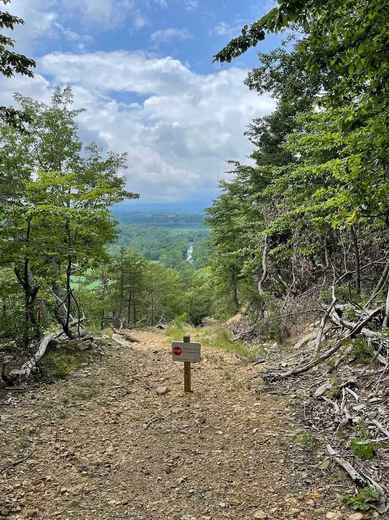
Nine miles of trails sounds modest until you actually start climbing toward Powell Mountain and realize the elevation gain is no joke.
The park sits at the base of the Massanutten Mountain Range, and several trails ascend the western slope with steep, sustained inclines that will genuinely test your legs.
That said, not every trail here is a workout. There is a real range, from easy riverside walks to full ridge-line climbs.
The Pawpaw Hollow Trail is one of the more talked-about options. It connects with trails that push up into the national forest, giving experienced hikers a longer, more immersive route.
The River Bend Rise Trail offers what some visitors describe as enchanted forest energy, with shaded canopy, good lookout spots, and benches placed at surprisingly thoughtful intervals along the route.
Those benches deserve a mention on their own. Someone clearly put real care into positioning them at moments where the view opens up or where you genuinely need a rest.
It is a small detail that makes the experience feel more considered than your average state park trail system.
Trails in the ripe summer months can be lined with wild raspberries, and the park is wild enough that black bear sightings have been reported, particularly along the Reservoir Trail.
If you encounter wildlife, the ranger station is reachable and staff are responsive.
Wear proper footwear for the steep sections, bring more water than you think you need, and expect to earn the views on the harder routes.
The Two Separate Entrances and How to Navigate Them
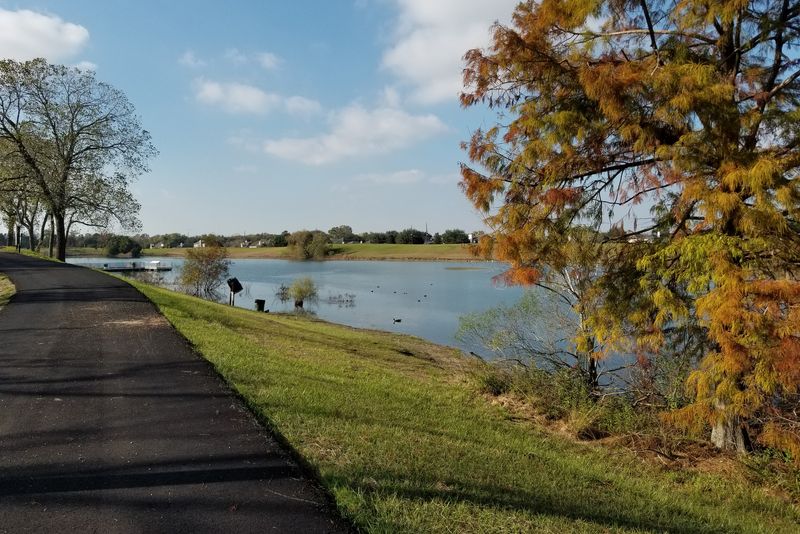
One of the most important things to know before visiting Seven Bends is that the park has two completely separate entrances that do not connect internally.
You cannot drive from one side to the other without leaving the park and heading back through town.
It sounds like a minor logistical detail, but if you show up at the wrong entrance for the trail you want, you will lose time backtracking.
The Hollingsworth Road entrance at 2111 South Hollingsworth Road is the access point for the Bass Bight Trail and Pawpaw Hollow Trail.
The road in is narrow and includes a one-lane bridge, so you will need to take turns if another car is coming the other direction.
Minivans and standard sedans make it fine in dry conditions, though rain can make the approach more challenging.
The Lupton Road entrance at 1191 Lupton Road is generally considered the more accessible side.
It leads to the Eagles Edge Trail, the Gokotta Trail, the suspension bridge, and the popular LOVE sign that makes for a great photo stop at sunset.
This side also has more open picnic space and better river access for casual visitors.
Both entrances have pit toilets in the parking areas, and a self-pay fee station handles the entry fee at each access point.
There is no ranger booth, but rangers do patrol both sides regularly and are genuinely helpful when you run into them.
Planning which entrance to use before you leave home saves real hassle on arrival.
The Natural Playground and Family-Friendly Features
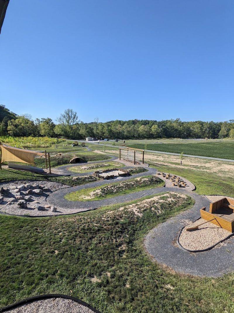
Not every great park moment involves a strenuous hike, and Seven Bends gets that. The Hollingsworth entrance has a natural playground area that genuinely caught families off guard in the best way.
It is built from natural materials, blends into the landscape, and includes a small watchtower that kids absolutely love climbing. The sensory garden nearby adds a thoughtful layer for younger or more sensory-focused visitors.
The playground skews toward slightly younger children, but older kids still find plenty to do around it. The path through the area is surfaced with crushed aggregate gravel, which is mostly accessible but may present some difficulty for wheelchairs.
It is worth noting for families traveling with anyone who uses mobility aids.
Picnic tables are spread across both sides of the park, with more concentrated options near the Lupton entrance. Most tables sit in open sun, so a hat and sunscreen go a long way on warmer days.
There are also picnic areas with grills, which makes a full afternoon cookout by the river entirely doable.
The park runs periodic ranger-led programs and educational events throughout the year. There is no visitor center on site, but rangers sometimes set up a pop-up station where you can grab a map, ask questions, and pick up small souvenirs.
The whole family-friendly setup here feels genuinely relaxed rather than over-programmed, which is exactly what a good day outside should feel like. Kids leave muddy and happy, which is pretty much the goal.
Practical Tips for Planning Your Visit
A few practical details can make the difference between a smooth visit and a frustrating one at Seven Bends.
The park is open every day from 6 a.m. until dusk, and there is a per-car entry fee collected via self-pay stations at both entrances.
Payment can be made with cash or through a mobile app using a QR code posted at the entrance, so both options are covered.
Cell service in the area can be spotty depending on your carrier, so downloading a trail map before you leave is a smart move.
The park does not have a visitor center, which means you are largely navigating on your own unless a ranger happens to be on site.
The trail signage is generally clear and well-maintained, but having a backup map on your phone gives you confidence on longer routes.
Bug spray is genuinely necessary in warmer months. The trails run through meadows and river corridors where insects are active, especially in the evening.
Solid hiking shoes are a must for anything beyond the flat riverside paths, and the steep sections of trails like Pawpaw Hollow will punish soft-soled sneakers quickly.
The park sits about an hour and a half from the Washington D.C. area and just off Interstate 81, which makes it a realistic day trip from a wide range of starting points.
Fall is particularly beautiful here when the leaves turn along the river corridor.
Arriving early on weekends gives you the trails and river access mostly to yourself, which is worth the early alarm.
Address: 2111 South Hollingsworth Road, Woodstock, VA 22664
