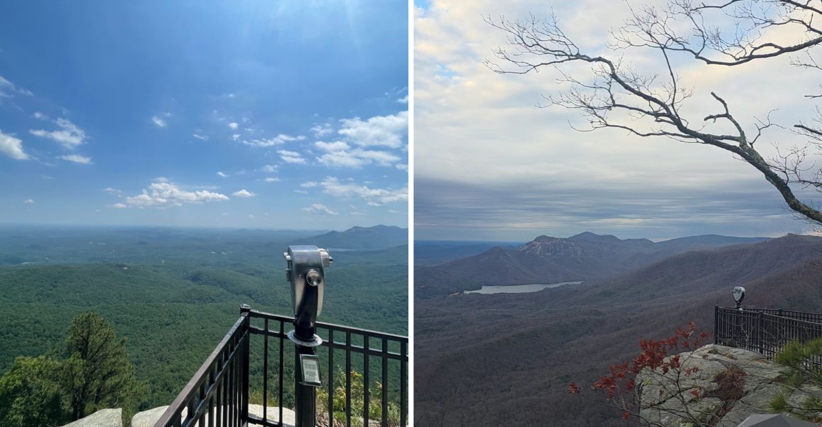
That switchback road in the mountains ended with a view that made me forget what I was talking about mid-sentence. One minute I was watching rhododendron leaves brush the car window, and the next I was looking out over a drop of nearly 2,000 feet into rolling green hills.
The rock outcropping I was standing near has a name that people have been arguing over for generations, and nobody fully agrees on where it came from, which somehow makes it better. The overlook itself takes about a minute to reach from the parking lot, and it delivers more than most hikes ten times longer.
I stood at the edge and watched the Piedmont spread out below me, the layers of blue-green ridges fading into the distance like a painting that had been left out in the sun. The wind was steady and cool, and I stayed longer than I planned, just watching the light shift across the valley.
Big mountain scenery without a big effort is exactly what this South Carolina spot delivers, and it is the place I keep recommending to friends who want the payoff without the struggle.
A place that gives you that much view for that little work deserves to be shared.
The Rock That Started All the Arguments
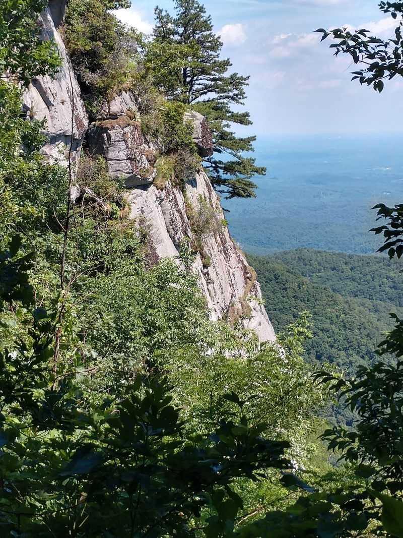
Nobody can agree on how this hunk of stone got its odd name, and honestly, I find that charming. The most repeated explanation is that the rock’s profile looks like the head of Julius Caesar when you catch it from the right angle.
Another story says a hunter’s dog named Caesar chased prey right off the edge of the cliff, and the spot kept his name. A third theory suggests Caesar is a worn-down version of sachem, the Cherokee word for chief, which fits since this land was Cherokee territory before being given up to the state in 1816.
The geology is less debatable. Caesar’s Head is granitic gneiss, formed roughly 409 million years ago, and its summit sits at 3,208 feet above sea level.
What makes it feel dramatic is the drop rather than the height. The rock rises about 2,000 feet above the Piedmont in a sudden, sheer plunge instead of a gradual slope.
Standing near it, you get the sense of being perched on the edge of something rather than climbing toward it. That single detail is what separates this overlook from most others in the Carolinas.
A View That Reaches Into Three States
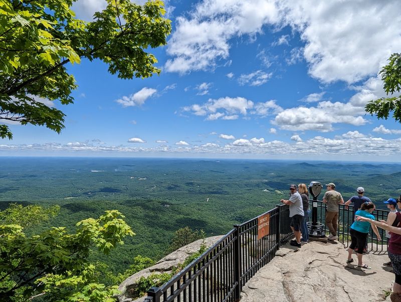
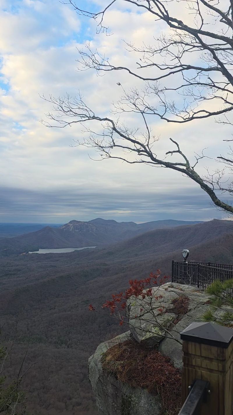
My favorite part of the whole trip took less than sixty seconds of walking. From the visitor center parking area, a short paved path leads to a railed platform on top of the outcrop, and suddenly the entire Blue Ridge Escarpment opens up in front of you.
On clear days the view stretches into North Carolina and Georgia. Table Rock and Pinnacle Mountain stand out to the east, with the reservoir tucked in the valley below them like a dropped mirror.
Fog rolls through here often, and I would not call that a loss. Watching clouds slide between ridges below your feet is its own kind of show.
There is a coin-operated viewing scope at the overlook, so tossing a couple of quarters in your pocket is a smart move. Rangers sometimes stand out there naming distant peaks for anyone who asks, and I learned more in five minutes of that than an hour of reading signs.
Sunrise and sunset both hit beautifully, though late afternoon light on the Piedmont is what I still picture when someone mentions this park.
Squeezing Through Devil’s Kitchen
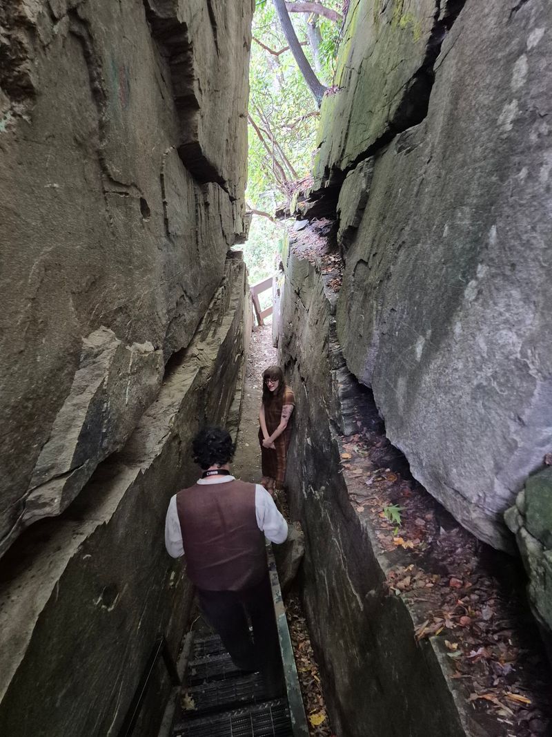
Just past the main overlook, a set of metal stairs disappears into a crack in the granite, and the first look down is genuinely a little unnerving. It is called Devil’s Kitchen, and the name sounds far more sinister than the experience actually is.
The passage is a narrow slot between two enormous chunks of rock, cool and shaded, with damp stone walls close enough to touch on both sides. Kids seem to love it, and I watched more than one adult grin their way through.
Walking it takes only a few minutes. The path pops out on the other side and curves gently back toward the parking lot, so nobody has to backtrack up the steps.
What I appreciated most was the perspective it gives. From down inside the crevice you finally see the Caesar’s Head outcropping from the side, which is impossible from up top.
Sturdy shoes help since the stone can be slick after rain. Beyond that, this is about as approachable as rock scrambling gets, which makes it a favorite for families passing through.
Chasing Raven Cliff Falls
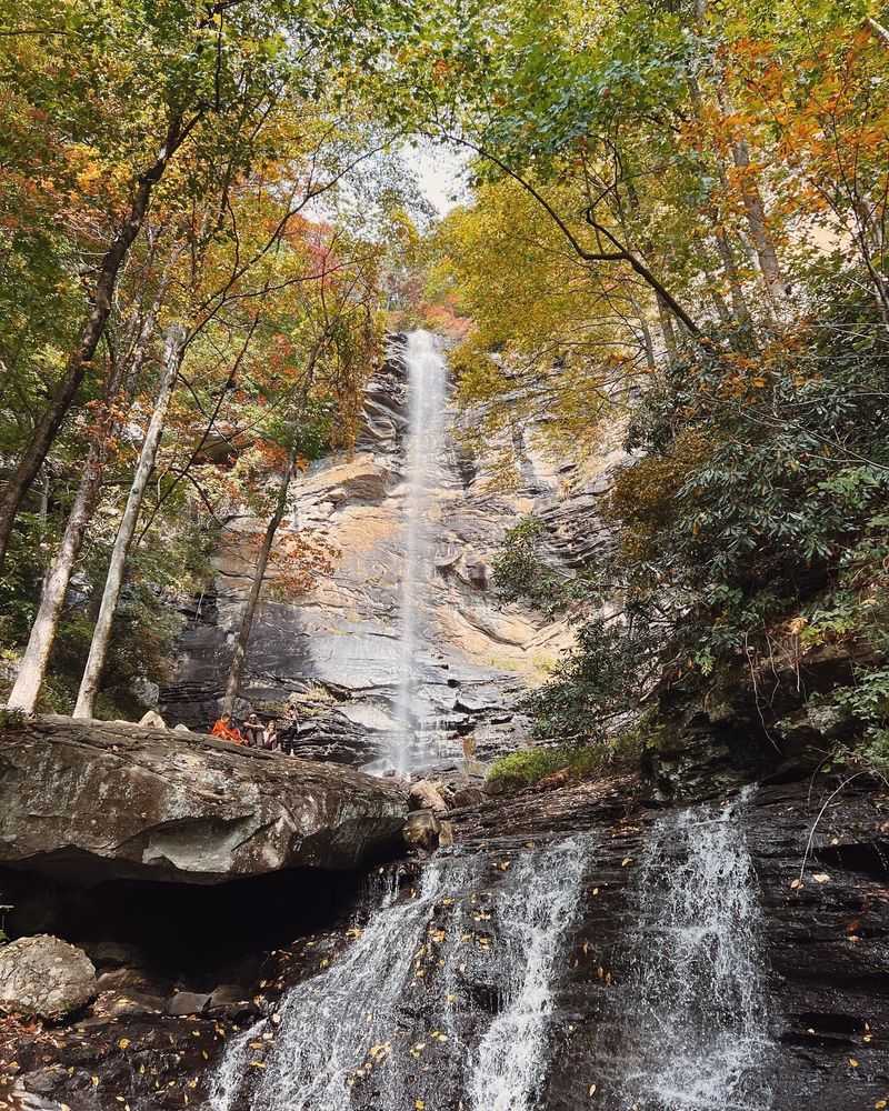
Raven Cliff Falls is the reason plenty of people come here in the first place, and it earns the hype. The water tumbles roughly 420 feet down the mountainside in a long, stepped cascade that looks almost unreal from the viewing platform.
Getting there means a four-mile round trip on a well-marked trail that begins from a separate pull-off along the highway. The grade is manageable for most reasonably fit hikers, with tree cover for much of the way.
Those wanting more can push on to a 6.6-mile round-trip route that reaches a suspension bridge crossing the creek right above the falls. Feeling the water rush beneath you before it drops into the cove is a memory that sticks.
A couple of practical notes I wish I had known sooner. Trailheads sit at different pull-offs, so stopping at the visitor center first to sort out parking and trail access saves confusion.
Bring water and snacks, since there are no facilities out on the trail. Portions occasionally close for maintenance, so a quick call ahead never hurts.
Sixty Miles of Trails Through the Mountain Bridge Wilderness
Here is the part that surprised me: the overlook is only the front door. Caesar’s Head connects with neighboring Jones Gap State Park to form the Mountain Bridge Wilderness Area, thousands of acres of protected southern mountain forest laced with more than 60 miles of trails.
Options run the full range. There are half-hour loops for anyone with limited time, mid-length routes in the two to three hour range, and demanding all-day climbs for hikers who want their legs to remember the trip.
I did the Frank Coggins Trail on a whim and stumbled onto small waterfalls I had not expected at all. Wildcat Wayside, easy to reach on the way out, has bigger falls with far less effort required.
For serious backcountry types, trailside primitive camping is available by reservation, which opens up longer point-to-point routes across the wilderness.
Signage throughout is clear and the tread is well maintained. Pack out everything you bring in, because this is a pack-in, pack-out park and trash cans are limited on the trails.
Autumn Skies Full of Hawks
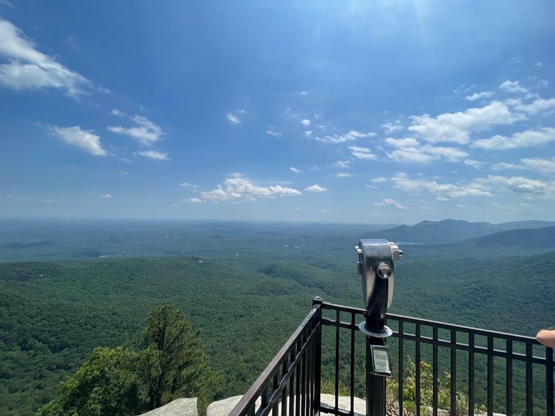
Every fall, this overlook turns into one of the best raptor-watching spots in South Carolina, and the birds put on a genuinely wild display. From September 1 through November 30, the park runs its Hawk Watch program, and thousands of migrating raptors pass overhead.
Hawks make up the bulk of the count, though eagles and falcons appear too. The park’s elevation and the sharp edge of the escarpment create thermals and updrafts that the birds ride south with almost no effort.
Watching them circle at eye level, then below you, is strange and wonderful. Binoculars are worth carrying, but plenty of the action happens close enough to enjoy without them.
September and October are the peak stretch, which happens to overlap with fall color on the ridges. Early November brings deep foliage tones, and yes, more visitors, even midweek.
Layers matter up here since the wind off the cliff can bite even on mild days. Find a spot along the railing, look up, and give it time.
The Visitor Center, Picnic Tables, and Planning Your Stop
Skipping the visitor center would be a mistake, and I say that as someone who almost did. Inside there is a relief map of the entire Mountain Bridge trail system, which finally made the layout of ridges and valleys click for me.
A digital microscope station lets you look at local insects, minerals, and plants up close, and a short film covers the park’s natural history and the fall hawk migration. Rangers here are generous with directions and local knowledge.
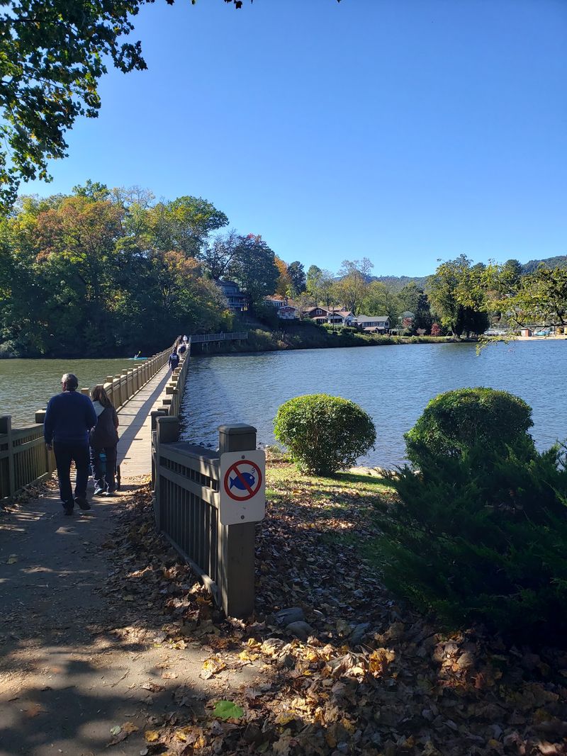
Restrooms, water, a small gift shop, and plenty of picnic tables sit near the lot, so packing lunch is an easy call. Trail access requires a small fee paid at the center, with a receipt for your dashboard, while the overlook itself costs nothing.
A bit of history: Colonel Benjamin Hagood built a summer cottage here in the mid-1800s that grew into a mountain hotel, which burned in 1954. The state acquired the land in phases and established the park in 1979.
Hours run 9 AM to 5 PM daily. Spring and fall bring the mildest weather and clearest views.
Address: 8155 Geer Hwy, Cleveland, South Carolina
