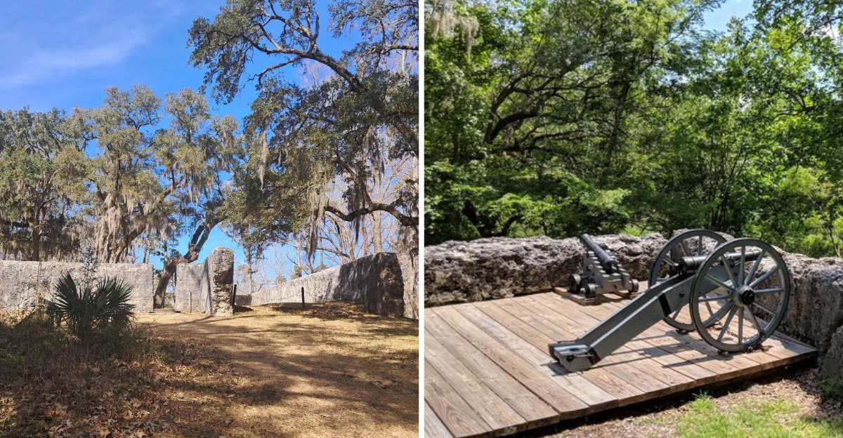
That brick bell tower rising up through the trees looked like it had been waiting, and the fort made from crushed oyster shells sat nearby, still holding its shape after more than 250 years.
I had pulled off a quiet South Carolina road on a sticky morning, half expecting a plain patch of grass and a couple of signs, and instead I found a whole town that used to be, hiding under oaks and Spanish moss along the river.
Nobody lives here anymore, and nobody has since the 1780s, which somehow makes the place feel louder rather than emptier. The town was established in the late 1600s by settlers who built their homes and fortifications from local materials, and it thrived for nearly a century before being abandoned.
I walked the loop slowly, reading every sign, listening to woodpeckers hammer away where merchants once shouted over cargo. The fort’s walls are still intact, and the bell tower stands at the edge of the site, a reminder of the settlement that once held authority over the surrounding area.
By the time I got back to my car, I was already planning a second visit.
A Town That Started With a Long Walk From Massachusetts
Most colonial towns in South Carolina were founded by people already living nearby. Dorchester was different.
In 1697, a group of Congregationalist settlers left Massachusetts and sailed south, looking for better farmland and a spot they could build from scratch. They picked a bend of the Ashley River, roughly 18 miles upstream from Charleston, and laid out streets, lots, and a market square.
The plan worked better than anyone probably expected. Dorchester grew into a busy inland trading town, eventually ranking among the largest settlements in the colony.
What struck me while walking the interpretive trail is how the layout is still readable if you pay attention. Mowed paths trace where roads once ran, and small markers show where houses and shops sat.
The site covers about 325 acres, though the core walking area is compact enough to cover in under an hour. I’d recommend grabbing the paper guide at the parking lot before you start, since it explains what you’re looking at far better than guessing does.
Bring bug spray in warm months. The mosquitoes here have clearly been around as long as the ruins have.
The Bell Tower That Refused to Fall
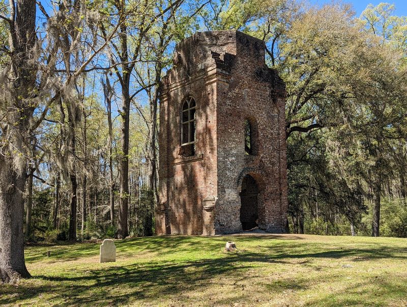
You see it before you see anything else. The brick bell tower of St. George’s Anglican Church climbs straight out of the grass, roofless and open to the sky, and it stops most visitors in their tracks.
Construction of the church happened between 1719 and 1720. The tower came later, added in 1751 when the parish had money and ambition to spare.
I put my palm against the brick, which is warm and rough and full of old mortar lines. Some bricks are chipped, others are darkened, and a few still look freshly fired.
British troops occupied Dorchester during the Revolutionary War and burned the church when they pulled out in December 1781. The walls came down eventually, but the tower stayed upright.
Photographers will want to come early or late, because midday sun flattens the texture of the brickwork. From the north side, you can frame the tower with hanging moss, which is the shot almost everyone ends up taking.
It’s a strange thing, admiring a building that lost its purpose centuries ago. Yet standing beneath it, you understand exactly why people keep coming back.
Oyster Shells, Lime, and Sand, Inside the Tabby Fort
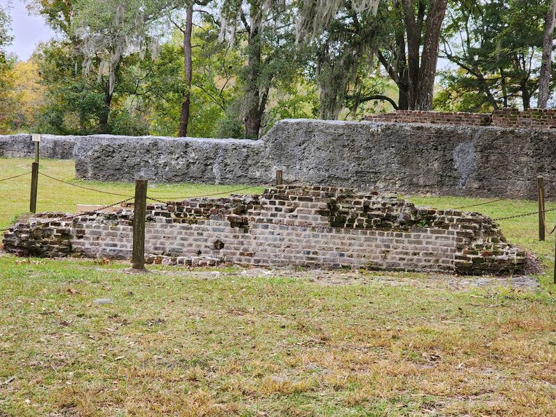
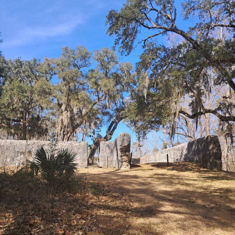
The fort was the part I knew least about, and it ended up being my favorite stop. Its walls are made of tabby, a building material mixed from burned oyster shells, lime, sand, and water.
Up close, the surface looks like frozen gravel, with shell fragments poking out everywhere. Run your fingers along it and you can feel individual pieces of shell that were scooped from the river long before the United States existed.
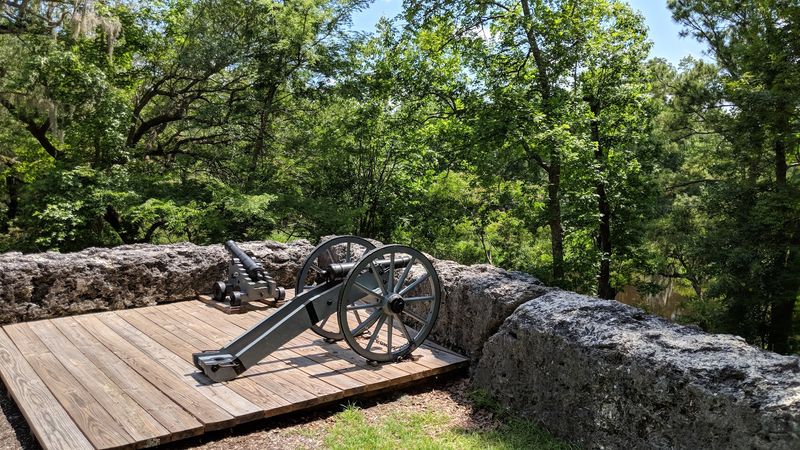
Workers built the fort between 1757 and 1760 to protect the town and its supplies. It is widely considered the best-preserved tabby fortification in the country, which is a big claim for such a quiet little park.
During the Revolutionary War, the fort served as a military depot, and Francis Marion, the officer nicknamed the Swamp Fox, commanded here for a stretch.
You can walk the interior and climb the low earthen ramp along the walls. Kids tend to love this section because it feels like a real castle rather than a museum piece.
Watch your footing near the edges. The ground is uneven and roots hide in the grass.
Reading Names in the Old Parish Cemetery
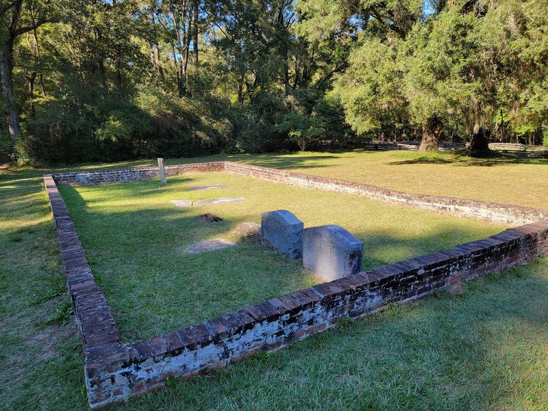
Tucked in the shade beside the bell tower sits the St. George Parish cemetery, and it’s easily the quietest corner of the whole site. Headstones lean at odd angles, some cracked, some worn nearly smooth.
I spent longer here than I planned. A few inscriptions are still legible, and reading a name and a date carved by hand centuries ago does something that no display panel can match.
Several graves are marked with flat brick tombs rather than upright stones, which was a common style in the lowcountry. Moss and lichen have crept across many surfaces, softening the letters year by year.
Please don’t do rubbings or lean on the stones, since old markers are fragile and repairs are difficult. Photographs work fine, especially in the soft light that filters through the oaks.
Visitors in the reviews mention this spot again and again, and I understand why. The ruins tell you a town existed, but the cemetery reminds you that actual families lived here, raised children, and buried the people they loved.
It grounds the whole visit in something human. That contrast stayed with me the longest.
Down at the Ashley River, Where the Wharf Once Stood
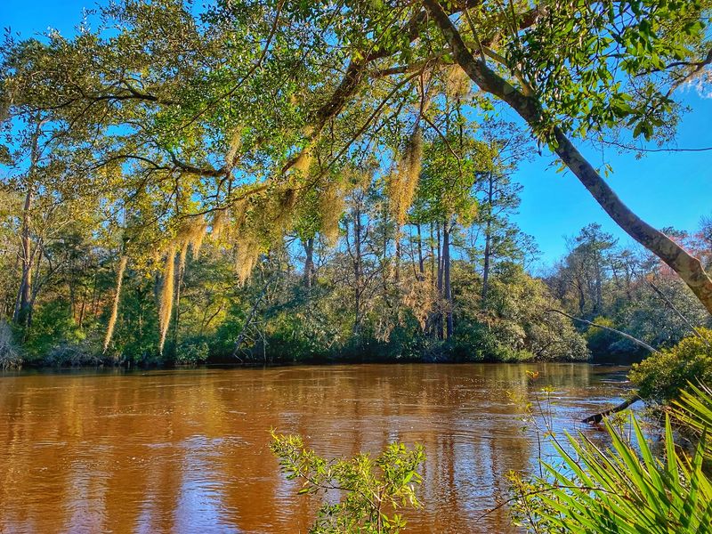
The trail eventually opens onto the Ashley River, and the change in air is immediate. Cooler, breezier, with that soft salty-marsh smell the lowcountry does so well.
Everything about Dorchester’s success traced back to this water. Rice, indigo, and other goods moved downstream toward Charleston, while supplies came back up to be sold inland.
Time your visit around low tide if you can. When the water drops, remains of an 18th-century log shipping wharf become visible along the muddy bank, dark timbers just barely breaking the surface.
I stood there squinting at them for a good while, trying to picture boats tied up and crews hauling barrels. Now it’s mostly herons, dragonflies, and the occasional kayaker gliding past.
Benches and picnic tables sit within easy reach, so this is a natural place to stop and eat something you packed. Several families were doing exactly that when I passed through.
The riverbank can get soft and slippery after rain, so sneakers beat sandals here. It’s also the best spot in the park for a photo that captures both nature and history at once.
Why Everyone Packed Up and Left
Here’s the question that kept nagging me as I walked: how does a thriving town simply stop existing?
The Revolutionary War did much of the damage. Dorchester was fortified by American forces early on, then occupied by British and Loyalist troops, and when the British withdrew in December 1781 they destroyed a great deal of what remained.
Location played a role too. The land here is low and swampy, which made the area prone to disease, and malaria was a serious threat throughout the colonial lowcountry.
By 1788, the town was essentially empty. Residents moved to higher, drier ground a few miles away, helping build up what became Summerville.
The detail I find hardest to shake is that bricks from Dorchester’s abandoned buildings were reportedly hauled off and reused in newer construction elsewhere. One town literally became part of another.
Interpretive signs along the loop explain this timeline clearly, and reading them while surrounded by empty fields hits differently than reading it at home.
Nature finished the job the war started. Trees moved in, roots split foundations, and the streets disappeared under grass.
Buried Clues and Ongoing Digs
Something I hadn’t expected: much of Dorchester is still underground, waiting.
Archaeologists work across the 325-acre property, uncovering foundations, pottery fragments, tools, and other everyday objects. Because the land was never built over after 1788, the record beneath the surface is unusually intact.
Park staff have described the site as a kind of time capsule of colonial American life, and that comparison makes sense once you see how undisturbed the layers are.
When digs are active, visitors are sometimes able to watch the work happen, and occasionally participate. I’d call ahead at 843-873-1740 or check the park website before driving out, since schedules shift.
Ranger-led programs run at various points during the year too, including guided hikes. Those add context that self-guided walking can’t quite deliver on its own.
Practical notes worth knowing: the park is open daily from 9 AM to 5 PM, entry is handled through an honor-system envelope, so bring cash, and leashed dogs are welcome. Restrooms and plenty of parking are available.
Most people finish the loop in an hour, though history fans easily stretch it longer.
Address: 300 State Park Road, Summerville, South Carolina
