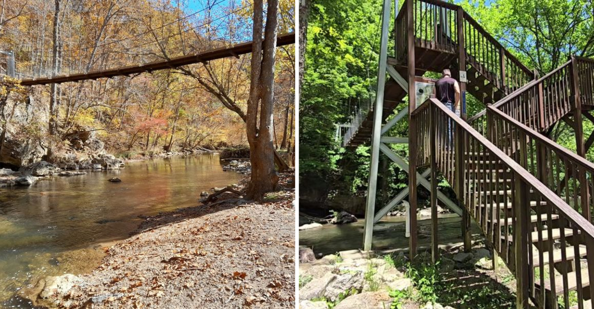
Swaying gently over the water below, that suspension bridge in Virginia made the whole world get quieter the moment I stepped onto it.
I had been looking for a low-key hike and ended up finding one of the most genuinely beautiful spots in the state.
Towering limestone cliffs, a roaring waterfall, rare wildflowers clinging to rocky ledges, and wildlife that shows up when it feels like it, all packed into about four miles of trail.
I spent an afternoon crossing that bridge, standing beneath the falls, and feeling like I had found something untouched.
No entrance fee, no crowds, no pretense, just real, raw Appalachian nature doing its thing. If you have been sleeping on that hidden gem, consider this your sign to finally make the drive.
The Suspension Footbridge That Starts the Adventure
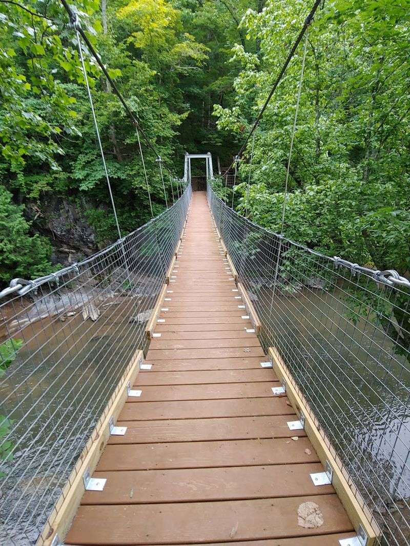
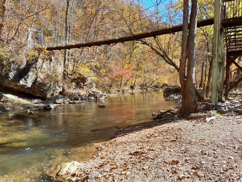
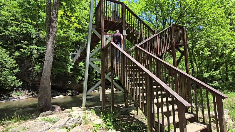
Right at the trailhead, before you even get your hiking legs warmed up, the suspension footbridge over Big Cedar Creek stops you in your tracks.
It sways just enough to make you grin, and the creek rushing below it is so clear you can spot the rocks on the bottom.
This is not a grand engineered structure, and that is exactly what makes it so charming.
The bridge serves as the gateway to everything the preserve has to offer. Without crossing it, you simply cannot access the trail network on the other side, which makes it both practical and memorable.
First-time visitors often pause mid-crossing to look upstream and downstream, and honestly, that is the right call.
Big Cedar Creek is a designated state scenic river, so the views from the bridge already feel earned even before you have taken a single step on the trail. The water moves with a confident energy, especially after rain.
Kids absolutely love the gentle bounce underfoot, and adults tend to linger a little longer than expected.
Fair warning, if swinging bridges are not your thing, this one is unavoidable. But it is sturdy, well-maintained, and shorter than your nerves might suggest.
The Virginia Department of Conservation and Recreation keeps the preserve in excellent shape, and the bridge is no exception. Cross it once and you will want to cross it again on the way back, maybe a little slower the second time around.
Big Cedar Creek Trail and the Path to Big Falls
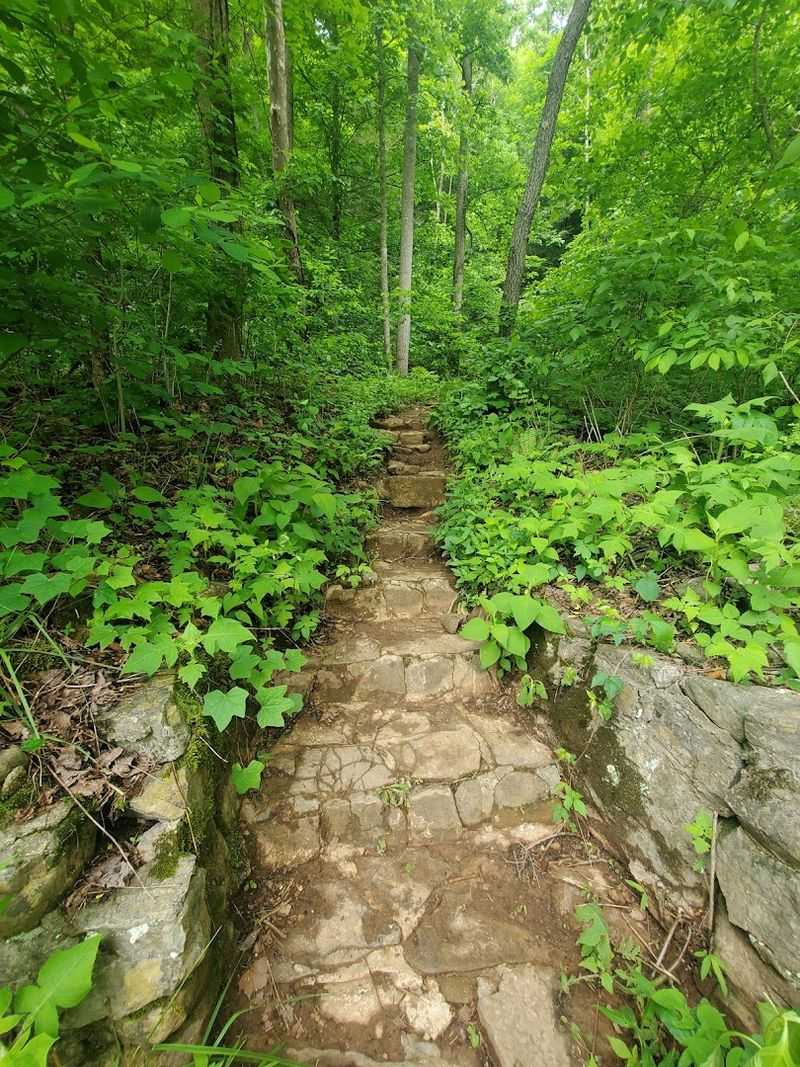
The Big Cedar Creek Trail is the backbone of the preserve, and it earns that title. Marked with white blazes, the trail follows the creek for roughly a mile and a quarter before delivering you to Big Falls, a waterfall that genuinely earns its name.
The path is mostly flat and shaded the entire way, which makes it feel like a gift on a warm summer afternoon.
Limestone ledges jut out along the creek banks, and the sound of moving water never really leaves you on this trail.
There is something grounding about hiking alongside a creek, the rhythm of it keeps your pace steady without you even noticing.
I found myself stopping more than once just to watch the water move over the rocks.
Big Falls itself is the kind of waterfall that makes you want to sit down and stay a while. The pool at its base is calm and the surrounding rock formations give the whole scene a dramatic, almost cinematic quality.
Visitors have described sitting on the bank and just listening, which is genuinely excellent advice.
The trail is suitable for most fitness levels, and families with young children regularly complete it without trouble. Signage throughout the path is clear and easy to follow.
One tip worth knowing: wear shoes with good grip, because some of the rocks near the water can get slick. Bring a water bottle and a snack, and plan to spend more time than you think you will need.
The Pinnacle Rock Outcrop Rising 400 Feet Above the Creek
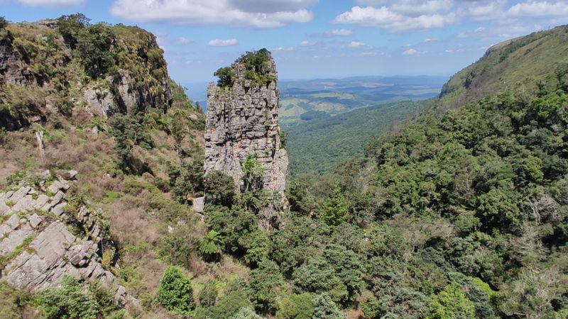
There are rock formations, and then there is The Pinnacle. This massive dolomite outcrop rises a full 400 feet above Big Cedar Creek, and the first time you see it from the trail below, it genuinely takes a second to process.
It does not look like something that belongs in Virginia, and yet here it is, carved by centuries of weather and water into something extraordinary.
The Pinnacle View Loop, marked with orange blazes, gives hikers a closer look at the formation and includes an interpretive sign that explains the geology behind what you are seeing.
The loop is short, around half a mile, making it an easy add-on to your main hike.
The payoff is a perspective that feels completely different from the creek-level view.
Dolomite is a close cousin to limestone, and the Pinnacle formation is part of what makes this preserve so geologically significant.
The cliffs and ledges created by these rock types also happen to be the perfect habitat for several rare plant species found nowhere else in the region.
Science and scenery rarely overlap this neatly.
On clear days, the views from the overlook area are the kind you end up describing to people for weeks. The valley spreads out below in every shade of green, with the creek threading through it like a silver ribbon.
Hikers who skip this section because it sounds optional are genuinely missing one of the best moments the preserve has to offer.
Rare Wildlife and Plant Species Found Only Here
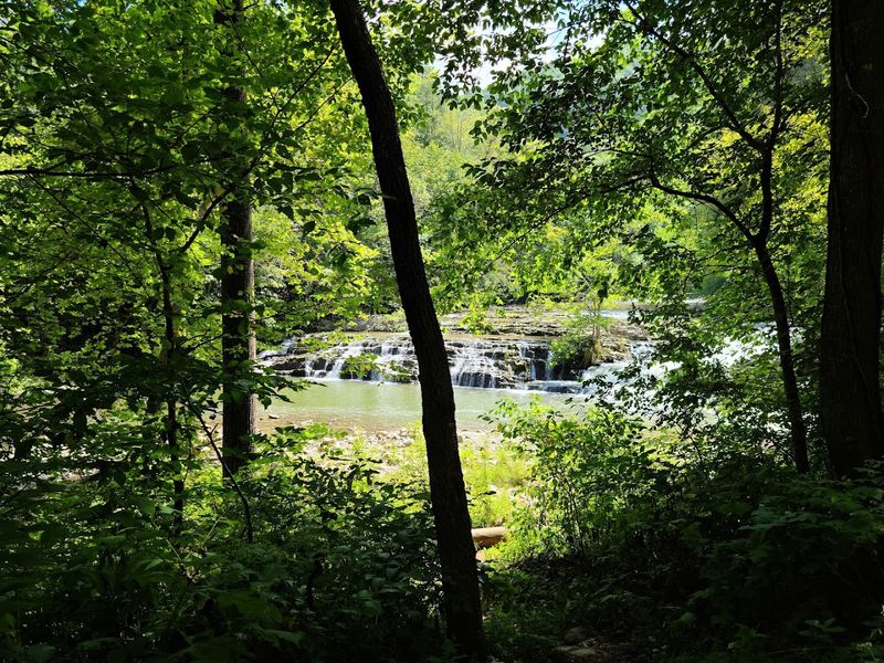
Most nature preserves have a few interesting species to note on a sign near the parking lot. Pinnacle Natural Area Preserve has at least nine rare plant species, five rare animal species, and four distinct natural communities, and that is not a number people throw around lightly.
The Clinch River watershed surrounding the preserve holds the highest concentration of globally imperiled freshwater species in the entire continental United States.
The Big Cedar Creek millipede is globally rare and calls this preserve home. Canby’s mountain-lover, Carolina saxifrage, American harebell, and glade spurge are among the plant species that cling to the limestone cliffs and creek banks here.
Seeing these names on the interpretive signs along the trail adds a layer of meaning to every step you take.
Beyond the rare and the scientifically catalogued, the preserve is just alive with everyday wildlife encounters. Visitors have spotted blue herons, eagles, crawdads, butterflies, and fish in the creek, often all in a single visit.
The trout fishery along Big Cedar Creek and the Clinch River is well-regarded, and fishing is a permitted activity within the preserve.
The key to spotting wildlife here is simple: slow down. The preserve rewards patience in a way that faster, busier trails never do.
Move quietly, keep your eyes near the water, and give the creek banks a long look before moving on. The preserve is free to enter, free to explore, and the wildlife does not charge extra for a good show either.
The Copper Ridge Trail Overlook and Clinch River Views
If you have the energy after the creek trail and the falls, the Copper Ridge Trail is worth every extra step. Marked with red blazes, this trail is about half a mile to a mile roundtrip and involves a genuinely steep climb.
The reward at the top is a sweeping overlook that puts the Clinch River valley on full display, and it is the kind of view that makes the burning in your legs feel completely worth it.
The Clinch River Trail, marked with blue blazes and about half a mile long, connects hikers to the river itself.
The confluence of Big Cedar Creek and the Clinch River is one of those natural meeting points that feels significant just to stand near.
Two bodies of water joining in a forested valley, with cliffs above and rare species below, is a combination that does not happen everywhere.
Canoeing and kayaking are available on the Clinch River, with public access boat ramps managed by the Virginia Department of Game and Inland Fisheries in the area.
If you are the type who prefers the water to the trail, the river gives you a completely different angle on the same landscape.
Seeing those limestone bluffs from a canoe is its own kind of experience.
The overlook from Copper Ridge is especially striking in the fall, when the tree canopy below turns every shade of orange and red. Even in summer, the view carries a depth that photographs struggle to capture.
This section of the preserve feels less visited, which makes the quiet up there feel especially personal.
Planning Your Visit: Trails, Tips, and What to Bring
Getting the most out of a visit to Pinnacle Natural Area Preserve starts with a few simple preparations.
The preserve is open year-round from sunrise to sunset, and there is no entrance fee, which immediately removes two of the most common barriers to a spontaneous outdoor trip.
Facilities on-site include a parking area, picnic tables, a day-use shelter, and pit toilets near the trailhead.
One practical note that saves real frustration: search specifically for Pinnacle Natural Area Preserve when navigating here. Searching for Big Cedar Falls alone can send GPS apps to the wrong location.
The road leading in is narrow and winding, but the scenic views along the way are a decent preview of what is waiting at the end.
Footwear matters here more than it might on a paved greenway. The rocks near the creek and falls get slick, so trail shoes or hiking boots with grip are a smart call.
Pack water, a snack, and a camera, because the light filtering through the tree canopy along the creek trail is genuinely photogenic at almost any hour of the day.
The Spring Falls Trail, marked with green blazes and about half a mile long, is a short detour near the picnic area that many visitors skip without realizing it exists. It is absolutely worth the extra time.
Dogs are welcome, the trail is mostly shaded, and the whole experience moves at whatever pace feels right. This is one of those places that fits almost any kind of visitor, from seasoned hikers to families with toddlers in tow.
Address: 891 State Park Rd, Honaker, VA 24260
