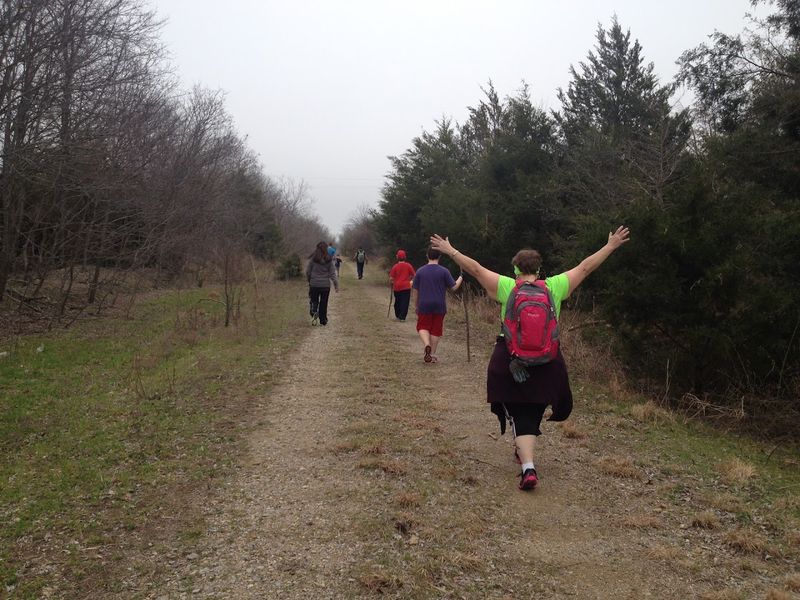
At some point, you realize this is not just a trail, it is a journey through places most people never see. Stretches like this pull in explorers from all over Texas who want something more than a quick workout.
Texas has a way of hiding long routes that feel like they tell a story as you move through them.
The trail cuts through open countryside, quiet wooded sections, and small towns that feel paused in time. Old rail bridges, empty crossings, and subtle remnants of the past appear along the way, giving each mile a sense of history.
The further you go, the quieter it gets, and the more it feels like you have stepped away from everything familiar.
What makes it stand out is how it keeps changing. One moment feels wide open and exposed, the next feels calm and tucked away, making the entire experience feel longer, richer, and far more memorable than expected.
The Western Terminus: Starting Your Adventure in Farmersville

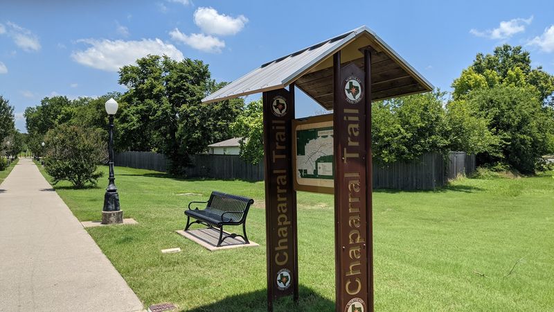
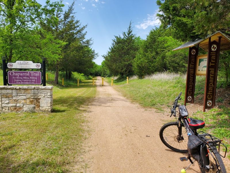
Right at the edge of downtown Farmersville, the trail begins at the Historic Onion Shed and the City Park, and the moment you step onto the path, you feel the quiet settle around you like a warm blanket. The Chaparral Trailhead is the official western starting point, and it is genuinely well set up for visitors.
There is ample parking, a covered pavilion with picnic tables, and clean restroom facilities, which matters more than people admit when you are planning a long outing.
The City of Farmersville maintains five miles of trail from this point, split evenly between a smooth paved surface and a decomposed granite stretch. The paved section is ideal for road bikes and casual joggers, while the granite portion gives the route a more rugged, natural feel.
Families with strollers can handle the paved part without any trouble.
Farmersville itself is a small town with real character. Named after early settlers who farmed the surrounding blackland prairie, it carries a modest, unhurried energy that sets the tone for everything ahead.
Starting here feels less like a trailhead and more like the opening chapter of something worth reading.
Farmersville to Merit: Five Miles of Smooth, Satisfying Pavement
The first major segment stretching from Farmersville to Merit runs about five miles and is fully paved, making it one of the most accessible and beginner-friendly portions of the entire trail.
Road cyclists can clip in and cruise, runners can find a comfortable rhythm quickly, and walkers can enjoy the open Texas sky without worrying about uneven ground beneath their feet.
This segment passes through gently rolling blackland prairie, the kind of landscape that does not demand your attention but quietly earns it. Wide open fields line both sides of the corridor, and the old railroad grade keeps the path impressively flat.
That flatness is a genuine gift, especially on a warm afternoon when you just want to move without fighting elevation.
Merit is a tiny community that most Texans have never heard of, and that is part of what makes arriving there feel oddly satisfying. There is something rewarding about reaching a place that does not appear on most tourist maps.
The transition from pavement to the next surface type happens here, signaling that the trail is about to get a little more adventurous. It is a good warm-up stretch that leaves you wanting more.
Merit to Celeste: Crushed Asphalt and the Original Rail Bed
Once you push past Merit, the trail shifts personality. The 7.7-mile stretch from Merit to Celeste runs along the original rail bed, surfaced with crushed asphalt that crunches satisfyingly underfoot.
Mountain bikers tend to love this section because it offers just enough texture to make the ride feel engaging without being punishing.
Hikers will find the surface comfortable for extended walks, and the scenery changes noticeably here. Trees begin to close in a little more along the corridor, offering patches of shade that feel genuinely earned after the open prairie miles behind you.
There is a rhythm to this section, a sense of repetition in the landscape that becomes almost meditative after a while.
Celeste is a small Hunt County town with the kind of quiet main street that makes you slow your pace automatically. The trail passes close enough to the town center that it is easy to wander in for a short break.
This segment is also a good reminder that the Northeast Texas Trail was never designed to be a destination in itself. It is more of a thread connecting overlooked places, and Merit to Celeste is where that idea starts to feel genuinely real.
Celeste to Wolfe City: Granite, Dirt, and Open Country Riding
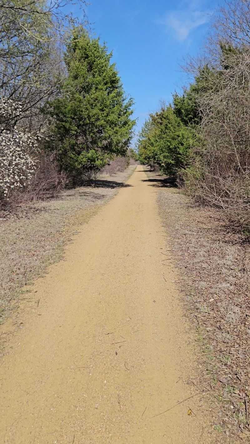
The 8.7-mile run from Celeste to Wolfe City is where the trail truly earns its rail-trail credentials. The surface here is a mix of crushed granite, packed dirt, and gravel, and the combination gives the corridor a raw, unpolished quality that feels honestly beautiful.
Mountain bikers with intermediate skills will find this section particularly rewarding.
Hikers who enjoy a more natural surface will appreciate the way the trail feels less engineered here. The ground beneath you tells a story of old rail lines and working land, and the surrounding landscape opens up into wide views of Texas farmland that stretch to the horizon.
Early morning light hits this section in a way that makes even the plainest field look like a painting.
Wolfe City is a small Hunt County town with a genuinely friendly atmosphere. The trail access near town makes it easy to stop, rest, and take in a bit of local life before heading back or continuing forward.
This segment is a physical reminder of why rail-trail conversions matter so much. Old infrastructure becomes new opportunity, and a forgotten corridor becomes a reason to show up on a Saturday morning with muddy shoes and a full water bottle.
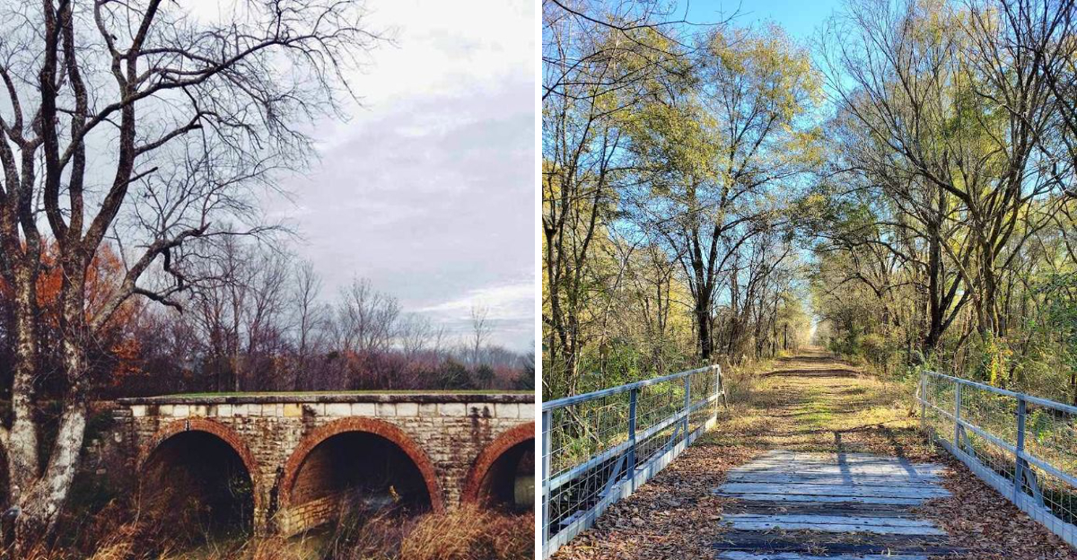
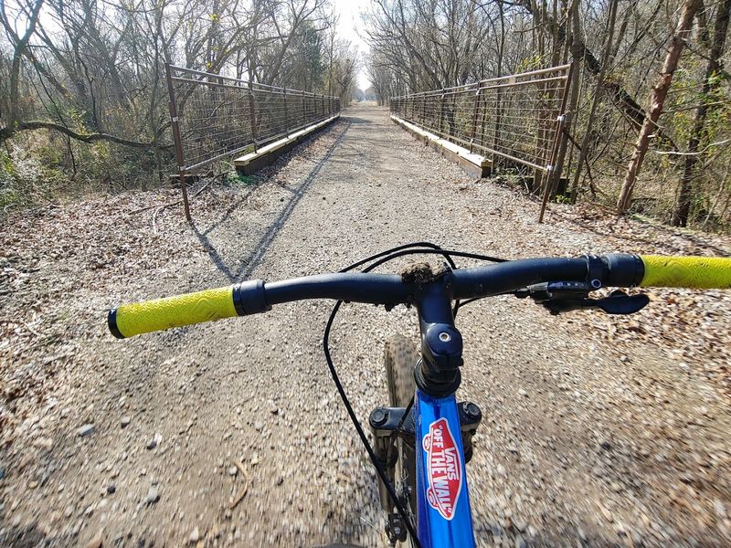
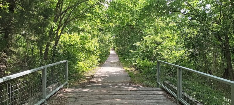
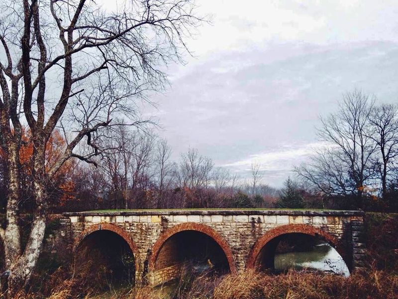
Over 100 Rail Bridges: The Engineering Marvels You Cross Without Thinking
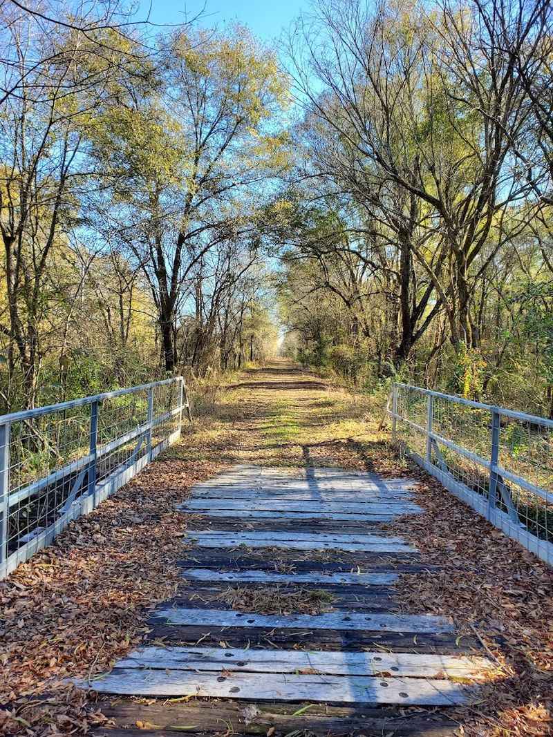
One of the most quietly impressive facts about the Northeast Texas Trail is that it crosses more than 100 rail bridges along its full length.
Most trail users cross them without pausing to think about what they represent, but each one is a piece of infrastructure that once carried freight and passengers across creek beds and low-lying land throughout Northeast Texas.
Some bridges are short and simple, spanning narrow creek crossings with a few planks and a handrail. Others are longer and more dramatic, offering elevated views of the wooded creek bottoms below.
I found myself slowing down on almost every one, not out of caution but out of genuine curiosity about the water and trees visible underneath.
The bridges also serve a practical purpose for trail planning. They are natural landmarks that help you track your progress through long, open segments where the landscape can start to blur together.
Spotting a bridge ahead gives you something to aim for, a small goal within the larger journey. For photographers, these structures are a constant source of compelling shots, especially in the early morning when mist hangs low over the creek beds and the light turns everything soft and golden.
The Paris Section: A Fully Paved Urban Trail Gem
Paris, Texas is not a city that gets a lot of national attention, but its section of the Northeast Texas Trail is genuinely impressive. The Trail de Paris runs nearly six paved miles and is smooth enough for road bikes, inline skates, and strollers alike.
It connects the broader trail network to actual city amenities, making it one of the most practically useful segments on the entire route.
Paris also happens to be home to a quirky landmark that trail users often detour to see: a replica of the Eiffel Tower, complete with a red cowboy hat perched on top. It is the kind of thing that sounds absurd until you are standing in front of it, at which point it becomes completely charming.
The city embraces its unusual twin-city joke with good humor, and that spirit carries over into how the trail is maintained and promoted.
The Paris section is also well connected to local parks and green spaces, so it is easy to extend a trail ride into a longer afternoon in the city. For visitors coming from outside the region, Paris makes a natural overnight stop.
The trail access is convenient, the town is welcoming, and the Eiffel Tower photo opportunity is essentially mandatory.
Forgotten Towns Along the Route: History That Still Breathes
Part of what makes the Northeast Texas Trail so different from other long-distance paths is the string of small, overlooked towns it connects. Places like Roxton, Telephone, and Pecan Gap are not destinations in the typical sense.
They are quiet communities that most travelers pass by without stopping, but the trail runs right through them, making a stop feel natural rather than forced.
Roxton, for example, is home to the City Drug Store Museum, a preserved piece of small-town American history that feels almost surreal to stumble upon mid-ride. These kinds of finds are the trail’s best-kept secret.
You are not just covering miles, you are moving through layers of Texas history that never made it into the history books most people read.
The towns along the route have their own personalities. Some feel frozen in time, with old storefronts and grain elevators still standing along the main street.
Others have adapted quietly to modern life while holding onto their small-town bones. Riding or running through them gives you a sense of the region that no highway drive ever could.
The trail does not just connect these places geographically. It gives them a reason to be visited again.
Trail Surfaces and What to Expect Under Your Feet
One thing that surprises first-time visitors to the Northeast Texas Trail is how much the surface varies from one segment to the next. The western sections near Farmersville offer smooth pavement, but further along the route, you will encounter crushed asphalt, decomposed granite, packed dirt, and loose gravel.
Planning your footwear or tire selection in advance makes a real difference.
Road cyclists will be most comfortable on the paved sections near Farmersville and Paris, while mountain bikers will find the middle segments more to their liking. Hikers and trail runners should be prepared for surface changes and carry enough water to handle longer stretches between towns.
The trail is not technical in the mountain-biking sense, but loose gravel can catch you off guard if you are moving fast.
Checking conditions before you go is genuinely useful. The Northeast Texas Trail Coalition maintains updates on trail status, and some sections can become muddy or difficult after heavy rain.
Wearing trail running shoes instead of road shoes on the unpaved segments will save you a lot of slipping and frustration. The variety of surfaces is honestly part of the charm, but going in prepared means you spend more time enjoying the trail and less time managing surprises.
Wildlife, Scenery, and the Quiet Rewards of Moving Slowly
Moving through the Northeast Texas Trail at a human pace, whether running, cycling, or walking, gives you a front-row seat to a landscape that most people only ever see from a car window at highway speed.
The trail passes through forests, open prairies, and wooded creek bottoms, and each environment brings its own cast of wildlife.
White-tailed deer are a common sight, especially in the early morning and late afternoon hours when they move close to the trail edge. Red-tailed hawks circle overhead in the open sections, and the creek crossings near the rail bridges often hold herons standing motionless in the shallows.
I once spotted a family of wild turkeys moving through a field just off the corridor, completely unbothered by my presence.
The prairie sections offer a different kind of beauty, one that is harder to photograph but easier to feel. Wide skies, tall grasses bending in the wind, and the distant sound of a farm somewhere just out of sight create an atmosphere that feels genuinely restorative.
The trail is not dramatic in the way that mountain trails are dramatic. Its rewards are quieter, more personal, and they tend to stay with you longer than you expect.
Planning Your Visit: Everything You Need Before You Go
Getting ready for a trip on the Northeast Texas Trail takes a little more planning than a typical day hike, mostly because of the trail’s length and the variation in surfaces and amenities across its segments. Starting at the Chaparral Trailhead in Farmersville is a smart choice for first-timers.
Parking is free, the facilities are clean, and the paved section gives you an easy warm-up before the terrain changes.
Bring more water than you think you need. Towns are spaced out along the route, and not every trailhead has a water source.
A hydration pack or multiple water bottles is a practical necessity, not an optional luxury. Sunscreen matters too, especially on the open prairie segments where shade disappears for long stretches.
The Northeast Texas Trail Coalition website is the best resource for current trail maps, segment updates, and access point information. Some sections are still under development, so confirming which segments are open before you leave home saves time and disappointment.
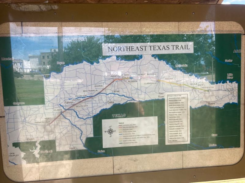
The trail runs from Farmersville near Dallas all the way to New Boston near Texarkana, and even a single segment can make for a memorable day out.
Address: Chaparral Trailhead, 301 Chaparral Dr, Farmersville, TX 75442
Dear Reader: This page may contain affiliate links which may earn a commission if you click through and make a purchase. Our independent journalism is not influenced by any advertiser or commercial initiative unless it is clearly marked as sponsored content. As travel products change, please be sure to reconfirm all details and stay up to date with current events to ensure a safe and successful trip.