Not every trail hands you the view without a fight. Out in Virginia’s Blue Ridge Mountains, this rugged route turns every rock, rut, and stretch of mud into part of the payoff.
Deep in the forest, it waits quietly for anyone willing to go looking. I kept hearing about it through off-road circles, the kind of place people mention without giving too much away, and it still managed to exceed every expectation.
The terrain is rough, unpredictable, and genuinely thrilling, balanced by sweeping overlooks that stop you in your tracks. It delivers that rare sense of freedom that only comes from pushing deeper into the wild.
What Makes This Trail So Legendary Among Off-Roaders
Few trails in Virginia carry the kind of cult reputation that the Bald Mountain Overlook/Big Levels 4X4 Trail has earned over the years. Off-road enthusiasts from across the Mid-Atlantic region make pilgrimages here, and it is easy to understand why once your tires hit the first stretch of rocky forest road.
The trail winds through the George Washington National Forest with a raw, untamed energy that feels completely different from anything paved or polished. There are no guardrails, no gift shops, and absolutely no hand-holding.
Just you, your rig, and miles of unpredictable mountain terrain that tests your skill at every turn.
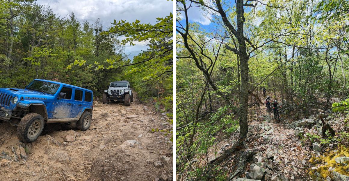
What really sets this trail apart is its variety. You get rocky climbs, muddy flats, tight tree-lined corridors, and sudden elevation changes all packed into one unforgettable run.
The trail has a point-to-point layout, which means every mile forward feels like a genuine commitment to the adventure ahead. Virginia has no shortage of scenic roads, but this one earns its legendary status the hard way, one obstacle at a time.
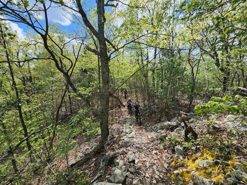
The Terrain That Will Test Every Ounce of Your Driving Skill
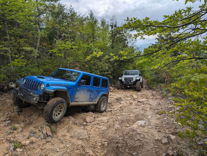
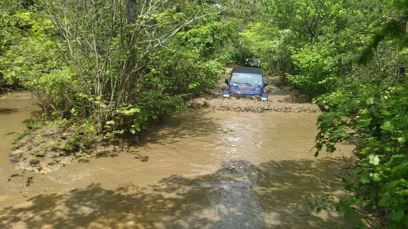
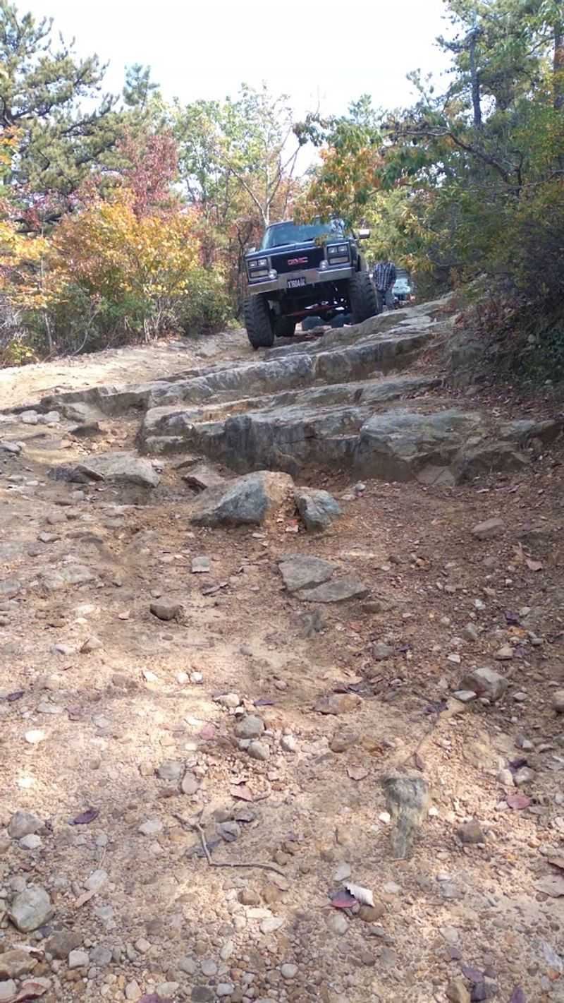
Rocky sections, deep mud pits, and unpredictable water crossings are the calling cards of the Bald Mountain Overlook/Big Levels 4X4 Trail. The ground beneath your wheels shifts constantly, moving from loose shale to slick clay to solid rock within just a few hundred feet.
Staying alert is not optional here, it is survival.
After any significant rainfall, the mud pits near the southern end of the trail transform into something genuinely intimidating. Water crossings that look shallow can surprise even experienced drivers, so probing before plunging is always the smart move.
The trail does not punish recklessness lightly.
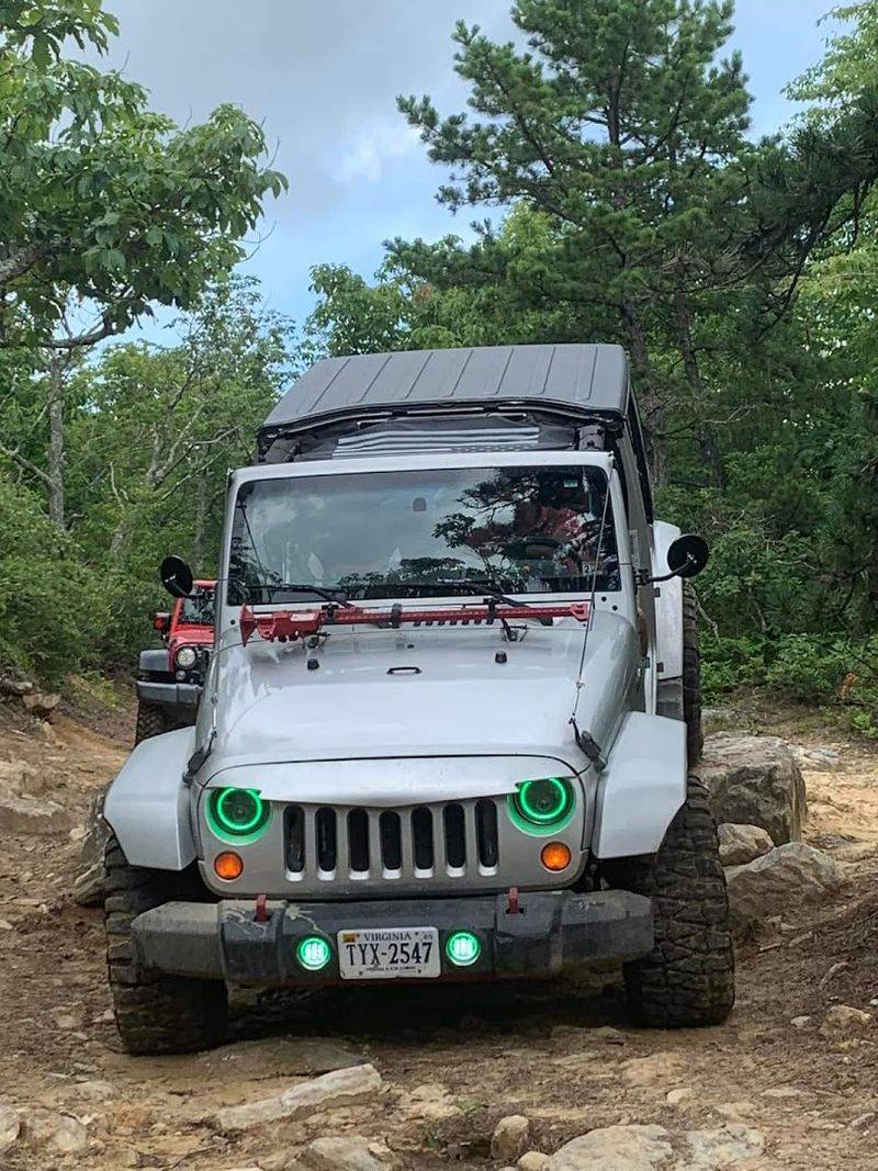
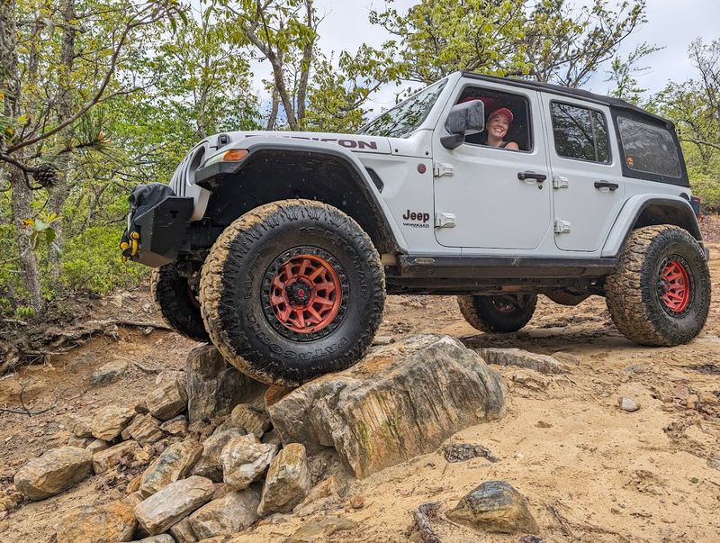
Rocky ledges scattered throughout the route demand precise wheel placement and a calm head. Larger vehicles like full-size trucks will find the tight corridors particularly challenging, with mountain laurel brushing both sides of the trail almost continuously.
Smaller, more nimble rigs like modified Jeeps tend to feel right at home here. The elevation gain across the trail adds another layer of physical demand, making descents just as thrilling as the climbs.
Every section of this trail feels purposefully designed by nature to keep you completely on your toes.
A Visual Payoff That Justifies Every Scratch on Your Paint
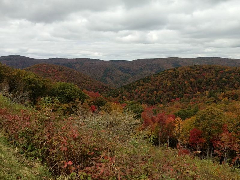
Reaching the top of Bald Mountain feels like cracking open a reward you genuinely earned. The overlook stretches out in front of you with sweeping views across the Blue Ridge Mountains, and on a clear day, the horizon seems to go on forever.
It is one of those views that makes you stop mid-sentence and just stare.
The mountain laurel that scratches your doors on the way up frames the trail with unexpected beauty. In late spring, those same shrubs burst into pink and white blooms that line the entire route like a floral welcome committee.
The contrast between the rugged trail surface and the delicate surrounding flora is genuinely striking.
Fall is arguably the best time to chase these views, when the forest explodes in gold, orange, and deep crimson across the hillsides. Summer visits offer lush green canopies but limit long-distance sightlines, so timing your trip matters.
Virginia delivers some of the most dramatic seasonal color in the entire eastern United States, and this overlook sits right in the middle of that spectacle. Pack a camera with extra storage because you will absolutely fill it up before the day is done.
Getting Your Vehicle Ready for the Challenge Ahead
Showing up at the Bald Mountain Overlook/Big Levels 4X4 Trail in a standard passenger car is a recipe for a very bad day. High ground clearance and four-wheel drive are absolute non-negotiables here.
Stock Jeep Wranglers with factory tires have made the run successfully, but preparation makes the difference between a fun day and a recovery operation.
Tire size matters more than most first-timers realize. Narrower trails and rocky surfaces reward vehicles running at least moderate off-road rubber.
Airing down your tires before hitting the trail dramatically improves traction and ride quality on the rocky sections, and it is one of the simplest tricks that makes a huge difference in real-world performance.
Recovery gear deserves a spot in your packing list right alongside snacks and sunscreen. A tow strap, a hi-lift jack, and a basic tool kit have saved more than a few rigs on this trail.
Larger trucks and full-size SUVs will likely take cosmetic damage from the tight brush corridors, so mentally prepare for door dings and side scratches. The trail rewards the well-prepared and reminds the unprepared that nature always wins in the end.
Camping Under the Stars at Big Levels
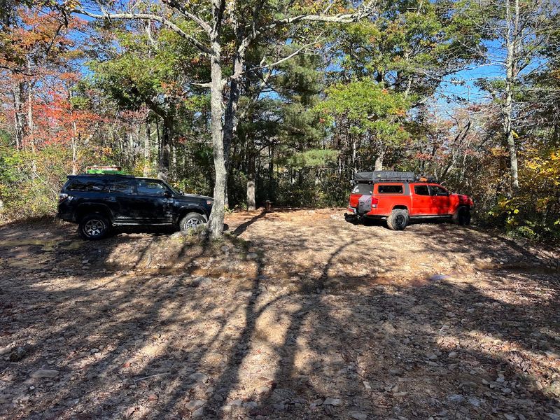
Dispersed camping along the Bald Mountain Overlook/Big Levels 4X4 Trail turns a day trip into a full-blown backcountry experience. Pull off at one of the numerous trailside spots, set up camp, and fall asleep to the sound of absolutely nothing except wind through the pines.
Virginia does not have many camping experiences this raw and this free.
The George Washington National Forest permits dispersed camping throughout much of its land, which means you can essentially pick your own private patch of wilderness for the night. No reservations, no campground fees, and no neighbors unless another adventurer happens to roll in beside you.
The freedom feels genuinely rare in today’s world of over-scheduled outdoor experiences.
Morning at elevation here is something special. Mist rolls through the tree line, birdsong fills the cool air, and the trail sits waiting just outside your tent door.
Campfires are permitted in many areas of the forest, so evenings can get wonderfully cozy after a long day of wheeling. Always follow Leave No Trace principles to keep this place pristine for the next group of adventurers who make the journey up the mountain.
Navigating the Trail Like a Pro With the Right Tools
Cell service on the Bald Mountain Overlook/Big Levels 4X4 Trail is essentially a rumor. Tall ridges and dense forest cover conspire to kill your signal well before you reach the interesting parts of the route.
Relying on a smartphone app without an offline map downloaded is the kind of mistake that turns a fun outing into a long, confusing afternoon.
A dedicated GPS unit loaded with topographic maps is the gold standard for navigating this trail confidently. Apps like OnX Off-Road or Gaia GPS work brilliantly when pre-loaded with the route before you leave home.
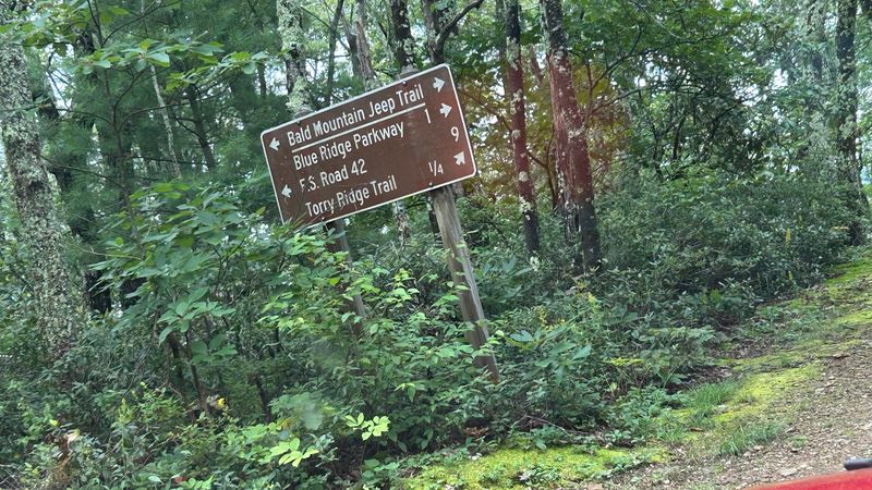
The trail runs along Forest Road 162 and connects to Coal Road, so having those reference points locked in ahead of time keeps navigation stress-free.
Physical paper maps still have a place in the backcountry, and the George Washington National Forest publishes detailed maps available at ranger stations. Knowing your entry and exit points before you start is especially important on a point-to-point route like this one.
The trailhead sits off Coal Road near Stuarts Draft, with the southern trailhead located on Forest Road 162 near Raphine. Plan your route, share it with someone at home, and head out with confidence.
Seasonal Timing and Trail Conditions Worth Knowing
The Bald Mountain Overlook/Big Levels 4X4 Trail generally runs from April through early January, giving adventurers a solid window to experience its many seasonal moods. Spring brings the muddiest conditions of the year, with snowmelt and April rains turning the trail into a gloriously messy obstacle course.
Mud lovers absolutely circle this season on their calendars.
Summer visits offer lush green scenery but can limit visibility at the overlook when foliage is at its fullest. The trail itself remains driveable through summer, and the dense canopy actually provides welcome shade during hotter stretches of the season.
Wild blueberries ripen along the trail edges in mid-July, which is a genuinely delightful surprise mid-run.
Fall transforms the entire experience into something almost cinematic. The Blue Ridge Mountains surrounding the trail light up in warm seasonal colors, and the overlook views reach their absolute peak clarity.
Temperatures drop enough to make the drive comfortable without the sticky summer humidity. Winter visits before the January closure can bring icy patches and snow-packed sections that require extra caution and the right tire setup.
Virginia mountain weather shifts fast, so always check forecasts before departure and plan for conditions to change throughout the day.
Mountain Biking and Hiking the Big Levels Area
Not everyone arriving at Bald Mountain comes with four wheels and a roll cage. The Big Levels area also serves as a launch point for some of the best single-track mountain biking in central Virginia, attracting two-wheeled adventurers who crave technical descents through gorgeous forest terrain.
The riding here has a reputation that extends well beyond state lines.
The Bald Mountain summit can be reached via several hiking approaches, including connections from Mill Creek Trail and the Lake Sherando area through White Rock and Slacks trails. Hikers who make the climb on foot are rewarded with the same spectacular overlook views as the off-road crowd, just with considerably more personal effort invested in the journey.
Adventure motorcycles also frequent this trail, with the rocky surface providing just enough technical challenge to keep experienced riders fully engaged without crossing into dangerously gnarly territory. The mix of user types on the trail means everyone shares the road, so patience and awareness are essential for all parties.
Hikers, bikers, and off-roaders coexist here with a mutual respect that feels refreshingly old-school. Virginia outdoor culture at its finest plays out on this mountain every single weekend through the open season.
Safety Tips That Every First-Timer Needs to Hear
The Bald Mountain Overlook/Big Levels 4X4 Trail does not come with safety nets, and that is precisely part of its appeal. Going in prepared makes the difference between an epic story and a rescue call.
Never run this trail alone, especially on your first visit, because having a second vehicle for recovery support is genuinely invaluable on the trickier sections.
Water crossings deserve serious respect, particularly after rainfall. What looks like a shallow puddle can conceal significant depth, and several drivers have discovered this fact the hard way over the years.
Walking crossings on foot before committing your vehicle takes only a minute and can save hours of recovery time.
Always let someone outside your group know your planned route and expected return time before heading out. The remote nature of the George Washington National Forest means emergency response times can be lengthy if something goes seriously wrong.
Carry extra water, basic first aid supplies, and enough food to sustain your group if an unexpected delay occurs. Cell coverage is unreliable throughout most of the trail, so do not count on calling for help easily.
Preparation and common sense are the two best pieces of safety equipment you can bring onto this Virginia mountain trail.
How to Find the Trailhead and Plan Your Visit
Finding the southern trailhead for the Bald Mountain Overlook/Big Levels 4X4 Trail is straightforward once you know the reference points. The southern trailhead sits on Forest Road 162 near Raphine, Virginia, at coordinates that any GPS unit will lock onto reliably.
Set your destination before leaving town since signal disappears quickly as you climb into the forest.
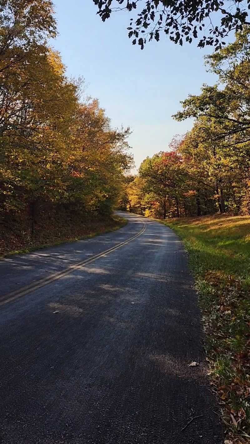
Coming from Interstate 81, take the exit toward US-33 East and follow it for several miles before turning onto Mount Torrey Road. A right turn onto Coal Road follows shortly after, and from there it is a few more miles to the trailhead area.
The route is manageable even for drivers visiting Virginia for the first time, provided they follow directions carefully.
The official address for the southern trailhead is Forest Road 162, Raphine, VA 24472. The trail is managed by the US Forest Service under the George Washington and Jefferson National Forests, and their website at fs.usda.gov provides updated information on seasonal closures and trail conditions.
Arriving early on weekends is a smart move since the trail attracts steady traffic during peak seasons. The phone number for local forest service contacts is available through the official site for any last-minute condition checks before your adventure begins.
Dear Reader: This page may contain affiliate links which may earn a commission if you click through and make a purchase. Our independent journalism is not influenced by any advertiser or commercial initiative unless it is clearly marked as sponsored content. As travel products change, please be sure to reconfirm all details and stay up to date with current events to ensure a safe and successful trip.