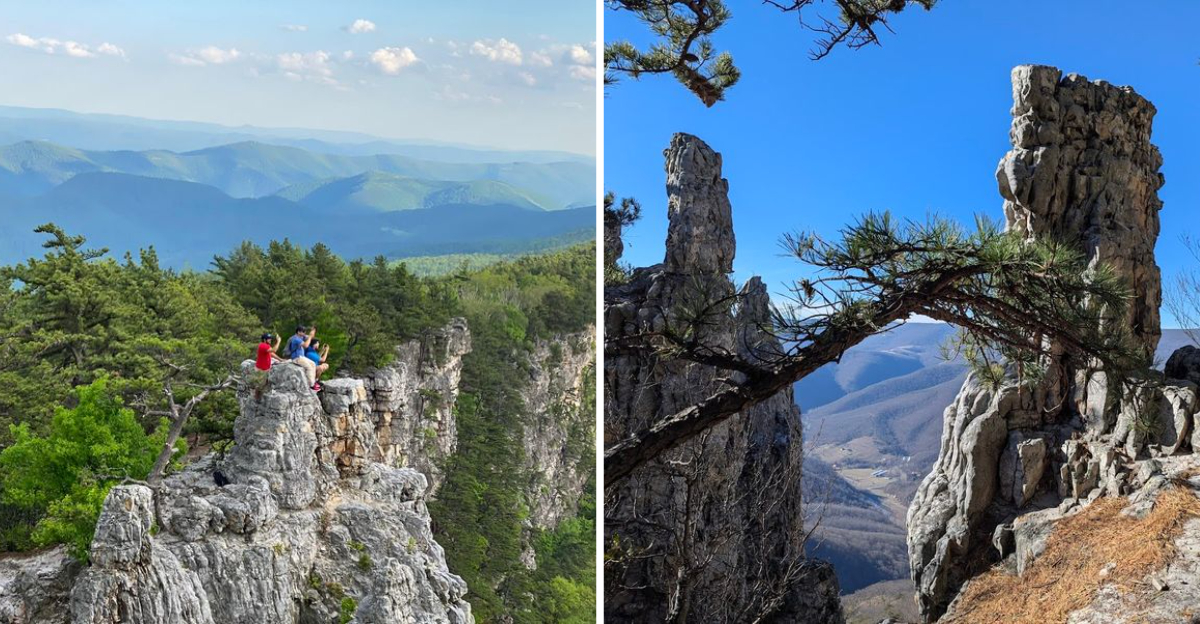
Some places just have a way of stopping you in your tracks.
This West Virginia ridge is one of them.
Stretching for miles along the crest of the Alleghenies, it offers a hiking experience that feels almost otherworldly.
The cliffs plunge hundreds of feet to the valley below, revealing layers of mountains that seem to go on forever.
The trail winds through open woodlands and along rocky outcrops, with views that change around every corner.
It is the kind of place where time slows down and the only thing that matters is the next step and the next vista.
Whether you are chasing sunrise, sunset, or just a moment of peace, this spot delivers. West Virginia has its share of natural wonders, but North Fork Mountain stands in a league of its own.
Come see for yourself.
A Ridge That Defines West Virginia’s Wild Beauty
Perched high above the Potomac Highlands, this West Virginia ridge offers some of the most breathtaking views you will find anywhere in the Appalachian Mountains.
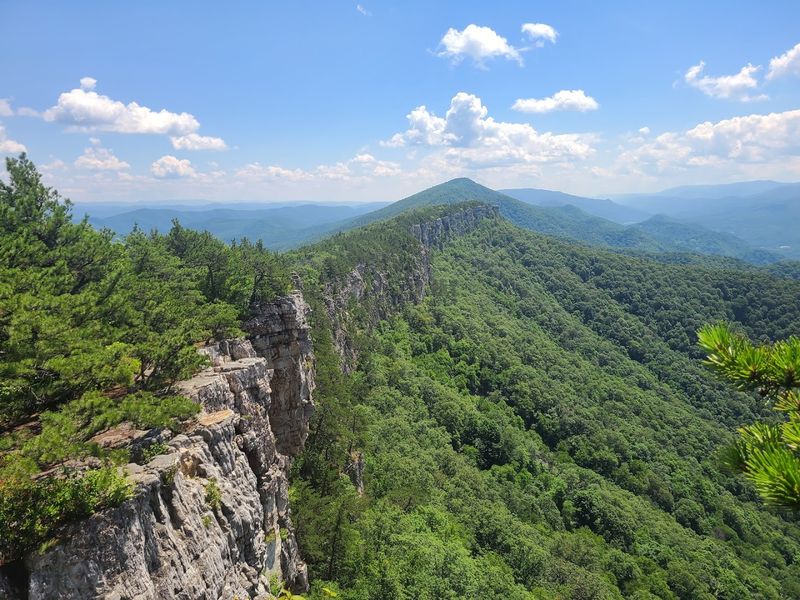
The North Fork Mountain Trail runs for approximately 24 miles along the mountain’s spine, with massive cliffs dropping dramatically to the west.
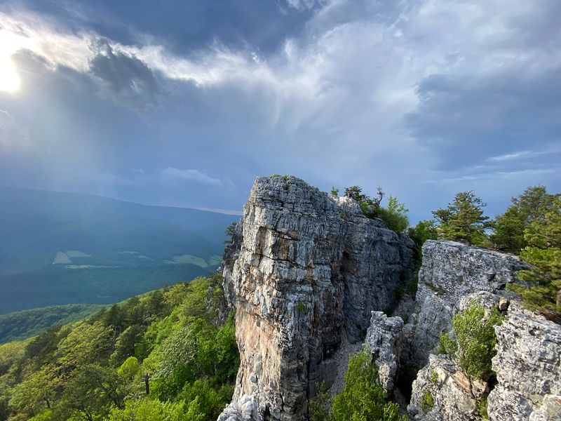
The Tuscarora quartzite cliffs create an almost unbroken wall that provides seemingly endless vantage points overlooking the Germany Valley, Seneca Rocks, and the distant Allegheny Front.
It is the kind of place where you can stand at the edge and feel completely small in the most wonderful way.
The trail winds along the mountain’s crest, with each turn revealing a new perspective more stunning than the last. Whether you hike a short section or tackle the full length, the payoff is absolutely worth every step.
West Virginia has a way of reminding you just how beautiful the world can be, and North Fork Mountain delivers that reminder in spades. Welcome to one of the most spectacular trails in the Mountain State.
A Geological Marvel
This is not just another ridge in the Alleghenies. It is a geological wonder that has been shaped over millions of years into something truly extraordinary.
The mountain stretches for 34 miles from North Fork Gap in the north to the Virginia border in the south, running parallel to the North Fork of the South Branch of the Potomac River.
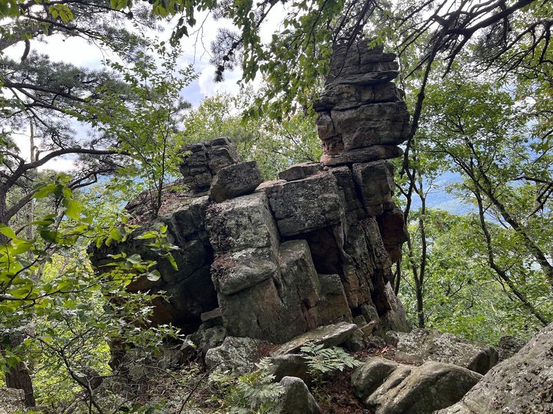
The mountain’s defining feature is its massive quartzite caprock, a remnant of the Tuscarora sandstone formation that has proven remarkably resistant to erosion.
The rock layers on the mountain’s crest are nearly flat, but the same quartzite that caps the summit has been bent dramatically on the mountain’s slopes, forming the vertical cliffs that make Seneca Rocks so famous.
This unique geology is what gives North Fork Mountain its distinctive silhouette, a long, straight ridge with a continuous wall of cliffs on its western flank.
From the valley below, it looks like an impenetrable barrier. From the top, it is a front-row seat to some of the most spectacular scenery in West Virginia.
Why It’s Called the Best in the State
The North Fork Mountain Trail has earned a reputation as one of the finest hikes in the entire state, and it is not hard to see why. The trail runs nearly 25 miles from U.S.
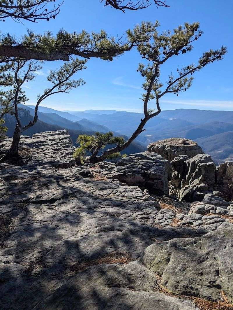
Route 33 in Judy Gap to Smoke Hole Road, traversing the entire length of the mountain’s crest. Right from the beginning, the wide trail undulates over small knobs with cliff bands appearing on the left, offering panoramic views that stretch from Spruce Knob to Seneca Rocks.
The trail is known for its relentless views. From almost any point along its length, you need only head a few steps to the west before you are standing atop cliffs with sweeping vistas of the Germany Valley and beyond.
The trail follows an old road grade along the ridge crest in some sections, making it relatively easy to follow. In other sections, it becomes a narrow footpath winding through small saddles and moderately difficult knobs.
The variety keeps the hike interesting, and the constant presence of those massive cliffs ensures that you are never far from a view worth stopping for.
The Crown Jewel of the Ridge
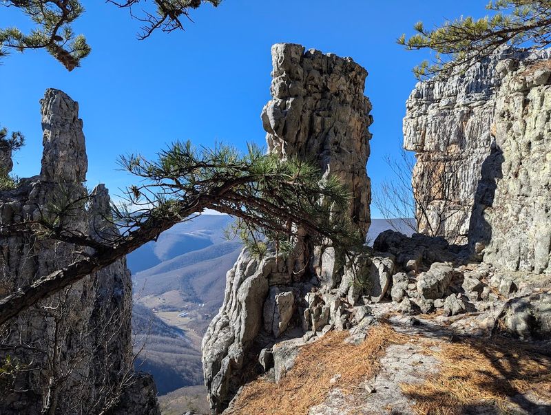
About 2.5 miles from the northern terminus, you will encounter one of the most spectacular points on the entire mountain. Chimney Top is a natural sandstone pillar that offers 360-degree views of the surrounding landscape.
The rock formation is dramatic, with separated outcroppings and a large cleft between two towering rocks. From this vantage point, you can see the weathered rock formations atop the forested Dolly Sods plateau to the west and the jagged quartzite cliffs of North Fork Mountain to the south.
The views here are nothing short of breathtaking. Peregrine falcons and golden eagles often circle the cliffs on thermals, adding a touch of wild majesty to the experience.
Chimney Top is not marked on the trail, so keep an eye out for an obvious herd path leading to the ridge. The effort to find it is absolutely worth it.
This is the kind of place where you will want to sit for a while, take it all in, and let the grandeur of West Virginia sink in.
The Unique Ecology of North Fork Mountain
Here is something that sets North Fork Mountain apart from nearly every other high peak in the Appalachians. It is the driest high mountain in the entire range.
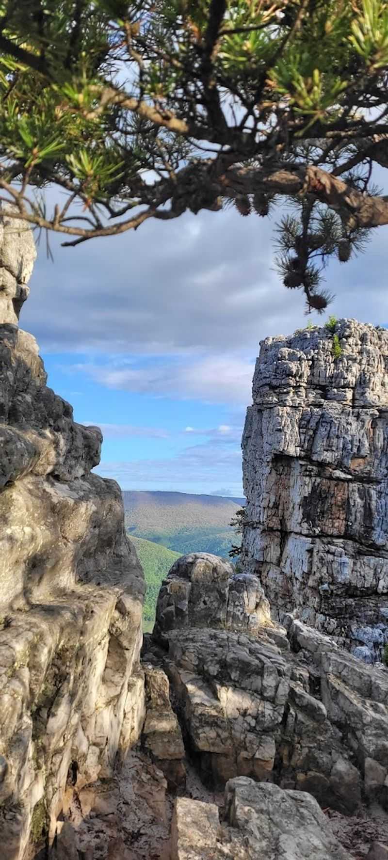
This unique characteristic has a profound effect on the vegetation and flora found along the ridge. Unlike the wetter, spruce-dominated summits just across the North Fork Valley, this ridge is covered with pines that thrive in the drier conditions.
The forest cover is more open than the lush greenery found elsewhere in the state, creating a landscape that feels distinct and almost otherworldly. You will find extensive fern beds, mountain laurel, flaming azaleas, and wintergreen scattered along the trail.
In the fall, the ridge becomes a prime location for observing migrating raptors, including bald eagles and golden eagles soaring on thermals.
The Nature Conservancy has protected several thousand acres on the mountain’s southern reaches, preserving rare plant and animal communities, including a virgin red pine forest and a dwarf pitch pine woodland.
What You Need to Know Before You Go
A hike on North Fork Mountain requires some preparation, but the rewards are well worth the effort. The trail is generally listed as moderate to strenuous, with elevation changes that can be challenging.
The southern trailhead sits at 3,592 feet, while the northern terminus is at just 1,300 feet. Most visitors start at the southern end because you access the trail up high and eliminate a long climb required at the northern end.
The key challenge on this ridge is water. There is almost none available along the trail, so you must carry everything you need.
There is one spring near the halfway mark, but it requires a detour. Many backpackers choose to stash water near the halfway point before their hike.
The trail is also known to be overgrown in sections, so long pants are recommended to protect against ticks. Despite these challenges, the trail is popular and well-traveled, with numerous established campsites along the ridge offering serene settings for an overnight stay.
The Views That Never End
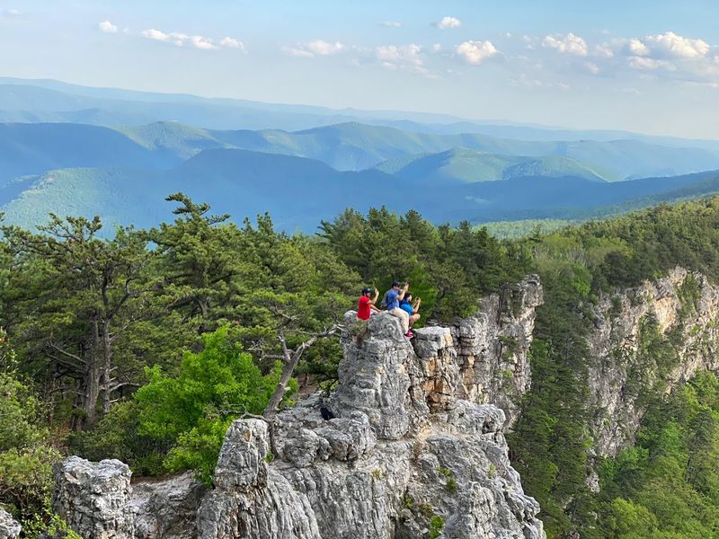
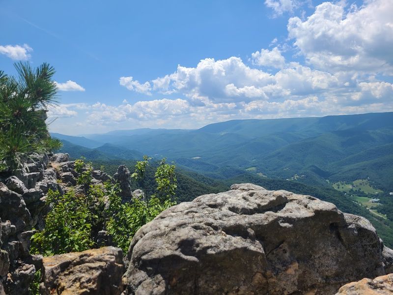
The views from North Fork Mountain are what make this hike truly unforgettable. Looking west from the many rocky outcrops, you can see the River Knobs, including Seneca Rocks and Champe Rocks, rising dramatically from the valley floor.
Beyond them lies the Germany Valley, a pastoral landscape of farmland that looks green enough to be mistaken for the coast of Ireland. To the north, you can see the Dolly Sods and Roaring Plains areas, which sit at over 4,000 feet.
To the south, the Allegheny Front stretches toward the horizon. The cliffs along the western edge provide a nearly continuous viewing platform, and the wind whistling at the cliff edge is a constant reminder of just how high up you are.
From the trail’s highest points, you can see nearby Cave Mountain and the tops of the Blue Ridge Mountains to the east. This is not a hike where you get one view and then spend the rest of the day in the woods.
The views are everywhere, and they keep coming mile after mile.
Why This Trail is a Must-Do
For backpackers, North Fork Mountain offers one of the finest multi-day hiking experiences in the region. The 24-mile length is perfect for a two-day trip, with plenty of established campsites located within a short walk of the cliff edge.
Spending the evening sitting on the rocks, watching the sun set while ravens zip up and down on the cliff’s updrafts, is an experience that stays with you long after you leave.
The trail’s moderate difficulty makes it accessible to reasonably fit hikers, and the constant views provide ample motivation to keep going.
Many choose to hike the trail from south to north, which allows for a start at higher elevation with less overall climbing. Others prefer the north-to-south route to save their knees from the pounding descent.
Either way, the trail delivers. As one hiker put it, you get a pretty good bang for your buck if you are looking for views compared to most trails in West Virginia.
This trail is on so many best hiking lists in the state for good reason.
Address: North Fork Mountain, West Virginia 26884, USA
