Northern Minnesota is bracing for a significant winter storm this weekend, with meteorologists predicting heavy snow and dangerous ice accumulations across the region.
Residents and travelers should prepare for challenging conditions as the weather system moves through the area, potentially disrupting travel plans and daily activities.
Understanding what to expect and how to stay safe during severe winter weather is essential for everyone in the affected zones.
This comprehensive guide will walk you through everything you need to know about the approaching storm and how to navigate Northern Minnesota safely during this winter weather event.
Understanding the Storm System Approaching Northern Minnesota
Weather patterns across the Upper Midwest are shifting dramatically as a powerful low-pressure system moves eastward from the Dakotas.
This storm is expected to bring a combination of heavy snow, freezing rain, and sleet to Northern Minnesota starting Friday evening and continuing through Sunday morning.
Meteorologists at the National Weather Service have been tracking this system for several days, and their models consistently show significant winter weather impacts for communities north of Highway 210.
The storm will draw moisture from the south while cold air plunges down from Canada, creating the perfect conditions for heavy precipitation.
Areas including Duluth, Hibbing, International Falls, and the Boundary Waters region are expected to see the most significant accumulations.
Snow totals could reach between eight and fourteen inches in some locations, with the heaviest bands likely forming along the North Shore of Lake Superior due to lake-effect enhancement.
Freezing rain is a particular concern for areas along the transition zone where temperatures hover right around the freezing mark.
Even a thin coating of ice can make roads treacherous and cause power outages when it accumulates on tree branches and power lines.
Travelers planning to visit Northern Minnesota this weekend should monitor weather forecasts closely and consider postponing non-essential trips.
Local emergency management officials are already coordinating with road crews and utilities to prepare for the storm’s arrival and ensure rapid response to any weather-related emergencies.
Timing and Geographic Impact of the Weekend Storm
Friday evening will mark the beginning of precipitation across the western portions of Northern Minnesota, with snow developing first near the North Dakota border.
By midnight, the snow will spread eastward, reaching communities like Bemidji and Grand Rapids.
Saturday morning will bring the heaviest snowfall rates, with visibility dropping to near zero during intense snow squalls.
Counties under winter storm warnings include Koochiching, Itasca, St. Louis, Lake, and Cook, representing a vast swath of the northern tier of the state.
The Minnesota Department of Transportation has already positioned additional plow trucks and materials throughout the region to address the anticipated road conditions.
Communities along Lake Superior’s North Shore face a double threat from both the main storm system and additional lake-effect snow bands that could persist into early next week.
The mixing zone where snow transitions to freezing rain will likely set up somewhere between Brainerd and Duluth, making travel particularly hazardous in this corridor.
By Sunday afternoon, the main storm system will begin moving into Wisconsin, but lingering snow showers and gusty winds will continue creating blowing and drifting snow across open areas.
Travelers heading to popular destinations like the Boundary Waters Canoe Area or Voyageurs National Park should expect complete whiteout conditions during peak snowfall hours.
The storm’s timing over the weekend means many residents will be home, which reduces commuter risks but could trap unprepared travelers at cabins or remote locations.
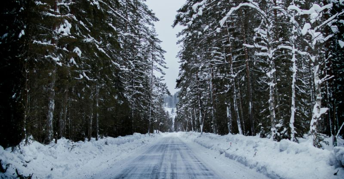
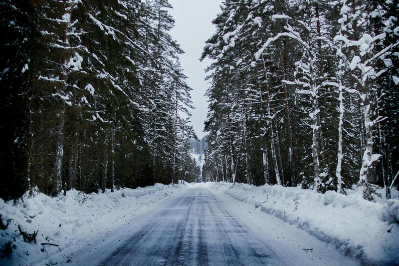
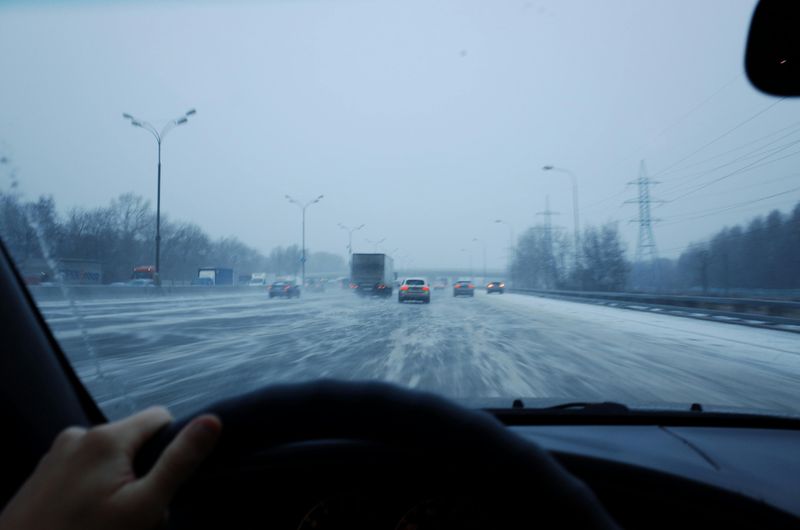
Road Conditions and Travel Safety Precautions
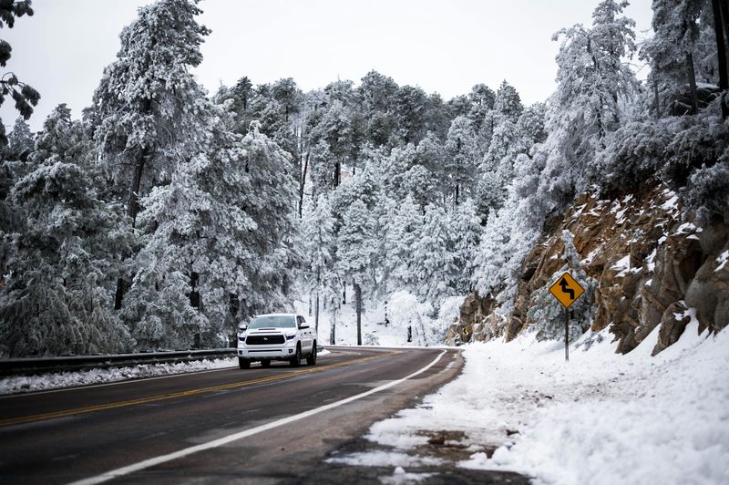
Driving during severe winter weather requires careful planning and appropriate vehicle preparation.
Before heading out, check current road conditions through the Minnesota Department of Transportation’s 511 system, which provides real-time updates on highway conditions, closures, and incidents.
During heavy snow and ice events, even major highways like Interstate 35 and Highway 61 can become impassable.
Visibility can drop to less than a quarter mile during intense snow bands, making it extremely difficult to see other vehicles or road edges.
Black ice is particularly dangerous because it forms a nearly invisible coating on pavement, especially on bridges, overpasses, and shaded areas.
If you must travel, reduce your speed significantly, increase following distances to at least eight to ten seconds, and avoid sudden braking or steering movements that could cause your vehicle to lose traction.
Keep an emergency kit in your vehicle that includes blankets, flashlights, extra batteries, non-perishable food, water, a first-aid kit, jumper cables, and a portable phone charger.
Inform someone of your travel route and expected arrival time so they can alert authorities if you don’t arrive as planned.
Many rural areas of Northern Minnesota have limited cell phone coverage, so carrying a full tank of gas becomes critically important in case you get stranded.
State patrol officers recommend staying with your vehicle if you become stuck, running the engine periodically for heat while ensuring the exhaust pipe remains clear of snow.
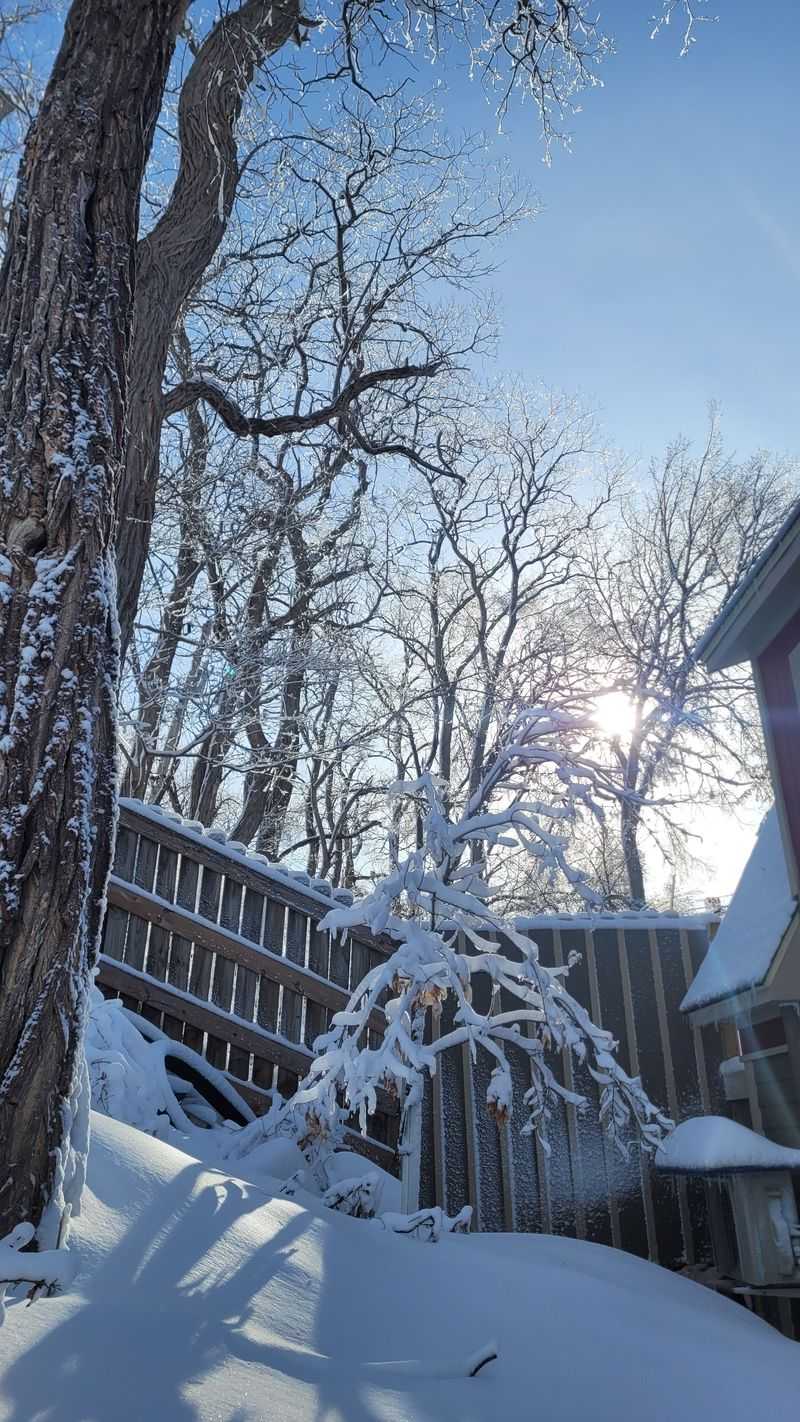
Power Outages and Home Preparedness Strategies

Ice accumulation poses a serious threat to electrical infrastructure throughout Northern Minnesota this weekend.
When freezing rain coats power lines and tree branches, the added weight can cause lines to snap and trees to fall, resulting in widespread outages.
Utility companies across the region have placed crews on standby and arranged for additional support from neighboring states if needed.
Homeowners should take proactive steps now to prepare for possible extended power loss.
Charge all electronic devices, including cell phones, tablets, and laptop computers, before the storm arrives.
Fill bathtubs and large containers with water since electric pumps won’t function during outages, affecting well water systems common in rural areas.
Stock up on non-perishable foods that don’t require cooking, and have manual can openers available.
If you use a generator, never operate it indoors or in attached garages due to deadly carbon monoxide risks.
Keep generators at least twenty feet from windows and doors, and ensure proper ventilation.
Have alternative heating sources ready, but use them safely according to manufacturer instructions.
Space heaters should be kept at least three feet from anything flammable, and never leave them unattended.
During extended outages, focus on heating one room where family members can gather to conserve warmth.
Check on elderly neighbors and those with medical conditions who may be more vulnerable during power outages and extreme cold.
Winter Storm Impacts on Outdoor Recreation Areas
Northern Minnesota’s vast outdoor recreation areas will experience dramatic changes as this winter storm moves through the region.
Popular destinations like the Superior Hiking Trail, Gooseberry Falls State Park, and Split Rock Lighthouse State Park will become extremely hazardous during the height of the storm.
Park managers may close facilities and trails to protect public safety when conditions deteriorate.
Backcountry enthusiasts planning winter camping trips should seriously reconsider their plans or postpone until after the storm passes and conditions stabilize.
Whiteout conditions can disorient even experienced outdoors people, making navigation nearly impossible and increasing the risk of hypothermia.
The Boundary Waters Canoe Area Wilderness attracts winter visitors for skiing and snowshoeing, but this storm could create life-threatening situations for anyone caught in remote areas.
Snowmobile trails throughout the Arrowhead region will likely be closed during the storm, and riders should wait until trail conditions are reassessed and grooming equipment can safely operate.
Ice fishing enthusiasts should avoid going out on lakes during the storm, as blowing snow makes it easy to lose bearings and wander away from shore.
Wildlife will seek shelter during severe weather, and many animals become more stressed and potentially dangerous when disturbed in their winter refuges.
After the storm passes, the fresh snow will create beautiful winter landscapes perfect for photography and recreation, but allow time for trails to be cleared and conditions to improve before venturing out.
Economic Effects on Northern Minnesota Communities
Severe winter weather creates significant economic challenges for communities throughout Northern Minnesota.
Small businesses depend heavily on weekend customer traffic, and major storms can result in substantial revenue losses when shoppers stay home.
Restaurants, retail stores, and service businesses in towns like Virginia, Ely, and Grand Marais will see dramatically reduced sales during the storm period.
Tourism represents a vital economic engine for the region, with winter visitors coming for skiing, snowmobiling, and other cold-weather activities.
When severe weather forces cancellations, hotels, resorts, and outfitters lose bookings that may not be rescheduled.
The iron mining industry, still important in parts of the Iron Range, may experience temporary operational disruptions if workers cannot safely reach mine sites.
School closures mean parents must arrange childcare or miss work, affecting productivity across various sectors.
Municipal budgets face strain from overtime costs for snow removal crews and emergency responders working extended shifts throughout the storm.
Road salt and sand supplies diminish quickly during major events, requiring expensive mid-winter restocking.
Healthcare facilities must maintain full staffing despite dangerous travel conditions, sometimes arranging for essential personnel to stay overnight at hospitals.
Delivery services experience delays, affecting everything from mail to medical supplies to grocery store inventory.
Agricultural operations, though less active in winter, still require daily animal care, and farmers must ensure livestock have adequate shelter, water, and feed during extended cold periods.
Historical Context of Major Minnesota Winter Storms
Minnesota has weathered countless severe winter storms throughout its history, with some events becoming legendary in state folklore.
The Armistice Day Blizzard of November 1940 remains one of the deadliest weather events in state history, catching hunters and travelers completely off guard with rapidly deteriorating conditions.
That storm claimed 49 lives in Minnesota alone, with temperatures plummeting from the 50s to single digits in just hours.
The Halloween Mega Storm of 1991 dumped record-breaking snow across much of the state, with some areas receiving over three feet of heavy, wet snow that collapsed buildings and caused widespread destruction.
More recently, the blizzard of December 2010 stranded hundreds of motorists on Interstate 90 in southern Minnesota, requiring National Guard assistance for rescues.
Northern Minnesota experiences more consistent and severe winter weather than the southern portions of the state due to its proximity to Canada and Lake Superior.
The lake-effect snow phenomenon can produce incredible localized snowfall totals, with some communities near the North Shore receiving over 100 inches in a single season.
Indigenous peoples who have lived in this region for thousands of years developed sophisticated survival strategies for extreme winter conditions, knowledge that remains relevant today.
Early European settlers faced tremendous hardships during their first Minnesota winters, often underestimating the severity and duration of cold weather.
Modern forecasting technology has dramatically improved our ability to predict and prepare for winter storms, but nature still occasionally surprises even the most experienced meteorologists with storms that exceed expectations.
Wildlife Behavior During Severe Winter Weather

Animals throughout Northern Minnesota have evolved remarkable adaptations for surviving harsh winter conditions, but severe storms still challenge even the hardiest species.
White-tailed deer seek dense conifer stands that provide overhead cover from heavy snow, creating areas called deer yards where they conserve energy by reducing movement.
During major storms, deer may remain bedded down for extended periods, living off fat reserves accumulated during autumn feeding.
Wolves, well adapted to winter hunting, actually benefit from deep snow that slows down prey animals and makes them more vulnerable.
Moose, with their long legs and massive bodies, can navigate deep snow more easily than many other large mammals, though they too seek sheltered areas during the worst weather.
Small mammals like voles and mice continue their activities beneath the snow in a hidden world called the subnivean zone, where temperatures remain relatively stable.
Birds face particular challenges during ice storms when freezing rain coats branches and makes it impossible to find food.
Species like chickadees and nuthatches rely on cached food supplies hidden throughout their territories during milder weather.
Ruffed grouse burrow into snow banks to create insulated shelters where they ride out storms in relative comfort.
Bald eagles that winter along open water areas near Duluth and other Lake Superior communities struggle when ice storms occur, sometimes going days without successfully hunting.
After storms pass, wildlife watching can be particularly rewarding as animals emerge to feed, and their tracks in fresh snow reveal fascinating stories about their movements and behaviors during the event.
School Closures and Community Response Coordination

School administrators throughout Northern Minnesota face difficult decisions when severe weather approaches, balancing educational priorities against student and staff safety.
Districts typically monitor weather forecasts closely and coordinate with county emergency managers and transportation directors to determine whether conditions warrant closures or delays.
Rural districts covering vast geographic areas face additional complexity since conditions can vary significantly across their boundaries.
Announcements about closures usually come through multiple channels, including local television and radio stations, district websites, automated phone systems, and social media platforms.
Parents should ensure their contact information remains current with schools so they receive timely notifications.
When schools close, many working parents scramble to arrange childcare, creating ripple effects throughout communities.
Some employers have adopted flexible policies that allow parents to work from home or take emergency leave during weather-related school closures.
Community centers and libraries often close during severe weather as well, limiting options for families seeking supervised activities for children.
Schools serving as emergency shelters must balance their closure status with potential needs for community refuge if power outages or other emergencies develop.
Extended closure periods can affect students receiving free or reduced-price meals at school, prompting some districts to arrange alternative food distribution methods.
Athletic events and extracurricular activities scheduled for storm days require rescheduling, creating scheduling challenges later in the season.
Despite the disruptions, snow days create cherished memories for many Minnesota children who embrace the opportunity for sledding, fort building, and other winter fun once conditions improve.
Post-Storm Recovery and Long-Term Weather Outlook
Once the storm system moves east and snow stops falling, Northern Minnesota communities will shift focus to recovery and cleanup operations.
Road crews will work around the clock to clear highways and municipal streets, prioritizing main routes before addressing residential areas.
Residents should avoid pushing snow from driveways into streets, as this creates hazards and interferes with plowing operations.
Utility companies will assess damage to electrical infrastructure and work systematically to restore power, starting with critical facilities like hospitals and emergency services.
Property owners should carefully remove snow from roofs if accumulations become excessive, though this work requires proper safety equipment and techniques.
Check on neighbors, especially elderly residents or those living alone, to ensure they weathered the storm safely and have necessary supplies.
Businesses will reopen as conditions allow, though some may need additional time to clear parking lots and ensure safe access for customers and employees.
Looking ahead, Minnesota’s winter weather patterns typically include multiple significant snow events between November and March.
Long-range forecasts suggest this winter may see above-average snowfall across northern regions, meaning residents should remain prepared for additional storms throughout the season.
Climate trends show that while overall winters may be gradually warming, individual extreme weather events can still produce significant impacts.
The experience gained from each storm helps communities refine their response procedures and improve resilience for future events.
Northern Minnesotans take pride in their ability to handle harsh winter weather, viewing it as part of their regional identity and an integral aspect of life in this beautiful but demanding landscape.
Dear Reader: This page may contain affiliate links which may earn a commission if you click through and make a purchase. Our independent journalism is not influenced by any advertiser or commercial initiative unless it is clearly marked as sponsored content. As travel products change, please be sure to reconfirm all details and stay up to date with current events to ensure a safe and successful trip.