Virginia holds places where the past still whispers, even when the map no longer says their names.
You will find vanished docks, quiet river bends, and streets that once carried the weight of a young nation.
Follow along to meet towns that shaped the Revolutionary era yet slipped into obscurity as time and trade moved on.
This list brings you to the edges of memory, where Virginia history lingers in brick, water, and soil.
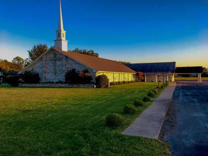
1. City Point, Hopewell
Many Virginia communities with ties to the Revolutionary era have either vanished, been renamed, or been absorbed into larger areas.
Here are ten such examples.
City Point.
Once a major port town on the James River, its strategic importance was significant during the colonial and later Civil War eras.
It was incorporated as a town in 1826 and later annexed by the City of Hopewell in 1923, erasing its independent identity.
Walk the quiet block around 100 Appomattox Street, Hopewell, Virginia, and you can still sense a busy wharf age in the low skyline and river breeze.
The Appomattox and James Rivers meet just beyond the bluff, where tide and current once carried tobacco, timber, and news.
Stand near Weston Manor and you notice how the water sets the pace, steady and indifferent to names on deeds.
You will not find a town hall for City Point anymore, only layers of Hopewell that grew around it.
Interpretive signs fill the gaps with measured details, pointing out vanished warehouses and piers.
The streets feel residential, tidy, and unhurried, more porch talk than port traffic.
Look for brickwork softened by time and fencing that frames views toward the confluence.
Virginia history turns tangible here without forcing the moment.
You step between past and present in a short walk, then pause at the overlook where gulls patrol the light.
The name City Point has faded on paper, yet the landscape keeps telling the story.
2. Colchester, Fairfax County
This was one of Fairfax County’s earliest settlements and a bustling colonial port on the Occoquan River.
The town eventually faded into an unincorporated community due to shifting trade routes and is now a quiet area with minimal historical remnants.
Begin at the end of Colchester Road, Lorton, Virginia, where the pavement narrows and the river widens into a mirror of green.
The shoreline shows traces of old roadbeds and quarried stone, hints rather than exhibits.
You can picture shallow draft boats easing in on the tide, sails down, crews scanning for the wharf that no longer stands.
Birdsong and the hum of insects cover what used to be dockside clatter.
Interpretive markers along the nearby trails sketch out a port that once linked plantations to the broader Chesapeake world.
The setting feels more natural than curated, which suits the story of a town that slipped away quietly.
Park carefully near the river turn and walk the grass to catch the best angle downstream.
Virginia rewards patient eyes, especially at water level where history silted into the banks.
You may notice brick fragments near the edge, rounded by time and current.
They sit like puzzle pieces without a finished picture to guide you.
The community that remains uses the river differently, mostly for light recreation and reflection.
No storefronts announce a district, yet the place holds mood and memory in equal measure.
Colchester survives as a shoreline of clues more than a town you can enter.
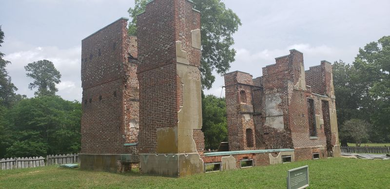
3. Warwick, absorbed by Newport News

An important colonial port and later a county seat, it served as a significant site on the James River.
The City of Warwick eventually consolidated with Newport News in 1958, effectively erasing the original town’s name and independent status.
To trace Warwick, head to the riverfront near 700 River Road, Newport News, Virginia, where open lawns meet working shoreline.
The view mixes marsh grass, ship silhouettes, and low masonry that hints at layered uses.
Little feels like a town center, which tells you how thoroughly the merger rewrote the map.
Quiet plaques offer brief context without staging a full narrative.
Stand by the water and the scale of the James makes the past feel both close and unreachable.
Wind presses waves into short ridges that tap the bank in a steady rhythm.
You keep noticing the absence of streets that once carried freight and county business.
Virginia often archives its river towns inside larger cities that needed the shoreline.
Look inland and the grid turns practical, more modern than colonial.
Any surviving foundations hide behind development, tucked into easements and edges.
That scattered footprint invites a different kind of visit, one built on inference and landscape reading.
Take a slow circuit along the water and let the sightlines do the talking.
Warwick lives now as a chapter inside Newport News rather than a destination with a gate.
4. Yorktown, York County

While still in existence, the town’s prosperity and physical footprint peaked around 1750.
The Siege of 1781, a major fire in 1814, and the shifting tobacco trade led to its decline.
Many original structures and landmarks, like the town windmill, are gone, leaving a much smaller historic village than its colonial height.
Start on Main Street near 301 Main Street, Yorktown, Virginia, where pale clapboard houses stand with polished restraint.
The sidewalks feel ceremonial, a careful stage for low eaves and brick chimneys.
Down the hill, Riverwalk Landing frames the York River with clean lines and calm shade.
Interpretive panels mark redoubts and avenues of approach, turning open fields into readable maps.
You travel between storefronts and shore in a few unhurried minutes.
The scale invites walking, not checking boxes.
Virginia history here is curated yet never stiff, helped by the light off the water.
Gaze toward the bluffs and imagine a taller skyline that no longer exists.
The gaps create space for your own timeline to overlay the facts.
Listen for flag halyards clinking, a small sound that keeps the scene anchored.
Yorktown did not disappear, it refined into a compact memory palace.
Give it time and it returns the favor with quiet detail.
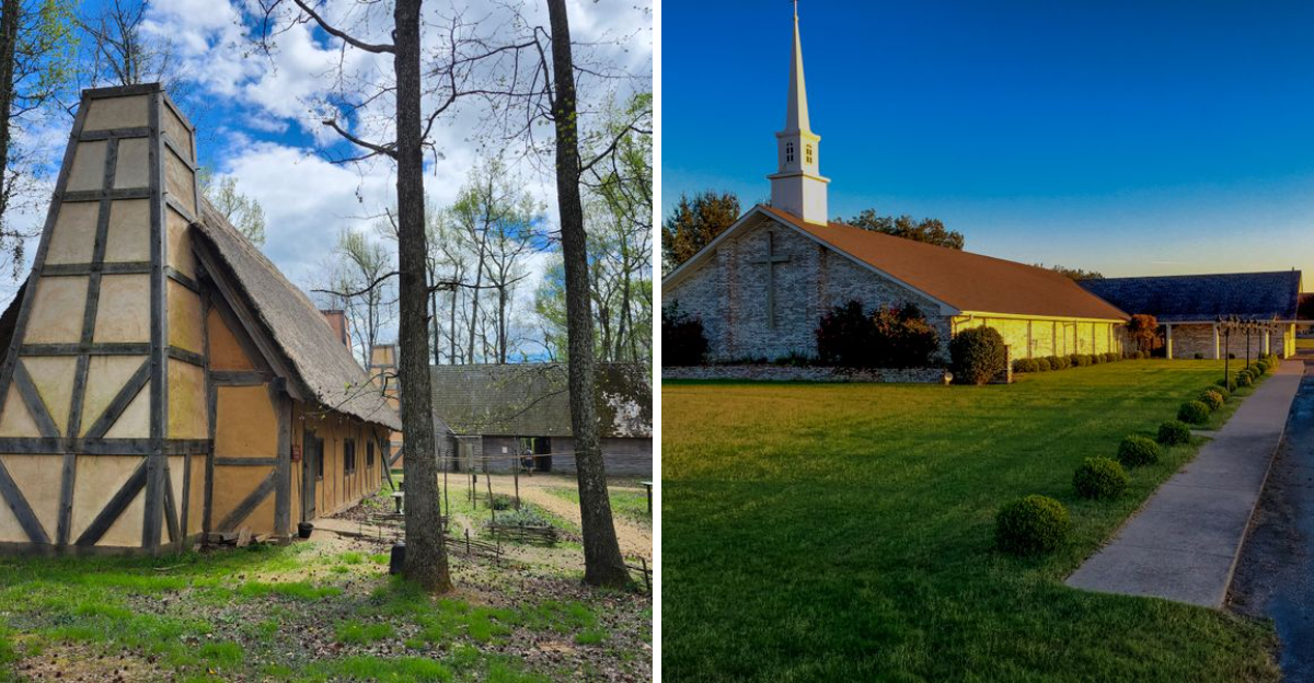
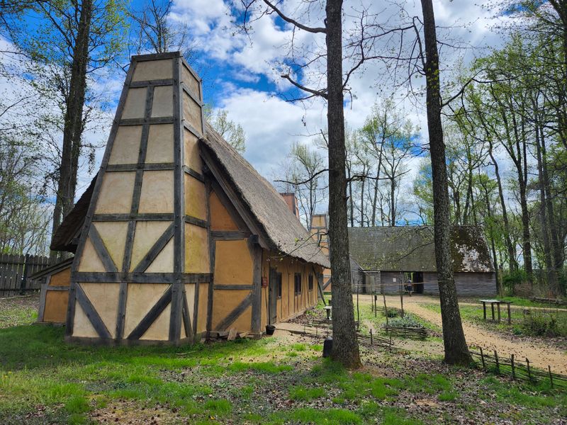
5. Henricus, Chesterfield County
Established in the early 17th century, this boom town was the second permanent English settlement after Jamestown.
It was wiped out during the Indian Massacre of 1622 and exists today only as a living history park, its original settlement long gone.
Arrive at 251 Henricus Park Road, Chester, Virginia, where the river bend wraps a ridge of woods and trails.
Stockade walls and timber roofs outline the idea of a place rather than the place itself.
The reconstructions help you feel scale, distance, and vulnerability.
Interpretive signs fill in names and trade goods with clear, careful language.
You hear the wind move through cordage and palmetto thatch, soft and insistent.
Footbridges lead to overlooks where the water widens into slate and silver.
Virginia shows its oldest story here in fragments, respectfully pieced together.
The park keeps the focus on environment and daily rhythms rather than spectacle.
Paths encourage slow steps and quiet conversation.
Every corner invites a moment to picture cabins, gardens, and smoke lifting straight up.
What vanished returns as understanding that settles in layers.
The lesson lands without hurry, helped by birds and open sky.
Henricus speaks plainly through wood grain and river light.
6. Jamestown District, James City County
Though the first permanent English settlement, it was largely abandoned as a population center when the capital moved to Williamsburg in 1699.
It reverted to farmland and is now solely an archaeological and historical site.
Set your bearings at 1368 Colonial Parkway, Jamestown, Virginia, where boardwalks edge marsh and river.
Archaeology tents and low fences frame squares of carefully sifted soil.
You look down to read the ground rather than up to scan for towers.
The approach turns patient, almost meditative, as details emerge from sand and clay.
Brick outlines draw room corners that time tried to erase.
Interpretive panels balance clear facts with measured speculation.
Virginia places its origin story in a landscape that breathes salt and history.
Water birds patrol the shallows while the wind writes ripples in long lines.
The site embraces absence as a teaching tool.
Imagine footsteps crossing thresholds that no longer rise above grade.
You leave with a mental map rather than a skyline snapshot.
The experience feels grounded, tactile, and gently humbling.
Jamestown District invites quiet attention instead of spectacle.
7. Boydton, Mecklenburg County

This town in Mecklenburg County was virtually destroyed by flooding of the Dan River around 1800, leading the community to rebuild across the river, eventually forming the town of South Boston.
Start your walk at 1294 Madison Street, Boydton, Virginia, where the courthouse lawn levels the scene with dignified shade.
Brick storefronts look composed and compact, holding their lines without fuss.
The past carries a watermarked edge in stories that speak of swift currents and hard choices.
Local markers describe routes that shifted with new crossings and steadier ground.
You read the square like a ledger of arrivals and departures.
Virginia small towns excel at quiet main streets that reward slow pacing.
Here, the rhythm is measured and the corners feel familiar.
Look for long window rows that glow when the sun tilts low.
Side streets slip toward fields and trees that gather in easy clusters.
The river sits outside town now, more memory than threat.
That separation gives the place a balanced, settled posture.
Benches encourage a pause before continuing the loop around the block.
What was lost to water found new footing in a different community downstream.
Boydton holds the earlier chapter with calm and clarity.
8. Bethel on the James
A James River ferry landing and tobacco inspection site established by the 1770s, it faded as canals and railroads redirected trade routes away from the river.
Reach the shoreline near 3200 River Road West, Goochland, Virginia, where a narrow pull off meets a broad sweep of water.
The landing no longer announces itself, yet the geometry of bank and current remains persuasive.
Grass parts to show flattened paths that once guided wagons to the ferry ramp.
Wood posts and scattered stone feel like punctuation marks after a long sentence.
The river reads as a road that lost its milestones.
Quiet defines the visit, and the scene asks for unhurried attention.
Virginia puts history at water level, where echoes travel farther.
Clouds drift low and the surface carries their shadows like slow handwriting.
You listen for the thud of cargo and hear only lap and rustle.
The site teaches scale more than dates, a sense of how movement once depended on current and tide.
Stand a minute and the past edges into view, steady and clear.
No storefronts or plaques compete for notice, only landscape and memory.
That simplicity suits a place that served and then stepped aside.
Bethel remains a waypoint drawn in water and light.
9. Columbia, Fluvanna County

Established in 1788, this small town on the James River was bypassed by major transportation routes and eventually disincorporated by referendum in 2016, ending its long history as an independent town.
Begin at 19 Columbia Street, Columbia, Virginia, where the road edges a bluff above the confluence.
Houses sit with porches that look toward trees and water rather than commerce.
The air feels open, with long sightlines that smooth the bend of both rivers.
Signage explains the vote that turned town into community.
The shift reads as pragmatic, shaped by distance from larger corridors.
Listen for the low drone of distant traffic that never quite arrives.
Virginia holds space for quiet places that choose a slower path.
Side lots roll into meadow, then down to sandy pockets at the edge.
Old storefronts show paint softened by years of weather.
Walk the short grid and the pattern reveals itself in modest steps.
You will not find a bustling main drag, only steady houses and careful gardens.
The confluence keeps the story grounded in movement and meeting.
Waves fold over each other and then settle without hurry.
Columbia feels complete in its silence, a map label turned into landscape.
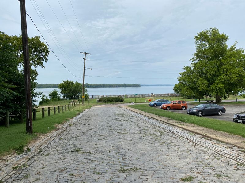
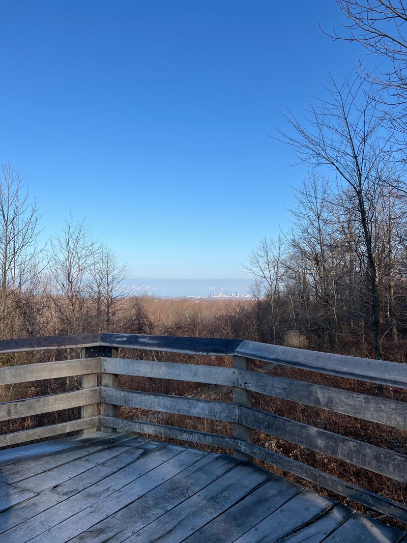
10. City Point Overlook Trail
Many Virginia communities with ties to the Revolutionary era have either vanished, been renamed, or been absorbed into larger areas, their original identities largely lost to time and development.
Here are ten such examples.
City Point Overlook Trail offers a simple way to take in the layered history from above the water.
Start near 505 Cedar Lane, Hopewell, Virginia, where a short path leads to benches and broad views.
The overlook frames the meeting of rivers that powered centuries of trade and travel.
You picture sail and oar moving like clockwork across the channel.
Today the scene rests in quiet greens and silvers with only distant motion.
Signs along the trail point to landmarks that no longer stand on the shore.
You trade streets for sky and river, a fair exchange for understanding place and scale.
Virginia reveals its past generously when you gain a little elevation.
The light changes quickly, shifting textures on water and brick.
Every turn offers a new line across the horizon.
Take time to read the landforms and their long relationship with settlement.
The town that once bustled below your feet now lives mostly in memory.
The view completes the history lesson with clarity and calm.
Dear Reader: This page may contain affiliate links which may earn a commission if you click through and make a purchase. Our independent journalism is not influenced by any advertiser or commercial initiative unless it is clearly marked as sponsored content. As travel products change, please be sure to reconfirm all details and stay up to date with current events to ensure a safe and successful trip.