Somewhere deep in the Appalachian highlands of Virginia, a sandstone labyrinth sits quietly at the top of a mountain, waiting for the curious and the bold. Most people drive right past Rosedale without a second glance, completely unaware that one of the most jaw-dropping geological wonders on the East Coast is tucked just beyond the tree line.
I stumbled onto this place almost by accident, and I can honestly say my jaw dropped the moment I squeezed between those ancient rock walls. Virginia has no shortage of stunning landscapes, but this one plays by completely different rules, and once you see it, you will absolutely understand why.
What Exactly Are the Great Channels and Why Are They So Remarkable
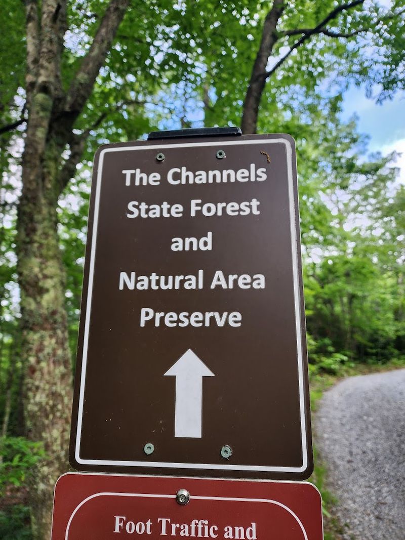
Picture a mountain ridge cracked open like a puzzle, with massive sandstone boulders split into dozens of narrow corridors that twist and turn in every direction. That is precisely what greets you at the summit of Middle Knob inside Channels State Forest, Rosedale.
The Great Channels are a geological formation unlike anything most East Coast hikers have ever encountered.
These formations are estimated to be around 400 million years old, shaped by permafrost and ice wedging during the last ice age. As the ice repeatedly expanded and contracted, it fractured the sandstone into slabs.
Over millions of years, water erosion smoothed and deepened those fractures into the intricate maze-like channels you can walk through today.
The result feels almost otherworldly, like a slot canyon teleported straight from the American Southwest and dropped onto a Virginia mountaintop. Spanning roughly 20 acres, this labyrinth of sandstone sits at the highest point of Clinch Mountain, making it one of Virginia’s most extraordinary natural features.
The scale and age of this place genuinely stop you in your tracks.
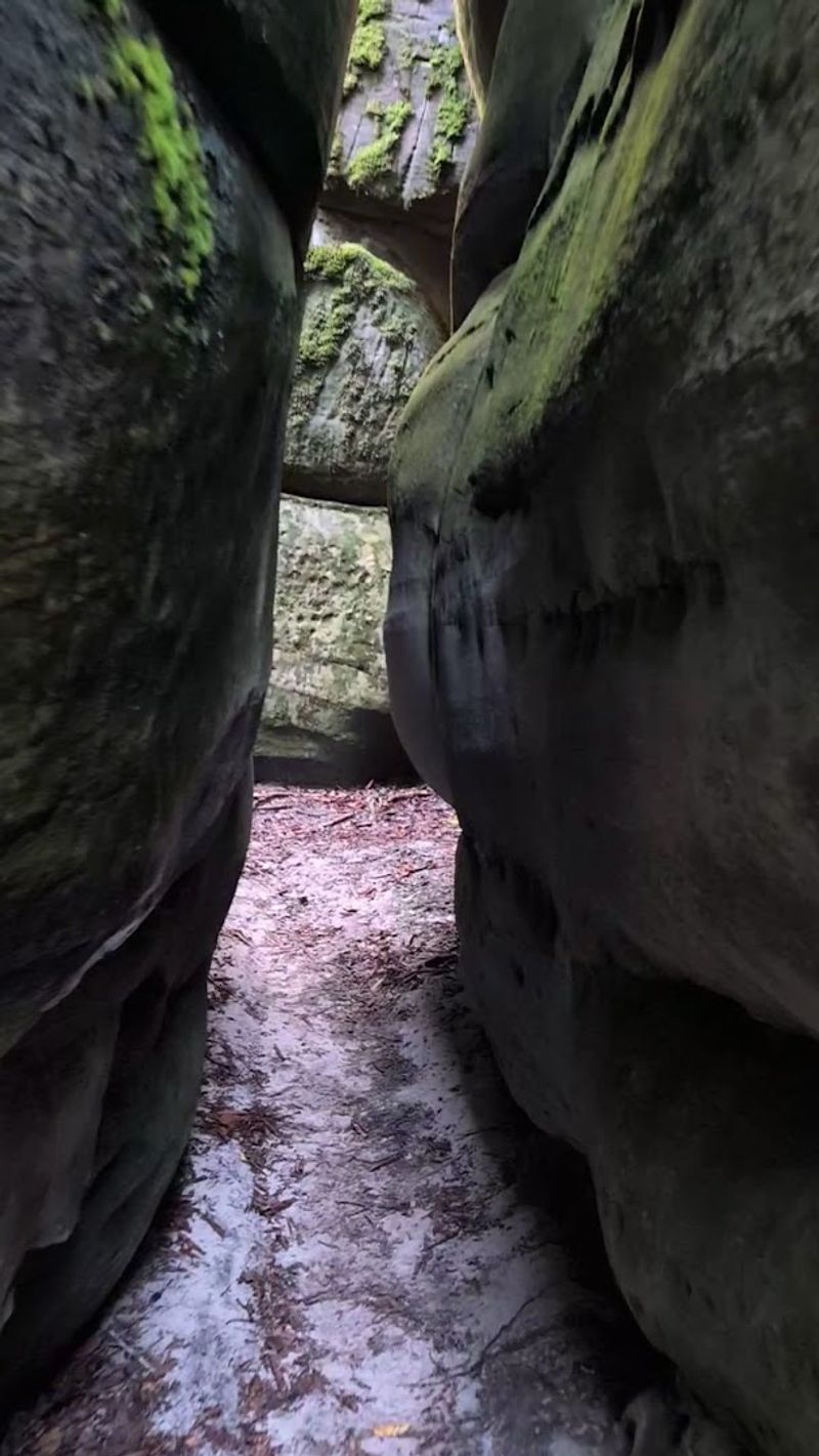
The Brumley Mountain Trail: Your Gateway to the Rock Maze
Starting at Hayters Gap on Route 80, the Brumley Mountain Trail is the shorter and more popular route to the Great Channels, coming in at roughly 6.5 miles round-trip. Most of the ascent follows a wide, well-maintained gravel forest road that makes the first portion feel almost leisurely.
Do not let that fool you, though, because the final stretch before the summit gets noticeably steeper and more demanding.
Gravel gives way to packed earth and exposed roots as you climb closer to the ridgeline. The trail passes through stunning eastern and northern hardwood forests, with rhododendron thickets appearing as you gain elevation.
Spotting those thick, twisting rhododendron branches signals you are getting close to something special.
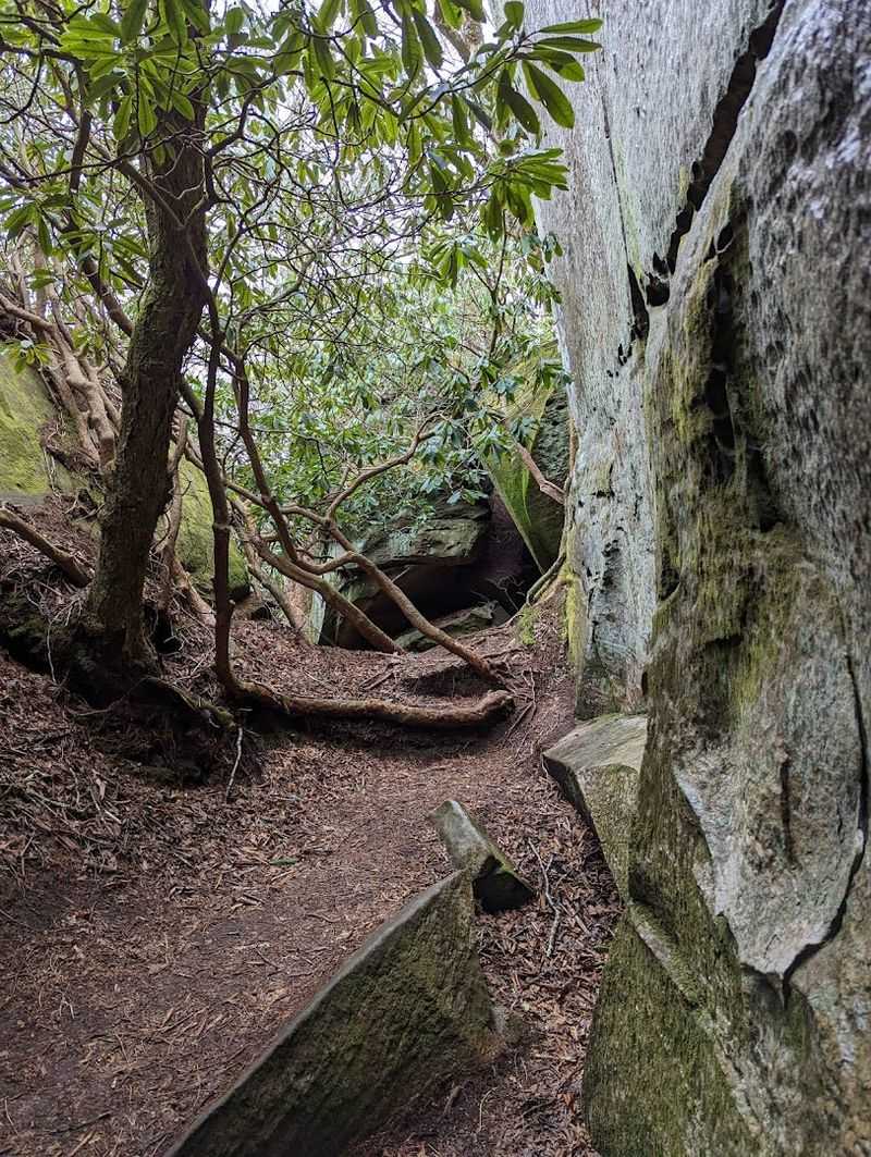
At a fork near the top, a sign points toward the Channels Spur trail on the left. Take it without hesitation.
The main trail continues straight toward the old fire tower, but the spur leads directly into the heart of the rock maze. Bring solid hiking boots, carry more water than you think you need, and plan to spend a couple of hours exploring once you arrive at Channels State Forest, Rosedale.
The Channels Trail: A Longer, Wilder Adventure
For those who prefer a more challenging and immersive experience, the Channels Trail offers a longer journey into the heart of Channels State Forest, Rosedale. This out-and-back route stretches approximately 11 miles in total and begins from the trailhead on Route 689, making it a serious commitment for experienced hikers looking to earn their reward.
Unlike the Brumley Mountain Trail, this path feels rawer and less polished throughout. The terrain is more rugged, the forest denser, and the sense of solitude much deeper.
Long stretches pass through quiet woodlands with minimal trail development, giving the whole experience a genuinely wild character that shorter routes cannot replicate.
Physically, this trail demands proper preparation. Sturdy footwear, layered clothing, and ample hydration are non-negotiable.
Starting early in the morning is smart, both to secure one of the extremely limited parking spots and to allow enough daylight for a comfortable return trip. The payoff at the end, stepping into that ancient sandstone maze after miles of forest walking, hits with an intensity that shorter approaches simply cannot match.
Virginia rewards patience, and this trail proves it beautifully.
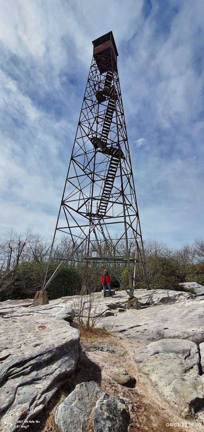
Hayter’s Knob Fire Tower: A Historic Landmark at the Summit
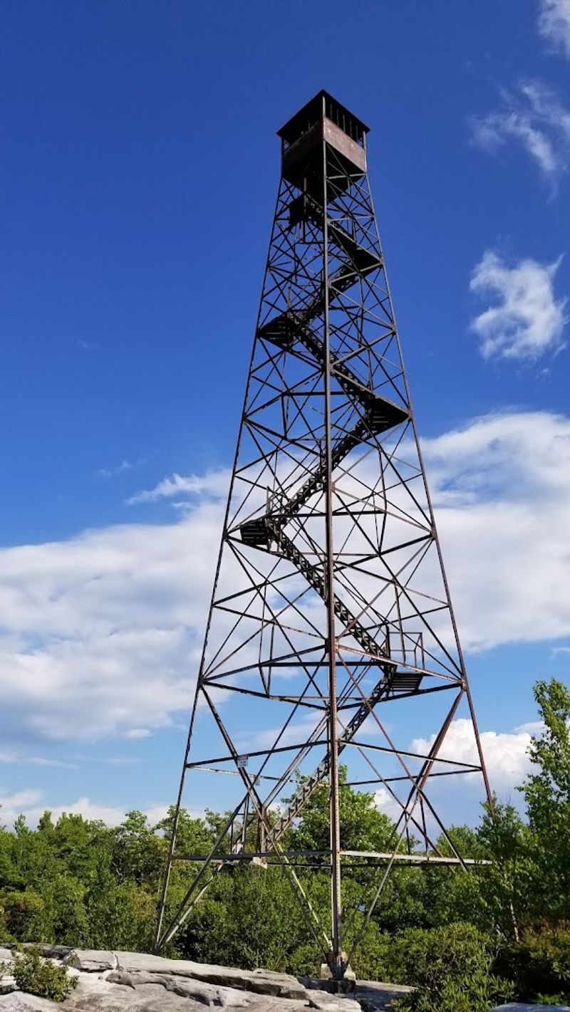
Perched at the summit near the Great Channels stands the Hayter’s Knob Fire Tower, a rugged relic built by Franklin Roosevelt’s Civilian Conservation Corps back in 1939. Constructed during a transformative era of American conservation, this tower served as an active fire lookout for over three decades before finally being retired in 1970.
Today it stands as a weathered monument to that remarkable period of public land stewardship.
The tower itself is no longer climbable, with the lower steps removed for safety reasons. That said, simply standing beside it and reading the history plaques delivers a surprisingly moving experience.
The structure has character, worn metal and aged wood telling a quiet story of the people who once scanned these ridges for smoke.
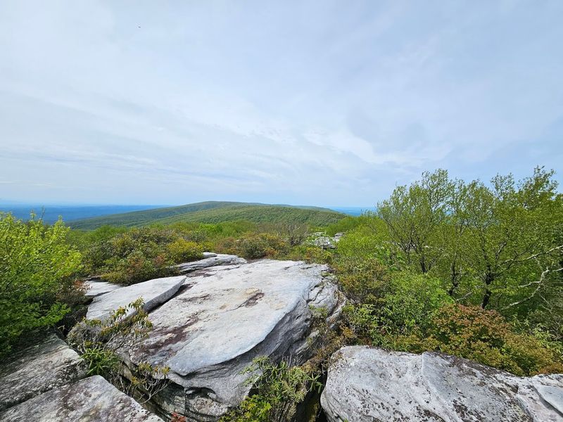
Just beyond the tower, massive sandstone outcrops offer open, unobstructed sightlines across the surrounding Appalachian landscape. Spreading a blanket on those rocks and eating lunch while the wind rolls across the ridge is one of those simple travel moments that sticks with you permanently.
Virginia has plenty of historic structures, but few sit in settings this dramatically beautiful. The fire tower and the channels together make Middle Knob a genuinely unforgettable summit.
360-Degree Views at Middle Knob: The Panorama That Earns Every Step
Reaching the summit of Middle Knob at Channels State Forest, Rosedale, feels like unlocking a reward you genuinely worked for. The moment you step onto the exposed sandstone outcrops near the fire tower, the Appalachian landscape unfolds in every direction with stunning clarity.
Ridge after ridge of forested mountains rolls toward the horizon, broken only by quiet valley floors far below.
On a clear day, the views stretch for miles in all directions, offering one of the most satisfying panoramas in all of Virginia. The elevation at this point sits at approximately 4,208 feet, placing you well above the surrounding terrain and giving the whole scene a genuinely elevated, expansive quality.
Clouds drift at eye level on misty mornings, and the ridgeline glows gold during autumn.
Photographers absolutely love this spot, and for obvious reasons. The combination of ancient rock formations, historic fire tower infrastructure, and sweeping mountain scenery creates a composition that practically frames itself.
Sunrise visits are particularly magical, with soft light washing across the sandstone in shades of amber and rose. Pack your camera, charge your phone, and prepare to take far more photos than you originally planned.
The views alone justify every uphill step.
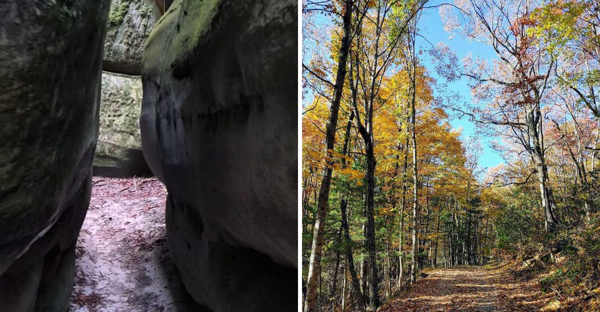
Walking the Rock Maze: What It Actually Feels Like Inside the Channels
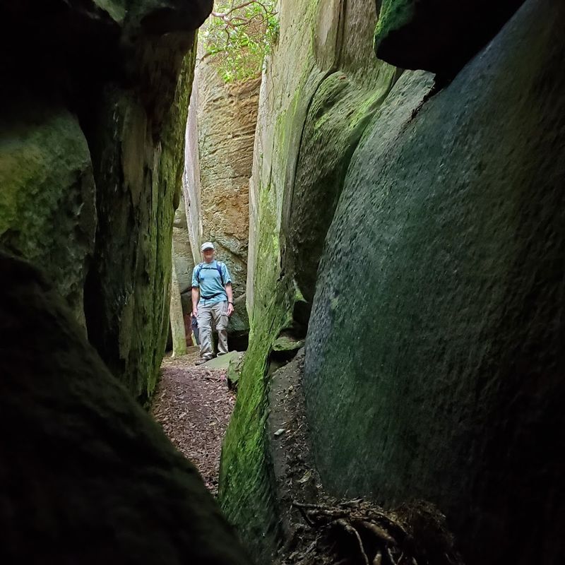
Stepping into the Great Channels for the first time is genuinely disorienting in the best possible way. The sandstone walls rise on both sides as you squeeze through passages barely wide enough for two people, and the outside world disappears completely.
Sound changes, temperature drops noticeably, and the sheer scale of the ancient rock pressing in around you triggers a kind of primal awe.
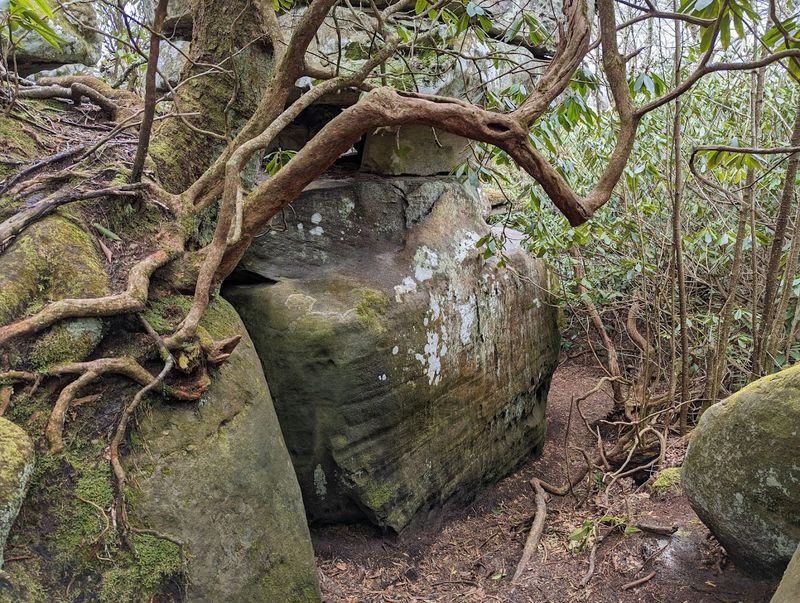
Some corridors are wide enough to walk comfortably, while others require turning sideways and ducking beneath low overhangs. The maze branches repeatedly, with paths looping back on themselves and new passages appearing around every turn.
Getting mildly turned around is part of the experience, though the formation is compact enough that finding your way back out never becomes genuinely stressful.
Scrambling up onto the top of the boulder field is equally rewarding, offering a bird’s-eye view of the channels below and another angle on those sweeping mountain vistas. The rocks stay cool even on warm summer days, making this a surprisingly refreshing spot during July and August hikes.
Channels State Forest, Rosedale, delivers a sensory experience that no photo fully captures. You simply have to stand inside those ancient corridors to understand what all the fuss is about.
Wildlife and Flora: The Living World Around the Rock Formations
Channels State Forest, Rosedale, is not just about ancient rocks. The surrounding forest teems with life, and paying attention to what grows and moves along the trail adds a rich layer to the whole experience.
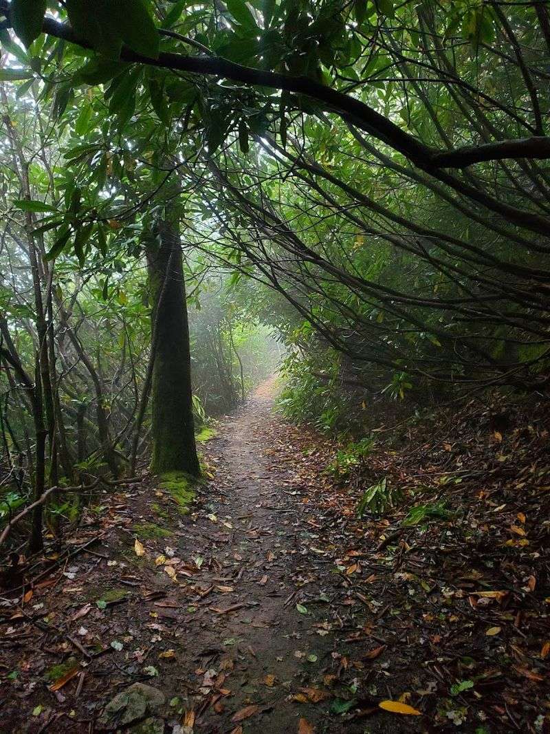
Eastern and northern hardwood forests dominate the lower elevations, transitioning into denser, more dramatic vegetation as you gain altitude.
Rhododendron thickets become increasingly prominent near the summit, creating tunnels of twisted greenery that feel almost enchanted during late spring blooms. The flowers peak around late May and early June, coating the trail edges in clusters of pink and purple that contrast beautifully against the gray sandstone.
Bees work those blossoms with impressive enthusiasm, though they pay hikers absolutely no mind.
Deer sightings along the trail are common, particularly in the early morning hours before the day warms up. Virginia’s diverse wildlife also includes a range of bird species that nest throughout the forest, making this a worthwhile destination for birdwatchers.
Wildflowers dot the gravel road sections during spring and summer, adding unexpected color to what might otherwise be a fairly utilitarian stretch of trail. Bring bug spray during summer months, as mosquitoes can be persistent in the shadier, more sheltered sections of the forest.
Practical Tips for Visiting: Parking, Timing, and Trail Prep
Logistics matter enormously at this destination, and skipping the planning phase can turn an exciting trip into a frustrating detour. The parking area at the Channels Natural Area Preserve holds exactly ten vehicles, and that limit is strictly enforced.
Parking along Highway 80 is not permitted, and towing is actively enforced, so arriving to a full lot means turning around and coming back later.
Weekday mornings before 10 a.m. offer the best odds of securing a spot without waiting. Weekend visits require arriving at dawn or accepting that a queue may have formed.
Carpooling is a genuinely smart strategy if you are traveling with a group, reducing pressure on the limited spaces and making the whole operation smoother for everyone.
The preserve operates daily from 6 a.m. to 5 p.m., so plan your hike to comfortably return before closing. There are no restroom facilities on site, which is worth knowing before you leave the car.
Good hiking boots, layered clothing, and at least two liters of water per person are strongly recommended. Trekking poles help considerably on the steeper sections near the summit.
A small snack for the rocks near the fire tower rounds out a perfectly prepared visit to Channels State Forest, Rosedale.
Seasonal Highlights: When to Visit for the Best Experience
Every season brings a completely different personality to Channels State Forest, Rosedale, and choosing the right time to visit depends entirely on what kind of experience you are chasing. Spring delivers wildflowers along the lower trail sections and the spectacular rhododendron blooms near the summit, making it arguably the most visually rewarding season for photography enthusiasts.
Summer visits offer the cool, shaded relief of the channels themselves, which stay noticeably cold even during hot days thanks to the depth of the crevices. Bug spray becomes essential from June onward, with mosquitoes particularly active in July.
The forest is lush and deeply green, creating a beautiful canopy overhead for most of the ascent.
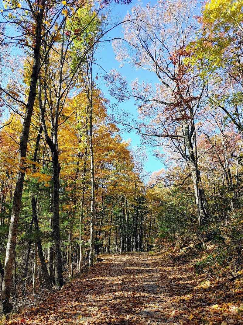
Autumn transforms the hardwood forest into a riot of gold, orange, and red, with the elevated position of Middle Knob providing sweeping views of fall color spreading across the Appalachian ridges in every direction. This is peak season for a reason.
Winter visits are possible for experienced hikers, but icy patches on the sandstone and trail surface make careful footing absolutely critical. Virginia’s mountain weather shifts quickly at elevation, so checking forecasts and packing accordingly applies regardless of which season you choose for your adventure.
Getting There and Making the Most of Your Visit to Rosedale
Rosedale sits in Russell County in the heart of southwestern Virginia, a region that rewards slow travel and genuine curiosity. The drive into this part of the state alone is worth the trip, with rolling farmland giving way to increasingly dramatic mountain terrain as you head deeper into the Appalachians.
The landscape shifts noticeably as you approach the trailhead, signaling that something extraordinary is close.
The Channels Natural Area Preserve address is Rosedale, VA 24280, and the trailhead is accessible from Route 80 at Hayters Gap. GPS works reasonably well in the area, though having a downloaded offline map as a backup is always wise in rural Virginia.
The site sits within the broader 721-acre Channels Natural Area Preserve managed by the Virginia Department of Conservation and Recreation.
After the hike, the surrounding region offers quiet country roads, small-town Virginia charm, and the kind of unhurried pace that feels genuinely restorative. Pack a cooler with your own food and plan to linger in the area.
This corner of Virginia does not get the tourist traffic it deserves, which means you get the whole experience largely to yourself. Pack your bags, point the car southwest, and go find that rock maze before everyone else does.
Dear Reader: This page may contain affiliate links which may earn a commission if you click through and make a purchase. Our independent journalism is not influenced by any advertiser or commercial initiative unless it is clearly marked as sponsored content. As travel products change, please be sure to reconfirm all details and stay up to date with current events to ensure a safe and successful trip.