Locals still argue the old ferry was better. Visitors point to the bridge-tunnel as the bay’s defining landmark.
But the most compelling story of Chesapeake Bay travel may belong to something many never saw at all. At the quiet northern tip of Virginia’s Eastern Shore, this spot holds the memory of a crossing that once linked two distant shores and shaped daily life around it.
For decades, it carried people, goods, and entire routines across open water, fueling local economies and connecting communities. Then, almost overnight, it gave way to a new era.
What remains is more than a place. It is a story of ambition, change, and a vanished way of moving through the world.
The Birth of a Bay Crossing That Nobody Talks About Anymore
Long before the Chesapeake Bay Bridge-Tunnel became Virginia’s most photographed engineering feat, a humble ferry route was doing the heavy lifting. The Little Creek-Cape Charles Ferry quietly connected the Eastern Shore to the mainland, threading passengers and cargo across open bay waters with remarkable consistency.
Cape Charles itself was born as a railroad town, purpose-built to serve as the southern anchor of a rail network stretching up the Delmarva Peninsula. The ferry terminal here was not an afterthought.
It was the crown jewel of a regional transportation system that kept Virginia moving.
Standing at the old terminal site today, you can almost hear the low horn of a departing vessel cutting through the morning fog. The Northampton County shoreline still carries that same quiet authority it had when thousands of passengers crossed here weekly.
Virginia’s Eastern Shore owes much of its early economic identity to this crossing. Farmers, merchants, and families all relied on it.
The ferry was not just a boat ride. It was a lifeline that made modern life on the peninsula genuinely possible, connecting isolated communities to the broader rhythms of the state.
How Cape Charles Became the Gateway to Virginia’s Eastern Shore
Few small towns in Virginia carry as much geographic swagger as Cape Charles. Perched at the very tip of the Delmarva Peninsula, it was strategically positioned to serve as the jumping-off point for anyone crossing the bay.
Railroads arrived first, then the ferry followed, and together they transformed this quiet coastal outpost into a genuine regional hub.
The town’s wide, tree-lined streets and Victorian-era architecture tell a story of prosperity built on connectivity. Every building downtown was once touched by the economic energy generated by the ferry terminal nearby.
Merchants thrived, hotels filled up, and Cape Charles buzzed with the kind of productive activity that only a transit hub can generate.
My first walk through downtown Cape Charles felt like stepping into a sepia photograph that somehow stayed in color. The bones of the old railroad and ferry era are still visible in the oversized warehouses and the broad avenues designed to handle serious commercial traffic.
Virginia rewarded Cape Charles handsomely for its role as a transportation anchor. The town grew confidently, and even today, its historic district reflects the ambition of a community that once believed it was the center of everything important happening on the bay.
The Fleet That Ruled the Chesapeake Before the Bridge-Tunnel Existed
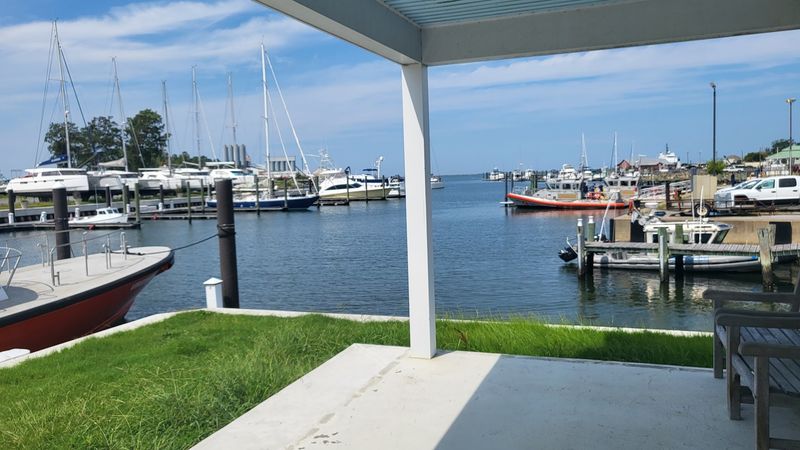
At peak operation, the ferry service running through Cape Charles Ferry Site was genuinely impressive. A fleet of vessels worked the crossing around the clock, hauling automobiles, trucks, and passengers across the bay with clockwork precision.
The flagship vessel, SS Pocahontas, was a floating city capable of carrying over a thousand passengers at once.
Watching that many people board a single ferry must have been a spectacle. Families loaded station wagons onto car decks.
Truckers lined up in long queues stretching back from the terminal. The whole operation hummed with the organized chaos of a major transportation artery doing exactly what it was designed to do.
By the time the service hit its operational peak, dozens of one-way crossings were completed every single day. That is not a small ferry operation.
That is a full-scale maritime transit system serving one of the most strategically important water crossings on the entire East Coast.
The vessels themselves became beloved fixtures of Chesapeake Bay life. Regular passengers knew the boats by name.
Virginia’s maritime culture was deeply shaped by these crossings, and the memory of those ferries still surfaces in conversations among older residents of Northampton County with unmistakable fondness.
Vehicles, Trucks, and the Road That Ran Straight Onto a Boat
The moment the ferry started carrying vehicles, everything changed. Suddenly, the Eastern Shore was not just accessible to rail passengers.
Drivers could load their cars onto a boat and wake up on the other side of the Chesapeake Bay. For Virginia’s road-tripping culture, this was a genuine revolution.
The Ocean Highway, a major coastal route running along the Eastern Seaboard, connected directly to the Cape Charles Ferry Site. Drivers heading north or south along the coast factored the ferry crossing into their journey the same way modern travelers factor in toll booths.
It was simply part of the route.
Imagine driving your car onto a massive deck, parking between trucks twice your size, and then watching the Northampton County shoreline slowly recede as the vessel pushed out into open water. That experience was completely ordinary for thousands of Virginia drivers across multiple decades.
Trucks carrying agricultural goods from Eastern Shore farms used the crossing extensively. The ferry was not just a passenger convenience.
It was a commercial artery that moved real economic value across the bay every single day, keeping markets connected and supply chains intact long before anyone had invented that phrase.
The Chesapeake Bay Ferry Commission and Virginia’s Bold Bet on Water Travel
Virginia did not leave its most important water crossing to chance. The state stepped in decisively, establishing the Chesapeake Bay Ferry District to bring professional oversight to an operation that had become genuinely critical infrastructure.
This was government taking transportation seriously in a way that actually worked.
The Chesapeake Bay Ferry Commission took over management of the crossing, pouring resources into improving the service and expanding capacity. For the communities on both sides of the bay, this institutional backing meant reliability.
Schedules were honored. Vessels were maintained.
The whole operation gained a professionalism that private management had struggled to sustain consistently.
Northampton County residents felt the difference almost immediately. A state-backed ferry service commanded more confidence than a privately run one, and that confidence translated into more people using the crossing, more commerce flowing through Cape Charles, and more investment in the surrounding area.
Virginia’s willingness to invest in this crossing reflected something important about how the state understood its own geography. The bay was not a barrier to be tolerated.
It was a feature to be managed, and the ferry commission approach proved that smart public investment could turn a geographic challenge into a genuine regional asset worth celebrating.
Life at the Terminal: What Cape Charles Looked Like on a Busy Crossing Day
A busy day at the Cape Charles Ferry Site was its own kind of theater. The terminal area filled with vehicles queuing in long, patient lines.
Passengers stretched their legs on the dockside walkways, watching gulls wheel overhead while the next vessel made its approach from across the bay.
Children pressed their faces against the railings as the ferry docked with a satisfying thud. Crew members moved with practiced efficiency, directing traffic and managing the boarding process with the calm authority of people who had done this hundreds of times before.
The whole scene had an energy that felt both routine and genuinely exciting.
Nearby, the town of Cape Charles absorbed the overflow. Travelers who missed a crossing or arrived early browsed the shops and sat at counters, making the town feel perpetually alive with passing humanity.
The ferry terminal was not just a transportation node. It was the economic heartbeat of the entire community.
On foggy mornings, the terminal took on a different character entirely. The sounds of the bay dominated everything, and the sight of a massive vessel emerging slowly from the mist must have struck every waiting passenger as something close to magical.
Virginia’s Chesapeake Bay has always known how to make an entrance.
The Chesapeake Bay Bridge-Tunnel Arrives and Changes Everything Overnight
Progress has a way of being both thrilling and a little heartbreaking. When the Chesapeake Bay Bridge-Tunnel opened in the mid-twentieth century, it was immediately recognized as one of the most audacious engineering projects in American history.
Drivers could now cross the bay without waiting for a boat, without schedules, without the weather-dependent uncertainty of a ferry crossing.
The Cape Charles Ferry Site felt the impact almost instantly. Crossing times dropped dramatically.
Traffic that once flowed through the terminal now bypassed it entirely, heading straight for the bridge-tunnel approach. The ferry service, which had operated reliably for decades, suddenly found itself without a purpose it could defend.
Within a short period of the bridge-tunnel’s completion, ferry operations ceased entirely. The vessels that had been such familiar presences on Chesapeake Bay waters were reassigned or retired.
The terminal at Cape Charles went quiet in a way that must have felt surreal to everyone who had worked or lived near it.
Virginia had made its choice. The future was concrete and cable, not steel hulls and diesel engines.
The decision made perfect economic sense, but it closed a chapter of the state’s transportation history that had genuinely shaped the character of Northampton County and the communities it served.
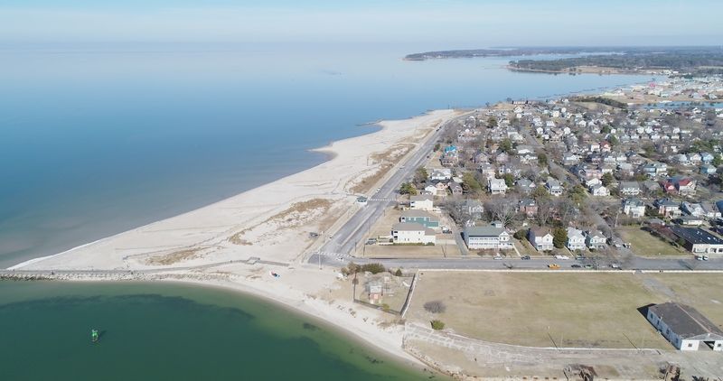
What Remains at the Cape Charles Ferry Site Today
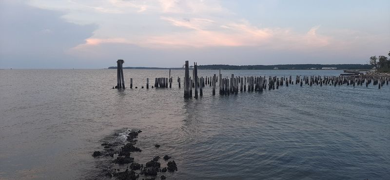
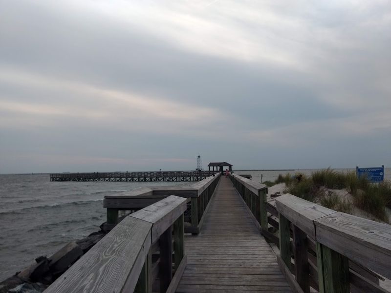
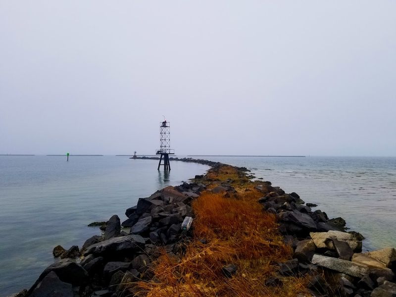
History does not disappear cleanly. At the Cape Charles Ferry Site, traces of the old operation are still visible for those willing to look carefully.
The northern terminus of the original crossing remains accessible, now serving a quieter but still functional purpose as a terminal for railway barges that move rail cars across the mouth of the bay.
Walking the waterfront near the old terminal area, I noticed the industrial bones of the past poking through the present. Wide concrete aprons, weathered pilings, and the general scale of the infrastructure all suggest something much larger once operated here.
This place was built for serious volume, and its proportions still reflect that ambition.
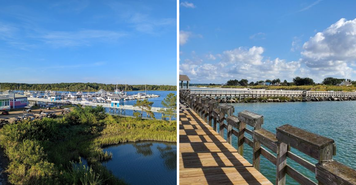
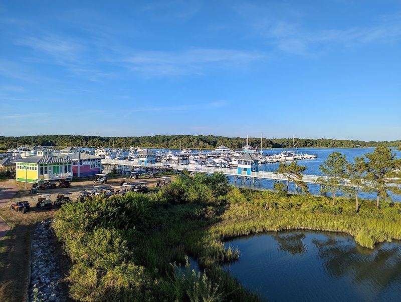
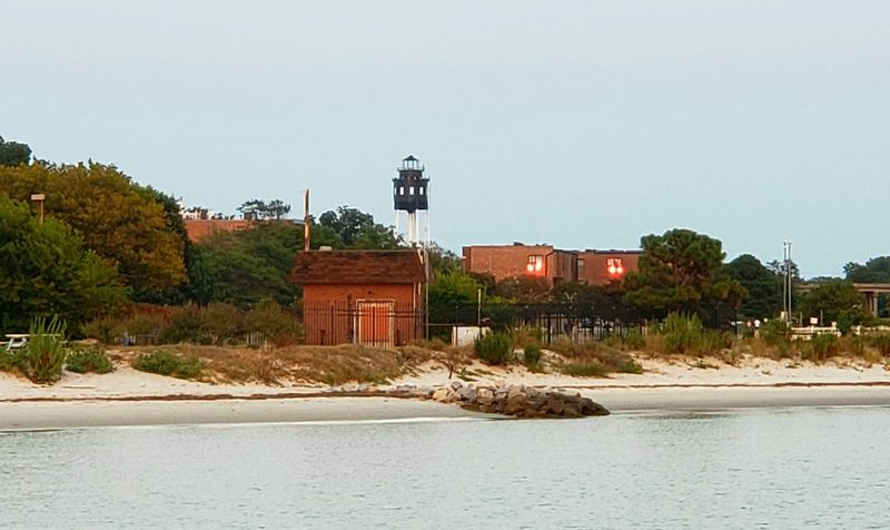
Cape Charles itself has evolved gracefully since the ferry era ended. The historic downtown has been carefully preserved, and the town now attracts visitors drawn to its architectural charm, bay access, and relaxed pace.
The ferry legacy is woven into the town’s identity even if the boats themselves are long gone.
Northampton County has done a thoughtful job of honoring this history without being consumed by nostalgia. The Cape Charles Ferry Site represents a specific moment in Virginia’s development, and the physical remnants that survive deserve recognition as genuine historical landmarks worth protecting and interpreting for future generations.
Exploring Cape Charles Beyond the Ferry History: A Town Worth Your Time

Cape Charles is the kind of town that rewards slow exploration. The historic district packs genuine architectural beauty into a compact, walkable grid.
Victorian-era homes line quiet streets, and the downtown commercial strip has a genuine character that feels earned rather than manufactured for tourist consumption.
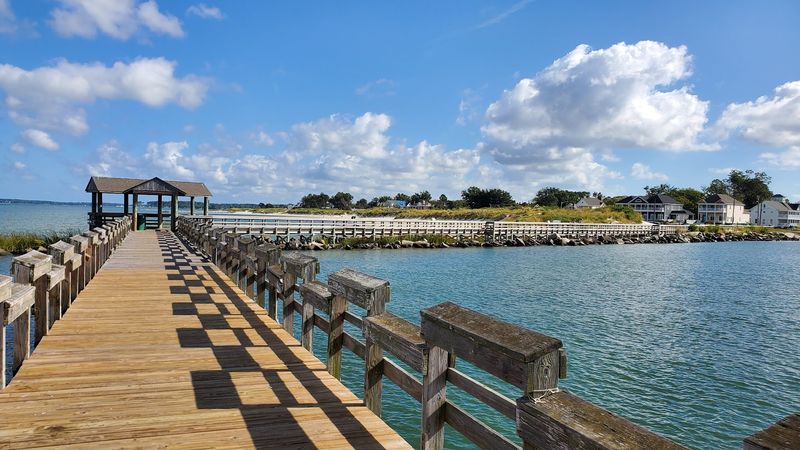
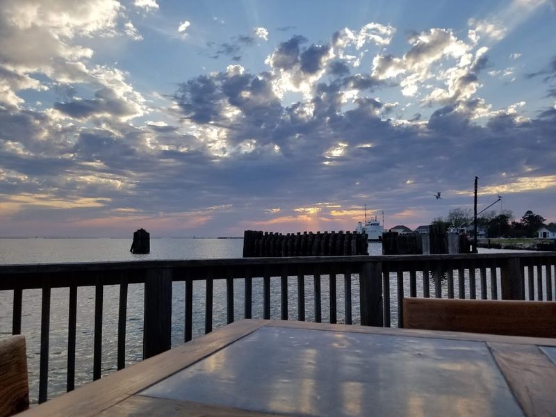
The beach at Cape Charles sits on the calmer, bay-facing side of the peninsula, which means gentler waves and warmer water than the ocean beaches to the east. Families set up for long afternoons here, and the sunsets over the Chesapeake Bay are the sort that make you reach for your phone and immediately run out of storage.
Virginia’s Eastern Shore has a distinct personality compared to the rest of the state. Life here moves at a different pace, shaped by water, agriculture, and a sense of geographic separation that breeds genuine community identity.
Cape Charles sits at the heart of that identity.
My afternoon wandering through the town confirmed what I had suspected from the moment I arrived. Cape Charles is not trading on borrowed history.
It has its own present-tense appeal that stands completely apart from the ferry legacy, making it a destination that justifies the drive regardless of your interest in transportation history.
Plan Your Visit to Cape Charles Ferry Site, Northampton Virginia
Getting to Cape Charles Ferry Site takes you through some of Virginia’s most underappreciated scenery. The drive down the Delmarva Peninsula on US Route 13 passes through flat farmland, roadside produce stands, and small communities that feel genuinely off the beaten path.
The approach to Northampton County builds anticipation in the best possible way.
Cape Charles is located at the southern end of the Eastern Shore, just north of where the Chesapeake Bay Bridge-Tunnel begins its dramatic crossing. The town address is Cape Charles, Virginia 23310, and it sits at coordinates that put it squarely between the bay and the Atlantic, making it one of the more geographically dramatic small towns in the entire state.
Spring and fall are my preferred seasons for visiting. The light is softer, the crowds are manageable, and the bay has a moody, atmospheric quality that summer’s brightness tends to flatten.
Birders particularly love the area during migration season, when the peninsula channels extraordinary numbers of species through its narrow geography.
Virginia consistently surprises visitors who take the time to explore beyond its most famous destinations. Cape Charles Ferry Site is proof that the most compelling stories are sometimes found in the quiet corners of the map, waiting patiently for someone curious enough to show up and listen carefully.
Dear Reader: This page may contain affiliate links which may earn a commission if you click through and make a purchase. Our independent journalism is not influenced by any advertiser or commercial initiative unless it is clearly marked as sponsored content. As travel products change, please be sure to reconfirm all details and stay up to date with current events to ensure a safe and successful trip.