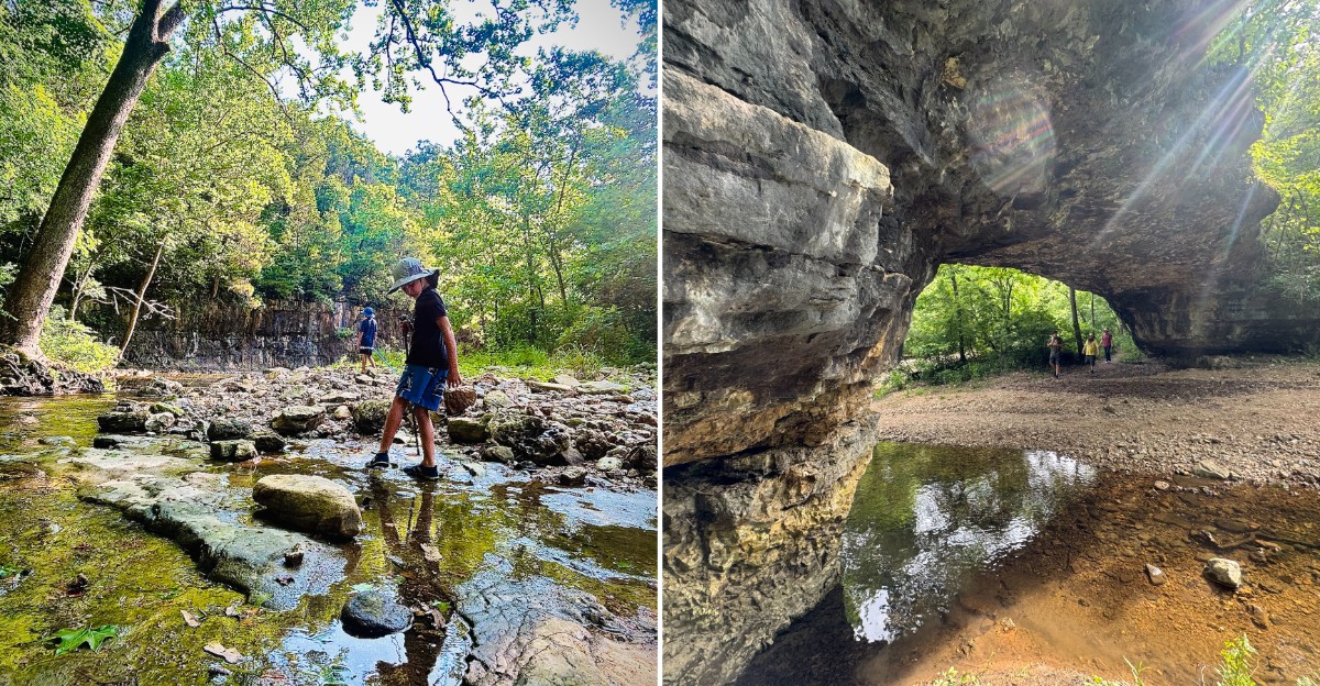
Volunteers carved an entire hiking loop out of rugged Ozark hillside using nothing but their hands and hand tools. At the halfway point, a stone arch about 40 feet across waits over a quiet creek.
I like how little fuss surrounds it. The parking lot holds about six cars, and there are no restrooms, no trash cans, and no cell signal.
You bring water, sturdy shoes, and some curiosity.
This corner of Missouri also carries a quiet bragging right. It was the very first spot in the state to earn official Natural Area status, back in 1971.
A geologist was already writing about the arch in 1857.
I believe the best places reward a little effort. This one asks for creek crossings, rocky climbs, and narrow paths.
Every Step Of This Loop Was Shaped By Volunteer Hands
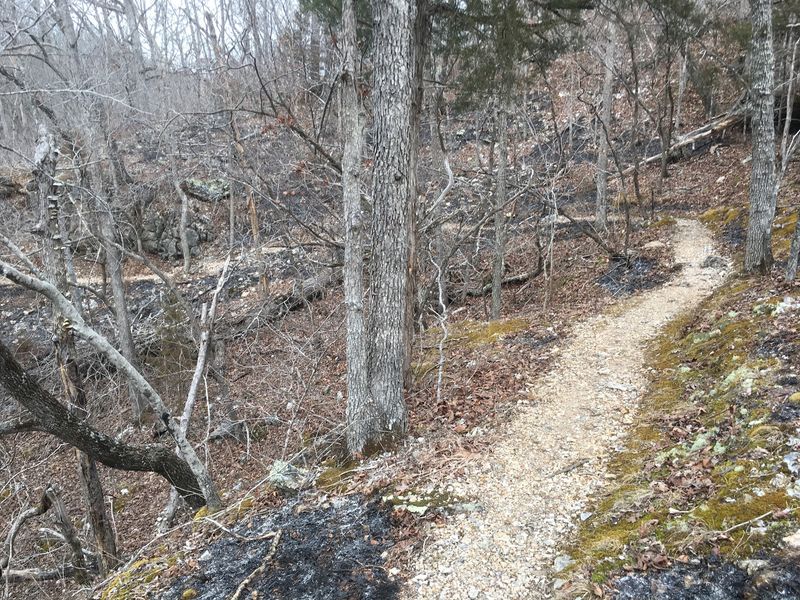
Shovels, rock bars, and plenty of sweat built this trail. Clifty Creek Natural Area got its 2.5-mile loop in the fall of 2008, and volunteers made it entirely by hand.
Those helpers came from across Missouri, not just the nearby hills. That means every switchback and rocky step was set by people who simply wanted others to enjoy this valley.
Funding came from a team effort too. The Missouri Department of Conservation and the Missouri Conservation Heritage Foundation both pitched in.
The L-A-D Foundation, which owns the natural area, also helped pay for the project. Federal Recreational Trails Program money arrived through the Department of Natural Resources.
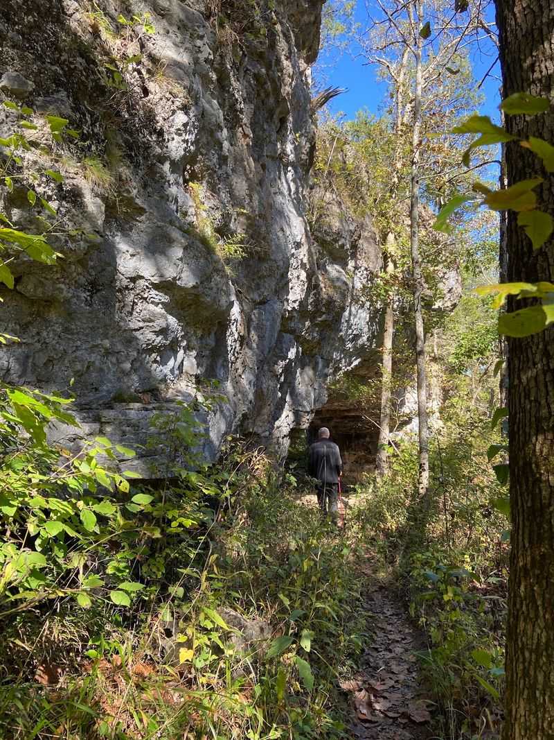
You can feel that handmade quality on the ground. The path stays narrow, often wide enough for one hiker at a time, and it bends with the land instead of flattening it.
I like that approach a lot. A bulldozed trail would have been faster, but it would have scarred the hillsides that make this place special.
Keep that in mind when a root or rock catches your boot. Someone placed many of those stones on purpose, so the trail could last without ruining the forest around it.
Treat the path kindly and stay on it. Those volunteers earned that much respect.
Forty Feet Of Stone Arch Makes The Hike Worth Every Climb
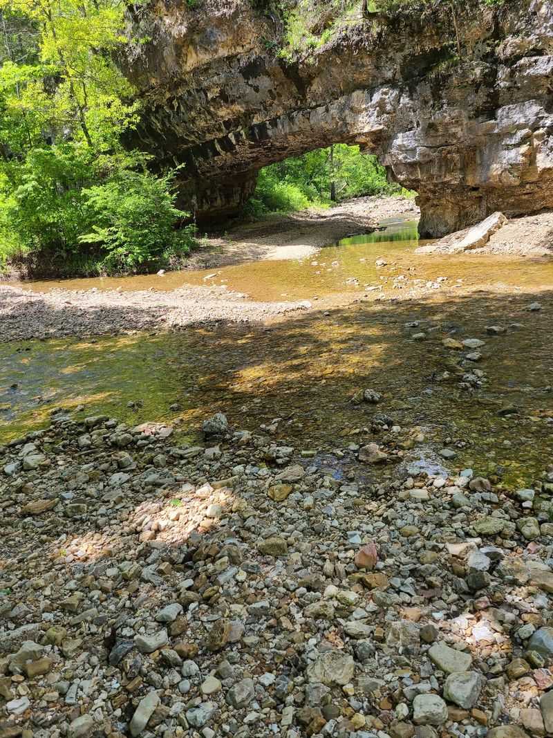
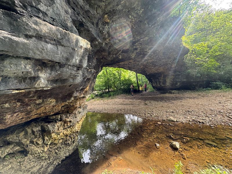
Thirteen feet tall and roughly 40 feet across, the natural bridge is the star of the show. It stretches over a small tributary of Clifty Creek like the water built itself a doorway.
That is basically what happened. Over a very long time, the stream wore its way through Gasconade dolomite, leaving a solid span of rock overhead.
Dolomite is a cousin of limestone, and water slowly dissolves it. Give a stubborn little creek enough centuries, and you get an arch instead of a wall.
The scale feels just right for a woodland hike. It is big enough to impress, yet cozy enough that the setting feels personal rather than crowded with railings and signs.
Bring a camera, because the arch frames the creek beautifully. Shots from downstream often show both the span and the water passing beneath it.
Please admire it without climbing on top. The rock has stood for ages, and it deserves a few more.
Plan to linger here a while. Most hikers treat the bridge as the turnaround point for a snack and a rest, and honestly, there are worse lunch spots.
After all that walking, you earned the view.
Missouri Handed Out Its Very First Natural Area Title Right Here
December 1971 marked a first for the whole state. Clifty Creek became the very first site in Missouri designated as a Natural Area.
That title is not handed out casually. It recognizes places that still show what the land looked like before heavy development changed so much of it.
The story stretches back even further, though. Early Missouri geologist G.C.
Broadhead described the natural bridge and its valley in 1857.
Think about that for a second. People were jotting notes about this arch before the Civil War era, and it still looks wild today.
Ownership sits with the L-A-D Foundation, which protects the natural area. Next door, Clifty Creek Conservation Area adds more protected ground to the mix.
That neighbor began in 1984 with a 156-acre donation from The Donald Walker Trust. The Conservation Department later bought another 100 acres.
Together, the two areas cover 486 acres. That is a generous buffer for such a quiet creek valley.
So when you hike here, you walk through Missouri conservation history. Not bad for an afternoon stroll that ends at a rock arch.
Turn Right At The Fork Unless You Want The Long Way Around
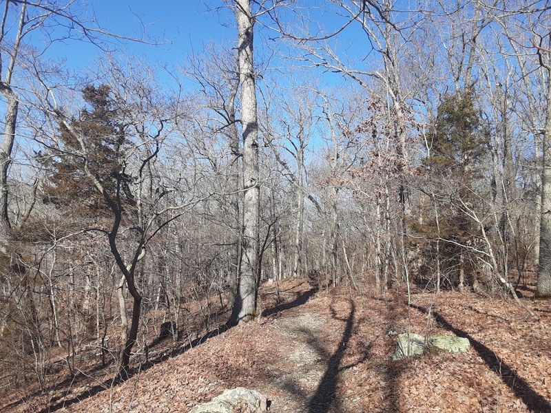
Decisions arrive fast on this hike. About one-tenth of a mile from the parking lot, the trail splits into two directions.
Go right, and you reach the natural bridge in about one mile. Go left, and the arch sits 1.4 miles away.
Either way, you finish the loop back at your car. The full circuit runs roughly 2.5 to 2.7 miles depending on who is measuring.
Heading right first makes the trip counterclockwise. Many hikers like that choice because the big reward shows up early, while legs still feel fresh.
The left option works well if you prefer saving the best for later. Think of it as dessert after the vegetables.
Signage stays minimal, so pay attention. Occasional arrows help, but you won’t find a sign at every bend.
A paper trail map is sometimes available at the trailhead. Grab one if it is there, and snap a photo of it just in case.
Download any map before you leave town too. Cell service disappears completely here, and guessing in the woods gets old quickly.
A little planning keeps the hike relaxing instead of confusing.
Your Legs Will Notice Those Ozark Ups And Downs
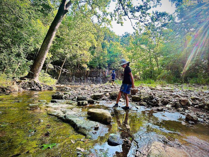
Two hundred feet separate the parking lot from the base of the arch. That number sounds friendly, but the trail refuses to drop in one tidy line.
Instead, it rolls up and down across the hillsides. By the end, you climb and descend more than 200 feet total.
Expect rocky ground, tree roots, and narrow stretches. The trail rates as moderate to rugged, so flip-flops should stay in the car.
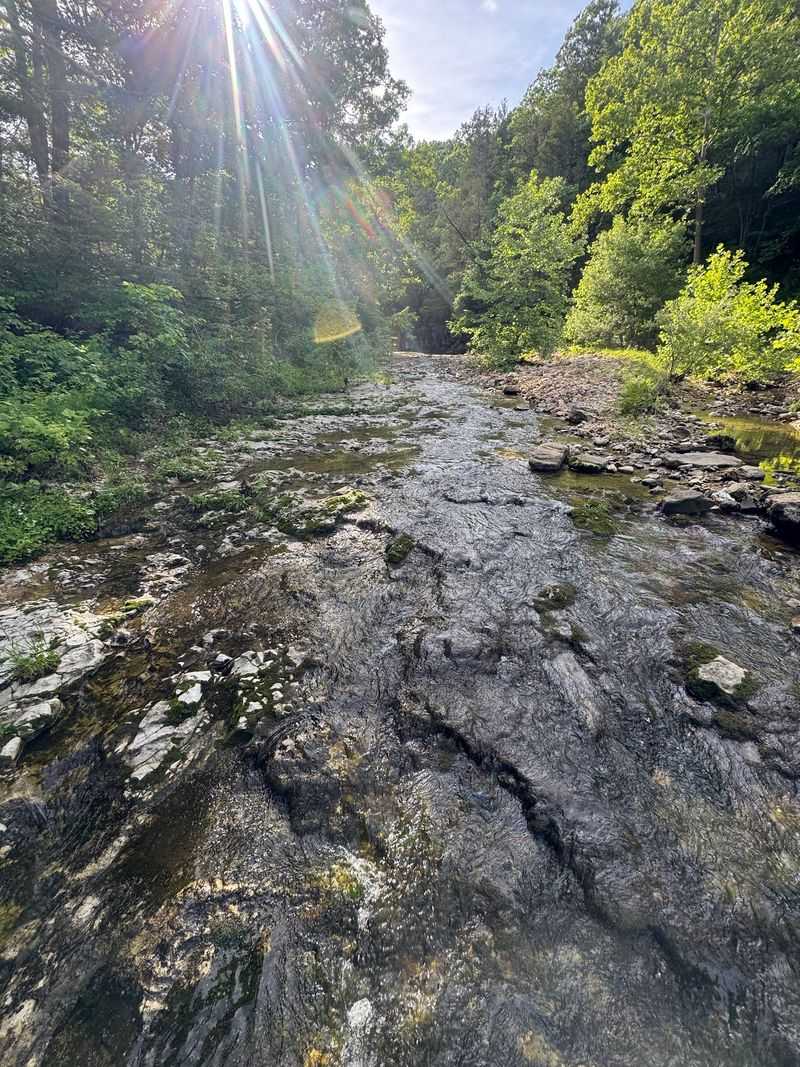
Creek crossings pop up along the way. They are part of the fun in normal weather, though wet feet are always possible.
Skip the hike after heavy rains. Water levels can rise high enough to make crossings risky, and mud makes slopes slick.
Summer brings another challenge. Some sections get overgrown, so long pants help against scratchy plants and bugs.
Winter can turn the steep spots icy. Traction devices or extra caution go a long way then.
None of this should scare you off. It just means pacing yourself and wearing real shoes with good grip.
Families with older kids often handle it fine. Smaller children may need a lift over creeks or steep bits, so plan arm strength accordingly.
A Pocket-Size Sampler Of The Whole Ozarks Waits On This Trail
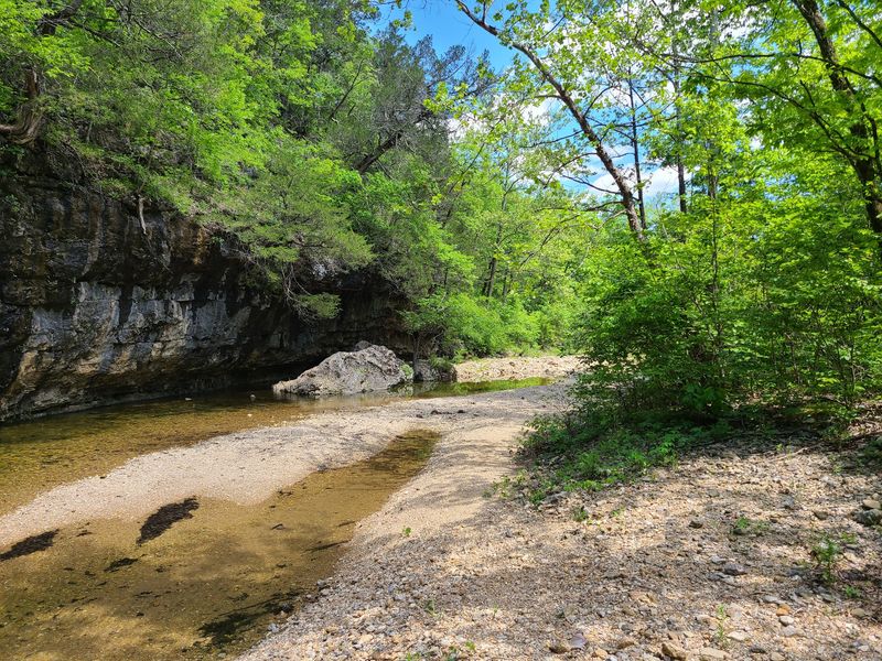
Few short hikes pack this much variety. Within one loop, you pass through several natural communities that usually take a road trip to see.
Oak-hickory forest covers the ridges with classic Ozark shade. Down low, mixed bottomland forest hugs the creek where soil stays richer and wetter.
Then the trees open up. Limestone glades and cliffs break through, along with sandstone glades that feel almost desert-like on a sunny day.
Glades are rocky, open patches with thin soil. Plants there have to tolerate heat and dryness, so the scenery changes in a hurry.
Bluffs rise around the valley too. Views of those rock walls add drama that flat trails can’t match.
I love how quickly the mood shifts. One minute you’re in cool, damp woods, and the next you’re squinting on sunny rock.
Fall paints the hardwoods in warm colors. Spring wakes up the glades and the creek banks with fresh green growth.
Each season offers a slightly different trail. That makes repeat visits feel less like reruns and more like new episodes.
Bring curiosity and slow down in the open spots. Glades hide plenty of small surprises.
Botany Nerds, Bring A Notebook Because The Plant List Is Huge
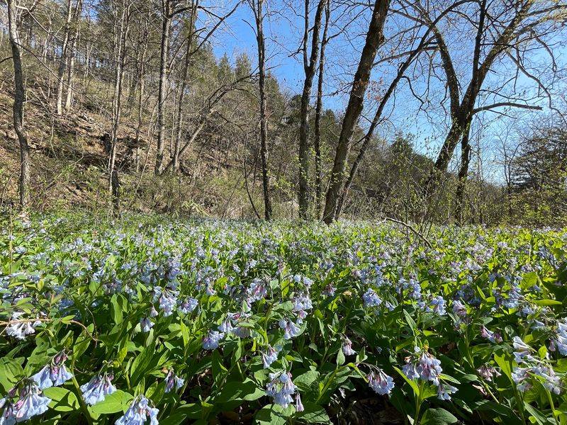
More than 458 plant species have been recorded here. That is a seriously long guest list for a few hundred acres.
Ferns put on a quiet show. Look for maidenhair, Christmas, and walking ferns tucked along shady rock and soil.
Walking fern earns its name in a fun way. Its leaf tips root where they touch ground, so the plant slowly strolls across rocks.
Wildflowers take turns through the warm months. Wild ginger, jack-in-the-pulpit, and Jacob’s ladder favor the moist woods.
Sunnier glades host Indian paintbrush and purple prairie clover. Their bright colors stand out against pale rock.
Other notable plants add character. Wild columbine, wild hydrangea, sycamore, and leatherwood all appear in the area.
Ward’s willow also grows here. It is one of those names that makes plant fans perk up immediately.
A simple field guide or plant app helps, though downloading it ahead is smart without cell signal. Photos work too for identifying later.
Please leave every bloom where it grows. A Natural Area works best when the only things you take home are pictures.
Your camera roll will thank you anyway.
Listen Closely For Warblers, Tanagers, And A Very Loud Woodpecker
Bright red flashes in the treetops usually mean scarlet tanager. This valley welcomes a lively crowd of forest and creek birds.
Belted kingfishers patrol the water with rattling calls. Louisiana waterthrushes bob along stream edges like they have springs for legs.
Up in the canopy, northern parulas and red-eyed vireos sing nearly nonstop. Wood thrushes add flute-like songs that sound almost unreal.
Warblers show up too. Black-and-white warblers creep along bark like tiny striped nuthatches.
Worm-eating warblers keep a lower profile in leafy slopes. Spotting one counts as a small victory for most birders.
Then there’s the pileated woodpecker. It is crow-sized, sports a red crest, and drums loudly enough to startle a sleepy hiker.
Binoculars make a big difference here. A small pair fits easily in a daypack and turns blurry shapes into real birds.
Early mornings tend to be the liveliest time for songbirds. Luckily, the area opens at 4 a.m. for true early risers.
Keep chatter low near the creek. You’ll hear more, see more, and maybe catch that kingfisher mid-dive.
Pack Like A Pro Because The Trailhead Offers Almost Nothing
Gravel crunches under your tires long before you park. From Dixon, take Highway 28 northeast, then Route W east until pavement ends.
The road becomes gravel County Road 511. For GPS, use 31825 Maries Rd 511, Dixon, MO 65459.
The gravel lot fits about six cars. Weekends can fill it fast, so an early start helps.
Amenities are refreshingly simple, meaning there basically aren’t any. No restrooms, no drinking water, and no trash cans wait at the trailhead.
Cell service is also missing. Tell someone your plans before driving out to this corner of Missouri.
Pack plenty of water, snacks, and a trash bag. Whatever comes in with you should leave with you.
Leashed pets are welcome on the trail. Dogs need water too, so pack extra for your furry hiking partner.
The area stays open year-round from 4 a.m. to 10 p.m. Walk-in backpack camping is allowed, though campers get no special facilities.
That bare-bones setup keeps the valley wild. A little preparation is the small price for walking a hand-built trail to Missouri’s first protected Natural Area arch.
