You look at the photos and feel the pull, then you realize Black Elk Peak Trail is the kind of place that turns a simple hike into a story you will tell for years.
The climb from Sylvan Lake weaves through granite spires and whispering pines, and every switchback reveals a new skyline that keeps your camera busy.
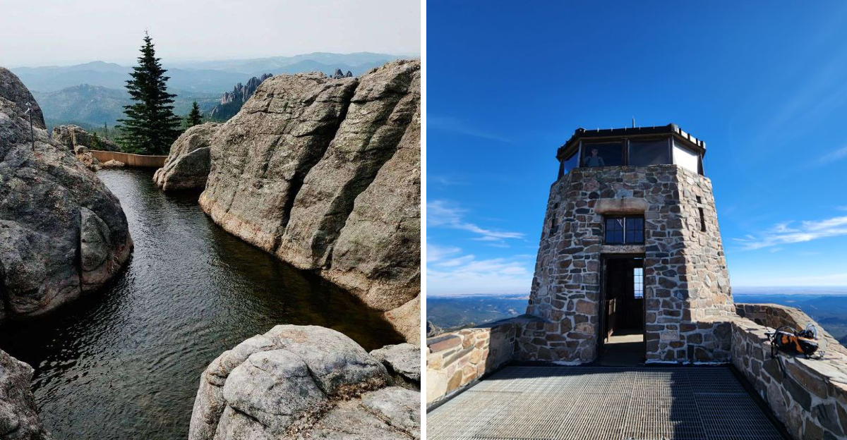
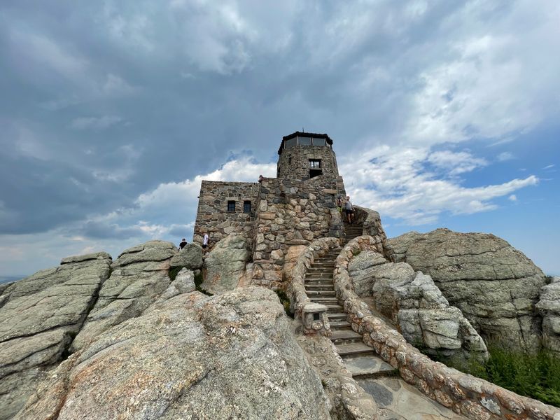
Sunrise glows over the Black Hills, and the stone fire tower at the top frames a horizon that seems to go on forever.
This trail is the highest natural point in South Dakota, and it still feels inviting for first-timers with good shoes and a bit of patience.
Stick with me and I will show you how to make every step count, from the trailhead to that panoramic finish.
Trail basics you actually need
Start at Sylvan Lake and follow Trail 9 to Black Elk Peak for a classic route that balances challenge and reward with steady elevation and sturdy footing.
The round trip usually runs six to eight miles depending on spurs, so plan three to five hours with extra time for photos and careful steps on granite.
You will want supportive shoes, layered clothing, sun protection, and enough water to keep pace with the dry mountain air that hides behind cool breezes.
Trail markers are clear at junctions, and you can confirm your heading at each wooden sign while using a downloaded map since cell service fades in the trees.
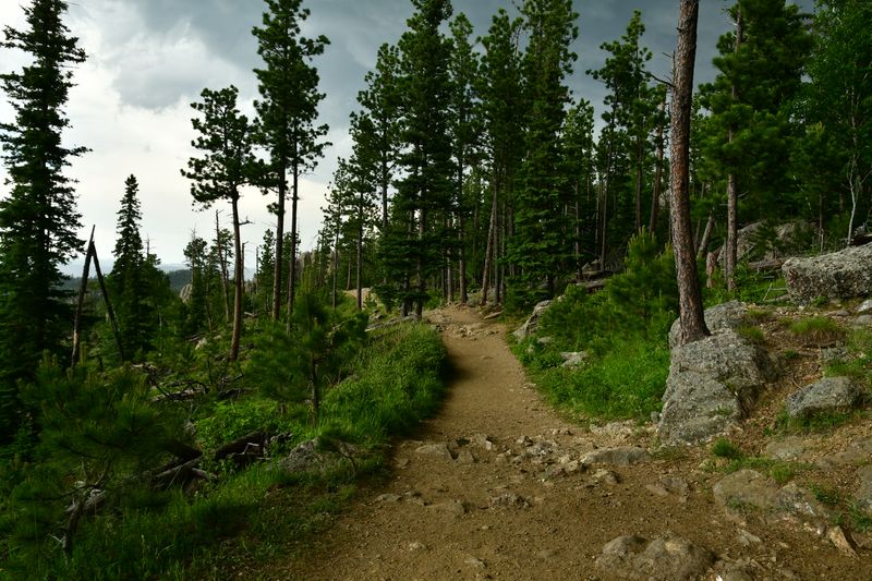
The path rises through ponderosa forests and opens onto rock slabs where the views stretch across the Black Hills and out toward distant prairie in South Dakota.
Grade and footing vary, but most sections feel friendly to steady hikers who take breaks and watch for loose gravel on steeper pitches near the summit tower.
Weather turns quickly at this elevation, so carry a light shell and note afternoon thunder patterns that can roll in with little warning on warm days.
Winter travel requires traction and experience, and shoulder seasons can stack ice in shaded gullies where melt refreezes overnight.
Trail courtesy keeps everyone smiling, so yield uphill, step aside with care, and keep voices low at overlooks where people soak in quiet moments.
You will leave with a camera full of scenes and a calm feeling that comes from moving through stone corridors carved by time rather than crowds.
Finding the right trailhead
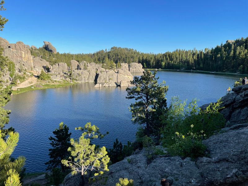
You reach Sylvan Lake by the Needles Highway and look for the signed parking areas that sit just uphill from the water with access to Trail 9 and other paths.
The Black Elk Peak Trail is commonly entered from the northwest side of the lake where boards and arrows point to the route that climbs through pines and granite corridors.
The place appears on Google Maps as Black Elk Peak Trail, Sylvan Lake with the Keystone label, and the location pin lands near the established start area along the shoreline.
Arrive early during summer because parking turns tight by mid morning and the lake loop draws families, anglers, and photographers who linger for sunrise light.
There is a day use atmosphere with bathrooms near the lake, and the trail kiosks carry maps and safety notices that help you plan a steady pace.
When lots fill you may need to walk a short distance from overflow, so budget extra minutes to lock the car, adjust pack straps, and settle into an easy rhythm.
Stay alert at the first junctions because multiple trails fan out and it is simple to follow the wrong spur if you leave the signs behind too quickly.
The official hours list open 24 hours, but practical hikers time departures for cooler mornings, safer storm windows, and better reading of the granite texture.
If you are using rideshare or a shuttle, confirm pickup points near the main lot since signal can dip among the spires and tall timber.
Take a final look back at the lake, breathe, and step onto a well used path that leads to the highest natural point in South Dakota.
Scenery that fills your camera
The first miles bring dappled light under ponderosa canopies, and you watch trunks rise like columns while chipmunks dart between roots and sun stripes.
Soon the forest thins and needles crackle underfoot as windows open onto granite walls that glow warm gray and blush pink in the changing daylight.
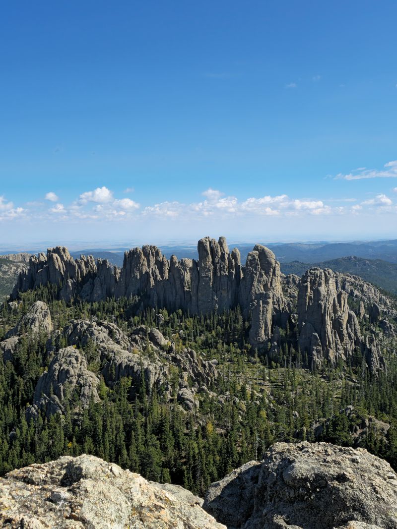
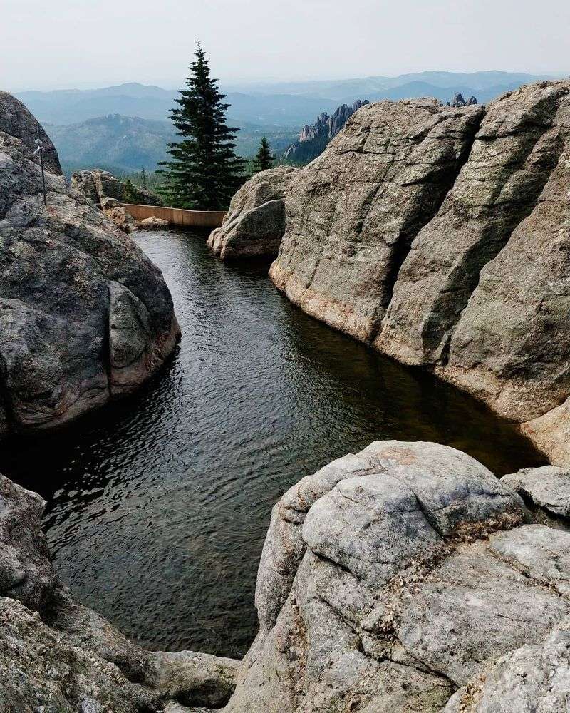
Those rock corridors frame spires that match the drama of the nearby Needles, and every turn tempts you to set down your pack and line up a new shot.
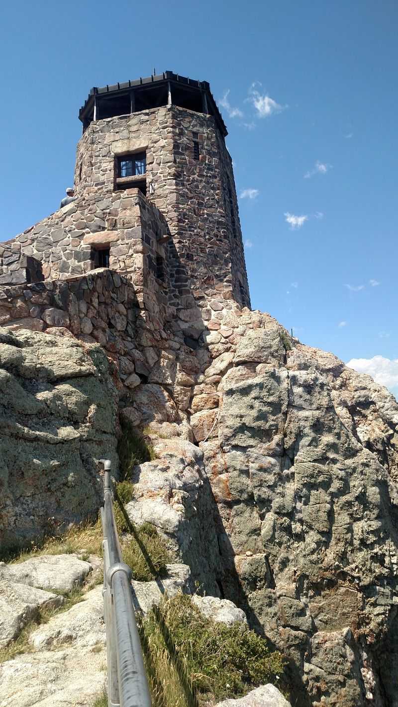
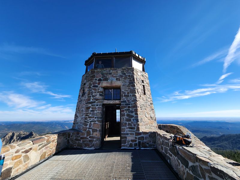
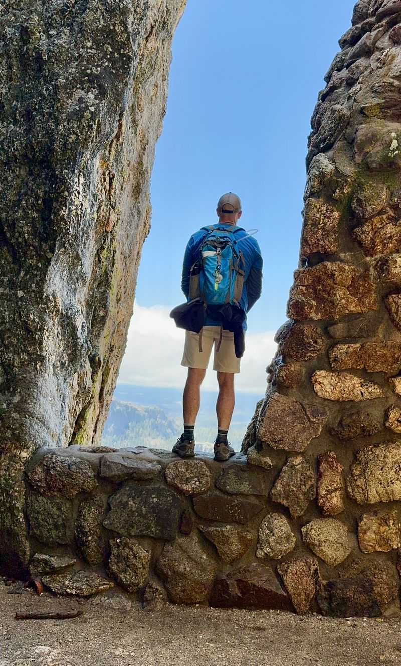
The summit fire tower appears like a storybook fort, built of stone that blends with the mountain, and stairs lead to parapets where the wind sings.
On clear days you trace ridgelines across the Black Hills and count lakes and meadows that scatter like coins, with South Dakota stretching far beyond.
Stormy skyscapes carry their own magic, and moving shadows sweep valleys while curtains of rain dissolve and reveal peaks in quick cinematic beats.
Golden hour warms the tower stones and paints long lines across polished slabs, and distant buttes soften into layered blues that make photos gentle and deep.
Wildflowers wake in June and July, and tiny bursts of purple and yellow dot the shoulders of the path where bees trade notes from bloom to bloom.
In fall the palette shifts to copper needles and pale grasses, and the light grows low enough to draw texture on every knuckled boulder along the ridge.
You leave with images that feel calm and strong, and the trail becomes a gallery where you are both visitor and curator of the views you earned.
Safety and weather made simple
Weather in the Black Hills can pivot quickly, so check the forecast before leaving the lake and carry a light shell that fits at the top of your pack.
Afternoons in summer often bring quick thunderstorms with wind, lightning, and brief hail, and earlier starts reduce exposure on higher granite near the tower.
Cool mornings can feel warm once you climb, then a gust can drop the chill, which is why layers matter more than heavy clothing that traps moisture.
Footing is mostly solid, but smooth rock can turn slick after rain or frost, and careful steps beat speed on steeper turns where gravel skitters under soles.
Bringing two to three liters of water per person is a sound baseline, with extra during heat, and you will not find reliable water on the route.
Snacks that handle heat and cold keep energy steady, and frequent short breaks help you enjoy views while keeping the heart rate in a comfortable place.
Carry a map that works offline and a small headlamp even on sunny days, because schedule slips or slow photo stops can push your return toward dusk.
Wildlife encounters are usually calm, yet give all animals space, pack out trash, and secure straps so nothing dangles where curious critters might tug.
In winter consider traction spikes and insulated layers, and let sunset times guide your turnaround point to avoid navigating icy steps in darkness.
With these simple habits the Black Elk Peak Trail feels welcoming and confident, and your focus can sit on the beauty that South Dakota does so well.
History on the summit
The stone fire tower crowns the summit and hints at the history of lookouts across the Black Hills that watched for smoke and measured distance from high points.
Historic sources link early lookout structures here to conservation efforts, and the current masonry blends with the granite in a way that feels timeless and sure.
Interpretive signs often share context about the landscape and stewardship, and you can see how the tower placement maximized sightlines for early detection.
The peak carries deep cultural significance for Lakota people, and the modern name honors Black Elk, an Oglala Lakota holy man known for his visions and teachings.
Reading about his life before the hike adds meaning to the climb, and standing on the summit can become a quiet moment to reflect on that living story.
The area has appeared in maps and journals for generations, and you sense how trails mirror earlier travel paths that followed ridges and natural corridors.
Stonework details feel deliberate, with steps that fit the rock and window openings that frame long horizons where forest and grassland share the view.
Many hikers whisper on top without being told, and the wind carries a chapel hush that makes cameras click softer and conversations slow down.
You can sketch or note landmarks from the parapet, tracing ranges and waters that knit South Dakota together from this commanding yet peaceful point.
Leaving the tower you will likely step lighter, not because the grade softens, but because the story above the trees gives each switchback a gentle glow.
Best times and crowd smarts
Sunrise departures are your best friend for solitude, cooler air, and directional light that makes granite pop without harsh midday glare.
Weekdays see fewer visitors, and shoulder seasons in May, September, and early October balance stable weather with open views and lighter parking pressure.
Afternoons draw more day trippers who start after scenic drives, so plan to be on the descent as storms and crowds build toward the warmest hours.
Winter can be blissfully quiet on calm days, yet short daylight and icy corners require experience and traction plus careful pacing on shaded slabs.
Use the overflow when primary lots fill near the lake, and consider a short break by the water to reset before joining the climb toward open ridges.
A flexible plan helps when smoky haze or wind blurs visibility, and photographing details like lichen, bark, and stone textures keeps the day rewarding.
If you love twilight, time your summit for late afternoon and bring a headlamp, then enjoy the color shift across the Black Hills while staying warm and alert.
Early spring weekends can feel busy, but quick starts and friendly trail manners turn passing into short chats that add a human note to the walk.
Holiday periods surge with visitors across South Dakota, so match your expectations to the season and let patience steer your pacing between viewpoints.
Crowd smarts keep your energy high and your photos clean, and you will finish with space to breathe even on a popular and beloved trail.
Navigation and signage clarity
Trail 9 from Sylvan Lake leads most hikers toward Black Elk Peak with clear wooden signs that mark key junctions and keep directions straightforward.
Download an offline map and carry a paper backup if you like tangibles, because reception drifts in the forest and high rock can block signals completely.
At major splits you will see carved arrows and mileage estimates, and pausing to confirm the route helps prevent accidental detours onto neighboring loops.
Blazes are subtle compared to some parks, so treat the signs as primary cues and read the landscape for beaten tread and polished stone on corners.
The summit spur reveals itself near the top with more visitors moving in the same direction, and the tower rises like a landmark that needs no map.
If fog rolls in, slow down and keep your last confirmed sign in mind, then retrace to that point rather than wandering toward unknown drop lines.
Snow can obscure prints, but junction posts usually stand proud above drifts, and you can probe with poles to find packed travel lines on popular days.
Family groups do well with a simple checkpoint plan, and naming trees or rocks as reunion spots turns navigation into a calm game rather than a worry.
Kids love spotting the next sign, and that small mission keeps everyone engaged while you teach basic wayfinding that pays off on future hikes across South Dakota.
Good navigation habits feel invisible once learned, and they let the scenery take the lead while the map stays quiet in your pocket.
Leave no trace with heart
The trail stays beautiful because people care, and your choices about footsteps and leftovers shape how the next visitor experiences this same granite corridor.
Stay on durable surfaces even when a photo angle tempts you into brush, and you will protect fragile soil and plants that hold the hillside together.
Pack out every scrap you bring, and use zip bags for wrappers and tissues so nothing escapes when the wind lifts or when pockets turn inside out.
Give wildlife room to move, and practice quiet observation that reads as respect rather than intrusion, with lenses doing the close work from a distance.
Group conversations can stay soft on narrow sections, and letting uphill hikers pass with a smile keeps the flow smooth without forcing anyone off tread.
Rest at established spots where rock is already worn, and keep boots away from delicate ledges that crumble under repeated edging and eager posing.
Avoid carving initials on bark or stone, and trade permanent marks for temporary art like a thoughtful photo that leaves only pixels behind.
If you find micro trash near overlooks, take a minute to clean a circle wider than your group and you will feel the place shine a little brighter.
Share these habits with friends who visit South Dakota, and the ripple creates trails that look loved rather than used, which is the difference that matters.
Leave no trace is not a rulebook to memorize, it is a simple promise to pass along the same quiet and wonder you came here to find today.
Dear Reader: This page may contain affiliate links which may earn a commission if you click through and make a purchase. Our independent journalism is not influenced by any advertiser or commercial initiative unless it is clearly marked as sponsored content. As travel products change, please be sure to reconfirm all details and stay up to date with current events to ensure a safe and successful trip.