You would never guess it by looking at it. Just a thin strip of sand with a few scrubby trees and some birds.
Nothing special at first glance. But this little patch of land is doing a massive job.
It sits between the ocean and a small fishing town in North Carolina, taking the full force of every storm that rolls in. Without it, that town would get destroyed on a regular basis. The problem?
The island is disappearing. Slowly but surely, wave by wave, storm by storm, it is shrinking.
Locals know what is coming. They watch the coastline change every year and wonder how much time they have left.
What Sugarloaf Island Actually Is
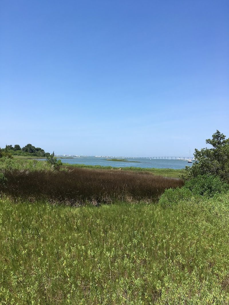
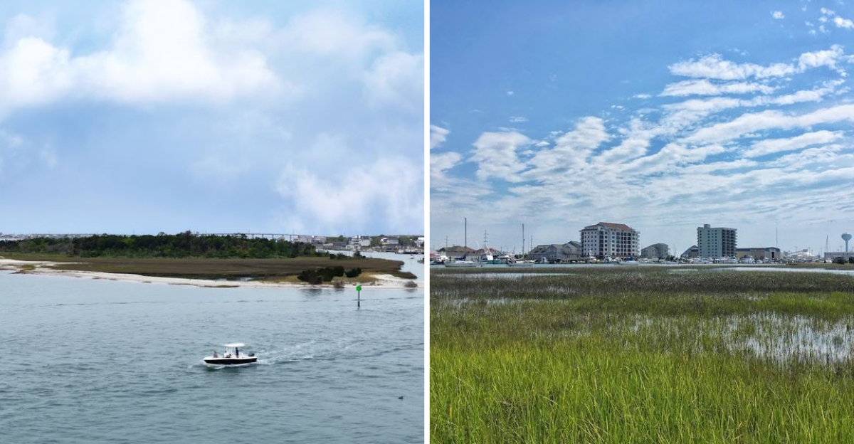
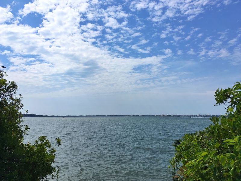
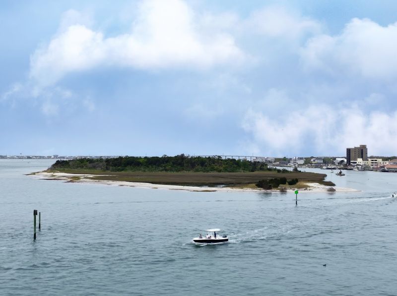
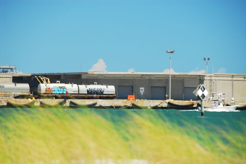
Most people picture a barrier island as something dramatic, wide beaches, tall dunes, maybe a lighthouse. Sugarloaf Island is none of those things, and that is exactly what makes it fascinating.
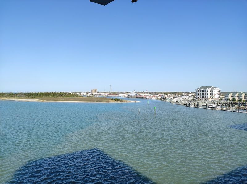
It sits quietly in Bogue Sound, just off the Morehead City waterfront, a low-lying strip of sand and scrubby vegetation that you could probably walk across in under five minutes. It has no permanent residents, no hotels, and no boardwalks.
What it does have is a remarkable ability to interrupt and slow down storm energy before it reaches the shore behind it.
Barrier islands like Sugarloaf form naturally over thousands of years through the movement of sand, wind, and tides. They are dynamic by nature, constantly shifting and reshaping themselves.
The problem is that the rate of change has accelerated dramatically in recent decades, pushed along by rising sea levels and stronger storms. Sugarloaf is not just shrinking around the edges.
It is losing volume from the inside out, becoming thinner and lower with each passing season. Understanding what it is helps explain why losing it matters so much to the people who live nearby.
The Hurricane Shield Nobody Talks About
Hurricanes do not hit a coastline all at once. They push walls of water called storm surges ahead of them, and those surges are often more destructive than the wind itself.
Barrier islands are the first thing that surge encounters, and that collision matters enormously.
When a surge hits a solid island, the water slows down, spreads out, and loses energy. By the time it reaches the mainland, it is weaker, lower, and far less likely to flood streets, destroy homes, or knock out infrastructure.
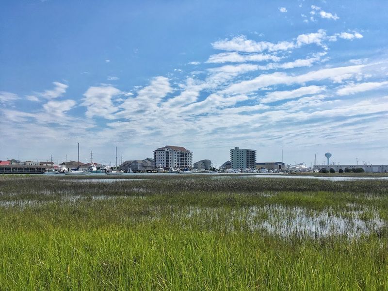
Sugarloaf Island plays exactly this role for the neighborhoods and businesses along Morehead City’s waterfront.
Without it, storm surges from even a moderate hurricane would arrive with much more force. Think of it like removing the bumper from a car before a crash.
The town behind it would absorb the full hit. Researchers studying the island have noted that its gradual erosion is already reducing its effectiveness as a buffer.
Each cubic meter of sand that washes away is one less layer of protection for the people living and working on the shore behind it. The math is straightforward and a little unsettling.
How Fast It Is Actually Disappearing
Numbers can feel abstract until you picture them in real space. Nearly 10,000 cubic meters of sand lost since 2014 is not a rounding error.
That is roughly the equivalent of filling four Olympic swimming pools with sand and then watching it all wash away in under a decade.
East Carolina University researchers have been monitoring Sugarloaf closely, using surveys and satellite data to track the changes over time. Their findings show that the island is not just getting smaller around its edges.
It is also getting lower, which means storm waves can wash completely over it rather than being deflected. An island that gets overtopped during a storm loses its buffering power almost entirely.
The erosion is driven by a combination of factors. Rising sea levels mean that tides reach further inland than they used to.
Boat wakes from increased waterway traffic chip away at the island’s soft edges. And stronger, more frequent storms strip away sand faster than natural processes can replace it.
The island that existed in 2014 and the one that exists today are measurably, visibly different. Local residents who have lived near the waterfront for decades say the change is obvious even without scientific instruments.
What Morehead City Stands to Lose
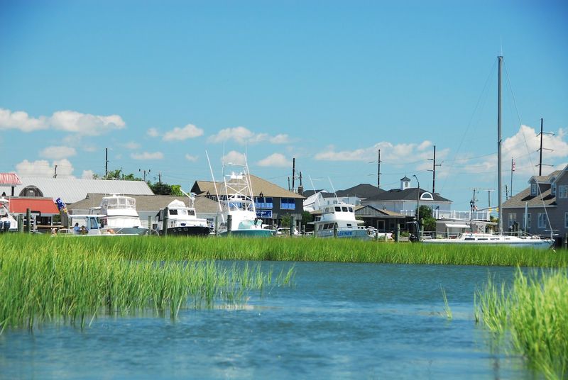
Morehead City is not a sleepy little village. It is a working port town with a deep-water harbor, an active commercial fishing industry, and a waterfront that draws visitors from across the state.
It is also one of the most hurricane-exposed communities on the North Carolina coast.
The town has weathered major storms before, including Hurricane Florence in 2018 and Hurricane Dorian in 2019, both of which caused serious flooding and damage. Each time, Sugarloaf Island absorbed some of that energy, even in its diminished state.
The question researchers and local officials are grappling with now is what happens when it is gone entirely.
Flood modeling suggests that without the island, storm surge heights in the downtown area could increase significantly during a major hurricane. That means more homes underwater, more businesses destroyed, more infrastructure to repair, and a longer recovery for a community that is already stretched thin by repeated storm seasons.
The economic cost alone would be staggering, but the human cost, the displacement, the stress, the loss of a place people have built their lives around, is harder to put a number on. Morehead City deserves better than to face that future unprepared.
The Science Behind Barrier Island Loss
Barrier islands have always been temporary in the grand geological sense. They migrate, shrink, and sometimes disappear entirely as sea levels and sediment supplies shift over thousands of years.
What is different now is the speed.
Sea level rise along the North Carolina coast is happening faster than the global average, partly because the land itself is slowly sinking, a process called subsidence. When you combine sinking land with rising water, the effective rate of sea level rise doubles.
For a low-lying island like Sugarloaf, that is a serious problem.
At the same time, the sediment that would naturally replenish barrier islands is being interrupted. Dredging, jetties, and other human modifications to waterways change the way sand moves through a coastal system.
Sand that would once have drifted naturally toward Sugarloaf gets trapped or redirected elsewhere. Scientists call this sediment starvation, and it is one of the leading causes of barrier island loss up and down the Atlantic coast.
Understanding the science does not make the situation less urgent. If anything, it makes it clearer that the forces working against Sugarloaf are multiple, interconnected, and not going to slow down on their own without deliberate intervention.
Shelly Island and Other Vanishing Neighbors
Sugarloaf is not the only North Carolina island fighting for its survival. The coast here has a long history of islands appearing, shifting, and vanishing, sometimes within a single lifetime.
Shelly Island is one of the most dramatic recent examples.
It formed almost overnight in 2017 off the tip of Cape Point near Buxton, quickly attracting curious visitors who waded across shallow water to explore it. By early 2018, a series of hurricanes had redistributed the sand and the island was essentially gone.
It was a vivid, real-time demonstration of just how fragile these formations can be.
Lea-Hutaff Island, located between Figure Eight Island and Topsail Island, tells a slower but equally sobering story. Once a broad barrier island supporting diverse wildlife habitat, it has been reduced to a narrow strip of sand by relentless erosion.
Nesting birds that once had wide, protected beaches now compete for shrinking ground. Each of these islands represents a different chapter in the same story, one about a coastline under pressure, a natural system struggling to keep pace with the forces reshaping it.
Sugarloaf fits into that larger picture, and its fate is connected to all of them.
Can Sugarloaf Island Be Saved?
The honest answer is that nobody knows for certain, but people are trying. Coastal restoration is a real and growing field, and there are tools available that did not exist even twenty years ago.
The question is whether those tools can be applied at Sugarloaf in time to matter.
One approach is beach nourishment, pumping sand from offshore deposits onto the island to rebuild its volume and elevation. It is expensive and temporary, requiring repeated applications as erosion continues.
But it buys time, and sometimes time is what a community needs most.
Another strategy involves planting native vegetation like marsh grasses, which can stabilize sediment and slow erosion from wave action. Living shoreline techniques, which use natural materials like oyster reefs and submerged vegetation to buffer wave energy, have shown promise at other sites along the North Carolina coast.
East Carolina University researchers are actively studying Sugarloaf and working with local and state agencies to identify the most effective interventions. There is genuine momentum behind these efforts.
Whether that momentum translates into funding, permits, and action fast enough to make a real difference is the part that keeps coastal scientists up at night. Hope is not absent here.
It just comes with urgency attached.
Why This Story Matters Far Beyond Morehead City
It would be easy to read this as a local story, one small island, one coastal town, one regional problem. But the forces at work around Sugarloaf are playing out on barrier islands from Maine to Florida and beyond.
What happens here is a preview of challenges that hundreds of coastal communities will face in the coming decades.
The United States has thousands of miles of barrier island coastline protecting millions of people and trillions of dollars in property, infrastructure, and cultural heritage. Most of that protection is taken for granted because it is invisible.
People do not think about the island absorbing the storm. They just notice when the storm is less bad than expected.
When those islands erode away, the protection disappears with them, and rebuilding it, if it can be rebuilt at all, costs far more than maintaining what already exists. The story of Sugarloaf is a case study in what it looks like when a natural system reaches its limit.
It is also a reminder that paying attention to small, unglamorous places can matter more than anyone expects. A tiny island off a working port town in North Carolina should not have to carry this much weight.
But right now, it does, and it is running out of time to keep doing it.
Dear Reader: This page may contain affiliate links which may earn a commission if you click through and make a purchase. Our independent journalism is not influenced by any advertiser or commercial initiative unless it is clearly marked as sponsored content. As travel products change, please be sure to reconfirm all details and stay up to date with current events to ensure a safe and successful trip.