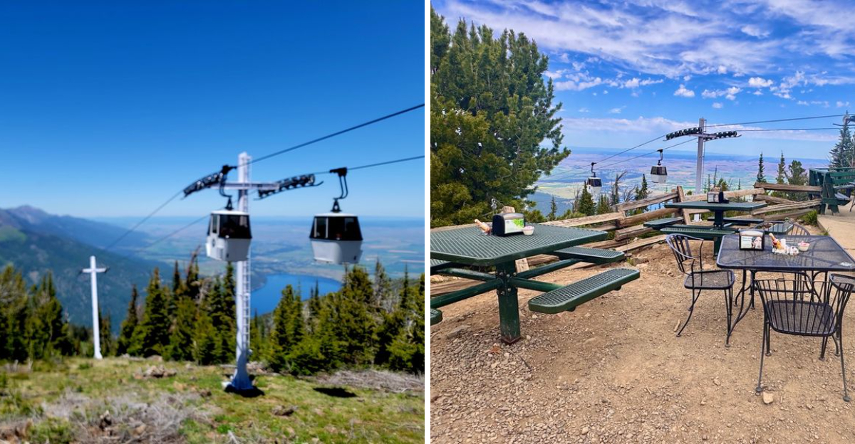
Heights like this aren’t supposed to feel this accessible. No hiking boots required, no exhausting climb, just a cable car pulling you higher and higher until the ground disappears beneath you.
Halfway up, conversations usually stop. People just stare instead, watching the lake shrink smaller with every passing second. Nearly four thousand feet later, the view opens up completely, stretching across mountains and water in every direction.
Oregon has scenic overlooks scattered everywhere, but few let you reach this altitude without breaking a sweat. Wind picks up near the top, sharp and cold even on warm days, reminding everyone exactly how high they’ve climbed.
Oregon locals still ride it regularly, somehow never getting tired of that same view. Some places make you earn the payoff. This one just hands it straight to you.
The Climb That Gains Almost 4,000 Feet
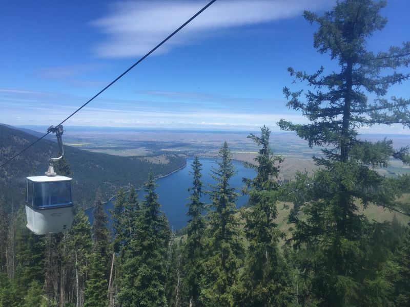
Fifteen minutes sounds short until you realize what those minutes are doing. The gondola lifts you nearly 4,000 vertical feet from the lakeshore to the summit of Mount Howard, and the mountainside falls away faster than your brain expects.
The ride itself is remarkably smooth. Cables hum softly overhead, pine tops slide past beneath your feet, and seasonal creeks trace silver lines down the rocky slope.
What surprised me most was the quiet. There is no engine noise inside the car, just the occasional click as you pass a tower.
Each group typically gets its own enclosed gondola, which means nobody is elbowing for a window seat. That detail matters more than it sounds, especially with kids who want to look in every direction at once.
The cars are fully enclosed, too, so mild nervousness about heights usually settles within the first minute or two.
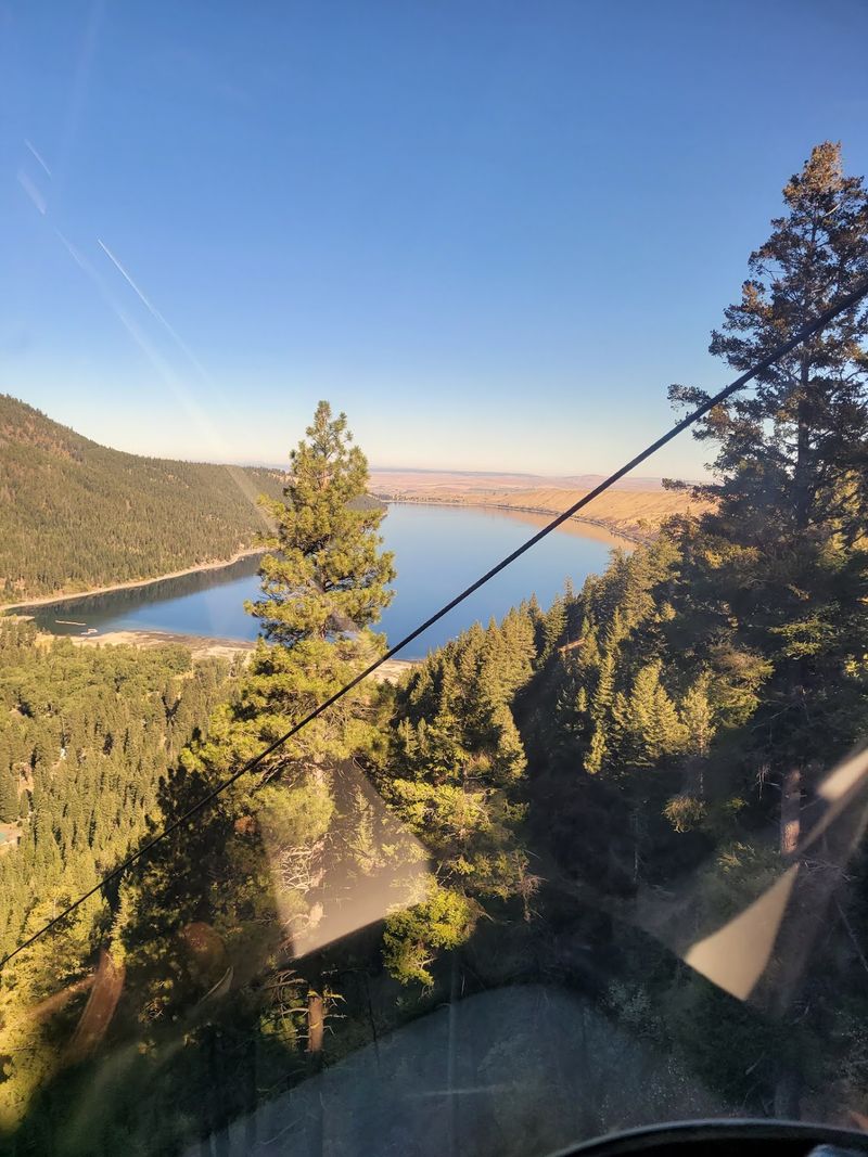
Plan to ride both directions with your camera ready. The descent frames Wallowa Lake head-on, and honestly, that view might beat the climb.
Wallowa Lake Looking Like Polished Glass
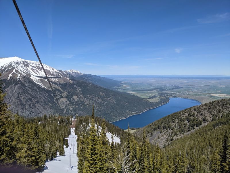
Glaciers did the heavy lifting here thousands of years ago, carving out a deep basin and leaving behind long ridges of debris called moraines. From the air, those ridges look like they were shaped by hand. Wallowa Lake fills that basin with water so blue it seems edited.
As the tram gains height, the lake slowly reveals its full shape, tucked between two symmetrical moraine walls with the green valley and the town of Joseph beyond. It is the kind of geography lesson you actually enjoy.
Late morning light tends to bring out the deepest color, while afternoon adds shadows along the ridges.
I found myself tracing the shoreline, spotting docks, campsites, and the ribbon of highway that brought me there. Small details become fascinating from that far up. Bring a lens cloth if you shoot photos, because gondola windows collect fingerprints fast.
People often call this region the Little Switzerland of America, and looking down at that lake, the nickname stops sounding like marketing.
Summit Trails You Can Actually Walk
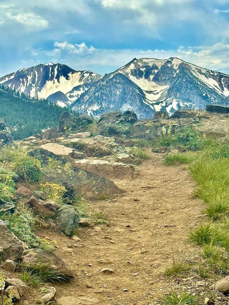
Reaching 8,150 feet without a backpack feels a little like cheating, in the best way. Four short trails fan out from the tram building, looping around the top of the mountain to a series of marked viewpoints. Total distance runs somewhere around two miles if you walk them all.
The paths are wide, well kept, and clearly signed, though a few sections tilt uphill enough to remind you that oxygen is thinner up here. Slow steps beat fast ones.
Wildflowers show up in force during early summer, scattered across meadows that seem to drop straight into the valley. Each overlook offers a different angle, so skipping one feels like leaving early. Sturdy shoes make a real difference on the loose gravel stretches.
I gave myself about ninety minutes and wished I had doubled it. Benches appear at good moments, usually right where the view opens toward the Eagle Cap Wilderness. Families with young kids can easily do a shorter thirty minute loop instead.
Chipmunks and Squirrels With Zero Shyness
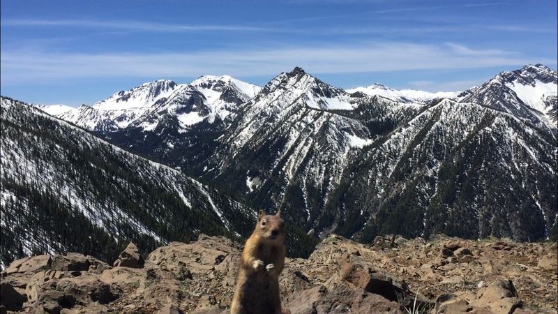
Nobody warned me about the chipmunks. Veer right after stepping off the tram and you will meet an entire committee of them, completely unbothered by humans and very interested in whatever you might be holding. Some sit up. Some come closer than expected.
Animal food is sold at the summit, and the critters will happily eat straight out of an open palm. Kids tend to lose their minds over this part, and adults quietly do the same.
Ground squirrels join the show as well, including a few oversized regulars who flop onto their stomachs to eat rather than bother standing.
Golden-mantled ground squirrels and least chipmunks both live at these elevations, so the fur patterns vary from one visitor to the next.
Keep hands flat and movements calm, and hold onto snack bags unless you want company. Sudden grabbing rarely ends well for anyone. It is a small, silly highlight that somehow ends up in half the photos people bring home from Mount Howard.
Peaks With Names Worth Remembering
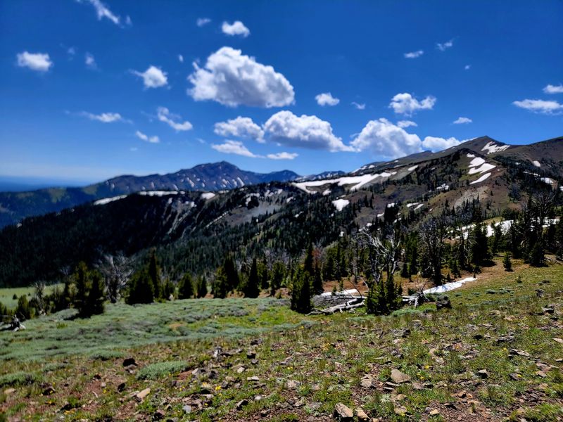
Standing on a mountaintop is fun. Naming the mountains around you is better. From the summit viewpoints, the Wallowa range unfolds in every direction: Eagle Cap, Sacajawea, the Matterhorn, East Peak, and the steep walls of the Hurwal Divide. Interpretive signs help match shapes to names.
Look east on a clear day and Idaho’s Seven Devils range appears across the Hells Canyon country, hazy and distant.
Glaciers sculpted these ridges roughly ten thousand years ago, leaving behind knife-edge crests and bowl-shaped basins that still hold snow into midsummer. The scale is hard to process from a photograph.
West of the summit, the Eagle Cap Wilderness stretches out in layers of granite and timber, mostly roadless and reachable only on foot. Visibility makes or breaks this section, so checking conditions before buying a ticket saves disappointment. Fog can erase everything.
The Nez Perce people long used this valley for camping and hunting, and from up here it becomes obvious why they returned again and again.
Weather Swings and What to Pack
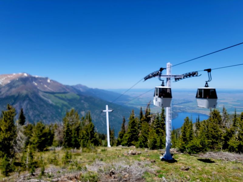
Down at the lake it might feel like beach weather. Up top, the wind has other plans. Temperatures at 8,150 feet run noticeably cooler than at the base, and gusts sweep across the open summit even on bright, still afternoons. A light jacket earns its place in your daypack.
Sun exposure is stronger at altitude, so sunscreen and a hat matter more than people assume. Water is the other essential. There is a small food option at the top, but carrying a bottle means you can wander the trails without cutting things short.
High winds occasionally pause tram operations, which can mean waiting for a ride back down. Building flexibility into your afternoon prevents stress.
Fog is the real spoiler, since low visibility turns a spectacular overlook into a gray wall. Staff are usually straightforward about conditions if you ask before buying. My own advice is simple. Pick a clear morning, layer up, and treat the mountain like the alpine environment it genuinely is.
Eating at the Top of the Mountain
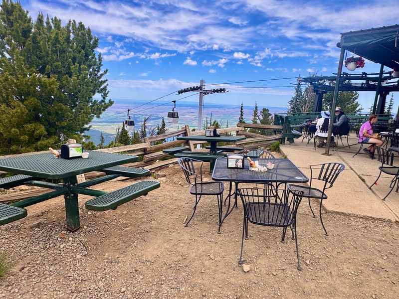
There is something ridiculous about ordering a sandwich at 8,150 feet, and I mean that as a compliment.
The Summit Grill sits close to the tram building, with a compact outdoor seating area and views that make any meal feel upgraded. Hearty sandwiches and simple sides make up most of the menu. Service can slow down during peak summer hours, so build in extra time if a meal is part of your plan.
Seating is limited and mostly open-air, which is lovely on a calm day and brisk when the wind picks up. Grabbing a table early helps. Restrooms are available at the summit during the main season, though the base station has facilities too, which is useful in early spring.
Some visitors prefer packing a light lunch and saving a proper sit-down meal for town, where Joseph has plenty of options. Both approaches work fine. Either way, a cold drink after walking the summit loops tastes noticeably better than it should.
Timing Your Ride for the Best Light
Schedules shape this experience more than most attractions. Trams stop carrying passengers uphill in mid-afternoon, with the final downhill trip following about an hour later, so late arrivals get squeezed. Morning riders often get the calmest air and clearest views.
Day tickets generally allow unlimited trips, meaning you can ride up, explore, come down for something in town, and head back if energy allows. Few people realize that.
Reserving online ahead of time helps on busy summer weekends, though the ticket booth handles walk-ups as well. Lines do form. Wildflower season peaks in early summer, while autumn brings sharper air and gold tones across the valley below.
If paragliders happen to be launching, you may catch someone sailing off the summit toward the valley floor. That is a strange and wonderful thing to witness. Parking at the base is plentiful and free of drama, which makes arriving early painless.
The station sits at 59919 Wallowa Lake Hwy, Joseph, OR 97846, just past the state park.
Making a Full Day Out of the Lakeshore
Riding the tram takes a couple of hours. Filling the rest of the day around it takes almost no effort.
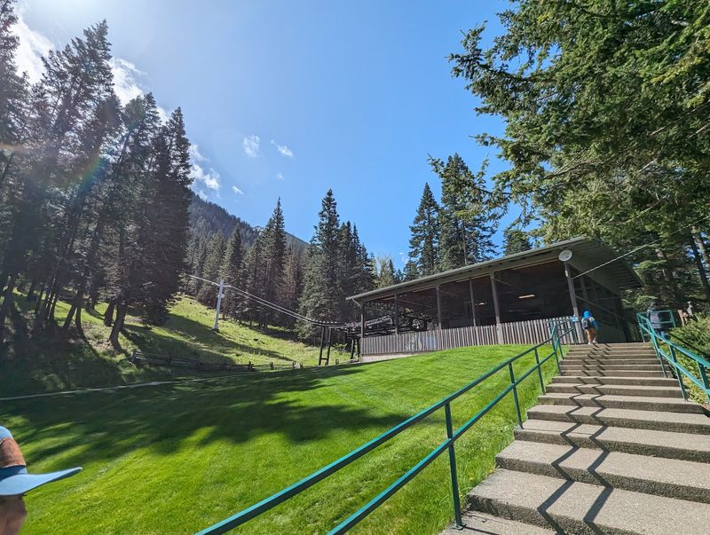
The base station sits at the south end of Wallowa Lake, right beside the state park, where swimming spots, picnic tables, and rental boats keep the shoreline busy through summer. Pine shade helps on hot afternoons.
Next door, the Eagle Cap Chalet offers mini golf and huckleberry ice cream, which is about as classic as an Oregon lake day gets. Six miles north, the town of Joseph is worth a slow stroll for its bronze sculptures and small galleries lining Main Street.
Serious hikers use the tram as a rest day between longer trips into the Eagle Cap Wilderness, and that pairing makes sense. Trailheads for backcountry routes start nearby, so the area rewards multi-day visits.
My suggestion is to ride up early, wander the summit, then spend the afternoon at water level. Same mountains, completely different perspective.
