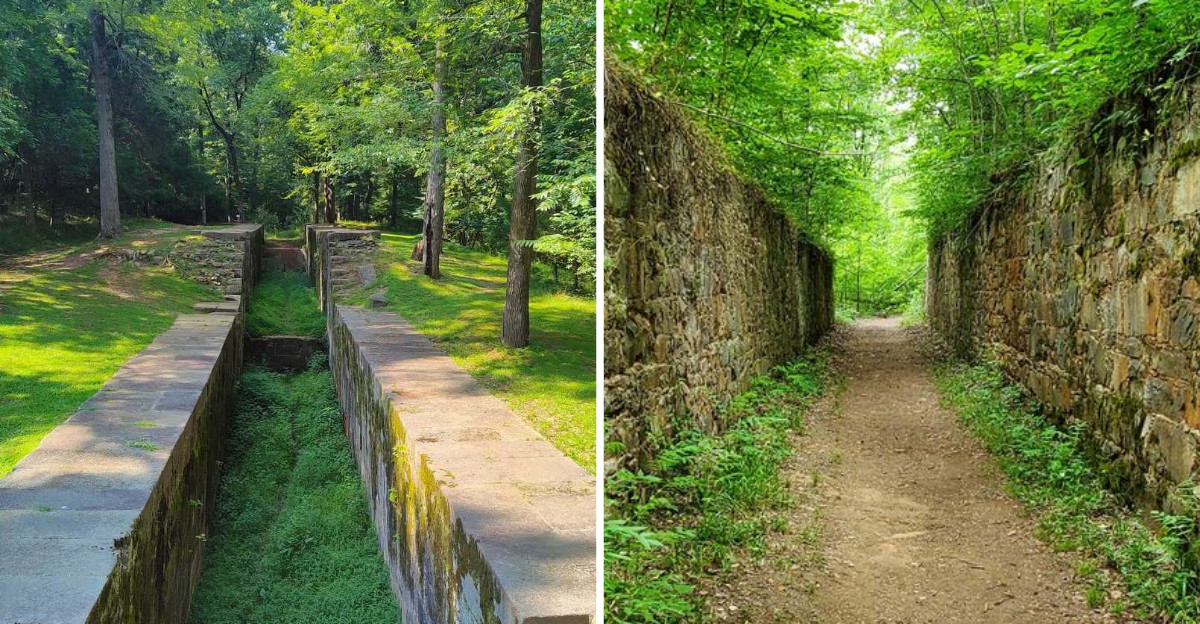
Warm South Carolina air came through the open windows as the road narrowed and pine and hardwood closed in on both sides, and a small brown sign pointed me toward a state park. What I found there surprised me more than I expected: a two-mile stone canal, cut by hand in the 1820s, still lying quietly in the woods beside the river.
The granite blocks are mossy now, the water low, and yet the whole thing feels oddly alive, like the forest simply grew up around it and decided to keep it.
The canal was built to allow boats to navigate past the shoals, a feat of engineering that took years of labor and still holds its shape after two centuries.
Add in the sound of water tumbling over rock and the flash of white lilies in late spring, and you have a place that rewards curiosity.
I stayed far longer than I planned, walking the towpath and tracing the hand-cut stone with my fingers, and I would go back tomorrow.
Stone Locks That Outlasted the Boats They Served
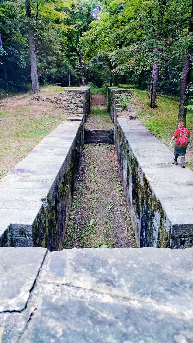
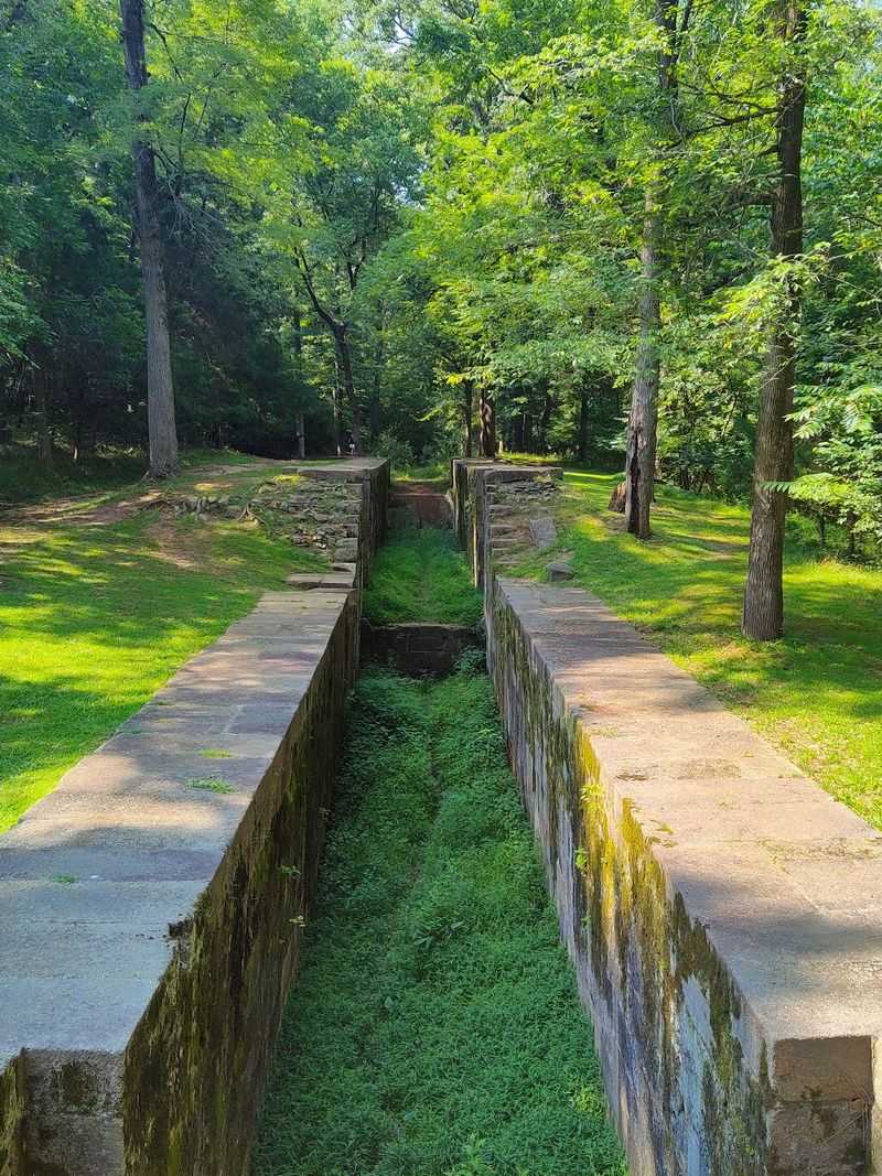
The first set of lock walls caught me off guard. They sit right beside the trail, big granite blocks stacked with a precision that seems impossible for hand tools and mule carts.
Built between 1820 and 1823, the canal ran about two miles and used five locks to handle a drop of roughly 32 to 34 feet in the river. Architect Robert Mills drew up the plans, with Robert Leckie serving as engineer on the project.
The heavy labor fell to Irish workers and enslaved people, who quarried the granite locally and shaped each block by hand. That detail sat with me as I ran a palm along the cool stone.
Cotton and other freight from the Up Country were meant to float down toward Charleston, skipping the shoals that made this stretch impassable. The plan worked for about fifteen years before flooding, drought, and the arrival of railroads ended it around 1835.
What remains feels almost accidental in how well it survived. Interpretive signs explain each structure, so even if you know nothing about canals, you leave understanding exactly what you just walked past.
Rocky Shoals Spider Lilies Turning the River White
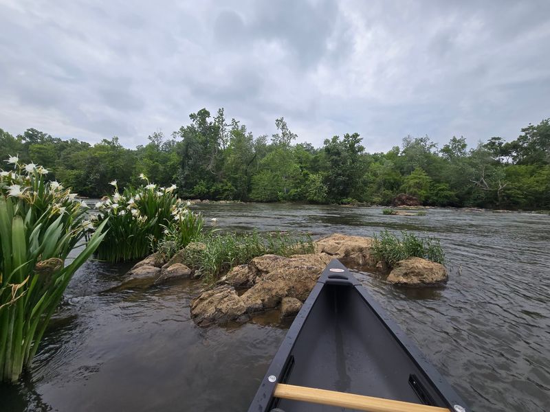
Late May is when this park stops being a quiet history walk and becomes something people drive hours to see. The Rocky Shoals spider lilies bloom across the Catawba’s rocky shallows in numbers that are honestly difficult to describe.
Landsford holds the largest known population of these lilies anywhere in the world. Peak bloom usually falls somewhere between mid-May and mid-June, depending on the weather that spring.
A wooden overlook deck sits at the best vantage point along the riverbank, about a mile in on the Nature Trail. From there the flowers stretch out in a wide, shifting field of white against dark rock and moving water.
Photos never quite capture it, and several visitors say the same thing. You need the sound of the shoals and the smell of river water for the full effect.
The park’s website posts a lily watch each spring with projected peak dates, which is worth checking before you commit to a drive. There is also a Spider Lily Festival held around the third weekend of May, with food, crafts, and music near the picnic area.
Trails That Trace the Old Towpath
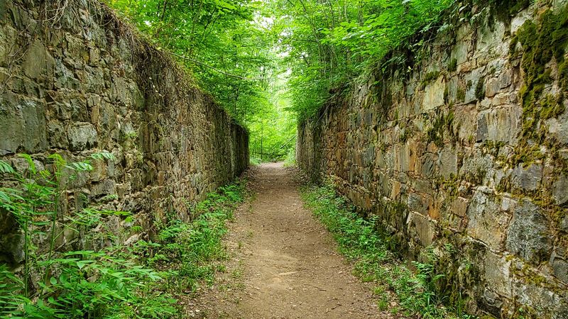
Three miles round trip and I barely broke a sweat, which tells you most of what you need to know about hiking here. The Canal Trail runs about 1.5 miles one way and follows the original towpath where mules once pulled boats along the waterway.
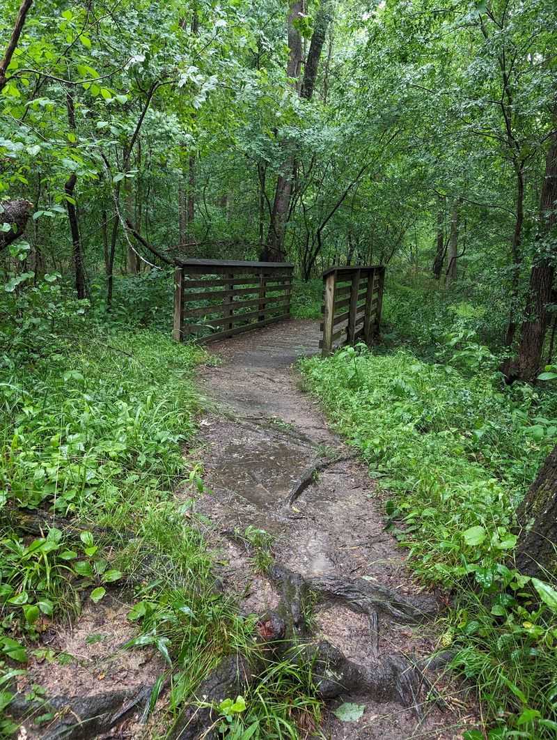
Surface is a mix of gravel and packed dirt, mostly flat, with a few gentle rises and plenty of tree roots crossing the path. Anyone using a cane or watching their footing should plan on looking down more than out.
The Nature Trail covers roughly 0.6 miles one way and connects the picnic area to the lily overlook. Eagle Point Trail is shorter still at about a quarter mile.
Benches appear at good intervals, several of them stained wood set at spots with river views. I used two of them, mostly to sit and listen.
Trail markers are clear and the vegetation stays cut back, so route-finding never becomes a puzzle. Keep an eye out near the far end for a broken millstone tucked into the woods, a small reward for paying attention.
Paddling the Catawba Past Blooming Shoals
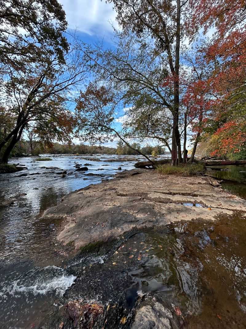
Kayakers get a version of this park that hikers never see. Bring your own boat, since the park does not rent equipment, and use the launch and the large dedicated paddling parking area.
The run along the canal stretch is roughly 1.5 miles and mixes calm water with mild class one shoals. During lily season you can drift right alongside the blooms, close enough to see individual petals.
Water level matters enormously here. Low flow turns the rapids scratchy and some paddlers end up dragging their boats across gravel bars instead of floating over them.
Checking conditions beforehand saves a lot of frustration, and I would scout the takeout before putting in. Signs mark the pullout clearly, but they are much easier to spot when you already know what you are looking for.
There is something genuinely strange about gliding over water that once carried cotton barges, now shallow and clear and full of turtles. The river feels less like scenery and more like a character in the story.
Go early if you want quiet water and softer light.
Bald Eagles, Turtles, and a Forest Full of Wings
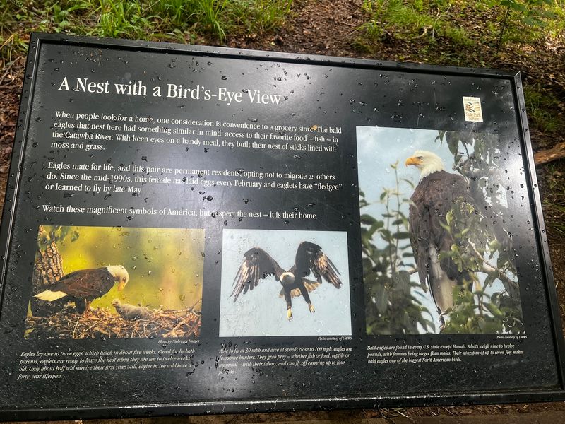
Somebody placed the eagle nest plaque at exactly the right angle, framed by a natural gap in the treeline. Whoever chose that spot deserves credit, because you can stand there and look straight at the nest without binoculars.
A resident pair of bald eagles nests in the park, and they are most often visible from the trails between late February and early June. I did not spot one on my visit, which happens plenty, but the anticipation kept my head up the whole walk.
The floodplain forest here supports far more than eagles. Osprey circle overhead, red-winged blackbirds rattle in the brush, and turtles line up on river rocks like they are posing.
Late April into early May brings migrating warblers, vireos, and thrushes moving through this neo-tropical corridor. Birders show up specifically for that window.
Spring also layers the forest floor with trout lilies, spring beauties, jack-in-the-pulpit, cranefly orchids, Atamasco lilies, and columbine. Deer, amphibians, and reptiles round out the cast.
Bring a camera with some zoom and a little patience.
A Revolutionary War Crossing Hiding in Plain Sight
Long before anyone thought about digging a canal, this stretch of river mattered for a much simpler reason. The water ran shallow enough here that people, horses, and armies could cross on foot.
That crossing was known as Lands Ford, and the park takes its name from Thomas Land, who received a land grant in 1754. Both British and Patriot forces used it during the Southern Campaign.
Lord Cornwallis moved his troops across in October 1780, retreating from Charlotte toward Winnsboro after the Battle of Kings Mountain. Earlier that same year, in August, General Thomas Sumter crossed and camped nearby ahead of the Battle of Hanging Rock.
The park museum covers Native American prehistory alongside the Revolutionary War, Antebellum, and Civil War periods. It fills in context you would otherwise miss entirely.
There is also a rustic log cabin from the 1790s that once served as the lockkeeper’s house, moved here from a downstream location. It now houses the ranger station and gift shop, with rocking chairs on the porch.
Two centuries of history stacked on one riverbank, and most of it is free to walk past.
Practical Details Worth Knowing Before You Go
Parking fills up fast during lily season, so aim for a weekday morning if you can swing it. The lot is not huge, and on busy weekends cars end up lining the road shoulder.
Gates open at 6:15 AM daily and close at 8:15 PM. There is a fee station at the entrance where you can pay by deposit box or scan a code online.
Restrooms are clean and accessible, which genuinely matters on a park where the nearest town is a drive away. The gift shop keeps limited hours, so arrive before midday if you want a state park patch or a map.
Picnic tables scatter along the river, some with grills, and a few shelters can be reserved ahead of time. A playground sits near the ranger station, handy if you brought kids who need to burn energy first.
Fishing is allowed with a valid South Carolina license, with bass, crappie, bream, catfish, carp, and gar in the water. Geocaches are hidden along the trails too, if that is your thing.
Address: 2051 Park Drive, Catawba, South Carolina
